Suspension Bridges of Michigan
This is a list of all 20 bridges from the suspension bridge inventory for Michigan in USA. Wherever you see a Bridgemeister ID number click it to isolate the bridge on its own page.
Related Lists:
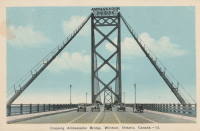
1929: Ambassador
Detroit, Michigan, USA and Windsor, Ontario, Canada - Detroit River
| Bridgemeister ID: | 160 (added before 2003) |
| Year Completed: | 1929 |
| Name: | Ambassador |
| Location: | Detroit, Michigan, USA and Windsor, Ontario, Canada |
| Crossing: | Detroit River |
| Coordinates: | 42.31210 N 83.07402 W |
| Maps: | Acme, GeoHack, Google, OpenStreetMap |
| Principals: | Jonathan Jones, McClintic-Marshall |
| References: | AAJ, AMB, GBD, PTS2 |
| Use: | Vehicular (major highway) |
| Status: | In use (last checked: 2022) |
| Main Cables: | Wire (steel) |
| Suspended Spans: | 1 |
| Main Span: | 1 x 563.9 meters (1,850 feet) |
| Deck width: | 55 feet |
Notes:
- Became longest suspension bridge by eclipsing 1926 Benjamin Franklin (Philadelphia-Camden) - Philadelphia, Pennsylvania and Camden, New Jersey, USA.
- Eclipsed by new longest suspension bridge 1931 George Washington (GWB) - New York, New York and Fort Lee, New Jersey, USA.
External Links:
Image Sets:


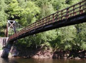
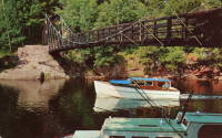
1939: Black River Harbor
Ottawa National Forest, Michigan, USA - Black River
| Bridgemeister ID: | 1045 (added 2003-12-06) |
| Year Completed: | 1939 |
| Name: | Black River Harbor |
| Location: | Ottawa National Forest, Michigan, USA |
| Crossing: | Black River |
| Coordinates: | 46.66608 N 90.04611 W |
| Maps: | Acme, GeoHack, Google, OpenStreetMap |
| Principals: | 3601st Company CCC (Civilian Conservation Corps) Camp Norrie |
| Use: | Footbridge |
| Status: | In use (last checked: 2019) |
| Main Cables: | Wire (steel) |
| Suspended Spans: | 1 |
| Main Span: | 1 x 58.8 meters (193 feet) |
Notes:
- Reconstructed, 1968, but appears to have retained its original appearance. Improvements made, 2009.
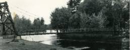
- Tom Haapoja provided information about this bridge. His father worked on its construction: "Built in 1938-39. They had a sawmill on site from which they took 'select' lumber for the bridge and boat docking area. I think the sawmill was located on the present-day parking lot. Each anchor for the suspension cables consisted of 44 tons of concrete. The concrete was transported to the forms via wheelbarrows. The construction of the East anchor was difficult because the wheelbarrows travelled uphill, and each were pushed by one man and pulled by another."
"It was a WPA and CCC effort. The CCC Camp discipline and logistics were provided by the US Army, but the construction supervision was provided by the WPA. About 200 Men from the Norrie CCC camp (Ironwood, Michigan) participated in the construction of the bridge and surrounding park. They worked during the cold of winter and rode to and from Camp Norrie in open trucks. Each trip took 1 1/2 hours. The architect of the bridge was 'Oakey' Johnson. The WPA construction foreman was 'Charlie' Johnson."
Image Sets:
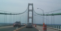
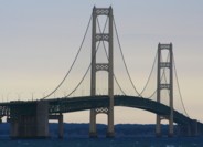
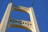
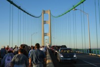
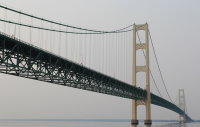
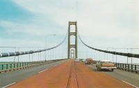
1957: Mackinac
St. Ignace and Mackinaw City, Michigan, USA - Straits of Mackinac
| Bridgemeister ID: | 210 (added before 2003) |
| Year Completed: | 1957 |
| Name: | Mackinac |
| Also Known As: | Mighty Mac |
| Location: | St. Ignace and Mackinaw City, Michigan, USA |
| Crossing: | Straits of Mackinac |
| Coordinates: | 45.820533 N 84.727667 W |
| Maps: | Acme, GeoHack, Google, OpenStreetMap |
| Principals: | David B. Steinman |
| References: | ADDS, BBR, BC3, BFL, BLD, BMA, COB, GBD, LAB, MACB, MM, WOT |
| Use: | Vehicular (four-lane) |
| Status: | In use (last checked: 2022) |
| Main Cables: | Wire (steel) |
| Suspended Spans: | 3 |
| Main Span: | 1 x 1,158.2 meters (3,800 feet) |
| Side Spans: | 2 x 548.6 meters (1,800 feet) |
External Links:
Image Sets:

| Bridgemeister ID: | 7577 (added 2023-04-23) |
| Year Completed: | 2022 |
| Name: | Hidden Lake Gardens |
| Location: | Tipton, Michigan, USA |
| At or Near Feature: | Hidden Lake Gardens |
| Principals: | Phoenix Experiential Designs |
| Use: | Footbridge |
| Status: | In use (last checked: 2023) |
| Main Cables: | Wire (steel) |
| Suspended Spans: | 2 |
| Main Spans: | 2 |
Annotated Citations:
- Walters, Alex. "MSU’s Hidden Lake Gardens hopes to be found with new canopy walk." The State News, 13 Dec 2022, https://statenews.com/article/2022/12/msus-hidden-lake-gardens-hopes-to-be-found-with-an-ambitious-new-attraction
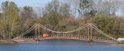
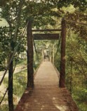
"Since Oct. 2017, they have been designing, funding, and building a suspension bridge hanging off of a 70 foot central tower. The bridge, an idea sparked by a frequent hiker, runs over a valley, giving visitors an up-close view of the trees without the climb."
- Graham, Lester. "Suspension bridge through the tree tops could attract more visitors to an MSU hidden gem." Michigan Radio, 20 Oct. 2022, https://www.michiganradio.org/environment-climate-change/2022-10-20/suspension-bridge-through-the-tree-tops-could-attract-more-visitors-to-an-msu-hidden-gem
"Oates says there was a perfect site [for the bridge] at Hidden Lake Gardens. There’s this sort of bowl-shaped valley. It’s called a kettle hole, a deep depression caused by a chunk of glacier falling off. The 700 foot bridge spans that ‘kettle hole’ valley."
External Links:
(footbridge)
Burton, Michigan, USA - Kearsley Creek
| Bridgemeister ID: | 3086 (added 2019-10-27) |
| Name: | (footbridge) |
| Location: | Burton, Michigan, USA |
| Crossing: | Kearsley Creek |
| At or Near Feature: | For-Mar Nature Preserve |
| Coordinates: | 43.039600 N 83.607800 W |
| Maps: | Acme, GeoHack, Google, OpenStreetMap |
| Use: | Footbridge |
| Status: | In use (last checked: 2020) |
| Main Cables: | Wire (steel) |
| Suspended Spans: | 1 |
(footbridge)
Deer Park vicinity, Michigan, USA - Two Hearted River
| Bridgemeister ID: | 1834 (added 2005-07-02) |
| Name: | (footbridge) |
| Location: | Deer Park vicinity, Michigan, USA |
| Crossing: | Two Hearted River |
| At or Near Feature: | North Country Trail |
| Coordinates: | 46.69857 N 85.422817 W |
| Maps: | Acme, GeoHack, Google, OpenStreetMap |
| Use: | Footbridge |
| Status: | In use (last checked: 2005) |
| Main Cables: | Wire |
| Suspended Spans: | 1 |
(footbridge)
Dexter vicinity, Michigan, USA - Mill Creek
| Bridgemeister ID: | 1483 (added 2004-09-04) |
| Name: | (footbridge) |
| Location: | Dexter vicinity, Michigan, USA |
| Crossing: | Mill Creek |
| Use: | Footbridge |
| Status: | In use (last checked: 2007) |
| Main Cables: | Wire |
Image Sets:
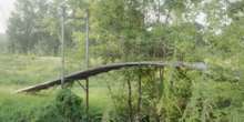
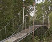
| Bridgemeister ID: | 2927 (added 2019-09-15) |
| Name: | (footbridge) |
| Location: | Jenison, Michigan, USA |
| At or Near Feature: | Grand Ravines Park |
| Coordinates: | 42.946855 N 85.879794 W |
| Maps: | Acme, GeoHack, Google, OpenStreetMap |
| Use: | Footbridge |
| Status: | In use (last checked: 2019) |
| Main Cables: | Wire (steel) |
| Suspended Spans: | 1 |
External Links:
(footbridge)
Mt. Pleasant, Michigan, USA - Chippewa River
| Bridgemeister ID: | 9126 (added 2025-03-30) |
| Name: | (footbridge) |
| Location: | Mt. Pleasant, Michigan, USA |
| Crossing: | Chippewa River |
| At or Near Feature: | Deerfield Nature Park |
| Coordinates: | 43.591278 N 84.894250 W |
| Maps: | Acme, GeoHack, Google, OpenStreetMap |
| Use: | Footbridge |
| Status: | In use |
| Main Cables: | Wire (steel) |
| Suspended Spans: | 1 |
| Main Span: | 1 |
Notes:
(footbridge)
Mt. Pleasant, Michigan, USA - Chippewa River
| Bridgemeister ID: | 9127 (added 2025-03-30) |
| Name: | (footbridge) |
| Location: | Mt. Pleasant, Michigan, USA |
| Crossing: | Chippewa River |
| At or Near Feature: | Deerfield Nature Park |
| Coordinates: | 43.576361 N 84.901083 W |
| Maps: | Acme, GeoHack, Google, OpenStreetMap |
| Use: | Footbridge |
| Status: | In use (last checked: 2024) |
| Main Cables: | Wire (steel) |
| Main Span: | 1 |
Notes:
(footbridge)
Richfield Center, Michigan, USA - Flint River
| Bridgemeister ID: | 821 (added 2003-05-31) |
| Name: | (footbridge) |
| Location: | Richfield Center, Michigan, USA |
| Crossing: | Flint River |
| At or Near Feature: | Richfield Park |
| Coordinates: | 43.105184 N 83.530717 W |
| Maps: | Acme, GeoHack, Google, OpenStreetMap |
| Use: | Footbridge |
| Status: | In use (last checked: 2020) |
| Main Cables: | Wire |
| Suspended Spans: | 1 |
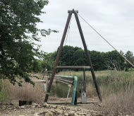
(pipeline bridge)
Dearborn, Michigan, USA - Rouge River
| Bridgemeister ID: | 7125 (added 2022-06-17) |
| Name: | (pipeline bridge) |
| Location: | Dearborn, Michigan, USA |
| Crossing: | Rouge River |
| Coordinates: | 42.290501 N 83.166260 W |
| Maps: | Acme, GeoHack, Google, OpenStreetMap |
| Use: | Pipeline |
| Status: | Extant (last checked: 2022) |
| Main Cables: | Wire (steel) |
| Main Span: | 1 x 76 meters (249.3 feet) estimated |
Image Sets:
Little Mac
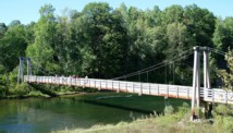
Marilla vicinity, Michigan, USA - Manistee River
| Bridgemeister ID: | 1316 (added 2004-04-18) |
| Name: | Little Mac |
| Location: | Marilla vicinity, Michigan, USA |
| Crossing: | Manistee River |
| Coordinates: | 44.3654 N 85.826467 W |
| Maps: | Acme, GeoHack, Google, OpenStreetMap |
| Use: | Footbridge |
| Status: | In use, March 11, 2025 (last checked: 2025) |
| Main Cables: | Wire (steel) |
| Suspended Spans: | 1 |
| Main Span: | 1 x 50.9 meters (167 feet) |
Notes:
- One of several Michigan suspension footbridges nicknamed "Little Mac".
- Stephen Quintana writes: "One of my first projects was to be the inspector on the construction of this bridge. This was somewhere between 1994 and 1996. I remember the contractor's only experience with any Forest Service projects was installing some toilets for us. He had never done anything like this before. I wasn't on the job site the day he pulled the cables across the river, so I asked him how he did it. He said he used a fishing pole with a small weight and cast it across the river. Then he used that to pull a larger rope, then a much larger rope, then finally the cables. I thought they did a pretty good job on this bridge. I remember the cost was somewhere around $100,000 for this project."
- 2024, November: Closed for refurbishment.
- 2025, March: The bridge is reopened, March 11 despite ongoing repair work.
External Links:
- The Herald Review - Manistee National Forest suspension bridge reopens, under construction. The bridge is reopened despite continuing refurbishment. "The bridge work included new galvanized hardware, decking, railing, curbing, galvanized paint on hard-to-reach components, needle beams, which support the bridge from the main cable, as well as a few new stringers."
- USDA Forest Service - Delayed Manistee River Suspension Bridge Maintenance Begins. Article dated November 8, 2024 regarding start of extensive refurbishment of the bridge: "Bridge upgrades include new galvanized hardware, decking, railing, curbing, galvanized paint on hard-to-reach components, needle beams, which support the bridge from the main cable, as well as new stringers."
Image Sets:
Little Mac
Reed City, Michigan, USA - Hersey River
| Bridgemeister ID: | 1055 (added 2003-12-13) |
| Name: | Little Mac |
| Location: | Reed City, Michigan, USA |
| Crossing: | Hersey River |
| Coordinates: | 43.88466 N 85.51286 W |
| Maps: | Acme, GeoHack, Google, OpenStreetMap |
| Use: | Footbridge |
| Status: | In use (last checked: 2007) |
| Main Cables: | Wire (steel) |
| Suspended Spans: | 1 |
| Main Span: | 1 x 45.7 meters (150 feet) |
Image Sets:
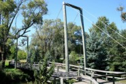
O Kun-de-kun Falls
Bruce Crossing vicinity, Michigan, USA - Baltimore River
| Bridgemeister ID: | 2708 (added 2019-06-16) |
| Name: | O Kun-de-kun Falls |
| Location: | Bruce Crossing vicinity, Michigan, USA |
| Crossing: | Baltimore River |
| Coordinates: | 46.651432 N 89.151181 W |
| Maps: | Acme, GeoHack, Google, OpenStreetMap |
| Use: | Footbridge |
| Status: | In use (last checked: 2021) |
| Main Cables: | Wire (steel) |
| Suspended Spans: | 1 |
Image Sets:
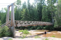
Presque Isle
Presque Isle Falls vicinity, Michigan, USA - Presque Isle River
| Bridgemeister ID: | 1197 (added 2004-01-27) |
| Name: | Presque Isle |
| Location: | Presque Isle Falls vicinity, Michigan, USA |
| Crossing: | Presque Isle River |
| At or Near Feature: | Porcupine Mountains Wilderness State Park |
| Coordinates: | 46.708528 N 89.973083 W |
| Maps: | Acme, GeoHack, Google, OpenStreetMap |
| Use: | Footbridge |
| Status: | In use (last checked: 2014) |
| Main Cables: | Wire (steel) |
| Suspended Spans: | 1 |
Do you have any information or photos for these bridges that you would like to share? Please email david.denenberg@bridgemeister.com.
Mail | Facebook | X (Twitter) | Bluesky
