Suspension Bridges of Scotland (1-100 of 108)
This is a list of bridges 1 through 100 (of 108 total) from the suspension bridge inventory for Scotland in United Kingdom. Wherever you see a Bridgemeister ID number click it to isolate the bridge on its own page.
Related Lists:
1816: Galashiels
Galashiels, Scotland, United Kingdom - Gala Water
| Bridgemeister ID: | 584 (added 2003-01-01) |
| Year Completed: | 1816 |
| Name: | Galashiels |
| Location: | Galashiels, Scotland, United Kingdom |
| Crossing: | Gala Water |
| Principals: | Richard Lees |
| References: | AAJ, BSI, HBE, PTS2 |
| Use: | Footbridge |
| Status: | Destroyed, 1839 |
| Main Cables: | Wire (iron) |
| Suspended Spans: | 1 |
| Main Span: | 1 x 33.8 meters (111 feet) |
| Deck width: | 3 feet |
Notes:
- BSI: Originally erected in the form of a traditional suspension bridge, but soon reinforced with wire stays from much larger towers to reduce unwanted motion. Destroyed by flood, 1839.
1818: Dryburgh Abbey
Dryburgh and St. Boswells, Scotland, United Kingdom - River Tweed
| Bridgemeister ID: | 1440 (added 2004-07-31) |
| Year Completed: | 1818 |
| Name: | Dryburgh Abbey |
| Location: | Dryburgh and St. Boswells, Scotland, United Kingdom |
| Crossing: | River Tweed |
| References: | AAJ, BEM, MOS |
| Use: | Footbridge |
| Status: | Collapsed, 1838 |
| Main Cables: | Chain (iron) |
| Suspended Spans: | 1 |
| Main Span: | 1 x 79.2 meters (260 feet) |
| Deck width: | 4.5 feet |
Notes:
- May have been rebuilt around 1850. History of the bridge is unclear between the 1838 collapse and replacement in 1872.
- This 1818 bridge was a replacement for the 1817 Dryburgh Abbey suspension bridge which appears to have been primarily a cable-stayed structure and is not included in the inventory. The 1817 bridge failed due to wind in early 1818.
- Later at same location 1872 Dryburgh Abbey - Dryburgh and St. Boswells, Scotland, United Kingdom.
External Links:

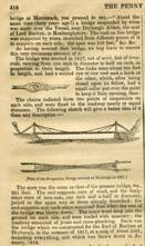
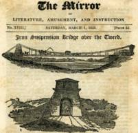
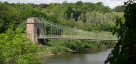
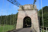
1820: Union
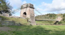
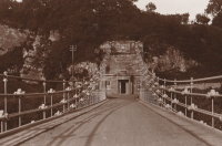
Horncliffe, Berwick-upon-Tweed vicinity, England and Fishwick, Scotland, United Kingdom - River Tweed
| Bridgemeister ID: | 373 (added before 2003) |
| Year Completed: | 1820 |
| Name: | Union |
| Location: | Horncliffe, Berwick-upon-Tweed vicinity, England and Fishwick, Scotland, United Kingdom |
| Crossing: | River Tweed |
| Coordinates: | 55.75256 N 2.10677 W |
| Maps: | Acme, GeoHack, Google, OpenStreetMap |
| Principals: | Sir Samuel Brown |
| References: | AAJ, BBR, BC3, BEM, BOB, HBE, MOS, NTB, PTS2, SBR |
| Use: | Vehicular (one-lane) |
| Status: | In use (last checked: 2023) |
| Main Cables: | Chain (iron) |
| Suspended Spans: | 1 |
| Main Span: | 1 x 136.9 meters (449 feet) |
| Deck width: | 18 feet |
Notes:
- 2007, March: Closed after a hanger snapped in high winds. Repaired and reopened August, 2007.
- 2020, October: Closed for major renovation and conservation project.
- 2023, April: The bridge is reopened.
- Eclipsed by new longest suspension bridge 1826 Menai Strait - Menai Bridge and Bangor vicinity, Wales, United Kingdom.
External Links:
- Conservation - Union Chain Bridge - unionchainbridge.org. Site devoted to the 2020-2023 renovation project. This page lists the highlights of the project.
- Structurae - Structure ID 20000162
1821: Trinity Pier
Trinity, Edinburgh vicinity, Scotland, United Kingdom - River Forth
| Bridgemeister ID: | 374 (added before 2003) |
| Year Completed: | 1821 |
| Name: | Trinity Pier |
| Also Known As: | Newhaven Pier |
| Location: | Trinity, Edinburgh vicinity, Scotland, United Kingdom |
| Crossing: | River Forth |
| Principals: | Sir Samuel Brown |
| References: | AAJ, MOS, SBR |
| Use: | Footbridge |
| Status: | Destroyed, 1898 |
| Main Cables: | Chain (iron) |
| Main Spans: | 3 x 63.7 meters (209 feet) |
| Deck width: | 4 feet |
Notes:
- SBR: Chain pier extending into 700 feet into the Forth, with three main spans each of 209 feet. Wrecked by storm, 1898.
External Links:
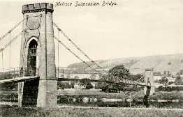
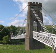
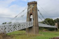
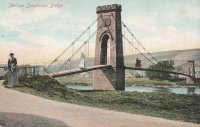
1826: Gattonside
Melrose, Scotland, United Kingdom - River Tweed
| Bridgemeister ID: | 381 (added before 2003) |
| Year Completed: | 1826 |
| Name: | Gattonside |
| Also Known As: | Melrose |
| Location: | Melrose, Scotland, United Kingdom |
| Crossing: | River Tweed |
| Coordinates: | 55.602830 N 2.723349 W |
| Maps: | Acme, GeoHack, Google, OpenStreetMap |
| Principals: | Redpath and Brown |
| References: | BC2, BSI, NTB |
| Use: | Footbridge |
| Status: | In use (last checked: 2014) |
| Main Cables: | Chain (iron) |
| Suspended Spans: | 3 |
| Main Span: | 1 x 91.4 meters (300 feet) |
| Side Spans: | 2 |
| Deck width: | 4 feet 4 inches |
Notes:
- Steel cables added, 1992.
External Links:
1827: (footbridge)
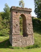
Denholm, Scotland, United Kingdom - River Teviot
| Bridgemeister ID: | 1555 (added 2004-11-24) |
| Year Completed: | 1827 |
| Name: | (footbridge) |
| Location: | Denholm, Scotland, United Kingdom |
| Crossing: | River Teviot |
| Coordinates: | 55.460001 N 2.686394 W |
| Maps: | Acme, GeoHack, Google, OpenStreetMap |
| Use: | Footbridge |
| Status: | Only towers remain, since 1875 (last checked: 2009) |
| Main Cables: | Chain (iron) |
1829: Montrose
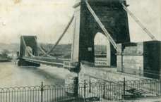
Montrose, Scotland, United Kingdom - South Esk River
| Bridgemeister ID: | 388 (added before 2003) |
| Year Completed: | 1829 |
| Name: | Montrose |
| Location: | Montrose, Scotland, United Kingdom |
| Crossing: | South Esk River |
| Coordinates: | 56.705802 N 2.475390 W |
| Maps: | Acme, GeoHack, Google, OpenStreetMap |
| Principals: | Sir Samuel Brown |
| References: | AAJ, BEM, BOB, HBE, PTS2, SBR |
| Use: | Vehicular |
| Status: | Demolished, 1929 |
| Main Cables: | Chain (iron) |
| Suspended Spans: | 1 |
Notes:
- SBR: March 19, 1830, with a "crowd of people, estimated at 700, ... watching a boat race," a chain broke "plunging most of the people into the river." Repaired.
- 1838: Wrecked by storm. Repaired.

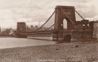
1830: Boharm
Boat o' Brig, Fochabers, Scotland, United Kingdom - River Spey
| Bridgemeister ID: | 4844 (added 2020-07-11) |
| Year Completed: | 1830 |
| Name: | Boharm |
| Also Known As: | Boat of Bridge, Boat o' Brig, New, Delfur |
| Location: | Boat o' Brig, Fochabers, Scotland, United Kingdom |
| Crossing: | River Spey |
| Coordinates: | 57.550528 N 3.140743 W |
| Maps: | Acme, GeoHack, Google, OpenStreetMap |
| Principals: | Sir Samuel Brown |
| Use: | Vehicular (one-lane) |
| Status: | Replaced, 1956 |
| Main Cables: | Chain (iron) |
| Suspended Spans: | 1 |
Notes:
- Completed 1830 or 1832.
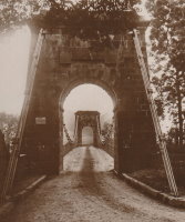
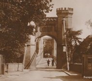
1831: Findhorn
Forres, Scotland, United Kingdom - River Findhorn
| Bridgemeister ID: | 391 (added before 2003) |
| Year Completed: | 1831 |
| Name: | Findhorn |
| Location: | Forres, Scotland, United Kingdom |
| Crossing: | River Findhorn |
| Coordinates: | 57.6018 N 3.6557 W |
| Maps: | Acme, GeoHack, Google, OpenStreetMap |
| Principals: | Sir Samuel Brown |
| References: | AAJ, MOS, SBR |
| Use: | Vehicular |
| Status: | Removed, 1938 |
| Main Cables: | Chain (iron) |
| Suspended Spans: | 1 |
Notes:
- Was still standing in 1938 when it was bypassed, but was likely demolished some time in 1938.
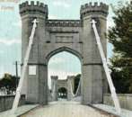
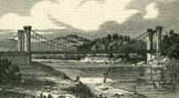
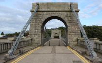
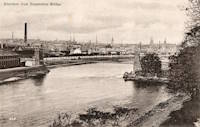
1831: Wellington
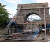
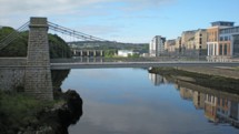
Aberdeen, Scotland, United Kingdom - River Dee
| Bridgemeister ID: | 393 (added before 2003) |
| Year Completed: | 1831 |
| Name: | Wellington |
| Also Known As: | Craiglug |
| Location: | Aberdeen, Scotland, United Kingdom |
| Crossing: | River Dee |
| Coordinates: | 57.13559 N 2.09560 W |
| Maps: | Acme, GeoHack, Google, OpenStreetMap |
| Principals: | Sir Samuel Brown |
| References: | SBR |
| Use: | Vehicular (one-lane) |
| Status: | Restricted to foot traffic (last checked: 2014) |
| Main Cables: | Chain (iron) |
| Suspended Spans: | 1 |
Notes:
- Reconstructed, 1930. Closed to vehicular traffic, 1984. Closed to all traffic 2002. Underwent extensive refurbishment, 2008.
External Links:


1832: Aboyne
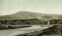
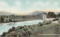
Aboyne, Scotland, United Kingdom - River Dee
| Bridgemeister ID: | 2203 (added 2007-01-28) |
| Year Completed: | 1832 |
| Name: | Aboyne |
| Location: | Aboyne, Scotland, United Kingdom |
| Crossing: | River Dee |
| Use: | Vehicular |
| Status: | Removed |
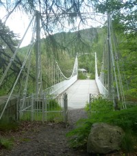
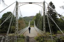
1834: Crathie
Crathie vicinity, Scotland, United Kingdom - River Dee
| Bridgemeister ID: | 1084 (added 2004-01-01) |
| Year Completed: | 1834 |
| Name: | Crathie |
| Location: | Crathie vicinity, Scotland, United Kingdom |
| Crossing: | River Dee |
| Coordinates: | 57.0335 N 3.211 W |
| Maps: | Acme, GeoHack, Google, OpenStreetMap |
| Principals: | Justice Junior and Co. |
| References: | AAJ, BSI, HBR |
| Use: | Vehicular (one-lane) |
| Status: | Closed, December 2015 (last checked: 2015) |
| Main Cables: | Eyebar (iron) |
| Suspended Spans: | 1 |
| Main Span: | 1 x 42.1 meters (138 feet) |
| Deck width: | 14 feet |
Notes:
- Small iron chain suspension bridge.
- BSI: Reported to have been "almost entirely renewed", 1885. Ruddock also suggests the bridge was originally constructed with just diagonal stays (as other Justice bridges) and the catenary chains were added during the renewal.
External Links:
- The Happy Pontist: Scottish Bridges: 56. Crathie Suspension Bridge (after the flood)
- Structurae - Structure ID 20070665
1836: Bonhill
Bonhill and Alexandria, Scotland, United Kingdom - River Leven
| Bridgemeister ID: | 5553 (added 2020-12-16) |
| Year Completed: | 1836 |
| Name: | Bonhill |
| Also Known As: | Bawbee |
| Location: | Bonhill and Alexandria, Scotland, United Kingdom |
| Crossing: | River Leven |
| Coordinates: | 55.984853 N 4.573088 W |
| Maps: | Acme, GeoHack, Google, OpenStreetMap |
| Use: | Vehicular |
| Status: | Removed, c. 1898 |
| Main Cables: | Chain (iron) |
| Suspended Spans: | 1 |
Notes:
- Coordinates are for the present-day (2020) bridge at this location, the replacement for the bridge that replaced the suspension bridge. The suspension bridge was either on the identical alignment of the current bridge or immediately adjacent.
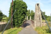
1836: Kalemouth
Eckford, Scotland, United Kingdom - River Teviot
| Bridgemeister ID: | 396 (added before 2003) |
| Year Completed: | 1836 |
| Name: | Kalemouth |
| Location: | Eckford, Scotland, United Kingdom |
| Crossing: | River Teviot |
| Coordinates: | 55.539902 N 2.463519 W |
| Maps: | Acme, GeoHack, Google, OpenStreetMap |
| Principals: | Sir Samuel Brown |
| References: | SBR |
| Use: | Vehicular (one-lane) |
| Status: | Restricted to foot traffic, since 2020 (last checked: 2022) |
| Main Cables: | Eyebar (iron) |
| Suspended Spans: | 1 |
| Main Span: | 1 x 64.6 meters (212 feet) |

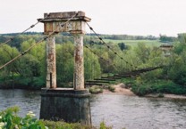
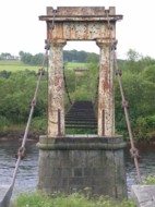
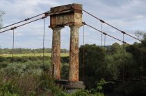
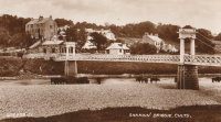
1837: Shakkin
Cults, Aberdeen, Scotland, United Kingdom - River Dee
| Bridgemeister ID: | 1546 (added 2004-11-13) |
| Year Completed: | 1837 |
| Name: | Shakkin |
| Also Known As: | Shakin, St. Devenick's, Morrison |
| Location: | Cults, Aberdeen, Scotland, United Kingdom |
| Crossing: | River Dee |
| Coordinates: | 57.11460 N 2.17056 W |
| Maps: | Acme, GeoHack, Google, OpenStreetMap |
| Principals: | John Smith |
| Use: | Footbridge |
| Status: | Derelict (last checked: 2014) |
| Main Cables: | Chain (iron) |
| Suspended Spans: | 3 |
| Main Span: | 1 x 54.9 meters (180.1 feet) |
| Side Spans: | 2 |
Notes:
- Damaged by flood, 1876, and 1920. Reconstructed, 1921-1922. "Stranded" by shift in river's course, 1970's and 1980's, sweeping away southern approach spans. Deck removed, 1984.
- Known locally as "Shakin' Briggie" or "Shakkin' Briggie," but also referred to as Morrison Bridge and St. Devenick's Bridge.
- Restoration under consideration, 2005.
External Links:
1841: Balloch Ferry
Balloch, Scotland, United Kingdom - River Leven
| Bridgemeister ID: | 5552 (added 2020-12-16) |
| Year Completed: | 1841 |
| Name: | Balloch Ferry |
| Location: | Balloch, Scotland, United Kingdom |
| Crossing: | River Leven |
| Coordinates: | 56.003420 N 4.581826 W |
| Maps: | Acme, GeoHack, Google, OpenStreetMap |
| Principals: | Sir James Colquhoun |
| References: | AAJ |
| Status: | Removed, c. 1887 |
| Main Cables: | Rod (iron) |
| Suspended Spans: | 3 |
| Main Span: | 1 x 61 meters (200 feet) |
| Side Spans: | 2 x 13.7 meters (45 feet) |
Notes:
- Design based on James Dredge's taper principle patent.
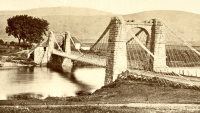
1849: Lochy
Inverlochy, Fort William vicinity, Scotland, United Kingdom - River Lochy
| Bridgemeister ID: | 6209 (added 2021-07-16) |
| Year Completed: | 1849 |
| Name: | Lochy |
| Also Known As: | Lochybridge, Victoria |
| Location: | Inverlochy, Fort William vicinity, Scotland, United Kingdom |
| Crossing: | River Lochy |
| Coordinates: | 56.835137 N 5.076679 W |
| Maps: | Acme, GeoHack, Google, OpenStreetMap |
| Principals: | James Dredge |
| Use: | Vehicular |
| Status: | Removed |
| Main Cables: | Rod (iron) |
| Main Span: | 1 |
Notes:
- 1928: Deck replaced. The aging suspension system was bypassed and the new deck supported by additional piers.
- Similar to 1854 Oich (Aberchalder) - Invergarry vicinity, Scotland, United Kingdom.
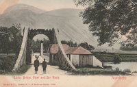
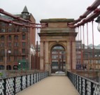
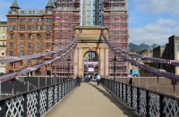
1851: South Portland
Glasgow, Scotland, United Kingdom - River Clyde
| Bridgemeister ID: | 404 (added before 2003) |
| Year Completed: | 1851 |
| Name: | South Portland |
| Also Known As: | Carlton |
| Location: | Glasgow, Scotland, United Kingdom |
| Crossing: | River Clyde |
| Coordinates: | 55.85433 N 4.25618 W |
| Maps: | Acme, GeoHack, Google, OpenStreetMap |
| Principals: | Alexander Kirkland, George Martin |
| References: | BEM, NTB |
| Use: | Footbridge |
| Status: | In use (last checked: 2019) |
| Main Cables: | Eyebar (iron) |
| Suspended Spans: | 1 |
Notes:
- 1853 sometimes cited as the year it opened.
External Links:
1852: Pey
Blantyre, Scotland, United Kingdom - River Clyde
| Bridgemeister ID: | 2633 (added 2019-02-24) |
| Year Completed: | 1852 |
| Name: | Pey |
| Also Known As: | Mill, Toll, Swing |
| Location: | Blantyre, Scotland, United Kingdom |
| Crossing: | River Clyde |
| Coordinates: | 55.801972 N 4.081433 W |
| Maps: | Acme, GeoHack, Google, OpenStreetMap |
| Principals: | Henry Monteith & Co |
| Use: | Footbridge |
| Status: | Removed (last checked: 1949) |
| Main Cables: | Rod (iron) |
| Suspended Spans: | 3 |
| Main Span: | 1 |
| Side Spans: | 2 |
Notes:
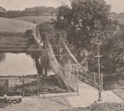
- Dredge patent bridge.
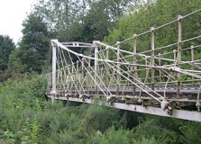
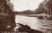
1853: General's Well
Inverness, Scotland, United Kingdom - River Ness
| Bridgemeister ID: | 406 (added before 2003) |
| Year Completed: | 1853 |
| Name: | General's Well |
| Location: | Inverness, Scotland, United Kingdom |
| Crossing: | River Ness |
| At or Near Feature: | Ness Islands |
| Coordinates: | 57.460944 N 4.237166 W |
| Maps: | Acme, GeoHack, Google, OpenStreetMap |
| Principals: | James Dredge |
| References: | HBR |
| Use: | Footbridge |
| Status: | In use (last checked: 2014) |
| Main Cables: | Rod (iron) |
| Suspended Spans: | 3 |
| Main Span: | 1 |
| Side Spans: | 2 |
Notes:
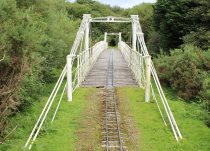
- Relocated to a nearby park (Whin Park) where it carries a miniature railway, 1988. The coordinates listed here are for that later (miniature railway park) location.
- Companion to 1853 Island Bank Road - Inverness, Scotland, United Kingdom.
- See 1988 (footbridge) - Inverness, Scotland, United Kingdom.
- See 1988 (footbridge) - Inverness, Scotland, United Kingdom.
External Links:

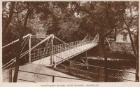
1853: Island Bank Road
Inverness, Scotland, United Kingdom - River Ness
| Bridgemeister ID: | 904 (added 2003-10-11) |
| Year Completed: | 1853 |
| Name: | Island Bank Road |
| Location: | Inverness, Scotland, United Kingdom |
| Crossing: | River Ness |
| At or Near Feature: | Ness Islands |
| Principals: | James Dredge |
| References: | HBR |
| Use: | Footbridge |
| Status: | Removed |
Notes:
- Companion to 1853 General's Well - Inverness, Scotland, United Kingdom.
- See 1988 (footbridge) - Inverness, Scotland, United Kingdom.
- See 1988 (footbridge) - Inverness, Scotland, United Kingdom.
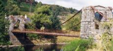
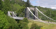
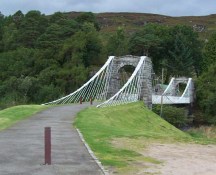
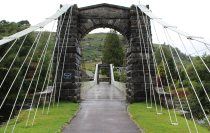
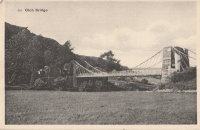
1854: Oich
Invergarry vicinity, Scotland, United Kingdom - River Oich
| Bridgemeister ID: | 403 (added before 2003) |
| Year Completed: | 1854 |
| Name: | Oich |
| Also Known As: | Aberchalder |
| Location: | Invergarry vicinity, Scotland, United Kingdom |
| Crossing: | River Oich |
| Coordinates: | 57.093377 N 4.745271 W |
| Maps: | Acme, GeoHack, Google, OpenStreetMap |
| Principals: | James Dredge |
| References: | BC3, HBR |
| Use: | Vehicular (one-lane) |
| Status: | Restricted to foot traffic (last checked: 2014) |
| Main Cables: | Rod (iron) |
| Suspended Spans: | 1 |
Notes:
- Restored and re-opened, late 1990's.
External Links:
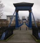
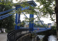
1854: Saint Andrew's
Glasgow, Scotland, United Kingdom - River Clyde
| Bridgemeister ID: | 408 (added before 2003) |
| Year Completed: | 1854 |
| Name: | Saint Andrew's |
| Location: | Glasgow, Scotland, United Kingdom |
| Crossing: | River Clyde |
| Coordinates: | 55.84883 N 4.23835 W |
| Maps: | Acme, GeoHack, Google, OpenStreetMap |
| Principals: | Neil Robson |
| References: | NTB |
| Use: | Footbridge |
| Status: | In use (last checked: 2019) |
| Main Cables: | Eyebar |
| Suspended Spans: | 1 |
| Main Span: | 1 x 67.1 meters (220 feet) |
| Deck width: | 13 feet |
Notes:
- Also sometimes attributed to Neil "Robinson" and completed 1853. May have originally been a narrow vehicular bridge.
External Links:
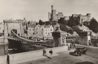
1855: Ness
Inverness, Scotland, United Kingdom - River Ness
| Bridgemeister ID: | 526 (added before 2003) |
| Year Completed: | 1855 |
| Name: | Ness |
| Location: | Inverness, Scotland, United Kingdom |
| Crossing: | River Ness |
| Use: | Vehicular |
| Status: | Demolished, 1961 |
| Main Cables: | Eyebar (iron) |
| Suspended Spans: | 1 |
Notes:
- Near 1881 Greig Street (Wobbly) - Inverness, Scotland, United Kingdom. In some photos, the two bridges are visible within a few hundred yards of each other.
External Links:

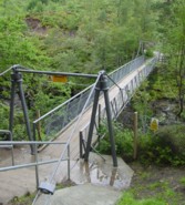
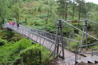
1867: Corrieshalloch
Braemore, Scotland, United Kingdom - Corrieshalloch Gorge
| Bridgemeister ID: | 1308 (added 2004-04-10) |
| Year Completed: | 1867 |
| Name: | Corrieshalloch |
| Location: | Braemore, Scotland, United Kingdom |
| Crossing: | Corrieshalloch Gorge |
| At or Near Feature: | Falls of Measach |
| Coordinates: | 57.755753 N 5.021048 W |
| Maps: | Acme, GeoHack, Google, OpenStreetMap |
| Principals: | John Fowler |
| References: | AAJ, HBR |
| Use: | Footbridge |
| Status: | In use (last checked: 2022) |
| Main Cables: | Wire |
| Suspended Spans: | 1 |
| Main Span: | 1 x 25.1 meters (82.5 feet) |
Notes:
- 2022, May: Closed again for maintenance and inspection, reopened by month's end.
- AAJ lists the bridge at "Corry Halloch" bridge completed in 1875. Other sources mention 1867, and 1874.
- 1977: Anchorages replaced (HBR).
- 2021: Closed September 10 due to safety concerns. Repaired and re-opened in October.
1871: Aboyne
Waterside, Aboyne vicinity, Scotland, United Kingdom - River Dee
| Bridgemeister ID: | 2202 (added 2007-01-28) |
| Year Completed: | 1871 |
| Name: | Aboyne |
| Location: | Waterside, Aboyne vicinity, Scotland, United Kingdom |
| Crossing: | River Dee |
| Principals: | Harper & Co. |
| References: | HARPER |
| Use: | Footbridge |
| Status: | Removed |
| Main Cables: | Wire |
| Main Span: | 1 x 91.4 meters (300 feet) |
Notes:
- HARPER: Likely destroyed by one of these major Dee River flood events: May 1913, December 1914, October 1920.
External Links:
1871: Boatford
Langholm, Borders, Scotland, United Kingdom - River Esk
| Bridgemeister ID: | 1428 (added 2004-07-24) |
| Year Completed: | 1871 |
| Name: | Boatford |
| Location: | Langholm, Borders, Scotland, United Kingdom |
| Crossing: | River Esk |
| References: | AAJ |
| Status: | Collapsed |
Notes:
- Collapsed soon after it was completed under weight of 200 spectators.
- Replaced by 1873 Boatford - Langholm, Borders, Scotland, United Kingdom.
1871: Tanarmouth
Glen Tanar, Aboyne vicinity, Scotland, United Kingdom - Water of Tanar
| Bridgemeister ID: | 7972 (added 2023-11-26) |
| Year Completed: | 1871 |
| Name: | Tanarmouth |
| Location: | Glen Tanar, Aboyne vicinity, Scotland, United Kingdom |
| Crossing: | Water of Tanar |
| Coordinates: | 57.066833 N 2.805167 W |
| Maps: | Acme, GeoHack, Google, OpenStreetMap |
| Principals: | Harper & Co. |
| Use: | Footbridge |
| Status: | Removed, 1950 |
| Main Cables: | Wire |
| Main Span: | 1 x 30.5 meters (100 feet) |
External Links:
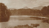
1872: Dryburgh Abbey
Dryburgh and St. Boswells, Scotland, United Kingdom - River Tweed
| Bridgemeister ID: | 1439 (added 2004-07-31) |
| Year Completed: | 1872 |
| Name: | Dryburgh Abbey |
| Location: | Dryburgh and St. Boswells, Scotland, United Kingdom |
| Crossing: | River Tweed |
| Coordinates: | 55.580771 N 2.654251 W |
| Maps: | Acme, GeoHack, Google, OpenStreetMap |
| Use: | Footbridge |
| Status: | Replaced, 1911 |
| Main Cables: | Wire |
| Suspended Spans: | 1 |
Notes:
- At former location of 1818 Dryburgh Abbey - Dryburgh and St. Boswells, Scotland, United Kingdom.
- Near Mertoun Estate - Mertoun, Scotland, United Kingdom.
- Replaced by 1911 Dryburgh Abbey - Dryburgh and St. Boswells, Scotland, United Kingdom.
External Links:
1872: Ravenscraig
Dundee, Scotland, United Kingdom - Caledonian Railway
| Bridgemeister ID: | 5078 (added 2020-08-30) |
| Year Completed: | 1872 |
| Name: | Ravenscraig |
| Location: | Dundee, Scotland, United Kingdom |
| Crossing: | Caledonian Railway |
| Coordinates: | 56.468350 N 2.901061 W |
| Maps: | Acme, GeoHack, Google, OpenStreetMap |
| Principals: | Harper & Co. |
| References: | HARPER |
| Use: | Footbridge |
| Status: | Removed |
| Main Cables: | Wire |
| Suspended Spans: | 1 |
| Main Span: | 1 x 16.8 meters (55.1 feet) |
Notes:
- Coordinates are approximate location of the bridge based on the description in HARPER noting the bridge crossed the railway at the estate of a Colonel Sandeman at Ravenscraig which is the location of the present day (2020) Ravenscraig Gardens in Dundee.
External Links:
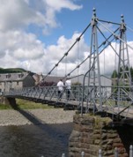
1873: Boatford
Langholm, Borders, Scotland, United Kingdom - River Esk
| Bridgemeister ID: | 534 (added before 2003) |
| Year Completed: | 1873 |
| Name: | Boatford |
| Location: | Langholm, Borders, Scotland, United Kingdom |
| Crossing: | River Esk |
| Coordinates: | 55.15098 N 3.00273 W |
| Maps: | Acme, GeoHack, Google, OpenStreetMap |
| References: | AAJ |
| Use: | Footbridge |
| Status: | In use (last checked: 2004) |
| Main Span: | 1 x 53.3 meters (175 feet) |
Notes:
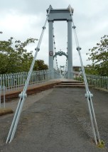
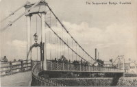
1875: Nith
Dumfries, Scotland, United Kingdom - River Nith
| Bridgemeister ID: | 524 (added before 2003) |
| Year Completed: | 1875 |
| Name: | Nith |
| Also Known As: | Biddall's |
| Location: | Dumfries, Scotland, United Kingdom |
| Crossing: | River Nith |
| Coordinates: | 55.065120 N 3.610292 W |
| Maps: | Acme, GeoHack, Google, OpenStreetMap |
| Principals: | J. Willett |
| Use: | Footbridge |
| Status: | In use (last checked: 2022) |
| Main Cables: | Chain (iron) |
| Suspended Spans: | 1 |
| Main Span: | 1 |
External Links:

1879: Infirmary
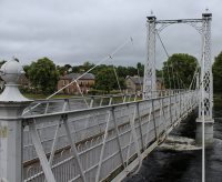
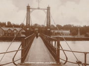
Inverness, Scotland, United Kingdom - River Ness
| Bridgemeister ID: | 539 (added before 2003) |
| Year Completed: | 1879 |
| Name: | Infirmary |
| Location: | Inverness, Scotland, United Kingdom |
| Crossing: | River Ness |
| Coordinates: | 57.471653 N 4.228844 W |
| Maps: | Acme, GeoHack, Google, OpenStreetMap |
| Principals: | C. R. Manners |
| References: | HBR |
| Use: | Footbridge |
| Status: | In use (last checked: 2021) |
| Main Cables: | Wire |
| Suspended Spans: | 3 |
| Main Span: | 1 x 61 meters (200 feet) |
| Side Spans: | 2 x 12.8 meters (42 feet) |
Notes:
- 2020, November: Highland Council likely to close bridge if funding for urgent repairs cannot be raised.
- 2021, July: Reopened after interim repairs completed. Future major refurbishment expected.
- Companion to 1881 Greig Street (Wobbly) - Inverness, Scotland, United Kingdom.
Annotated Citations:
- Glen, Louise. “Closure Fears for Iconic Inverness Bridge Facing Huge Repair Bill.” Inverness Courier, 21 Apr. 2021, www.inverness-courier.co.uk/news/closure-fears-for-iconic-inverness-bridge-facing-huge-repair-235713/.
"Fears have been raised that decades of under investment in an iconic city bridge could see it closed permanently. Members of Ballifeary Community Council believe the cost of fixing and upgrading the Infirmary Bridge to bring it up to modern standards may be more than £1 million..."
- Duncan, Ian. "The future of Infirmary Bridge secured into the 2040s as Highland Council's Economy and Infrastructure Committee today agrees up to £550,000 in funding for repairs." Inverness Courier, 05 May 2021, www.inverness-courier.co.uk/news/the-future-of-infirmary-bridge-secured-into-the-2040s-237340/.
"Highland Council's Economy and Infrastructure Committee agreed today to include up to £550,000 for repairs for Infirmary Bridge… 'It will be 2022 before the repairs are completed, but once done the bridge's life will be extended for a further 20 to 25 years.'"
External Links:

1879: Swing
Monymusk, Scotland, United Kingdom - River Don
| Bridgemeister ID: | 2192 (added 2007-01-26) |
| Year Completed: | 1879 |
| Name: | Swing |
| Location: | Monymusk, Scotland, United Kingdom |
| Crossing: | River Don |
| Principals: | Harper & Co. |
| References: | HARPER |
| Use: | Footbridge |
| Status: | Demolished, c. 2005 |
| Main Cables: | Wire |
| Suspended Spans: | 1 |
| Main Span: | 1 x 32.6 meters (107 feet) |
External Links:

1880: Birkhall
Birkhall, Ballater, Scotland, United Kingdom - River Muick
| Bridgemeister ID: | 2193 (added 2007-01-26) |
| Year Completed: | 1880 |
| Name: | Birkhall |
| Location: | Birkhall, Ballater, Scotland, United Kingdom |
| Crossing: | River Muick |
| Coordinates: | 57.028215 N 3.072693 W |
| Maps: | Acme, GeoHack, Google, OpenStreetMap |
| Principals: | Harper & Co. |
| References: | HARPER |
| Use: | Footbridge |
| Status: | Destroyed, December, 2015 |
| Main Cables: | Wire |
| Suspended Spans: | 1 |
| Main Span: | 1 x 18.3 meters (60 feet) |
Notes:
- 2015, December: Destroyed by flooding during Storm Frank.
- Replaced by Birkhall - Birkhall, Ballater, Scotland, United Kingdom.
External Links:
1880: Burnhervie
Burnhervie, Inverurie vicinity, Scotland, United Kingdom - River Don
| Bridgemeister ID: | 2174 (added 2007-01-13) |
| Year Completed: | 1880 |
| Name: | Burnhervie |
| Location: | Burnhervie, Inverurie vicinity, Scotland, United Kingdom |
| Crossing: | River Don |
| Coordinates: | 57.261024 N 2.440063 W |
| Maps: | Acme, GeoHack, Google, OpenStreetMap |
| Principals: | Harper & Co. |
| References: | HARPER |
| Use: | Footbridge |
| Status: | Collapsed, 1979 |
| Main Cables: | Wire |
| Main Span: | 1 x 30.5 meters (100 feet) |
Notes:
- Completed c. 1880. Douglas Harper writes: "The original bridge was built by Harper & Co, Aberdeen, around 1880 and its timber pylons were replaced with cast iron ones. In 1979 when overloaded during a raft race a bank stay cable failed and a major rebuild was undertaken by the local authority. This version was similar to its predecessor but was repalced in 2005 by a cable stayed bridge."
- Replaced by 1980 Shakin - Burnhervie, Inverurie vicinity, Scotland, United Kingdom.
External Links:
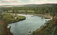
1881: Cromdale
Cromdale, Scotland, United Kingdom - River Spey
| Bridgemeister ID: | 2194 (added 2007-01-26) |
| Year Completed: | 1881 |
| Name: | Cromdale |
| Location: | Cromdale, Scotland, United Kingdom |
| Crossing: | River Spey |
| Coordinates: | 57.341944 N 3.553111 W |
| Maps: | Acme, GeoHack, Google, OpenStreetMap |
| Principals: | Harper & Co. |
| References: | HARPER |
| Use: | Footbridge |
| Status: | Collapsed, 1892 |
| Main Cables: | Wire |
| Main Span: | 1 x 59.4 meters (195 feet) |
Notes:
- Replaced by 1894 Cromdale - Cromdale, Scotland, United Kingdom.
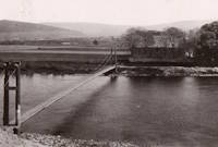
1881: Greig Street
Inverness, Scotland, United Kingdom - River Ness
| Bridgemeister ID: | 538 (added before 2003) |
| Year Completed: | 1881 |
| Name: | Greig Street |
| Also Known As: | Wobbly |
| Location: | Inverness, Scotland, United Kingdom |
| Crossing: | River Ness |
| Coordinates: | 57.479111 N 4.229796 W |
| Maps: | Acme, GeoHack, Google, OpenStreetMap |
| References: | HBR |
| Use: | Footbridge |
| Status: | In use (last checked: 2021) |
| Main Cables: | Wire |
| Suspended Spans: | 3 |
| Main Span: | 1 |
| Side Spans: | 2 |
Notes:
- Companion to 1879 Infirmary - Inverness, Scotland, United Kingdom.
- Near 1855 Ness - Inverness, Scotland, United Kingdom. In some photos, the two bridges are visible within a few hundred yards of each other.
External Links:
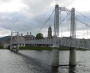
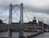
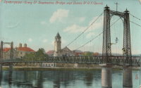
1885: Abergeldie Castle
Balmoral vicinity, Scotland, United Kingdom - River Dee
| Bridgemeister ID: | 1705 (added 2005-03-29) |
| Year Completed: | 1885 |
| Name: | Abergeldie Castle |
| Location: | Balmoral vicinity, Scotland, United Kingdom |
| Crossing: | River Dee |
| Coordinates: | 57.043806 N 3.176197 W |
| Maps: | Acme, GeoHack, Google, OpenStreetMap |
| Principals: | Blaikie Brothers |
| References: | AAJ, HBR |
| Use: | Footbridge |
| Status: | Derelict (last checked: 2016) |
| Main Cables: | Wire |
| Suspended Spans: | 1 |
Notes:
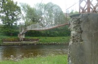
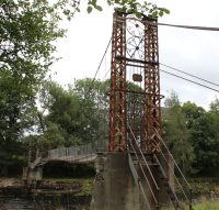
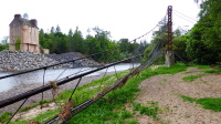
- William Craig describes the bridge, "A wood and angle iron deck supported from two pairs of wire cables and rod suspenders. The railings are of light woven wire. Pylons with ornamental heads are of lattice gider construction on concrete bases five miles west of Ballater, Scotland."
- Was already derelict before December 2015 flooding (Storm Frank) that severely damaged several River Dee bridges. Dave Cooper writes in early 2016: "The bridge's southern tower and its base are gone. The river bank has eroded back to within feet of the grade one listed Abergeldie Castle. Seat of Baron Abergeldie."
External Links:


1886: Blairgowrie
Blairgowrie, Scotland, United Kingdom - River Ericht
| Bridgemeister ID: | 2181 (added 2007-01-13) |
| Year Completed: | 1886 |
| Name: | Blairgowrie |
| Location: | Blairgowrie, Scotland, United Kingdom |
| Crossing: | River Ericht |
| At or Near Feature: | Craighall Castle |
| Principals: | Louis Harper |
| References: | HARPER |
| Use: | Footbridge |
| Status: | Removed |
| Main Cables: | Wire |
| Suspended Spans: | 1 |
| Main Span: | 1 x 27.4 meters (89.9 feet) |
Notes:
- HARPER: Some remnants of the bridge still present, 2006.
External Links:
1887: Jubilee
Nairn, Scotland, United Kingdom - River Nairn
| Bridgemeister ID: | 1945 (added 2005-10-29) |
| Year Completed: | 1887 |
| Name: | Jubilee |
| Location: | Nairn, Scotland, United Kingdom |
| Crossing: | River Nairn |
| Principals: | Harpers Limited |
| References: | HARPER |
| Use: | Footbridge |
| Status: | Replaced, 1915 |
| Main Cables: | Wire |
| Suspended Spans: | 1 |
| Main Span: | 1 x 30.5 meters (100 feet) |
External Links:
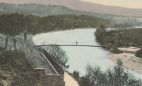
1892: Polhollick
Ballater vicinity, Aberdeenshire, Scotland, United Kingdom - River Dee
| Bridgemeister ID: | 1905 (added 2005-10-08) |
| Year Completed: | 1892 |
| Name: | Polhollick |
| Location: | Ballater vicinity, Aberdeenshire, Scotland, United Kingdom |
| Crossing: | River Dee |
| Coordinates: | 57.055048 N 3.083452 W |
| Maps: | Acme, GeoHack, Google, OpenStreetMap |
| Principals: | James Abernethy & Co. |
| References: | HARPER, HBR |
| Use: | Footbridge |
| Status: | In use (last checked: 2014) |
| Main Cables: | Wire (steel) |
| Suspended Spans: | 1 |
| Main Span: | 1 x 54.4 meters (178.5 feet) |
Notes:
- Closed May 2015 for repairs. Reopened October, 2015.
External Links:
- The Happy Pontist: Scottish Bridges: 19. Polhollick Suspension Bridge
- The Happy Pontist: Scottish Bridges: 44. Polhollick Bridge (revisited)
- Structurae - Structure ID 20021613
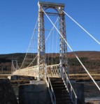
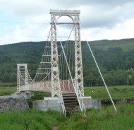
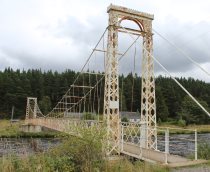
1893: Dorrator
Falkirk, Scotland, United Kingdom - River Carron
| Bridgemeister ID: | 2201 (added 2007-01-28) |
| Year Completed: | 1893 |
| Name: | Dorrator |
| Also Known As: | Falkirk, Carronvale |
| Location: | Falkirk, Scotland, United Kingdom |
| Crossing: | River Carron |
| Coordinates: | 56.011418 N 3.819145 W |
| Maps: | Acme, GeoHack, Google, OpenStreetMap |
| Principals: | Louis Harper |
| References: | AAJ, HARPER |
| Use: | Footbridge |
| Status: | Only towers remain (last checked: 2014) |
| Main Cables: | Wire |
| Suspended Spans: | 1 |
| Main Span: | 1 x 27 meters (88.6 feet) |
Notes:
- Replaced 2014. One tower remains as a monument to the Harper bridge.
External Links:
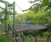
1893: Feugh
Banchory, Scotland, United Kingdom - Water of Feugh
| Bridgemeister ID: | 2196 (added 2007-01-26) |
| Year Completed: | 1893 |
| Name: | Feugh |
| Location: | Banchory, Scotland, United Kingdom |
| Crossing: | Water of Feugh |
| Coordinates: | 57.042679 N 2.493234 W |
| Maps: | Acme, GeoHack, Google, OpenStreetMap |
| Principals: | Louis Harper |
| References: | AAJ, HARPER |
| Use: | Footbridge |
| Status: | In use (last checked: 2014) |
| Main Cables: | Wire |
| Suspended Spans: | 1 |
| Main Span: | 1 x 30 meters (98.4 feet) |
Notes:
- Towers replaced, at some point. Unclear how much of the present-day (2020) bridge is original.
External Links:
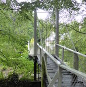
1894: Cromdale
Cromdale, Scotland, United Kingdom - River Spey
| Bridgemeister ID: | 5077 (added 2020-08-30) |
| Year Completed: | 1894 |
| Name: | Cromdale |
| Location: | Cromdale, Scotland, United Kingdom |
| Crossing: | River Spey |
| Coordinates: | 57.341528 N 3.553306 W |
| Maps: | Acme, GeoHack, Google, OpenStreetMap |
| References: | HARPER |
| Use: | Footbridge |
| Status: | Removed, 1921 |
| Main Cables: | Wire |
| Suspended Spans: | 1 |
Notes:
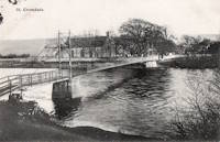
1897: Carfin
Crossford, Carluke, Scotland, United Kingdom - River Clyde
| Bridgemeister ID: | 5172 (added 2020-09-26) |
| Year Completed: | 1897 |
| Name: | Carfin |
| Also Known As: | Crossford |
| Location: | Crossford, Carluke, Scotland, United Kingdom |
| Crossing: | River Clyde |
| Coordinates: | 55.693646 N 3.863803 W |
| Maps: | Acme, GeoHack, Google, OpenStreetMap |
| Principals: | P & R Flemming & Co. |
| Use: | Footbridge |
| Status: | Closed (last checked: 2020) |
| Main Cables: | Rod |
| Suspended Spans: | 2 |
| Main Spans: | 2 |
Notes:
- Restored early 1990s, but has since fallen into disrepair and is closed. Unusual main "cables" appear to be steel rods or some kind of segmented rigid steel members.
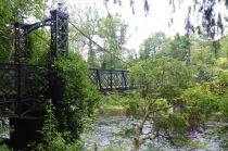
1897: Jubilee
Annan, Scotland, United Kingdom - River Annan
| Bridgemeister ID: | 6206 (added 2021-07-15) |
| Year Completed: | 1897 |
| Name: | Jubilee |
| Location: | Annan, Scotland, United Kingdom |
| Crossing: | River Annan |
| Coordinates: | 55.005848 N 3.265549 W |
| Maps: | Acme, GeoHack, Google, OpenStreetMap |
| Use: | Footbridge |
| Status: | Destroyed, October 28, 2021 |
| Main Cables: | Wire (steel) |
| Suspended Spans: | 1 |
Notes:
- 2021, October 28: Destroyed by flood.
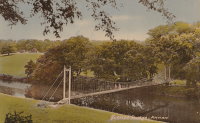
1900: Dunes
Bighouse, Melvich Bay vicinity, Scotland, United Kingdom - Halladale River
| Bridgemeister ID: | 2567 (added 2012-02-05) |
| Year Completed: | 1900 |
| Name: | Dunes |
| Location: | Bighouse, Melvich Bay vicinity, Scotland, United Kingdom |
| Crossing: | Halladale River |
| Coordinates: | 58.55716 N 3.91118 W |
| Maps: | Acme, GeoHack, Google, OpenStreetMap |
| References: | HBR |
| Use: | Footbridge |
| Status: | Removed |
| Main Cables: | Wire |
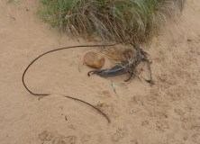
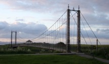
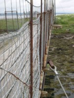
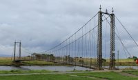
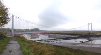
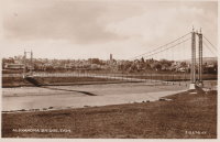
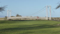
1902: Alexandra
Tain, Ross-Shire, Scotland, United Kingdom - River Tain
| Bridgemeister ID: | 2350 (added 2007-08-18) |
| Year Completed: | 1902 |
| Name: | Alexandra |
| Location: | Tain, Ross-Shire, Scotland, United Kingdom |
| Crossing: | River Tain |
| Coordinates: | 57.81496 N 4.04622 W |
| Maps: | Acme, GeoHack, Google, OpenStreetMap |
| Principals: | Rose Street Foundry (Inverness) |
| Use: | Footbridge |
| Status: | In use (last checked: 2018) |
| Main Cables: | Wire (steel) |
| Suspended Spans: | 1 |
| Main Span: | 1 x 43 meters (141 feet) |
Notes:
- Closed, 2011. Sign posted at the bridge in 2011 stated "No pedestrians beyond this point. Footbridge Closed. Imminent Danger of Collapse."
- Most news stories on the bridge's condition state it was closed continuously, due to deteriorating conditions, from 2011 through 2015, but this was not entirely accurate. The bridge was open in August 2014, but restricted to two people at a time (see accompanying photo sets). Closed again, sometime soon after. Contract awarded for refurbishment, April 2015.
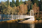
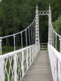
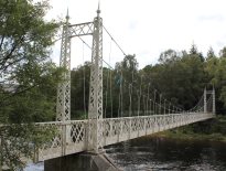
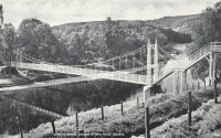
1905: Cambus O'May
Ballater, Scotland, United Kingdom - River Dee
| Bridgemeister ID: | 429 (added before 2003) |
| Year Completed: | 1905 |
| Name: | Cambus O'May |
| Also Known As: | Gordon |
| Location: | Ballater, Scotland, United Kingdom |
| Crossing: | River Dee |
| Coordinates: | 57.065803 N 2.956825 W |
| Maps: | Acme, GeoHack, Google, OpenStreetMap |
| Principals: | James Abernethy & Co. |
| References: | BC2, BC3, BEM, HARPER, HBR, NTB |
| Use: | Footbridge |
| Status: | In use (last checked: April, 2021) |
| Main Cables: | Wire (steel) |
| Suspended Spans: | 1 |
| Main Span: | 1 x 51.8 meters (170 feet) |
Notes:
- 1988: Refurbished (HBR)
- 2015, December: Damaged by the River Dee flood caused by Storm Frank. Closed indefinitely. Repairs expected to start in 2020.
- 2020, August 31: Repairs underway, expected to be completed in approximately 16 weeks.
- 2020, December: Storm Frank repairs now expected to be completed in January 2021.
- 2021, January: Completion of repairs delayed due to COVID-19 pandemic "stay at home" recommendations.
- 2021, April 1: Repairs completed, bridge reopened.
External Links:
- Cambus O' May | Harper Bridges
- The Happy Pontist: Scottish Bridges: 20. Cambus O'May Footbridge
- The Happy Pontist: Scottish Bridges: 43. Cambus O' May Bridge (revisited)
- The Happy Pontist: Scottish Bridges: 55. Cambus O'May Bridge (after the flood)
- Structurae - Structure ID 20019638

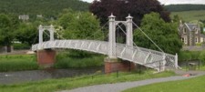
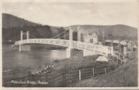
1905: Priorsford
Peebles, Scotland, United Kingdom - River Tweed
| Bridgemeister ID: | 1441 (added 2004-07-31) |
| Year Completed: | 1905 |
| Name: | Priorsford |
| Location: | Peebles, Scotland, United Kingdom |
| Crossing: | River Tweed |
| Coordinates: | 55.649532 N 3.187578 W |
| Maps: | Acme, GeoHack, Google, OpenStreetMap |
| Principals: | Robert Inglis |
| References: | BC3 |
| Use: | Footbridge |
| Status: | In use (last checked: 2014) |
| Main Cables: | Wire (steel) |
| Main Span: | 1 x 29.6 meters (97 feet) |
External Links:

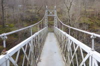
1911: Coronation
Pitlochry, Scotland, United Kingdom - River Tummel
| Bridgemeister ID: | 2621 (added 2018-12-30) |
| Year Completed: | 1911 |
| Name: | Coronation |
| Location: | Pitlochry, Scotland, United Kingdom |
| Crossing: | River Tummel |
| At or Near Feature: | Linn of Tummel vicinity |
| Coordinates: | 56.720118 N 3.793993 W |
| Maps: | Acme, GeoHack, Google, OpenStreetMap |
| Use: | Footbridge |
| Status: | In use (last checked: 2022) |
| Main Cables: | Wire (steel) |
| Suspended Spans: | 1 |
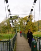
1911: Dryburgh Abbey
Dryburgh and St. Boswells, Scotland, United Kingdom - River Tweed
| Bridgemeister ID: | 6218 (added 2021-07-16) |
| Year Completed: | 1911 |
| Name: | Dryburgh Abbey |
| Location: | Dryburgh and St. Boswells, Scotland, United Kingdom |
| Crossing: | River Tweed |
| Coordinates: | 55.580452 N 2.654235 W |
| Maps: | Acme, GeoHack, Google, OpenStreetMap |
| Use: | Footbridge |
| Status: | In use (last checked: 2021) |
| Main Cables: | Wire (steel) |
| Suspended Spans: | 1 |
Notes:
- Although the current (as of 2021) Dryburgh Abbey bridge is often attributed to 1872, it more closely resembles bridges built starting in the 1890s.
- Replaced 1872 Dryburgh Abbey - Dryburgh and St. Boswells, Scotland, United Kingdom.
- Near Mertoun Estate - Mertoun, Scotland, United Kingdom.
External Links:
- The Happy Pontist: Scottish Bridges: 15. Dryburgh Abbey Footbridge
- Structurae - Structure ID 20016083
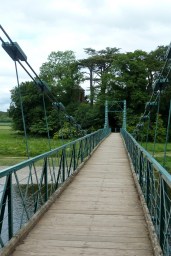
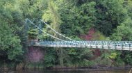
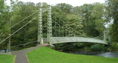
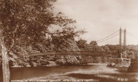
1911: King George V
Newton Stewart, Scotland, United Kingdom - River Cree
| Bridgemeister ID: | 2468 (added 2008-12-19) |
| Year Completed: | 1911 |
| Name: | King George V |
| Location: | Newton Stewart, Scotland, United Kingdom |
| Crossing: | River Cree |
| Coordinates: | 54.967048 N 4.485349 W |
| Maps: | Acme, GeoHack, Google, OpenStreetMap |
| Principals: | D. H. and F. Reid Engineers, Victoria Bridge Works |
| Use: | Footbridge |
| Status: | In use (last checked: 2019) |
| Main Cables: | Wire (steel) |
| Suspended Spans: | 1 |
Notes:
- Plaques posted at the bridge indicate major refurbishments in 1982 and 2001.
External Links:
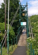
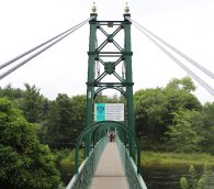
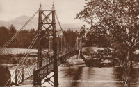
1913: Port-na-Craig
Pitlochry and Port-na Craig, Scotland, United Kingdom - River Tummel
| Bridgemeister ID: | 547 (added before 2003) |
| Year Completed: | 1913 |
| Name: | Port-na-Craig |
| Location: | Pitlochry and Port-na Craig, Scotland, United Kingdom |
| Crossing: | River Tummel |
| Coordinates: | 56.698167 N 3.733017 W |
| Maps: | Acme, GeoHack, Google, OpenStreetMap |
| Use: | Footbridge |
| Status: | In use (last checked: 2014) |
| Main Cables: | Wire (steel) |
| Suspended Spans: | 1 |
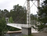
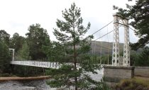
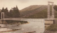
1924: Invercauld
Braemar vicinity, Scotland, United Kingdom - River Dee
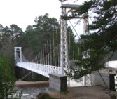
| Bridgemeister ID: | 1906 (added 2005-10-08) |
| Year Completed: | 1924 |
| Name: | Invercauld |
| Also Known As: | Ballochbuie, Garbh Allt Shiel |
| Location: | Braemar vicinity, Scotland, United Kingdom |
| Crossing: | River Dee |
| Coordinates: | 57.001768 N 3.322743 W |
| Maps: | Acme, GeoHack, Google, OpenStreetMap |
| Principals: | James Abernethy & Co. |
| References: | HARPER, HBR |
| Use: | Footbridge |
| Status: | In use (last checked: 2014) |
| Main Cables: | Wire (steel) |
| Suspended Spans: | 1 |
External Links:
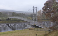
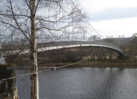
1938: Brae Doune
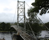
Brae Doune, Scotland, United Kingdom - River Oykel
| Bridgemeister ID: | 2635 (added 2019-03-02) |
| Year Completed: | 1938 |
| Name: | Brae Doune |
| Also Known As: | Tuitean |
| Location: | Brae Doune, Scotland, United Kingdom |
| Crossing: | River Oykel |
| Coordinates: | 57.974258 N 4.638333 W |
| Maps: | Acme, GeoHack, Google, OpenStreetMap |
| Principals: | John Henderson and Co. (Aberdeen) |
| Use: | Footbridge |
| Status: | Closed (last checked: 2022) |
| Main Cables: | Wire (steel) |
| Suspended Spans: | 1 |
| Main Span: | 1 x 91.4 meters (300 feet) |
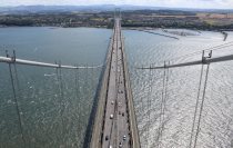
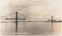
1964: Forth Road
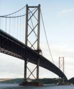
Queensferry, Scotland, United Kingdom - Firth of Forth
| Bridgemeister ID: | 463 (added before 2003) |
| Year Completed: | 1964 |
| Name: | Forth Road |
| Location: | Queensferry, Scotland, United Kingdom |
| Crossing: | Firth of Forth |
| Coordinates: | 56.004020 N 3.404095 W |
| Maps: | Acme, GeoHack, Google, OpenStreetMap |
| References: | BBR, BC3, BDU, BFL, FRB, NTB, WOT |
| Use: | Vehicular (major highway), with walkway |
| Status: | In use (last checked: 2021) |
| Main Cables: | Wire (steel) |
| Suspended Spans: | 3 |
| Main Span: | 1 x 1,006 meters (3,300.5 feet) |
| Side Spans: | 2 x 408 meters (1,338.6 feet) |
Notes:
- December 4, 2015: Closed to all traffic because of structural issues. Reopened for lighter traffic, December 23, 2015. Fully reopened February 20, 2016.
- September 5, 2017: All traffic diverted to newly-opened nearby Queensferry Crossing. Closed completely for repairs. Reopened February 1, 2018 but restricted to public transportation (buses and taxis), pedestrians, and cyclists.
External Links:

1980: Shakin
Burnhervie, Inverurie vicinity, Scotland, United Kingdom - River Don
| Bridgemeister ID: | 1578 (added 2005-01-22) |
| Year Completed: | 1980 |
| Name: | Shakin |
| Location: | Burnhervie, Inverurie vicinity, Scotland, United Kingdom |
| Crossing: | River Don |
| Coordinates: | 57.261031 N 2.440388 W |
| Maps: | Acme, GeoHack, Google, OpenStreetMap |
| Use: | Footbridge |
| Status: | Replaced, 2005 |
| Main Cables: | Wire (steel) |
| Suspended Spans: | 1 |
Notes:
- Replaced by a cable-stayed bridge, 2005.
- Replaced 1880 Burnhervie - Burnhervie, Inverurie vicinity, Scotland, United Kingdom.
1982: (footbridge)
Glen Nevis vicinity, Scotland, United Kingdom - River Nevis
| Bridgemeister ID: | 1458 (added 2004-08-21) |
| Year Completed: | 1982 |
| Name: | (footbridge) |
| Location: | Glen Nevis vicinity, Scotland, United Kingdom |
| Crossing: | River Nevis |
| Coordinates: | 56.811717 N 5.076033 W |
| Maps: | Acme, GeoHack, Google, OpenStreetMap |
| Use: | Footbridge |
| Status: | In use (last checked: 2009) |
| Main Cables: | Wire (steel) |
| Suspended Spans: | 1 |
| Main Span: | 1 x 32.6 meters (107 feet) |
Notes:
- This is not the popular wire rope crossing at Glen Nevis which is literally three ropes -- two to hold onto and one to walk on. Instead, this listing is a traditional suspension footbridge just north of Glen Nevis.
- Don McGillivray worked on this bridge and sent information about its construction.
"The Suspension bridge was principally built by five Royal Engineers from 15 Field Support Squadron Royal Engineers in the summer of 1982. They were Sapper Terry Bradley (Metal workworker) Sapper Paul Brookes (Draughtsman), Sapper Ian Duggan (Surveyor), Sapper Taff Green (Draughtsman) Sapper Don McGillivray (Blacksmith).
"The pier footings and anchorages were excavated by hand as the plant machines were being used on another project at Caol and upriver at the priority bridge opposite the YMCA.The Accrow shuttering and Re-bar was humped and Concrete was pumped across the river over a series of aluminium Mk4 assualt boats. Once the concrete cured, the steel work, provided by Highland Engineering was manhandled across the river using the same boats. The steel uprights and main cable were raised and positioned using a block and tackle from a wooden Gyn. The main cables were anchored on the east bank and were tensioned on the west bank using two tirfor winches. The hangers and stringers were strung out from the west bank in a series like stepping stones until the decking could be positioned.
"The Bridge took five weeks start to finish the best part of the build was the weather which was hot and as we were constantly dropping tools etc. in the river, you had to jump in after it. We later moved up to finish the two span through deck bridge at the YMCA. This bridge replaced an old narrow bridge that used to be a part of a WW2 Mulberry Harbour section."
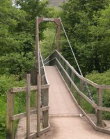
1983: (footbridge)
Glenlivet, Scotland, United Kingdom - River Livet
| Bridgemeister ID: | 2638 (added 2019-03-02) |
| Year Completed: | 1983 |
| Name: | (footbridge) |
| Location: | Glenlivet, Scotland, United Kingdom |
| Crossing: | River Livet |
| At or Near Feature: | Speyside Way - Tomintoul Spur |
| Coordinates: | 57.347297 N 3.331187 W |
| Maps: | Acme, GeoHack, Google, OpenStreetMap |
| Use: | Footbridge |
| Status: | In use (last checked: 2014) |
| Main Cables: | Wire (steel) |
| Suspended Spans: | 1 |
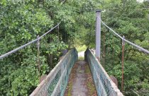
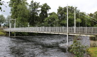
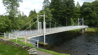
1988: (footbridge)
Inverness, Scotland, United Kingdom - River Ness
| Bridgemeister ID: | 905 (added 2003-10-11) |
| Year Completed: | 1988 |
| Name: | (footbridge) |
| Location: | Inverness, Scotland, United Kingdom |
| Crossing: | River Ness |
| At or Near Feature: | Ness Islands |
| Coordinates: | 57.462946 N 4.233579 W |
| Maps: | Acme, GeoHack, Google, OpenStreetMap |
| Principals: | Cruden and Tough |
| References: | HBR |
| Use: | Footbridge |
| Status: | In use (last checked: 2019) |
| Main Cables: | Wire (steel) |
| Suspended Spans: | 3 |
| Main Span: | 1 |
| Side Spans: | 2 |
Notes:
- One of two footbridges in the Ness Islands near the locations of the two 1853 Ness Islands bridges. This one has towers that are more in the river than the other 1988 bridge.
- Near 1988 (footbridge) - Inverness, Scotland, United Kingdom.
- See 1853 General's Well - Inverness, Scotland, United Kingdom.
- See 1853 Island Bank Road - Inverness, Scotland, United Kingdom.
External Links:
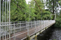
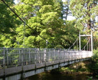
1988: (footbridge)
Inverness, Scotland, United Kingdom - River Ness
| Bridgemeister ID: | 906 (added 2003-10-11) |
| Year Completed: | 1988 |
| Name: | (footbridge) |
| Location: | Inverness, Scotland, United Kingdom |
| Crossing: | River Ness |
| At or Near Feature: | Ness Islands |
| Coordinates: | 57.465699 N 4.228247 W |
| Maps: | Acme, GeoHack, Google, OpenStreetMap |
| References: | HBR |
| Use: | Footbridge |
| Status: | In use (last checked: 2019) |
| Main Cables: | Wire (steel) |
| Suspended Spans: | 1 |
Notes:
- One of two footbridges in the Ness Islands near the locations of the two 1853 Ness Islands bridges. This one has towers set back from the river.
- Near 1988 (footbridge) - Inverness, Scotland, United Kingdom.
- See 1853 General's Well - Inverness, Scotland, United Kingdom.
- See 1853 Island Bank Road - Inverness, Scotland, United Kingdom.
External Links:
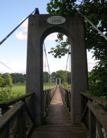
1999: (footbridge)
Monteviot, Ancrum vicinity, Scotland, United Kingdom - River Teviot
| Bridgemeister ID: | 1434 (added 2004-07-30) |
| Year Completed: | 1999 |
| Name: | (footbridge) |
| Location: | Monteviot, Ancrum vicinity, Scotland, United Kingdom |
| Crossing: | River Teviot |
| Coordinates: | 55.512985 N 2.555607 W |
| Maps: | Acme, GeoHack, Google, OpenStreetMap |
| Use: | Footbridge |
| Status: | In use (last checked: 2009) |
| Main Cables: | Wire (steel) |
| Suspended Spans: | 1 |
| Main Span: | 1 x 69.8 meters (229 feet) |
| Deck width: | 3 feet |
2004: Doll
Doll vicinity, Brora, Scotland, United Kingdom - River Brora
| Bridgemeister ID: | 2613 (added 2014-04-15) |
| Year Completed: | 2004 |
| Name: | Doll |
| Also Known As: | Ford |
| Location: | Doll vicinity, Brora, Scotland, United Kingdom |
| Crossing: | River Brora |
| At or Near Feature: | Brora Ford |
| Coordinates: | 58.01495 N 3.91287 W |
| Maps: | Acme, GeoHack, Google, OpenStreetMap |
| Use: | Footbridge |
| Status: | In use (last checked: 2022) |
| Main Cables: | Wire (steel) |
| Suspended Spans: | 1 |
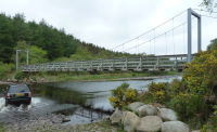
(footbridge)
Aberlour, Scotland, United Kingdom - Burn of Aberlour
| Bridgemeister ID: | 2529 (added 2010-05-19) |
| Name: | (footbridge) |
| Location: | Aberlour, Scotland, United Kingdom |
| Crossing: | Burn of Aberlour |
| At or Near Feature: | Speyside Way |
| Coordinates: | 57.4688 N 3.2317 W |
| Maps: | Acme, GeoHack, Google, OpenStreetMap |
| Use: | Footbridge |
| Status: | In use (last checked: 2009) |
| Main Cables: | Wire (steel) |
| Suspended Spans: | 1 |
| Main Span: | 1 x 23.2 meters (76 feet) |
Notes:
- Near Victoria (Penny, Aberlour) - Charlestown of Aberlour and Wester Elchies, Scotland, United Kingdom.
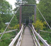
(footbridge)
Badintagairt, Lairg, Scotland, United Kingdom - River Cassley
| Bridgemeister ID: | 7131 (added 2022-06-19) |
| Name: | (footbridge) |
| Location: | Badintagairt, Lairg, Scotland, United Kingdom |
| Crossing: | River Cassley |
| Coordinates: | 58.050790 N 4.665025 W |
| Maps: | Acme, GeoHack, Google, OpenStreetMap |
| Use: | Footbridge |
| Status: | Derelict, since c. 2019-2021 (last checked: 2022) |
| Main Span: | 1 |
Notes:
- Appears to have been largely destroyed at some point in the 2019-2021 time frame.
(footbridge)
Ballindalloch vicinity, Scotland, United Kingdom - Allt a'Gheallaidh
| Bridgemeister ID: | 2530 (added 2010-05-19) |
| Name: | (footbridge) |
| Location: | Ballindalloch vicinity, Scotland, United Kingdom |
| Crossing: | Allt a'Gheallaidh |
| At or Near Feature: | Speyside Way |
| Coordinates: | 57.4225 N 3.3745 W |
| Maps: | Acme, GeoHack, Google, OpenStreetMap |
| Use: | Footbridge |
| Status: | In use (last checked: 2009) |
| Main Cables: | Wire (steel) |
| Suspended Spans: | 1 |
| Main Span: | 1 x 24.8 meters (81.5 feet) |
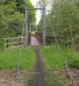
(footbridge)
Berriedale, Scotland, United Kingdom - Berriedale Water
| Bridgemeister ID: | 7132 (added 2022-06-19) |
| Name: | (footbridge) |
| Location: | Berriedale, Scotland, United Kingdom |
| Crossing: | Berriedale Water |
| Coordinates: | 58.182341 N 3.497737 W |
| Maps: | Acme, GeoHack, Google, OpenStreetMap |
| Use: | Footbridge |
| Status: | In use (last checked: 2021) |
| Main Cables: | Wire |
| Suspended Spans: | 1 |
| Main Span: | 1 |
(footbridge)
Branxholm, Hawick, Scotland, United Kingdom - River Teviot
| Bridgemeister ID: | 8210 (added 2024-02-05) |
| Name: | (footbridge) |
| Location: | Branxholm, Hawick, Scotland, United Kingdom |
| Crossing: | River Teviot |
| At or Near Feature: | Branxholme Castle |
| Coordinates: | 55.395528 N 2.845694 W |
| Maps: | Acme, GeoHack, Google, OpenStreetMap |
| Use: | Footbridge |
| Status: | Removed |
| Main Span: | 1 |
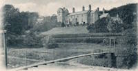
(footbridge)
Contin vicinity, Scotland, United Kingdom - Black Water River
| Bridgemeister ID: | 907 (added 2003-10-11) |
| Name: | (footbridge) |
| Location: | Contin vicinity, Scotland, United Kingdom |
| Crossing: | Black Water River |
| At or Near Feature: | Rogie Falls |
| Coordinates: | 57.589014 N 4.603213 W |
| Maps: | Acme, GeoHack, Google, OpenStreetMap |
| Use: | Footbridge |
| Status: | Replaced, c. 2014 |
| Main Cables: | Wire (steel) |
| Suspended Spans: | 1 |
Notes:
- Sign at bridge reads: "Reconstructed by the Territorial Army in 1975."
- Replaced, likely in 2014.
- Replaced by (footbridge) - Contin vicinity, Scotland, United Kingdom.
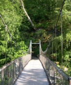
(footbridge)
Contin vicinity, Scotland, United Kingdom - Black Water River
| Bridgemeister ID: | 2932 (added 2003-10-11) |
| Name: | (footbridge) |
| Location: | Contin vicinity, Scotland, United Kingdom |
| Crossing: | Black Water River |
| At or Near Feature: | Rogie Falls |
| Coordinates: | 57.588906 N 4.603127 W |
| Maps: | Acme, GeoHack, Google, OpenStreetMap |
| Use: | Footbridge |
| Status: | In use (last checked: 2019) |
| Main Cables: | Wire (steel) |
| Suspended Spans: | 1 |
Notes:
- Replaced (footbridge) - Contin vicinity, Scotland, United Kingdom. Likely erected in 2014.
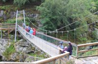
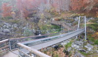
(footbridge)
Danaglar Castle, Scotland, United Kingdom - Shee Water
| Bridgemeister ID: | 6248 (added 2021-07-18) |
| Name: | (footbridge) |
| Location: | Danaglar Castle, Scotland, United Kingdom |
| Crossing: | Shee Water |
| At or Near Feature: | Danaglar Ford |
| Use: | Footbridge |
| Main Cables: | Wire |
| Suspended Spans: | 1 |
Notes:
- Likely removed. Exact location unknown but appears to have been in the vicinity of Danaglar Castle.
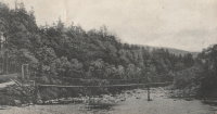
(footbridge)
Duchally, Lairg, Scotland, United Kingdom - River Cassley
| Bridgemeister ID: | 7130 (added 2022-06-19) |
| Name: | (footbridge) |
| Location: | Duchally, Lairg, Scotland, United Kingdom |
| Crossing: | River Cassley |
| Coordinates: | 58.108786 N 4.736285 W |
| Maps: | Acme, GeoHack, Google, OpenStreetMap |
| Use: | Footbridge |
| Status: | Extant (last checked: 2021) |
| Main Cables: | Wire |
| Suspended Spans: | 1 |
| Main Span: | 1 x 32 meters (105 feet) estimated |
(footbridge)
Duible vicinity, Helmsdale, Scotland, United Kingdom - River Helmsdale
| Bridgemeister ID: | 2698 (added 2019-05-27) |
| Name: | (footbridge) |
| Location: | Duible vicinity, Helmsdale, Scotland, United Kingdom |
| Crossing: | River Helmsdale |
| Coordinates: | 58.149375 N 3.819557 W |
| Maps: | Acme, GeoHack, Google, OpenStreetMap |
| Use: | Footbridge |
| Status: | Extant (last checked: 2019) |
| Main Cables: | Wire (steel) |
| Suspended Spans: | 1 |
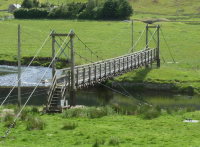
(footbridge)
Dunbeath, Scotland, United Kingdom - Houstry Burn
| Bridgemeister ID: | 1914 (added 2005-10-09) |
| Name: | (footbridge) |
| Location: | Dunbeath, Scotland, United Kingdom |
| Crossing: | Houstry Burn |
| Coordinates: | 58.254200 N 3.439300 W |
| Maps: | Acme, GeoHack, Google, OpenStreetMap |
| Principals: | Wm. Smith and Son |
| Use: | Footbridge |
| Status: | In use (last checked: 2010) |
| Main Cables: | Wire |
| Suspended Spans: | 1 |
Notes:
- Very short footbridge.
- Near Milton - Dunbeath, Scotland, United Kingdom.
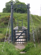
(footbridge)
Glen Brittle, Skye, Scotland, United Kingdom - River Brittle
| Bridgemeister ID: | 3163 (added 2019-11-03) |
| Name: | (footbridge) |
| Location: | Glen Brittle, Skye, Scotland, United Kingdom |
| Crossing: | River Brittle |
| Coordinates: | 57.206041 N 6.292533 W |
| Maps: | Acme, GeoHack, Google, OpenStreetMap |
| Use: | Footbridge |
| Status: | Removed, c. 2011-2021 |
| Main Cables: | Wire |
| Suspended Spans: | 1 |
Notes:
- Removed at some point in the 2011-2021 time frame and replaced with a non-suspension bridge.
(footbridge)
Kilbraur, Scotland, United Kingdom - River Brora
| Bridgemeister ID: | 6764 (added 2021-10-26) |
| Name: | (footbridge) |
| Location: | Kilbraur, Scotland, United Kingdom |
| Crossing: | River Brora |
| Coordinates: | 58.066959 N 3.996902 W |
| Maps: | Acme, GeoHack, Google, OpenStreetMap |
| Use: | Footbridge |
| Status: | In use (last checked: 2021) |
| Main Cables: | Wire |
| Suspended Spans: | 1 |
Notes:
- Likely built in 1960s or 1970s.
(footbridge)
Kildonan Lodge vicinity, Helmsdale, Scotland, United Kingdom - River Helmsdale
| Bridgemeister ID: | 2906 (added 2019-09-15) |
| Name: | (footbridge) |
| Location: | Kildonan Lodge vicinity, Helmsdale, Scotland, United Kingdom |
| Crossing: | River Helmsdale |
| Coordinates: | 58.184200 N 3.871900 W |
| Maps: | Acme, GeoHack, Google, OpenStreetMap |
| Use: | Footbridge |
| Status: | In use (last checked: 2010) |
| Main Cables: | Wire (steel) |
| Suspended Spans: | 1 |
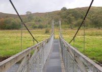
(footbridge)
Kildonan Lodge, Helmsdale, Scotland, United Kingdom - River Helmsdale
| Bridgemeister ID: | 2907 (added 2019-09-15) |
| Name: | (footbridge) |
| Location: | Kildonan Lodge, Helmsdale, Scotland, United Kingdom |
| Crossing: | River Helmsdale |
| Coordinates: | 58.1767 N 3.8664 W |
| Maps: | Acme, GeoHack, Google, OpenStreetMap |
| Use: | Footbridge |
| Status: | In use (last checked: 2011) |
| Main Cables: | Wire (steel) |
| Suspended Spans: | 1 |
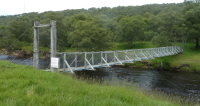
(footbridge)
Kilphedir, Helmsdale, Scotland, United Kingdom - River Helmsdale
| Bridgemeister ID: | 2908 (added 2019-09-15) |
| Name: | (footbridge) |
| Location: | Kilphedir, Helmsdale, Scotland, United Kingdom |
| Crossing: | River Helmsdale |
| Coordinates: | 58.1431 N 3.7222 W |
| Maps: | Acme, GeoHack, Google, OpenStreetMap |
| Use: | Footbridge |
| Status: | In use (last checked: 2009) |
| Main Cables: | Wire (steel) |
| Suspended Spans: | 1 |
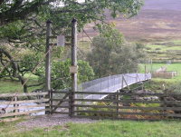
(footbridge)
Lairg vicinity, Scotland, United Kingdom - River Shin
| Bridgemeister ID: | 1463 (added 2004-08-28) |
| Name: | (footbridge) |
| Location: | Lairg vicinity, Scotland, United Kingdom |
| Crossing: | River Shin |
| Coordinates: | 58.003383 N 4.407083 W |
| Maps: | Acme, GeoHack, Google, OpenStreetMap |
| Use: | Footbridge |
| Status: | In use (last checked: 2014) |
| Main Cables: | Wire (steel) |
| Suspended Spans: | 1 |
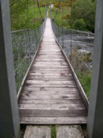
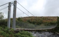
(footbridge)
Lochmaddy, Isle of North Uist, Western Isles, Scotland, United Kingdom
| Bridgemeister ID: | 2741 (added 2019-06-23) |
| Name: | (footbridge) |
| Location: | Lochmaddy, Isle of North Uist, Western Isles, Scotland, United Kingdom |
| At or Near Feature: | Hut of the Shadows Camera Obscura |
| Coordinates: | 57.609180 N 7.155199 W |
| Maps: | Acme, GeoHack, Google, OpenStreetMap |
| Use: | Footbridge |
| Status: | In use (last checked: 2023) |
| Main Cables: | Wire (steel) |
| Suspended Spans: | 1 |
(footbridge)
Loubcroy, Scotland, United Kingdom - River Oykel
| Bridgemeister ID: | 2637 (added 2019-03-02) |
| Name: | (footbridge) |
| Location: | Loubcroy, Scotland, United Kingdom |
| Crossing: | River Oykel |
| Coordinates: | 57.983621 N 4.789704 W |
| Maps: | Acme, GeoHack, Google, OpenStreetMap |
| Use: | Footbridge |
| Status: | In use (last checked: 2022) |
| Main Cables: | Wire (steel) |
| Suspended Spans: | 1 |
| Main Span: | 1 |
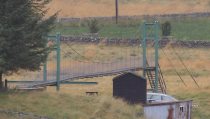
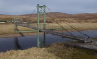
(footbridge)
New Luce vicinity, Dumfries and Galloway, Scotland, United Kingdom - Water of Luce
| Bridgemeister ID: | 6981 (added 2022-04-02) |
| Name: | (footbridge) |
| Location: | New Luce vicinity, Dumfries and Galloway, Scotland, United Kingdom |
| Crossing: | Water of Luce |
| At or Near Feature: | Southern Upland Way |
| Coordinates: | 54.920573 N 4.852780 W |
| Maps: | Acme, GeoHack, Google, OpenStreetMap |
| Use: | Footbridge |
| Status: | In use (last checked: 2022) |
| Main Cables: | Wire (steel) |
| Suspended Spans: | 1 |
| Main Span: | 1 |
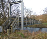
(footbridge)
St. John's Town of Dalry, Scotland, United Kingdom - Water of Ken
| Bridgemeister ID: | 2575 (added 2012-12-29) |
| Name: | (footbridge) |
| Location: | St. John's Town of Dalry, Scotland, United Kingdom |
| Crossing: | Water of Ken |
| Coordinates: | 55.10654 N 4.16751 W |
| Maps: | Acme, GeoHack, Google, OpenStreetMap |
| Use: | Footbridge |
| Status: | In use (last checked: 2012) |
| Main Cables: | Wire (steel) |
| Suspended Spans: | 1 |
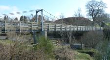
(footbridge)
Strathyre, Scotland, United Kingdom - River Balvaig
| Bridgemeister ID: | 5193 (added 2020-10-04) |
| Name: | (footbridge) |
| Location: | Strathyre, Scotland, United Kingdom |
| Crossing: | River Balvaig |
| Coordinates: | 56.321848 N 4.331051 W |
| Maps: | Acme, GeoHack, Google, OpenStreetMap |
| Use: | Footbridge |
| Status: | In use (last checked: 2020) |
| Main Cables: | Wire (steel) |
| Suspended Spans: | 1 |
Notes:
- Crosses the waterway connecting Loch Voil and Loch Lubnaig.
- Damaged by flood and subsequently rebuilt, 2017.
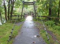
(footbridge)
Ullapool, Scotland, United Kingdom - Rhidorroch River
| Bridgemeister ID: | 2845 (added 2019-07-07) |
| Name: | (footbridge) |
| Location: | Ullapool, Scotland, United Kingdom |
| Crossing: | Rhidorroch River |
| At or Near Feature: | East Rhidorroch Lodge |
| Coordinates: | 57.897378 N 4.976504 W |
| Maps: | Acme, GeoHack, Google, OpenStreetMap |
| Use: | Footbridge |
| Status: | In use (last checked: 2022) |
| Main Cables: | Wire (steel) |
| Suspended Spans: | 1 |
Notes:
- 2014: Heavily damaged by a storm. Repaired.
(suspension bridge)
Tomintoul, Scotland, United Kingdom - River Avon
| Bridgemeister ID: | 1904 (added 2005-10-08) |
| Name: | (suspension bridge) |
| Location: | Tomintoul, Scotland, United Kingdom |
| Crossing: | River Avon |
| References: | HBR |
Notes:
- HBR notes this bridge as 'remains of a former suspension bridge' located 'in the next field' from the Tomintoul footbridge.
- Near Tomintoul - Tomintoul, Scotland, United Kingdom.
Athnamulloch
Loch Affric, Scotland, United Kingdom - River Affric
| Bridgemeister ID: | 1907 (added 2005-10-08) |
| Name: | Athnamulloch |
| Location: | Loch Affric, Scotland, United Kingdom |
| Crossing: | River Affric |
| References: | HBR |
| Use: | Footbridge |
| Main Cables: | Wire |
| Suspended Spans: | 1 |
| Main Span: | 1 x 27.4 meters (90 feet) |
Birkhall
Birkhall, Ballater, Scotland, United Kingdom - River Muick
| Bridgemeister ID: | 6435 (added 2021-08-12) |
| Name: | Birkhall |
| Location: | Birkhall, Ballater, Scotland, United Kingdom |
| Crossing: | River Muick |
| Coordinates: | 57.028166 N 3.072770 W |
| Maps: | Acme, GeoHack, Google, OpenStreetMap |
| Use: | Footbridge |
| Status: | In use (last checked: 2021) |
| Main Cables: | Wire (steel) |
| Suspended Spans: | 1 |
Notes:
- Built at some point in the 2016-2020 time frame as a reproduction of the Harper bridge destroyed by flood in December 2015.
- Replaced 1880 Birkhall - Birkhall, Ballater, Scotland, United Kingdom.
Bonawe
Bonawe, Scotland, United Kingdom - River Awe
| Bridgemeister ID: | 1909 (added 2005-10-08) |
| Name: | Bonawe |
| Location: | Bonawe, Scotland, United Kingdom |
| Crossing: | River Awe |
| Coordinates: | 56.434000 N 5.215000 W |
| Maps: | Acme, GeoHack, Google, OpenStreetMap |
| References: | HBR |
| Use: | Footbridge |
| Status: | In use (last checked: 2012) |
| Main Cables: | Wire (steel) |
| Suspended Spans: | 1 |
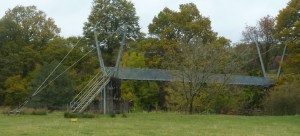
Burnfoot
Langholm, Scotland, United Kingdom - River Esk
| Bridgemeister ID: | 7857 (added 2023-09-15) |
| Name: | Burnfoot |
| Location: | Langholm, Scotland, United Kingdom |
| Crossing: | River Esk |
| Coordinates: | 55.189486 N 3.042137 W |
| Maps: | Acme, GeoHack, Google, OpenStreetMap |
| Status: | Removed |
| Suspended Spans: | 1 |
Notes:
- The coordinates provided here appear to be the likely location of this bridge. The current (as of the 2020s) bridge dates to 1902. The linked postcard image for "Suspension Bridge Burnfoot" is postmarked from nearby Langholm (in 1908).
External Links:
- BURNFOOT BRIDGE (LB16925) - Historic Environment Scotland. Notes the current (1902) bridge is said to have been preceded by a suspension bridge completed in 1810 (unlikely) or possibly 1836 (more likely) per a datestone at the site.
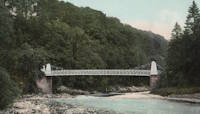
Deanshugh
Elgin, Scotland, United Kingdom - River Lossie
| Bridgemeister ID: | 7983 (added 2023-12-02) |
| Name: | Deanshugh |
| Also Known As: | Deanhugh, River Lossie |
| Location: | Elgin, Scotland, United Kingdom |
| Crossing: | River Lossie |
| At or Near Feature: | Cooper Park |
| Coordinates: | 57.654333 N 3.310278 W |
| Maps: | Acme, GeoHack, Google, OpenStreetMap |
| Use: | Footbridge |
| Status: | Removed |
| Suspended Spans: | 1 |
External Links:
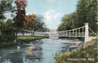
Duneaves
Glen Lyon, Perthshire, Scotland, United Kingdom - River Lyon
| Bridgemeister ID: | 2584 (added 2013-11-03) |
| Name: | Duneaves |
| Location: | Glen Lyon, Perthshire, Scotland, United Kingdom |
| Crossing: | River Lyon |
| Coordinates: | 56.598316 N 4.040413 W |
| Maps: | Acme, GeoHack, Google, OpenStreetMap |
| Use: | Footbridge |
| Status: | In use (last checked: 2013) |
| Main Cables: | Wire |
| Suspended Spans: | 1 |
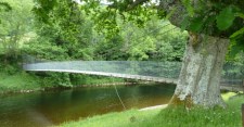
Elvanfoot
Elvanfoot, Scotland, United Kingdom - River Clyde
| Bridgemeister ID: | 3674 (added 2020-01-26) |
| Name: | Elvanfoot |
| Location: | Elvanfoot, Scotland, United Kingdom |
| Crossing: | River Clyde |
| Coordinates: | 55.441074 N 3.654928 W |
| Maps: | Acme, GeoHack, Google, OpenStreetMap |
| Principals: | David Rowell & Co. |
| Use: | Footbridge |
| Status: | Closed, 2007 (last checked: 2020) |
| Main Cables: | Wire (steel) |
| Main Span: | 1 x 38.5 meters (126.3 feet) estimated |
Notes:
- Completed 1920s.
External Links:
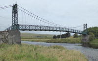
Kendoon I
Kendoon, Scotland, United Kingdom - Water of Ken
| Bridgemeister ID: | 987 (added 2003-11-15) |
| Name: | Kendoon I |
| Location: | Kendoon, Scotland, United Kingdom |
| Crossing: | Water of Ken |
| Coordinates: | 55.16313 N 4.19360 W |
| Maps: | Acme, GeoHack, Google, OpenStreetMap |
| Use: | Footbridge |
| Status: | In use (last checked: 2012) |
| Main Cables: | Wire (steel) |
| Suspended Spans: | 1 |
Notes:
- Provides access to Kendoon Power Station near Kendoon Loch. One of two suspension bridges at this location.
- Was closed for repairs in 2010, reopened by 2012.
- Near Kendoon II - Kendoon, Scotland, United Kingdom.
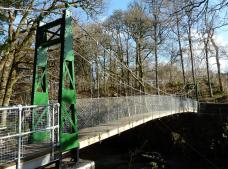
Kendoon II
Kendoon, Scotland, United Kingdom - Water of Deugh
| Bridgemeister ID: | 2534 (added 2011-12-25) |
| Name: | Kendoon II |
| Location: | Kendoon, Scotland, United Kingdom |
| Crossing: | Water of Deugh |
| Coordinates: | 55.16356 N 4.19224 W |
| Maps: | Acme, GeoHack, Google, OpenStreetMap |
| Use: | Footbridge |
| Status: | In use (last checked: 2012) |
| Main Cables: | Wire (steel) |
| Suspended Spans: | 1 |
Notes:
- Provides access to Kendoon Power Station near Kendoon Loch. One of two suspension bridges at this location.
- Closed for repairs in 2010, reopened by 2012.
- Near Kendoon I - Kendoon, Scotland, United Kingdom.
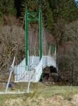
Langwell
Langwell, Scotland, United Kingdom - River Oykel
| Bridgemeister ID: | 2636 (added 2019-03-02) |
| Name: | Langwell |
| Location: | Langwell, Scotland, United Kingdom |
| Crossing: | River Oykel |
| Coordinates: | 57.972010 N 4.681621 W |
| Maps: | Acme, GeoHack, Google, OpenStreetMap |
| Use: | Footbridge |
| Status: | In use (last checked: 2014) |
| Main Cables: | Wire (steel) |
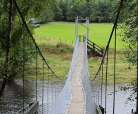
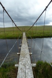
Loch Achnamoine
Loch Achnamoine, Scotland, United Kingdom - River Helmsdale
| Bridgemeister ID: | 1908 (added 2005-10-08) |
| Name: | Loch Achnamoine |
| Location: | Loch Achnamoine, Scotland, United Kingdom |
| Crossing: | River Helmsdale |
| Coordinates: | 58.263535 N 4.032381 W |
| Maps: | Acme, GeoHack, Google, OpenStreetMap |
| References: | HBR |
| Use: | Footbridge |
| Status: | Extant (last checked: 2011) |
| Main Cables: | Wire |
Notes:
- HBR notes several other light footbridges in this area. Dave Cooper noted there are likely five River Helmsdale suspension bridges (including this one) in this area.
Do you have any information or photos for these bridges that you would like to share? Please email david.denenberg@bridgemeister.com.