Undated/Named Suspension Bridges (1,301-1,400 of 1,494)
This is a list of bridges 1,301 through 1,400 (of 1,494 total) in the suspension bridge inventory that are undated named bridges. Wherever you see a Bridgemeister ID number click it to isolate the bridge on its own page.
Related Lists:
Bridgemeister ID: 3750 (added 2020-02-28)Name: Tømmerdal Location: Nordnes, Saltdal, Nordland, Norway Crossing: Luonosjåhkå Coordinates: 66.95365 N 15.30116 E Maps: Acme , GeoHack , Google , kart.1881.no , OpenStreetMap Use: Footbridge Status: In use (last checked: 2014) Main Cables: Wire (steel) Suspended Spans: 1 Main Span: 1 x 71 meters (232.9 feet) estimated
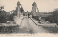
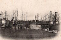
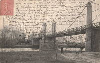
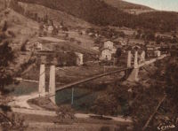
Rebuilt at some point between 2004 and June, 2010 when it was reopened. In use but crossings sometimes highly restricted. Bridgemeister ID: 7445 (added 2022-12-23)Name: Tercis-les-Bains Location: Tercis-les-Bains, Landes , France Crossing: Luy River Coordinates: 43.663829 N 1.101447 W Maps: Acme , GeoHack , Google , OpenStreetMap Use: Vehicular (one-lane) Status: Only towers remain (last checked: 2013) Main Cables: Wire (iron) Suspended Spans: 1
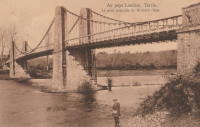
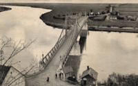
Bridgemeister ID: 7446 (added 2022-12-23)Name: Tercis-les-Bains Location: Tercis-les-Bains, Landes , France Crossing: Adour River Coordinates: 43.673966 N 1.135208 W Maps: Acme , GeoHack , Google , OpenStreetMap Use: Vehicular Status: Removed Main Cables: Wire (iron) Suspended Spans: 3 Main Span: 1 Side Spans: 2
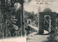
Bridgemeister ID: 8165 (added 2024-02-03)Name: Termas de Cauquenes Location: Termas de Cauquenes, Rancagua vicinity, Chile Coordinates: 34.247750 S 70.553944 W Maps: Acme , GeoHack , Google , OpenStreetMap Use: Footbridge Status: In use (last checked: 2023) Main Cables: Wire Suspended Spans: 1
The Termas de Cauquenes suspension bridge pictured here may not be exactly the same bridge that survives (as of 2023) at the coordinates provided here. The terrain and view of the resort do not seem to match the location of the surviving bridge. Satellite images show what appears to be a derelict suspension bridge about 230 meters north, crossing an arm of the Cachapoal River to reach a large outcropping (S 34.245472, E 70.553833). This may be the location of the bridge pictured. However, the fact remains there is a 1920s-era (or older) suspension bridge at the coordinates provided with this record. Bridgemeister ID: 6177 (added 2021-07-08)Name: Tezikov Also Known As: Тезиков Location: Tambov (Тамбов), Tambov Oblast, Russia Crossing: Reka Tsna Coordinates: 52.711624 N 41.472909 E Maps: Acme , GeoHack , Google , OpenStreetMap Use: Footbridge Status: In use (last checked: 2021) Main Cables: Wire (steel) Suspended Spans: 3 Main Span: 1 x 49 meters (160.8 feet) estimated Side Spans: 2
Bridgemeister ID: 6146 (added 2021-07-07)Name: Tha Kha-nun Also Known As: สะพานแขวน วัดท่าขนุน Location: Tha Kha-nun, Thong Pha Phum District, Kanchanaburi, Thailand Crossing: Khwae Noi Coordinates: 14.742293 N 98.634510 E Maps: Acme , GeoHack , Google , OpenStreetMap Use: Footbridge Status: In use (last checked: 2021) Main Cables: Wire (steel) Main Span: 1 Side Spans: 2
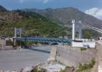
Bridgemeister ID: 3468 (added 2019-12-23)Name: Thakot Location: Thakot and Dandai, Pakistan Crossing: Indus River Coordinates: 34.804124 N 72.936253 E Maps: Acme , GeoHack , Google , OpenStreetMap Use: Vehicular Status: In use (last checked: 2019) Main Cables: Wire (steel) Suspended Spans: 1
Bridgemeister ID: 2997 (added 2019-10-13)Name: Thenmala Location: Thenmala, Kerala , India Coordinates: 8.956652 N 77.065556 E Maps: Acme , GeoHack , Google , OpenStreetMap Use: Footbridge Status: In use (last checked: 2019) Main Cables: Wire (steel)
Bridgemeister ID: 2290 (added 2007-04-24)Name: Thierbach-Zinnberg Location: Thierbach and Zinnberg, Saxony, Germany Crossing: Zwickauer Mulde River Use: Footbridge Status: Destroyed, 1954, by flood Suspended Spans: 1
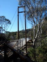
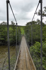
Bridgemeister ID: 6739 (added 2021-10-23)Name: Thredbo Valley Track Location: Thredbo, New South Wales , Australia Crossing: Thredbo River At or Near Feature: Kosciuszko National Park Coordinates: 36.489870 S 148.332086 E Maps: Acme , GeoHack , Google , OpenStreetMap Use: Footbridge Status: In use (last checked: 2021) Main Cables: Wire (steel) Suspended Spans: 3 Main Span: 1 Side Spans: 2
Bridgemeister ID: 6740 (added 2021-10-23)Name: Thredbo Valley Track Location: Thredbo, New South Wales , Australia Crossing: Thredbo River At or Near Feature: Kosciuszko National Park Coordinates: 36.494634 S 148.323923 E Maps: Acme , GeoHack , Google , OpenStreetMap Use: Footbridge Status: In use (last checked: 2021) Main Cables: Wire (steel) Suspended Spans: 3 Main Span: 1 Side Spans: 2
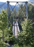
Bridgemeister ID: 1283 (added 2004-03-14)Name: Thunder Creek Location: Ross Lake National Recreation Area, Washington , USA Crossing: Thunder Creek At or Near Feature: Diablo Lake vicinity, North Cascades National Park Coordinates: 48.67825 N 121.07848 W Maps: Acme , GeoHack , Google , OpenStreetMap Use: Footbridge Status: Destroyed, October 2003 Main Cables: Wire (steel) Main Span: 1 x 39.6 meters (130 feet) estimated
Damaged by fallen tree, summer 2003. Soon repaired. Destroyed during storm, October 2003. According to a June 2004 National Park Service web page advising as to storm damage in North Cascade National Park: "The suspension bridge over Thunder Creek one-mile from the trailhead in Colonial Creek Campground was destroyed. This large bridge was in a location which flooded at the beginning of many summer seasons. Planning for a better location, environmental assessment of alternatives, and application for funding will take place this year with construction happening in 2005. The log jam at the former bridge site is closed to crossing because of safety considerations." The bridge was indeed replaced with a non-suspension bridge at a different location. Bridgemeister ID: 2763 (added 2019-06-30)Name: Tianchang Also Known As: 天長橋 Location: Fanlu Township, Chiayi County, Taiwan Crossing: Bazhang River Coordinates: 23.438911 N 120.605908 E Maps: Acme , GeoHack , Google , OpenStreetMap Use: Footbridge Status: In use (last checked: 2019) Main Cables: Wire (steel) Suspended Spans: 1
Bridgemeister ID: 2762 (added 2019-06-30)Name: Tianchang Location: Fanlu Township, Chiayi County, Taiwan Coordinates: 23.439673 N 120.607941 E Maps: Acme , GeoHack , Google , OpenStreetMap Use: Footbridge Status: In use (last checked: 2019) Main Cables: Wire (steel) Suspended Spans: 1
Bridgemeister ID: 4328 (added 2020-04-10)Name: Tianlong Also Known As: 天竜橋 Location: Tenryu, Nagano , Japan Crossing: Tenryu River Coordinates: 35.310277 N 137.847685 E Maps: Acme , GeoHack , Google , OpenStreetMap Status: In use (last checked: 2018) Main Cables: Wire (steel) Suspended Spans: 1 Main Span: 1 x 117 meters (383.9 feet) estimated
Bridgemeister ID: 3771 (added 2020-02-29)Name: Tianlong Location: Haiduan Township, Taitung County, Taiwan Coordinates: 23.173628 N 121.042297 E Maps: Acme , GeoHack , Google , OpenStreetMap Use: Footbridge Status: In use (last checked: 2013) Main Cables: Wire (steel)
Bridgemeister ID: 2776 (added 2019-06-30)Name: Tianlun Baileng Location: Heping District, Taichung City, Taiwan Coordinates: 24.186072 N 120.919595 E Maps: Acme , GeoHack , Google , OpenStreetMap Use: Footbridge Status: In use (last checked: 2019) Main Cables: Wire (steel)
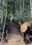
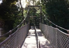
Bridgemeister ID: 6142 (added 2021-07-06)Name: Tieton Nature Trail Location: Tieton, Naches vicinity, Washington , USA Crossing: Tieton River Coordinates: 46.718284 N 120.834342 W Maps: Acme , GeoHack , Google , OpenStreetMap Use: Footbridge Status: In use (last checked: 2021) Main Cables: Wire (steel) Suspended Spans: 1 Main Span: 1
Bridgemeister ID: 1556 (added 2004-11-24)Name: Tinlandia Location: Coconut Creek, Florida , USA Coordinates: 26.268251 N 80.171012 W Maps: Acme , GeoHack , Google , OpenStreetMap Use: Footbridge Status: In use (last checked: 2019) Main Cables: Wire (steel) Suspended Spans: 1
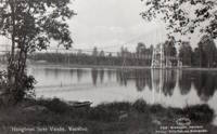
On the grounds of Butterfly World. Bridgemeister ID: 4422 (added 2020-04-19)Name: Tintrabrua Location: Vossevangen, Voss, Vestland, Norway Crossing: Vosso Coordinates: 60.619924 N 6.423772 E Maps: Acme , GeoHack , Google , kart.1881.no , OpenStreetMap Use: Footbridge Status: Replaced Main Cables: Wire Suspended Spans: 1 Main Span: 1 x 41.5 meters (136.2 feet) estimated
Appears to have been a pedestrian-only replacement middle span for a former non-suspension bridge vehicular crossing. Approach spans were much wider and clearly wide enough for automobile traffic. This hybrid configuration was in existence before 1958 and replaced by a three span suspension footbridge at some point between 1963 and 2004. Replaced by Tintrabrua - Vossevangen, Voss, Vestland, Norway . Bridgemeister ID: 4423 (added 2020-04-19)Name: Tintrabrua Location: Vossevangen, Voss, Vestland, Norway Crossing: Vosso Coordinates: 60.619616 N 6.424249 E Maps: Acme , GeoHack , Google , kart.1881.no , OpenStreetMap Use: Footbridge Status: Destroyed, October, 2014 Main Cables: Wire (steel) Suspended Spans: 3 Main Span: 1 x 41.5 meters (136.2 feet) estimated Side Spans: 2 x 31.5 meters (103.3 feet) estimated
Damaged by flood, 1928. Rebuilt, 1937. Bridgemeister ID: 2799 (added 2019-07-04)Name: Tjavatjavang Also Known As: 達來吊橋, 三地門達來吊橋 Location: Sandimen Township, Pingtung County, Taiwan Coordinates: 22.726067 N 120.673068 E Maps: Acme , GeoHack , Google , OpenStreetMap Use: Footbridge Status: In use (last checked: 2020) Main Cables: Wire (steel) Suspended Spans: 1 Main Span: 1 x 127 meters (416.7 feet) estimated
Bridgemeister ID: 4319 (added 2020-04-10)Name: Tjærestrømbrua Location: Væting, Birkenes, Agder, Norway Crossing: Tovdalselva Coordinates: 58.403606 N 8.282574 E Maps: Acme , GeoHack , Google , kart.1881.no , OpenStreetMap Use: Vehicular (one-lane) Status: In use (last checked: 2019) Main Cables: Wire (steel) Suspended Spans: 2 Main Span: 1 x 53.5 meters (175.5 feet) estimated Side Span: 1 x 15 meters (49.2 feet)
Likely completed early 1960s. Bridgemeister ID: 8509 (added 2024-03-24)Name: Todaiji Also Known As: Dongda Temple Location: Rencheng District, Jining, Shandong , China Coordinates: 35.4040609 N 116.5831231 E Maps: Acme , GeoHack , Google , OpenStreetMap Status: Extant (last checked: 2023) Suspended Spans: 1 Main Span: 1 x 25 meters (82 feet) estimated
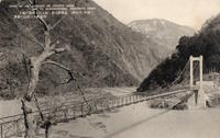
Bridgemeister ID: 7586 (added 2023-05-06)Name: Togakyo Gorge Location: Kofu, Yamanashi , Japan At or Near Feature: Shosenkyo Gorge vicinity Use: Footbridge Main Cables: Wire
Linked postcard image says "Views of the entrance of Togakyo Gorge and its neighbourhood, Shosenkyo Gorge." Unclear where the modern day location of "Togakyo Gorge" is, but it seems likely this bridge was at the present location of Nosen Lake (能泉湖) formed by the nearby Arakawa dam. Bridgemeister ID: 7633 (added 2023-05-27)Name: Tolantongo Location: Tolantongo, Hidalgo, Mexico Coordinates: 20.644276 N 98.991543 W Maps: Acme , GeoHack , Google , OpenStreetMap Use: Footbridge Status: In use (last checked: 2022) Main Cables: Wire (steel) Suspended Spans: 1
Bridgemeister ID: 2609 (added 2014-04-15)Name: Tom Sawyer Island Location: Orlando, Florida , USA At or Near Feature: Disney World Coordinates: 28.420305 N 81.583760 W Maps: Acme , GeoHack , Google , OpenStreetMap Use: Footbridge Status: In use (last checked: 2019) Main Cables: Wire (steel) Suspended Spans: 1
Suspension bridge inside Disney World at the Tom Sawyer Island attraction. Bridgemeister ID: 6346 (added 2021-07-25)Name: Tongjunshan Also Known As: 桐君山 Location: Tongjun, Tonglu County, Hangzhou, Zhejiang , China Crossing: Fenshui River Coordinates: 29.812263 N 119.678599 E Maps: Acme , GeoHack , Google , OpenStreetMap Use: Footbridge Status: In use (last checked: 2017) Main Cables: Wire (steel) Suspended Spans: 1 Main Span: 1 x 136 meters (446.2 feet) estimated
Bridgemeister ID: 3060 (added 2019-10-26)Name: Tongluo Skywalk Location: Tongxiao Township, Miaoli County, Taiwan Coordinates: 24.460374 N 120.753569 E Maps: Acme , GeoHack , Google , OpenStreetMap Use: Footbridge Status: In use (last checked: 2019) Main Cables: Wire (steel) Suspended Spans: 3 Main Span: 1 Side Spans: 2
Bridgemeister ID: 6161 (added 2021-07-07)Name: Tongmai Also Known As: Tong Mai Location: Tongmai (塘麦), Pome (波密县), Nyingchi (林芝市), Tibet , China Crossing: Yiong Tsangpo Coordinates: 30.097609 N 95.064564 E Maps: Acme , GeoHack , Google , OpenStreetMap Use: Vehicular Status: Extant (last checked: 2018) Main Cables: Wire (steel) Main Span: 1 x 212 meters (695.5 feet) estimated
Bridgemeister ID: 2760 (added 2019-06-30)Name: Tongtou Also Known As: 桶頭吊橋 Location: Zhushan Township, Nantou County, Taiwan Coordinates: 23.644842 N 120.659126 E Maps: Acme , GeoHack , Google , OpenStreetMap Use: Footbridge Status: In use (last checked: 2014) Main Cables: Wire (steel) Suspended Spans: 1
Bridgemeister ID: 3034 (added 2019-10-13)Name: Torreones Location: El Balseo, Chile Crossing: Rio Simpson Coordinates: 45.424330 S 72.427564 W Maps: Acme , GeoHack , Google , OpenStreetMap Use: Vehicular (one-lane) Status: In use (last checked: 2019) Main Cables: Wire (steel) Suspended Spans: 1
Bridgemeister ID: 7756 (added 2023-07-23)Name: Tournon-Saint-Martin Location: Tournon-Saint-Martin, Indre , France Crossing: Creuse River Use: Vehicular Status: Removed Main Cables: Wire (iron) Suspended Spans: 1
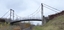
Bridgemeister ID: 928 (added 2003-10-20)Name: Tower Also Known As: Hellroaring, Yellowstone River Location: Mammoth Hot Springs vicinity, Wyoming , USA Crossing: Yellowstone River At or Near Feature: Hellroaring Creek Trail, Yellowstone National Park Coordinates: 44.9597 N 110.447067 W Maps: Acme , GeoHack , Google , OpenStreetMap Use: Footbridge Status: In use (last checked: 2006) Main Cables: Wire (steel) Suspended Spans: 1 Main Span: 1 x 67.1 meters (220 feet) estimated
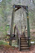
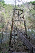
Near the confluence of Hellroaring Creek and the Yellowstone River. Patrick S. O'Donnell clarifies: " It carries the Hellroaring Creek Trail. It crosses the Yellowstone River then continues to the Hellroaring Creek. Shortly thereafter the Yellowstone River Trail is met." Near (footbridge) - Gardiner vicinity, Montana, USA . The bridges are similar in appearance. Bridgemeister ID: 2296 (added 2007-04-26)Name: Toxaway Creek Location: Cane Break vicinity, North Carolina , USA Crossing: Toxaway Creek Use: Footbridge Status: In use (last checked: 2009) Main Cables: Wire
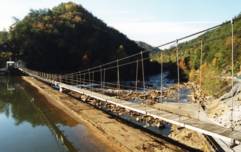
Bridgemeister ID: 287 (added before 2003)Name: Toxaway River Location: Cane Break vicinity, North Carolina , USA Crossing: Toxaway River Coordinates: 35.07168 N 82.88685 W Maps: Acme , GeoHack , Google , OpenStreetMap Principals: Duke Power Use: Footbridge Status: In use (last checked: 2019) Main Cables: Wire (steel) Suspended Spans: 3 Main Span: 1 x 50.6 meters (166 feet) estimated Side Spans: 1 x 7.3 meters (24 feet) estimated,
Bridgemeister ID: 2046 (added 2006-05-10)Name: Trabach Location: Santa Cruz do Sul, Rio Grande do Sul, Brazil Crossing: Rio Pardinho Use: Footbridge Status: In use Main Cables: Wire Suspended Spans: 1
Bridgemeister ID: 2577 (added 2013-03-27)Name: Trailhead Park Location: Delphi, Indiana , USA Crossing: Deer Creek At or Near Feature: Delphi Trails Entrance Coordinates: 40.57327 N 86.68522 W Maps: Acme , GeoHack , Google , OpenStreetMap Use: Footbridge Status: In use (last checked: 2012) Main Cables: Wire (steel) Suspended Spans: 1
Appears to have been removed at some point in 1980s or early 1990s. Bridgemeister ID: 5637 (added 2020-12-29)Name: Tree Top Walk Location: O'Reilly, Queensland , Australia At or Near Feature: Lamington National Park Coordinates: 28.233076 S 153.138488 E Maps: Acme , GeoHack , Google , OpenStreetMap Use: Footbridge Status: In use (last checked: 2020) Main Cables: Wire (steel) Main Spans: 9
At least eight separate suspension spans at this site, all very tall, narrow, long footbridges along which you can walk to tour the tropical canopy. Built prior to 1938. Removed by 2003. Coordinates are for estimated location based on historical images and descriptions. Bridgemeister ID: 2734 (added 2019-06-23)Name: Trongstraumen Location: Finnsæter, Senja, Troms og Finnmark, Norway Crossing: Trongstraumen Coordinates: 69.403300 N 17.293492 E Maps: Acme , GeoHack , Google , kart.1881.no , OpenStreetMap Use: Vehicular (one-lane) Status: In use (last checked: 2019) Main Cables: Wire (steel) Suspended Spans: 1 Main Span: 1 x 140 meters (459.3 feet)
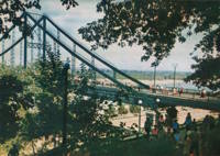
Bridgemeister ID: 1078 (added 2003-12-28)Name: Trukhanov Island Also Known As: Парковий, Parkovyi, Park Location: Kiev, Ukraine Crossing: Dnieper River At or Near Feature: Trukhanov Island Coordinates: 50.456418 N 30.533784 E Maps: Acme , GeoHack , Google , OpenStreetMap Use: Footbridge Status: In use (last checked: 2022) Main Cables: Riveted plate Suspended Spans: 3 Main Span: 1 Side Spans: 2 Characteristics: Self-anchored
The "cables" of this large footbridge appear to be I-beams riveted end-to-end.. Bridgemeister ID: 3995 (added 2020-03-24)Name: Tsarskaya Okhota Location: Barangol, Altai Republic, Russia Crossing: Katun River Coordinates: 51.681552 N 85.777923 E Maps: Acme , GeoHack , Google , OpenStreetMap Use: Footbridge Status: In use (last checked: 2020) Main Cables: Wire (steel) Suspended Spans: 2 Main Span: 1 Side Span: 1
Bridgemeister ID: 2094 (added 2006-07-03)Name: Tsuta Location: Towada, Kamikita District, Aomori , Japan Crossing: Tsuta River Coordinates: 40.576347 N 140.976640 E Maps: Acme , GeoHack , Google , OpenStreetMap Use: Footbridge Status: In use (last checked: 2016) Main Cables: Wire (steel) Suspended Spans: 1 Main Span: 1 x 55 meters (180.4 feet)
Bridgemeister ID: 5840 (added 2021-05-09)Name: Tsutsuji Also Known As: つつじ吊り橋 Location: Nasu, Tochigi , Japan Crossing: Nigato River Coordinates: 37.106171 N 140.001506 E Maps: Acme , GeoHack , Google , OpenStreetMap Use: Footbridge Status: In use (last checked: 2021) Main Cables: Wire (steel) Suspended Spans: 1 Main Span: 1 x 130 meters (426.5 feet) estimated
Bridgemeister ID: 2798 (added 2019-07-04)Name: Tuban Also Known As: 土坂吊橋 Location: Daren Township, Taitung County, Taiwan Coordinates: 22.449344 N 120.879915 E Maps: Acme , GeoHack , Google , OpenStreetMap Use: Footbridge Status: In use (last checked: 2019) Main Cables: Wire (steel) Suspended Spans: 1
Bridgemeister ID: 8442 (added 2024-03-09)Name: Tukainti Location: Villamontes, Tarija, Bolivia Crossing: Rio Pilcomayo Coordinates: 21.219861 S 63.579722 W Maps: Acme , GeoHack , Google , OpenStreetMap Use: Footbridge Status: In use (last checked: 2023) Main Cables: Wire (steel) Main Span: 1 x 83 meters (272.3 feet) estimated
Bridgemeister ID: 4494 (added 2020-05-01)Name: Turtenhagen Location: Sundsfjord, Nordland, Norway Crossing: Øvre Forsåvatnet Coordinates: 66.934127 N 14.214066 E Maps: Acme , GeoHack , Google , kart.1881.no , OpenStreetMap Use: Footbridge Status: In use (last checked: 2019) Main Cables: Wire (steel) Suspended Spans: 2 Main Spans: 1 x 68 meters (223.1 feet) estimated,
Built at some point before 2007. Bridgemeister ID: 4576 (added 2020-06-04)Name: Twantay Also Known As: Twante Location: Payagi, Yangon vicinity, Myanmar Crossing: Twante Canal Coordinates: 16.731473 N 96.024538 E Maps: Acme , GeoHack , Google , OpenStreetMap Use: Vehicular (three or more lanes) Status: In use (last checked: 2019) Main Cables: Wire (steel) Suspended Spans: 1 Main Span: 1 x 256 meters (839.9 feet) estimated
Bridgemeister ID: 4599 (added 2020-06-06)Name: Ueno Sky Also Known As: 上野スカイブリッジ Location: Ueno, Gunma , Japan Coordinates: 36.071914 N 138.778668 E Maps: Acme , GeoHack , Google , OpenStreetMap Use: Footbridge Status: In use (last checked: 2019) Main Cables: Wire (steel) Suspended Spans: 1 Main Span: 1 x 225 meters (738.2 feet)
Bridgemeister ID: 6050 (added 2021-07-03)Name: Ueyoshinogawa Also Known As: 上吉野川橋 Location: Tosa, Kochi , Japan Crossing: Yoshino River Coordinates: 33.758000 N 133.530866 E Maps: Acme , GeoHack , Google , OpenStreetMap Use: Vehicular (two-lane) Status: In use (last checked: 2021) Main Cables: Wire (steel) Suspended Spans: 1 Main Span: 1 x 254 meters (833.3 feet) estimated
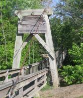
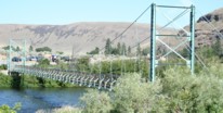
Bridgemeister ID: 865 (added 2003-08-23)Name: Umtanum Location: Yakima and Ellensburg, Washington , USA Crossing: Yakima River Coordinates: 46.85555 N 120.48405 W Maps: Acme , GeoHack , Google , OpenStreetMap Use: Footbridge Status: In use (last checked: 2021) Main Cables: Wire (steel) Suspended Spans: 1 Main Span: 1 x 67.1 meters (220 feet) estimated
2021, February: Closed for planned repairs. Expected to reopen in May. 2021, June: Bridge reopened following rehabilitation project. Bridgemeister ID: 6208 (added 2021-07-16)Name: Uncle Kolya Also Known As: дяди Коли Location: Aviastroitel'nyy Rayon (Авиастроительный район), Kazan, Republic of Tatarstan, Russia Crossing: Reka Kazanka Coordinates: 55.935474 N 49.210020 E Maps: Acme , GeoHack , Google , OpenStreetMap Use: Footbridge Status: In use (last checked: 2021) Main Cables: Wire (steel) Main Span: 1
Bridgemeister ID: 5161 (added 2020-09-07)Name: Unzen Also Known As: 雲仙橋 Location: Okutama, Tokyo , Japan Crossing: Tama River Coordinates: 35.814209 N 139.129686 E Maps: Acme , GeoHack , Google , OpenStreetMap Use: Vehicular (one-lane) Status: Only towers remain (last checked: 2020) Suspended Spans: 1
Towers still standing at both ends of a present-day (2020) non-suspension bridge. Bridgemeister ID: 2714 (added 2019-06-16)Name: Upper Hooker Location: Aoraki Mount Cook Village vicinity, New Zealand Crossing: Hooker River At or Near Feature: Hooker Valley Track Coordinates: 43.692699 S 170.098418 E Maps: Acme , GeoHack , Google , OpenStreetMap Use: Footbridge Status: In use (last checked: 2015) Main Cables: Wire (steel)
Bridgemeister ID: 1390 (added 2004-07-03)Name: Upper Warm Springs Pack Location: Clearwater National Forest, Idaho , USA Crossing: Warm Springs Creek Coordinates: 46.44903 N 114.86788 W Maps: Acme , GeoHack , Google , OpenStreetMap Use: Pack Status: In use (last checked: 2003) Main Cables: Wire (steel) Suspended Spans: 1 Main Span: 1 x 27.4 meters (90 feet) estimated
Bridgemeister ID: 7394 (added 2022-11-25)Name: Urbano Location: Dabeiba, Antioquia, Colombia Crossing: Rio Sucio Coordinates: 6.986374 N 76.253172 W Maps: Acme , GeoHack , Google , OpenStreetMap Use: Footbridge Status: In use (last checked: 2019) Main Cables: Wire (steel) Suspended Spans: 1
2018: Major rehabilitation project completed. Patrick S. O'Donnell observes: "Total deck replacement. The tower legs appear they were all reinforced/cladded in more concrete as were the headers/struts. The above ground anchorage blocks at one end appear new, or just with another layer of concrete." Twitter . Images of the refurbished bridge, posted April 28, 2019.Twitter . Images of the refurbished bridge, posted August 20, 2018.Twitter . Images of the bridge at different stages of renovation, posted August 20, 2018.Twitter . Images of the bridge prior to the start of the rehabilitation project, posted August 20, 2018.Twitter . Images of the bridge, posted June 23, 2017.Bridgemeister ID: 5348 (added 2020-11-14)Name: Vadaktėliai Also Known As: Vadaktėlių Location: Vadaktėliai, Lithuania Crossing: Vadaktis Coordinates: 55.630263 N 24.118552 E Maps: Acme , GeoHack , Google , OpenStreetMap Use: Footbridge Status: In use (last checked: 2020) Main Cables: Wire (steel) Suspended Spans: 1
Bridgemeister ID: 3633 (added 2020-01-01)Name: Val Meltger Location: Lantsch/Lenz, Switzerland Coordinates: 46.685902 N 9.580230 E Maps: Acme , GeoHack , Google , OpenStreetMap Use: Footbridge Status: In use (last checked: 2015) Main Cables: Wire (steel)
Bridgemeister ID: 5337 (added 2020-11-12)Name: Valiña Location: Valiña, Spain Crossing: Sil Coordinates: 42.513924 N 6.807337 W Maps: Acme , GeoHack , Google , OpenStreetMap Use: Footbridge Status: Damaged, June 2022 (last checked: 2022) Main Cables: Wire (steel)
2022, June: Deck is heavily damaged by a windstorm. The bridge is unusable. Bridgemeister ID: 3675 (added 2020-02-08)Name: Vallersund Location: Vallersund, Ørland, Trøndelag, Norway Coordinates: 63.865480 N 9.749440 E Maps: Acme , GeoHack , Google , kart.1881.no , OpenStreetMap Use: Vehicular (one-lane) Status: In use (last checked: 2020) Main Cables: Wire (steel) Suspended Spans: 1 Main Span: 1 x 100 meters (328 feet) estimated
Bridgemeister ID: 6420 (added 2021-07-31)Name: Valparaiso Pier Location: Valparaiso, Chile Principals: Charles D. Young and Co., Frederick W. Etheredge Use: Footbridge Status: Destroyed, March, 1856 Main Cables: Rod (iron) Suspended Spans: 3 Main Span: 1 Side Spans: 2
Suspension pier based on James Dredge's patent. A large illustration of a suspension pier built based on Dredge's patent appears in Illustrated and Descriptive Catalogue of Machinery, Implements, Tools, Manufactured Articles, Raw Materials, etc.… published by Charles D. Young & Co. in the 1850s. Lloyd, William. A Railway Pioneer Notes by a Civil Engineer in Europe and America from 1838 to 1888 . London, Baines and Scarsbrook, 1900.Mentions "In March of the same year [1856], a disastrous gale at Valparaiso drove several ships on shore, destroying a large iron suspension pier, erected by one of my Directors". This is very likely referring to the Dredge patent pier.
Bridgemeister ID: 3937 (added 2020-03-21)Name: Vangsbrua Also Known As: Vangenbrua Location: Straalsjöaasen, Alvdal, Innlandet, Norway Crossing: Folla Coordinates: 62.19654 N 10.35615 E Maps: Acme , GeoHack , Google , kart.1881.no , OpenStreetMap Use: Vehicular (one-lane) Status: In use (last checked: 2013) Main Cables: Wire (steel) Suspended Spans: 1 Main Span: 1 x 38 meters (124.7 feet) estimated
Bridgemeister ID: 7536 (added 2023-01-15)Name: Vansbro Also Known As: Saltviksbro Location: Vansbro, Sweden Crossing: Vanån Coordinates: 60.516661 N 14.226446 E Maps: Acme , GeoHack , Google , OpenStreetMap Use: Footbridge Status: In use (last checked: 2015) Main Cables: Wire (steel) Main Span: 1 x 115 meters (377.3 feet) estimated
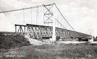
Bridgemeister ID: 7848 (added 2023-09-09)Name: Vännäsby Location: Vännäsby, Vännäs, Sweden Crossing: Umeälven Coordinates: 63.914078 N 19.845491 E Maps: Acme , GeoHack , Google , OpenStreetMap Use: Vehicular Status: Removed Main Cables: Wire Main Span: 1 Side Spans: 2
Bridgemeister ID: 4068 (added 2020-04-04)Name: Værdalske Befestninger Location: Stormoen, Verdal, Trøndelag, Norway Crossing: Inna Coordinates: 63.702376 N 11.900524 E Maps: Acme , GeoHack , Google , kart.1881.no , OpenStreetMap Use: Footbridge Status: Removed, c. 1970s Main Cables: Wire (steel) Suspended Spans: 1 Main Span: 1 x 23 meters (75.5 feet) estimated
Bridgemeister ID: 1512 (added 2004-10-09)Name: Vemork Location: Vemork, Våer vicinity, Telemark, Norway Coordinates: 59.872963 N 8.495374 E Maps: Acme , GeoHack , Google , kart.1881.no , OpenStreetMap Status: In use (last checked: 2019) Main Cables: Wire (steel) Suspended Spans: 1
See (pipeline bridge) - Vemork, Våer vicinity, Telemark, Norway . The pipeline was effectively a separate suspension bridge built on top of the main suspension bridge at Vemork resulting in a unique "stack" of two suspension bridges. The pipeline structure was removed at some point in the 1900s. Bridgemeister ID: 3004 (added 2019-10-13)Name: Vennakkad Location: Vennakkad, Kerala , India Coordinates: 11.339465 N 75.898076 E Maps: Acme , GeoHack , Google , OpenStreetMap Use: Footbridge Status: In use (last checked: 2016) Main Cables: Wire (steel)
Bridgemeister ID: 7862 (added 2023-09-15)Name: Venzone Location: Venzone and Pioverno, Udine, Italy Crossing: Tagliamento River Status: Removed Main Spans: 3
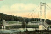
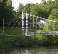
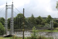
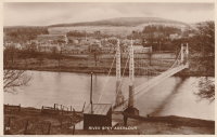
Bridgemeister ID: 781 (added 2003-03-16)Name: Victoria Also Known As: Penny, Aberlour Location: Charlestown of Aberlour and Wester Elchies, Scotland , United Kingdom Crossing: River Spey Coordinates: 57.47044 N 3.23173 W Maps: Acme , GeoHack , Google , OpenStreetMap Principals: James Abernethy & Co. "Abernethy Foundry" References: HARPER , HBR Use: Footbridge Status: In use (last checked: 2014) Main Cables: Wire (steel) Suspended Spans: 1
William Craig describes the bridge, "Built about 1900 by James Abernethy & Co. The pylons are tapered lattice girders with ball and spike finials and cross braced. Walkway is lattice girder hung from suspension cables." Near (footbridge) - Aberlour, Scotland, United Kingdom . Destroyed by flood, but some remains still visible at site, 2006. BOTO refers to as "Ballpark Rd." bridge for lack of a known name as the bridge was on the route following Ballpark Road out of Vienna. 1990s-2000s: Rebuilt more than once. 2013-2014: Bridge is in a derelict state. By 2015 the deck is completely gone or removed. Do you have any information or photos for these bridges that you would like to share? Please email david.denenberg@bridgemeister.com .
Mail | Facebook | Twitter
