Suspension Bridges of Idaho
This is a list of all 25 bridges from the suspension bridge inventory for Idaho in USA. Wherever you see a Bridgemeister ID number click it to isolate the bridge on its own page.
Related Lists:
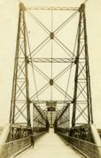
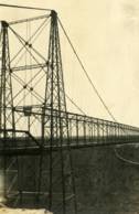
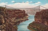
Bridgemeister ID: 334 (added before 2003)Year Completed: 1919 Name: Hansen Location: Twin Falls vicinity, Idaho , USA Crossing: Snake River Principals: Freygang and Trocon References: AAJ , PTS2 Use: Vehicular (two-lane) Status: Replaced, 1966 Main Cables: Wire (steel) Suspended Spans: 1 Main Span: 1 x 185.3 meters (608 feet) Deck width: 17 feet
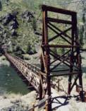
Bridgemeister ID: 641 (added 2003-02-15)Year Completed: 1937 Name: Stoddard Pack Location: Salmon and North Fork vicinity, Idaho , USA Crossing: Salmon River Coordinates: 45.29601 N 114.60448 W Maps: Acme , GeoHack , Google , OpenStreetMap Principals: CCC (Civilian Conservation Corps) Use: Pack and Footbridge Status: Replaced, 2014 Main Cables: Wire (steel) Suspended Spans: 1 Main Span: 1 x 106.7 meters (350 feet) estimated
Bridgemeister ID: 1333 (added 2004-05-01)Year Completed: 1938 Name: Manning Also Known As: Crevasse Location: Riggins Hot Springs vicinity, Idaho , USA Crossing: Salmon River At or Near Feature: Manning Crevice Coordinates: 45.401517 N 116.11682 W Maps: Acme , GeoHack , Google , OpenStreetMap Principals: J. P. Martin, E. Myers References: AAJ Use: Vehicular (one-lane) Status: Replaced, 2018 Main Cables: Wire (steel) Suspended Spans: 1 Main Span: 1 x 73.2 meters (240 feet)
Bridgemeister ID: 2379 (added 2007-11-03)Year Completed: 1956 Name: Frances Zaunmiller Memorial Also Known As: Campbell's Ferry Location: Campbell's Ferry, Idaho , USA Crossing: Salmon River At or Near Feature: Frank Church-River of No Return Wilderness Coordinates: 45.48638 N 115.33467 W Maps: Acme , GeoHack , Google , OpenStreetMap Use: Pack and Footbridge Status: In use (last checked: 2007) Main Cables: Wire (steel)
Bridgemeister ID: 640 (added 2003-02-15)Year Completed: 1957 Name: Bernard Pack Location: Frank Church-River Of No Return Wilderness Area, Idaho , USA Crossing: Salmon River Middle Fork Coordinates: 44.95800 N 114.73427 W Maps: Acme , GeoHack , Google , OpenStreetMap Use: Pack and Footbridge Status: In use (last checked: 2017) Main Cables: Wire (steel) Suspended Spans: 1 Main Span: 1 x 82.3 meters (270 feet) estimated
Substantial repairs by Sahale, LLC in 2001 following fire damage. Bridgemeister ID: 229 (added before 2003)Year Completed: 1971 Name: Dent Location: Orofino vicinity, Idaho , USA Crossing: Dworshak Reservoir Coordinates: 46.605 N 116.179 W Maps: Acme , GeoHack , Google , OpenStreetMap Principals: Army Corps of Engineers Use: Vehicular (two-lane, heavy vehicles), with walkway Status: In use (last checked: 2004) Main Cables: Wire (steel) Suspended Spans: 3 Main Span: 1 x 320 meters (1,050 feet) Side Spans: 2
Reservoir formed by damming of the North Fork of the Clearwater River. Bridgemeister ID: 1513 (added 2004-10-09)Year Completed: 1982 Name: (pipeline bridge) Location: Idaho Falls, Idaho , USA Crossing: Snake River Coordinates: 43.46399 N 112.07037 W Maps: Acme , GeoHack , Google , OpenStreetMap Principals: Clear Span Engineering, Inc. Use: Pipeline Status: Extant (last checked: 2019) Main Cables: Wire (steel) Suspended Spans: 1 Main Span: 1 x 167.6 meters (550 feet)
Carries a 24-inch sewer pipe. Bridgemeister ID: 7028 (added 2022-05-15)Year Completed: 2014 Name: Stoddard Pack Location: Salmon and North Fork vicinity, Idaho , USA Crossing: Salmon River Coordinates: 45.296224 N 114.604197 W Maps: Acme , GeoHack , Google , OpenStreetMap Use: Pack and Footbridge Status: Destroyed, March 15, 2017 Main Cables: Wire (steel) Suspended Spans: 1 Main Span: 1 x 103.6 meters (340 feet) estimated
Bridgemeister ID: 5546 (added 2020-12-13)Year Completed: 2018 Name: Manning Crevice Location: Riggins Hot Springs vicinity, Idaho , USA Crossing: Salmon River Coordinates: 45.401611 N 116.116483 W Maps: Acme , GeoHack , Google , OpenStreetMap Use: Vehicular Status: In use (last checked: 2018) Main Cables: Wire (steel) Suspended Spans: 1 Main Span: 1 x 91.4 meters (300 feet)
Bridgemeister ID: 7349 (added 2022-10-15)Name: (footbridge) Location: Twin Falls, Idaho , USA Crossing: Snake River At or Near Feature: Shoshone Falls Coordinates: 42.596689 N 114.400463 W Maps: Acme , GeoHack , Google , OpenStreetMap Use: Footbridge Status: In use (last checked: 2022) Main Cables: Wire (steel) Suspended Spans: 1 Main Span: 1 x 63 meters (206.7 feet) estimated
Bridgemeister ID: 2214 (added 2007-02-13)Name: (suspension bridge) Location: Riggins vicinity, Idaho , USA Crossing: Little Salmon River Coordinates: 45.39347 N 116.34313 W Maps: Acme , GeoHack , Google , OpenStreetMap Use: Vehicular (one-lane) Status: In use (last checked: 2006) Main Cables: Wire (steel) Suspended Spans: 1 Main Span: 1 x 39.6 meters (130 feet) estimated
Bridgemeister ID: 1384 (added 2004-07-03)Name: Boulder Creek Pack Location: Lowell vicinity, Idaho , USA Crossing: Boulder Creek At or Near Feature: Clearwater National Forest Coordinates: 46.33599 N 115.31319 W Maps: Acme , GeoHack , Google , OpenStreetMap Use: Pack and Footbridge Status: Closed, September 14, 2007 (last checked: 2007) Main Cables: Wire (steel) Main Span: 1 x 30.5 meters (100 feet) estimated
Located approximately 23 miles east of Lowell near the junction of Boulder Creek and the Lochsa River. According to an article in the September 13, 2007 edition of the Latah Eagle (Latah County, Idaho): "The suspension bridge that crosses Boulder Creek at Wilderness Gateway Campground 49 miles east of Kooskia, Idaho, off U.S. Highway 12 will be permanently closed Friday, September 14, due to structural weakness discovered recently on a routine engineering review." Bridgemeister ID: 326 (added before 2003)Name: Eagle Mountain Pack Location: Clearwater National Forest, Idaho , USA Crossing: Lochsa River Coordinates: 46.430033 N 115.133567 W Maps: Acme , GeoHack , Google , OpenStreetMap Use: Pack Status: In use (last checked: 2007) Main Cables: Wire (steel) Suspended Spans: 1 Main Span: 1 x 39.6 meters (130 feet) estimated
Bridgemeister ID: 1323 (added 2004-04-26)Name: Fourth of July Pack Location: Clearwater National Forest, Idaho , USA Crossing: North Fork Clearwater River At or Near Feature: Bear Butte Trail Coordinates: 46.6635 N 115.37843 W Maps: Acme , GeoHack , Google , OpenStreetMap Use: Pack and Footbridge Status: In use (last checked: 2016) Main Cables: Wire (steel) Suspended Spans: 1 Main Span: 1 x 67.1 meters (220 feet) estimated
Bridgemeister ID: 1322 (added 2004-04-25)Name: Junction Mountain Trail Location: Clearwater National Forest, Idaho , USA Crossing: Kelly Creek Coordinates: 46.71925 N 115.23276 W Maps: Acme , GeoHack , Google , OpenStreetMap Use: Pack and Footbridge Status: In use (last checked: 2003) Main Cables: Wire (steel) Suspended Spans: 1 Main Span: 1 x 45.7 meters (150 feet) estimated
Bridgemeister ID: 2380 (added 2007-11-03)Name: Mackay Bar Location: Mackay Bar, Idaho , USA Crossing: Salmon River At or Near Feature: Frank Church-River of No Return Wilderness Coordinates: 45.38511 N 115.49917 W Maps: Acme , GeoHack , Google , OpenStreetMap Use: Pack and Footbridge Status: In use Main Cables: Wire (steel)
Bridgemeister ID: 344 (added before 2003)Name: Mocus Point Pack Location: Clearwater National Forest, Idaho , USA Crossing: Lochsa River Coordinates: 46.46130 N 115.01868 W Maps: Acme , GeoHack , Google , OpenStreetMap References: PQU Use: Pack Status: In use (last checked: 2003) Main Cables: Wire (steel) Suspended Spans: 1 Main Span: 1 x 61 meters (200 feet) estimated
Bridgemeister ID: 1404 (added 2004-07-04)Name: Paradise Ranch Location: Lowell vicinity, Idaho , USA Crossing: Clearwater River Coordinates: 46.14862 N 115.73054 W Maps: Acme , GeoHack , Google , OpenStreetMap Use: Vehicular Status: In use (last checked: 2003) Main Cables: Wire (steel) Suspended Spans: 3 Main Span: 1 x 78 meters (256 feet) estimated Side Spans: 2 x 29.3 meters (96 feet) estimated
Private vehicular bridge. Bridgemeister ID: 1347 (added 2004-05-08)Name: Riggins Hot Springs Lodge Location: Riggins vicinity, Idaho , USA Crossing: Salmon River Coordinates: 45.41820 N 116.17263 W Maps: Acme , GeoHack , Google , OpenStreetMap Use: Vehicular (one-lane) Status: In use (last checked: 2003) Main Cables: Wire (steel) Suspended Spans: 1 Main Span: 1 x 106.7 meters (350 feet) estimated
Bridgemeister ID: 4544 (added 2020-05-23)Name: Sheep Location: Stanton Crossing vicinity, Idaho , USA Crossing: Big Wood River Coordinates: 43.329264 N 114.359692 W Maps: Acme , GeoHack , Google , OpenStreetMap Use: Stock and Footbridge Status: In use (last checked: 2019) Main Cables: Wire Suspended Spans: 1
Bridgemeister ID: 1346 (added 2004-05-08)Name: Sorthfork River Ranch Location: Southfork River Ranch, Idaho , USA Crossing: South Fork Clearwater River Coordinates: 46.01567 N 115.96030 W Maps: Acme , GeoHack , Google , OpenStreetMap Use: Vehicular (one-lane) Status: In use (last checked: 2003) Main Cables: Wire (steel) Suspended Spans: 1 Main Span: 1 x 45.7 meters (150 feet) estimated
Bridgemeister ID: 1410 (added 2004-07-04)Name: Split Creek Pack Location: Lowell vicinity, Idaho , USA Crossing: Lochsa River Coordinates: 46.2307 N 115.416733 W Maps: Acme , GeoHack , Google , OpenStreetMap Use: Pack Status: In use (last checked: 2007) Main Cables: Wire (steel) Suspended Spans: 1 Main Span: 1 x 45.7 meters (150 feet) estimated
Bridgemeister ID: 1390 (added 2004-07-03)Name: Upper Warm Springs Pack Location: Clearwater National Forest, Idaho , USA Crossing: Warm Springs Creek Coordinates: 46.44903 N 114.86788 W Maps: Acme , GeoHack , Google , OpenStreetMap Use: Pack Status: In use (last checked: 2003) Main Cables: Wire (steel) Suspended Spans: 1 Main Span: 1 x 27.4 meters (90 feet) estimated
Bridgemeister ID: 367 (added before 2003)Name: Warm Springs Creek Pack Also Known As: Jerry Johnson Hot Springs Pack Location: Clearwater National Forest, Idaho , USA Crossing: Lochsa River Coordinates: 46.474333 N 114.885067 W Maps: Acme , GeoHack , Google , OpenStreetMap References: PQU Use: Pack Status: In use (last checked: 2005) Main Cables: Wire (steel) Suspended Spans: 1 Main Span: 1 x 67.7 meters (222 feet) estimated
Bridgemeister ID: 1334 (added 2004-05-01)Name: Wind River Pack Location: Green, Idaho , USA Crossing: Salmon River Coordinates: 45.45382 N 115.94525 W Maps: Acme , GeoHack , Google , OpenStreetMap Use: Pack and Footbridge Status: In use (last checked: 2003) Main Cables: Wire (steel) Suspended Spans: 1
Do you have any information or photos for these bridges that you would like to share? Please email david.denenberg@bridgemeister.com .
Mail | Facebook | Twitter
