Suspension Bridges of France (401-500 of 696)
This is a list of bridges 401 through 500 (of 696 total) from the suspension bridge inventory for the country France. Wherever you see a Bridgemeister ID number click it to isolate the bridge on its own page.
Related Lists:
1935: Mirepoix-sur-Tarn
Mirepoix-sur-Tarn, Haute-Garonne, France - Tarn River
| Bridgemeister ID: | 3196 (added 2019-11-10) |
| Year Completed: | 1935 |
| Name: | Mirepoix-sur-Tarn |
| Location: | Mirepoix-sur-Tarn, Haute-Garonne, France |
| Crossing: | Tarn River |
| Coordinates: | 43.811976 N 1.571879 E |
| Maps: | Acme, GeoHack, Google, OpenStreetMap |
| Use: | Vehicular (two-lane) |
| Status: | Collapsed, November 18, 2019 |
| Main Cables: | Wire (steel) |
| Suspended Spans: | 1 |
| Main Span: | 1 x 152 meters (498.7 feet) |
Notes:
- Collapsed November 18, 2019 as an overweight vehicle crossed, killing two people.
- Replaced 1855 Mirepoix-sur-Tarn - Mirepoix-sur-Tarn, Haute-Garonne, France.
External Links:
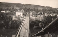
1935: Remoulins
Remoulins, Gard, France - Gardon River
| Bridgemeister ID: | 4910 (added 2020-07-19) |
| Year Completed: | 1935 |
| Name: | Remoulins |
| Location: | Remoulins, Gard, France |
| Crossing: | Gardon River |
| Coordinates: | 43.937978 N 4.556684 E |
| Maps: | Acme, GeoHack, Google, OpenStreetMap |
| Use: | Vehicular |
| Status: | Removed |
| Main Cables: | Wire (steel) |
Notes:
- Remnants of this bridge are preserved in a car park at the eastern end of the present day (2020s) Pont de Remoulins.
- Replaced 1830 Remoulins - Remoulins, Gard, France. The later bridge appears to have been built on an alignment about 175 meters north of the 1830 bridge.
External Links:
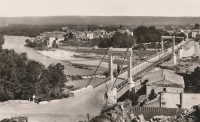
1935: Tréboul
Thérondels vicinity, Aveyron and Sainte-Marie, Cantal, France - Lac de Sarrans
| Bridgemeister ID: | 1989 (added 2005-12-02) |
| Year Completed: | 1935 |
| Name: | Tréboul |
| Location: | Thérondels vicinity, Aveyron and Sainte-Marie, Cantal, France |
| Crossing: | Lac de Sarrans |
| Coordinates: | 44.872780 N 2.867253 E |
| Maps: | Acme, GeoHack, Google, OpenStreetMap |
| Use: | Vehicular (one-lane) |
| Status: | In use (last checked: 2014) |
| Main Cables: | Wire (steel) |
| Suspended Spans: | 1 |
Notes:
External Links:

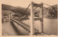
1936: Mornay-sur-Allier
Mornay-sur-Allier, Cher and St-Pierre-le-Moûtier, Nièvre, France - Allier River
| Bridgemeister ID: | 1550 (added 2004-11-13) |
| Year Completed: | 1936 |
| Name: | Mornay-sur-Allier |
| Location: | Mornay-sur-Allier, Cher and St-Pierre-le-Moûtier, Nièvre, France |
| Crossing: | Allier River |
| Coordinates: | 46.815265 N 3.043460 E |
| Maps: | Acme, GeoHack, Google, OpenStreetMap |
| References: | BPF |
| Use: | Vehicular |
| Status: | Removed, circa 1970s |
| Main Cables: | Wire (steel) |
| Suspended Spans: | 3 |
| Main Span: | 1 x 80 meters (262.5 feet) |
| Side Spans: | 1 x 67.57 meters (221.7 feet), 1 x 64.27 meters (210.9 feet) |
Notes:
External Links:
- Art-et-Histoire - Nouveau pont de Mornay - St-Pierre-le-Moûtier - 1937
- Structurae - Structure ID 20003000
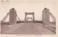
1936: Saint-Didier-sous-Aubenas
Saint-Didier-sous-Aubenas, Ardèche, France - Ardèche River
| Bridgemeister ID: | 2930 (added 2019-09-16) |
| Year Completed: | 1936 |
| Name: | Saint-Didier-sous-Aubenas |
| Location: | Saint-Didier-sous-Aubenas, Ardèche, France |
| Crossing: | Ardèche River |
| Coordinates: | 44.604219 N 4.419136 E |
| Maps: | Acme, GeoHack, Google, OpenStreetMap |
| Use: | Vehicular (two-lane) |
| Status: | Collapsed, 1995 |
| Main Cables: | Wire (steel) |
Notes:
- Collapsed, 1995. One tower remains.
- Replaced Saint-Didier-sous-Aubenas - Saint-Didier-sous-Aubenas, Ardèche, France.
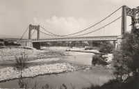
1937: Aiguilly
Roanne vicinity and Vougy vicinity, Loire, France - Loire River
| Bridgemeister ID: | 1567 (added 2004-11-28) |
| Year Completed: | 1937 |
| Name: | Aiguilly |
| Location: | Roanne vicinity and Vougy vicinity, Loire, France |
| Crossing: | Loire River |
| References: | AAJ, BPF |
| Use: | Vehicular |
| Status: | Destroyed, 1940 |
| Main Cables: | Wire (steel) |
| Suspended Spans: | 1 |
| Main Span: | 1 x 135 meters (442.9 feet) |
Notes:
- Destroyed to slow advancing German troops, 1940.
- Replaced 1841 Aiguilly - Roanne vicinity and Vougy vicinity, Loire, France.
- Replaced by 1945 Aiguilly - Roanne vicinity and Vougy vicinity, Loire, France.
External Links:
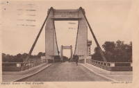
1937: Lacq
Lacq and Abidos, Pyrénées-Atlantiques, France - Ousse River
| Bridgemeister ID: | 7968 (added 2023-11-25) |
| Year Completed: | 1937 |
| Name: | Lacq |
| Location: | Lacq and Abidos, Pyrénées-Atlantiques, France |
| Crossing: | Ousse River |
| Coordinates: | 43.404111 N 0.624083 W |
| Maps: | Acme, GeoHack, Google, OpenStreetMap |
| Use: | Vehicular (two-lane) |
| Status: | In use (last checked: 2023) |
| Main Cables: | Wire (steel) |
| Suspended Spans: | 1 |
| Main Span: | 1 x 77 meters (252.6 feet) estimated |
Notes:
- Next to (pipeline bridge) - Lacq and Abidos, Pyrénées-Atlantiques, France.
- Near (pipeline bridge) - Lacq and Abidos, Pyrénées-Atlantiques, France.
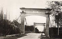
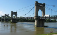
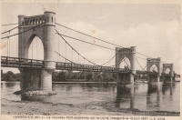
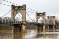
1937: Langeais
Langeais, Indre-et-Loire, France - Loire River
| Bridgemeister ID: | 1029 (added 2003-11-30) |
| Year Completed: | 1937 |
| Name: | Langeais |
| Location: | Langeais, Indre-et-Loire, France |
| Crossing: | Loire River |
| Coordinates: | 47.319667 N 0.404217 E |
| Maps: | Acme, GeoHack, Google, OpenStreetMap |
| References: | AAJ, BPF |
| Use: | Vehicular (two-lane), with walkway |
| Status: | In use (last checked: 2021) |
| Main Cables: | Wire (steel) |
| Suspended Spans: | 5 |
| Main Spans: | 3 x 90 meters (295.29 feet) |
| Side Spans: | 2 x 45 meters (147.64 feet) |
Notes:
- 1940: Deck collapsed.
- 1946: Repaired, but carrying just a footbridge.
- 1950: Rebuilt as a vehicular bridge.
- 1983: Reinforced to support heavier traffic.
- Replaced 1849 Langeais - Langeais, Indre-et-Loire, France.
External Links:
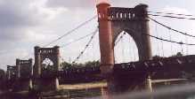
1938: Assat
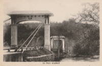
Assat and Narcastet, Pyrénées-Atlantiques, France - Ousse
| Bridgemeister ID: | 4687 (added 2020-06-20) |
| Year Completed: | 1938 |
| Name: | Assat |
| Location: | Assat and Narcastet, Pyrénées-Atlantiques, France |
| Crossing: | Ousse |
| Coordinates: | 43.244390 N 0.308003 W |
| Maps: | Acme, GeoHack, Google, OpenStreetMap |
| Use: | Vehicular (two-lane) |
| Status: | In use (last checked: 2020) |
| Main Cables: | Wire (steel) |
| Suspended Spans: | 1 |
Notes:
- See Assat - Assat, Pyrénées-Atlantiques, France. The relationship between the two bridges is unclear, but likely the 1938 bridge was a direct replacement.
External Links:
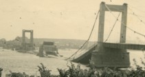
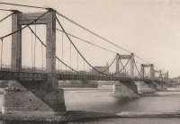
1938: Montjean-sur-Loire
Montjean-sur-Loire, Maine-et-Loire, France - Loire River
| Bridgemeister ID: | 6422 (added 2021-08-09) |
| Year Completed: | 1938 |
| Name: | Montjean-sur-Loire |
| Location: | Montjean-sur-Loire, Maine-et-Loire, France |
| Crossing: | Loire River |
| Coordinates: | 47.392675 N 0.860650 W |
| Maps: | Acme, GeoHack, Google, OpenStreetMap |
| Use: | Vehicular |
| Status: | Destroyed, June, 1940 |
| Main Cables: | Wire (steel) |
| Suspended Spans: | 6 |
| Main Spans: | 4 |
| Side Spans: | 2 |
Notes:
- 1940, June: Intentionally destroyed to slow advancing German troops.
- Replaced 1927 Montjean-sur-Loire - Montjean-sur-Loire, Maine-et-Loire, France.
- Later at same location 1949 Montjean-sur-Loire - Montjean-sur-Loire, Maine-et-Loire, France.
1938: Roquefort-sur-Garonne
Fourc and Roquefort-sur-Garonne, Haute-Garonne, France - Salat River
| Bridgemeister ID: | 7399 (added 2022-12-03) |
| Year Completed: | 1938 |
| Name: | Roquefort-sur-Garonne |
| Location: | Fourc and Roquefort-sur-Garonne, Haute-Garonne, France |
| Crossing: | Salat River |
| Coordinates: | 43.158060 N 0.968714 E |
| Maps: | Acme, GeoHack, Google, OpenStreetMap |
| Use: | Vehicular (two-lane) |
| Status: | In use (last checked: 2021) |
| Main Cables: | Wire (steel) |
| Suspended Spans: | 1 |
| Main Span: | 1 x 67 meters (219.8 feet) estimated |
Notes:
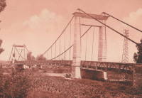
1938: Saint-Gilles
Saint-Gilles-du-Gard, Gard, France - Petit Rhône River
| Bridgemeister ID: | 6743 (added 2021-10-23) |
| Year Completed: | 1938 |
| Name: | Saint-Gilles |
| Location: | Saint-Gilles-du-Gard, Gard, France |
| Crossing: | Petit Rhône River |
| Coordinates: | 43.665675 N 4.452997 E |
| Maps: | Acme, GeoHack, Google, OpenStreetMap |
| Use: | Vehicular |
| Status: | Replaced, 1985 |
| Main Cables: | Wire (steel) |
| Suspended Spans: | 1 |
| Main Span: | 1 |
Notes:
External Links:
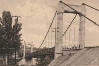
1938: Saula
Lafrançaise, Tarn-et-Garonne, France - Tarn River
| Bridgemeister ID: | 7185 (added 2022-07-02) |
| Year Completed: | 1938 |
| Name: | Saula |
| Location: | Lafrançaise, Tarn-et-Garonne, France |
| Crossing: | Tarn River |
| Coordinates: | 44.113997 N 1.247532 E |
| Maps: | Acme, GeoHack, Google, OpenStreetMap |
| Use: | Vehicular (two-lane) |
| Status: | In use (last checked: 2019) |
| Main Cables: | Wire (steel) |
| Suspended Spans: | 1 |
| Main Span: | 1 x 120 meters (393.7 feet) estimated |
Notes:
1939: Manosque
Manosque, Alpes-de-Haute-Provence, France - Durance River
| Bridgemeister ID: | 897 (added 2003-09-07) |
| Year Completed: | 1939 |
| Name: | Manosque |
| Location: | Manosque, Alpes-de-Haute-Provence, France |
| Crossing: | Durance River |
| Coordinates: | 43.8047 N 5.8238 E |
| Maps: | Acme, GeoHack, Google, OpenStreetMap |
| Use: | Vehicular (two-lane, heavy vehicles), with walkway |
| Status: | Replaced, 2019 |
| Main Cables: | Wire (steel) |
| Suspended Spans: | 1 |
Notes:
- At former location of 1839 Manosque - Manosque, Alpes-de-Haute-Provence, France.
External Links:
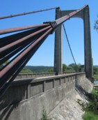
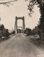
1939: Saint-Jean-de-Blaignac
Saint-Jean-de-Blaignac and Lavagnac, Gironde, France - Dordogne River
| Bridgemeister ID: | 7336 (added 2022-09-03) |
| Year Completed: | 1939 |
| Name: | Saint-Jean-de-Blaignac |
| Location: | Saint-Jean-de-Blaignac and Lavagnac, Gironde, France |
| Crossing: | Dordogne River |
| Use: | Vehicular |
| Status: | Destroyed |
| Suspended Spans: | 3 |
| Main Spans: | 3 |
Notes:
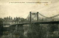
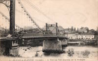
1941: Belleperche
Cordes-Tolosannes, Tarn-et-Garonne, France - Garonne River
| Bridgemeister ID: | 3193 (added 2019-11-10) |
| Year Completed: | 1941 |
| Name: | Belleperche |
| Location: | Cordes-Tolosannes, Tarn-et-Garonne, France |
| Crossing: | Garonne River |
| Coordinates: | 43.995616 N 1.125695 E |
| Maps: | Acme, GeoHack, Google, OpenStreetMap |
| Use: | Vehicular (two-lane) |
| Status: | In use (last checked: 2019) |
| Main Cables: | Wire (steel) |
| Suspended Spans: | 1 |
| Main Span: | 1 x 150 meters (492.1 feet) |
Notes:
- At former location of 1839 Belleperche - Cordes-Tolosannes, Tarn-et-Garonne, France.
External Links:
1941: Carennac
Carennac, Lot, France - Dordogne River
| Bridgemeister ID: | 3067 (added 2019-10-26) |
| Year Completed: | 1941 |
| Name: | Carennac |
| Location: | Carennac, Lot, France |
| Crossing: | Dordogne River |
| Coordinates: | 44.915186 N 1.743939 E |
| Maps: | Acme, GeoHack, Google, OpenStreetMap |
| Use: | Vehicular (two-lane) |
| Status: | In use (last checked: 2019) |
| Main Cables: | Wire (steel) |
| Suspended Spans: | 1 |
| Main Span: | 1 x 134 meters (439.6 feet) estimated |
Notes:
- Likely completed in 1941, possibly 1940.
- Replaced 1846 Carennac - Carennac, Lot, France.
External Links:
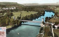
1941: Rangiport
Épône and Gargenville, Yvelines, France - Seine River
| Bridgemeister ID: | 6421 (added 2021-07-31) |
| Year Completed: | 1941 |
| Name: | Rangiport |
| Location: | Épône and Gargenville, Yvelines, France |
| Crossing: | Seine River |
| At or Near Feature: | Île de Rangiport |
| Coordinates: | 48.971502 N 1.808905 E |
| Maps: | Acme, GeoHack, Google, OpenStreetMap |
| Use: | Footbridge |
| Status: | Removed, c. 1965 |
| Main Cables: | Wire (steel) |
Notes:
- Large temporary footbridge built on the piers of the arch bridge destroyed in 1941. This was likely two separate, similar suspension bridges crossing the channels on both sides of Rangiport Island.
External Links:
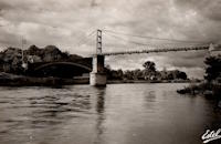
1941: Saint-Denis-de-Pile
Saint-Denis-de-Pile and Bonzac, Gironde, France - Isle River
| Bridgemeister ID: | 2962 (added 2019-10-06) |
| Year Completed: | 1941 |
| Name: | Saint-Denis-de-Pile |
| Location: | Saint-Denis-de-Pile and Bonzac, Gironde, France |
| Crossing: | Isle River |
| Coordinates: | 44.993221 N 0.207261 W |
| Maps: | Acme, GeoHack, Google, OpenStreetMap |
| References: | AAJ |
| Use: | Vehicular (two-lane) |
| Status: | In use (last checked: 2019) |
| Main Cables: | Wire (steel) |
| Suspended Spans: | 1 |
Notes:
- 1931, June 3, 1931: Deck and hangers fail during load testing when a truck hits a cable. Ten people die in the accident.
- 1935: Construction starts on a replacement bridge.
- Replaced Saint-Denis-de-Pile - Saint-Denis-de-Pile and Bonzac, Gironde, France.
External Links:
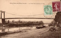
1943: Izeron
Izeron and Saint-Sauveur, Isère, France - Isère River
| Bridgemeister ID: | 7160 (added 2022-06-25) |
| Year Completed: | 1943 |
| Name: | Izeron |
| Location: | Izeron and Saint-Sauveur, Isère, France |
| Crossing: | Isère River |
| Coordinates: | 45.154525 N 5.364199 E |
| Maps: | Acme, GeoHack, Google, OpenStreetMap |
| Use: | Vehicular (one-lane) |
| Status: | Demolished, 2013 |
| Main Cables: | Wire (steel) |
| Suspended Spans: | 1 |
| Main Span: | 1 x 166 meters (544.6 feet) |
Notes:
1945: Aiguilly
Roanne vicinity and Vougy vicinity, Loire, France - Loire River
| Bridgemeister ID: | 4923 (added 2020-07-26) |
| Year Completed: | 1945 |
| Name: | Aiguilly |
| Location: | Roanne vicinity and Vougy vicinity, Loire, France |
| Crossing: | Loire River |
| Use: | Vehicular |
| Status: | Demolished, 1982 |
| Main Cables: | Wire (steel) |
| Suspended Spans: | 1 |
| Main Span: | 1 x 135 meters (442.9 feet) |
Notes:
External Links:
1945: College
Lyon, Métropole de Lyon, France - Rhône River
| Bridgemeister ID: | 6423 (added 2021-08-09) |
| Year Completed: | 1945 |
| Name: | College |
| Also Known As: | Collège |
| Location: | Lyon, Métropole de Lyon, France |
| Crossing: | Rhône River |
| Coordinates: | 45.765661 N 4.840563 E |
| Maps: | Acme, GeoHack, Google, OpenStreetMap |
| References: | BPF, PQL |
| Use: | Footbridge |
| Status: | In use (last checked: 2021) |
| Main Cables: | Wire (steel) |
| Suspended Spans: | 3 |
| Main Span: | 1 x 109.7 meters (359.9 feet) |
| Side Spans: | 2 |
Notes:
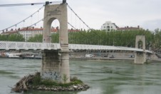
1945: Saint-Esprit
Pont-Saint-Esprit, Gard and Mondragon, Vaucluse, France - Rhône River
| Bridgemeister ID: | 8139 (added 2024-01-20) |
| Year Completed: | 1945 |
| Name: | Saint-Esprit |
| Location: | Pont-Saint-Esprit, Gard and Mondragon, Vaucluse, France |
| Crossing: | Rhône River |
| Coordinates: | 44.258917 N 4.650833 E |
| Maps: | Acme, GeoHack, Google, OpenStreetMap |
| Use: | Vehicular |
| Status: | Replaced, 1954 |
| Main Cables: | Wire (steel) |
| Suspended Spans: | 1 |
Notes:
- This suspension span replaced one arch of the Saint-Espirit bridge that had been destroyed in 1944 during WWII. It was replaced by a new concrete arch in 1954.
External Links:
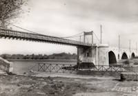
1945: Triel-sur-Seine
Triel-sur-Seine and Vernouillet, Yvelines, France - Seine River
| Bridgemeister ID: | 7810 (added 2023-09-01) |
| Year Completed: | 1945 |
| Name: | Triel-sur-Seine |
| Location: | Triel-sur-Seine and Vernouillet, Yvelines, France |
| Crossing: | Seine River |
| Coordinates: | 48.978374 N 2.001012 E |
| Maps: | Acme, GeoHack, Google, OpenStreetMap |
| Use: | Footbridge |
| Status: | Replaced, 1956 |
| Main Cables: | Wire (steel) |
| Suspended Spans: | 3 |
| Main Span: | 1 |
| Side Spans: | 2 |
Notes:
- A temporary suspension footbridge erected on the piers of the former Triel-sur-Seine suspension bridge.
- Replaced 1838 Triel-sur-Seine - Triel-sur-Seine and Vernouillet, Yvelines, France.
- Replaced by 1956 Triel-sur-Seine - Triel-sur-Seine and Vernouillet, Yvelines, France.
External Links:
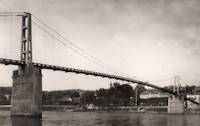
1946: Boran
Boran-sur-Oise, Oise, France - Oise River
| Bridgemeister ID: | 6952 (added 2022-02-13) |
| Year Completed: | 1946 |
| Name: | Boran |
| Location: | Boran-sur-Oise, Oise, France |
| Crossing: | Oise River |
| Coordinates: | 49.168337 N 2.366662 E |
| Maps: | Acme, GeoHack, Google, OpenStreetMap |
| Use: | Vehicular, with walkway |
| Status: | In use (last checked: 2017) |
| Main Cables: | Wire (steel) |
| Suspended Spans: | 1 |
| Main Span: | 1 |
Notes:
- At former location of 1841 Boran - Boran-sur-Oise, Oise, France.
External Links:
1946: Châteauneuf-sur-Loire
Châteauneuf-sur-Loire, Loiret, France - Loire River
| Bridgemeister ID: | 1015 (added 2003-11-22) |
| Year Completed: | 1946 |
| Name: | Châteauneuf-sur-Loire |
| Location: | Châteauneuf-sur-Loire, Loiret, France |
| Crossing: | Loire River |
| Coordinates: | 47.8581 N 2.22345 E |
| Maps: | Acme, GeoHack, Google, OpenStreetMap |
| Use: | Vehicular (two-lane), with walkway |
| Status: | In use (last checked: 2021) |
| Main Cables: | Wire (steel) |
| Suspended Spans: | 5 |
| Main Spans: | 2 x 49.15 meters (161.3 feet), 3 x 59.5 meters (195.2 feet) |
| Deck width: | 7 meters |
Notes:
External Links:
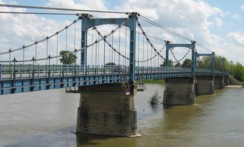
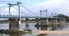
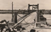
1947: Grésin
Bellegarde-sur-Valserine vicinity, Ain and Haute-Savoie, France - Rhône River
| Bridgemeister ID: | 1003 (added 2003-11-18) |
| Year Completed: | 1947 |
| Name: | Grésin |
| Location: | Bellegarde-sur-Valserine vicinity, Ain and Haute-Savoie, France |
| Crossing: | Rhône River |
| Coordinates: | 46.085407 N 5.861124 E |
| Maps: | Acme, GeoHack, Google, OpenStreetMap |
| Use: | Footbridge |
| Status: | In use (last checked: 2018) |
| Main Cables: | Wire (steel) |
| Suspended Spans: | 1 |
External Links:
1947: Jean Jacquet
Rivesaltes, Pyrénées-Orientales, France - Agly River
| Bridgemeister ID: | 2467 (added 2008-12-19) |
| Year Completed: | 1947 |
| Name: | Jean Jacquet |
| Also Known As: | Jacquet |
| Location: | Rivesaltes, Pyrénées-Orientales, France |
| Crossing: | Agly River |
| Coordinates: | 42.771912 N 2.871446 E |
| Maps: | Acme, GeoHack, Google, OpenStreetMap |
| Use: | Vehicular (two-lane) |
| Status: | In use (last checked: 2019) |
| Main Cables: | Wire (steel) |
| Suspended Spans: | 3 |
| Main Span: | 1 |
| Side Spans: | 2 |
External Links:
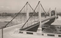
1947: Les Andelys
Les Andelys, Eure, France - Seine River
| Bridgemeister ID: | 456 (added before 2003) |
| Year Completed: | 1947 |
| Name: | Les Andelys |
| Location: | Les Andelys, Eure, France |
| Crossing: | Seine River |
| Coordinates: | 49.236625 N 1.398946 E |
| Maps: | Acme, GeoHack, Google, OpenStreetMap |
| References: | BPF |
| Use: | Vehicular (two-lane, heavy vehicles), with walkway |
| Status: | In use (last checked: 2021) |
| Main Cables: | Wire (steel) |
| Suspended Spans: | 1 |
| Main Span: | 1 x 146 meters (479 feet) |
Notes:
- 1988: Suspension system refurbished. Main cables and suspenders may have been replaced at this time.
- Replaced 1920 Les Andelys - Les Andelys, Eure, France.
External Links:
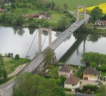
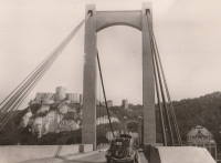
1948: Chalonnes
Chalonnes-sur-Loire, Maine-et-Loire, France - Loire River
| Bridgemeister ID: | 1014 (added 2003-11-22) |
| Year Completed: | 1948 |
| Name: | Chalonnes |
| Location: | Chalonnes-sur-Loire, Maine-et-Loire, France |
| Crossing: | Loire River |
| Coordinates: | 47.354367 N 0.761583 W |
| Maps: | Acme, GeoHack, Google, OpenStreetMap |
| Use: | Vehicular (two-lane, heavy vehicles), with walkway |
| Status: | In use (last checked: 2019) |
| Main Cables: | Wire (steel) |
| Suspended Spans: | 1 |
| Main Span: | 1 x 109.65 meters (359.7 feet) |
Notes:
- At former location of 1841 Chalonnes - Chalonnes-sur-Loire, Maine-et-Loire, France.
External Links:
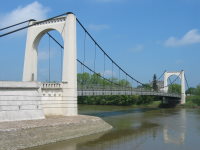
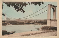
1948: Ennery
Ennery and Hauconcourt, Maizières-lès-Metz vicinity, Moselle, France - Moselle/Mosel River
| Bridgemeister ID: | 2377 (added 2007-10-14) |
| Year Completed: | 1948 |
| Name: | Ennery |
| Location: | Ennery and Hauconcourt, Maizières-lès-Metz vicinity, Moselle, France |
| Crossing: | Moselle/Mosel River |
| Coordinates: | 49.223593 N 6.197988 E |
| Maps: | Acme, GeoHack, Google, OpenStreetMap |
| Use: | Vehicular |
| Status: | Removed, 2012-2014 |
| Main Cables: | Wire (steel) |
| Suspended Spans: | 3 |
| Main Span: | 1 |
| Side Spans: | 2 |
Notes:
- Removed, c. 2012-2014. Replaced with a non-suspension bridge in 2014.
External Links:
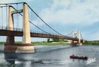
1948: Gennes
Gennes and Les Rosiers-sur-Loire, Maine-et-Loire, France - Loire River
| Bridgemeister ID: | 1174 (added 2004-01-23) |
| Year Completed: | 1948 |
| Name: | Gennes |
| Location: | Gennes and Les Rosiers-sur-Loire, Maine-et-Loire, France |
| Crossing: | Loire River |
| Coordinates: | 47.345283 N 0.230567 W |
| Maps: | Acme, GeoHack, Google, OpenStreetMap |
| Use: | Vehicular (two-lane, heavy vehicles), with walkway |
| Status: | In use (last checked: 2005) |
| Main Cables: | Wire (steel) |
| Suspended Spans: | 3 |
| Main Span: | 1 |
| Side Spans: | 2 |
Notes:
- Replaced 1932 Gennes - Gennes and Les Rosiers-sur-Loire, Maine-et-Loire, France.
- Connects to 1948 Les Rosiers-sur-Loire - Les Rosiers-sur-Loire and Gennes, Maine-et-Loire, France.
External Links:
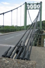
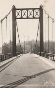
1948: Les Rosiers-sur-Loire
Les Rosiers-sur-Loire and Gennes, Maine-et-Loire, France - Loire River
| Bridgemeister ID: | 1534 (added 2004-10-31) |
| Year Completed: | 1948 |
| Name: | Les Rosiers-sur-Loire |
| Location: | Les Rosiers-sur-Loire and Gennes, Maine-et-Loire, France |
| Crossing: | Loire River |
| Coordinates: | 47.348533 N 0.2277 W |
| Maps: | Acme, GeoHack, Google, OpenStreetMap |
| Use: | Vehicular (two-lane, heavy vehicles), with walkway |
| Status: | In use (last checked: 2005) |
| Main Cables: | Wire (steel) |
| Suspended Spans: | 3 |
| Main Span: | 1 |
| Side Spans: | 2 |
Notes:
- Replaced 1932 Les Rosiers-sur-Loire - Les Rosiers-sur-Loire and Gennes, Maine-et-Loire, France.
- Connects to 1948 Gennes - Gennes and Les Rosiers-sur-Loire, Maine-et-Loire, France.
External Links:
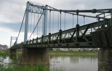
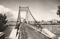
1948: Meung-sur-Loire
Meung-sur-Loire, Loiret, France - Loire River
| Bridgemeister ID: | 1175 (added 2004-01-23) |
| Year Completed: | 1948 |
| Name: | Meung-sur-Loire |
| Location: | Meung-sur-Loire, Loiret, France |
| Crossing: | Loire River |
| Coordinates: | 47.822517 N 1.7026 E |
| Maps: | Acme, GeoHack, Google, OpenStreetMap |
| Use: | Vehicular (two-lane, heavy vehicles), with walkway |
| Status: | In use (last checked: 2021) |
| Main Cables: | Wire (steel) |
| Suspended Spans: | 4 |
| Main Spans: | 2 x 74 meters (242.8 feet) |
| Side Spans: | 2 x 70.5 meters (231.3 feet) |
Notes:
External Links:
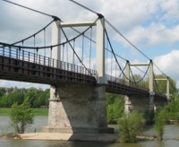
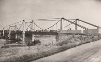
1949: (footbridge)
Valence, Drôme and Guilherand-Granges, Ardèche, France - Rhône River
| Bridgemeister ID: | 6517 (added 2021-08-27) |
| Year Completed: | 1949 |
| Name: | (footbridge) |
| Location: | Valence, Drôme and Guilherand-Granges, Ardèche, France |
| Crossing: | Rhône River |
| Coordinates: | 44.931773 N 4.883700 E |
| Maps: | Acme, GeoHack, Google, OpenStreetMap |
| Use: | Footbridge |
| Status: | Removed, 1960s |
| Main Cables: | Wire (steel) |
| Main Spans: | 2 |
Notes:
- At former location of 1830 Valence - Valence, Drôme and Guilherand-Granges, Ardèche, France.
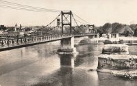
1949: Lacroix-Saint-Ouen
Lacroix-Saint-Ouen, Oise, France - Oise River
| Bridgemeister ID: | 7082 (added 2022-05-28) |
| Year Completed: | 1949 |
| Name: | Lacroix-Saint-Ouen |
| Location: | Lacroix-Saint-Ouen, Oise, France |
| Crossing: | Oise River |
| Coordinates: | 49.352884 N 2.767171 E |
| Maps: | Acme, GeoHack, Google, OpenStreetMap |
| Use: | Vehicular (one-lane) |
| Status: | In use (last checked: 2019) |
| Main Cables: | Wire (steel) |
| Suspended Spans: | 1 |
| Main Span: | 1 x 65 meters (213.3 feet) estimated |
Notes:
- At former location of 1846 Lacroix-Saint-Ouen - Lacroix-Saint-Ouen, Oise, France.
External Links:
1949: Montjean-sur-Loire
Montjean-sur-Loire, Maine-et-Loire, France - Loire River
| Bridgemeister ID: | 1538 (added 2004-10-31) |
| Year Completed: | 1949 |
| Name: | Montjean-sur-Loire |
| Location: | Montjean-sur-Loire, Maine-et-Loire, France |
| Crossing: | Loire River |
| Coordinates: | 47.393783 N 0.859783 W |
| Maps: | Acme, GeoHack, Google, OpenStreetMap |
| Use: | Vehicular (two-lane, heavy vehicles), with walkway |
| Status: | In use (last checked: 2021) |
| Main Cables: | Wire (steel) |
| Suspended Spans: | 6 |
| Main Spans: | 4 |
| Side Spans: | 2 |
Notes:
- At former location of 1938 Montjean-sur-Loire - Montjean-sur-Loire, Maine-et-Loire, France.
External Links:

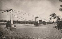
1949: Volonne
Volonne, Alpes-de-Haute-Provence, France - Durance River
| Bridgemeister ID: | 1491 (added 2004-09-19) |
| Year Completed: | 1949 |
| Name: | Volonne |
| Location: | Volonne, Alpes-de-Haute-Provence, France |
| Crossing: | Durance River |
| Coordinates: | 44.108633 N 6.00785 E |
| Maps: | Acme, GeoHack, Google, OpenStreetMap |
| Use: | Vehicular (one-lane), with walkway |
| Status: | Removed, c. 2006 |
| Main Cables: | Wire (steel) |
| Suspended Spans: | 1 |
Notes:
- Replaced by a cable-stayed bridge in the mid 2000s.
- Replaced 1928 Volonne - Volonne, Alpes-de-Haute-Provence, France.
External Links:
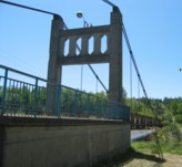
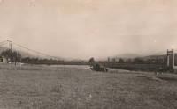
1950: (suspension bridge)
Saint-Germain-au-Mont-d'Or, Métropole de Lyon, France
| Bridgemeister ID: | 3214 (added 2019-11-11) |
| Year Completed: | 1950 |
| Name: | (suspension bridge) |
| Location: | Saint-Germain-au-Mont-d'Or, Métropole de Lyon, France |
| Coordinates: | 45.898758 N 4.794597 E |
| Maps: | Acme, GeoHack, Google, OpenStreetMap |
| Use: | Vehicular (two-lane) |
| Status: | In use (last checked: 2011) |
| Main Cables: | Wire (steel) |
| Suspended Spans: | 3 |
| Main Span: | 1 |
| Side Spans: | 2 |
External Links:
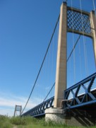
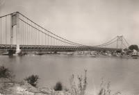
1950: Rognonas
Rognonas, Bouches-du-Rhône and Avignon, Vaucluse, France - Durance River
| Bridgemeister ID: | 549 (added before 2003) |
| Year Completed: | 1950 |
| Name: | Rognonas |
| Location: | Rognonas, Bouches-du-Rhône and Avignon, Vaucluse, France |
| Crossing: | Durance River |
| Coordinates: | 43.914624 N 4.808279 E |
| Maps: | Acme, GeoHack, Google, OpenStreetMap |
| References: | BC2, BPF |
| Use: | Vehicular (two-lane, heavy vehicles), with walkway |
| Status: | In use (last checked: 2019) |
| Main Cables: | Wire (steel) |
| Suspended Spans: | 3 |
| Main Span: | 1 x 255 meters (836.6 feet) |
| Side Spans: | 2 |
External Links:
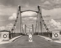
1950: Tournus
Tournus, Saône-et-Loire, France - Saône River
| Bridgemeister ID: | 5659 (added 2021-01-01) |
| Year Completed: | 1950 |
| Name: | Tournus |
| Location: | Tournus, Saône-et-Loire, France |
| Crossing: | Saône River |
| Coordinates: | 46.564335 N 4.913185 E |
| Maps: | Acme, GeoHack, Google, OpenStreetMap |
| Use: | Vehicular (two-lane) |
| Status: | Removed |
| Main Cables: | Wire (steel) |
| Suspended Spans: | 3 |
| Main Span: | 1 |
| Side Spans: | 2 |
Notes:
- At former location of 1838 Tournus - Tournus, Saône-et-Loire, France.
1951: Bonny-sur-Loire
Bonny-sur-Loire and Beaulieu-sur-Loire, Loiret, France - Loire River
| Bridgemeister ID: | 1783 (added 2005-05-13) |
| Year Completed: | 1951 |
| Name: | Bonny-sur-Loire |
| Location: | Bonny-sur-Loire and Beaulieu-sur-Loire, Loiret, France |
| Crossing: | Loire River |
| Coordinates: | 47.5505 N 2.835633 E |
| Maps: | Acme, GeoHack, Google, OpenStreetMap |
| Use: | Vehicular (two-lane, heavy vehicles), with walkway |
| Status: | In use (last checked: 2019) |
| Main Cables: | Wire (steel) |
| Suspended Spans: | 3 |
| Main Spans: | 3 x 120 meters (393.7 feet) |
| Deck width: | 7.9 meters |
Notes:
External Links:
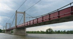
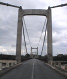
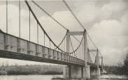
1951: Bouchemaine
Bouchemaine, Maine-et-Loire, France - Maine River
| Bridgemeister ID: | 1782 (added 2005-05-12) |
| Year Completed: | 1951 |
| Name: | Bouchemaine |
| Location: | Bouchemaine, Maine-et-Loire, France |
| Crossing: | Maine River |
| Coordinates: | 47.420383 N 0.608567 W |
| Maps: | Acme, GeoHack, Google, OpenStreetMap |
| Use: | Vehicular (two-lane, heavy vehicles), with walkway |
| Status: | In use (last checked: 2021) |
| Main Cables: | Wire (steel) |
| Suspended Spans: | 3 |
| Main Span: | 1 |
| Side Spans: | 2 |
Notes:
- 2018: Major renovation completed.
- Replaced 1910 Bouchemaine - Bouchemaine, Maine-et-Loire, France.
External Links:
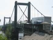
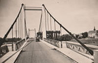
1951: Brion
Roissard and Lavars, Isère, France - Ebron River
| Bridgemeister ID: | 1805 (added 2005-05-19) |
| Year Completed: | 1951 |
| Name: | Brion |
| Location: | Roissard and Lavars, Isère, France |
| Crossing: | Ebron River |
| Coordinates: | 44.868143 N 5.670883 E |
| Maps: | Acme, GeoHack, Google, OpenStreetMap |
| Use: | Vehicular (one-lane) |
| Status: | In use (last checked: 2019) |
| Main Cables: | Wire |
| Suspended Spans: | 1 |
Notes:
External Links:
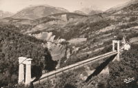
1951: Châtillon-sur-Loire
Châtillon-sur-Loire, Loiret, France - Loire River
| Bridgemeister ID: | 1925 (added 2005-10-23) |
| Year Completed: | 1951 |
| Name: | Châtillon-sur-Loire |
| Location: | Châtillon-sur-Loire, Loiret, France |
| Crossing: | Loire River |
| Coordinates: | 47.597657 N 2.760439 E |
| Maps: | Acme, GeoHack, Google, OpenStreetMap |
| Use: | Vehicular (two-lane, heavy vehicles), with walkway |
| Status: | In use (last checked: 2005) |
| Main Cables: | Wire (steel) |
| Suspended Spans: | 4 |
| Main Spans: | 2 x 92 meters (301.8 feet), 2 x 76 meters (249.3 feet) |
| Deck width: | 6.9 meters |
Notes:
External Links:
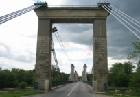
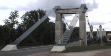
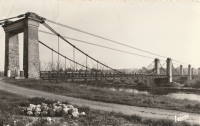
1951: Sablons
Sablons, Isère and Serrières, Ardèche, France - Rhône River
| Bridgemeister ID: | 892 (added 2003-09-06) |
| Year Completed: | 1951 |
| Name: | Sablons |
| Location: | Sablons, Isère and Serrières, Ardèche, France |
| Crossing: | Rhône River |
| Coordinates: | 45.318183 N 4.766867 E |
| Maps: | Acme, GeoHack, Google, OpenStreetMap |
| References: | BPF |
| Use: | Vehicular (two-lane, heavy vehicles), with walkway |
| Status: | In use (last checked: 2005) |
| Main Cables: | Wire (steel) |
| Suspended Spans: | 1 |
| Main Span: | 1 x 185 meters (607 feet) |
Notes:
External Links:
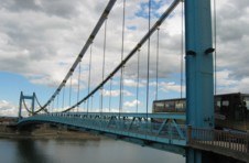
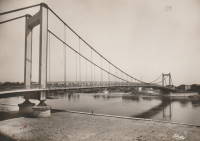
1951: Yenne
Yenne, Savoie and Ain, France - Rhône River
| Bridgemeister ID: | 1969 (added 2005-11-26) |
| Year Completed: | 1951 |
| Name: | Yenne |
| Location: | Yenne, Savoie and Ain, France |
| Crossing: | Rhône River |
| Coordinates: | 45.705713 N 5.750965 E |
| Maps: | Acme, GeoHack, Google, OpenStreetMap |
| Use: | Vehicular (one-lane) |
| Status: | In use (last checked: 2019) |
| Main Cables: | Wire (steel) |
| Suspended Spans: | 1 |
| Main Span: | 1 x 10⁶ meters (347.8 feet) estimated |
Notes:
- At former location of 1883 Yenne - Yenne, Savoie and Ain, France.
External Links:
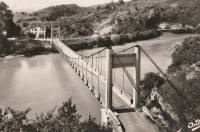
1952: François Baud
Morzine, Haute-Savoie, France
| Bridgemeister ID: | 2447 (added 2008-04-23) |
| Year Completed: | 1952 |
| Name: | François Baud |
| Location: | Morzine, Haute-Savoie, France |
| Coordinates: | 46.184141 N 6.704373 E |
| Maps: | Acme, GeoHack, Google, OpenStreetMap |
| Use: | Footbridge |
| Status: | In use (last checked: 2019) |
| Main Cables: | Wire (steel) |
External Links:
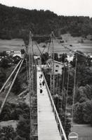
1952: Pertuis
Pertuis, Vaucluse and Bouches-du-Rhône, France - Durance River
| Bridgemeister ID: | 901 (added 2003-09-07) |
| Year Completed: | 1952 |
| Name: | Pertuis |
| Location: | Pertuis, Vaucluse and Bouches-du-Rhône, France |
| Crossing: | Durance River |
| Coordinates: | 43.66735 N 5.496117 E |
| Maps: | Acme, GeoHack, Google, OpenStreetMap |
| Use: | Vehicular (two-lane, heavy vehicles), with walkway |
| Status: | Removed, 2013 |
| Main Cables: | Wire (steel) |
| Suspended Spans: | 2 |
| Main Spans: | 2 |
Notes:
External Links:
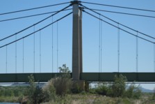
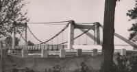
1952: Térénez
Landévennec vicinity and Rosnoen vicinity, Finistère, France - Aulne River
| Bridgemeister ID: | 1454 (added 2004-08-14) |
| Year Completed: | 1952 |
| Name: | Térénez |
| Location: | Landévennec vicinity and Rosnoen vicinity, Finistère, France |
| Crossing: | Aulne River |
| Coordinates: | 48.268980 N 4.262381 W |
| Maps: | Acme, GeoHack, Google, OpenStreetMap |
| References: | BPF |
| Use: | Vehicular (two-lane, heavy vehicles), with walkway |
| Status: | Removed, 2015 |
| Main Cables: | Wire (steel) |
| Suspended Spans: | 1 |
| Main Span: | 1 x 272 meters (892.4 feet) |
Notes:
- Bypassed by a cable-stayed bridge, 2011.
- Replaced 1925 Térénez - Landévennec vicinity and Rosnoen vicinity, Finistère, France.
External Links:
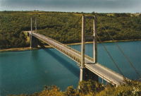
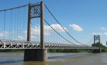
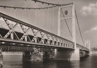
1953: Ancenis
Ancenis, Loire-Atlantique and Le Fourneau, Maine-et-Loire, France - Loire River
| Bridgemeister ID: | 1037 (added 2003-12-03) |
| Year Completed: | 1953 |
| Name: | Ancenis |
| Location: | Ancenis, Loire-Atlantique and Le Fourneau, Maine-et-Loire, France |
| Crossing: | Loire River |
| Coordinates: | 47.36195 N 1.176417 W |
| Maps: | Acme, GeoHack, Google, OpenStreetMap |
| References: | BPF |
| Use: | Vehicular (two-lane, heavy vehicles) |
| Status: | In use (last checked: 2021) |
| Main Cables: | Wire (steel) |
| Suspended Spans: | 3 |
| Main Span: | 1 x 238 meters (780.8 feet) |
| Side Spans: | 2 |
Notes:
External Links:
1953: Guynemer
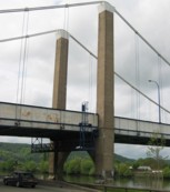
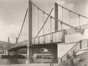
Elbeuf and Saint-Aubin-lès-Elbeuf, Seine-Maritime, France - Seine River
| Bridgemeister ID: | 1518 (added 2004-10-10) |
| Year Completed: | 1953 |
| Name: | Guynemer |
| Location: | Elbeuf and Saint-Aubin-lès-Elbeuf, Seine-Maritime, France |
| Crossing: | Seine River |
| Coordinates: | 49.29415 N 1.00475 E |
| Maps: | Acme, GeoHack, Google, OpenStreetMap |
| Use: | Vehicular (two-lane), with walkway |
| Status: | In use (last checked: 2005) |
| Main Cables: | Wire (steel) |
| Suspended Spans: | 3 |
| Main Span: | 1 x 152 meters (498.7 feet) |
| Side Spans: | 2 |
Notes:
External Links:
1954: Varades
Varades, Loire-Atlantique and Saint-Florent-le-Vieil, Maine-et-Loire, France - Loire River
| Bridgemeister ID: | 1106 (added 2004-01-03) |
| Year Completed: | 1954 |
| Name: | Varades |
| Location: | Varades, Loire-Atlantique and Saint-Florent-le-Vieil, Maine-et-Loire, France |
| Crossing: | Loire River |
| Coordinates: | 47.36965 N 1.015717 W |
| Maps: | Acme, GeoHack, Google, OpenStreetMap |
| Use: | Vehicular (two-lane, heavy vehicles), with walkway |
| Status: | In use (last checked: 2021) |
| Main Cables: | Wire (steel) |
| Suspended Spans: | 3 |
| Main Span: | 1 |
| Side Spans: | 2 |
Notes:
- 2020: Bridge is strengthened to continue carrying heavy trucks.
- At former location of 1853 Saint-Florent-le-Vieil - Saint-Florent-le-Vieil, Maine-et-Loire and Varades, Loire-Atlantique, France.
- At former location of 1853 Varades - Varades, Loire-Atlantique and Saint-Florent-le-Vieil, Maine-et-Loire, France.
External Links:
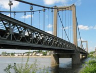
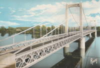
1954: Viviers
Viviers, Ardèche and Châteauneuf-Du-Rhône, Drôme, France - Rhône River
| Bridgemeister ID: | 1545 (added 2004-11-05) |
| Year Completed: | 1954 |
| Name: | Viviers |
| Location: | Viviers, Ardèche and Châteauneuf-Du-Rhône, Drôme, France |
| Crossing: | Rhône River |
| Coordinates: | 44.481583 N 4.698717 E |
| Maps: | Acme, GeoHack, Google, OpenStreetMap |
| Use: | Vehicular (two-lane, heavy vehicles), with walkway |
| Status: | In use (last checked: 2021) |
| Main Cables: | Wire (steel) |
| Suspended Spans: | 3 |
| Main Span: | 1 |
| Side Spans: | 2 |
Notes:
- At former location of 1847 Viviers - Viviers, Ardèche and Drôme, France.
External Links:
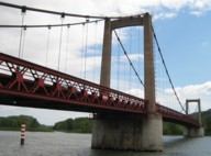
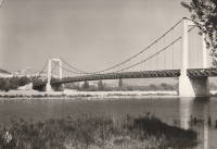
1955: Bessières
Bessières, Haute-Garonne, France - Tarn River
| Bridgemeister ID: | 3197 (added 2019-11-10) |
| Year Completed: | 1955 |
| Name: | Bessières |
| Location: | Bessières, Haute-Garonne, France |
| Crossing: | Tarn River |
| Coordinates: | 43.801612 N 1.609436 E |
| Maps: | Acme, GeoHack, Google, OpenStreetMap |
| Principals: | Baudin-Châteauneuf |
| Use: | Vehicular (two-lane) |
| Status: | In use (last checked: 2021) |
| Main Cables: | Wire (steel) |
| Suspended Spans: | 1 |
| Main Span: | 1 x 119.4 meters (391.7 feet) estimated |
Notes:
External Links:
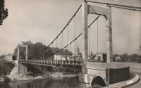
1955: Buzet-sur-Tarn
Buzet-sur-Tarn, Haute-Garonne, France - Tarn River
| Bridgemeister ID: | 6612 (added 2021-09-05) |
| Year Completed: | 1955 |
| Name: | Buzet-sur-Tarn |
| Location: | Buzet-sur-Tarn, Haute-Garonne, France |
| Crossing: | Tarn River |
| Coordinates: | 43.781136 N 1.634988 E |
| Maps: | Acme, GeoHack, Google, OpenStreetMap |
| Principals: | Baudin Chateauneuf |
| Use: | Vehicular (one-lane), with walkway |
| Status: | In use (last checked: 2021) |
| Main Cables: | Wire (steel) |
| Suspended Spans: | 1 |
| Main Span: | 1 |
Notes:
- At former location of 1844 Buzet-sur-Tarn - Buzet-sur-Tarn, Haute-Garonne, France. Unclear if the 1955 bridge was a direct replacement.
External Links:
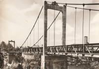
1955: Riscle
Riscle, Gers, France - Adour River
| Bridgemeister ID: | 7315 (added 2022-08-28) |
| Year Completed: | 1955 |
| Name: | Riscle |
| Location: | Riscle, Gers, France |
| Crossing: | Adour River |
| Coordinates: | 43.663989 N 0.081795 W |
| Maps: | Acme, GeoHack, Google, OpenStreetMap |
| Use: | Vehicular (two-lane), with walkway |
| Status: | In use (last checked: 2021) |
| Main Cables: | Wire (steel) |
| Suspended Spans: | 1 |
| Main Span: | 1 x 102.5 meters (336.3 feet) estimated |
Notes:
- Replaced 1930 Riscle - Riscle, Gers, France.
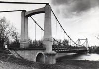
1956: Lorois
Plouhinec vicinity, Morbihan, France - Etel River
| Bridgemeister ID: | 1080 (added 2003-12-29) |
| Year Completed: | 1956 |
| Name: | Lorois |
| Location: | Plouhinec vicinity, Morbihan, France |
| Crossing: | Etel River |
| Coordinates: | 47.675905 N 3.200095 W |
| Maps: | Acme, GeoHack, Google, OpenStreetMap |
| References: | BPF |
| Use: | Vehicular (two-lane) |
| Status: | In use (last checked: 2019) |
| Main Cables: | Wire (steel) |
| Suspended Spans: | 1 |
| Main Span: | 1 x 237 meters (777.6 feet) |
Notes:
External Links:
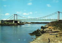
1956: Triel-sur-Seine
Triel-sur-Seine and Vernouillet, Yvelines, France - Seine River
| Bridgemeister ID: | 1540 (added 2004-10-31) |
| Year Completed: | 1956 |
| Name: | Triel-sur-Seine |
| Location: | Triel-sur-Seine and Vernouillet, Yvelines, France |
| Crossing: | Seine River |
| Coordinates: | 48.978517 N 2.0015 E |
| Maps: | Acme, GeoHack, Google, OpenStreetMap |
| Use: | Vehicular (two-lane, heavy vehicles), with walkway |
| Status: | In use (last checked: 2022) |
| Main Cables: | Wire (steel) |
| Suspended Spans: | 3 |
| Main Span: | 1 x 105.5 meters (346.1 feet) estimated |
| Side Spans: | 2 |
| Characteristics: | Self-anchored |
Notes:
External Links:
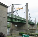
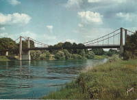
1958: Gustave Toursier
Tournon-sur-Rhône, Ardèche and Tain-L'Hermitage, Drôme, France - Rhône River
| Bridgemeister ID: | 1455 (added 2004-08-14) |
| Year Completed: | 1958 |
| Name: | Gustave Toursier |
| Location: | Tournon-sur-Rhône, Ardèche and Tain-L'Hermitage, Drôme, France |
| Crossing: | Rhône River |
| Coordinates: | 45.066638 N 4.840666 E |
| Maps: | Acme, GeoHack, Google, OpenStreetMap |
| Use: | Vehicular (two-lane, heavy vehicles), with walkway |
| Status: | In use (last checked: 2022) |
| Main Cables: | Wire (steel) |
| Suspended Spans: | 3 |
| Main Span: | 1 x 144 meters (472.4 feet) estimated |
| Side Spans: | 2 |
Notes:
- Near 1825 Tain-Tournon - Tournon-sur-Rhône, Ardèche and Tain, Drôme, France.
- Near 1849 Marc Seguin - Tournon-sur-Rhône, Ardèche and Tain-L'Hermitage, Drôme, France.
External Links:
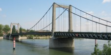
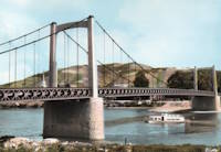
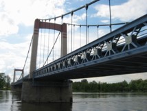
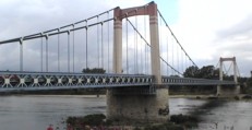
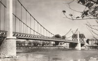
1959: Cosne-sur-Loire
Cosne-Cours-sur-Loire, Nièvre and Cher, France - Loire River
| Bridgemeister ID: | 1179 (added 2004-01-24) |
| Year Completed: | 1959 |
| Name: | Cosne-sur-Loire |
| Location: | Cosne-Cours-sur-Loire, Nièvre and Cher, France |
| Crossing: | Loire River |
| Coordinates: | 47.411367 N 2.921417 E |
| Maps: | Acme, GeoHack, Google, OpenStreetMap |
| Use: | Vehicular (two-lane, heavy vehicles), with walkway |
| Status: | In use (last checked: 2005) |
| Main Cables: | Wire (steel) |
| Suspended Spans: | 3 |
| Main Span: | 1 x 157 meters (515.1 feet) |
| Side Spans: | 2 x 63 meters (206.7 feet) |
| Deck width: | 9.5 meters |
Notes:
- At former location of 1833 Cosne-sur-Loire - Cosne-sur-Loire, Nièvre and Boulleret, Cher, France.
External Links:
1959: Saint-Hubert
Port Saint-Hubert, Plouër-sur-Rance vicinity and La Ville-es-Nonais, Côtes-d'Armor, France - Rance River
| Bridgemeister ID: | 1493 (added 2004-09-19) |
| Year Completed: | 1959 |
| Name: | Saint-Hubert |
| Location: | Port Saint-Hubert, Plouër-sur-Rance vicinity and La Ville-es-Nonais, Côtes-d'Armor, France |
| Crossing: | Rance River |
| Coordinates: | 48.535455 N 1.970929 W |
| Maps: | Acme, GeoHack, Google, OpenStreetMap |
| Use: | Vehicular (two-lane, heavy vehicles), with walkway |
| Status: | In use (last checked: 2019) |
| Main Cables: | Wire (steel) |
| Suspended Spans: | 1 |
Notes:
External Links:
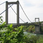
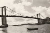
1959: Tancarville
Tancarville, Seine-Maritime and Marais-Vernier, Eure, France - Seine River
| Bridgemeister ID: | 460 (added before 2003) |
| Year Completed: | 1959 |
| Name: | Tancarville |
| Location: | Tancarville, Seine-Maritime and Marais-Vernier, Eure, France |
| Crossing: | Seine River |
| Coordinates: | 49.47 N 0.467267 E |
| Maps: | Acme, GeoHack, Google, OpenStreetMap |
| References: | AOB, BPF |
| Use: | Vehicular (major highway), with walkway |
| Status: | In use (last checked: 2021) |
| Main Cables: | Wire (steel) |
| Suspended Spans: | 3 |
| Main Span: | 1 x 608 meters (1,994.8 feet) |
| Side Spans: | 2 x 176 meters (577.4 feet) |
| Deck width: | 12.5 meters |
Notes:
- Main cables replaced, 1999.
External Links:
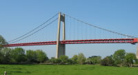
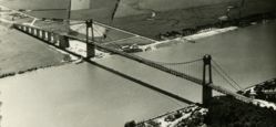
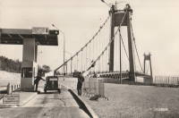
1959: Vernaison
Vernaison and Solaize, Métropole de Lyon, France - Rhône River
| Bridgemeister ID: | 1832 (added 2005-05-30) |
| Year Completed: | 1959 |
| Name: | Vernaison |
| Location: | Vernaison and Solaize, Métropole de Lyon, France |
| Crossing: | Rhône River |
| Coordinates: | 45.645621 N 4.816518 E |
| Maps: | Acme, GeoHack, Google, OpenStreetMap |
| Use: | Vehicular (two-lane) |
| Status: | In use (last checked: 2019) |
| Main Cables: | Wire (steel) |
| Suspended Spans: | 3 |
| Main Span: | 1 |
| Side Spans: | 2 |
Notes:
- At former location of 1902 Vernaison - Vernaison, Métropole de Lyon, France.
- Connects to Solaize - Solaize and Vernaison, Métropole de Lyon, France.
External Links:
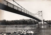
1960: Roche-Bernard
La Roche-Bernard, Morbihan, France - Vilaine River
| Bridgemeister ID: | 896 (added 2003-09-07) |
| Year Completed: | 1960 |
| Name: | Roche-Bernard |
| Location: | La Roche-Bernard, Morbihan, France |
| Crossing: | Vilaine River |
| Coordinates: | 47.524359 N 2.304873 W |
| Maps: | Acme, GeoHack, Google, OpenStreetMap |
| References: | BPF |
| Use: | Vehicular (two-lane), with walkway |
| Status: | In use (last checked: 2021) |
| Main Cables: | Wire (steel) |
| Suspended Spans: | 3 |
| Main Span: | 1 x 244.8 meters (803.1 feet) |
| Side Spans: | 2 x 81 meters (265.7 feet) |
Notes:
External Links:
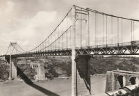
1961: Saint-Foy-la-Grande
Saint-Foy-la-Grande, Gironde and Port-Sainte-Foy-et-Ponchapt, Dordogne, France - Dordogne River
| Bridgemeister ID: | 1970 (added 2005-11-26) |
| Year Completed: | 1961 |
| Name: | Saint-Foy-la-Grande |
| Location: | Saint-Foy-la-Grande, Gironde and Port-Sainte-Foy-et-Ponchapt, Dordogne, France |
| Crossing: | Dordogne River |
| Coordinates: | 44.840960 N 0.208675 E |
| Maps: | Acme, GeoHack, Google, OpenStreetMap |
| Use: | Vehicular (two-lane), with walkway |
| Status: | In use (last checked: 2019) |
| Main Cables: | Wire (steel) |
| Suspended Spans: | 3 |
| Main Span: | 1 |
| Side Spans: | 2 |
Notes:
- Near former location of 1897 Port-Sainte-Foy - Port-Sainte-Foy-et-Ponchapt, Dordogne and Sainte-Foy-la-Grande, Gironde, France.
External Links:
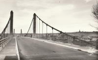
1963: Saint-Symphorien
Tours, Indre-et-Loire, France - Loire River
| Bridgemeister ID: | 7840 (added 2023-09-03) |
| Year Completed: | 1963 |
| Name: | Saint-Symphorien |
| Location: | Tours, Indre-et-Loire, France |
| Crossing: | Loire River |
| At or Near Feature: | l'Île Aucard |
| Coordinates: | 47.399002 N 0.693011 E |
| Maps: | Acme, GeoHack, Google, OpenStreetMap |
| Status: | Restricted to foot traffic (last checked: 2023) |
| Main Cables: | Wire (steel) |
| Suspended Spans: | 3 |
| Main Spans: | 3 |
Notes:
- This is the present-day (2020s) three-span southern Saint-Symphorien bridge.
- Replaced Saint-Symphorien - Tours, Indre-et-Loire, France.
- Connects to 1963 Saint-Symphorien - Tours, Indre-et-Loire, France.
External Links:
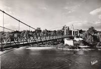
1963: Saint-Symphorien
Tours, Indre-et-Loire, France - Loire River
| Bridgemeister ID: | 7841 (added 2023-09-03) |
| Year Completed: | 1963 |
| Name: | Saint-Symphorien |
| Location: | Tours, Indre-et-Loire, France |
| Crossing: | Loire River |
| At or Near Feature: | l'Île Aucard |
| Coordinates: | 47.401695 N 0.693334 E |
| Maps: | Acme, GeoHack, Google, OpenStreetMap |
| Status: | Restricted to foot traffic (last checked: 2023) |
| Main Cables: | Wire (steel) |
| Suspended Spans: | 2 |
| Main Spans: | 2 |
Notes:
- This is the present-day (2020s) two-span northern Saint-Symphorien bridge.
- Replaced 1847 Saint-Symphorien - Tours, Indre-et-Loire, France.
- Connects to 1963 Saint-Symphorien - Tours, Indre-et-Loire, France.
External Links:
1964: Saint-Bachi Aqueduct
Rians, Var, France - Ruisseau de Saint-Bachi
| Bridgemeister ID: | 4691 (added 2020-06-20) |
| Year Completed: | 1964 |
| Name: | Saint-Bachi Aqueduct |
| Location: | Rians, Var, France |
| Crossing: | Ruisseau de Saint-Bachi |
| Coordinates: | 43.613862 N 5.687426 E |
| Maps: | Acme, GeoHack, Google, OpenStreetMap |
| Use: | Aqueduct |
| Status: | In use |
| Main Cables: | Wire (steel) |
| Suspended Spans: | 1 |
External Links:
1967: Aquitaine
Bordeaux, Gironde, France - Garonne River
| Bridgemeister ID: | 466 (added before 2003) |
| Year Completed: | 1967 |
| Name: | Aquitaine |
| Location: | Bordeaux, Gironde, France |
| Crossing: | Garonne River |
| Coordinates: | 44.879916 N 0.537012 W |
| Maps: | Acme, GeoHack, Google, OpenStreetMap |
| References: | BPF |
| Use: | Vehicular (major highway) |
| Status: | In use (last checked: 2019) |
| Main Cables: | Wire (steel) |
| Suspended Spans: | 3 |
| Main Span: | 1 x 394 meters (1,292.7 feet) |
| Side Spans: | 2 x 143 meters (469.2 feet) |
External Links:
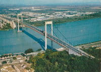
1985: Val-Joly
Eppe-Sauvage vicinity, Nord, France - Lac du Val-Joly
| Bridgemeister ID: | 2137 (added 2006-10-28) |
| Year Completed: | 1985 |
| Name: | Val-Joly |
| Location: | Eppe-Sauvage vicinity, Nord, France |
| Crossing: | Lac du Val-Joly |
| Coordinates: | 50.122243 N 4.124874 E |
| Maps: | Acme, GeoHack, Google, OpenStreetMap |
| Use: | Footbridge |
| Status: | In use (last checked: 2019) |
| Main Cables: | Wire (steel) |
| Suspended Spans: | 1 |
External Links:
| Bridgemeister ID: | 1416 (added 2004-07-04) |
| Year Completed: | 1991 |
| Name: | Diable |
| Also Known As: | Devil's |
| Location: | Avrieux vicinity, Modane, Savoie, France |
| Crossing: | Arc River |
| Coordinates: | 45.210240 N 6.738880 E |
| Maps: | Acme, GeoHack, Google, OpenStreetMap |
| Use: | Footbridge |
| Status: | In use (last checked: 2019) |
| Main Cables: | Wire (steel) |
| Suspended Spans: | 1 |
| Main Span: | 1 x 45 meters (147.6 feet) |
Notes:
- Connecting the Marie-Thérèse and Victor Emmanuel II forts.
- Replaced Diable (Devil's) - Avrieux, L'Esseillon, and Modane vicinity, Savoie, France.
External Links:
2000: Chavanon Viaduct
Merlines, Corrèze and Messeix, Puy-de-Dôme, France - Chavanon Valley
| Bridgemeister ID: | 509 (added before 2003) |
| Year Completed: | 2000 |
| Name: | Chavanon Viaduct |
| Location: | Merlines, Corrèze and Messeix, Puy-de-Dôme, France |
| Crossing: | Chavanon Valley |
| Coordinates: | 45.62404 N 2.479349 E |
| Maps: | Acme, GeoHack, Google, OpenStreetMap |
| References: | BPF |
| Use: | Vehicular (major highway) |
| Status: | In use (last checked: 2019) |
| Main Cables: | Wire (steel) |
| Suspended Spans: | 1 |
| Main Span: | 1 x 300 meters (984.3 feet) |
Notes:
- Monocable across A-pylon towers.
External Links:
2001: (footbridge)
Sarreguemines, Moselle, France - Sarre River
| Bridgemeister ID: | 1889 (added 2005-10-01) |
| Year Completed: | 2001 |
| Name: | (footbridge) |
| Location: | Sarreguemines, Moselle, France |
| Crossing: | Sarre River |
| Coordinates: | 49.110183 N 7.072017 E |
| Maps: | Acme, GeoHack, Google, OpenStreetMap |
| Use: | Footbridge |
| Status: | In use (last checked: 2017) |
| Main Cables: | Wire (steel) |
| Suspended Spans: | 2 |
| Side Spans: | 2 |
| Characteristics: | Self-anchored |
Notes:
- Self-anchored. Inclined suspenders.
External Links:
2001: (footbridge)
Tours, Indre-et-Loire, France - Cher River
| Bridgemeister ID: | 1019 (added 2003-11-22) |
| Year Completed: | 2001 |
| Name: | (footbridge) |
| Location: | Tours, Indre-et-Loire, France |
| Crossing: | Cher River |
| Coordinates: | 47.37155 N 0.682467 E |
| Maps: | Acme, GeoHack, Google, OpenStreetMap |
| Principals: | Alain Spielmann |
| Use: | Footbridge |
| Status: | In use (last checked: 2005) |
| Main Cables: | Wire (steel) |
| Suspended Spans: | 1 |
Notes:
- Monocable from A-shaped towers.
External Links:
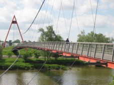
2002: Agen
Agen, Lot-et-Garonne, France - Garonne River
| Bridgemeister ID: | 1032 (added 2003-11-30) |
| Year Completed: | 2002 |
| Name: | Agen |
| Location: | Agen, Lot-et-Garonne, France |
| Crossing: | Garonne River |
| Coordinates: | 44.201950 N 0.608290 E |
| Maps: | Acme, GeoHack, Google, OpenStreetMap |
| Use: | Footbridge |
| Status: | In use (last checked: 2019) |
| Main Cables: | Wire (steel) |
| Suspended Spans: | 3 |
| Main Span: | 1 x 174.25 meters (571.7 feet) |
| Side Spans: | 1 x 29.5 meters (96.8 feet), 1 x 20.6 meters (67.6 feet) |
| Deck width: | 2.3 meters |
Notes:
- Replaced 1841 Agen - Agen, Lot-et-Garonne, France.
External Links:
2005: Poètes
Dole, Jura, France - Doubs River
| Bridgemeister ID: | 4904 (added 2020-07-18) |
| Year Completed: | 2005 |
| Name: | Poètes |
| Location: | Dole, Jura, France |
| Crossing: | Doubs River |
| Coordinates: | 47.088697 N 5.498601 E |
| Maps: | Acme, GeoHack, Google, OpenStreetMap |
| Use: | Footbridge |
| Status: | In use (last checked: 2020) |
| Main Cables: | Wire (steel) |
| Suspended Spans: | 1 |
External Links:
2008: Saint-Just-Saint-Rambert
Saint-Just-Saint-Rambert, Loire, France - Loire River
| Bridgemeister ID: | 3232 (added 2019-11-15) |
| Year Completed: | 2008 |
| Name: | Saint-Just-Saint-Rambert |
| Also Known As: | Grand |
| Location: | Saint-Just-Saint-Rambert, Loire, France |
| Crossing: | Loire River |
| Coordinates: | 45.516882 N 4.248869 E |
| Maps: | Acme, GeoHack, Google, OpenStreetMap |
| Use: | Vehicular (four-lane) |
| Status: | In use (last checked: 2019) |
| Main Cables: | Wire (steel) |
| Suspended Spans: | 1 |
External Links:
2009: Müller
Ivry-sur-Seine, Val-de-Marne, France
| Bridgemeister ID: | 4912 (added 2020-07-19) |
| Year Completed: | 2009 |
| Name: | Müller |
| Location: | Ivry-sur-Seine, Val-de-Marne, France |
| Coordinates: | 48.817871 N 2.388870 E |
| Maps: | Acme, GeoHack, Google, OpenStreetMap |
| Use: | Footbridge |
| Status: | In use (last checked: 2020) |
| Main Cables: | Wire (steel) |
| Suspended Spans: | 1 |
External Links:
2010: Verdun-sur-Garonne
Verdun-sur-Garonne, Tarn-et-Garonne, France - Garonne River
| Bridgemeister ID: | 2939 (added 2019-09-23) |
| Year Completed: | 2010 |
| Name: | Verdun-sur-Garonne |
| Location: | Verdun-sur-Garonne, Tarn-et-Garonne, France |
| Crossing: | Garonne River |
| Coordinates: | 43.855042 N 1.243785 E |
| Maps: | Acme, GeoHack, Google, OpenStreetMap |
| Use: | Vehicular (two-lane), with walkway |
| Status: | In use (last checked: 2019) |
| Main Cables: | Wire (steel) |
| Suspended Spans: | 1 |
| Characteristics: | Rocker towers |
Notes:
External Links:
2013: Himalayenne
Rochemaure, Ardèche, France - Rhône River
| Bridgemeister ID: | 6717 (added 2021-10-12) |
| Year Completed: | 2013 |
| Name: | Himalayenne |
| Also Known As: | Rochemaure, Himalayan |
| Location: | Rochemaure, Ardèche, France |
| Crossing: | Rhône River |
| At or Near Feature: | ViaRhôna Cycle Path |
| Coordinates: | 44.582660 N 4.711102 E |
| Maps: | Acme, GeoHack, Google, OpenStreetMap |
| Use: | Footbridge |
| Status: | In use (last checked: 2021) |
| Main Cables: | Wire (steel) |
Notes:
- Built on the rehabilitated piers of the older Rochemaure bridge.
- Replaced 1842 Rochemaure - Rochemaure, Ardèche and Ancône, Drôme, France.
External Links:
2013: Moulin
Vernosc-lès-Annonay, Ardèche, France - Cance River
| Bridgemeister ID: | 3195 (added 2019-11-10) |
| Year Completed: | 2013 |
| Name: | Moulin |
| Location: | Vernosc-lès-Annonay, Ardèche, France |
| Crossing: | Cance River |
| Coordinates: | 45.210761 N 4.703166 E |
| Maps: | Acme, GeoHack, Google, OpenStreetMap |
| Use: | Footbridge |
| Status: | In use (last checked: 2020) |
| Main Cables: | Wire |
| Suspended Spans: | 1 |
Notes:
- Effectively a reproduction of the prior Moulin bridge.
- Replaced 1865 Moulin - Vernosc-lès-Annonay, Ardèche, France.
External Links:
2013: Nelson Mandela
Décines-Charpieu, Métropole de Lyon, France - Jonage Canal
| Bridgemeister ID: | 4918 (added 2020-07-26) |
| Year Completed: | 2013 |
| Name: | Nelson Mandela |
| Location: | Décines-Charpieu, Métropole de Lyon, France |
| Crossing: | Jonage Canal |
| At or Near Feature: | Réservoir du Grand-Large |
| Coordinates: | 45.775461 N 4.953934 E |
| Maps: | Acme, GeoHack, Google, OpenStreetMap |
| Use: | Footbridge |
| Status: | In use (last checked: 2020) |
| Main Cables: | Wire (steel) |
| Suspended Spans: | 2 |
| Side Spans: | 2 |
External Links:
2013: Rethel
Rethel, Ardennes, France - Aisne River
| Bridgemeister ID: | 4558 (added 2020-06-01) |
| Year Completed: | 2013 |
| Name: | Rethel |
| Location: | Rethel, Ardennes, France |
| Crossing: | Aisne River |
| Coordinates: | 49.511419 N 4.356874 E |
| Maps: | Acme, GeoHack, Google, OpenStreetMap |
| Use: | Footbridge |
| Status: | In use (last checked: 2019) |
| Main Cables: | Wire (steel) |
| Suspended Spans: | 1 |
| Main Span: | 1 x 48 meters (157.5 feet) estimated |
External Links:
2015: Nelson Mandela
Creil, Oise, France - Oise River
| Bridgemeister ID: | 4914 (added 2020-07-19) |
| Year Completed: | 2015 |
| Name: | Nelson Mandela |
| Location: | Creil, Oise, France |
| Crossing: | Oise River |
| Coordinates: | 49.259205 N 2.466867 E |
| Maps: | Acme, GeoHack, Google, OpenStreetMap |
| Use: | Footbridge |
| Status: | In use (last checked: 2020) |
| Main Cables: | Wire (steel) |
| Suspended Spans: | 1 |
External Links:
| Bridgemeister ID: | 7386 (added 2022-11-24) |
| Year Completed: | 2016 |
| Name: | Sérignan |
| Location: | Sérignan, Béziers, Hérault, France |
| Crossing: | Orb River |
| Coordinates: | 43.283630 N 3.282533 E |
| Maps: | Acme, GeoHack, Google, OpenStreetMap |
| Use: | Footbridge |
| Status: | In use (last checked: 2022) |
| Main Cables: | Wire (steel) |
| Suspended Spans: | 1 |
Notes:
- Near former location of 1851 Sérignan - Sérignan, Béziers vicinity, Hérault, France.
2021: Virignin
La Balme, Savoie and Virignin, Ain, France - Rhône River
| Bridgemeister ID: | 7575 (added 2023-04-21) |
| Year Completed: | 2021 |
| Name: | Virignin |
| Location: | La Balme, Savoie and Virignin, Ain, France |
| Crossing: | Rhône River |
| At or Near Feature: | Véloroute ViaRhôna |
| Coordinates: | 45.710808 N 5.705120 E |
| Maps: | Acme, GeoHack, Google, OpenStreetMap |
| Use: | Footbridge |
| Status: | In use (last checked: 2022) |
| Main Cables: | Wire (steel) |
| Suspended Spans: | 1 |
| Main Span: | 1 x 164 meters (538.1 feet) estimated |
(conveyor bridge)
Loisy, Meurthe-et-Moselle, France - Moselle/Mosel River
| Bridgemeister ID: | 4716 (added 2020-06-26) |
| Name: | (conveyor bridge) |
| Location: | Loisy, Meurthe-et-Moselle, France |
| Crossing: | Moselle/Mosel River |
| Coordinates: | 48.874604 N 6.095162 E |
| Maps: | Acme, GeoHack, Google, OpenStreetMap |
| Use: | Conveyor |
| Status: | Extant (last checked: 2019) |
| Main Cables: | Wire (steel) |
| Suspended Spans: | 2 |
| Main Spans: | 2 x 115 meters (377.3 feet) estimated |
External Links:
(footbridge)
Auberives-en-Royans, Isère and Drôme, France - Bourne River
| Bridgemeister ID: | 5564 (added 2020-12-19) |
| Name: | (footbridge) |
| Location: | Auberives-en-Royans, Isère and Drôme, France |
| Crossing: | Bourne River |
| Coordinates: | 45.055189 N 5.325440 E |
| Maps: | Acme, GeoHack, Google, OpenStreetMap |
| Use: | Footbridge |
| Status: | In use (last checked: 2020) |
| Main Cables: | Wire (steel) |
(footbridge)
Aulnay, Châtenay-Malabry, Hauts-de-Seine, France
| Bridgemeister ID: | 5576 (added 2020-12-20) |
| Name: | (footbridge) |
| Location: | Aulnay, Châtenay-Malabry, Hauts-de-Seine, France |
| At or Near Feature: | Arboretum de la Vallée aux Loups |
| Coordinates: | 48.771694 N 2.271225 E |
| Maps: | Acme, GeoHack, Google, OpenStreetMap |
| Use: | Footbridge |
| Status: | In use (last checked: 2020) |
| Suspended Spans: | 1 |
Notes:
- This small garden footbridge appears to currently (2020) be aided by a substantial steel beam supporting the deck.
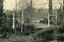
(footbridge)
Aurec-sur-Loire, Haute-Loire, France - Loire River
| Bridgemeister ID: | 6806 (added 2021-11-21) |
| Name: | (footbridge) |
| Location: | Aurec-sur-Loire, Haute-Loire, France |
| Crossing: | Loire River |
| Coordinates: | 45.369532 N 4.197222 E |
| Maps: | Acme, GeoHack, Google, OpenStreetMap |
| Use: | Footbridge |
| Status: | In use (last checked: 2021) |
| Main Cables: | Wire (steel) |
| Suspended Spans: | 3 |
| Main Span: | 1 |
| Side Spans: | 2 |
Notes:
- 2010s: This suspension footbridge is installed on the piers of the old vehicular suspension bridge at this location.
- At former location of 1892 Aurec-sur-Loire - Aurec-sur-Loire, Haute-Loire, France.
(footbridge)
Auzat-la-Combelle, Puy-de-Dôme, France
| Bridgemeister ID: | 7538 (added 2023-01-22) |
| Name: | (footbridge) |
| Location: | Auzat-la-Combelle, Puy-de-Dôme, France |
| Use: | Footbridge |
| Status: | Removed |
| Main Cables: | Wire (steel) |
| Suspended Spans: | 1 |
Notes:
- Location known as Auzat-sur-Allier at the time the bridge was completed.
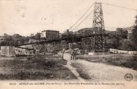
(footbridge)
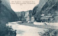
Avignonet, Isère, France - Drac River
| Bridgemeister ID: | 8220 (added 2024-02-06) |
| Name: | (footbridge) |
| Location: | Avignonet, Isère, France |
| Crossing: | Drac River |
| At or Near Feature: | Avignonet Hydroelectric Plant |
| Use: | Footbridge |
| Main Span: | 1 |
Notes:
- Exact location of this bridge is unclear, but likely in close proximity to the current (as of 2023) Drac River dam at Avignonet.
(footbridge)
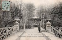
Île de Bercy and Île de Reuilly, Paris, France - Lac Daumesnil
| Bridgemeister ID: | 7904 (added 2023-10-15) |
| Name: | (footbridge) |
| Location: | Île de Bercy and Île de Reuilly, Paris, France |
| Crossing: | Lac Daumesnil |
| Coordinates: | 48.831052 N 2.412569 E |
| Maps: | Acme, GeoHack, Google, OpenStreetMap |
| Use: | Footbridge |
| Status: | In use (last checked: 2023) |
| Main Cables: | Wire |
| Suspended Spans: | 1 |
Notes:
(footbridge)
Île de Reuilly, Paris, France - Lac Daumesnil
| Bridgemeister ID: | 7905 (added 2023-10-15) |
| Name: | (footbridge) |
| Location: | Île de Reuilly, Paris, France |
| Crossing: | Lac Daumesnil |
| Coordinates: | 48.829803 N 2.415193 E |
| Maps: | Acme, GeoHack, Google, OpenStreetMap |
| Use: | Footbridge |
| Status: | In use (last checked: 2023) |
| Main Cables: | Wire |
| Suspended Spans: | 1 |
Notes:

(footbridge)
Coupvray, Seine-et-Marne, France - Chalifert Canal
| Bridgemeister ID: | 1517 (added 2004-10-10) |
| Name: | (footbridge) |
| Location: | Coupvray, Seine-et-Marne, France |
| Crossing: | Chalifert Canal |
| Coordinates: | 48.896971 N 2.796701 E |
| Maps: | Acme, GeoHack, Google, OpenStreetMap |
| Principals: | Freyssinet International |
| Use: | Footbridge |
| Status: | Extant (last checked: 2019) |
| Main Cables: | Wire (steel) |
| Suspended Spans: | 1 |
| Main Span: | 1 x 34 meters (111.5 feet) |
External Links:
(footbridge)
Injoux-Génissiat, Ain and Franclens, Haute-Savoie, France - Rhône River
| Bridgemeister ID: | 7403 (added 2022-12-03) |
| Name: | (footbridge) |
| Location: | Injoux-Génissiat, Ain and Franclens, Haute-Savoie, France |
| Crossing: | Rhône River |
| At or Near Feature: | Barrage de Génissiat |
| Coordinates: | 46.050202 N 5.811581 E |
| Maps: | Acme, GeoHack, Google, OpenStreetMap |
| Use: | Footbridge |
| Status: | Removed |
| Main Cables: | Wire (steel) |
| Suspended Spans: | 1 |
Notes:
- Likely built around 1946-1947 during construction of the Génissiat dam.
(footbridge)
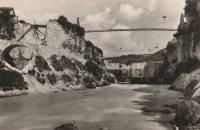
Joué-lèz-Tours, Indre-et-Loire, France
| Bridgemeister ID: | 7758 (added 2023-07-23) |
| Name: | (footbridge) |
| Location: | Joué-lèz-Tours, Indre-et-Loire, France |
| Coordinates: | 47.335385 N 0.668899 E |
| Maps: | Acme, GeoHack, Google, OpenStreetMap |
| Use: | Footbridge |
| Status: | Removed |
| Main Cables: | Wire |
| Suspended Spans: | 1 |
Notes:
- Coordinates provided appear to be the approximate vicinity of the bridge, crossing the north/south rail line.
(footbridge)
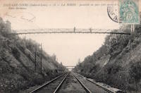
Saint-Thibéry, Hérault, France - Hérault River
| Bridgemeister ID: | 4555 (added 2020-06-01) |
| Name: | (footbridge) |
| Location: | Saint-Thibéry, Hérault, France |
| Crossing: | Hérault River |
| Coordinates: | 43.398414 N 3.422952 E |
| Maps: | Acme, GeoHack, Google, OpenStreetMap |
| Use: | Footbridge |
| Status: | Extant (last checked: 2021) |
| Main Cables: | Wire |
| Suspended Spans: | 3 |
| Main Span: | 1 |
| Side Spans: | 2 |
External Links:
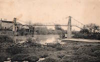
(footbridge)
Toulouse, Haute-Garonne, France - Canal de Brienne
| Bridgemeister ID: | 4565 (added 2020-06-02) |
| Name: | (footbridge) |
| Location: | Toulouse, Haute-Garonne, France |
| Crossing: | Canal de Brienne |
| Coordinates: | 43.608793 N 1.423906 E |
| Maps: | Acme, GeoHack, Google, OpenStreetMap |
| Use: | Footbridge |
| Status: | In use (last checked: 2018) |
| Main Cables: | Wire (steel) |
| Suspended Spans: | 1 |
External Links:
Do you have any information or photos for these bridges that you would like to share? Please email david.denenberg@bridgemeister.com.