Undated/Named Suspension Bridges (1-1,556 of 1,567)
This is a list of bridges 1 through 1,556 (of 1,567 total) in the suspension bridge inventory that are undated named bridges. Wherever you see a Bridgemeister ID number click it to isolate the bridge on its own page.
Related Lists:
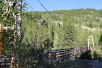
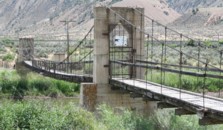
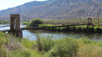
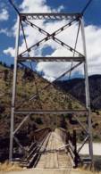
Scheduled for reconstruction starting April 2008. According to an article in the March 24, 2008 issue of The Durango Herald : "The wood support frames will be replaced with steel while the railing and deck will be replaced with a wood polymer such as Trex, which is made of recycled plastic and wood fibers." Bridgemeister ID: 7473 (added 2022-12-25)Name: 24 de Julio Location: Corral Quemado, Utcubamba, Amazonas and Jaén, Cajamarca, Peru Crossing: Rio Marañón Coordinates: 5.754081 S 78.692978 W Maps: Acme , GeoHack , Google , OpenStreetMap Use: Vehicular (two-lane) Status: In use (last checked: 2021) Main Cables: Wire (steel) Suspended Spans: 1 Main Span: 1 x 156.1 meters (512 feet) estimated
Bridgemeister ID: 8256 (added 2024-02-08)Name: Aaphsoti LSTB Location: Sahare (सहरे), Nepal Crossing: Bheri River Coordinates: 28.430211 N 81.904844 E Maps: Acme , GeoHack , Google , OpenStreetMap Use: Footbridge Status: Extant (last checked: 2024) Main Span: 1 x 179.8 meters (589.9 feet)
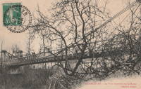
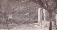
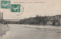
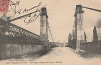
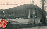
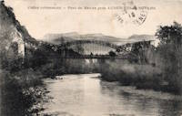
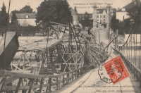
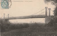
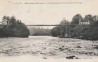
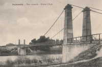
Completed at some point in the 2018-2020 time frame. Bridgemeister ID: 7389 (added 2022-11-25)Name: Ablancourt Location: Ablancourt, Marne , France Crossing: Marne River Status: Removed Main Cables: Wire Suspended Spans: 1
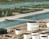
Large industrial structure. According to the August 22, 2005 U.S. Coast Guard press release on the demolition: "The suspended conveyor bridge is approximately 26 feet wide, 400 feet in length, and has a vertical clearance of 130 feet. It is located in an industrial area approximately 15 miles south of downtown Chicago on the old Acme Steel and Heckett Slag properties." Bridgemeister ID: 7373 (added 2022-11-23)Name: Agua Fría Location: Guazapa, El Salvador Crossing: Rio Acelhuate Coordinates: 13.877006 N 89.194169 W Maps: Acme , GeoHack , Google , OpenStreetMap Use: Footbridge Status: In use (last checked: 2020) Main Cables: Wire (steel) Suspended Spans: 1 Main Span: 1 x 79.9 meters (262 feet) estimated
Replaced a bridge located nearby (13.873925, -89.189553) destroyed by Hurricane Ida (2009) that may have also been a suspended deck suspension bridge. Bridgemeister ID: 1034 (added 2003-12-03)Name: Aguaytía Location: Aguaytía, Provincia de Padre Abad, Peru Crossing: Rio Aguaytía Coordinates: 9.037190 S 75.504482 W Maps: Acme , GeoHack , Google , OpenStreetMap Use: Vehicular (two-lane), with walkway Status: In use (last checked: 2014) Main Cables: Wire (steel) Suspended Spans: 2 Main Span: 1 Side Span: 1
Bridgemeister ID: 1035 (added 2003-12-03)Name: Aguaytía Location: Aguaytía, Provincia de Padre Abad, Peru Crossing: Rio Aguaytía Coordinates: 9.037504 S 75.505019 W Maps: Acme , GeoHack , Google , OpenStreetMap Use: Vehicular Status: Collapsed, September 2022 Main Cables: Wire (steel) Suspended Spans: 1
Bridgemeister ID: 7917 (added 2023-10-22)Name: Aibuchinotsuri Also Known As: 相渕の吊橋 Location: Warabino (蕨野), Aoi Ward and Aibuchi (相淵), Aoi Ward, Shizuoka , Japan Crossing: Abe River Coordinates: 35.122263 N 138.358845 E Maps: Acme , GeoHack , Google , OpenStreetMap Use: Footbridge Status: In use (last checked: 2023) Main Cables: Wire (steel) Suspended Spans: 2 Main Spans: 1 x 113 meters (370.7 feet) estimated,
Bridgemeister ID: 2095 (added 2006-07-03)Name: Ajisai Location: Kawauchi, Shimokita District, Aomori , Japan Use: Footbridge Status: In use Main Cables: Wire (steel) Main Span: 1 x 56 meters (183.7 feet)
Bridgemeister ID: 5211 (added 2020-10-11)Name: Akahito Also Known As: 赤人橋 Location: Uda, Nara , Japan Crossing: Uda River At or Near Feature: Murou Lake Coordinates: 34.544447 N 135.990481 E Maps: Acme , GeoHack , Google , OpenStreetMap Use: Vehicular (one-lane) Status: In use (last checked: 2020) Main Cables: Wire (steel) Suspended Spans: 1
Bridgemeister ID: 4322 (added 2020-04-10)Name: Akiba Also Known As: 秋葉橋 Location: Hamamatsu, Shizuoka , Japan Crossing: Tenryu River Coordinates: 34.939657 N 137.833360 E Maps: Acme , GeoHack , Google , OpenStreetMap Status: Restricted to foot traffic (last checked: 2019) Main Cables: Wire (steel) Main Span: 1 x 214 meters (702.1 feet) estimated
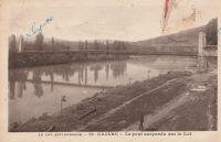
May have originally carried one lane of vehicular traffic, but now restricted to foot traffic and light motor bikes. Bridgemeister ID: 1944 (added 2005-10-29)Name: Albas Location: Albas, Lot , France Crossing: Lot River Coordinates: 44.471604 N 1.236137 E Maps: Acme , GeoHack , Google , OpenStreetMap Use: Vehicular (one-lane) Status: In use (last checked: 2023) Main Cables: Wire (steel) Suspended Spans: 1 Main Span: 1 x 116 meters (380.6 feet) estimated
Bridgemeister ID: 1402 (added 2004-07-04)Name: Allan Location: Segenhoe, Scone vicinity, New South Wales , Australia Crossing: Pages River Coordinates: 32.123321 S 150.925866 E Maps: Acme , GeoHack , Google , OpenStreetMap Use: Vehicular (one-lane) Status: In use (last checked: 2017) Main Cables: Wire (steel) Suspended Spans: 3 Main Span: 1 Side Spans: 2 Characteristics: Braced (trussed) chain/cable,
Similar to 1889 Fiorentini (Ferro, Soldo, Soldino) - Rome, Italy . Similar to 1936 Kindee - Kindee, Ellenborough vicinity, New South Wales, Australia . Similar to 1951 Marias River (Pugsley) - Chester vicinity, Montana, USA . Similar to (footbridge) - Sarov (Саров), Nizhny Novgorod Oblast, Russia . Similar to Ininskiy (Ининский) - Inya (Иня), Altai Republic, Russia . Similar to Reku Vel' - Solginskiy (Солгинский), Arkhangelsk Oblast, Russia . Bridgemeister ID: 6013 (added 2021-07-02)Name: Allccomachay Location: Mayoc, Peru Crossing: Rio Warpa Coordinates: 12.844715 S 74.331433 W Maps: Acme , GeoHack , Google , OpenStreetMap Use: Vehicular (one-lane) Status: In use (last checked: 2021) Main Cables: Wire (steel) Suspended Spans: 1 Main Span: 1 x 70 meters (229.7 feet)
Bridgemeister ID: 1326 (added 2004-04-28)Name: Allegany Location: Luke vicinity, Maryland , USA Crossing: Savage River At or Near Feature: Savage River State Forest Coordinates: 39.501343 N 79.108957 W Maps: Acme , GeoHack , Google , OpenStreetMap Principals: 121st Engineer Battalion (CBT) of the Maryland Army National Guard (Companies B and C) Use: Footbridge Status: In use (last checked: 2016) Main Cables: Wire (steel) Suspended Spans: 1
One of two similar bridges in this park. This one has a plaque "Allegany Bridge." Al Schweizer, the operations officer for the project, wrote: "The bridge panels (that portion between the vertical suspender cables attached to the main cables) were prefabricated with deck beams, decking, sway braces, handrails. They were trolleyed across the river since we were not allowed to get into the river. The bridges were erected by Company B from Cumberland, Maryland and Company C from Oakland, Maryland. The erection, to include the forming and pouring of the deadmen cable supports, abutments, towers, cable installation (2” diameter) and all the decking took just two weeks! DNR added the lattice because of children crawling on the bridge." Built as part of same project as (footbridge) - Luke vicinity, Maryland, USA . Bridgemeister ID: 2045 (added 2006-05-10)Name: Alnwick Castle Location: Alnwick, England , United Kingdom At or Near Feature: Alnwick Garden Coordinates: 55.414198 N 1.697342 W Maps: Acme , GeoHack , Google , OpenStreetMap Use: Footbridge Status: In use (last checked: 2017) Main Cables: Rope Suspended Spans: 1
Bridgemeister ID: 3093 (added 2019-10-27)Name: Alnwick Castle Location: Alnwick, England , United Kingdom At or Near Feature: Alnwick Garden Coordinates: 55.414414 N 1.697201 W Maps: Acme , GeoHack , Google , OpenStreetMap Use: Footbridge Status: In use (last checked: 2017) Main Cables: Rope Suspended Spans: 1
Bridgemeister ID: 6084 (added 2021-07-04)Name: Amagasetsuri Also Known As: 天ヶ瀬吊橋 Location: Uji, Kyoto , Japan Crossing: Uji River Coordinates: 34.881637 N 135.821044 E Maps: Acme , GeoHack , Google , OpenStreetMap Status: Restricted to foot traffic (last checked: 2021) Main Cables: Wire (steel) Suspended Spans: 1 Main Span: 1
Bridgemeister ID: 4609 (added 2020-06-07)Name: Andrije Kazica Location: Podgorica (Подгорица), Montenegro Crossing: Moraca River Coordinates: 42.456444 N 19.261328 E Maps: Acme , GeoHack , Google , OpenStreetMap Use: Footbridge Status: In use (last checked: 2016) Main Cables: Wire (steel) Suspended Spans: 3 Main Span: 1 x 44 meters (144.4 feet) estimated Side Spans: 2
Bridgemeister ID: 1946 (added 2005-11-04)Name: Anglars-Juillac Location: Anglars-Juillac, Lot , France Crossing: Lot River Coordinates: 44.482239 N 1.194641 E Maps: Acme , GeoHack , Google , OpenStreetMap Use: Vehicular (one-lane) Status: In use (last checked: 2021) Main Cables: Wire Suspended Spans: 1
Bridgemeister ID: 988 (added 2003-11-15)Name: Anglers Way Road Location: Flat Rock, Clinchport, Virginia , USA Crossing: Clinch River Coordinates: 36.6111 N 82.84273 W Maps: Acme , GeoHack , Google , OpenStreetMap Principals: VDOT Use: Footbridge Status: In use (last checked: 2019) Main Cables: Wire (steel) Suspended Spans: 2 Main Span: 1 x 80.8 meters (265 feet) estimated Side Span: 1 x 15.2 meters (50 feet) estimated
Bridgemeister ID: 6072 (added 2021-07-04)Name: Anos Also Known As: Анос Location: Anos (Анос), Altai Republic, Russia Crossing: Katun River Coordinates: 51.501000 N 85.954205 E Maps: Acme , GeoHack , Google , OpenStreetMap Use: Footbridge Status: In use (last checked: 2021) Main Cables: Wire (steel)
Google Maps - Most V Anos . Image of the bridge showing multiple suspension bridge towers at one end, likely the result of multiple reconstructions of the bridge. February 2020.Bridgemeister ID: 2960 (added 2019-10-06)Name: Anosizato Location: Antananarivo, Madagascar Crossing: Ikopa River Use: Vehicular (one-lane) Status: Replaced Main Cables: Wire Suspended Spans: 1
Bridgemeister ID: 2463 (added 2008-09-27)Name: Antonio José de Sucre Location: Sucre, Chuquisaca, Bolivia Crossing: Rio Pilcomayo Coordinates: 19.35535 S 65.17752 W Maps: Acme , GeoHack , Google , OpenStreetMap Use: Vehicular (one-lane) Status: In use (last checked: 2021) Main Cables: Wire Suspended Spans: 1
Large suspension bridge, likely completed in 1890s or early 1900s. May be a very narrow single-lane vehicular bridge. Likely built in 1950s and removed by 1985. Bridgemeister ID: 4740 (added 2020-06-27)Name: Aseman Location: Tehran, Iran At or Near Feature: Nahj al-Balagha Park Coordinates: 35.746648 N 51.342116 E Maps: Acme , GeoHack , Google , OpenStreetMap Use: Footbridge Status: In use (last checked: 2020) Main Cables: Wire (steel) Main Span: 1 x 228 meters (748 feet) estimated
Bridgemeister ID: 5575 (added 2020-12-20)Name: Assat Location: Assat, Pyrénées-Atlantiques , France Crossing: Ousse Use: Vehicular (one-lane) Status: Removed Main Cables: Wire Suspended Spans: 1
Bridgemeister ID: 6845 (added 2022-01-01)Name: Asunción-Villanueva Location: Copacabana, Antioquia, Colombia Crossing: Medellin River Coordinates: 6.348237 N 75.512312 W Maps: Acme , GeoHack , Google , OpenStreetMap Use: Footbridge Status: In use (last checked: 2017) Main Cables: Wire (steel) Suspended Spans: 1
Bridgemeister ID: 1907 (added 2005-10-08)Name: Athnamulloch Location: Loch Affric, Scotland , United Kingdom Crossing: River Affric References: HBR Use: Footbridge Main Cables: Wire Suspended Spans: 1 Main Span: 1 x 27.4 meters (90 feet)
Bridgemeister ID: 1995 (added 2005-12-18)Name: Auguste Dubois Also Known As: Massoins Location: Massoins and Malaussène, Alpes-Maritimes , France Crossing: Var River Coordinates: 43.933042 N 7.119215 E Maps: Acme , GeoHack , Google , OpenStreetMap Use: Vehicular (one-lane) Status: In use (last checked: 2021) Main Cables: Wire (steel) Suspended Spans: 1
Bridgemeister ID: 3837 (added 2020-03-06)Name: Aunan Lodge Location: Grindal, Trøndelag, Norway Crossing: Orkla Coordinates: 62.93607 N 9.77114 E Maps: Acme , GeoHack , Google , kart.1881.no , OpenStreetMap Use: Footbridge Status: In use (last checked: 2014) Main Cables: Wire (steel) Main Span: 1 x 72 meters (236.2 feet) estimated
Based on historical aerial imagery, completed prior to 1958. Bridgemeister ID: 3066 (added 2019-10-26)Name: Auriac Also Known As: Chambon Location: Saint-Merd-de-Lapleau, Auriac vicinity, Corrèze , France Crossing: Dordogne River Coordinates: 45.219999 N 2.112607 E Maps: Acme , GeoHack , Google , OpenStreetMap Use: Vehicular Status: In use (last checked: 2019) Main Cables: Wire (steel) Suspended Spans: 1
Bridgemeister ID: 4042 (added 2020-03-29)Name: Austvoll Location: Austvoll, Stavn, Flå, Viken, Norway Crossing: Hallingdalselva Coordinates: 60.42960 N 9.35839 E Maps: Acme , GeoHack , Google , kart.1881.no , OpenStreetMap Use: Vehicular (one-lane) Status: Restricted to foot traffic (last checked: 2019) Main Cables: Wire (steel) Suspended Spans: 2 Main Spans: 2 x 59 meters (193.6 feet) estimated
Based on historic aerial images, completed prior to 1962. Bridgemeister ID: 2950 (added 2019-10-01)Name: Ayatori Location: Oita, Oita , Japan At or Near Feature: Nanasegawa Nature Park Coordinates: 33.181348 N 131.576471 E Maps: Acme , GeoHack , Google , OpenStreetMap Use: Footbridge Status: In use (last checked: 2013) Main Cables: Wire (steel)
Bridgemeister ID: 4634 (added 2020-06-07)Name: Ayin Also Known As: Ayeen Location: Bahrain, Khyber Pakhtunkhwa, Pakistan Crossing: Swat River Coordinates: 35.187824 N 72.538770 E Maps: Acme , GeoHack , Google , OpenStreetMap Use: Vehicular (one-lane) Status: Destroyed, 2022 Main Cables: Wire Suspended Spans: 1
Bridgemeister ID: 5600 (added 2020-12-28)Name: Ayunotsuri Also Known As: あゆのつり橋 Location: Yamatsuri, Fukushima , Japan Crossing: Kuji River Coordinates: 36.849572 N 140.395980 E Maps: Acme , GeoHack , Google , OpenStreetMap Use: Footbridge Status: In use (last checked: 2020) Main Cables: Wire (steel) Suspended Spans: 1
Bridgemeister ID: 2994 (added 2019-10-13)Name: Ayyappancoil Also Known As: Ayyappankovil, അയ്യപ്പൻകോവിൽ Location: Ayyappancoil, Kerala , India Coordinates: 9.716675 N 77.033302 E Maps: Acme , GeoHack , Google , OpenStreetMap Use: Footbridge Status: In use (last checked: 2021) Main Cables: Wire (steel) Suspended Spans: 3 Main Span: 1 x 135 meters (442.9 feet) estimated Side Spans: 2
Bridgemeister ID: 3109 (added 2019-10-28)Name: Azángaro Location: Azángaro, Peru Coordinates: 14.899137 S 70.190111 W Maps: Acme , GeoHack , Google , OpenStreetMap Use: Motorcycle Status: In use (last checked: 2014) Main Cables: Wire (steel) Suspended Spans: 1
Bridgemeister ID: 7375 (added 2022-11-23)Name: Ángel Km. 29 Location: Aguilares and Guazapa, El Salvador Crossing: Rio Guaza Coordinates: 13.921442 N 89.175447 W Maps: Acme , GeoHack , Google , OpenStreetMap Use: Footbridge Main Cables: Wire (steel) Main Span: 1 x 30.2 meters (99 feet) estimated
Bridgemeister ID: 7431 (added 2022-12-10)Name: Çorovodë Also Known As: Çorovoda Location: Çorovoda, Albania Crossing: Osum River Coordinates: 40.501206 N 20.225139 E Maps: Acme , GeoHack , Google , OpenStreetMap Use: Footbridge Status: In use (last checked: 2022) Main Cables: Wire (steel)
Bridgemeister ID: 3872 (added 2020-03-08)Name: Østeng Location: Ålen vicinity, Trøndelag, Norway Crossing: Gaula Coordinates: 62.848361 N 11.250722 E Maps: Acme , GeoHack , Google , kart.1881.no , OpenStreetMap Status: In use (last checked: 2014) Main Cables: Wire (steel) Suspended Spans: 1 Main Span: 1 x 43 meters (141.1 feet) estimated
Heavily damaged by flood, 2011. Rebuilt. Based on historical aerial images, completed prior to 1955 and removed by 2003. Bridgemeister ID: 3889 (added 2020-03-13)Name: Øvre Sæter Camping Location: Øvre Surnadal, Møre og Romsdal, Norway Crossing: Surna Coordinates: 62.999365 N 8.988644 E Maps: Acme , GeoHack , Google , kart.1881.no , OpenStreetMap Use: Footbridge Status: In use (last checked: 2019) Main Cables: Wire (steel) Suspended Spans: 2 Main Span: 1 x 69 meters (226.4 feet) estimated Side Span: 1 x 15.5 meters (50.9 feet) estimated
Bridgemeister ID: 2758 (added 2019-06-30)Name: Baba Also Known As: 八八吊橋 Location: Zhushan Township, Nantou County, Taiwan Coordinates: 23.638161 N 120.786309 E Maps: Acme , GeoHack , Google , OpenStreetMap Use: Footbridge Status: In use (last checked: 2014) Main Cables: Wire (steel) Suspended Spans: 1
Bridgemeister ID: 8452 (added 2024-03-10)Name: Babathan Location: Mahakali (Dodhara Chandani, दोधारा-चाँदनी नगरपालिका), Kanchanpur, Nepal Crossing: Jogbuda River Coordinates: 28.868997 N 80.073042 E Maps: Acme , GeoHack , Google , OpenStreetMap Use: Footbridge Status: In use (last checked: 2023) Main Cables: Wire (steel) Main Span: 1 x 120 meters (393.7 feet)
Bridgemeister ID: 6370 (added 2021-07-27)Name: Badholmen Location: Saltsjöbaden, Sweden Coordinates: 59.274544 N 18.311515 E Maps: Acme , GeoHack , Google , OpenStreetMap Use: Footbridge Status: In use (last checked: 2021) Main Cables: Wire (steel) Main Span: 1 x 47 meters (154.2 feet) estimated
Bridgemeister ID: 5812 (added 2021-04-11)Name: Baga Also Known As: Shenzhen People's Heart Bridge, 深圳民心桥 Location: Zayu, Zhuwagen Town, Chayu County, Nyingchi, Tibet , China Crossing: Zayu River Coordinates: 28.600355 N 97.191897 E Maps: Acme , GeoHack , Google , OpenStreetMap Use: Vehicular (one-lane) Status: Extant (last checked: 2020) Main Cables: Wire (steel) Suspended Spans: 1 Main Span: 1 x 50 meters (164 feet)
Bridgemeister ID: 2779 (added 2019-06-30)Name: Baguali Also Known As: 八卦力吊橋 Location: Nanzhuang Township, Miaoli County, Taiwan Coordinates: 24.527300 N 120.961275 E Maps: Acme , GeoHack , Google , OpenStreetMap Use: Footbridge Status: In use (last checked: 2017) Main Cables: Wire (steel) Suspended Spans: 1
Bridgemeister ID: 7079 (added 2022-05-27)Name: Bahawit Location: Lagawe, Ifugao, Philippines Crossing: Ibulao River Coordinates: 16.799753 N 121.111553 E Maps: Acme , GeoHack , Google , OpenStreetMap Use: Footbridge Status: In use (last checked: 2021) Main Cables: Wire (steel) Suspended Spans: 1 Main Span: 1
Bridgemeister ID: 2985 (added 2019-10-12)Name: Bailly Location: Bailly, Oise , France Crossing: Oise River Use: Vehicular (one-lane) Status: Removed Main Cables: Wire Suspended Spans: 1
Bridgemeister ID: 8233 (added 2024-02-07)Name: Baima Location: Baima (白马镇), Baxoi County (八宿县), Chamdo, Tibet , China Coordinates: 30.059139 N 96.917583 E Maps: Acme , GeoHack , Google , OpenStreetMap Status: Extant (last checked: 2020) Main Cables: Wire (steel) Main Span: 1 x 114 meters (374 feet) estimated
Bridgemeister ID: 2782 (added 2019-06-30)Name: Baishi Also Known As: 白石吊橋 Location: Jianshi Township, Hsinchu County, Taiwan Coordinates: 24.554484 N 121.227375 E Maps: Acme , GeoHack , Google , OpenStreetMap Use: Footbridge Status: In use (last checked: 2018) Main Cables: Wire (steel) Suspended Spans: 1
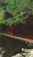
Bridgemeister ID: 1136 (added 2004-01-17)Name: Baiyang Falls Also Known As: 白楊吊橋 Location: Xiulin Township, Hualien County, Taiwan Crossing: Baiyang Falls At or Near Feature: Taroko Gorge Coordinates: 24.178318 N 121.475306 E Maps: Acme , GeoHack , Google , OpenStreetMap Use: Footbridge Status: In use (last checked: 2019) Main Cables: Wire (steel) Suspended Spans: 1
One of many suspension bridges in this area. This one is a short footbridge with simple rectangular red towers with one cross-bar. Bridgemeister ID: 2490 (added 2008-12-23)Name: Bajo Pacuare Location: Bajo Pacuare, Cartago Province, Turrialba, Costa Rica Crossing: Rio Pacuare Coordinates: 9.827773 N 83.509871 W Maps: Acme , GeoHack , Google , OpenStreetMap Use: Vehicular (one-lane) Status: Restricted to foot traffic (last checked: 2021) Main Cables: Wire (steel) Suspended Spans: 1
Bridgemeister ID: 7776 (added 2023-08-18)Name: Bajo Pacuare Location: Bajo Pacuare. Turrialba, Cartago Province, Costa Rica Crossing: Rio Pacuare Coordinates: 9.887321 N 83.527088 W Maps: Acme , GeoHack , Google , OpenStreetMap Use: Footbridge Status: In use (last checked: 2018) Main Cables: Wire (steel) Main Span: 1
Bridgemeister ID: 3475 (added 2019-12-23)Name: Balakot Location: Balakot (بالاکوٹ), Khyber Pakhtunkhwa, Pakistan Crossing: Kunhar River Coordinates: 34.549146 N 73.353637 E Maps: Acme , GeoHack , Google , OpenStreetMap Use: Vehicular Status: In use (last checked: 2019) Main Cables: Wire (steel)
Google Maps . Panorama of the bridge, posted February 2016.Bridgemeister ID: 7199 (added 2022-07-04)Name: Balakot Location: Balakot (بالاکوٹ), Khyber Pakhtunkhwa, Pakistan Crossing: Kunhar River Coordinates: 34.548976 N 73.353755 E Maps: Acme , GeoHack , Google , OpenStreetMap Status: Replaced Main Cables: Eyebar (steel) Suspended Spans: 2 Main Span: 1 Side Span: 1
Bridgemeister ID: 6622 (added 2021-09-06)Name: Balepanjang Location: Balekambang, Bogor, West Java , Indonesia Coordinates: 6.505996 S 107.110069 E Maps: Acme , GeoHack , Google , OpenStreetMap Use: Vehicular (one-lane) Status: In use (last checked: 2021) Main Cables: Wire (steel) Suspended Spans: 1
This short vehicular bridge has multiple concrete piers supporting the deck. It is unclear how long those extra piers have been there, but this bridge has unusual proportions with large oversized metal-frame towers and (seemingly) unusually small main cables. Bridgemeister ID: 2863 (added 2019-09-08)Name: Baler Also Known As: Zabali Location: Sabang and Baler, Aurora, Philippines Crossing: Duongan River Coordinates: 15.750043 N 121.569412 E Maps: Acme , GeoHack , Google , OpenStreetMap Use: Footbridge Status: In use (last checked: 2023) Main Cables: Wire (steel) Suspended Spans: 1
Bridgemeister ID: 3239 (added 2019-11-16)Name: Baling Also Known As: 老巴陵橋 Location: Baling, Fuxing District, Taoyuan City, Taiwan At or Near Feature: Fuba Cross-ridge Trail Coordinates: 24.681070 N 121.377845 E Maps: Acme , GeoHack , Google , OpenStreetMap Use: Vehicular Status: Restricted to foot traffic (last checked: 2019) Main Cables: Wire (steel) Suspended Spans: 1
Facebook . Image of the bridge as construction is underway on its adjacent replacement.Facebook . Image of the bridge as construction is underway on its adjacent replacement.Facebook . Image of the bridge with its replacement in the foreground.Facebook . Image of the bridge (left) as seen from the replacement bridge.Bridgemeister ID: 8252 (added 2024-02-07)Name: Baluwakot Location: Baluwakot (बलुवाकोट), Sangari (संगरी), Suwa (सुवा), Uttarakhand , India and Dattu, Nepal Crossing: Sharda River Coordinates: 29.796108 N 80.421429 E Maps: Acme , GeoHack , Google , OpenStreetMap Use: Footbridge Status: In use (last checked: 2020) Main Cables: Wire (steel) Main Span: 1 x 100 meters (328 feet) estimated
Facebook . Image of the bridge. Posted February 16, 2013.Facebook . Image of the bridge. Posted February 25, 2020.Bridgemeister ID: 7117 (added 2022-06-12)Name: Bamoth Location: Bholnaon (भोल्नाओं) and Bamoth (बमोथ), Uttarakhand , India Crossing: Alakananda River Coordinates: 30.269579 N 79.170776 E Maps: Acme , GeoHack , Google , OpenStreetMap Use: Footbridge Status: In use (last checked: 2021) Main Cables: Wire (steel) Suspended Spans: 1 Main Span: 1 x 80 meters (262.5 feet) estimated
Bridgemeister ID: 6176 (added 2021-07-08)Name: Ban Haad Ngew Also Known As: สะพานแขวนบ้านหาดงิ้ว Location: Wang Krachae, Sai Yok District, Kanchanaburi, Thailand Crossing: Khwae Noi Coordinates: 14.340045 N 98.938161 E Maps: Acme , GeoHack , Google , OpenStreetMap Use: Vehicular (one-lane) Status: In use (last checked: 2019) Main Cables: Wire (steel) Main Span: 1
Bridgemeister ID: 4540 (added 2020-05-23)Name: Bang Pla Ma Location: Bang Pla Ma, Suphan Buri, Thailand Crossing: Tha Chin Coordinates: 14.402199 N 100.156284 E Maps: Acme , GeoHack , Google , OpenStreetMap Use: Footbridge Status: In use (last checked: 2019) Main Cables: Wire (steel) Suspended Spans: 1
Bridgemeister ID: 5571 (added 2020-12-20)Name: Bangchukdo Location: Okdo-myeon, Gunsan-si, Jeollabuk-do, South Korea At or Near Feature: Cheongseom Island Coordinates: 35.847709 N 126.363794 E Maps: Acme , GeoHack , Google , OpenStreetMap Use: Footbridge Status: In use (last checked: 2020) Main Cables: Wire (steel) Suspended Spans: 1 Main Span: 1 x 83 meters (272.3 feet)
Bridgemeister ID: 6604 (added 2021-09-05)Name: Banjar Irigasi Location: Banjar Irigasi, Lebak Regency, Banten , Indonesia Crossing: Ciberang River Coordinates: 6.566736 S 106.410644 E Maps: Acme , GeoHack , Google , OpenStreetMap Use: Footbridge Status: Wrecked, December 31, 2019 - January 1, 2020 Main Cables: Wire (steel) Main Span: 1
Bridgemeister ID: 2829 (added 2019-07-04)Name: Baohu Also Known As: 寶湖吊橋 Location: Baoshan, Hsinchu County, Taiwan Crossing: Pao-shan Reservoir Coordinates: 24.748764 N 121.046662 E Maps: Acme , GeoHack , Google , OpenStreetMap Use: Footbridge Status: In use (last checked: 2016) Main Cables: Wire (steel) Suspended Spans: 3 Main Span: 1 Side Spans: 2
Bridgemeister ID: 2814 (added 2019-07-04)Name: Baoxian Location: Guanxi Township, Hsinchu County, Taiwan At or Near Feature: Shih-men Reservoir Coordinates: 24.799582 N 121.240380 E Maps: Acme , GeoHack , Google , OpenStreetMap Use: Footbridge Status: In use Main Cables: Wire (steel)
Bridgemeister ID: 3212 (added 2019-11-10)Name: Baraggiolo Also Known As: Crevola Location: Varallo, Vercelli, Italy Crossing: Sesia River Coordinates: 45.818814 N 8.241911 E Maps: Acme , GeoHack , Google , OpenStreetMap Status: Extant (last checked: 2019) Main Cables: Wire Suspended Spans: 1
Bridgemeister ID: 5182 (added 2020-10-04)Name: Barcis Location: Barcis, Pordenone, Italy Crossing: Cellina Coordinates: 46.189601 N 12.549677 E Maps: Acme , GeoHack , Google , OpenStreetMap Use: Vehicular (one-lane) Status: In use (last checked: 2017) Main Cables: Wire (steel)
Bridgemeister ID: 6791 (added 2021-10-30)Name: Bargo Bala Location: Sharote and Bargo Bala, Gilgit-Baltistan, Pakistan Crossing: Gilgit River Coordinates: 36.050128 N 74.127358 E Maps: Acme , GeoHack , Google , OpenStreetMap Use: Vehicular (one-lane) Status: In use (last checked: 2021) Main Cables: Wire Suspended Spans: 1 Main Span: 1 x 121.6 meters (399 feet) estimated
Bridgemeister ID: 8451 (added 2024-03-10)Name: Barko Rukh LSTB Location: Mahakali (Dodhara Chandani, दोधारा-चाँदनी नगरपालिका), Kanchanpur, Nepal Crossing: Jogbuda River Coordinates: 28.916247 N 80.069689 E Maps: Acme , GeoHack , Google , OpenStreetMap Use: Footbridge Status: Extant (last checked: 2024) Main Span: 1 x 148.6 meters (487.5 feet)
Bridgemeister ID: 4492 (added 2020-05-01)Name: Barmsøya Location: Kragerø, Vestfold og Telemark, Norway Crossing: Barmskilen Coordinates: 58.927564 N 9.478547 E Maps: Acme , GeoHack , Google , kart.1881.no , OpenStreetMap Use: Footbridge Status: In use (last checked: 2019) Main Cables: Wire (steel) Main Span: 1 x 26.25 meters (86.1 feet) estimated
Removed at some point in the 2015-2017 time frame. Bridgemeister ID: 1187 (added 2004-01-24)Name: Bear Creek Location: Valdez vicinity, Alaska , USA Crossing: Bear Creek Use: Vehicular
Carried Richardson Highway across Bear Creek circa 1930's and earlier. Alaska Digital Archives identifier UAF-2003-63-179 shows a very similar (or the same) suspension bridge as crossing Sheep Creek on the Valdez Trail but they also note a potential discrepancy with another image in the archive that labels the bridge as carrying the Richardson Highway. Bridgemeister ID: 4063 (added 2020-03-30)Name: Beauchastel Location: Beauchastel, Ardèche , France Crossing: Eyrieux River References: AAJ Use: Vehicular Status: Removed Main Cables: Wire (iron)
AAJ supposes this bridge was completed in 1842 based on a contract let in 1840 proposing a two-year construction period, but other material suggest the bridge was built later. Bridgemeister ID: 1146 (added 2004-01-17)Name: Beauharnois Location: Melocheville, Quebec , Canada Crossing: St. Lawrence River Coordinates: 45.316050 N 73.908033 W Maps: Acme , GeoHack , Google , OpenStreetMap Use: Vehicular (two-lane, heavy vehicles), with walkway Status: In use (last checked: 2018) Main Cables: Wire (steel) Suspended Spans: 1
Carries route 132 across a small arm of the St. Lawrence by the Canal de Beauharnois dam. Major rehabilitation efforts completed in 2011 and 2012 including replacement of 56 vertical suspenders. Bridgemeister ID: 1177 (added 2004-01-24)Name: Beaulieu-sur-Dordogne Location: Beaulieu-sur-Dordogne, Corrèze , France Crossing: Dordogne River Use: Vehicular (one-lane) Status: Removed Main Cables: Wire (iron) Suspended Spans: 2 Main Spans: 2
Bridgemeister ID: 2629 (added 2019-01-01)Name: Beaver Creek Location: Caledonia vicinity, Minnesota , USA Crossing: Beaver Creek East At or Near Feature: Beaver Creek Valley State Park Coordinates: 43.642983 N 91.581983 W Maps: Acme , GeoHack , Google , OpenStreetMap Use: Footbridge Status: In use (last checked: 2016) Main Cables: Wire (steel) Suspended Spans: 1
Bridgemeister ID: 7000 (added 2022-04-30)Name: Bedu Bagad Also Known As: Begubagad, Bedubagarh Location: Bedu Bagad (बेडू बगड), Uttarakhand , India Crossing: Mandakini River Coordinates: 30.406964 N 79.045850 E Maps: Acme , GeoHack , Google , OpenStreetMap Status: Destroyed, June 2013 Main Cables: Wire Suspended Spans: 1 Main Span: 1 x 49.4 meters (162 feet) estimated
Bridgemeister ID: 2786 (added 2019-06-30)Name: Beijiao Location: Jianshi Township, Hsinchu County, Taiwan Coordinates: 24.701500 N 121.197967 E Maps: Acme , GeoHack , Google , OpenStreetMap Use: Footbridge Status: In use (last checked: 2017) Main Cables: Wire (steel)
Bridgemeister ID: 6777 (added 2021-10-28)Name: Bel-Air Country Club Location: Los Angeles, California , USA Coordinates: 34.078701 N 118.450619 W Maps: Acme , GeoHack , Google , OpenStreetMap Use: Golf cart and Footbridge Status: In use (last checked: 2021) Main Cables: Wire (steel) Suspended Spans: 1 Main Span: 1 x 58 meters (190.3 feet) estimated
Bridgemeister ID: 4802 (added 2020-07-04)Name: Belimbing Besi Location: Medingin, Belandang, Ogan Komering Ulu Regency, South Sumatra , Indonesia Coordinates: 4.053892 S 103.767248 E Maps: Acme , GeoHack , Google , OpenStreetMap Use: Footbridge Status: In use (last checked: 2019) Main Cables: Wire (steel)
Deck may have been replaced in the 2010s. Bridgemeister ID: 6351 (added 2021-07-25)Name: Benchmark Pack Location: Augusta vicinity, Montana , USA Crossing: South Fork Sun River At or Near Feature: Continental Divide Trail, Bob Marshall Wilderness Coordinates: 47.506399 N 112.890707 W Maps: Acme , GeoHack , Google , OpenStreetMap Use: Pack and Footbridge Status: In use (last checked: 2018) Main Cables: Wire (steel) Suspended Spans: 1 Main Span: 1 x 27.4 meters (90 feet) estimated
Bridgemeister ID: 6242 (added 2021-07-17)Name: Bengal Sikkim Border Also Known As: বেঙ্গল সিকিম বর্ডার ব্রিজ Location: Goke, West Bengal and Jorethang, Sikkim , India Crossing: Rammam River Coordinates: 27.128267 N 88.272631 E Maps: Acme , GeoHack , Google , OpenStreetMap Use: Vehicular (one-lane) Status: In use (last checked: 2021) Main Cables: Wire (steel) Suspended Spans: 1
Bridgemeister ID: 7429 (added 2022-12-10)Name: Berat Location: Berat, Albania Crossing: Osum River Coordinates: 40.703878 N 19.949729 E Maps: Acme , GeoHack , Google , OpenStreetMap Use: Footbridge Status: In use (last checked: 2022) Main Cables: Wire (steel) Suspended Spans: 3 Main Span: 1 Side Spans: 2
Bridgemeister ID: 7688 (added 2023-07-04)Name: Berglern Location: Berglern, Germany Crossing: Mittlere-Isar-Kanal Coordinates: 48.388860 N 11.928390 E Maps: Acme , GeoHack , Google , OpenStreetMap Use: Footbridge Status: In use (last checked: 2023) Main Cables: Wire (steel) Suspended Spans: 1 Main Span: 1 x 32 meters (105 feet) estimated
Completed at some point in the 2009-2016 time frame. Bridgemeister ID: 3847 (added 2020-03-07)Name: Berkåksmoen Location: Berkåk, Rennebu, Trøndelag, Norway Crossing: Orkla Coordinates: 62.813810 N 10.007180 E Maps: Acme , GeoHack , Google , kart.1881.no , OpenStreetMap Use: Footbridge Status: In use (last checked: 2019) Main Cables: Wire (steel) Main Span: 1 x 52.5 meters (172.2 feet) estimated
Based on historical aerial imagery, completed prior to 1958. Bridgemeister ID: 5952 (added 2021-06-29)Name: Bethania Location: Lima, Peru Coordinates: 12.026920 S 76.992967 W Maps: Acme , GeoHack , Google , OpenStreetMap Use: Footbridge Status: In use (last checked: 2013) Main Cables: Wire (steel) Suspended Spans: 1
Bridgemeister ID: 7061 (added 2022-05-27)Name: Bettou Location: Shiramine, Hakusan, Ishikawa , Japan Coordinates: 36.124814 N 136.741428 E Maps: Acme , GeoHack , Google , OpenStreetMap Use: Footbridge Status: In use (last checked: 2022) Main Cables: Wire (steel) Suspended Spans: 1 Main Span: 1 x 115 meters (377.3 feet) estimated
Bridgemeister ID: 7973 (added 2023-11-26)Name: Bharyang Bhurung Location: Samari (समारी), Nepal Crossing: Bharyang Bhurung Coordinates: 27.953556 N 85.009806 E Maps: Acme , GeoHack , Google , OpenStreetMap Principals: Louis Harper, Harpers Limited Use: Footbridge Status: In use (last checked: 2019) Main Cables: Wire Suspended Spans: 1 Main Span: 1 x 50.7 meters (166.3 feet) Deck width: 1.2 meters
Completed at some point in the 1900-1909 time frame. Bridgemeister ID: 5259 (added 2020-11-07)Name: Bidhyang Location: Dalapachan Khasmahal and Lolay Khasmahal, West Bengal , India Coordinates: 27.076170 N 88.549858 E Maps: Acme , GeoHack , Google , OpenStreetMap Use: Footbridge Status: In use (last checked: 2019) Main Cables: Wire (steel) Suspended Spans: 1
Bridgemeister ID: 2185 (added 2007-01-14)Name: Big Beaver Creek Location: Ross Lake National Recreation Area, Washington , USA Crossing: Big Beaver Creek At or Near Feature: North Cascades National Park Coordinates: 48.77475 N 121.06659 W Maps: Acme , GeoHack , Google , OpenStreetMap Use: Footbridge Status: In use (last checked: 2006) Main Cables: Wire (steel) Suspended Spans: 1 Main Span: 1 x 38.4 meters (126 feet) estimated
Bridgemeister ID: 5555 (added 2020-12-17)Name: Big Creek Location: Concord Township, Ohio , USA Crossing: Big Creek At or Near Feature: Girdled Road Reservation Coordinates: 41.659951 N 81.184281 W Maps: Acme , GeoHack , Google , OpenStreetMap Use: Footbridge Status: In use (last checked: 2020) Main Cables: Wire (steel) Suspended Spans: 1
Bridgemeister ID: 557 (added before 2003)Name: Big Run Location: Troy vicinity, Gilmer County, West Virginia , USA Crossing: Cove Creek Coordinates: 39.04545 N 80.77028 W Maps: Acme , GeoHack , Google , OpenStreetMap Use: Footbridge Status: In use (last checked: 2008) Main Cables: Wire Suspended Spans: 3 Main Span: 1 Side Spans: 2
Bridgemeister ID: 360 (added before 2003)Name: Bill Perk Litteral Memorial Also Known As: Swinging Location: Paintsville, Kentucky , USA Crossing: Big Sandy River Levisa Fork Coordinates: 37.81233 N 82.80991 W Maps: Acme , GeoHack , Google , OpenStreetMap Use: Footbridge Status: Derelict (last checked: 2023) Main Cables: Wire (steel) Suspended Spans: 3 Main Span: 1 x 59.4 meters (195 feet) estimated Side Spans: 1 x 27.1 meters (89 feet) estimated,
Bridgemeister ID: 8097 (added 2023-12-25)Name: Bing'an Also Known As: 丙安铁索桥 Location: Bing'anxiang (丙安乡), Chishui City, Guizhou , China Crossing: Chishui River Coordinates: 28.474250 N 105.818944 E Maps: Acme , GeoHack , Google , OpenStreetMap Use: Footbridge Status: In use Main Cables: Wire Suspended Spans: 1 Main Span: 1 x 89 meters (292 feet) estimated
Bridgemeister ID: 8343 (added 2024-02-09)Name: Bingli Location: Liuku (六库镇), Lushui (泸水市), Nujiang Lisu (怒江傈僳族自治州), Yunnan , China Crossing: Nujiang Coordinates: 25.766806 N 98.863417 E Maps: Acme , GeoHack , Google , OpenStreetMap Status: Extant (last checked: 2021) Main Span: 1 x 137 meters (449.5 feet) estimated
Bridgemeister ID: 8344 (added 2024-02-09)Name: Bingli Location: Liuku (六库镇), Lushui (泸水市), Nujiang Lisu (怒江傈僳族自治州), Yunnan , China Crossing: Nujiang Coordinates: 25.767028 N 98.863389 E Maps: Acme , GeoHack , Google , OpenStreetMap Status: Removed, c. 2015 Main Span: 1 x 143 meters (469.2 feet) estimated
Bridgemeister ID: 1311 (added 2004-04-11)Name: Birr Castle Location: Birr Castle, County Offaly, Ireland Crossing: Camcor River Coordinates: 53.095198 N 7.915938 W Maps: Acme , GeoHack , Google , OpenStreetMap References: BSI Use: Footbridge Status: In use (last checked: 2023) Main Cables: Wire Suspended Spans: 1 Main Span: 1 x 13.4 meters (44 feet)
Bridgemeister ID: 5344 (added 2020-11-14)Name: Bitchukonotsuri Also Known As: 備中湖の吊橋 Location: Jinsekikogen, Hiroshima , Japan Crossing: Bitchu Lake Coordinates: 34.820162 N 133.336145 E Maps: Acme , GeoHack , Google , OpenStreetMap Use: Footbridge Status: In use (last checked: 2013) Main Cables: Wire (steel) Main Span: 1 x 126 meters (413.4 feet) estimated
Bridgemeister ID: 4098 (added 2020-04-05)Name: Bjørgesund Location: Rollag, Viken, Norway Crossing: Numedalslågen Coordinates: 59.983021 N 9.294304 E Maps: Acme , GeoHack , Google , kart.1881.no , OpenStreetMap Use: Vehicular (one-lane) Status: Restricted to foot traffic Main Cables: Wire (steel) Suspended Spans: 1 Main Span: 1 x 110 meters (360.9 feet) estimated
Bridgemeister ID: 3972 (added 2020-03-22)Name: Bjørnsjøhelvete Location: Bjørnholt, Oslo, Norway Crossing: Bjørnsjøelva Coordinates: 60.04021 N 10.69927 E Maps: Acme , GeoHack , Google , kart.1881.no , OpenStreetMap Use: Footbridge Status: In use (last checked: 2019) Main Cables: Wire (steel) Suspended Spans: 1 Main Span: 1 x 16 meters (52.5 feet) estimated
Bridgemeister ID: 931 (added 2003-10-25)Name: Blaney Also Known As: Trinity Alps Resort Location: Trinity Alps, California , USA Crossing: Stuart Fork Trinity River Coordinates: 40.85663 N 122.88776 W Maps: Acme , GeoHack , Google , OpenStreetMap Use: Footbridge Status: In use (last checked: 2007) Main Cables: Wire (steel) Suspended Spans: 1 Main Span: 1 x 51.2 meters (168 feet) estimated
Asymmetrical bridge with one tower much taller than the other. The larger tower appears to have been added in 2003 when the bridge was rebuilt following an August 2002 collapse due to a rusted cable. A sign on the current bridge reads "Blaney Bridge, Engineered by Colin Blaney, 2003," but there has been a suspension bridge at this location since before 2003. Follow the photo showing the damaged bridge for more information. Pictured on page 464 of the 1956 series of National Geographic magazines. Some remnants appear to be present (as of 2020). Bridgemeister ID: 6080 (added 2021-07-04)Name: Bokenhirobanotsuri Also Known As: 冒険広場の吊橋 Location: Taka, Hyogo , Japan At or Near Feature: Takacho Leisure Village Park - 多可町余暇村公園 Coordinates: 35.077803 N 134.923879 E Maps: Acme , GeoHack , Google , OpenStreetMap Use: Footbridge Status: In use (last checked: 2021) Main Cables: Wire (steel) Suspended Spans: 1
Bridgemeister ID: 318 (added before 2003)Name: Boldman Location: Pikeville vicinity, Kentucky , USA Crossing: Big Sandy River Levisa Fork Use: Vehicular (one-lane) Status: Removed Main Cables: Wire (steel) Suspended Spans: 1
Carried Kentucky route 1384 over the Levisa Fork. Likely removed in time frame 1985-1994. Bridgemeister ID: 1583 (added 2005-01-22)Name: Bollène Location: Bollène, Vaucluse , France Crossing: Donzère Canal Coordinates: 44.284683 N 4.732283 E Maps: Acme , GeoHack , Google , OpenStreetMap Use: Vehicular (two-lane), with walkway Status: In use (last checked: 2023) Main Cables: Wire (steel) Suspended Spans: 3 Main Span: 1 Side Spans: 2
Bridgemeister ID: 7033 (added 2022-05-21)Name: Boranomiya Also Known As: 保良の宮橋 Location: Koka, Shiga , Japan Crossing: Daido River At or Near Feature: Gyokukeiji-Mae Station (玉桂寺前駅) Coordinates: 34.884988 N 136.069489 E Maps: Acme , GeoHack , Google , OpenStreetMap Use: Footbridge Status: In use (last checked: 2023) Main Cables: Wire (steel) Suspended Spans: 3 Main Span: 1 x 66 meters (216.5 feet) estimated Side Spans: 2
Bridgemeister ID: 4470 (added 2020-04-26)Name: Borregaard Location: Sarpsborg, Viken, Norway Crossing: Glomma Coordinates: 59.274801 N 11.126999 E Maps: Acme , GeoHack , Google , kart.1881.no , OpenStreetMap Use: Pipeline Status: Removed Main Cables: Wire Suspended Spans: 1 Main Span: 1 x 135 meters (442.9 feet) estimated
Built before 1938. Removed at some point between 1963 and 1978. There was a simple (drooping) suspension bridge immediately adjacent to this pipeline bridge. The simple suspension bridge is not tracked in the Bridgemeister inventory. Bridgemeister ID: 2632 (added 2019-02-24)Name: Bottcher's Landing Location: Big Flats, New York , USA Crossing: Chemung River Use: Vehicular Status: Removed Main Cables: Wire
Bridgemeister ID: 867 (added 2003-08-23)Name: Boughton Location: Titusville vicinity, Venango County, Pennsylvania , USA Crossing: Oil Creek At or Near Feature: Oil Creek State Park Coordinates: 41.59955 N 79.64521 W Maps: Acme , GeoHack , Google , OpenStreetMap Use: Footbridge Status: In use (last checked: 2005) Main Cables: Wire Suspended Spans: 1 Main Span: 1 x 39.6 meters (130 feet)
The Pennsylvania Department of Conservation and Natural Resources posted an advisory, effective February 28, 2005, that this bridge was closed until further notice. This is likely a temporary closing. Bridgemeister ID: 1384 (added 2004-07-03)Name: Boulder Creek Pack Location: Lowell vicinity, Idaho , USA Crossing: Boulder Creek At or Near Feature: Clearwater National Forest Coordinates: 46.33599 N 115.31319 W Maps: Acme , GeoHack , Google , OpenStreetMap Use: Pack and Footbridge Status: Closed, September 14, 2007 (last checked: 2007) Main Cables: Wire (steel) Main Span: 1 x 30.5 meters (100 feet) estimated
Located approximately 23 miles east of Lowell near the junction of Boulder Creek and the Lochsa River. According to an article in the September 13, 2007 edition of the Latah Eagle (Latah County, Idaho): "The suspension bridge that crosses Boulder Creek at Wilderness Gateway Campground 49 miles east of Kooskia, Idaho, off U.S. Highway 12 will be permanently closed Friday, September 14, due to structural weakness discovered recently on a routine engineering review." Bridgemeister ID: 2317 (added 2007-05-05)Name: Bouziès Location: Bouziès, Lot , France Crossing: Lot River Coordinates: 44.485815 N 1.642999 E Maps: Acme , GeoHack , Google , OpenStreetMap Use: Vehicular (one-lane) Status: In use (last checked: 2020) Main Cables: Wire (steel) Suspended Spans: 1
Visible in 1967 satellite images. Was demolished after a replacement was completed crossing Helgåa at Kleppen, northwest of this location. Footbridge with large steel towers. Bridgemeister ID: 3958 (added 2020-03-22)Name: Breivegsbrua Location: Harpefoss, Sør-Fron, Innlandet, Norway Crossing: Lågen Coordinates: 61.56418 N 9.90609 E Maps: Acme , GeoHack , Google , kart.1881.no , OpenStreetMap Use: Vehicular (one-lane) Status: In use (last checked: 2019) Main Cables: Wire (steel) Suspended Spans: 1 Main Span: 1 x 120 meters (393.7 feet) estimated
Bridgemeister ID: 7987 (added 2023-12-04)Name: Bridge of Beauty Also Known As: სილამაზის ხიდი Location: Borjomi (ბორჯომი), Georgia Crossing: Kura River Coordinates: 41.842250 N 43.382000 E Maps: Acme , GeoHack , Google , OpenStreetMap Use: Vehicular (two-lane), with walkway Status: In use (last checked: 2021) Main Cables: Wire (steel) Suspended Spans: 1 Main Span: 1 x 78 meters (255.9 feet) estimated
Bridgemeister ID: 888 (added 2003-09-06)Name: Bridge of the Great Falls Location: Kinko, Kimotsuki, Kagoshima , Japan Crossing: Kono River At or Near Feature: Kamikawaotaki Park Coordinates: 31.256971 N 130.813565 E Maps: Acme , GeoHack , Google , OpenStreetMap Use: Footbridge Status: In use (last checked: 2018) Main Cables: Wire (steel) Suspended Spans: 1 Main Span: 1 x 130 meters (426.5 feet) estimated
Bridgemeister ID: 3896 (added 2020-03-14)Name: Brooklyn Location: Grøa, Sunndal, Møre og Romsdal, Norway Crossing: Driva River Coordinates: 62.64407 N 8.78574 E Maps: Acme , GeoHack , Google , kart.1881.no , OpenStreetMap Use: Footbridge Status: In use (last checked: 2019) Main Cables: Wire (steel) Suspended Spans: 1 Main Span: 1 x 60 meters (196.9 feet) estimated
Based on historical aerial images, built prior to 1971. Bridgemeister ID: 1644 (added 2005-03-18)Name: Brookside Park Location: Ames, Iowa , USA Crossing: Squaw Creek At or Near Feature: Brookside Park Coordinates: 42.02895 N 93.62915 W Maps: Acme , GeoHack , Google , OpenStreetMap Use: Footbridge Status: Replaced (last checked: 2009) Main Cables: Wire (steel) Suspended Spans: 1 Main Span: 1 x 39 meters (128 feet) estimated
Wrecked by flood May, 2008. Permanently replaced by a non-suspension bridge February, 2009. Bridgemeister ID: 6145 (added 2021-07-07)Name: Bruklinskiy Also Known As: Brooklyn, Бруклинский Location: Zavarzino (Заварзино), Tomsk Oblast, Russia Crossing: Reka Ushayka Coordinates: 56.468649 N 85.075854 E Maps: Acme , GeoHack , Google , OpenStreetMap Use: Footbridge Status: In use (last checked: 2021) Main Cables: Wire Main Span: 1
Known as "Brooklyn Bridge in Zavarzino" as an homage to New York's Brooklyn Bridge. Bridgemeister ID: 4853 (added 2020-07-12)Name: Brushy Hollow Swinging Location: Clifton Forge, Virginia , USA Crossing: Wilson Creek At or Near Feature: Brushy Hollow Trail, Douthat State Park Coordinates: 37.881186 N 79.807108 W Maps: Acme , GeoHack , Google , OpenStreetMap Use: Footbridge Status: In use (last checked: 2020) Main Cables: Wire (steel) Suspended Spans: 1
Bridgemeister ID: 6774 (added 2021-10-27)Name: Bubur Location: Bubur, Gilgit-Baltistan, Pakistan Crossing: Gilgit River Coordinates: 36.143838 N 73.857727 E Maps: Acme , GeoHack , Google , OpenStreetMap Use: Vehicular (one-lane) Status: In use (last checked: 2021) Main Cables: Wire Suspended Spans: 1 Main Span: 1 x 100.6 meters (330 feet) estimated
2010: Deck wrecked by flood. Eventually repaired. Bridgemeister ID: 2693 (added 2019-05-27)Name: Buffalo Bayou Location: Houston, Texas , USA Crossing: Buffalo Bayou At or Near Feature: Bayou Bend Collection and Gardens Coordinates: 29.758388 N 95.421279 W Maps: Acme , GeoHack , Google , OpenStreetMap Use: Footbridge Status: In use (last checked: 2019) Main Cables: Wire (steel)
Bridgemeister ID: 7977 (added 2023-11-26)Name: Bukhi Also Known As: Bukki, Bhukki Location: Bhukki (भुक्की) and Tihar (तिहार), Uttarakhand , India Crossing: Bhagirathi River Coordinates: 30.865856 N 78.653675 E Maps: Acme , GeoHack , Google , OpenStreetMap Status: In use (last checked: 2013) Main Cables: Wire (steel) Suspended Spans: 1 Main Span: 1 x 56.4 meters (185 feet) estimated
Bridgemeister ID: 6913 (added 2022-01-21)Name: Bukit Gasing Also Known As: Steel Location: Kuala Lumpur, Malaysia At or Near Feature: Taman Rimba Bukit Kerinchi Coordinates: 3.096987 N 101.662530 E Maps: Acme , GeoHack , Google , OpenStreetMap Use: Footbridge Status: In use (last checked: 2021) Main Cables: Wire (steel) Suspended Spans: 3 Main Span: 1 Side Spans: 2
2022, September: Bridge is scheduled to be replaced by November 2022. The coordinates provided here appear to be the likely location of this bridge. The current (as of the 2020s) bridge dates to 1902. The linked postcard image for "Suspension Bridge Burnfoot" is postmarked from nearby Langholm (in 1908). Bridgemeister ID: 682 (added 2003-03-08)Name: Butcher's Ford Also Known As: Durrell's Ford, Hassall's Ford, Butchers Location: Kaiapoi, New Zealand Crossing: Kaiapoi River Coordinates: 43.382244 S 172.631183 E Maps: Acme , GeoHack , Google , OpenStreetMap References: GAP Use: Footbridge Status: In use (last checked: 2019) Main Cables: Wire Suspended Spans: 4 Main Spans: 2 Side Spans: 2
Completed at some point in 2014 or 2015. Bridgemeister ID: 1558 (added 2004-11-26)Name: Cacheuta Location: Cacheuta, Luján de Cuyo vicinity, Mendoza, Argentina Crossing: Mendoza River Coordinates: 33.012172 S 33.012172 W Maps: Acme , GeoHack , Google , OpenStreetMap Use: Footbridge Status: In use (last checked: 2022) Main Cables: Wire (steel) Suspended Spans: 3 Main Span: 1 Side Spans: 2
Bridgemeister ID: 5108 (added 2020-09-05)Name: Cadramazzo Location: Chiusaforte, Udine, Italy Coordinates: 46.428731 N 13.315500 E Maps: Acme , GeoHack , Google , OpenStreetMap Use: Footbridge Status: In use (last checked: 2020) Main Cables: Wire (steel) Suspended Spans: 1
Bridgemeister ID: 2754 (added 2019-06-29)Name: Caihong Also Known As: 彩虹吊橋, Rainbow Location: Xinyi Township, Nantou County, Taiwan Coordinates: 23.566231 N 120.934592 E Maps: Acme , GeoHack , Google , OpenStreetMap Use: Footbridge Status: In use (last checked: 2019) Main Cables: Wire (steel) Suspended Spans: 1
Bridgemeister ID: 2315 (added 2007-05-05)Name: Cajarc Location: Cajarc, Lot and Salvagnac-Cajarc, Aveyron , France Crossing: Lot River Coordinates: 44.482974 N 1.844528 E Maps: Acme , GeoHack , Google , OpenStreetMap Use: Vehicular (one-lane), with walkway Status: In use (last checked: 2021) Main Cables: Wire (steel) Suspended Spans: 1 Main Span: 1 x 100 meters (328.1 feet) estimated
Bridgemeister ID: 7058 (added 2022-05-27)Name: Calbiga National High School Location: Calbiga, Samar, Philippines Crossing: Calbiga River Coordinates: 11.621606 N 125.016794 E Maps: Acme , GeoHack , Google , OpenStreetMap Use: Footbridge Status: In use (last checked: 2022) Main Cables: Wire (steel) Main Span: 1
Bridgemeister ID: 7895 (added 2023-10-14)Name: Calicanto Location: Caraz, Peru Crossing: Rio Santa Coordinates: 9.055538 S 77.812614 W Maps: Acme , GeoHack , Google , OpenStreetMap Use: Footbridge Status: In use (last checked: 2023) Main Cables: Wire (steel) Suspended Spans: 1
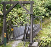
Bridgemeister ID: 771 (added 2003-03-13)Name: Callery Location: Franz Josef Glacier vicinity, New Zealand Coordinates: 43.400787 S 170.186270 E Maps: Acme , GeoHack , Google , OpenStreetMap Use: Footbridge Status: In use (last checked: 2022) Main Cables: Wire (steel) Suspended Spans: 1
Bridgemeister ID: 3641 (added 2020-01-23)Name: Calvelo Location: Calvelo, Spain Crossing: Rio Lérez Coordinates: 42.461338 N 8.570086 W Maps: Acme , GeoHack , Google , OpenStreetMap Use: Footbridge Status: In use (last checked: 2021) Main Cables: Wire (steel) Main Span: 1
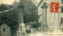
Bridgemeister ID: 1170 (added 2004-01-23)Name: Cambo-les-Bains Location: Cambo-les-Bains, Pyrénées-Atlantiques , France Crossing: Nive River Use: Vehicular Status: Removed Main Cables: Wire (iron) Suspended Spans: 1
Bridgemeister ID: 3057 (added 2019-10-26)Name: Caminito del Rey Location: El Chorro vicinity, Spain Coordinates: 36.916111 N 4.772482 W Maps: Acme , GeoHack , Google , OpenStreetMap Use: Footbridge Status: In use (last checked: 2019) Main Cables: Wire (steel) Suspended Spans: 1
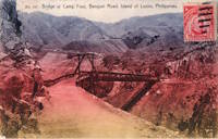
Coordinates indicate location of current (as of the 2020s) Camp Four bridge carrying the Kennon (Benguet) Road. Unclear if the suspension bridge was at this exact location. Bridgemeister ID: 4557 (added 2020-06-01)Name: Canet Location: Canet and Le Pouget, Hérault , France Crossing: Hérault River Coordinates: 43.597574 N 3.492968 E Maps: Acme , GeoHack , Google , OpenStreetMap Use: Vehicular (two-lane) Status: In use (last checked: 2018) Main Cables: Wire (steel) Suspended Spans: 1 Main Span: 1 x 110 meters (360.9 feet) estimated
Completed in 1930 or late 1920s. 2017: A cable snaps. The bridge is closed for temporary repairs and reopened. 2020, October: Closed for more substantial repairs including replacement of all of the suspender cables and reinforcement of the anchorages. 2021, July: The bridge is reopened. Replaced 1874 Canet - Canet and Le Pouget, Hérault, France . Bridgemeister ID: 8234 (added 2024-02-07)Name: Canglang Location: Danling County (丹棱县), Meishan (眉山市), Sichuan , China Coordinates: 30.011778 N 103.516389 E Maps: Acme , GeoHack , Google , OpenStreetMap Status: Removed, c. 2018-2021 Main Span: 1 x 45 meters (147.6 feet) estimated Side Spans: 2
Completed at some point in the 2003-2009 time frame. Replaced at some point in the 2018-2021 time frame. Bridgemeister ID: 3329 (added 2019-12-07)Name: Canlaon Location: Canlaon City, Negros Oriental, Philippines At or Near Feature: Quipot Falls Coordinates: 10.345721 N 123.198158 E Maps: Acme , GeoHack , Google , OpenStreetMap Use: Footbridge Status: In use (last checked: 2019) Main Cables: Wire (steel) Suspended Spans: 1
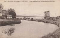
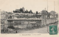
Bridgemeister ID: 7860 (added 2023-09-15)Name: Canne Location: Cercy-la-Tour, Nièvre , France Crossing: La Canne Coordinates: 46.867109 N 3.640361 E Maps: Acme , GeoHack , Google , OpenStreetMap Use: Vehicular (one-lane) Status: Restricted to foot traffic (last checked: 2022) Suspended Spans: 1 Main Span: 1 x 14 meters (45.9 feet) estimated
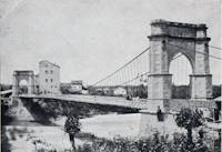
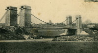
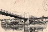
There may have been another suspension bridge in the Montereau vicinity crossing the Seine. The bridge pictured here was definitely located at the indicated coordinates, crossing the Yonne. Destroyed by French troops to slow the progression of the German army. Bridgemeister ID: 1967 (added 2005-11-26)Name: Capdenac Location: Capdenac, Lot and Capdenac-Gare, Aveyron , France Crossing: Lot River Use: Vehicular Status: Removed Main Cables: Wire Suspended Spans: 1
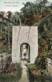
The bridge pictured here was presumably located in the village of Puente Capelo at the indicated coordinates, but this has not been confirmed. Bridgemeister ID: 7405 (added 2022-12-04)Name: Caracolí Location: Apartadó, Antioquia, Colombia Crossing: Rio Apartadó Coordinates: 7.864928 N 76.572171 W Maps: Acme , GeoHack , Google , OpenStreetMap Status: In use (last checked: 2021) Main Cables: Wire (steel) Suspended Spans: 1 Main Span: 1 x 66.1 meters (217 feet) estimated
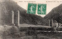
Bridgemeister ID: 6189 (added 2021-07-10)Name: Carlo Alberto Also Known As: Albertino Location: Pollenzo, Bra vicinity, Cuneo, Piedmont, Italy Crossing: Tanaro River Coordinates: 44.684560 N 7.912520 E Maps: Acme , GeoHack , Google , OpenStreetMap Use: Vehicular (one-lane) Status: Only towers remain, since c. 1945 (last checked: 2021) Main Cables: Wire (iron) Suspended Spans: 1
Appears to have been built in the late 1840s or early 1850s. Destroyed during World War II. Bridgemeister ID: 7733 (added 2023-07-07)Name: Carlos Castillo Peraza Location: Playa Vicente, Veracruz, Mexico Crossing: Rio Tesechoacan Coordinates: 17.833802 N 95.812130 W Maps: Acme , GeoHack , Google , OpenStreetMap Use: Footbridge Status: In use (last checked: 2022) Main Cables: Wire (steel) Main Spans: 3
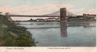
Bridgemeister ID: 7554 (added 2023-03-18)Name: Casale Monferrato Location: Casale Monferrato, Italy Crossing: Po River Status: Removed Suspended Spans: 2 Main Spans: 2
Bridgemeister ID: 7372 (added 2022-11-23)Name: Caserío El Progreso Location: Aguilares and Guazapa, El Salvador Crossing: Rio Acelhuate Coordinates: 13.923739 N 89.198697 W Maps: Acme , GeoHack , Google , OpenStreetMap Use: Footbridge Status: In use (last checked: 2020) Main Cables: Wire (steel) Suspended Spans: 1 Main Span: 1 x 54.9 meters (180 feet) estimated
Replaced a bridge destroyed by Hurricane Ida (2009). 2020, May: Deck heavily damaged by Tropical Storm Amanda floodwaters. Repaired soon after. Facebook . Image posted June 2, 2020 showing flood damage.Facebook . Image posted June 2, 2020 showing flood damage.Facebook . Video posted May 31, 2020 showing the flood in progress.Facebook . Video posted June 6, 2020 showing a group of people trying to repair the collapsed deck.Facebook . Group of photos, posted June 10, 2020, showing repairs in progress.Facebook . Image posted June 1, 2022 showing storm damage.Facebook . Group of photos, posted August 1, 2022, showing construction of a flood/retaining wall.Facebook . Image posted September 24, 2022 showing the completed retaining wall.Facebook . Image posted September 24, 2022 showing the current state of the bridge.historico.elsalvador.com - Habitantes de Aguilares y Guazapa tratan de reparar manualmente el puente con lazos, al no contar con ayuda de las instituciones . Article dated June 6, 2020 with several photos of a group of people trying to repair the collapsed deck.Bridgemeister ID: 321 (added before 2003)Name: Cassidy Location: Sierra National Forest, California , USA Crossing: Middle Fork San Joaquin River At or Near Feature: Ansel Adams Wilderness, Minarets Ranger District Coordinates: 37.48328 N 119.20778 W Maps: Acme , GeoHack , Google , OpenStreetMap Use: Footbridge and Pack Status: In use Main Cables: Wire (steel) Suspended Spans: 1 Main Span: 1 x 45.7 meters (150 feet) Deck width: 5 feet
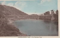
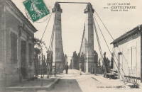
Bridgemeister ID: 1949 (added 2005-11-04)Name: Castelfranc Location: Castelfranc, Lot , France Crossing: Lot River Coordinates: 44.499927 N 1.220113 E Maps: Acme , GeoHack , Google , OpenStreetMap Use: Vehicular (one-lane) Status: In use (last checked: 2011) Main Cables: Wire (steel) Suspended Spans: 1
Bridgemeister ID: 7588 (added 2023-05-06)Name: Castle Rock Location: Castle Rock, Washington , USA Crossing: Cowlitz River Use: Vehicular Status: Destroyed, September 17, 1906 Main Cables: Wire Main Span: 1
Destroyed by fire, September 17, 1906. Bridgemeister ID: 319 (added before 2003)Name: Castor Also Known As: Burning Springs Location: Clark Hill Islands, Ontario , Canada Crossing: Niagara River Status: Removed Main Cables: Wire Suspended Spans: 1
Bridgemeister ID: 1663 (added 2005-03-20)Name: Catwalk Canyon Location: Glenwood, New Mexico , USA Crossing: Whitewater Canyon At or Near Feature: Catwalk National Recreation Trail Coordinates: 33.37611 N 108.82806 W Maps: Acme , GeoHack , Google , OpenStreetMap Use: Footbridge Status: In use (last checked: 2008) Main Cables: Wire Suspended Spans: 1
Bridgemeister ID: 4234 (added 2020-04-09)Name: Cau Nà Làng Location: Tình Húc, Binh Liêu District, Quang Ninh, Vietnam Crossing: Sông Tiên Yên Coordinates: 21.533303 N 107.397442 E Maps: Acme , GeoHack , Google , OpenStreetMap Use: Footbridge Status: In use (last checked: 2020) Main Cables: Wire (steel) Suspended Spans: 1 Main Span: 1 x 120 meters (393.7 feet)
Bridgemeister ID: 4235 (added 2020-04-09)Name: Cau Phac Tha Location: Hua Cau, Tiên Yên District, Quang Ninh, Vietnam Crossing: Sông Tiên Yên Coordinates: 21.381504 N 107.370005 E Maps: Acme , GeoHack , Google , OpenStreetMap Use: Footbridge Status: In use (last checked: 2019) Main Cables: Wire (steel) Main Span: 1 x 118.5 meters (388.8 feet) estimated
Coordinates indicate likely location. It appears the present day (2020) truss bridge was installed on the former suspension bridge's abutments. Bridgemeister ID: 2903 (added 2019-09-13)Name: Cawit Location: Manito, Philippines Coordinates: 13.127770 N 123.864854 E Maps: Acme , GeoHack , Google , OpenStreetMap Use: Footbridge Status: In use (last checked: 2019) Main Cables: Wire (steel)
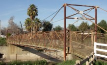
Bridgemeister ID: 2352 (added 2007-08-18)Name: Cazadero Location: Cazadero, California , USA Use: Footbridge Status: In use Main Cables: Wire
Appears to provide access to the Cazadero Performing Arts Camp. Bridgemeister ID: 4545 (added 2020-05-30)Name: Cazouls Also Known As: Gaston-Doumergue Location: Thézan-lès-Béziers, Hérault , France Crossing: Orb River Coordinates: 43.412204 N 3.131734 E Maps: Acme , GeoHack , Google , OpenStreetMap Use: Vehicular (one-lane) Status: In use (last checked: 2019) Main Cables: Wire (steel) Suspended Spans: 1 Main Span: 1 x 121.5 meters (398.6 feet) estimated
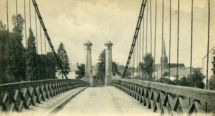
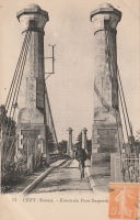
Bridgemeister ID: 2054 (added 2006-06-02)Name: Cézy Also Known As: Jacques Cœur Location: Cézy and Saint-Aubin-sur-Yonne, Yonne , France Crossing: Yonne River Coordinates: 47.993878 N 3.343591 E Maps: Acme , GeoHack , Google , OpenStreetMap Use: Vehicular (one-lane), with walkway Status: In use (last checked: 2019) Main Cables: Wire Suspended Spans: 1
Bridgemeister ID: 3275 (added 2019-11-17)Name: Cedar Rapids Country Club Location: Cedar Rapids, Iowa , USA Crossing: Indian Creek Coordinates: 42.004703 N 91.624127 W Maps: Acme , GeoHack , Google , OpenStreetMap Use: Golf cart Status: In use (last checked: 2019) Main Cables: Wire (steel)
Bridgemeister ID: 3350 (added 2019-12-14)Name: Cedar Rapids Country Club Location: Cedar Rapids, Iowa , USA Crossing: Indian Creek Coordinates: 41.999404 N 91.620777 W Maps: Acme , GeoHack , Google , OpenStreetMap Use: Golf cart Status: In use (last checked: 2019) Main Cables: Wire (steel)
Bridgemeister ID: 5773 (added 2021-04-08)Name: Cementas Location: Othemars, Slite vicinity, Sweden Coordinates: 57.719961 N 18.755321 E Maps: Acme , GeoHack , Google , OpenStreetMap Use: Footbridge Status: In use (last checked: 2021) Main Cables: Wire (steel) Suspended Spans: 1
Bridgemeister ID: 5930 (added 2021-06-27)Name: Centenario Also Known As: Centennial Location: San Jerónimo de Tunán, Huancayo, Peru Crossing: Mantaro River Coordinates: 11.955931 S 75.296669 W Maps: Acme , GeoHack , Google , OpenStreetMap Use: Vehicular (one-lane) Status: In use (last checked: 2020) Main Cables: Wire (steel) Suspended Spans: 1 Main Span: 1
Bridgemeister ID: 2067 (added 2006-06-06)Name: Cercy-la-Tour Location: Cercy-la-Tour, Nièvre , France Crossing: Aron River Use: Vehicular Status: Removed Suspended Spans: 1
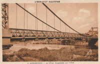
Bridgemeister ID: 2357 (added 2007-09-03)Name: Cessenon-sur-Orb Location: Cessenon-sur-Orb, Hérault , France Crossing: Orb River Coordinates: 43.451300 N 3.046790 E Maps: Acme , GeoHack , Google , OpenStreetMap Use: Vehicular (one-lane) Status: In use (last checked: 2019) Main Cables: Wire (steel) Suspended Spans: 1
Short one-lane suspension bridge apparently on private property near gate house for Stuckeridge House. Visible from route A396. Bridgemeister ID: 4971 (added 2020-08-15)Name: Chakura Also Known As: ちゃくらばし Location: Matsusaka, Mie , Japan Crossing: Kushida River Coordinates: 34.460305 N 136.399619 E Maps: Acme , GeoHack , Google , OpenStreetMap Use: Footbridge Status: In use (last checked: 2021) Main Cables: Wire (steel) Suspended Spans: 1 Main Span: 1 x 90 meters (295.3 feet) estimated
Bridgemeister ID: 322 (added before 2003)Name: Chandler's Location: Gorham, New Hampshire , USA Crossing: Androscoggin River Use: Footbridge Status: Removed Main Cables: Wire Main Span: 1 x 68.6 meters (225 feet)
Was located at the end of present-day Alpine Street. Bridgemeister ID: 7581 (added 2023-04-30)Name: Chanfi Location: Chanfi, Nainital, Uttarakhand , India Crossing: Kalsa River Coordinates: 29.377118 N 79.582109 E Maps: Acme , GeoHack , Google , OpenStreetMap Use: Footbridge Status: In use (last checked: 2022) Main Cables: Wire (steel) Suspended Spans: 1 Main Span: 1 x 35.1 meters (115 feet) estimated
Bridgemeister ID: 8459 (added 2024-03-17)Name: Chanuwa Jarayotar Location: Jarayotar (जरायोटार), Bhojpur and Chanuwa (चनुवा), Dhankuta, Nepal Crossing: Arun River Coordinates: 27.166942 N 87.272783 E Maps: Acme , GeoHack , Google , OpenStreetMap Use: Footbridge Status: Extant (last checked: 2020) Main Span: 1 x 199 meters (652.9 feet)
Completed in 2014 or 2015. Google Maps . Image with bridge barely visible along the right edge. Dated December 2020.Bridgemeister ID: 8155 (added 2024-02-03)Name: Chatra Ghat Location: Mainamaine (मैनामैनी) and Barahakshetra (बराहक्षेत्र), Nepal Crossing: Koshi Coordinates: 26.868525 N 87.151944 E Maps: Acme , GeoHack , Google , OpenStreetMap Use: Footbridge Status: In use (last checked: 2021) Main Cables: Wire (steel) Suspended Spans: 1 Main Span: 1 x 167.8 meters (550.5 feet)
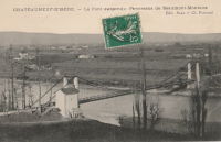
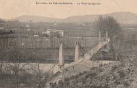
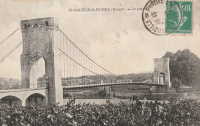
Completed at some point around 1997-1998. Bridgemeister ID: 4879 (added 2020-07-18)Name: Châteauneuf-sur-Isère Location: Châteauneuf-sur-Isère and Beaumont-Monteux, Drôme , France Crossing: Isère River Use: Vehicular Status: Removed Main Cables: Wire (iron)
Destroyed by flood, 2018. Bridgemeister ID: 5869 (added 2021-05-17)Name: Cheonjang Lake Also Known As: 천장호 출렁다리, Cheongyang Location: Cheongyang-gun, Chungcheongnam-do, South Korea Crossing: Cheonjang Lake Coordinates: 36.414838 N 126.915755 E Maps: Acme , GeoHack , Google , OpenStreetMap Use: Footbridge Status: In use (last checked: 2021) Main Cables: Wire (steel) Suspended Spans: 1 Main Span: 1
One suspension tower is formed in the shape of two red chili peppers (capsicum) and a red bell pepper Bridgemeister ID: 5286 (added 2020-11-08)Name: Chhatru Also Known As: छतरू ब्रिज Location: Chhatru, Himachal Pradesh , India Crossing: Chenab River Coordinates: 32.319258 N 77.364527 E Maps: Acme , GeoHack , Google , OpenStreetMap Use: Vehicular (one-lane) Status: In use (last checked: 2019) Main Cables: Wire (steel) Suspended Spans: 1 Main Span: 1 x 51 meters (167.3 feet) estimated
Bridgemeister ID: 7120 (added 2022-06-12)Name: Chhinka Also Known As: Chinka Location: Mathmalana (मथ्मलाना), Uttarakhand , India Crossing: Alakananda River Coordinates: 30.413322 N 79.366495 E Maps: Acme , GeoHack , Google , OpenStreetMap Use: Footbridge Status: In use (last checked: 2021) Main Cables: Wire (steel) Suspended Spans: 1 Main Span: 1 x 121.9 meters (400 feet) estimated
Facebook . Image of the bridge, posted October 2020.Instagram . Video of the bridge, posted August 2019.Bridgemeister ID: 5283 (added 2020-11-08)Name: Chhintang Location: Chhintang (छिन्ताङ), Nepal Crossing: Tamor River Coordinates: 26.916174 N 87.161599 E Maps: Acme , GeoHack , Google , OpenStreetMap Use: Footbridge Status: In use (last checked: 2017) Main Cables: Wire (steel)
Bridgemeister ID: 4608 (added 2020-06-07)Name: Chihani Location: Chihani, Algeria Crossing: Oed Seybouse Coordinates: 36.652540 N 7.782742 E Maps: Acme , GeoHack , Google , OpenStreetMap Principals: Ferdinand Arnodin Use: Vehicular Status: In use (last checked: 2019) Main Cables: Wire (steel)
Extensive renovation in late 2000s included complete replacement of suspension system, widening, and a new deck. Bridgemeister ID: 8311 (added 2024-02-09)Name: Chihengdi Location: Chihengdi (赤恒底村), Lumadengxiang (鹿马登乡), Fugong County (福贡县), Nujiang Lisu (怒江傈僳族自治州), Yunnan , China Crossing: Nujiang Coordinates: 26.983889 N 98.864722 E Maps: Acme , GeoHack , Google , OpenStreetMap Status: Extant (last checked: 2021) Main Span: 1 x 126 meters (413.4 feet) estimated
Bridgemeister ID: 4963 (added 2020-08-15)Name: Chimbalhar Location: Bhagotla (भागोतला) and Chimbalhar (चिम्बल्हर), Palumpar (पालमपुर) vicinity, Himachal Pradesh , India Crossing: Nyugal Khad Coordinates: 32.115047 N 76.499873 E Maps: Acme , GeoHack , Google , OpenStreetMap Use: Footbridge Status: In use (last checked: 2018) Main Cables: Wire (steel) Main Span: 1 x 65 meters (213.3 feet) estimated
Completed at some point in the 2005-2009 time frame. Bridgemeister ID: 1432 (added 2004-07-25)Name: China Flat Tract Location: Downiesville vicinity and Sierra City vicinity, California , USA Crossing: North Yuba River Coordinates: 39.561033 N 120.754067 W Maps: Acme , GeoHack , Google , OpenStreetMap Use: Footbridge Status: In use (last checked: 2005) Main Cables: Wire (steel) Suspended Spans: 1 Main Span: 1 x 41.5 meters (136 feet) estimated
Off Route 49 about midway between Downiesville and Sierra City. Bridgemeister ID: 6772 (added 2021-10-27)Name: Chinese Also Known As: China Location: Hamardas and Gupis, Gilgit-Baltistan, Pakistan Crossing: Gilgit River Coordinates: 36.239134 N 73.425963 E Maps: Acme , GeoHack , Google , OpenStreetMap Use: Vehicular (one-lane) Status: In use (last checked: 2021) Main Cables: Wire (steel) Suspended Spans: 1 Main Span: 1 x 128 meters (420 feet) estimated
Bridgemeister ID: 133 (added before 2003)Name: Choctaw Creek Location: Bells vicinity, Grayson County, Texas , USA Crossing: Choctaw Creek Coordinates: 33.650717 N 96.480981 W Maps: Acme , GeoHack , Google , OpenStreetMap Principals: William H. C. Greer References: HAERTX98 Use: Vehicular (one-lane) Status: Derelict (last checked: 2018) Main Cables: Wire Suspended Spans: 1
Likely built in the 1910s. Bridgemeister ID: 6394 (added 2021-07-27)Name: Chongos Location: Chongos Bajo District and Viques District, Peru Crossing: Mantaro River Coordinates: 12.154210 S 75.244333 W Maps: Acme , GeoHack , Google , OpenStreetMap Use: Vehicular (one-lane) Status: Removed Main Cables: Wire Suspended Spans: 1
2014: Towers remain with no deck or cables. Demolished by 2020. Bridgemeister ID: 7392 (added 2022-11-25)Name: Choromandó Location: Dabeiba, Antioquia, Colombia Crossing: Rio Sucio Coordinates: 7.020618 N 76.326122 W Maps: Acme , GeoHack , Google , OpenStreetMap Status: In use (last checked: 2020) Main Cables: Wire (steel) Suspended Spans: 1
2019: Rehabilitation and deck replacement project completed Facebook . Image of the bridge, posted December 29, 2019.Facebook . Images of the bridge, posted October 25, 2019.Facebook . Image of the bridge, posted March 9, 2016.Facebook . Image of the bridge, posted June 27, 2019.Flickr - Territorios por descubrir: Puente sobre Río Sucio, Dabeiba, Choromandó . Image of the bridge, posted August 2, 2015.Twitter . Thread with several photos highlighting the recently refurbished bridge, posted December 29, 2019.Twitter . Images of the bridge, posted December 29, 2019.Bridgemeister ID: 4325 (added 2020-04-10)Name: Chubu Also Known As: 中部橋 Location: Hamamatsu, Shizuoka , Japan Crossing: Tenryu River Coordinates: 35.082517 N 137.801151 E Maps: Acme , GeoHack , Google , OpenStreetMap Use: Footbridge Status: In use (last checked: 2017) Main Cables: Wire (steel) Suspended Spans: 1 Main Span: 1 x 161 meters (528.2 feet) estimated
Bridgemeister ID: 7409 (added 2022-12-04)Name: Chucarima Location: San Luis de Chucarima, Chitagá, North Santander, Colombia Crossing: Río Valegra Coordinates: 7.11976 N 72.49793 W Maps: Acme , GeoHack , Google , OpenStreetMap Use: Footbridge Status: In use (last checked: 2019) Main Cables: Wire (steel)
Bridgemeister ID: 7716 (added 2023-07-07)Name: Chuchumbletza Also Known As: Chuchumbleza Location: Chuchumblezo, Ecuador Crossing: Rio Zamora Coordinates: 3.531468 S 78.529385 W Maps: Acme , GeoHack , Google , OpenStreetMap Use: Footbridge Status: In use (last checked: 2022) Main Cables: Wire (steel) Suspended Spans: 1 Main Span: 1 x 127 meters (416.7 feet) estimated
Bridgemeister ID: 3389 (added 2019-12-21)Name: Chukushitsuri Location: Shigesato, Totsukawa, Yoshino, Nara , Japan Crossing: Imanishi River Coordinates: 33.942308 N 135.744448 E Maps: Acme , GeoHack , Google , OpenStreetMap Use: Footbridge Status: In use (last checked: 2019) Main Cables: Wire (steel) Suspended Spans: 1
Bridgemeister ID: 3226 (added 2019-11-11)Name: Chulilla Location: Chulilla, Valencia, Spain Crossing: Turia Coordinates: 39.668803 N 0.894004 W Maps: Acme , GeoHack , Google , OpenStreetMap Use: Footbridge Status: In use (last checked: 2022) Main Cables: Wire (steel) Suspended Spans: 1
Bridgemeister ID: 7502 (added 2023-01-01)Name: Chuntrun Also Known As: Cerro Chuntrun Location: San Ignacio, El Salvador Crossing: Rio de San Ignacio Coordinates: 14.335781 N 89.209075 W Maps: Acme , GeoHack , Google , OpenStreetMap Use: Footbridge Status: In use (last checked: 2020) Main Cables: Wire (steel) Suspended Spans: 1 Main Span: 1 x 48.8 meters (160 feet) estimated
Bridgemeister ID: 5803 (added 2021-04-10)Name: Ciclopedonale Location: Filago, Bergamo, Italy Crossing: Brembo Coordinates: 45.634927 N 9.559870 E Maps: Acme , GeoHack , Google , OpenStreetMap Use: Footbridge Status: In use (last checked: 2021) Main Cables: Wire (steel) Suspended Spans: 1
Substructure and suspension system appear to be intact (in 2020) but deck has been removed. Bridgemeister ID: 6625 (added 2021-09-06)Name: Cipamingkis Location: Sukanegara, Jonggol, Bogor and Sukaresmi, Bogor, West Java , Indonesia Coordinates: 6.523140 S 107.049485 E Maps: Acme , GeoHack , Google , OpenStreetMap Status: In use (last checked: 2021) Main Cables: Wire (steel) Suspended Spans: 1 Main Span: 1 x 118 meters (387.1 feet) estimated
Bridgemeister ID: 7545 (added 2023-03-05)Name: Cipicung Location: Bantargebang, Sukabumi Regency and Mekarasih, Sukabumi Regency, West Java , Indonesia Coordinates: 7.022849 S 106.664674 E Maps: Acme , GeoHack , Google , OpenStreetMap Use: Footbridge Status: In use (last checked: 2020) Main Cables: Wire (steel) Main Span: 1 x 81.1 meters (266 feet) estimated
Appears to have been completed in the 2013-2014 time frame. Bridgemeister ID: 1561 (added 2004-11-27)Name: City of Ghosts Gate Location: Fengdu County (丰都县), Chongqing , China At or Near Feature: Fengdu Ghost City - 丰都鬼城 Coordinates: 29.886528 N 107.717056 E Maps: Acme , GeoHack , Google , OpenStreetMap Use: Footbridge Status: In use (last checked: 2023) Main Span: 1
Bridgemeister ID: 323 (added before 2003)Name: Clarendon Gorge Also Known As: Robert Brugmann Memorial Location: Rutland vicinity, Vermont , USA Crossing: Mill River At or Near Feature: Appalachian Trail Coordinates: 43.520240 N 72.925480 W Maps: Acme , GeoHack , Google , OpenStreetMap References: PQU Use: Footbridge Status: In use (last checked: 2021) Main Cables: Wire (steel) Main Span: 1
Destroyed by flood 1973, rebuilt. Welles Lobb writes: "Bob Brugmann, my best friend from high school, was attempting to cross an older damaged version of the bridge on July 4, 1973 during a flood when he was swept to death in the raging waters. Bob was 17, a brilliant budding environmentalist, and was attempting a southbound thru-hike of the Appalachian Trail the time of his accident. Later, the Green Mountain Club (a hiking organization) rebuilt the bridge and dedicated it to my late friend." Bridgemeister ID: 2595 (added 2014-04-14)Name: Club Les Chevaliers De La Motoneige Location: New Richmond, Quebec , Canada Crossing: Little Cascapedia River Use: Snowmobile Status: In use (last checked: 2011) Main Cables: Wire (steel) Suspended Spans: 1 Main Span: 1 x 79.9 meters (262 feet) estimated
Bridgemeister ID: 7604 (added 2023-05-16)Name: Coiron Location: Coiron, Salamanca, Chile Crossing: Rio Choapa Coordinates: 31.897482 S 70.772009 W Maps: Acme , GeoHack , Google , OpenStreetMap Use: Vehicular (one-lane) Status: Restricted to foot traffic (last checked: 2023) Main Cables: Wire (steel) Suspended Spans: 1 Main Span: 1 x 61 meters (200.1 feet) estimated
Bridgemeister ID: 8169 (added 2024-02-03)Name: Colònia Sedó Location: Esparreguera, Barcelona and Olesa de Montserrat, Barcelona, Catalonia, Spain Crossing: Llobregat River Coordinates: 41.546694 N 1.873694 E Maps: Acme , GeoHack , Google , OpenStreetMap Status: Derelict (last checked: 2023) Main Cables: Wire Main Span: 1
The sequence of bridges at this location through the 1800s is unclear, but the current (as of 2023) derelict suspension system appears to date to the 1890s (possibly 1892 or 1896). Bridgemeister ID: 7607 (added 2023-05-19)Name: Colgante Location: Manganeses de la Polvorosa and Villabrázaro, Zamora, Spain Crossing: Eria River Coordinates: 42.054829 N 5.749975 W Maps: Acme , GeoHack , Google , OpenStreetMap Use: Footbridge Status: In use (last checked: 2023) Main Cables: Wire (iron) Suspended Spans: 1
Bridgemeister ID: 2964 (added 2019-10-10)Name: Collonges Location: Collonges-au-Mont-d'Or, Métropole de Lyon , France Crossing: Saône River Use: Vehicular Status: Destroyed, September 2, 1944 Main Cables: Wire
Bridgemeister ID: 6847 (added 2022-01-01)Name: Colorados-Puerto Salgar Location: Puerto Salgar, Cundinamarca, Colombia Crossing: Rio Negro Coordinates: 5.469484 N 74.593308 W Maps: Acme , GeoHack , Google , OpenStreetMap Use: Footbridge Status: In use (last checked: 2020) Main Cables: Wire (steel) Suspended Spans: 1
Bridgemeister ID: 7506 (added 2023-01-02)Name: Condrieu Location: Condrieu, Rhône and Les Roches-de-Condrieu, Isère , France Crossing: Rhône River Coordinates: 45.456769 N 4.768646 E Maps: Acme , GeoHack , Google , OpenStreetMap Use: Vehicular Status: In use (last checked: 2022) Main Cables: Wire (steel) Suspended Spans: 2 Main Spans: 2
Bridgemeister ID: 1939 (added 2005-10-29)Name: Cormery Location: Cormery and Truyes, Indre-et-Loire , France Crossing: Indre River Principals: Joseph Chaley References: AAJ Status: Removed Main Cables: Wire (iron)
Bridgemeister ID: 518 (added before 2003)Name: Corrigan's Location: Balook, Victoria , Australia Crossing: Macks Creek At or Near Feature: Tarra-Bulga National Park Coordinates: 38.425584 S 146.572375 E Maps: Acme , GeoHack , Google , OpenStreetMap Use: Footbridge Status: In use (last checked: 2022) Main Cables: Wire (steel) Suspended Spans: 1
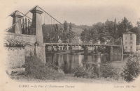
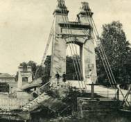
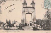
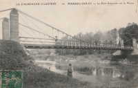
Bridgemeister ID: 2059 (added 2006-06-03)Name: Créteil Also Known As: Saint-Maur Location: Créteil-sur-Marne and Saint-Maur-des-Fossés, Val-de-Marne , France Crossing: Marne River Use: Vehicular (one-lane) Status: Removed Main Cables: Wire Suspended Spans: 1
Bridgemeister ID: 1978 (added 2005-11-27)Name: Cuddebackville Location: Cuddebackville and Godeffroy, New York , USA Crossing: Neversink River Use: Vehicular (one-lane) Status: Removed Main Cables: Wire (iron) Suspended Spans: 1
Completed c. 1850, replaced c. 1900s. Bridgemeister ID: 3116 (added 2019-10-29)Name: Cumandá Location: Cumandá vicinity, Ecuador Crossing: Rio Pastaza Coordinates: 1.452518 S 78.153815 W Maps: Acme , GeoHack , Google , OpenStreetMap Use: Vehicular (one-lane) Status: In use (last checked: 2018) Main Cables: Wire (steel)
Bridgemeister ID: 2787 (added 2019-06-30)Name: Cushihu Also Known As: 粗石斛吊橋 Location: Pinglin District, New Taipei City, Taiwan Coordinates: 24.952830 N 121.749591 E Maps: Acme , GeoHack , Google , OpenStreetMap Use: Footbridge Status: In use (last checked: 2015) Main Cables: Wire (steel) Suspended Spans: 1
Bridgemeister ID: 7495 (added 2022-12-30)Name: Cuyca Location: Cuyca, Colasay, Peru Crossing: Rio Chamaya Coordinates: 6.009487 S 78.860944 W Maps: Acme , GeoHack , Google , OpenStreetMap Use: Footbridge Status: Derelict, since March 2022 Main Cables: Wire (steel) Suspended Spans: 1 Main Span: 1 x 75 meters (246.1 feet) estimated
2022, March: Heavily damaged by flood. Bridgemeister ID: 2813 (added 2019-07-04)Name: Dabao Also Known As: 大豹吊橋 Location: Sanxia District, New Taipei City, Taiwan Coordinates: 24.869427 N 121.408924 E Maps: Acme , GeoHack , Google , OpenStreetMap Use: Footbridge Status: In use (last checked: 2019) Main Cables: Wire (steel) Suspended Spans: 1
Bridgemeister ID: 8110 (added 2024-01-06)Name: Dahan Gali Also Known As: Dhan Gali, Dangali Location: Pallal Mallahan, Rawalpindi, Punjab and Mirpur, Azad Jammu and Kashmir, Pakistan Crossing: Jhelum River Coordinates: 33.361259 N 73.567533 E Maps: Acme , GeoHack , Google , OpenStreetMap Use: Vehicular (one-lane) Status: Inundated, c. 2010 Main Cables: Wire (steel) Suspended Spans: 1 Main Span: 1 x 199.6 meters (655 feet) estimated
Location partially inundated behind the Mangla Dam after the reservoir capacity was increased in 2009. Bridgemeister ID: 6812 (added 2021-12-04)Name: Dain Also Known As: Chatorkhand Location: Chatorkhand, Gilgit-Baltistan, Pakistan Crossing: Karambar River Coordinates: 36.346528 N 73.834333 E Maps: Acme , GeoHack , Google , OpenStreetMap Use: Vehicular (one-lane) Status: In use Main Cables: Wire (steel) Suspended Spans: 1 Main Span: 1 x 186.2 meters (611 feet) estimated
Bridgemeister ID: 4109 (added 2020-04-05)Name: Dalsfoss Location: Sannidal, Kragerø, Vestfold Og Telemark, Norway Crossing: Lundereidelva Coordinates: 58.962502 N 9.321384 E Maps: Acme , GeoHack , Google , kart.1881.no , OpenStreetMap Use: Vehicular (one-lane) Status: In use (last checked: 2019) Main Cables: Wire (steel) Suspended Spans: 2 Main Spans: 1 x 41 meters (134.5 feet) estimated,
Bridgemeister ID: 3711 (added 2020-02-09)Name: Dalsnes Location: Dalsnes, Hegra vicinity, Stjørdal, Trøndelag, Norway Crossing: Forra Coordinates: 63.48559 N 11.28784 E Maps: Acme , GeoHack , Google , kart.1881.no , OpenStreetMap Use: Vehicular (one-lane) Status: In use (last checked: 2010) Main Cables: Wire (steel) Suspended Spans: 1 Main Span: 1 x 73.2 meters (240 feet) estimated
Bridgemeister ID: 4648 (added 2020-06-16)Name: Damanskiy Also Known As: Даманский, Damansky Location: Yaroslavskaya, Krasnodar Krai, Russia Crossing: Kotorosl River Coordinates: 57.620478 N 39.898030 E Maps: Acme , GeoHack , Google , OpenStreetMap Use: Footbridge Status: In use (last checked: 2019) Main Cables: Wire (steel) Suspended Spans: 3 Main Span: 1 x 88 meters (288.7 feet) estimated Side Spans: 2
Bridgemeister ID: 2826 (added 2019-07-04)Name: Danda Location: Xinyi Township, Nantou County, Taiwan Coordinates: 23.787197 N 121.011677 E Maps: Acme , GeoHack , Google , OpenStreetMap Use: Footbridge Status: Only towers remain (last checked: 2017) Main Cables: Wire (steel) Suspended Spans: 1
Bridge was still in use at least as late as 2007. Removed or destroyed at some point after. In 2019 only the towers remain. Bridgemeister ID: 2819 (added 2019-07-04)Name: Danlan Location: Shiding District, New Taipei City, Taiwan Coordinates: 25.004531 N 121.651588 E Maps: Acme , GeoHack , Google , OpenStreetMap Use: Footbridge Status: In use (last checked: 2018) Main Cables: Wire (steel) Suspended Spans: 2 Main Span: 1 Side Span: 1
Bridgemeister ID: 2795 (added 2019-07-04)Name: Danlin Location: Xinpi Township, Pingtung County, Taiwan Coordinates: 22.519956 N 120.629523 E Maps: Acme , GeoHack , Google , OpenStreetMap Use: Footbridge Status: In use Main Cables: Wire (steel)
Bridgemeister ID: 537 (added before 2003)Name: Danyor Also Known As: Danyore Location: Gilgit vicinity, Pakistan Crossing: Hunza River Coordinates: 35.92497 N 74.37201 E Maps: Acme , GeoHack , Google , OpenStreetMap Use: Vehicular (one-lane) Status: In use (last checked: 2012) Main Cables: Wire Suspended Spans: 1
Bridgemeister ID: 3244 (added 2019-11-16)Name: Dauwan Also Known As: 多望吊橋 Location: Datong Township, Yilan County, Taiwan Coordinates: 24.546160 N 121.507448 E Maps: Acme , GeoHack , Google , OpenStreetMap Use: Footbridge Status: In use (last checked: 2020) Main Cables: Wire (steel)
Bridgemeister ID: 3016 (added 2019-10-13)Name: David Scott Trail Location: Mawmyrsiang, Meghalaya , India Coordinates: 25.427530 N 91.752336 E Maps: Acme , GeoHack , Google , OpenStreetMap Use: Footbridge Status: In use (last checked: 2019) Main Cables: Wire (steel)
Bridgemeister ID: 3237 (added 2019-11-16)Name: Daxi Also Known As: 大溪橋 Location: Daxi, Taoyuan City, Taiwan Crossing: Dahan River Coordinates: 24.884920 N 121.283372 E Maps: Acme , GeoHack , Google , OpenStreetMap Use: Footbridge Status: In use (last checked: 2019) Main Cables: Wire (steel) Suspended Spans: 3 Main Spans: 3
Bridgemeister ID: 7249 (added 2022-07-16)Name: Deer View Also Known As: สะพานชมกวาง Location: Bang Luek, Mueang Chumphon District, Chumphon, Thailand Coordinates: 10.547492 N 99.196661 E Maps: Acme , GeoHack , Google , OpenStreetMap Use: Footbridge Status: In use (last checked: 2022) Main Cables: Wire (steel) Suspended Spans: 1
Bridgemeister ID: 4309 (added 2020-04-10)Name: Deheibashi Location: Hamamatsu, Shizuoka , Japan Crossing: Sugi River Coordinates: 35.045013 N 138.010321 E Maps: Acme , GeoHack , Google , OpenStreetMap Use: Vehicular (one-lane) Status: Closed (last checked: 2023) Main Cables: Wire (steel) Suspended Spans: 1
Twitter . Several images of the bridge. Posted October 13, 2023.Bridgemeister ID: 3555 (added 2019-12-26)Name: Depot Location: Kaiwhakauka Falls vicinity, Retaruke, New Zealand Coordinates: 39.132533 S 175.074265 E Maps: Acme , GeoHack , Google , OpenStreetMap Use: Footbridge Status: Collapsed, December 2014 Main Cables: Wire (steel) Suspended Spans: 1
Coordinates are approximate. This footbridge had been built in the early 2000s over and through the remains of the historic Depot truss bridge. In December 2014, the remains of the older bridge collapsed destroying the suspension bridge. Bridgemeister ID: 6798 (added 2021-10-30)Name: Derani Location: Derani, Sherqilla vicinity, Gilgit-Baltistan, Pakistan Crossing: Sher Gah Coordinates: 36.127927 N 74.035919 E Maps: Acme , GeoHack , Google , OpenStreetMap Use: Vehicular Status: In use (last checked: 2020) Main Cables: Wire Main Span: 1
Bridgemeister ID: 2596 (added 2014-04-14)Name: Des Chutes Du Ruisseau Creux Location: Saint-Alphonse-de-Caplan, Quebec , Canada Crossing: Bonaventure River Coordinates: 48.192363 N 65.563592 W Maps: Acme , GeoHack , Google , OpenStreetMap Use: Snowmobile and Footbridge Status: In use (last checked: 2018) Main Cables: Wire (steel) Suspended Spans: 1 Main Span: 1 x 79.2 meters (260 feet) estimated
Bridgemeister ID: 2183 (added 2007-01-14)Name: Devils Creek Location: Ross Lake National Recreation Area, Washington , USA Crossing: Devils Creek At or Near Feature: North Cascades National Park Coordinates: 48.82405 N 121.03226 W Maps: Acme , GeoHack , Google , OpenStreetMap Use: Footbridge Status: In use (last checked: 2006) Main Cables: Wire (steel) Suspended Spans: 1 Main Span: 1 x 55.5 meters (182 feet)
Bridgemeister ID: 6166 (added 2021-07-07)Name: Dhandole Also Known As: हैंगिंग फूट ब्रिज धन्दोले Location: Ghanghol, Himachal Pradesh , India Coordinates: 31.948347 N 76.684777 E Maps: Acme , GeoHack , Google , OpenStreetMap Use: Footbridge Status: In use (last checked: 2021) Main Cables: Wire (steel) Suspended Spans: 1
Bridgemeister ID: 5456 (added 2020-11-26)Name: Dhari Devi Also Known As: Dharidevi Location: Kalyasaur (कल्यासौङ), Uttarakhand , India Crossing: Alakananda River At or Near Feature: Dhari Devi Temple Coordinates: 30.258213 N 78.877268 E Maps: Acme , GeoHack , Google , OpenStreetMap Status: In use (last checked: 2023) Main Cables: Wire (steel) Suspended Spans: 1
Bridgemeister ID: 7350 (added 2022-10-21)Name: Diable Also Known As: Devil's Location: Avrieux, L'Esseillon, and Modane vicinity, Savoie , France Crossing: Arc River Coordinates: 45.210125 N 6.738907 E Maps: Acme , GeoHack , Google , OpenStreetMap Use: Footbridge Status: Replaced Main Cables: Wire Suspended Spans: 1
Bridgemeister ID: 2184 (added 2007-01-14)Name: Diablo Lake Trail Location: Ross Lake National Recreation Area, Washington , USA Crossing: Skagit River At or Near Feature: North Cascades National Park Coordinates: 48.72857 N 121.07277 W Maps: Acme , GeoHack , Google , OpenStreetMap Use: Footbridge Status: In use (last checked: 2006) Main Cables: Wire (steel) Suspended Spans: 1 Main Span: 1 x 75.9 meters (249 feet)
Spans the Skagit River at the extreme northern end of Lake Diablo near the Ross Dam power house. Bridgemeister ID: 6929 (added 2022-01-22)Name: Dikiuram Location: Dikiuram, Tamenglong District, Manipur , India Crossing: Barak River Coordinates: 25.195102 N 93.602497 E Maps: Acme , GeoHack , Google , OpenStreetMap Use: Vehicular (one-lane) Status: In use (last checked: 2021) Main Cables: Wire (steel) Suspended Spans: 1 Main Span: 1 x 130 meters (426.5 feet) estimated
Bridgemeister ID: 2086 (added 2006-06-24)Name: Dinkytown Also Known As: "M" Bridge Location: Minneapolis, Minnesota , USA At or Near Feature: University of Minnesota Coordinates: 44.98 N 93.238267 W Maps: Acme , GeoHack , Google , OpenStreetMap Use: Footbridge Status: Closed (last checked: 2019) Main Cables: Wire (steel) Suspended Spans: 1
Connects University of Minnesota campus to Dinkytown neighborhood. Closed March 2008 for fear some heavily rusted plates could fail. Restored and reopened by early 2009, possibly sooner. Closed June 2018 due to "structural deterioration". Expected to be demolished in 2019. Moved from 1949 (footbridge) - Minneapolis, Minnesota, USA . The bridge was moved to its current location from the Bierman Field area of the same campus. Bridgemeister ID: 2224 (added 2007-03-17)Name: Diroontah Location: Jallabad vicinity, Afghanistan Principals: Rushworth Halliday Use: Vehicular (one-lane) Main Cables: Wire (steel) Suspended Spans: 1 Main Span: 1 x 93.3 meters (306 feet) Deck width: 10 feet
Bridgemeister ID: 5109 (added 2020-09-05)Name: Dogna Location: Dogna, Udine, Italy Crossing: Torrente Dogna Coordinates: 46.447863 N 13.318000 E Maps: Acme , GeoHack , Google , OpenStreetMap Use: Footbridge Status: In use (last checked: 2014) Main Cables: Wire (steel) Suspended Spans: 1
Bridgemeister ID: 7423 (added 2022-12-09)Name: Dolamara Location: Dolamara, Assam , India Coordinates: 26.565472 N 93.539351 E Maps: Acme , GeoHack , Google , OpenStreetMap Use: Footbridge Status: In use (last checked: 2022) Main Cables: Wire (steel) Main Span: 1
2020s: A truss span is sitting in on the piers of the former suspension bridge. Bridgemeister ID: 2783 (added 2019-06-30)Name: Donghe Also Known As: 東河吊橋 Location: Nanzhuang Township, Miaoli County, Taiwan Coordinates: 24.599301 N 121.038996 E Maps: Acme , GeoHack , Google , OpenStreetMap Use: Footbridge Status: In use (last checked: 2022) Main Cables: Wire (steel) Suspended Spans: 1 Main Span: 1 x 185 meters (607 feet) estimated
Bridgemeister ID: 2753 (added 2019-06-29)Name: Dongpu Also Known As: 東埔吊橋, Dongbudiao Location: Xinyi Township, Nantou County, Taiwan Coordinates: 23.560004 N 120.922835 E Maps: Acme , GeoHack , Google , OpenStreetMap Use: Footbridge Status: In use (last checked: 2019) Main Cables: Wire (steel) Suspended Spans: 1 Main Span: 1 x 200 meters (656.2 feet)
Bridgemeister ID: 5807 (added 2021-04-10)Name: Dongshan Also Known As: 東山吊橋 Location: Nantou City, Nantou County, Taiwan Coordinates: 23.936003 N 120.727422 E Maps: Acme , GeoHack , Google , OpenStreetMap Use: Footbridge Status: Derelict, since c. 2019 (last checked: 2019) Main Cables: Wire (steel) Suspended Spans: 1 Main Span: 1 x 66 meters (216.5 feet) estimated
2014: Deck damaged at some point in 2013 or 2014. Bridge closed. 2017: Repaired at some point since 2014, open. 2019: Deck appears to have completely failed, unclear if it was due to flood or another reason. Bridge is closed. Bridgemeister ID: 1130 (added 2004-01-15)Name: Dormans Location: Dormans, Marne and Aisne , France Crossing: Marne River Coordinates: 49.075499 N 3.636878 E Maps: Acme , GeoHack , Google , OpenStreetMap Use: Vehicular (two-lane), with walkway Status: In use (last checked: 2016) Main Cables: Wire (steel) Suspended Spans: 1 Main Span: 1 x 81 meters (265.7 feet) estimated
Bridgemeister ID: 5063 (added 2020-08-29)Name: Doshi Kubo Also Known As: 道志 久保つり橋 Location: Doshi, Yamanashi , Japan Crossing: Doshi River Coordinates: 35.535608 N 139.085717 E Maps: Acme , GeoHack , Google , OpenStreetMap Use: Footbridge Status: In use (last checked: 2018) Main Cables: Wire (steel) Suspended Spans: 1
Bridgemeister ID: 3029 (added 2019-10-13)Name: Double Ten Also Known As: 雙十吊橋, Shuangshi, Shuang-Dong Location: Caotun, Nantou, Taiwan Coordinates: 23.984570 N 120.780614 E Maps: Acme , GeoHack , Google , OpenStreetMap Use: Footbridge Status: In use (last checked: 2019) Main Cables: Wire (steel) Suspended Spans: 3 Main Spans: 3
Bridgemeister ID: 1898 (added 2005-10-02)Name: Doushandiao Also Known As: 斗山吊橋, Dosang, Doosan Location: Dashi Village, Guoxing Township, Nantou County, Taiwan Coordinates: 23.985117 N 120.863117 E Maps: Acme , GeoHack , Google , OpenStreetMap Use: Footbridge Status: In use (last checked: 2023) Main Cables: Wire (steel) Suspended Spans: 1
Long narrow footbridge with tall narrow concrete towers. Nantou Dosang Suspension Bridge . Translated from page: "The Doosan Suspension Bridge was first built around 1961. It was destroyed by floods in 1986. In 1987, a new bridge was built about 50 meters upstream, and then it was disturbed by a typhoon. It was renovated again in 2011."Bridgemeister ID: 3482 (added 2019-12-23)Name: Dulai Location: Dulai and Garry, Abbottabad, Pakistan Crossing: Jhelum River Coordinates: 34.234554 N 73.479064 E Maps: Acme , GeoHack , Google , OpenStreetMap Use: Vehicular (one-lane) Status: In use (last checked: 2019) Main Cables: Wire Suspended Spans: 1
Bridgemeister ID: 7116 (added 2022-06-12)Name: Канатный Location: Rezina, Moldova Coordinates: 47.760396 N 28.954568 E Maps: Acme , GeoHack , Google , OpenStreetMap Use: Footbridge and Pipeline Status: In use (last checked: 2022) Main Cables: Wire (steel) Suspended Spans: 1 Main Span: 1 x 324 meters (1,063 feet) estimated
Popular bungee jumping site. Bridgemeister ID: 6358 (added 2021-07-26)Name: Eagle Falls Location: Great Falls, Montana , USA Crossing: Missouri River At or Near Feature: Eagle Falls, Black Eagle Dam Coordinates: 47.519905 N 111.262229 W Maps: Acme , GeoHack , Google , OpenStreetMap Use: Footbridge Status: Destroyed, June 6, 1908 Main Cables: Wire (steel) Main Span: 1 Side Span: 1
Completed early 1890s. 1908, June: Destroyed by flood. Black Eagle Dam - Wikipedia . From the article (retrieved 2021): "A 200-foot-long (61 m), 10-foot-wide (3.0 m) pedestrian suspension bridge ran from the bluffs above each powerhouse over the river." However, historic images of the bridge show it wa significantly longer with main and side spans of roughly 400 and 200 feet respectively.Bridgehunter.com | Eagle Falls Suspension Bridge Bridgemeister ID: 326 (added before 2003)Name: Eagle Mountain Pack Location: Clearwater National Forest, Idaho , USA Crossing: Lochsa River Coordinates: 46.430033 N 115.133567 W Maps: Acme , GeoHack , Google , OpenStreetMap Use: Pack Status: In use (last checked: 2007) Main Cables: Wire (steel) Suspended Spans: 1 Main Span: 1 x 39.6 meters (130 feet) estimated
Folsom's Rainbow Bridge occupies the location where this bridge stood. IHS: Bridge is purchased by Christian L. Ecklon (a local butcher) in 1872 from "Kinsey & Whitely." Mohi-ud-din, Noor. "Damaged suspension footbridge at Eco Park Baramulla poses risk to commuters." Rising Kashmir , 17 Feb. 2023, http://risingkashmir.com/damaged-suspension-footbridge-at-eco-park-baramulla-poses-risk-to-commuters ."Locals said the bridge has been neglected by the department responsible for its maintenance and that no steps have been taken to repair the damage. The bridge, which is a popular attraction for tourists and locals, has now become a cause for alarm. The safety of pedestrians, particularly during peak hours, is at risk as the damage has rendered the footbridge unsafe for use, locals said."
Bridgemeister ID: 3071 (added 2019-10-26)Name: Edgar Location: Arrow Junction, New Zealand Crossing: Arrow River At or Near Feature: Queenstown Trail - Arrow River Bridges Ride Coordinates: 45.001332 S 168.873649 E Maps: Acme , GeoHack , Google , OpenStreetMap Use: Footbridge Status: In use (last checked: 2022) Main Cables: Wire (steel) Suspended Spans: 1
Bridgemeister ID: 1001 (added 2003-11-17)Name: Eiffel Location: Giza, Egypt At or Near Feature: Giza Zoo Coordinates: 30.023836 N 31.214587 E Maps: Acme , GeoHack , Google , OpenStreetMap Principals: Gustave Eiffel Use: Footbridge Status: Closed, 1990s (last checked: 2020) Main Cables: Wire Suspended Spans: 1
2020: Egypt's Minister of Agriculture and Land Reclamation announced a partnership between Egypt and France to restore the bridge. A Cairo Times article (June 12, 1997) by Samir Raafat describes describes it as a "light suspension bridge built by Alexandre-Gustave Eiffel and brought to Cairo when [Khedive] Ismail visited the Paris Exhibition" which dates it to around 1900. Appeared to be closed for repairs or rehabilitation in 2019. Bridgemeister ID: 1699 (added 2005-03-28)Name: Eiserner Location: Eltmann vicinity, Bavaria, Germany Crossing: Main River Use: Footbridge Status: In use (last checked: 2005) Main Cables: Wire (steel) Suspended Spans: 1 Main Span: 1 x 50 meters (164 feet) Deck width: 1.5 meters
Bridgemeister ID: 7718 (added 2023-07-07)Name: El Cabo Location: Gualaceo and El Cabo, Ecuador Crossing: Rio Paute Coordinates: 2.862069 S 78.776452 W Maps: Acme , GeoHack , Google , OpenStreetMap Use: Vehicular (one-lane) Status: In use (last checked: 2022) Main Cables: Wire (steel) Suspended Spans: 1
Bridgemeister ID: 7230 (added 2022-07-16)Name: El Salto Location: Babahoyo, Los Rios, Ecuador Crossing: Babahoyo River Coordinates: 1.797506 S 79.535459 W Maps: Acme , GeoHack , Google , OpenStreetMap Use: Footbridge Status: In use (last checked: 2015) Main Cables: Wire (steel) Suspended Spans: 1 Main Span: 1
Bridgemeister ID: 7209 (added 2022-07-08)Name: El Torbes Location: El Torbes, Táchira, Venezuela Coordinates: 7.844487 N 72.196598 W Maps: Acme , GeoHack , Google , OpenStreetMap Use: Vehicular (one-lane) Status: In use (last checked: 2022) Main Cables: Wire (steel) Main Span: 1 x 41 meters (134.5 feet) estimated
Bridgemeister ID: 7458 (added 2022-12-24)Name: El Vado Location: El Vado, Cantón Potrero Sula vicinity, El Salvador Crossing: Rio Lempa Coordinates: 14.113753 N 89.408081 W Maps: Acme , GeoHack , Google , OpenStreetMap Use: Footbridge Status: In use Main Cables: Wire (steel) Main Span: 1 x 121.9 meters (400 feet) estimated
Facebook . Image of the bridge posted October 7, 2016.Facebook . Image of the bridge nearing completion of comprehensive rehabilitation project. Posted September 12, 2016.Facebook . Image of the bridge nearing completion of comprehensive rehabilitation project. Posted September 12, 2016.Facebook . Image of the bridge nearing completion of comprehensive rehabilitation project. Posted September 12, 2016.Facebook . Image of the bridge nearing completion of comprehensive rehabilitation project. Posted September 12, 2016.Facebook . Image of the bridge prior to rehabilitation. Posted September 25, 2015.Facebook . Image of the bridge prior to rehabilitation. Posted September 25, 2015.Facebook . Image of the bridge prior to rehabilitation. Posted September 25, 2015.Bridgemeister ID: 4508 (added 2020-05-02)Name: Eldsmoen Location: Hattfjelldal, Nordland, Norway Crossing: Susna Coordinates: 65.331850 N 14.319635 E Maps: Acme , GeoHack , Google , kart.1881.no , OpenStreetMap Use: Vehicular (one-lane) Status: In use Main Cables: Wire (steel) Suspended Spans: 1 Main Span: 1 x 40.5 meters (132.9 feet) estimated
Bridgemeister ID: 327 (added before 2003)Name: Elkhurst Location: Elkhurst, Clay County, West Virginia , USA Crossing: Elk River Coordinates: 38.45182 N 81.15428 W Maps: Acme , GeoHack , Google , OpenStreetMap Use: Vehicular (one-lane) Status: Closed, 2003 (last checked: 2004) Main Cables: Wire (steel) Suspended Spans: 3 Main Span: 1 Side Spans: 2
Very narrow vehicular suspension bridge. 4,200-pound weight limit imposed, 1968. Bridgemeister ID: 3674 (added 2020-01-26)Name: Elvanfoot Location: Elvanfoot, Scotland , United Kingdom Crossing: River Clyde Coordinates: 55.441074 N 3.654928 W Maps: Acme , GeoHack , Google , OpenStreetMap Principals: David Rowell & Co. Use: Footbridge Status: Closed, 2007 (last checked: 2020) Main Cables: Wire (steel) Main Span: 1 x 38.5 meters (126.3 feet) estimated
Bridgemeister ID: 4999 (added 2020-08-16)Name: Emílio Méier Location: Jaraguá Esquerdo, Jaraguá do Sul, Santa Catarina, Brazil Coordinates: 26.503567 S 49.092458 W Maps: Acme , GeoHack , Google , OpenStreetMap Use: Footbridge Status: In use (last checked: 2019) Main Cables: Wire Suspended Spans: 3 Main Span: 1 Side Spans: 2
Bridgemeister ID: 5025 (added 2020-08-17)Name: Emilio Meier Location: Jaraguá do Sul, Santa Catarina, Brazil Coordinates: 26.510215 S 49.113843 W Maps: Acme , GeoHack , Google , OpenStreetMap Use: Footbridge Status: In use (last checked: 2019) Main Cables: Wire
2005: Reported as damaged. Appears to have been replaced with a non-suspension bridge. Coordinates provided here are likely location of the former suspension bridge. Bridgemeister ID: 7771 (added 2023-08-17)Name: Eruvatty-Manikkal Also Known As: എരുവാട്ടി - മണിക്കൽ തൂക്കുപാലം Location: Eruvatty (എരുവട്ടി) and Manikkal (മണിക്കൽ), Kerala , India Crossing: Kuppam River Coordinates: 12.176194 N 75.418139 E Maps: Acme , GeoHack , Google , OpenStreetMap Use: Footbridge Status: In use (last checked: 2023) Main Cables: Wire (steel) Main Span: 1
Bridgemeister ID: 6890 (added 2022-01-16)Name: Estuari Gardens Location: Nusajaya, Johor, Malaysia Coordinates: 1.430377 N 103.653455 E Maps: Acme , GeoHack , Google , OpenStreetMap Use: Footbridge Status: In use (last checked: 2022) Main Cables: Rope Suspended Spans: 3 Main Span: 1 Side Spans: 2
Appears to have been completed in 2017 or 2018. Twitter . Thread with several images of the bridge.Bridgemeister ID: 864 (added 2003-08-23)Name: Eva Howe Stevens Also Known As: Rifle Range Location: Ithaca, New York , USA Crossing: Fall Creek Coordinates: 42.454983 N 76.45545 W Maps: Acme , GeoHack , Google , OpenStreetMap Use: Footbridge Status: In use (last checked: 2004) Main Cables: Wire (steel) Suspended Spans: 1 Main Span: 1 x 54.9 meters (180 feet) estimated
Bridgemeister ID: 1892 (added 2005-10-01)Name: Evergreen Also Known As: 長青橋 Location: Beitun District, Taichung City, Taiwan Coordinates: 24.17565 N 120.79165 E Maps: Acme , GeoHack , Google , OpenStreetMap Use: Footbridge Status: In use (last checked: 2005) Main Cables: Wire Suspended Spans: 1
Bridgemeister ID: 2715 (added 2019-06-21)Name: Evry-Petit-Bourg Location: Étiolles, Soisy-sur-Seine vicinity and Évry, Essonne , France Crossing: Seine River Coordinates: 48.63661 N 2.455212 E Maps: Acme , GeoHack , Google , OpenStreetMap Use: Vehicular Status: Removed Main Cables: Wire Suspended Spans: 2 Main Spans: 2
Abutments still standing as of 2022. Bridgemeister ID: 2372 (added 2007-09-29)Name: Eyguians Location: Lagrand and Eyguians, Hautes-Alpes , France Crossing: Buëch River Use: Vehicular Status: Removed Suspended Spans: 1
Location inundated behind Chastang Dam. Coordinates are approximate location in the Dordogne valley. Unclear if the bridge was removed before the valley was inundated. 2021-2022: Replaced by an arch bridge. Bridgemeister ID: 3717 (added 2020-02-14)Name: Fallan Location: Fallmo and Turmo, Nordland, Norway Crossing: Vefsna Coordinates: 65.67760 N 13.25036 E Maps: Acme , GeoHack , Google , kart.1881.no , OpenStreetMap Use: Vehicular (one-lane) Status: In use (last checked: 2016) Main Cables: Wire (steel) Suspended Spans: 1 Main Span: 1 x 60 meters (197 feet) estimated
Bridgemeister ID: 1635 (added 2005-03-12)Name: Falls River Swing Location: Abel Tasman National Park, New Zealand Crossing: Falls River Coordinates: 40.9287808 S 173.0486477 E Maps: Acme , GeoHack , Google , OpenStreetMap Use: Footbridge Status: In use (last checked: 2017) Main Cables: Wire (steel) Suspended Spans: 1
2021, May-June: possibly replaced by a new bridge. Bridgemeister ID: 1747 (added 2005-04-20)Name: Far Red Hill Location: Mount Morgan, Queensland , Australia Crossing: Dee River Status: Destroyed, 1928, by flood. Main Cables: Wire
Mount Morgan (link reported not working). Notes that this bridge was destroyed by flood in 1928 and later replaced. A sign at one of the remaining Mount Morgan suspension bridges says this bridge "spanned the river on the far side of Red Hill, from Baldwin Street on the south to School Street on the west."Bridgemeister ID: 4477 (added 2020-04-26)Name: Farlig Norsk Location: Ospelonin, Tinn, Vestfold og Telemark, Norway Crossing: Austbygdåe Coordinates: 60.049435 N 8.816480 E Maps: Acme , GeoHack , Google , kart.1881.no , OpenStreetMap Use: Footbridge Status: In use (last checked: 2019) Main Cables: Wire (steel) Suspended Spans: 1 Main Span: 1 x 26.75 meters (87.8 feet) estimated
Bridgemeister ID: 8453 (added 2024-03-10)Name: Feilong Location: Ninghai (宁海县), Ningbo (宁波市), Zhejiang , China At or Near Feature: Tianhe Scenic Area Coordinates: 29.230448 N 121.239751 E Maps: Acme , GeoHack , Google , OpenStreetMap Status: Extant (last checked: 2023) Main Span: 1 x 184 meters (603.7 feet) estimated
Bridgemeister ID: 7106 (added 2022-06-04)Name: Fellital Location: Gurtnellen, Switzerland Crossing: Fellibach Coordinates: 46.740381 N 8.639588 E Maps: Acme , GeoHack , Google , OpenStreetMap Use: Footbridge Status: In use (last checked: 2022) Main Cables: Wire (steel) Suspended Spans: 1 Main Span: 1
Bridgemeister ID: 2828 (added 2019-07-04)Name: Fenglin Also Known As: 楓林吊橋 Location: Toufen City, Miaoli County, Taiwan Coordinates: 24.691179 N 120.950266 E Maps: Acme , GeoHack , Google , OpenStreetMap Use: Footbridge Status: In use (last checked: 2022) Main Cables: Wire (steel)
Bridgemeister ID: 3216 (added 2019-11-11)Name: Figols Location: Organyà, Spain Crossing: Segre River Coordinates: 42.211103 N 1.333711 E Maps: Acme , GeoHack , Google , OpenStreetMap Use: Vehicular (one-lane) Status: In use (last checked: 2015) Main Cables: Wire (steel) Suspended Spans: 1
Bridgemeister ID: 4458 (added 2020-04-25)Name: Finnsetbrua Location: Nesset, Møre og Romsdal, Norway Crossing: Aura Coordinates: 62.420526 N 8.319360 E Maps: Acme , GeoHack , Google , kart.1881.no , OpenStreetMap Use: Vehicular (one-lane) Status: In use (last checked: 2019) Main Cables: Wire (steel) Suspended Spans: 1 Main Span: 1 x 22.5 meters (73.8 feet) estimated
Bridgemeister ID: 1896 (added 2005-10-01)Name: Folda Location: Foldereid, Nærøysund, Trøndelag, Norway Crossing: Foldereidsundet Coordinates: 64.954905 N 12.184916 E Maps: Acme , GeoHack , Google , kart.1881.no , OpenStreetMap Use: Vehicular (two-lane) Status: In use (last checked: 2019) Main Cables: Wire (steel) Suspended Spans: 2 Main Span: 1 x 225 meters (738.2 feet) Side Span: 1
Bridgemeister ID: 2423 (added 2008-03-02)Name: Forêt Ouareau Location: Notre-Dame-de-la-Merci, Quebec , Canada Crossing: Ouareau River At or Near Feature: Ouareau Forest Coordinates: 46.252520 N 73.974730 W Maps: Acme , GeoHack , Google , OpenStreetMap Use: Snowmobile Status: In use (last checked: 2020) Main Cables: Wire (steel)
GAP: Similar construction to 1900 Mafeking bridge at Raven Quay, NZ. Destroyed by flood July, 1963. Bridgemeister ID: 7398 (added 2022-12-03)Name: Fourc Location: Fourc, Roquefort-sur-Garonne vicinity and Boussens, Haute-Garonne , France Crossing: Garonne River Coordinates: 43.160816 N 0.962040 E Maps: Acme , GeoHack , Google , OpenStreetMap Use: Vehicular (two-lane), with walkway Status: In use (last checked: 2021) Main Cables: Wire (steel) Suspended Spans: 1 Main Span: 1 x 50 meters (164 feet) estimated
Bridgemeister ID: 1323 (added 2004-04-26)Name: Fourth of July Pack Location: Clearwater National Forest, Idaho , USA Crossing: North Fork Clearwater River At or Near Feature: Bear Butte Trail Coordinates: 46.6635 N 115.37843 W Maps: Acme , GeoHack , Google , OpenStreetMap Use: Pack and Footbridge Status: In use (last checked: 2016) Main Cables: Wire (steel) Suspended Spans: 1 Main Span: 1 x 67.1 meters (220 feet) estimated
Bridgemeister ID: 5657 (added 2021-01-01)Name: Frans Location: Villefranche-sur-Saône, Rhône and Jassans-Riottier, Ain , France Crossing: Saône River Coordinates: 45.984570 N 4.750048 E Maps: Acme , GeoHack , Google , OpenStreetMap References: AAJ Use: Vehicular Status: Removed, 1900 Main Cables: Wire (iron) Suspended Spans: 2 Main Spans: 2
Bridgemeister ID: 2114 (added 2006-09-09)Name: Friendship Location: Bucyrus, Ohio , USA Crossing: Sandusky River At or Near Feature: Aumiller Park Coordinates: 40.802678 N 82.992352 W Maps: Acme , GeoHack , Google , OpenStreetMap Use: Footbridge Status: In use (last checked: 2014) Main Cables: Wire (steel) Suspended Spans: 1 Main Span: 1 x 30.5 meters (100 feet) estimated
Eric Powell estimates the main span at approximately 100 feet. Bridgemeister ID: 2851 (added 2019-09-08)Name: Frutigen Location: Frutigen, Switzerland Coordinates: 46.560196 N 7.617164 E Maps: Acme , GeoHack , Google , OpenStreetMap Use: Footbridge Status: In use (last checked: 2019) Main Cables: Wire (steel)
Bridgemeister ID: 5065 (added 2020-08-29)Name: Fudakaketsuri Location: Kiyokawa, Kanagawa , Japan Crossing: Fu River Coordinates: 35.460987 N 139.213159 E Maps: Acme , GeoHack , Google , OpenStreetMap Use: Footbridge Status: In use (last checked: 2018) Main Cables: Wire (steel) Suspended Spans: 1
Bridgemeister ID: 4965 (added 2020-08-15)Name: Fudosawa Location: Omachi, Nagano , Japan Coordinates: 36.477104 N 137.683751 E Maps: Acme , GeoHack , Google , OpenStreetMap Use: Footbridge Status: In use (last checked: 2020) Main Cables: Wire (steel)
Bridgemeister ID: 4390 (added 2020-04-18)Name: Fuglestveit Location: Marnadal, Lindesnes, Agder, Norway Crossing: Marna Coordinates: 58.217949 N 7.522247 E Maps: Acme , GeoHack , Google , kart.1881.no , OpenStreetMap Use: Vehicular (one-lane) Status: Removed Main Cables: Wire (steel) Main Span: 1 x 47 meters (154.2 feet) estimated
In existence in 1930s. Removed at some point in time frame 1969-2004. Bridgemeister ID: 6127 (added 2021-07-04)Name: Fukase Also Known As: 深瀬大橋, Fukaze Location: Hakusan, Ishikawa , Japan Crossing: Tedori Lake Coordinates: 36.231728 N 136.640024 E Maps: Acme , GeoHack , Google , OpenStreetMap Use: Vehicular Status: In use (last checked: 2012) Main Cables: Wire (steel) Suspended Spans: 1 Main Span: 1 x 218 meters (715.2 feet) estimated
Bridgemeister ID: 6081 (added 2021-07-04)Name: Fukuchikeikokukyuyo Center Also Known As: 福知渓谷休養センターの吊橋 Location: Shiso, Hyogo , Japan Crossing: Fukuchi River Coordinates: 35.159809 N 134.658138 E Maps: Acme , GeoHack , Google , OpenStreetMap Use: Footbridge Status: In use (last checked: 2013) Main Cables: Wire (steel) Suspended Spans: 1
Bridgemeister ID: 2951 (added 2019-10-04)Name: Fukuwatarifudotsuri Also Known As: 福渡不動吊橋 Location: Nasushiobara, Tochigi , Japan Crossing: Hoki River Coordinates: 36.962811 N 139.839459 E Maps: Acme , GeoHack , Google , OpenStreetMap Use: Footbridge Status: In use (last checked: 2019) Main Cables: Wire (steel) Suspended Spans: 1
Bridgemeister ID: 1235 (added 2004-02-15)Name: Fulong Location: Zhongdian and Deqin, Yunnan , China Crossing: Jinsha River References: BYU Main Cables: Wire (steel) Suspended Spans: 1 Main Span: 1 x 10⁸ meters (354.3 feet)
Bridgemeister ID: 4509 (added 2020-05-02)Name: Furuheim Gård Location: Hattfjelldal, Nordland, Norway Crossing: Susna Coordinates: 65.365005 N 14.053160 E Maps: Acme , GeoHack , Google , kart.1881.no , OpenStreetMap Use: Footbridge Status: In use (last checked: 2017) Main Cables: Wire (steel) Suspended Spans: 1 Main Span: 1 x 52.5 meters (172.2 feet) estimated
Built at some point before 2005. Bridgemeister ID: 7910 (added 2023-10-21)Name: Futatsuno Ohashi Also Known As: 二津野大橋 Location: Totsukawa, Nara , Japan Crossing: Totsukawa River Coordinates: 33.913667 N 135.785333 E Maps: Acme , GeoHack , Google , OpenStreetMap Use: Footbridge Status: In use (last checked: 2022) Main Cables: Wire (steel) Suspended Spans: 1
Bridgemeister ID: 3238 (added 2019-11-16)Name: Fuxing Location: Fuxing, Taoyuan City, Taiwan Coordinates: 24.801231 N 121.366369 E Maps: Acme , GeoHack , Google , OpenStreetMap Use: Vehicular (one-lane) Status: In use (last checked: 2019) Main Cables: Wire (steel) Suspended Spans: 1
Bridgemeister ID: 3772 (added 2020-02-29)Name: Fuxing Location: Namaxia District, Kaohsiung City, Taiwan Coordinates: 23.238619 N 120.694264 E Maps: Acme , GeoHack , Google , OpenStreetMap Use: Footbridge Status: In use (last checked: 2014) Main Cables: Wire (steel) Suspended Spans: 1
Bridgemeister ID: 4406 (added 2020-04-18)Name: Gaarden Hummervold Location: Håmmålvoll, Os Kommune, Innlandet, Norway Crossing: Glåma Coordinates: 62.447686 N 11.121575 E Maps: Acme , GeoHack , Google , kart.1881.no , OpenStreetMap Status: Removed Main Cables: Wire Main Spans: 2 x 37.5 meters (123 feet) estimated
Bridgemeister ID: 4639 (added 2020-06-10)Name: Gaietta Location: Millesimo, Savona, Italy Crossing: Zemola Coordinates: 44.363288 N 8.204768 E Maps: Acme , GeoHack , Google , OpenStreetMap Use: Footbridge Status: In use (last checked: 2017) Main Cables: Wire (steel) Suspended Spans: 1
Bridgemeister ID: 7176 (added 2022-07-02)Name: Gaillac Location: Gaillac, Cajarc and Andressac, Cajarc, Lot , France Crossing: Lot River Coordinates: 44.469016 N 1.829985 E Maps: Acme , GeoHack , Google , OpenStreetMap Use: Vehicular Status: Only towers remain, since 2002 Main Cables: Wire Suspended Spans: 1 Main Span: 1 x 97 meters (318.2 feet) estimated
Bridgemeister ID: 815 (added 2003-05-30)Name: Galatea Trail Location: Kananaskis Village vicinity, Alberta , Canada Crossing: Kananaskis River At or Near Feature: Galatea Trailhead Coordinates: 50.8634 N 115.178917 W Maps: Acme , GeoHack , Google , OpenStreetMap Use: Footbridge Status: In use (last checked: 2022) Main Cables: Wire (steel) Suspended Spans: 1
Bridgemeister ID: 7158 (added 2022-06-25)Name: Galgon Location: Girard, Galgon, Gironde , France Crossing: Isle River Use: Vehicular Status: Removed Main Cables: Wire Suspended Spans: 1
Bridgemeister ID: 7762 (added 2023-07-23)Name: Gangdao Location: Zhoushan Island and Xiaogan Island, Zhoushan, Zhejiang , China Coordinates: 29.974403 N 122.208258 E Maps: Acme , GeoHack , Google , OpenStreetMap Use: Vehicular (four or more lanes) Status: Extant (last checked: 2023) Main Cables: Wire (steel) Suspended Spans: 3 Main Span: 1 x 370 meters (1,213.9 feet) estimated Side Spans: 2
Likely completed in 2018, or maybe early 2019, but unclear when the bridge opened. Connecting roads on the south end of the bridge weren't completed until 2022 or later. Bridgemeister ID: 2797 (added 2019-07-04)Name: Gangkou Also Known As: 港口吊橋 Location: Manzhou Township, Pingtung County, Taiwan Coordinates: 21.988548 N 120.841904 E Maps: Acme , GeoHack , Google , OpenStreetMap Use: Footbridge Status: In use (last checked: 2021) Main Cables: Wire (steel) Suspended Spans: 3 Main Span: 1 x 129 meters (423.2 feet) estimated Side Spans: 2
Bridgemeister ID: 8515 (added 2024-03-24)Name: Ganquan Lake Location: Chunhua County (淳化县), Xianyang (咸阳市), Shaanxi , China Coordinates: 34.794622 N 108.5798566 E Maps: Acme , GeoHack , Google , OpenStreetMap Use: Footbridge Status: Extant (last checked: 2022) Main Span: 1 x 84 meters (275.6 feet) estimated
Facebook . Images of the bridge. Posted July 16, 2021.Facebook . Photos and information about a planned replacement suspension bridge. Posted February 14, 2023.Facebook . Posts and video of the old bridge and beginning of construction of the replacement bridge. Posted May 15, 2023.Facebook . Progress on the south tower foundation. Posted July 10, 2023.YouTube - GENTING, Jembatan Gantung Desa Ganting . Video of the bridge. Posted January 13, 2022.Bridgemeister ID: 7341 (added 2022-09-30)Name: Gap Location: Kuala Kubu Bharu vicinity, Selangor, Malaysia Coordinates: 3.691576 N 101.748731 E Maps: Acme , GeoHack , Google , OpenStreetMap Use: Footbridge Status: In use (last checked: 2022) Main Cables: Wire (steel) Suspended Spans: 1 Main Span: 1
Bridgemeister ID: 4506 (added 2020-05-02)Name: Gaunbrua Location: Snåsa vicinity, Trøndelag, Norway Crossing: Gauna Coordinates: 64.016925 N 12.663650 E Maps: Acme , GeoHack , Google , kart.1881.no , OpenStreetMap Use: Vehicular (one-lane) Status: In use (last checked: 2019) Main Cables: Wire (steel) Suspended Spans: 1 Main Span: 1 x 30.5 meters (100.1 feet) estimated
Built at some point in time frame 2010-2017. Bridgemeister ID: 8504 (added 2024-03-23)Name: Gelan Also Known As: Shangjiang Grand Location: Shangjiangxiang (上江乡), Shangri-La City (香格里拉市), Diqing (迪庆藏族自治州), Yunnan , China Crossing: Jinsha River Coordinates: 27.368785 N 99.647026 E Maps: Acme , GeoHack , Google , OpenStreetMap Use: Vehicular Status: Extant (last checked: 2021) Main Cables: Wire (steel) Suspended Spans: 1 Main Span: 1 x 200 meters (656.2 feet)
Completed at some point in the 2017-2019 time frame. Demolished late 2012 or early 2013, since replaced with a new George C. King bridge completed 2014. Bridgemeister ID: 2591 (added 2014-04-14)Name: Gervais Lacasse Location: Causapscal vicinity, Quebec , Canada Crossing: Assemetquagan River Use: ATV and Footbridge Status: In use (last checked: 2011) Main Cables: Wire (steel) Suspended Spans: 1 Main Span: 1 x 36.6 meters (120 feet) estimated
Bridgemeister ID: 7979 (added 2023-11-26)Name: GIC Bhatwari Location: Dwari (द्वारी) and Bhatwari (भटवारी), Uttarakhand , India Crossing: Bhagirathi River Coordinates: 30.807817 N 78.620969 E Maps: Acme , GeoHack , Google , OpenStreetMap Use: Footbridge Status: In use (last checked: 2020) Main Cables: Wire (steel) Suspended Spans: 1 Main Span: 1 x 71.3 meters (234 feet) estimated
Referred to as GIC (Government Inter College) Bhatwari Bridge due to the school at the east end of the bridge. Bridgemeister ID: 3188 (added 2019-11-10)Name: Gignac Also Known As: Lagamas Location: Gignac and Lagamas, Hérault , France Crossing: Hérault River Coordinates: 43.663873 N 3.537615 E Maps: Acme , GeoHack , Google , OpenStreetMap References: AAJ Use: Vehicular (one-lane) Status: In use (last checked: 2014) Main Cables: Wire Suspended Spans: 1
Likely completed in 1869 or early 1870s. Bridgemeister ID: 3714 (added 2020-02-09)Name: Gløymem Location: Gløymem, Skogmo vicinity, Overhalla, Trøndelag, Norway Crossing: Bjøra Coordinates: 64.524100 N 12.081680 E Maps: Acme , GeoHack , Google , kart.1881.no , OpenStreetMap Use: Vehicular (one-lane) Status: In use (last checked: 2010) Main Cables: Wire (steel) Suspended Spans: 1 Main Span: 1 x 65 meters (213.3 feet) estimated
Bridgemeister ID: 5340 (added 2020-11-12)Name: Glemmtaler Baumzipfelweg Location: Hinterglemm vicinity, Austria Crossing: Saalach Coordinates: 47.365234 N 12.509284 E Maps: Acme , GeoHack , Google , OpenStreetMap Use: Footbridge Status: In use (last checked: 2020) Main Cables: Wire (steel) Suspended Spans: 3 Main Span: 1 Side Spans: 2
Bridgemeister ID: 300 (added before 2003)Name: Glenwoody Location: Pilar, New Mexico , USA Crossing: Rio Grande At or Near Feature: Rio Grande Gorge State Park vicinity Coordinates: 36.2467 N 105.825 W Maps: Acme , GeoHack , Google , OpenStreetMap Use: Vehicular (one-lane) Status: In use (last checked: 2003) Main Cables: Wire Suspended Spans: 1 Main Span: 1 x 50.3 meters (165 feet)
This is the modern suspension bridge of 20th-century construction at Gluges. It is unclear if this bridge is at the same location as the older Gluges suspension bridge. See Gluges - Gluges, Lot, France . This is an older bridge of 19th-century construction that has likely been removed. It is unclear if this bridge was at the same location as the current Gluges suspension bridge. See Gluges - Gluges, Lot, France . Bridgemeister ID: 5128 (added 2020-09-06)Name: Gogatsu Also Known As: 五月橋 Location: Yaotsu and Mizunami, Gifu , Japan Crossing: Kiso River Coordinates: 35.458699 N 137.239661 E Maps: Acme , GeoHack , Google , OpenStreetMap Status: Restricted to foot traffic (last checked: 2020) Main Cables: Wire (steel) Suspended Spans: 1 Main Span: 1 x 100 meters (328.1 feet) estimated
Appears to be a former one-lane vehicular bridge retrofit to be a pedestrian-only span. Bridgemeister ID: 4522 (added 2020-05-17)Name: Gokseong Duga Location: Gokseong-gun, Jeollanam-do, South Korea Coordinates: 35.229328 N 127.369536 E Maps: Acme , GeoHack , Google , OpenStreetMap Use: Footbridge Status: In use (last checked: 2020) Main Cables: Wire (steel) Suspended Spans: 3 Main Span: 1 x 125 meters (410.1 feet) Side Spans: 2 x 37.5 meters (123 feet)
Bridgemeister ID: 8236 (added 2024-02-07)Name: Golden Hairpin Location: Yunxi County (郧西县), Shiyan (十堰市), Hubei , China Coordinates: 32.9913292 N 110.3987461 E Maps: Acme , GeoHack , Google , OpenStreetMap Use: Vehicular Status: In use (last checked: 2023) Main Cables: Wire (steel) Suspended Spans: 2 Side Spans: 2 x 43 meters (141.1 feet) estimated Characteristics: Self-anchored
Completed at some point in the 2012-2014 time frame. Bridgemeister ID: 7137 (added 2022-06-20)Name: Goncelin Location: Goncelin, Isère , France Crossing: Isère River Use: Vehicular Status: Removed
Bridgemeister ID: 7528 (added 2023-01-14)Name: Gonokawa Also Known As: 信喜橋, Shiki Location: Misato, Shimane , Japan Crossing: Gōnokawa River Coordinates: 35.035246 N 132.626740 E Maps: Acme , GeoHack , Google , OpenStreetMap Use: Vehicular (one-lane) Status: In use (last checked: 2021) Main Cables: Wire (steel) Suspended Spans: 1 Main Span: 1 x 152 meters (498.7 feet) estimated
Later at same location Goodwin Dam - Jamestown, California, USA . Coordinates given here are for approximate location of this bridge which appeared to be slightly further downstream from Goodwin Dam as the present day (2020) suspension bridge. Bridgemeister ID: 2981 (added 2019-10-12)Name: Goranbo Location: Genbicho, Ichinoseki, Iwate , Japan Crossing: Iwai River At or Near Feature: Genbikei Gorge Coordinates: 38.943352 N 141.050579 E Maps: Acme , GeoHack , Google , OpenStreetMap Use: Footbridge Status: In use Main Cables: Wire (steel) Suspended Spans: 1
Bridgemeister ID: 1958 (added 2005-11-05)Name: Gorge Trail (Lower) Location: Rostraver, Pennsylvania , USA Crossing: Cedar Creek At or Near Feature: Cedar Creek Park Coordinates: 40.1781 N 79.780533 W Maps: Acme , GeoHack , Google , OpenStreetMap Use: Footbridge Status: In use (last checked: 2005) Main Cables: Wire Suspended Spans: 1 Main Span: 1 x 18.3 meters (60 feet) estimated
Bridgemeister ID: 1992 (added 2005-12-03)Name: Gorge Trail (Upper) Location: Rostraver, Pennsylvania , USA Crossing: Cedar Creek At or Near Feature: Cedar Creek Park Coordinates: 40.171717 N 79.7834 W Maps: Acme , GeoHack , Google , OpenStreetMap Use: Footbridge Status: In use (last checked: 2005) Main Cables: Wire Suspended Spans: 1 Main Span: 1 x 12.8 meters (42 feet) estimated
Bridgemeister ID: 3883 (added 2020-03-08)Name: Gorset Location: Gorset, Jerpstad, Trøndelag, Norway Crossing: Orkla Coordinates: 62.96099 N 9.78389 E Maps: Acme , GeoHack , Google , kart.1881.no , OpenStreetMap Use: Footbridge Status: In use (last checked: 2014) Main Cables: Wire (steel) Suspended Spans: 1 Main Span: 1 x 44 meters (144.4 feet) estimated
Bridgemeister ID: 5569 (added 2020-12-20)Name: Goryeong Daegaya Location: Goryeong-gun, Gyeongsangbuk-do, South Korea Coordinates: 35.726309 N 128.277835 E Maps: Acme , GeoHack , Google , OpenStreetMap Use: Footbridge Status: In use (last checked: 2019) Main Cables: Wire (steel) Suspended Spans: 2 Main Spans: 2 x 10⁵ meters (344.5 feet)
Symmetric single tower suspension bridge. Bridgemeister ID: 1194 (added 2004-01-26)Name: Gott's Location: Burley and Armley, England , United Kingdom Crossing: River Aire Use: Footbridge Status: Only towers remain (last checked: 2007) Suspended Spans: 1
Bridgemeister ID: 2569 (added 2012-02-05)Name: Graehl Location: Slaterville, Alaska , USA Crossing: Noyes Slough Use: Footbridge Main Cables: Wire
See Alaska Digital Archives identifiers UAF-2003-63-255 and UAF-2003-63-256 for photos of this bridge from the Walter W. Hodge Papers collection dated 1925-1948. Bridgemeister ID: 6178 (added 2021-07-08)Name: Gramazú Location: Gramazú, Peru Coordinates: 10.512456 S 75.449030 W Maps: Acme , GeoHack , Google , OpenStreetMap Status: In use (last checked: 2021) Main Cables: Wire (steel) Suspended Spans: 1 Main Span: 1 x 98 meters (321.5 feet)
Bridgemeister ID: 1006 (added 2003-11-21)Name: Grand Canyon Also Known As: Second Canyon Location: Capilano, British Columbia , Canada Use: Footbridge
Level footbridge with large timber towers, not the famous Capilano swinging bridge. Bridgemeister ID: 8221 (added 2024-02-06)Name: Great Volkhov Location: Novgorod, Novgorod Oblast, Russia Crossing: Volkhov River Coordinates: 58.520417 N 31.280000 E Maps: Acme , GeoHack , Google , OpenStreetMap Use: Vehicular Status: Removed Main Cables: Riveted plate Suspended Spans: 3 Main Span: 1 Side Spans: 2
Bridgemeister ID: 3791 (added 2020-02-29)Name: Gressli Location: Gressli, Tydal, Trøndelag, Norway Crossing: Nea Coordinates: 63.054650 N 11.455210 E Maps: Acme , GeoHack , Google , kart.1881.no , OpenStreetMap Use: Vehicular (one-lane) Status: Extant (last checked: 2019) Main Cables: Wire (iron) Suspended Spans: 1 Main Span: 1 x 75 meters (246.1 feet) estimated
Bridgemeister ID: 6628 (added 2021-09-07)Name: Grimohaye Also Known As: Limal, Limale Location: Limal, Wavre vicinity, Belgium At or Near Feature: Limal Castle References: IBB Use: Footbridge Main Cables: Wire (iron)
IBB: One of earliest known wire suspension bridges in Belgium. Bridge was in existence in 1830, presumably built in mid-to-late 1820s. Bridgemeister ID: 4005 (added 2020-03-28)Name: Grimsrud Location: Begnadalen, Bagn vicinity, Innlandet, Norway Crossing: Begna Coordinates: 60.675530 N 9.749180 E Maps: Acme , GeoHack , Google , kart.1881.no , OpenStreetMap Use: Vehicular (one-lane) Status: Restricted to foot traffic (last checked: 2019) Main Cables: Wire (steel) Suspended Spans: 2 Main Span: 1 x 43 meters (141.1 feet) estimated Side Span: 1 x 11 meters (36.1 feet) estimated Deck width: ~3 meters
AAJ estimates completed in 1844 because of source indicating contract was let in 1841 with construction time set at three years. Currently, there is a bridge at Groléjac that has the shape of a suspension bridge, but appears to be a concrete cantilever. This newer bridge was completed in 1932. Bridgemeister ID: 6262 (added 2021-07-18)Name: Grum Location: Grum, Khyber Pakhtunkhwa, Pakistan Coordinates: 35.775817 N 71.692299 E Maps: Acme , GeoHack , Google , OpenStreetMap Use: Vehicular (one-lane) Status: In use (last checked: 2017) Main Cables: Wire Suspended Spans: 1
Bridgemeister ID: 2790 (added 2019-06-30)Name: Guanpu Also Known As: 觀瀑吊橋 Location: Pingxi District, New Taipei City, Taiwan Crossing: Keelung River Coordinates: 25.048738 N 121.785301 E Maps: Acme , GeoHack , Google , OpenStreetMap Use: Footbridge Status: In use (last checked: 2019) Main Cables: Wire (steel) Suspended Spans: 1
Bridgemeister ID: 5570 (added 2020-12-20)Name: Gubongsan Also Known As: 구봉산 구름다리 Location: Jinan-gun, Jeollabuk-do, South Korea Coordinates: 35.927800 N 127.424350 E Maps: Acme , GeoHack , Google , OpenStreetMap Use: Footbridge Status: In use (last checked: 2020) Main Cables: Wire (steel) Suspended Spans: 1 Main Span: 1 x 100 meters (328.1 feet)
Bridgemeister ID: 2775 (added 2019-06-30)Name: Guguan Also Known As: 谷關吊橋 Location: Guguan, Heping District, Taichung City, Taiwan Coordinates: 24.203938 N 121.008805 E Maps: Acme , GeoHack , Google , OpenStreetMap Use: Footbridge Status: In use (last checked: 2019) Main Cables: Wire (steel) Suspended Spans: 1
Bridgemeister ID: 2820 (added 2019-07-04)Name: Guihua Also Known As: 桂花吊橋 Location: Nangang District, Taipei City, Taiwan Coordinates: 25.025724 N 121.661763 E Maps: Acme , GeoHack , Google , OpenStreetMap Use: Footbridge Status: In use Main Cables: Wire (steel) Suspended Spans: 1
Removed at some point before 1962. Spanned a channel of Storåne that has since been filled. Bridgemeister ID: 3841 (added 2020-03-06)Name: Gunnesbrua Location: Skjerve, Rennebu, Trøndelag, Norway Crossing: Orkla Coordinates: 62.842850 N 9.901260 E Maps: Acme , GeoHack , Google , kart.1881.no , OpenStreetMap Use: Vehicular (one-lane) Status: Extant (last checked: 2019) Main Cables: Wire Suspended Spans: 1 Main Span: 1 x 56 meters (183.7 feet) estimated
Based on historical aerial imagery, completed prior to 1958. Bridgemeister ID: 6560 (added 2021-08-31)Name: Gunung Perak Location: Gunung Perak, West Sinjai, Sinjai Regency, South Sulawesi , Indonesia Coordinates: 5.262847 S 119.982372 E Maps: Acme , GeoHack , Google , OpenStreetMap Use: Footbridge Status: Removed, c. 2017-2020 Main Cables: Wire (steel) Suspended Spans: 1
Bridgemeister ID: 6779 (added 2021-10-29)Name: Gurunjar Location: Gurunjar, Gilgit-Baltistan, Pakistan Crossing: Gilgit River Coordinates: 36.161244 N 73.839989 E Maps: Acme , GeoHack , Google , OpenStreetMap Use: Vehicular (one-lane) Status: In use (last checked: 2021) Main Cables: Wire (steel) Suspended Spans: 1 Main Span: 1 x 90.5 meters (297 feet) estimated
Bridgemeister ID: 282 (added before 2003)Name: Guymard Location: Godeffroy, Guymard Lake vicinity, New York , USA Crossing: Neversink River Status: Removed
Completed circa 1850. Deck failed, 1927. Bridgemeister ID: 4872 (added 2020-07-12)Name: Hachiman Also Known As: 八幡橋 Location: Minamiyamashiro, Kyoto and Nara , Japan Crossing: Nabari River At or Near Feature: Tsukigase Lake Coordinates: 34.707958 N 136.015405 E Maps: Acme , GeoHack , Google , OpenStreetMap Use: Vehicular (one-lane) Status: In use (last checked: 2013) Main Cables: Wire (steel) Suspended Spans: 1 Main Span: 1 x 161 meters (528.2 feet) estimated
Bridgemeister ID: 7493 (added 2022-12-30)Name: Hacienda Also Known As: Asienda Location: Hacienda Vieja, Cantón El Gavilán and Los Apoyos, El Salvador Crossing: Rio Lempa Coordinates: 14.052492 N 89.433883 W Maps: Acme , GeoHack , Google , OpenStreetMap Use: Footbridge Status: In use (last checked: 2020) Main Cables: Wire (steel) Main Span: 1 x 118.6 meters (389 feet) estimated
Built at some point in the 2002-2010 time frame. Bridgemeister ID: 4654 (added 2020-06-17)Name: Hakogase Also Known As: 箱ケ瀬橋, Dream, Hakoke Location: Ono, Fukui , Japan Crossing: Kuzuryu River Coordinates: 35.874213 N 136.752033 E Maps: Acme , GeoHack , Google , OpenStreetMap Use: Vehicular Status: In use (last checked: 2020) Main Cables: Wire (steel) Suspended Spans: 1 Main Span: 1 x 208 meters (682.4 feet) estimated
Bridgemeister ID: 887 (added 2003-09-06)Name: Hakuryu Kisaki Also Known As: Queen of the White Dragon, 白龍妃橋 Location: Eshiro, Mizukami, Kumamoto , Japan Crossing: Shiramuzuno Falls Coordinates: 32.375540 N 131.037947 E Maps: Acme , GeoHack , Google , OpenStreetMap Use: Footbridge Status: In use (last checked: 2017) Main Cables: Wire (steel) Suspended Spans: 1 Main Span: 1 x 120 meters (393.7 feet)
Bridgemeister ID: 886 (added 2003-09-06)Name: Hakuryuou Also Known As: King of the White Dragon, Takiminotsuri, 滝見の吊橋 Location: Eshiro, Mizukami, Kumamoto , Japan Coordinates: 32.373756 N 131.035092 E Maps: Acme , GeoHack , Google , OpenStreetMap Use: Footbridge Status: In use (last checked: 2017) Main Cables: Wire (steel) Suspended Spans: 1 Main Span: 1 x 164 meters (538.1 feet)
Bridgemeister ID: 863 (added 2003-08-09)Name: Halfway Brook Location: Barryville and Eldred, New York , USA Crossing: Halfway Brook Use: Vehicular Main Cables: Wire Suspended Spans: 1
This is a different bridge than the better-known Delaware crossing between Barryville and Shohola, Pennsylvania. The Halfway Brook bridge was a short, squat suspension bridge with stone towers, probably not longer than 75 feet. Was in use in 1917. Bridgemeister ID: 3313 (added 2019-11-29)Name: Haloluwa-Dodanwala Location: Kandy, Sri Lanka Crossing: Mahaweli Ganga Coordinates: 7.287941 N 80.608617 E Maps: Acme , GeoHack , Google , OpenStreetMap Use: Footbridge Status: Extant (last checked: 2018) Main Cables: Wire (steel) Suspended Spans: 3 Main Span: 1 Side Spans: 2
Bridgemeister ID: 7441 (added 2022-12-17)Name: Hamaca Location: Malpaneca, San Pablo Tacachico and Los Naranjos, San Pablo Tacachico, El Salvador Crossing: Río Suquiapa Coordinates: 13.978853 N 89.346458 W Maps: Acme , GeoHack , Google , OpenStreetMap Use: Footbridge Main Cables: Wire (steel) Suspended Spans: 1 Main Span: 1 x 35.1 meters (115 feet) estimated
2020, June: Deck is wrecked by floodwaters from Tropical Storm Amanda just before the bridge is scheduled to be reopened following repair work. Bridgemeister ID: 7084 (added 2022-05-29)Name: Hamaca Location: Parcelas Nuevas, Cidra and Cayey, Puerto Rico , USA Crossing: Rio de la Plata Coordinates: 18.139683 N 66.204144 W Maps: Acme , GeoHack , Google , OpenStreetMap Use: Footbridge Status: Derelict, since January 5, 1992 (last checked: 2022) Main Cables: Wire Suspended Spans: 2 Main Span: 1 Side Span: 1
Heavily damaged by flood, January 5, 1992. Facebook - Puente Hamaca, Cidra PR - Gracias al Sr. Edgardo Sanchez . Many close-up images of the derelict bridge.Flickr - Puente de hamaca . Photo of the bridge from 1961, posted in 2007. Translation of description: "In the Honduras neighborhood, the old hammock bridge is located. It was in use in the 1940s. It was repaired at a cost of $15,000.00. The communication between the Toíta neighborhoods of Cayey and Honduras, of Cidra, was established across this bridge. After the heavy rains of January 5, 1992, the bridge was out of use. The waters of the Río La Plata washed away half of it. Although it was incredible to many, the water level managed to reach to the bridge, collapsing part of it."Puente de Hamaca, Cidra . Several images of the derelict bridge.Bridgemeister ID: 4949 (added 2020-08-08)Name: Hamilton Dam Location: Blufton, Texas , USA Crossing: Colorado River Status: Removed Main Cables: Wire (steel)
Completed 1930s during construction of the Hamilton (now Buchanan) Dam. Appears to have been a large one-lane bridge. Likely removed during 1930s. Bridgemeister ID: 3040 (added 2019-10-19)Name: Handola Also Known As: Nehla, हंडोला सस्पेंशन ब्रिज Location: Una, Bangana and Nella (नेल्ला), Himachal Pradesh , India Crossing: Sutlej River Coordinates: 31.418609 N 76.394136 E Maps: Acme , GeoHack , Google , OpenStreetMap Use: Footbridge Status: In use (last checked: 2023) Main Cables: Wire (steel) Main Span: 1 x 232 meters (761.2 feet) estimated Side Span: 1
Bridgemeister ID: 6867 (added 2022-01-02)Name: Hangbrug Location: Arnhem, Netherlands Crossing: St. Jansbeek At or Near Feature: Sonsbeek Park Coordinates: 51.992101 N 5.899451 E Maps: Acme , GeoHack , Google , OpenStreetMap Use: Footbridge Status: In use (last checked: 2021) Main Cables: Wire Suspended Spans: 1
Very short suspension bridge, likely less than 15 meters. Originally built in the late 1800s. The cables appear to be only decorative at this point with the deck replaced with a solid steel girder. Similar to Kasteel Enghuizen - Hummelo, Netherlands . Bridgemeister ID: 7738 (added 2023-07-15)Name: Hanuman Chatti Location: Hanuman Chatti, Uttarakhand , India Crossing: Yamuna River Coordinates: 30.934089 N 78.402092 E Maps: Acme , GeoHack , Google , OpenStreetMap Status: In use (last checked: 2020) Main Cables: Wire Suspended Spans: 1 Main Span: 1 x 50 meters (164 feet) estimated
Bridgemeister ID: 2831 (added 2019-07-04)Name: Hanxi Also Known As: 寒溪吊橋 Location: Datong Township, Yilan County, Taiwan Coordinates: 24.612401 N 121.687683 E Maps: Acme , GeoHack , Google , OpenStreetMap Use: Footbridge Status: In use (last checked: 2019) Main Cables: Wire (steel) Suspended Spans: 4 Main Spans: 2 Side Spans: 2
Bridgemeister ID: 5774 (added 2021-04-08)Name: Harafudō Location: Shiso, Hyogo , Japan At or Near Feature: Harafudō Falls, 原不動滝 Coordinates: 35.197873 N 134.502023 E Maps: Acme , GeoHack , Google , OpenStreetMap Use: Footbridge Status: In use (last checked: 2021) Main Cables: Wire (steel) Suspended Spans: 1
There appear to be two suspension bridges right at the falls with at least one more suspension bridge closer to the nearby Harafudō campground. This entry represents one of the two bridges very close to the falls. The coordinates provided here may not be exact. Near (footbridge) - Shiso, Hyogo, Japan . Near Harafudō - Shiso, Hyogo, Japan . Bridgemeister ID: 5845 (added 2021-05-13)Name: Harafudō Location: Shiso, Hyogo , Japan At or Near Feature: Harafudō Falls, 原不動滝 Coordinates: 35.198081 N 134.501896 E Maps: Acme , GeoHack , Google , OpenStreetMap Use: Footbridge Status: In use (last checked: 2020) Main Cables: Wire (steel)
There appear to be two suspension bridges right at the falls with at least one more suspension bridge closer to the nearby Harafudō campground. This entry represents one of the two bridges very close to the falls. The coordinates provided here may not be exact. Near (footbridge) - Shiso, Hyogo, Japan . Near Harafudō - Shiso, Hyogo, Japan . Bridgemeister ID: 7365 (added 2022-11-03)Name: Hardwick Location: Hardwick, Vermont , USA Crossing: Lamoille River Coordinates: 44.504374 N 72.367150 W Maps: Acme , GeoHack , Google , OpenStreetMap Use: Footbridge Status: Closed, c. 2020-2021 (last checked: 2021) Main Cables: Wire Suspended Spans: 1 Main Span: 1 x 31 meters (101.7 feet) estimated
Bridgemeister ID: 8158 (added 2024-02-03)Name: Hariyapani Location: Khadang, Lhan (ल्ह्ना), Nepal Crossing: Thuli Bheri Coordinates: 28.990581 N 82.664137 E Maps: Acme , GeoHack , Google , OpenStreetMap Use: Footbridge Status: In use (last checked: 2020) Main Cables: Wire (steel) Main Span: 1 x 44.9 meters (147.3 feet)
Completed at some point around 1988-1989. The Himalayan - Crossing Bheri River by 'tuin' . Image showing a vehicle crossing the the river via "tuin" (a cable and pulley system) between a drooping suspension bridge and the suspended deck bridge tracked by this record. Posted January 4, 2020.Bridgemeister ID: 1863 (added 2005-08-01)Name: Harold Chapman Location: Kananaskis Village vicinity, Alberta , Canada Coordinates: 50.791133 N 114.858333 W Maps: Acme , GeoHack , Google , OpenStreetMap Use: Footbridge Status: In use (last checked: 2023) Main Cables: Wire (steel)
Bridgemeister ID: 7976 (added 2023-11-26)Name: Harsil Also Known As: Harshil Location: Bagori, Harsil (हर्षिल), Uttarakhand , India Crossing: Bhagirathi River Coordinates: 31.038339 N 78.739208 E Maps: Acme , GeoHack , Google , OpenStreetMap Status: In use (last checked: 2021) Main Cables: Wire (steel) Suspended Spans: 1 Main Span: 1 x 62.8 meters (206 feet) estimated
Google Maps . Image of the bridge. June 2021.Google Maps . Image of the bridge and a lot of sheep. October 2018.Bridgemeister ID: 3476 (added 2019-12-23)Name: Hasa Location: Batacar Hasa, Pakistan Crossing: Kunhar River Coordinates: 34.510859 N 73.349276 E Maps: Acme , GeoHack , Google , OpenStreetMap Use: Vehicular (one-lane) Status: In use (last checked: 2019) Main Cables: Wire (steel) Suspended Spans: 1
Bridgemeister ID: 2858 (added 2019-09-08)Name: Hashidate Also Known As: 橋立吊橋 Location: Yawatano, Ito, Shizuoka , Japan Coordinates: 34.870828 N 139.107411 E Maps: Acme , GeoHack , Google , OpenStreetMap Use: Footbridge Status: In use (last checked: 2019) Main Cables: Wire (steel) Suspended Spans: 1
Bridgemeister ID: 3222 (added 2019-11-11)Name: Hastings Trail Location: Hastings, Maine , USA Crossing: Wild River References: PQU Use: Footbridge Status: Destroyed, October 22, 1995 Main Cables: Wire (steel)
Bridgemeister ID: 3295 (added 2019-11-24)Name: Hatanagiotsuri Also Known As: 畑薙大吊橋 Location: Aoi Ward, Shizuoka , Japan Crossing: Ōi River Coordinates: 35.348065 N 138.183369 E Maps: Acme , GeoHack , Google , OpenStreetMap Use: Footbridge Status: In use (last checked: 2019) Main Cables: Wire (steel)
Bridgemeister ID: 6750 (added 2021-10-23)Name: Hatoon Location: Damas vicinity, Gilgit-Baltistan, Pakistan Crossing: Gilgit River Coordinates: 36.225528 N 73.704017 E Maps: Acme , GeoHack , Google , OpenStreetMap Use: Vehicular (one-lane) Status: Destroyed, 2010 Main Cables: Wire Main Span: 1
Bridgemeister ID: 1183 (added 2004-01-24)Name: Hawk Creek Location: Wood Creek Lake vicinity, Kentucky , USA Crossing: Hawk Creek At or Near Feature: Sheltowee Trace Trail Use: Footbridge Status: In use Main Cables: Wire (steel) Suspended Spans: 1
Bridgemeister ID: 2098 (added 2006-07-04)Name: Hayes Location: Retaruke, King Country, New Zealand Crossing: Retaruke River Status: Collapsed, 1982, under weight of sheep Main Cables: Wire
Bridgemeister ID: 7613 (added 2023-05-26)Name: Hayward Location: Hector vicinity, Stockton, West Coast, New Zealand At or Near Feature: Charming Creek Walkway Coordinates: 41.598457 S 171.923891 E Maps: Acme , GeoHack , Google , OpenStreetMap Use: Footbridge Status: In use (last checked: 2023) Main Cables: Wire (steel) Suspended Spans: 1
Bridgemeister ID: 5772 (added 2021-04-08)Name: Hác Sá Location: Coloane Village, Macau Crossing: Hác Sá Reservoir Coordinates: 22.125114 N 113.570257 E Maps: Acme , GeoHack , Google , OpenStreetMap Use: Footbridge Status: In use (last checked: 2021) Main Cables: Wire (steel) Suspended Spans: 1 Main Span: 1 x 60.5 meters (198.5 feet) estimated
May have been built 1938 or earlier. Bridgemeister ID: 4481 (added 2020-04-26)Name: Høgefossrenna Location: Tjonnefoss, Haugsjåsund vicinity, Nissedal, Vestfold og Telemark, Norway Crossing: Nidelva At or Near Feature: Illekleivfossen Coordinates: 58.958023 N 8.518958 E Maps: Acme , GeoHack , Google , kart.1881.no , OpenStreetMap Use: Flume Status: Removed Main Cables: Wire (steel) Suspended Spans: 1 Main Span: 1 x 65 meters (213.3 feet) estimated
Bridgemeister ID: 8348 (added 2024-02-10)Name: Hebo Location: Puladixiang (普拉底乡), Gongshan County (贡山县), Nujiang Lisu (怒江傈僳族自治州), Yunnan , China Crossing: Nujiang Coordinates: 27.548778 N 98.826222 E Maps: Acme , GeoHack , Google , OpenStreetMap Status: Extant (last checked: 2021) Main Span: 1 x 168 meters (551.2 feet) estimated
Bridgemeister ID: 6880 (added 2022-01-09)Name: Helang Location: Salna Chak Urgam (सलना चाक उरगाम) and Hailang (हैलंग), Uttarakhand , India Crossing: Alakanada River Coordinates: 30.525969 N 79.501264 E Maps: Acme , GeoHack , Google , OpenStreetMap Use: Footbridge Status: Extant (last checked: 2021) Main Cables: Wire (steel) Suspended Spans: 1 Main Span: 1 x 97.5 meters (320 feet) estimated
Patrick S. O'Donnell observes: "The north end has no tower with the main cables anchored directly into a mountainside anchorage with the deck end stopping short. At the south end there is a separate tower and anchorage block with the deck stopping considerably shy of the tower." Bridgemeister ID: 1244 (added 2004-02-16)Name: Hell's Gate Location: Boston Bar, British Columbia , Canada Crossing: Fraser River At or Near Feature: Hell's Gate Coordinates: 49.780421 N 121.449785 W Maps: Acme , GeoHack , Google , OpenStreetMap Use: Footbridge Status: In use (last checked: 2020) Main Cables: Wire (steel) Suspended Spans: 1 Main Span: 1 x 82.3 meters (270 feet) estimated
Appears to be wide enough to have once carried vehicles, but is now restricted to pedestrians. Bridgemeister ID: 4739 (added 2020-06-27)Name: Hermanos Patiño Location: Santiago De Los Caballeros, Dominican Republic Crossing: Rio Yaque Del Norte Coordinates: 19.448122 N 70.708532 W Maps: Acme , GeoHack , Google , OpenStreetMap Use: Vehicular (four-lane), with walkway Status: In use (last checked: 2020) Main Cables: Wire (steel) Suspended Spans: 3 Main Span: 1 x 121 meters (397 feet) estimated Side Spans: 2
The canal at this location was previously known as "Canal de la Marne à la Saône". Bridgemeister ID: 5927 (added 2021-06-21)Name: Hibberdene Location: Hibberdene, South Africa Crossing: Mzimayi River Coordinates: 30.583848 S 30.568249 E Maps: Acme , GeoHack , Google , OpenStreetMap Use: Footbridge Status: Extant (last checked: 2021) Main Cables: Wire (steel) Suspended Spans: 1 Main Span: 1 x 77 meters (252.6 feet) estimated
2021: Undergoing renovation. Bridgemeister ID: 5167 (added 2020-09-07)Name: Hibikibashi Also Known As: ひびきばし 吊り橋 Location: Takasaki, Gunma , Japan Coordinates: 36.307074 N 138.981180 E Maps: Acme , GeoHack , Google , OpenStreetMap Status: In use (last checked: 2016) Main Cables: Wire (steel) Suspended Spans: 1 Main Span: 1 x 120 meters (393.7 feet) estimated
Bridgemeister ID: 2026 (added 2006-02-12)Name: Hidden Valley Trail Location: Warm Springs vicinity, Virginia , USA Crossing: Jackson River At or Near Feature: George Washington National Forest Coordinates: 38.1165 N 79.7916 W Maps: Acme , GeoHack , Google , OpenStreetMap Use: Footbridge Status: In use Main Cables: Wire Suspended Spans: 1
Bridgemeister ID: 3871 (added 2020-03-08)Name: Higashiyama Park Location: Tatsuno, Hyogo , Japan Crossing: Ibo River Coordinates: 34.916624 N 134.552448 E Maps: Acme , GeoHack , Google , OpenStreetMap Use: Footbridge Status: In use (last checked: 2020) Main Cables: Wire (steel) Suspended Spans: 3 Main Span: 1 Side Spans: 2
Bridgemeister ID: 1386 (added 2004-07-03)Name: High Cliff Park Location: Galesville, Wisconsin , USA Crossing: Beaver Creek Coordinates: 44.08065 N 91.348517 W Maps: Acme , GeoHack , Google , OpenStreetMap Use: Footbridge Status: In use (last checked: 2006) Main Cables: Wire Suspended Spans: 1 Main Span: 1 x 35.1 meters (115 feet) estimated
Bridgemeister ID: 5151 (added 2020-09-07)Name: Hikawako Also Known As: 氷川小橋 Location: Okutama, Tokyo , Japan Crossing: Nippara River Coordinates: 35.807294 N 139.096749 E Maps: Acme , GeoHack , Google , OpenStreetMap Use: Footbridge Status: In use (last checked: 2017) Main Cables: Wire (steel) Suspended Spans: 1
Bridgemeister ID: 6064 (added 2021-07-03)Name: Hirotanotsuri Also Known As: Hirota, 広田のつり橋 Location: Tamba, Hyogo , Japan Crossing: Sasayama River Coordinates: 35.086410 N 135.096276 E Maps: Acme , GeoHack , Google , OpenStreetMap Use: Footbridge Status: In use (last checked: 2021) Main Cables: Wire (steel) Suspended Spans: 1
Bridgemeister ID: 2880 (added 2019-09-13)Name: Holden Arboretum Location: Kirtland, Ohio , USA At or Near Feature: Judith and Maynard H. Murch IV Canopy Walk Use: Footbridge Status: In use (last checked: 2019) Main Cables: Wire (steel)
Bridgemeister ID: 2881 (added 2019-09-13)Name: Holden Arboretum Location: Kirtland, Ohio , USA At or Near Feature: Judith and Maynard H. Murch IV Canopy Walk Use: Footbridge Status: In use (last checked: 2019) Main Cables: Wire (steel)
Bridgemeister ID: 2882 (added 2019-09-13)Name: Holden Arboretum Location: Kirtland, Ohio , USA At or Near Feature: Judith and Maynard H. Murch IV Canopy Walk Use: Footbridge Status: In use (last checked: 2019) Main Cables: Wire (steel)
Bridgemeister ID: 2883 (added 2019-09-13)Name: Holden Arboretum Location: Kirtland, Ohio , USA At or Near Feature: Judith and Maynard H. Murch IV Canopy Walk Use: Footbridge Status: In use (last checked: 2019) Main Cables: Wire (steel)
Bridgemeister ID: 1233 (added 2004-02-15)Name: Hongjun Also Known As: Red Army Location: Zhongdian, Yunnan , China Crossing: Shangqiaotou River References: BYU Main Cables: Wire (steel) Suspended Spans: 1
Bridgemeister ID: 3569 (added 2019-12-26)Name: Hongling Location: Zhuqi, Chiayi County, Taiwan Coordinates: 23.526686 N 120.551135 E Maps: Acme , GeoHack , Google , OpenStreetMap Use: Footbridge Status: In use (last checked: 2015) Main Cables: Wire (steel) Suspended Spans: 1 Main Span: 1 x 207 meters (679.1 feet) estimated
Bridgemeister ID: 2713 (added 2019-06-16)Name: Hooker Bluff Location: Aoraki Mount Cook Village vicinity, New Zealand Crossing: Hooker River At or Near Feature: Hooker Valley Track Coordinates: 43.705495 S 170.099967 E Maps: Acme , GeoHack , Google , OpenStreetMap Use: Footbridge Status: In use (last checked: 20195) Main Cables: Wire (steel)
Bridgemeister ID: 6035 (added 2021-07-03)Name: Horai Also Known As: 蓬莱橋 Location: Niyodogawa, Kochi , Japan Crossing: Yasui River Coordinates: 33.670024 N 133.190992 E Maps: Acme , GeoHack , Google , OpenStreetMap Status: In use (last checked: 2021) Main Cables: Wire (steel) Suspended Spans: 1 Main Span: 1 x 44 meters (144.4 feet) estimated
Bridgemeister ID: 1715 (added 2005-04-04)Name: Horse Location: Tassajara Hot Springs vicinity, California , USA Crossing: Arroyo Seco At or Near Feature: Los Padres National Forest Coordinates: 36.218867 N 121.502183 W Maps: Acme , GeoHack , Google , OpenStreetMap Use: Footbridge Status: Destroyed, January 9, 2023 Main Cables: Wire (steel) Suspended Spans: 1 Main Span: 1 x 29.6 meters (97 feet) estimated
Located near confluence of Willow Creek and Arroyo Seco. 2023, January 9: Destroyed by flood. Bridgemeister ID: 1959 (added 2005-11-05)Name: Horseshoe Dam Location: Horseshoe Dam, Arizona , USA References: HAERAZ10 Status: Removed, 1944 Suspended Spans: 1
Bridgemeister ID: 3422 (added 2019-12-22)Name: Hoshi no Buranko Also Known As: 星のブランコ Location: Katano, Osaka , Japan Coordinates: 34.753624 N 135.685773 E Maps: Acme , GeoHack , Google , OpenStreetMap Use: Footbridge Status: In use (last checked: 2019) Main Cables: Wire (steel)
Bridgemeister ID: 7918 (added 2023-10-22)Name: Hosono Also Known As: 細野橋 Location: Do (渡), Aoi Ward, Shizuoka , Japan Crossing: Abe River Coordinates: 35.191306 N 138.359444 E Maps: Acme , GeoHack , Google , OpenStreetMap Use: Footbridge Status: In use (last checked: 2023) Main Cables: Wire (steel) Main Span: 1
Bridgemeister ID: 1611 (added 2005-02-20)Name: HSBC Tree Top Walk Location: MacRitchie Reservoir Park, Singapore At or Near Feature: Central Catchment Nature Reserve Coordinates: 1.360667 N 103.812667 E Maps: Acme , GeoHack , Google , OpenStreetMap Use: Footbridge Status: Closed, August, 2020 (last checked: 2021) Main Cables: Wire (steel)
Long narrow footbridge. 2020, August: Closed for maintenance. Expected to reopen late May, 2021. Bridgemeister ID: 291 (added before 2003)Name: Huapoca Location: Madera vicinity, Chihuahua, Mexico Crossing: Sirupa River At or Near Feature: Huapoca Canyon Coordinates: 29.184149 N 108.326139 W Maps: Acme , GeoHack , Google , OpenStreetMap Use: Vehicular (one-lane) Status: Extant (last checked: 2017) Main Cables: Wire Suspended Spans: 1
Bridgemeister ID: 2756 (added 2019-06-30)Name: Huashan Creek Also Known As: 華山溪吊橋 Location: Gukeng Township, Yunlin County, Taiwan Coordinates: 23.593734 N 120.609010 E Maps: Acme , GeoHack , Google , OpenStreetMap Use: Footbridge Status: In use (last checked: 2021) Main Cables: Wire (steel) Suspended Spans: 1
Bridgemeister ID: 6870 (added 2022-01-06)Name: Huayang Also Known As: 華陽吊橋 Location: Changhua City, Changhua County, Taiwan Coordinates: 24.068820 N 120.555072 E Maps: Acme , GeoHack , Google , OpenStreetMap Use: Footbridge Status: In use (last checked: 2022) Main Cables: Wire (steel) Suspended Spans: 1
Bridgemeister ID: 7701 (added 2023-07-04)Name: Hueca Location: Panguintza and Hueca, Ecuador Crossing: Rio Zamora Coordinates: 3.906468 S 78.810982 W Maps: Acme , GeoHack , Google , OpenStreetMap Use: Footbridge Status: In use (last checked: 2022) Main Cables: Wire (steel) Main Span: 1 x 123 meters (403.5 feet) estimated
Bridgemeister ID: 4113 (added 2020-04-06)Name: Huequecura Location: Carmen, Santa Bárbara, Bio Bio, Chile Crossing: Rio Huequecura Coordinates: 37.707859 S 71.776444 W Maps: Acme , GeoHack , Google , OpenStreetMap Use: Vehicular (one-lane) Status: In use (last checked: 2020) Main Cables: Wire (steel) Suspended Spans: 1 Main Span: 1 x 75 meters (246.1 feet) estimated
Bridgemeister ID: 2817 (added 2019-07-04)Name: Huliaotan Also Known As: 虎寮潭吊橋 Location: Pinglin District, New Taipei City, Taiwan Coordinates: 24.950246 N 121.740518 E Maps: Acme , GeoHack , Google , OpenStreetMap Use: Footbridge Status: In use (last checked: 2022) Main Cables: Wire (steel) Suspended Spans: 1
Bridgemeister ID: 2702 (added 2019-06-15)Name: Hushan Location: Tai'an Township, Miaoli County, Taiwan At or Near Feature: Hushan Hot Springs Coordinates: 24.467235 N 120.940557 E Maps: Acme , GeoHack , Google , OpenStreetMap Use: Footbridge Status: In use (last checked: 2022) Main Cables: Wire (steel) Suspended Spans: 1 Main Span: 1
The vehicular suspension bridge at Hyampom, not to be confused with the locally famous Hyampom Mule Bridge, was likely located at the coordinates provided here and likely destroyed by the Christmas flood of 1964. Bridgemeister ID: 3297 (added 2019-11-24)Name: Ichiyotsuri Also Known As: 市代吊橋 Location: Oigawa Dam vicinity, Kawanehon, Shizuoka , Japan Crossing: Ōi River Coordinates: 35.165962 N 138.144181 E Maps: Acme , GeoHack , Google , OpenStreetMap Use: Footbridge Status: In use (last checked: 2019) Main Cables: Wire (steel)
Bridgemeister ID: 2009 (added 2006-01-04)Name: Ignacio Rengifo Location: Cali vicinity and Palmira vicinity, Colombia Crossing: Cauca River Coordinates: 3.492513 N 76.483247 W Maps: Acme , GeoHack , Google , OpenStreetMap Use: Vehicular (two-lane) Status: Bypassed (last checked: 2019) Main Cables: Wire (steel) Suspended Spans: 1 Main Span: 1 x 110 meters (360.9 feet)
Bridgemeister ID: 2838 (added 2019-07-06)Name: Igne Location: Longarone, Italy Coordinates: 46.263873 N 12.275717 E Maps: Acme , GeoHack , Google , OpenStreetMap Use: Footbridge Status: In use (last checked: 2019) Main Cables: Wire (steel) Suspended Spans: 1 Main Span: 1 x 124 meters (406.8 feet)
Bridgemeister ID: 3296 (added 2019-11-24)Name: Ikawao Location: Ikawa Lake, Aoi Ward, Shizuoka , Japan Crossing: Ōi River Coordinates: 35.239922 N 138.249947 E Maps: Acme , GeoHack , Google , OpenStreetMap Use: Vehicular (one-lane) Status: In use (last checked: 2022) Main Cables: Wire (steel) Suspended Spans: 1 Main Span: 1 x 258 meters (846.5 feet) estimated
Bridgemeister ID: 6487 (added 2021-08-15)Name: Ininskiy Also Known As: Ининский Location: Inya (Иня), Altai Republic, Russia Crossing: Katun River Coordinates: 50.456666 N 86.623624 E Maps: Acme , GeoHack , Google , OpenStreetMap Use: Vehicular Status: Derelict (last checked: 2021) Main Cables: Wire (steel) Suspended Spans: 1 Main Span: 1 Characteristics: Hinged cables
Unconventional hinged suspension system with asymmetric cables. Similar to 1889 Fiorentini (Ferro, Soldo, Soldino) - Rome, Italy . Similar to 1936 Kindee - Kindee, Ellenborough vicinity, New South Wales, Australia . Similar to 1951 Marias River (Pugsley) - Chester vicinity, Montana, USA . Similar to (footbridge) - Sarov (Саров), Nizhny Novgorod Oblast, Russia . Similar to Allan - Segenhoe, Scone vicinity, New South Wales, Australia . Similar to Reku Vel' - Solginskiy (Солгинский), Arkhangelsk Oblast, Russia . Bridgemeister ID: 5347 (added 2020-11-14)Name: Inkūnai-Mikieriai Also Known As: Inkūnų-Mikierių Location: Inkūnai, Lithuania Crossing: Šventoji River Coordinates: 55.658377 N 25.178863 E Maps: Acme , GeoHack , Google , OpenStreetMap Use: Footbridge Status: In use (last checked: 2019) Main Cables: Wire (steel) Suspended Spans: 1
Likely completed in the 1930s. 1964, December: Destroyed by flood. Bridgemeister ID: 7856 (added 2023-09-15)Name: Issoux Location: Les Issoux, Vals-des-Bains and Lalevade-d'Ardèche, Ardèche , France Crossing: Ardèche River Use: Footbridge Status: Removed Suspended Spans: 1
Bridgemeister ID: 7819 (added 2023-09-02)Name: Ivochote Location: Ivochote, Echarate, Peru Crossing: Urubamba River Coordinates: 12.460944 S 72.966333 W Maps: Acme , GeoHack , Google , OpenStreetMap Status: In use (last checked: 2022) Main Cables: Wire (steel) Main Span: 1 x 95 meters (311.7 feet) estimated Side Span: 1
Coordinates provided are for approximate location of the bridge crossing the Nashua River from the railroad tracks north of Temple St., to Jackson Mill building number 2. Bridge was in existence in 1875 when it was photographed for a popular stereoview image. Bridgemeister ID: 822 (added 2003-05-31)Name: James Craig Bair Sheep Ranch Location: Dotsero vicinity, Colorado , USA Crossing: Colorado River At or Near Feature: Glenwood Canyon vicinity Coordinates: 39.64485 N 107.07813 W Maps: Acme , GeoHack , Google , OpenStreetMap Use: Footbridge and Stock Status: Extant (last checked: 2020) Main Cables: Wire (steel) Suspended Spans: 2 Main Span: 1 x 64 meters (210 feet) estimated Side Span: 1 x 16.5 meters (54 feet) estimated
Bridgemeister ID: 6713 (added 2021-10-09)Name: Jandarot Location: Jandarot, Khalti vicinity, Gilgit-Baltistan, Pakistan Crossing: Gilgit River Coordinates: 36.247222 N 73.379750 E Maps: Acme , GeoHack , Google , OpenStreetMap Use: Footbridge Status: In use (last checked: 2021) Main Cables: Wire (steel) Suspended Spans: 1 Main Span: 1 x 57.9 meters (190 feet) estimated
Completed at some point in the 2011-2013 time frame. Bridgemeister ID: 5326 (added 2020-11-11)Name: Japan Location: Kuz Purwa, Kandia, Khyber Pakhtunkhwa, Pakistan Crossing: Indus River Coordinates: 35.432599 N 73.204553 E Maps: Acme , GeoHack , Google , OpenStreetMap Use: Vehicular Status: Extant (last checked: 2022) Main Cables: Wire (steel) Suspended Spans: 1 Main Span: 1 x 175.6 meters (576 feet) estimated
Bridgemeister ID: 6843 (added 2022-01-01)Name: Jardin Location: San Rafael, Antioquia, Colombia Crossing: Rio Guatape Coordinates: 6.293217 N 75.027339 W Maps: Acme , GeoHack , Google , OpenStreetMap Use: Footbridge Status: In use (last checked: 2017) Main Cables: Wire (steel) Suspended Spans: 1 Main Span: 1 x 100 meters (328.1 feet) estimated
Bridgemeister ID: 8175 (added 2024-02-04)Name: Jaulgonne Location: Jaulgonne and Varennes, Aisne , France Crossing: Marne River Use: Vehicular (one-lane) Status: Removed Main Cables: Wire
Bridgemeister ID: 4554 (added 2020-06-01)Name: Jean Biondi Location: Verneuil-en-Halatte and Villers-Saint-Paul, Oise , France Crossing: Oise River Coordinates: 49.280330 N 2.509134 E Maps: Acme , GeoHack , Google , OpenStreetMap Use: Footbridge Status: In use (last checked: 2019) Main Cables: Wire (steel)
Bridgemeister ID: 7757 (added 2023-07-23)Name: Jeulikat Reservoir Location: Jeulikat, Lhokseumawe City, Aceh , Indonesia Crossing: Jeulikat Reservoir Coordinates: 5.140775 N 97.104640 E Maps: Acme , GeoHack , Google , OpenStreetMap Use: Footbridge Status: In use (last checked: 2023) Main Cables: Wire (steel) Suspended Spans: 1 Main Span: 1 x 91 meters (298.6 feet) estimated
Bridgemeister ID: 6542 (added 2021-08-29)Name: Jhulunge Location: Panchakule (पञ्चकुले), Nepal Crossing: Sewa Khola Coordinates: 28.134723 N 82.112067 E Maps: Acme , GeoHack , Google , OpenStreetMap Status: Extant (last checked: 2021) Main Span: 1 x 208 meters (682.4 feet) estimated
Bridgemeister ID: 2815 (added 2019-07-04)Name: Jiajiuliao Location: Wulai District, New Taipei City, Taiwan Coordinates: 24.883937 N 121.541440 E Maps: Acme , GeoHack , Google , OpenStreetMap Status: In use (last checked: 2005) Main Cables: Wire (steel)
Bridgemeister ID: 8083 (added 2023-12-24)Name: Jianshe Also Known As: 建设桥 Location: Zhangjiakou (张家口市), Hebei , China Crossing: Qingshui River Coordinates: 40.803944 N 114.875306 E Maps: Acme , GeoHack , Google , OpenStreetMap Use: Vehicular Status: In use (last checked: 2023) Main Cables: Wire (steel) Suspended Spans: 3 Main Span: 1 Side Spans: 2 Characteristics: Self-anchored
Completed in 2009 or 2010. Bridgemeister ID: 7610 (added 2023-05-19)Name: Jicaltepec Location: Jicaltepec, Veracruz, Mexico Crossing: Rio Filobobos Coordinates: 20.169449 N 96.850697 W Maps: Acme , GeoHack , Google , OpenStreetMap Use: Footbridge Status: In use (last checked: 2023) Main Cables: Wire (steel) Main Span: 1 x 128 meters (419.9 feet) estimated
Built at some point in the 2010s. Bridgemeister ID: 8172 (added 2024-02-04)Name: Jimighat Location: Jimighat (जिमिघट), Uttarakhand , India Crossing: Kwiri Gad At or Near Feature: Milam Mule Track Coordinates: 30.134547 N 80.249225 E Maps: Acme , GeoHack , Google , OpenStreetMap Use: Footbridge Status: Extant (last checked: 2022) Suspended Spans: 1 Main Span: 1 x 71 meters (233 feet) estimated
Bridgemeister ID: 7730 (added 2023-07-07)Name: Jincheon Sky Also Known As: 진천 하늘다리, Jincheon Nongdari Location: Hwasan-ri, Chopyeong-myeon, Jincheon-gun, Chungcheongbuk-do, South Korea Crossing: Chopyeong Reservoir Coordinates: 36.830760 N 127.503173 E Maps: Acme , GeoHack , Google , OpenStreetMap Use: Footbridge Status: In use (last checked: 2023) Main Cables: Wire (steel) Suspended Spans: 1
Bridgemeister ID: 1678 (added 2005-03-25)Name: Jing-Shan Also Known As: 菁山吊橋, Jingshan Location: Lengshuikeng, Shilin District, Taipei City, Taiwan At or Near Feature: Yangmingshan National Park Coordinates: 25.1664 N 121.565667 E Maps: Acme , GeoHack , Google , OpenStreetMap Use: Footbridge Status: In use (last checked: 2014) Main Cables: Wire (steel) Suspended Spans: 1
Bridgemeister ID: 2788 (added 2019-06-30)Name: Jingan Location: Pingxi District, New Taipei City, Taiwan Crossing: Keelung River Coordinates: 25.041229 N 121.776166 E Maps: Acme , GeoHack , Google , OpenStreetMap Use: Footbridge Status: In use (last checked: 2019) Main Cables: Wire (steel) Suspended Spans: 1
Bridgemeister ID: 2564 (added 2012-02-04)Name: Jinnah Also Known As: Chinaar Bhagh Location: Gilgit, Pakistan Crossing: Gilgit River Coordinates: 35.92298 N 74.32843 E Maps: Acme , GeoHack , Google , OpenStreetMap Use: Vehicular (one-lane) Status: In use (last checked: 2019) Main Cables: Wire Suspended Spans: 1
Bridgemeister ID: 2565 (added 2012-02-04)Name: Jinnah Also Known As: Chinaar Bhagh Location: Gilgit, Pakistan Crossing: Gilgit River Coordinates: 35.92316 N 74.32807 E Maps: Acme , GeoHack , Google , OpenStreetMap Use: Vehicular (one-lane) Status: In use (last checked: 2019) Main Cables: Wire (steel)
Bridgemeister ID: 8098 (added 2023-12-25)Name: Jinwan Location: Jinzhou District, Dalian, Liaoning , China Coordinates: 39.079167 N 122.014083 E Maps: Acme , GeoHack , Google , OpenStreetMap Use: Vehicular Status: In use Main Cables: Wire (steel) Suspended Spans: 3 Main Span: 1 x 50 meters (164 feet) estimated Side Spans: 2
Bridgemeister ID: 2768 (added 2019-06-30)Name: Jinxing Also Known As: 金興吊橋 Location: Shanlin District, Kaohsiung City, Taiwan Coordinates: 23.001193 N 120.591485 E Maps: Acme , GeoHack , Google , OpenStreetMap Use: Footbridge Status: In use (last checked: 2017) Main Cables: Wire (steel) Suspended Spans: 1
Bridgemeister ID: 8231 (added 2024-02-07)Name: Jinyuan Shawan Location: Shawan (沙弯), Jinyuanxiang (金源乡), Xundian County (寻甸县), Kunming (昆明市), Yunnan , China Coordinates: 25.830738 N 103.126359 E Maps: Acme , GeoHack , Google , OpenStreetMap Use: Vehicular Status: Only towers remain Suspended Spans: 1
Bridgemeister ID: 8510 (added 2024-03-24)Name: Jinzhu Location: Jinxiang County (金乡县), Jining (济宁市), Shandong , China Coordinates: 35.076300 N 116.3205741 E Maps: Acme , GeoHack , Google , OpenStreetMap Use: Vehicular Status: In use (last checked: 2023) Suspended Spans: 1 Side Span: 1 x 126 meters (413.4 feet) estimated
Bridgemeister ID: 8511 (added 2024-03-24)Name: Jinzhu Location: Jinxiang County (金乡县), Jining (济宁市), Shandong , China Coordinates: 35.076528 N 116.320111 E Maps: Acme , GeoHack , Google , OpenStreetMap Use: Vehicular Status: In use (last checked: 2023) Suspended Spans: 1 Side Span: 1 x 126 meters (413.4 feet) estimated
Bridgemeister ID: 7806 (added 2023-08-21)Name: Jiufeng Location: Nanping (南平市), Fujian , China Coordinates: 26.636251 N 118.175995 E Maps: Acme , GeoHack , Google , OpenStreetMap Use: Footbridge Status: In use (last checked: 2022) Main Cables: Wire (steel) Suspended Spans: 1 Main Span: 1 x 197 meters (646.3 feet) estimated
Bridgemeister ID: 2497 (added 2008-12-24)Name: Jiumei Location: Taroko National Park, Taiwan Use: Footbridge Status: In use (last checked: 2008)
Bridgemeister ID: 7629 (added 2023-05-27)Name: Jokowi Location: Dukun, Magelang Regency and Mangunsoko, Magelang Regency, Central Java , Indonesia Coordinates: 7.537180 S 110.356915 E Maps: Acme , GeoHack , Google , OpenStreetMap Use: Footbridge Status: In use (last checked: 2023) Main Cables: Wire (steel)
Bridgemeister ID: 6846 (added 2022-01-01)Name: Jordan y Los Santos Location: Jordan, Santander, Colombia Coordinates: 6.733326 N 73.095577 W Maps: Acme , GeoHack , Google , OpenStreetMap Use: Footbridge Status: In use (last checked: 2021) Main Cables: Wire Suspended Spans: 1 Main Span: 1 x 37 meters (121.4 feet) estimated
Bridgemeister ID: 7435 (added 2022-12-10)Name: Jubileum Also Known As: Sir Frederic Location: Nieu-Bethesda, South Africa Crossing: Gats River Coordinates: 31.870186 S 24.552747 E Maps: Acme , GeoHack , Google , OpenStreetMap Use: Footbridge Status: In use (last checked: 2022) Main Cables: Wire (steel)
1998, August: Major landslide leads to the collapse of the bridge. Bridgemeister ID: 2850 (added 2019-08-25)Name: Julta Also Known As: Julto, Morbi, જુલતા બ્રિજ Location: Morbi, Gujarat , India Crossing: Machhu River Coordinates: 22.818299 N 70.842713 E Maps: Acme , GeoHack , Google , OpenStreetMap Use: Footbridge Status: Collapsed, October 30, 2022 (last checked: 2022) Main Cables: Wire (steel) Suspended Spans: 1 Main Span: 1 x 194 meters (636.5 feet) estimated
2022, October 30: Collapsed under the weight of a large crowd killing more than 100 people. The bridge had reopened four days earlier after being closed for several months for repairs. Bridgemeister ID: 7170 (added 2022-06-26)Name: Jumeaux Location: Jumeaux, Puy-de-Dôme , France Crossing: Allier River Use: Vehicular Status: Removed Main Cables: Wire Suspended Spans: 1
Bridgemeister ID: 1322 (added 2004-04-25)Name: Junction Mountain Trail Location: Clearwater National Forest, Idaho , USA Crossing: Kelly Creek Coordinates: 46.71925 N 115.23276 W Maps: Acme , GeoHack , Google , OpenStreetMap Use: Pack and Footbridge Status: In use (last checked: 2003) Main Cables: Wire (steel) Suspended Spans: 1 Main Span: 1 x 45.7 meters (150 feet) estimated
Bridgemeister ID: 2811 (added 2019-07-04)Name: Junde Also Known As: 俊德吊橋 Location: Qidu District, Keelung City, Taiwan Crossing: Keelung River Coordinates: 25.096785 N 121.708140 E Maps: Acme , GeoHack , Google , OpenStreetMap Use: Footbridge Status: In use (last checked: 2016) Main Cables: Wire (steel) Suspended Spans: 1
Bridgemeister ID: 5542 (added 2020-12-11)Name: Jwagusan Also Known As: 좌구산 명상구름다리 Location: Jeungpyeong-gun, Chungcheongbuk-do, South Korea Coordinates: 36.708536 N 127.650195 E Maps: Acme , GeoHack , Google , OpenStreetMap Use: Footbridge Status: In use (last checked: 2020) Main Cables: Wire (steel) Main Span: 1
Bridgemeister ID: 3191 (added 2019-11-10)Name: Kadowaki Also Known As: 門脇つり橋, Kadowakitsuri Location: Futo vicinity, Shizuoka , Japan At or Near Feature: Jogasaki Coast Coordinates: 34.890497 N 139.138726 E Maps: Acme , GeoHack , Google , OpenStreetMap Use: Footbridge Status: In use (last checked: 2022) Main Cables: Wire (steel)
Bridgemeister ID: 3869 (added 2020-03-08)Name: Kaeng Krachan Also Known As: สะพานแขวนแก่งกระจาน Location: Kaeng Krachan, Thailand Coordinates: 12.884272 N 99.626272 E Maps: Acme , GeoHack , Google , OpenStreetMap Use: Footbridge Status: In use (last checked: 2022) Main Cables: Wire (steel) Suspended Spans: 1
Deck replaced at some point in the 2019-2022 time frame. Bridgemeister ID: 7631 (added 2023-05-27)Name: Kaithachira Also Known As: Temple Hills Location: Payyanadam (പയ്യനടം) and Kaithachira (കൈതച്ചിറ), Kerala , India Crossing: Kunthipuzha River Coordinates: 11.015100 N 76.448538 E Maps: Acme , GeoHack , Google , OpenStreetMap Use: Footbridge Status: In use (last checked: 2023) Main Cables: Wire (steel)
Bridgemeister ID: 7022 (added 2022-05-15)Name: Kali Merah Location: Gununglarang, Bantarujeg, Majalengka Regency and Babakansari, Majalengka Regency, West Java , Indonesia Crossing: Manuk River Coordinates: 6.953338 S 108.237043 E Maps: Acme , GeoHack , Google , OpenStreetMap Use: Footbridge Status: In use (last checked: 2019) Main Cables: Wire (steel) Suspended Spans: 1 Main Span: 1
Bridgemeister ID: 3578 (added 2019-12-29)Name: Kaligaleh Also Known As: Sekrikil-Sanggen Location: Parakan, Temanggung Regency, Central Java , Indonesia Coordinates: 7.289970 S 110.095449 E Maps: Acme , GeoHack , Google , OpenStreetMap Status: In use (last checked: 2019) Main Cables: Wire (steel)
Likely completed in 2017. Bridgemeister ID: 5870 (added 2021-05-18)Name: Kalsi Also Known As: Khalsi Location: Jikala, Kaisi (कलसी) vicinity, Uttarakhand , India Crossing: Yamuna River Coordinates: 30.511666 N 77.834239 E Maps: Acme , GeoHack , Google , OpenStreetMap Use: Vehicular Status: Only towers remain (last checked: 2020) Suspended Spans: 3 Main Span: 1 Side Spans: 2
Bridgemeister ID: 1500 (added 2004-10-08)Name: Kalvøy Location: Sandvika, Bærum, Viken, Norway Crossing: Oslofjorden At or Near Feature: Kalvøya Nature Reserve Coordinates: 59.885899 N 10.533384 E Maps: Acme , GeoHack , Google , kart.1881.no , OpenStreetMap Use: Footbridge Status: In use (last checked: 2016) Main Cables: Wire (steel) Suspended Spans: 1
Bridgemeister ID: 6756 (added 2021-10-24)Name: Kameiketsuri Also Known As: 亀池つり橋, Kameike Location: Kainan, Wakayama , Japan Crossing: Kameike Lake Coordinates: 34.155405 N 135.260578 E Maps: Acme , GeoHack , Google , OpenStreetMap Use: Footbridge Status: In use (last checked: 2021) Main Cables: Wire (steel) Suspended Spans: 1 Main Span: 1
Bridgemeister ID: 5117 (added 2020-09-06)Name: Kami No Iwahashi Also Known As: 神の岩橋 Location: Semboku, Akita , Japan Crossing: Tama River Coordinates: 39.609218 N 140.655293 E Maps: Acme , GeoHack , Google , OpenStreetMap Status: In use (last checked: 2018) Main Cables: Wire (steel) Suspended Spans: 1 Main Span: 1 x 78.5 meters (257.5 feet) estimated
Bridgemeister ID: 4890 (added 2020-07-18)Name: Kamidoro Also Known As: 上瀞橋 Location: Kumano, Mie , Japan Crossing: Kitayama River Coordinates: 33.936868 N 135.951011 E Maps: Acme , GeoHack , Google , OpenStreetMap Use: Vehicular (one-lane) Status: In use (last checked: 2021) Main Cables: Wire (steel) Suspended Spans: 1 Main Span: 1 x 175 meters (574.1 feet) estimated
Narrow vehicular bridge. Posted weight limit is 1 ton. Bridgemeister ID: 4706 (added 2020-06-20)Name: Kamikawaotaki Koen Kotsuri Also Known As: 神川大滝公園小吊橋 Location: Kinko, Kimotsuki District, Kagoshima , Japan Crossing: Kono River At or Near Feature: Kamikawaotaki Park Coordinates: 31.259613 N 130.812034 E Maps: Acme , GeoHack , Google , OpenStreetMap Use: Footbridge Status: In use (last checked: 2019) Main Cables: Wire (steel) Suspended Spans: 1
Bridgemeister ID: 7530 (added 2023-01-14)Name: Kamikoyabukawanotsuri Also Known As: 上小薮川の吊橋 Location: Sogawa, Hidakagawa, Hidaka District, Wakayama , Japan Crossing: Koyabu River Coordinates: 33.958618 N 135.507373 E Maps: Acme , GeoHack , Google , OpenStreetMap Status: Derelict (last checked: 2021) Main Cables: Wire (steel) Suspended Spans: 3 Main Spans: 2 Side Span: 1
Bridgemeister ID: 885 (added 2003-09-06)Name: Kamo Yurarinko Also Known As: 加茂ゆらりんこ橋 Location: Nijo Town, Itoshima District, Fukuoka , Japan Crossing: Nijo Ravine Coordinates: 33.492916 N 130.103341 E Maps: Acme , GeoHack , Google , OpenStreetMap Use: Footbridge Status: In use (last checked: 2019) Main Cables: Wire (steel) Suspended Spans: 1
Monocable over A-shaped towers. Bridgemeister ID: 3386 (added 2019-12-21)Name: Kanawan Location: Morong, Bataan, Philippines Coordinates: 14.718264 N 120.311902 E Maps: Acme , GeoHack , Google , OpenStreetMap Use: Footbridge Status: In use (last checked: 2019) Main Cables: Wire
Bridgemeister ID: 7743 (added 2023-07-21)Name: Kanda Also Known As: 神田橋 Location: Ina, Nagano , Japan Crossing: Mibu River At or Near Feature: Miwa Lake Coordinates: 35.792831 N 138.080379 E Maps: Acme , GeoHack , Google , OpenStreetMap Use: Vehicular Status: In use (last checked: 2018) Main Cables: Wire (iron) Suspended Spans: 3 Main Span: 1 x 10⁶ meters (347.8 feet) estimated Side Spans: 2
Bridgemeister ID: 7109 (added 2022-06-04)Name: Kaneri Kandadi Also Known As: कनेरी कन्दाड़ी Location: Ramgarh (रामगढ़) vicinity, Chhattisgarh , India Coordinates: 20.495657 N 80.719499 E Maps: Acme , GeoHack , Google , OpenStreetMap Use: Vehicular (one-lane) Status: In use (last checked: 2022) Main Cables: Wire (steel) Suspended Spans: 1 Main Span: 1 x 98 meters (321.5 feet) estimated
Bridgemeister ID: 3769 (added 2020-02-29)Name: Kangji Location: Nanzhuang Township, Miaoli County, Taiwan Coordinates: 24.596226 N 120.999414 E Maps: Acme , GeoHack , Google , OpenStreetMap Use: Footbridge Status: In use (last checked: 2019) Main Cables: Wire (steel)
Bridgemeister ID: 834 (added 2003-06-01)Name: Kankakee River Trail Location: Altorf vicinity, Illinois , USA Crossing: Rock Creek At or Near Feature: Kankakee River State Park Coordinates: 41.205533 N 87.984933 W Maps: Acme , GeoHack , Google , OpenStreetMap Use: Footbridge Status: In use (last checked: 2020) Main Cables: Wire (steel) Suspended Spans: 1
Bridgemeister ID: 5160 (added 2020-09-07)Name: Kanpataninotsuri Also Known As: カンパ谷吊橋 Location: Tateyama, Toyama , Japan Crossing: Lake Kurobe Coordinates: 36.563596 N 137.656793 E Maps: Acme , GeoHack , Google , OpenStreetMap Use: Footbridge Status: In use (last checked: 2020) Main Cables: Wire (steel)
Bridgemeister ID: 2471 (added 2008-12-20)Name: Kapaa Location: Kapaa, Hawaii , USA Crossing: Kapaa Stream Coordinates: 22.10394 N 159.32420 W Maps: Acme , GeoHack , Google , OpenStreetMap Use: Footbridge Status: In use (last checked: 2008) Main Cables: Wire (steel) Suspended Spans: 1 Main Span: 1 x 45.7 meters (150 feet)
Bridgemeister ID: 3307 (added 2019-11-29)Name: Kappa Also Known As: 河童橋 Location: Kamikochi Azumi, Matsumoto, Nagano , Japan Crossing: Azusa River Coordinates: 36.248872 N 137.637786 E Maps: Acme , GeoHack , Google , OpenStreetMap Use: Footbridge Status: In use (last checked: 2019) Main Cables: Wire (steel) Suspended Spans: 1
Bridgemeister ID: 6464 (added 2021-08-13)Name: Karakoram Dwar Location: Shyok, Ladakh , India Crossing: Shyok River Coordinates: 34.167638 N 78.158532 E Maps: Acme , GeoHack , Google , OpenStreetMap Use: Vehicular Status: In use (last checked: 2021) Main Cables: Wire (steel) Suspended Spans: 1 Main Span: 1 x 100 meters (328.1 feet) estimated
Bridgemeister ID: 6985 (added 2022-04-03)Name: Karangkemiri Location: Karangkemiri, Banjarnegara, Central Java , Indonesia Coordinates: 7.374889 S 109.643005 E Maps: Acme , GeoHack , Google , OpenStreetMap Use: Footbridge Status: In use (last checked: 2019) Main Cables: Wire (steel) Main Span: 1
Bridgemeister ID: 4652 (added 2020-06-17)Name: Kasaiwa Also Known As: 笠岩橋 Location: Shinshiro, Aichi , Japan Crossing: Toyokawa River At or Near Feature: Sakurabuchi Park Coordinates: 34.895108 N 137.505514 E Maps: Acme , GeoHack , Google , OpenStreetMap Status: Restricted to foot traffic (last checked: 2020) Main Cables: Wire (steel) Suspended Spans: 1
Bridgemeister ID: 1819 (added 2005-05-21)Name: Kasteel Cortewalle Location: Cortewalle Castle, Beveren, Belgium Coordinates: 51.21435 N 4.2651 E Maps: Acme , GeoHack , Google , OpenStreetMap References: ISFF Use: Footbridge Status: In use (last checked: 2019) Main Cables: Wire Suspended Spans: 1 Main Span: 1 x 26.37 meters (86.5 feet) Deck width: 2.4 meters
ISFF: Completed in time frame 1900-1905. Renovated, 1970, and again in 1991. Bridgemeister ID: 7382 (added 2022-11-24)Name: Kasteel Enghuizen Location: Hummelo, Netherlands Coordinates: 52.014558 N 6.232077 E Maps: Acme , GeoHack , Google , OpenStreetMap Use: Footbridge Status: Extant (last checked: 2022) Main Cables: Wire Suspended Spans: 1 Main Span: 1 x 20 meters (65.6 feet) estimated
Bridgemeister ID: 4054 (added 2020-03-29)Name: Katfos Fabrikker Location: Geithus, Modum, Viken, Norway Crossing: Drammenselva Coordinates: 59.93468 N 9.95775 E Maps: Acme , GeoHack , Google , kart.1881.no , OpenStreetMap Use: Conveyor Status: Removed Main Cables: Wire Main Spans: 1 x 81.5 meters (267.4 feet) estimated,
Industrial conveyor bridge at paper and cellulose processing plant. Completed prior to 1959. Plant operations discontinued in 1983. Bridge has since been removed. Bridgemeister ID: 7525 (added 2023-01-14)Name: Kawamukai Also Known As: 川向橋 Location: Iwakuni, Yamaguchi , Japan Crossing: Nishiki River Coordinates: 34.251421 N 131.977913 E Maps: Acme , GeoHack , Google , OpenStreetMap Use: Vehicular (one-lane) Status: Restricted to foot traffic (last checked: 2018) Main Cables: Wire (steel) Suspended Spans: 3 Main Span: 1 x 44 meters (144.4 feet) estimated Side Spans: 2
Bridgemeister ID: 6066 (added 2021-07-03)Name: Kawashiro Koen Also Known As: 川代公園の吊橋 Location: Tamba, Hyogo , Japan Crossing: Sasayama River Coordinates: 35.078455 N 135.111582 E Maps: Acme , GeoHack , Google , OpenStreetMap Use: Footbridge Status: In use (last checked: 2019) Main Cables: Wire (steel) Suspended Spans: 2 Main Span: 1 x 69 meters (226.4 feet) estimated Side Span: 1
Bridgemeister ID: 6861 (added 2022-01-02)Name: Kedungsoko Location: Kedungsoko, Tulungagung Regency and Krajan, Waung, Tulungagung Regency, East Java , Indonesia Coordinates: 8.085157 S 111.876364 E Maps: Acme , GeoHack , Google , OpenStreetMap Use: Footbridge Status: In use (last checked: 2021) Main Cables: Wire (steel) Suspended Spans: 1 Main Span: 1 x 51 meters (167.3 feet) estimated
Bridgemeister ID: 6626 (added 2021-09-06)Name: Kelurahan Rangkasbitung Barat Location: West Rangkasbitung, Lebak Regency, Banten , Indonesia Coordinates: 6.374363 S 106.251278 E Maps: Acme , GeoHack , Google , OpenStreetMap Status: In use (last checked: 2016) Main Cables: Wire (steel) Main Span: 1
Bridgemeister ID: 8529 (added 2024-03-24)Name: Khahareghat Location: Sarasyunkhark (सर्स्युँखर्क) and Birtadeurali (बिर्तादेउराली), Nepal Crossing: Sunkoshi Coordinates: 27.573116 N 85.733387 E Maps: Acme , GeoHack , Google , OpenStreetMap Use: Footbridge Status: Extant (last checked: 2022) Main Cables: Wire (steel) Main Span: 1 x 124.6 meters (408.8 feet)
Facebook . Image with the bridge visible in the foreground. Posted March 18, 2021.Facebook . Image of the nearby road bridge with the suspension bridge visible in the background. Posted August 30, 2019.Facebook . Image of man posing in front of the bridge. Posted February 17, 2016.Bridgemeister ID: 7585 (added 2023-04-30)Name: Khand Koti Also Known As: खांद कोटी पुल Location: Gangtari (गंग्तरी), Uttarakhand , India Crossing: Badyar Gad Coordinates: 30.884769 N 78.238936 E Maps: Acme , GeoHack , Google , OpenStreetMap Status: Extant (last checked: 2021) Main Span: 1 x 59.7 meters (196 feet) estimated
Bridgemeister ID: 3359 (added 2019-12-20)Name: Khao Phang Location: Khao Phang, Bhan Ta Khun, Surat Thani, Thailand Coordinates: 8.948916 N 98.822435 E Maps: Acme , GeoHack , Google , OpenStreetMap Status: In use (last checked: 2022) Main Cables: Wire (steel)
Bridgemeister ID: 7682 (added 2023-07-04)Name: Kharadi Also Known As: Khardi Location: Kharadi (खराडी) vicinity, Bhansari (भंसरी), Uttarakhand , India Crossing: Yamuna River Coordinates: 30.845881 N 78.276128 E Maps: Acme , GeoHack , Google , OpenStreetMap Status: Destroyed, June 2013 Main Span: 1 x 46.9 meters (154 feet) estimated
Bridgemeister ID: 7683 (added 2023-07-04)Name: Kharadi Also Known As: Khardi Location: Kharadi (खराडी) vicinity, Bhansari (भंसरी), Uttarakhand , India Crossing: Yamuna River Coordinates: 30.846125 N 78.275910 E Maps: Acme , GeoHack , Google , OpenStreetMap Status: In use (last checked: 2021) Main Cables: Wire (steel) Main Span: 1 x 114.9 meters (377 feet) estimated
Bridgemeister ID: 2869 (added 2019-09-08)Name: Khndzoresk Location: Khndzoresk, Syunik Province, Armenia Coordinates: 39.500756 N 46.433126 E Maps: Acme , GeoHack , Google , OpenStreetMap Use: Footbridge Status: In use (last checked: 2019) Main Cables: Wire (steel)
Bridgemeister ID: 7699 (added 2023-07-04)Name: Kiim Location: El Kiim and Muchime, Ecuador Crossing: Rio Yacuambi Coordinates: 3.785250 S 78.903139 W Maps: Acme , GeoHack , Google , OpenStreetMap Use: Footbridge Status: In use (last checked: 2021) Main Cables: Wire (steel) Main Span: 1 x 71 meters (232.9 feet) estimated
Bridgemeister ID: 3579 (added 2019-12-30)Name: Kincang Purwonegoro Location: Purwanegara, Banjarnegara, Jawa Tengah, Central Java , Indonesia Coordinates: 7.429023 S 109.557779 E Maps: Acme , GeoHack , Google , OpenStreetMap Status: In use (last checked: 2019) Main Cables: Wire Suspended Spans: 1
Bridgemeister ID: 1421 (added 2004-07-17)Name: King Hans Also Known As: Kong Hans Location: Skjern and Tarm, Denmark Crossing: Skjern River Coordinates: 55.929384 N 8.499012 E Maps: Acme , GeoHack , Google , OpenStreetMap Use: Footbridge Status: In use (last checked: 2021) Main Cables: Wire (steel) Suspended Spans: 1 Main Span: 1 x 54.5 meters (178.8 feet) estimated
Bridgemeister ID: 1312 (added 2004-04-11)Name: Kinnitty Castle Location: Kinnitty Castle, County Offaly, Ireland Crossing: Camcor River Coordinates: 53.102260 N 7.696501 W Maps: Acme , GeoHack , Google , OpenStreetMap References: BSI Use: Footbridge Status: Closed (last checked: 2019) Main Cables: Wire Suspended Spans: 1 Main Span: 1 x 8.2 meters (27 feet)
Bridgemeister ID: 4707 (added 2020-06-20)Name: Kinonemisato Also Known As: 木の根三里橋 Location: Ino, Kochi , Japan Crossing: Yoshino River Coordinates: 33.741119 N 133.334964 E Maps: Acme , GeoHack , Google , OpenStreetMap Use: Footbridge Status: In use (last checked: 2019) Main Cables: Wire (steel) Suspended Spans: 1
Bridgemeister ID: 7553 (added 2023-03-18)Name: Kirkonvarkauden Also Known As: Kirkonvorkous Location: Mikkeli and Syrjälä, Finland Coordinates: 61.665444 N 27.296778 E Maps: Acme , GeoHack , Google , OpenStreetMap Use: Vehicular (two-lane) Status: In use (last checked: 2023) Main Cables: Wire (steel) Suspended Spans: 1 Main Span: 1 x 139 meters (456 feet) estimated
Bridgemeister ID: 6079 (added 2021-07-04)Name: Kitaharimayokamura Koen Also Known As: 北播磨余暇村公園の吊橋 Location: Taka, Hyogo , Japan At or Near Feature: Takacho Leisure Village Park - 多可町余暇村公園 Coordinates: 35.077616 N 134.924178 E Maps: Acme , GeoHack , Google , OpenStreetMap Use: Footbridge Status: In use (last checked: 2021) Main Cables: Wire (steel) Suspended Spans: 1
Bridgemeister ID: 8262 (added 2024-02-08)Name: Kitanojo Also Known As: 北の城橋 Location: Miyada, Nagano , Japan Crossing: Tenryu River Coordinates: 35.772361 N 137.961028 E Maps: Acme , GeoHack , Google , OpenStreetMap Use: Vehicular (one-lane) Status: In use (last checked: 2023) Main Cables: Wire (steel) Suspended Spans: 1 Main Span: 1 x 60 meters (196.9 feet) estimated
Bridgemeister ID: 3141 (added 2019-11-02)Name: Kjerkbrua Location: Rennebu, Trøndelag, Norway Crossing: Orkla Coordinates: 62.874897 N 9.831168 E Maps: Acme , GeoHack , Google , kart.1881.no , OpenStreetMap Principals: Sivert Gunnes Use: Vehicular (one-lane) Status: In use (last checked: 2010) Main Cables: Wire Suspended Spans: 1 Main Span: 1 x 56 meters (183.7 feet) estimated
Major rehabilitation completed, 2014. Bridgemeister ID: 4459 (added 2020-04-25)Name: Kløvstien Location: Rauma, Møre og Romsdal, Norway Crossing: Istra Coordinates: 62.480486 N 7.665235 E Maps: Acme , GeoHack , Google , kart.1881.no , OpenStreetMap Use: Footbridge Status: In use (last checked: 2019) Main Cables: Wire (steel) Suspended Spans: 1 Main Span: 1 x 16 meters (52.5 feet) estimated
Completed at some point between 1971 and 2006. Bridgemeister ID: 3079 (added 2019-10-26)Name: Klobenstein Location: Staffen vicinity, Kössen, Austria Crossing: Grossache River Coordinates: 47.688390 N 12.393899 E Maps: Acme , GeoHack , Google , OpenStreetMap Use: Footbridge Status: In use (last checked: 2020) Main Cables: Wire (steel) Suspended Spans: 1
Collapsed, July, 1962 while a car was crossing. Three adults were killed, one child was injured, but survived. From a UPI wire news article appearing in July 1962 Kentucky newspapers: "The swinging bridge fell when a cable snapped afler being weakened by rubbing against a concrele abutment, [Commisioner of Highways Henry Ward] said." Bridgemeister ID: 7531 (added 2023-01-14)Name: Kogoshinosenotsuri Also Known As: 小越の瀬の吊橋 Location: Nakahechicho Hyozei, Tanabe, Wakayama , Japan Crossing: Tonda River Coordinates: 33.849478 N 135.581287 E Maps: Acme , GeoHack , Google , OpenStreetMap Status: Derelict (last checked: 2021) Main Cables: Wire (steel) Suspended Spans: 1
Bridgemeister ID: 3486 (added 2019-12-23)Name: Kohala Location: Kohala vicinity, Azad Jammu and Kashmir and Khyber Pakhtunkhwa, Pakistan Crossing: Jhelum River Coordinates: 34.116019 N 73.494825 E Maps: Acme , GeoHack , Google , OpenStreetMap Use: Vehicular Status: In use (last checked: 2019) Main Cables: Wire Suspended Spans: 1
Bridgemeister ID: 7359 (added 2022-10-29)Name: Kohala Location: Kohala vicinity, Azad Jammu and Kashmir and Khyber Pakhtunkhwa, Pakistan Crossing: Jhelum River Coordinates: 34.116147 N 73.494633 E Maps: Acme , GeoHack , Google , OpenStreetMap Status: Destroyed, 1893 Main Cables: Wire Suspended Spans: 1
Bridgemeister ID: 6645 (added 2021-09-11)Name: Koletet Location: Kolelet Wetan, Lebak Regency and Kolelet Wetan, Lebak Regency, Banten , Indonesia Coordinates: 6.302264 S 106.271462 E Maps: Acme , GeoHack , Google , OpenStreetMap Status: In use (last checked: 2021) Main Cables: Wire (steel) Main Span: 1
Bridgemeister ID: 4043 (added 2020-03-29)Name: Kolsrud Location: Kolsrud, Stavn, Flå, Viken, Norway Crossing: Hallingdalselva Coordinates: 60.44697 N 9.31353 E Maps: Acme , GeoHack , Google , kart.1881.no , OpenStreetMap Use: Vehicular (one-lane) Status: In use (last checked: 2019) Main Cables: Wire (steel) Suspended Spans: 1 Main Span: 1 x 63 meters (206.7 feet) estimated
Based on historic aerial images, completed prior to 1962. Bridgemeister ID: 3392 (added 2019-12-21)Name: Kominoue Also Known As: 込之上橋 Location: Kominoue, Totsukawa, Yoshino, Nara , Japan Crossing: Totsukawa River Coordinates: 33.941999 N 135.796014 E Maps: Acme , GeoHack , Google , OpenStreetMap Use: Footbridge Status: In use (last checked: 2021) Main Cables: Wire (steel) Suspended Spans: 1
Bridgemeister ID: 2439 (added 2008-04-22)Name: Kon Tum Also Known As: Kon K'Lor, Kon Klor Location: Kon Tum and Kon K'Lor, Vietnam Crossing: Dak bla River Coordinates: 14.347364 N 108.035293 E Maps: Acme , GeoHack , Google , OpenStreetMap Use: Vehicular (one-lane) Status: In use (last checked: 2021) Main Cables: Wire (steel) Suspended Spans: 2 Main Span: 1 Side Span: 1 x 173 meters (567.6 feet) estimated
Bridgemeister ID: 2809 (added 2019-07-04)Name: Kongxi Location: Jianshi Township, Hsinchu County, Taiwan At or Near Feature: Xiuluan Hot Springs Coordinates: 24.621474 N 121.286673 E Maps: Acme , GeoHack , Google , OpenStreetMap Use: Footbridge Status: In use (last checked: 2019) Main Cables: Wire (steel) Suspended Spans: 1
Bridgemeister ID: 3878 (added 2020-03-08)Name: Korsbrua Location: Vindøla, Møre og Romsdal, Norway Crossing: Surna Coordinates: 62.99242 N 8.83704 E Maps: Acme , GeoHack , Google , kart.1881.no , OpenStreetMap Use: Vehicular (one-lane) Status: In use (last checked: 2018) Main Cables: Wire (steel) Main Span: 1 x 72 meters (236.2 feet) estimated
Based on historical aerial images, completed prior to 1963. Bridgemeister ID: 2093 (added 2006-07-03)Name: Kouran Location: Asuke, Higashikamo District, Aichi , Japan Use: Footbridge Status: In use Main Cables: Wire (steel) Suspended Spans: 1
Bridgemeister ID: 5126 (added 2020-09-06)Name: Kowasawa Also Known As: 小和沢橋 Location: Mitake, Gifu , Japan Crossing: Kiso River Coordinates: 35.467577 N 137.169592 E Maps: Acme , GeoHack , Google , OpenStreetMap Use: Vehicular (one-lane) Status: Restricted to foot traffic (last checked: 2017) Main Cables: Wire (steel) Suspended Spans: 1
Bridgemeister ID: 4871 (added 2020-07-12)Name: Koyama Also Known As: Takayama, 高山橋 Location: Minamiyamashiro, Kyoto , Japan Crossing: Nabari River At or Near Feature: Tsukigase Lake Coordinates: 34.740530 N 136.013871 E Maps: Acme , GeoHack , Google , OpenStreetMap Use: Vehicular (one-lane) Status: In use (last checked: 2013) Main Cables: Wire (steel) Suspended Spans: 1 Main Span: 1 x 195 meters (639.8 feet) estimated
Bridgemeister ID: 7914 (added 2023-10-22)Name: Kudamatsushima Also Known As: 下松嶋橋 Location: Midori (みどり市), Gunma , Japan Crossing: Watarase River Coordinates: 36.534583 N 139.338750 E Maps: Acme , GeoHack , Google , OpenStreetMap Use: Footbridge Status: In use (last checked: 2023) Main Cables: Wire (steel) Suspended Spans: 1
Bridgemeister ID: 4751 (added 2020-06-27)Name: Kuhankoski Location: Kuhankoski, Finland Coordinates: 62.376939 N 25.949845 E Maps: Acme , GeoHack , Google , OpenStreetMap Use: Footbridge Status: In use (last checked: 2020) Main Cables: Wire (steel) Suspended Spans: 1
Bridgemeister ID: 4532 (added 2020-05-17)Name: Kuolaidiao Also Known As: 闊瀨吊橋 Location: New Taipei City, Taiwan Coordinates: 24.964778 N 121.771127 E Maps: Acme , GeoHack , Google , OpenStreetMap Use: Footbridge Status: In use (last checked: 2020) Main Cables: Wire (steel)
Bridgemeister ID: 2954 (added 2019-10-04)Name: Kurenai Also Known As: Red, 紅の吊橋 Location: Nasushiobara, Tochigi , Japan Crossing: Hoki River Coordinates: 36.972092 N 139.820137 E Maps: Acme , GeoHack , Google , OpenStreetMap Status: In use (last checked: 2016) Main Cables: Wire (steel) Suspended Spans: 1
Bridgemeister ID: 1205 (added 2004-02-05)Name: Kusanovic Location: Torres del Paine and Amarga, Chile Crossing: Rio Paine Coordinates: 50.974692 S 72.802274 W Maps: Acme , GeoHack , Google , OpenStreetMap Principals: David Rowell & Co. Use: Vehicular (one-lane) Status: Bypassed (last checked: 2019) Main Cables: Wire Suspended Spans: 1 Main Span: 1
Bridgemeister ID: 8457 (added 2024-03-17)Name: Kutiya Kapar Location: Mahakali (Dodhara Chandani, दोधारा-चाँदनी नगरपालिका), Kanchanpur, Nepal Crossing: Jogbuda River Coordinates: 28.828035 N 80.096334 E Maps: Acme , GeoHack , Google , OpenStreetMap Use: Footbridge Status: In use (last checked: 2023) Main Cables: Wire (steel) Main Span: 1 x 136 meters (446.2 feet) estimated
Completed at some point in 2017 or 2018. Bridgemeister ID: 8301 (added 2024-02-09)Name: La Asunta Location: La Asunta and Boopi Motacal, Bolivia Crossing: Rio Boopi Coordinates: 16.137083 S 67.187278 W Maps: Acme , GeoHack , Google , OpenStreetMap Use: Footbridge Status: In use (last checked: 2022) Main Cables: Wire (steel) Main Span: 1 x 204 meters (669.3 feet) estimated
Completed at some point in the 2004-2016 time frame. Facebook . Image of the bridge. Posted July 8, 2022.Bridgemeister ID: 6022 (added 2021-07-02)Name: La Auvernia Location: Auvernia and La Victoria, Peru Crossing: Rio Tarma Coordinates: 11.107733 S 75.384482 W Maps: Acme , GeoHack , Google , OpenStreetMap Use: Vehicular (one-lane) Status: In use (last checked: 2020) Main Cables: Wire (steel) Suspended Spans: 1 Main Span: 1 x 42 meters (137.8 feet) estimated
Bridgemeister ID: 2075 (added 2006-06-10)Name: La Grand-Combe Location: La Grand-Combe, Gard , France Crossing: Gardon River Use: Vehicular Status: Removed Main Cables: Wire Suspended Spans: 1
Bridgemeister ID: 2316 (added 2007-05-05)Name: La Palisse Location: La Palisse, Cros-de-Géorand vicinity, Ardèche , France Crossing: Loire River Coordinates: 44.779846 N 4.102626 E Maps: Acme , GeoHack , Google , OpenStreetMap Use: Vehicular (two-lane), with walkway Status: In use (last checked: 2021) Main Cables: Wire (steel) Suspended Spans: 1
This record represents the bridge as rebuilt with the midspan pier in the 1880s. Ann Saul sent a synopsis of this bridge's history from La Roche-Guyon, Bourg Feodal de l'Ancien Vexin Francais by Ernest Colas. "The author states that the bridge was built in 1838, originally with two pylons, one on each bank of the Seine. In 1882, gale force winds turned over a wide stretch of the bridge floor. Afterwards, another pylon was placed in the middle of the river; however, the bridge was not considered stable enough for modern transportation (the automobile, perhaps). Plans were made for a new bridge and the old one was demolished. The new bridge was never built because of World War I." Replaced 1838 La Roche-Guyon - La Roche-Guyon, Val-d'Oise and Yvelines, France . Bridgemeister ID: 2311 (added 2007-05-02)Name: La Saulce Location: La Saulce, Hautes-Alpes , France Crossing: Durance River Use: Vehicular Status: Removed Main Cables: Wire Suspended Spans: 1
Bridgemeister ID: 5563 (added 2020-12-19)Name: La Sône Location: La Sône, Isère , France Crossing: Isère River Coordinates: 45.111177 N 5.280148 E Maps: Acme , GeoHack , Google , OpenStreetMap Use: Vehicular (two-lane), with walkway Status: In use (last checked: 2020) Main Cables: Wire (steel) Suspended Spans: 1
Likely built 1949-1953. Huge derelict industrial conveyor suspension bridge, mostly demolished by 2011. Patrick S. O'Donnell estimated the main span at approximately 750 feet. Mostly demolished as of late 2011. Bridgemeister ID: 6809 (added 2021-11-26)Name: Lacort Location: Lacort, Huesca, Spain Crossing: Rio Ara Coordinates: 42.472622 N 0.028726 W Maps: Acme , GeoHack , Google , OpenStreetMap Use: Footbridge Status: In use (last checked: 2021) Main Cables: Wire (steel) Suspended Spans: 1 Main Span: 1
Bridgemeister ID: 7852 (added 2023-09-15)Name: Lago Senaiga Location: Lamon, Belluno, Italy Crossing: Lago del Senaiga Coordinates: 46.033608 N 11.736865 E Maps: Acme , GeoHack , Google , OpenStreetMap Use: Footbridge Status: In use (last checked: 2018) Main Cables: Wire (steel) Suspended Spans: 1
Bridgemeister ID: 8334 (added 2024-02-09)Name: Laguwadi Location: Chengganxiang (称杆乡), Lushui (泸水市), Nujiang Lisu (怒江傈僳族自治州), Yunnan , China Crossing: Nujiang Coordinates: 26.212333 N 98.867222 E Maps: Acme , GeoHack , Google , OpenStreetMap Status: Extant (last checked: 2021) Main Span: 1 x 121 meters (397 feet) estimated
Bridgemeister ID: 7592 (added 2023-05-07)Name: Lake Monowai Road Location: Monowai and Blackmount, New Zealand Crossing: Waiau River Coordinates: 45.794496 S 167.630901 E Maps: Acme , GeoHack , Google , OpenStreetMap Use: Vehicular (one-lane) Status: In use (last checked: 2022) Main Cables: Wire (steel) Suspended Spans: 1
Bridgemeister ID: 2624 (added 2018-12-31)Name: Lake Pegasus Location: Pegasus, New Zealand Crossing: Lake Pegasus Coordinates: 43.310571 S 172.696599 E Maps: Acme , GeoHack , Google , OpenStreetMap Use: Footbridge Status: In use (last checked: 2017) Main Cables: Wire (steel) Suspended Spans: 3 Main Span: 1 Side Spans: 2
Bridgemeister ID: 8122 (added 2024-01-13)Name: Lansheng Also Known As: Automobile City Expo Park Location: Anting (安亭镇), Jiading District (嘉定区), Shanghai , China Crossing: Wusong River Coordinates: 31.277528 N 121.169778 E Maps: Acme , GeoHack , Google , OpenStreetMap Use: Footbridge Status: In use (last checked: 2023) Main Cables: Wire (steel) Suspended Spans: 3 Main Span: 1 Side Spans: 2 Characteristics: Self-anchored
Bridgemeister ID: 7611 (added 2023-05-19)Name: Lantian Baiyun Location: Beitun District, Taichung City, Taiwan Coordinates: 24.171287 N 120.728998 E Maps: Acme , GeoHack , Google , OpenStreetMap Use: Vehicular, with walkway Status: In use (last checked: 2022) Main Cables: Riveted plate Suspended Spans: 2 Side Spans: 2
Bridgemeister ID: 2796 (added 2019-07-04)Name: Laoqijia Also Known As: 老七佳吊橋 Location: Chunri Township, Pingtung County, Taiwan Coordinates: 22.439174 N 120.692870 E Maps: Acme , GeoHack , Google , OpenStreetMap Use: Footbridge Status: In use (last checked: 2019) Main Cables: Wire (steel) Suspended Spans: 1
Bridgemeister ID: 7486 (added 2022-12-30)Name: Las Delicias Location: Bajo San Joaquín, Delicias, Saravena, Arauca, Colombia Crossing: Rio Banadia Coordinates: 6.874941 N 71.810245 W Maps: Acme , GeoHack , Google , OpenStreetMap Use: Footbridge Status: Derelict, since 2021 (last checked: 2021) Main Cables: Wire (steel) Suspended Spans: 1 Main Span: 1 x 150 meters (492.1 feet) estimated
Likely replaced another suspension bridge at the same location. A tower and anchorage from the former bridge were still extant in the early 2020s. 2021: West approach of the bridge severely undermined and washed away by flood. Facebook . Image of the damaged bridge and the adjacent tower of another older suspension bridge, posted June 6, 2021.Facebook . Image of the bridge before the flood damage, posted May 10, 2021. A tower from a former suspension bridge at this location is also visible.Facebook - Puente la hamaca vereda las delicias . Video of the damaged bridge, posted August 12, 2021.Twitter . Image of the damaged bridge, posted July 14, 2021.Appears to have reinforced concrete main "cables". Bridgemeister ID: 7374 (added 2022-11-23)Name: Las Marías Km. 30 Location: Aguilares and Guazapa, El Salvador Crossing: Rio Guaza Coordinates: 13.927300 N 89.181006 W Maps: Acme , GeoHack , Google , OpenStreetMap Use: Footbridge Status: In use (last checked: 2021) Main Cables: Wire (steel) Suspended Spans: 1 Main Span: 1 x 39.9 meters (131 feet) estimated
Facebook - Puente Km. 30 . Image of the bridge before deck replacement, posted June 1, 2020.Facebook - Puente Km. 30 . Image of the bridge before deck replacement, posted June 1, 2020.Facebook - Puente Km. 30 . Image of the bridge before deck replacement, posted June 1, 2020.Facebook - Puente Km. 30 . Image of the bridge before deck replacement, posted June 1, 2020.Facebook - Puente Peatonal Las Marías Km.30 . Group of photos of the deck replacement, posted January 28, 2021.Bridgemeister ID: 5769 (added 2021-04-08)Name: Las Veguillas Location: San Fabián, Ñuble, Chile Crossing: Ñuble River Coordinates: 36.655620 S 71.384376 W Maps: Acme , GeoHack , Google , OpenStreetMap Use: Vehicular (one-lane) Status: In use (last checked: 2021) Main Cables: Wire (steel) Suspended Spans: 1 Main Span: 1 x 138 meters (452.8 feet) estimated
Instagram . Several images of the bridge, posted November 5, 2022.Bridgemeister ID: 3757 (added 2020-02-29)Name: Lasarettmoen Location: Skoganvarre, Porsanger, Troms og Finnmark, Norway Crossing: Fielbmá At or Near Feature: Lasarettmoen Nature Trail Coordinates: 69.83026 N 25.13412 E Maps: Acme , GeoHack , Google , kart.1881.no , OpenStreetMap Use: Footbridge Status: In use (last checked: 2019) Main Cables: Wire (steel) Suspended Spans: 1 Main Span: 1 x 60 meters (196.9 feet) estimated
Bridgemeister ID: 1700 (added 2005-03-28)Name: Laudenbach Conveyor Location: Laudenbach, Karlstadt am Main, Bavaria, Germany Crossing: Main River Coordinates: 49.952643 N 9.763726 E Maps: Acme , GeoHack , Google , OpenStreetMap Use: Conveyor Status: Extant (last checked: 2019) Main Cables: Wire (steel) Suspended Spans: 3 Main Span: 1 x 125 meters (410.1 feet) Side Spans: 2 Deck width: 4.7 meters
Bridgemeister ID: 4203 (added 2020-04-08)Name: Lauvøya Location: Grønvollfoss, Notodden, Vestfold Og Telemark, Norway Crossing: Tinne Coordinates: 59.651457 N 9.220381 E Maps: Acme , GeoHack , Google , kart.1881.no , OpenStreetMap Use: Footbridge Status: Extant (last checked: 2019) Main Cables: Wire (steel) Suspended Spans: 1 Main Span: 1 x 65.5 meters (214.9 feet) estimated
Completed in time frame 1913-1917. Bridgemeister ID: 5583 (added 2020-12-21)Name: Lava Creek Location: Mammoth, Wyoming , USA Crossing: Lava Creek At or Near Feature: Lava Creek Trail, Yellowstone National Park Coordinates: 44.973740 N 110.683292 W Maps: Acme , GeoHack , Google , OpenStreetMap Use: Footbridge Status: In use (last checked: 2020) Main Cables: Wire (steel) Suspended Spans: 1
Bridgemeister ID: 7477 (added 2022-12-25)Name: Layrac Location: Layrac, Lot-et-Garonne , France Crossing: Garonne River Use: Vehicular Status: Removed Main Cables: Wire (iron) Suspended Spans: 3 Main Spans: 3
Bridgemeister ID: 7183 (added 2022-07-02)Name: Layrac-sur-Tarn Location: Layrac-sur-Tarn and La Magdelaine-sur-Tarn, Haute-Garonne , France Crossing: Tarn River Use: Vehicular Status: Destroyed, 1930 Main Cables: Wire (iron) Suspended Spans: 3 Main Span: 1 Side Spans: 2
Bridgemeister ID: 8319 (added 2024-02-09)Name: Lazajia Location: Zilijiaxiang (子里甲乡), Fugong County (福贡县), Nujiang Lisu (怒江傈僳族自治州), Yunnan , China Crossing: Nujiang Coordinates: 26.633444 N 98.904972 E Maps: Acme , GeoHack , Google , OpenStreetMap Status: Extant (last checked: 2021) Main Span: 1 x 139 meters (456 feet) estimated
Completed at some point in the 2012-2019 time frame. Bridgemeister ID: 4854 (added 2020-07-12)Name: Längenfeld Also Known As: Burgstein Location: Längenfeld, Austria Coordinates: 47.062722 N 10.971271 E Maps: Acme , GeoHack , Google , OpenStreetMap Use: Footbridge Status: In use (last checked: 2020) Main Cables: Wire (steel) Suspended Spans: 1 Main Span: 1 x 83 meters (272.3 feet)
Bridgemeister ID: 8168 (added 2024-02-03)Name: Leiro Location: Leiro, Ourense, Spain Crossing: Rio Avia Coordinates: 42.371000 N 8.123528 W Maps: Acme , GeoHack , Google , OpenStreetMap Use: Footbridge Status: In use (last checked: 2023) Main Cables: Wire (steel) Main Span: 1 x 90 meters (295.3 feet) estimated
Bridgemeister ID: 4011 (added 2020-03-28)Name: Leite Location: Islandsmoen, Bagn, Sør-Aurdal, Innlandet, Norway Crossing: Begna Coordinates: 60.78448 N 9.60187 E Maps: Acme , GeoHack , Google , kart.1881.no , OpenStreetMap Status: Replaced, 2015 Suspended Spans: 1 Main Span: 1 x 38.25 meters (125.5 feet) estimated Deck width: ~2.2 meters
Removed between 2013-2015. Replaced 2015 by a timber bowstring arch bridge. Bridgemeister ID: 2761 (added 2019-06-30)Name: Lemi Also Known As: 樂米吊橋 Location: Alishan Township, Chiayi County, Taiwan Coordinates: 23.472398 N 120.714123 E Maps: Acme , GeoHack , Google , OpenStreetMap Use: Footbridge Status: In use (last checked: 2019) Main Cables: Wire (steel)
Bridgemeister ID: 7276 (added 2022-07-22)Name: Les Ormes Location: Les Ormes, Vienne , France Crossing: Vienne River Use: Vehicular Status: Removed Main Cables: Wire (steel) Suspended Spans: 1 Main Span: 1
Bridgemeister ID: 2032 (added 2006-04-23)Name: Les Taillades Location: Branoux-Les-Taillades and La Levade, Gard , France Crossing: Gardon d'Alès Use: Vehicular Status: Removed Main Cables: Wire Suspended Spans: 1
Bridgemeister ID: 1975 (added 2005-11-27)Name: Libourne Location: Libourne, Gironde , France Crossing: Isle River Use: Vehicular (one-lane) Status: Removed Main Cables: Wire Suspended Spans: 1
Bridgemeister ID: 7428 (added 2022-12-10)Name: Licantén Also Known As: Los Escalones Location: Licantén, Curicó, Chile Crossing: Mataquito River Coordinates: 34.984763 S 72.009507 W Maps: Acme , GeoHack , Google , OpenStreetMap Use: Footbridge Status: In use (last checked: 2022) Main Cables: Wire (steel) Suspended Spans: 1 Main Span: 1 x 161 meters (528.2 feet) estimated
Bridgemeister ID: 2182 (added 2007-01-14)Name: Lightning Creek Location: Ross Lake National Recreation Area, Washington , USA Crossing: Lightning Creek At or Near Feature: North Cascades National Park Coordinates: 48.87465 N 121.01784 W Maps: Acme , GeoHack , Google , OpenStreetMap Use: Footbridge Status: In use (last checked: 2006) Main Cables: Wire (steel) Suspended Spans: 1 Main Span: 1 x 59.6 meters (195.5 feet)
Bridgemeister ID: 2777 (added 2019-06-30)Name: Lileng Location: Heping District, Taichung City, Taiwan Coordinates: 24.166322 N 120.948985 E Maps: Acme , GeoHack , Google , OpenStreetMap Use: Footbridge Status: Closed (last checked: 2014) Main Cables: Wire (steel) Suspended Spans: 1
Bridgemeister ID: 1332 (added 2004-05-01)Name: Lindsay Lane Location: Criglersville, Virginia , USA Crossing: Robinson River Coordinates: 38.4574 N 78.301833 W Maps: Acme , GeoHack , Google , OpenStreetMap Principals: VDOT Use: Footbridge Status: Closed, October, 2020 (last checked: 2022) Main Cables: Wire (steel) Suspended Spans: 1 Main Span: 1 x 45.7 meters (150 feet) estimated
There are two suspension footbridges across the Robinson River at Criglersville. This one is located where Lindsay Lane fords Robinson River. 2020, October: Closed after failing safety inspection. 2021, February: VDOT (Virginia Department of Transportation) proposals to either rehabilitate or replace the bridge are being considered. Near 1987 (footbridge) - Criglersville, Virginia, USA . Bridgemeister ID: 8024 (added 2023-12-17)Name: Linzhi Taizhao Also Known As: 林芝太昭大桥 Location: Taizhao (太昭村), Nyingchi, Tibet , China Crossing: Niyang River Coordinates: 29.9988637 N 93.0809710 E Maps: Acme , GeoHack , Google , OpenStreetMap Use: Vehicular (one-lane) Status: Derelict (last checked: 2020) Main Cables: Wire (steel) Suspended Spans: 1
Deck removed at some point before 2010. Bridgemeister ID: 1316 (added 2004-04-18)Name: Little Mac Location: Marilla vicinity, Michigan , USA Crossing: Manistee River Coordinates: 44.3654 N 85.826467 W Maps: Acme , GeoHack , Google , OpenStreetMap Use: Footbridge Status: In use (last checked: 2007) Main Cables: Wire (steel) Suspended Spans: 1 Main Span: 1 x 50.9 meters (167 feet)
This is the third Michigan suspension footbridge I've found nicknamed "Little Mac". Stephen Quintana writes: "One of my first projects was to be the inspector on the construction of this bridge. This was somewhere between 1994 and 1996. I remember the contractor's only experience with any Forest Service projects was installing some toilets for us. He had never done anything like this before. I wasn't on the job site the day he pulled the cables across the river, so I asked him how he did it. He said he used a fishing pole with a small weight and cast it across the river. Then he used that to pull a larger rope, then a much larger rope, then finally the cables. I thought they did a pretty good job on this bridge. I remember the cost was somewhere around $100,000 for this project." Bridgemeister ID: 1055 (added 2003-12-13)Name: Little Mac Location: Reed City, Michigan , USA Crossing: Hersey River Coordinates: 43.88466 N 85.51286 W Maps: Acme , GeoHack , Google , OpenStreetMap Use: Footbridge Status: In use (last checked: 2007) Main Cables: Wire (steel) Suspended Spans: 1 Main Span: 1 x 45.7 meters (150 feet)
Bridgemeister ID: 3568 (added 2019-12-26)Name: Liujiadian Changshou Also Known As: 六家佃長壽橋 Location: Liujiao, Chiayi County, Taiwan Coordinates: 23.482533 N 120.295856 E Maps: Acme , GeoHack , Google , OpenStreetMap Use: Footbridge Status: In use (last checked: 2019) Main Cables: Wire (steel)
Bridgemeister ID: 2096 (added 2006-07-03)Name: Livinhac Location: Livinhac, Aveyron , France Crossing: Lot River Use: Vehicular (one-lane) Status: Demolished, 2004 Main Cables: Wire
HBR notes several other light footbridges in this area. Dave Cooper noted there are likely five River Helmsdale suspension bridges (including this one) in this area. Bridgemeister ID: 2113 (added 2006-09-03)Name: Long Bottom Location: Hinton, West Virginia , USA Crossing: New River Status: Removed Main Cables: Wire (steel)
From a sign at the New River Gorge visitors center: "Built in the 1920's, this suspension bridge connected the New River Lumber Company sawmill with the Long bottom train station on the other side of the New River. Rail cars pulled by a steel cable carried lumber to the railroad station." Bridgemeister ID: 2061 (added 2006-06-03)Name: Long Creek Location: Melvern, Kansas , USA At or Near Feature: Melvern Dam vicinity Coordinates: 38.513867 N 95.704033 W Maps: Acme , GeoHack , Google , OpenStreetMap Use: Footbridge Status: In use (last checked: 2006)
Sign at bridge reads: "Long Creek Suspension Bridge. This is a replica of the bridge that once spanned Long Creek at Francis Crossing approximately 2 miles southwest of Melvern. It was the only known bridge of this design in Kansas. The bridge was originally constructed between 1885 and 1890 by the Wilden Bridge Company. The original bridge was 100 feet long and 13 feet wide. It was designed for horse drawn hay wagons..." See 1882 Long Creek - Melvern vicinity, Kansas, USA . Bridgemeister ID: 2818 (added 2019-07-04)Name: Longmen Also Known As: 龍門吊橋 Location: Gongliao District, New Taipei City, Taiwan Crossing: Shuang River Coordinates: 25.022898 N 121.935492 E Maps: Acme , GeoHack , Google , OpenStreetMap Use: Footbridge Status: In use (last checked: 2019) Main Cables: Wire (steel) Suspended Spans: 3 Main Span: 1 Side Spans: 2
Bridgemeister ID: 7590 (added 2023-05-06)Name: Longues Location: Longues, Vic-le-Comte and Les Martres-de-Veyre, Puy-de-Dôme , France Crossing: Allier River Use: Vehicular Status: Removed Main Span: 1
Bridgemeister ID: 2832 (added 2019-07-04)Name: Longyin Also Known As: 龍吟吊橋 Location: Wanrong Township, Hualien County, Taiwan Coordinates: 23.589316 N 121.338364 E Maps: Acme , GeoHack , Google , OpenStreetMap Use: Footbridge Status: In use (last checked: 2017) Main Cables: Wire (steel)
Bridgemeister ID: 7070 (added 2022-05-27)Name: Lord Curzon Also Known As: लॉर्ड कर्ज़न ब्रिज, Curzon's Location: Jhinji, F-2 vicinity, Uttarakhand , India Crossing: Birahi Ganga At or Near Feature: Kuari Pass Trek - Lord Curzon's Trail Coordinates: 30.364545 N 79.570162 E Maps: Acme , GeoHack , Google , OpenStreetMap Use: Footbridge Status: In use (last checked: 2019) Main Cables: Wire (steel) Main Span: 1 x 60.4 meters (198 feet) estimated
Bridgemeister ID: 1739 (added 2005-04-19)Name: Lorois Location: Plouhinec vicinity, Morbihan , France Crossing: Etel River Use: Vehicular (one-lane) Status: Replaced Main Cables: Wire (iron) Suspended Spans: 1
Bridgemeister ID: 2553 (added 2012-01-01)Name: Louis-Marie Gagnon Location: Grand-Fonds vicinity, Quebec , Canada Coordinates: 49.04213 N 66.69042 W Maps: Acme , GeoHack , Google , OpenStreetMap Use: Snowmobile Status: In use (last checked: 2010) Main Cables: Wire (steel) Suspended Spans: 1
Sign at bridge says "Passerelle - Louis-Marie Gagnon - Cap-Chat 2000" Bridgemeister ID: 7076 (added 2022-05-27)Name: Lover's Lake Location: Anle District, Keelung City, Taiwan Coordinates: 25.159448 N 121.704904 E Maps: Acme , GeoHack , Google , OpenStreetMap Use: Footbridge Status: In use (last checked: 2022) Main Cables: Wire (steel) Suspended Spans: 1
Bridgemeister ID: 2769 (added 2019-06-30)Name: Lovers' Valley Also Known As: 情人谷吊橋 Location: Maolin District, Kaohsiung City, Taiwan Crossing: Zhuokou River Coordinates: 22.882282 N 120.665932 E Maps: Acme , GeoHack , Google , OpenStreetMap Use: Footbridge Status: In use (last checked: 2019) Main Cables: Wire (steel) Suspended Spans: 1
Bridgemeister ID: 2712 (added 2019-06-16)Name: Lower Hooker Location: Aoraki Mount Cook Village vicinity, New Zealand Crossing: Hooker River At or Near Feature: Hooker Valley Track Coordinates: 43.715830 S 170.103086 E Maps: Acme , GeoHack , Google , OpenStreetMap Use: Footbridge Status: In use (last checked: 2015) Main Cables: Wire (steel) Suspended Spans: 1
Bridgemeister ID: 1105 (added 2004-01-03)Name: Luis I. Andrade Also Known As: Rio Magdalena Location: Honda (San Bartolomeo de Honda), Tolima, Colombia Crossing: Rio Magdalena Coordinates: 5.206923 N 74.734510 W Maps: Acme , GeoHack , Google , OpenStreetMap Use: Vehicular (two-lane, heavy vehicles), with walkway Status: In use (last checked: 2018) Main Cables: Wire (steel) Suspended Spans: 1
Bridgemeister ID: 8447 (added 2024-03-10)Name: Lujiao Location: Lujiao (鹿角镇), Pengshui (彭水县), Chongqing , China Crossing: Wu River Coordinates: 29.132711 N 108.284067 E Maps: Acme , GeoHack , Google , OpenStreetMap Use: Footbridge Status: In use (last checked: 2023) Main Cables: Wire (steel) Main Span: 1 x 250 meters (820.2 feet) estimated
Bridgemeister ID: 8309 (added 2024-02-09)Name: Lumadeng Location: Lumadengxiang (鹿马登乡), Fugong County (福贡县), Nujiang Lisu (怒江傈僳族自治州), Yunnan , China Crossing: Nujiang Coordinates: 27.028333 N 98.864500 E Maps: Acme , GeoHack , Google , OpenStreetMap Status: Extant (last checked: 2021) Main Span: 1 x 118 meters (387.1 feet) estimated
Bridgemeister ID: 2764 (added 2019-06-30)Name: Luming Also Known As: 鹿鳴吊橋 Location: Zhuoxi Township, Hualien County, Taiwan Coordinates: 23.318034 N 121.254424 E Maps: Acme , GeoHack , Google , OpenStreetMap Use: Footbridge Status: In use (last checked: 2019) Main Cables: Wire (steel) Suspended Spans: 1
Bridgemeister ID: 4627 (added 2020-06-07)Name: Lushan Location: Ren'ai Township, Nantou County, Taiwan Crossing: Talurwan River Coordinates: 24.022564 N 121.187218 E Maps: Acme , GeoHack , Google , OpenStreetMap Use: Footbridge Status: In use (last checked: 2019) Main Cables: Wire (steel) Suspended Spans: 1
Bridgemeister ID: 4493 (added 2020-05-01)Name: Lyseren Strandpark Location: Ytre Enebakk, Enebakk, Viken, Norway Crossing: Lyseren Lake Coordinates: 59.707246 N 11.102365 E Maps: Acme , GeoHack , Google , kart.1881.no , OpenStreetMap Use: Footbridge Status: In use (last checked: 2019) Main Cables: Wire (steel) Main Span: 1 x 54 meters (177.2 feet) estimated
Based on historic aerial images, completed before 1956. Bridgemeister ID: 7443 (added 2022-12-23)Name: Machraà Ben Abbou Location: Machraà Ben Abbou, Morocco Use: Vehicular Main Cables: Wire Suspended Spans: 1
Closed due to safety concerns, late 2006. Replaced by a cable-stayed footbridge, 2007. New bridge opened October, 2007. Bridgemeister ID: 2380 (added 2007-11-03)Name: Mackay Bar Location: Mackay Bar, Idaho , USA Crossing: Salmon River At or Near Feature: Frank Church-River of No Return Wilderness Coordinates: 45.38511 N 115.49917 W Maps: Acme , GeoHack , Google , OpenStreetMap Use: Pack and Footbridge Status: In use Main Cables: Wire (steel)
Bridgemeister ID: 2866 (added 2019-09-08)Name: Mae Kuang Dam Location: Luang Nuea, Doi Saket District, Chiang Mai, Thailand Crossing: Mae Kuang River Coordinates: 18.951784 N 99.136172 E Maps: Acme , GeoHack , Google , OpenStreetMap Use: Vehicular (one-lane) Status: In use (last checked: 2020) Main Cables: Wire (steel) Suspended Spans: 1
Bridgemeister ID: 4539 (added 2020-05-23)Name: Mae Kuang Dam Location: Luang Nuea, Doi Saket District, Chiang Mai, Thailand Crossing: Mae Kuang River Coordinates: 18.951937 N 99.136202 E Maps: Acme , GeoHack , Google , OpenStreetMap Use: Vehicular (one-lane) Status: In use (last checked: 2020) Main Cables: Wire (steel) Suspended Spans: 1
Bridgemeister ID: 5056 (added 2020-08-29)Name: Maekawa Also Known As: 前川橋 Location: Sagamihara, Kanagawa , Japan Crossing: Akiyama River Coordinates: 35.582933 N 139.126175 E Maps: Acme , GeoHack , Google , OpenStreetMap Use: Vehicular (one-lane) Status: Restricted to foot traffic (last checked: 2020) Main Cables: Wire (steel) Suspended Spans: 1
Bridgemeister ID: 7668 (added 2023-06-11)Name: Maglietto Location: Villadossola, Verbano-Cusio-Ossola, Italy Crossing: Torrente Ovesca Coordinates: 46.065891 N 8.256645 E Maps: Acme , GeoHack , Google , OpenStreetMap Use: Footbridge Status: Closed (last checked: 2022) Main Cables: Wire Suspended Spans: 1
Bridgemeister ID: 8302 (added 2024-02-09)Name: Maji Location: Majixiang (马吉乡), Fugong County (福贡县), Nujiang Lisu (怒江傈僳族自治州), Yunnan , China Crossing: Nujiang Coordinates: 27.407167 N 98.826333 E Maps: Acme , GeoHack , Google , OpenStreetMap Status: Extant (last checked: 2021) Main Span: 1 x 127 meters (416.7 feet) estimated
Completed at some point in the 2012-2018 time frame. Bridgemeister ID: 2998 (added 2019-10-13)Name: Malampuzha Location: Malampuzha, Kerala , India Coordinates: 10.830380 N 76.683160 E Maps: Acme , GeoHack , Google , OpenStreetMap Use: Footbridge Status: In use Main Cables: Wire (steel) Suspended Spans: 1
Bridgemeister ID: 2999 (added 2019-10-13)Name: Malampuzha Location: Malampuzha, Kerala , India Coordinates: 10.829803 N 76.681505 E Maps: Acme , GeoHack , Google , OpenStreetMap Use: Footbridge Status: In use (last checked: 2019) Main Cables: Wire (steel) Suspended Spans: 1
Bridgemeister ID: 7182 (added 2022-07-02)Name: Maltoro Also Known As: Malturo Location: Chunda, Gilgit−Baltistan, Pakistan Coordinates: 35.314801 N 75.485659 E Maps: Acme , GeoHack , Google , OpenStreetMap Use: Footbridge Status: In use (last checked: 2022) Main Cables: Wire (steel) Suspended Spans: 1
Bridgemeister ID: 5654 (added 2020-12-31)Name: Mananjary Location: Mananjary vicinity, Madagascar Crossing: Mananjary River Coordinates: 21.218314 S 48.233091 E Maps: Acme , GeoHack , Google , OpenStreetMap References: AAJ Use: Vehicular (one-lane) Status: Extant (last checked: 2020) Main Cables: Wire (steel) Main Span: 1 x 159.4 meters (523 feet)
Presumably, a suspension bridge was built at this location in the 1840s. Later, the towers and abutments were reused for an unusual arch bridge. Bridgemeister ID: 8253 (added 2024-02-08)Name: Manthali Ghat Location: Manthali (मन्थली) and Bhatauli (भटौली), Nepal Crossing: Tama Koshi Coordinates: 27.383953 N 86.045973 E Maps: Acme , GeoHack , Google , OpenStreetMap Use: Footbridge Status: In use (last checked: 2018) Main Cables: Wire (steel) Main Span: 1 x 124.6 meters (408.8 feet)
Completed at some point in 1983-1984. Facebook . Image of man posing on the bridge. Posted January 15, 2015.Bridgemeister ID: 7833 (added 2023-09-02)Name: Mantoreal Location: Manto Real, Echarate, Peru Crossing: Urubamba River Coordinates: 12.649711 S 72.569289 W Maps: Acme , GeoHack , Google , OpenStreetMap Status: Extant (last checked: 2022) Main Cables: Wire (steel) Main Span: 1 x 98 meters (321.5 feet)
Bridgemeister ID: 1044 (added 2003-12-06)Name: Maquehue Location: Maquehue, Padre Las Casas, Chile Crossing: Rio Quepe Use: Vehicular (one-lane)
Bridgemeister ID: 2071 (added 2006-06-07)Name: Mareuil-sur-Ay Location: Mareuil-sur-Ay, Marne , France Crossing: Marne River Use: Vehicular (one-lane) Status: Destroyed, c. 1910s (WWI) Suspended Spans: 1
Bridgemeister ID: 2422 (added 2008-02-23)Name: Mariposa Equestrian Also Known As: Horse Location: Burbank, California , USA Crossing: Los Angeles River Coordinates: 34.15550 N 118.31265 W Maps: Acme , GeoHack , Google , OpenStreetMap Use: Equestrian and Footbridge Status: In use (last checked: 2021) Main Cables: Wire (steel) Suspended Spans: 1 Main Span: 1 x 41.1 meters (135 feet)
Bridgemeister ID: 1046 (added 2003-12-06)Name: Martins Ferry Location: Martins Ferry, Weitchpec vicinity, California , USA Crossing: Klamath River Use: Vehicular (one-lane) Status: Removed Main Cables: Wire
Bridgemeister ID: 1658 (added 2005-03-19)Name: Martins Ferry Location: Martins Ferry, Weitchpec vicinity, California , USA Crossing: Klamath River Status: Destroyed, Jan. 1890 Main Cables: Wire
Bird's eye view of Martins Ferry Bridge and buildings beyond . Undated high-resolution image of a Martins Ferry suspension bridge with open-frame timber towers. Unclear if this photo was taken before 1890, the purported destruction date of this early Martins Ferry suspension bridge. Despite the resolution, there is not much to see in the image to help date it. Twisted strand main cables are evident, but such cables were manufactured as early as the mid-1850s.Bridgemeister ID: 3388 (added 2019-12-21)Name: Masagoseranotsuri Location: Hiradani, Totsukawa, Yoshino, Nara , Japan Crossing: Nishi River Coordinates: 33.940329 N 135.748987 E Maps: Acme , GeoHack , Google , OpenStreetMap Use: Footbridge Status: In use (last checked: 2019) Main Cables: Wire (steel)
Bridgemeister ID: 884 (added 2003-09-06)Name: Masubuchi Location: Dobaru, Kokuraminami Ward, Kitakyushu City, Fukuoka , Japan Coordinates: 33.761023 N 130.835768 E Maps: Acme , GeoHack , Google , OpenStreetMap Use: Footbridge Status: In use Main Cables: Wire (steel) Suspended Spans: 1
Bridgemeister ID: 4857 (added 2020-07-12)Name: Masui Also Known As: 桝井橋 Location: Gojo, Nara , Japan Crossing: Nyu River Coordinates: 34.290915 N 135.756632 E Maps: Acme , GeoHack , Google , OpenStreetMap Use: Footbridge Status: In use (last checked: 2018) Main Cables: Wire (steel) Suspended Spans: 1 Main Span: 1 x 38.5 meters (126.3 feet) estimated
Bridgemeister ID: 7134 (added 2022-06-19)Name: Matukituki River Location: Cattle Flat, West Wanaka, Wanaka vicinity, Otago, New Zealand Crossing: Matukituki River Coordinates: 44.635819 S 168.992208 E Maps: Acme , GeoHack , Google , OpenStreetMap Use: Vehicular (one-lane) Status: In use (last checked: 2022) Main Cables: Wire (steel) Suspended Spans: 1 Main Span: 1 x 72 meters (236.2 feet) estimated
Bridgemeister ID: 7763 (added 2023-08-05)Name: Mayoc Location: Mayoc, Peru Crossing: Mantaro River Coordinates: 12.813517 S 74.385397 W Maps: Acme , GeoHack , Google , OpenStreetMap Use: Vehicular Status: Only towers remain, since April 25, 1974 (last checked: 2022) Suspended Spans: 1 Main Span: 1 x 83 meters (272.3 feet) estimated
1974, April 25: Destroyed by floodwaters. At this point the suspension bridge had already been bypassed by a concrete arch bridge. Later at same location 1975 Mayoc - Mayoc, Peru . Bridgemeister ID: 2980 (added 2019-10-12)Name: Mazeppa Bay Island Location: Mazeppa Bay, South Africa Coordinates: 32.476801 S 28.655778 E Maps: Acme , GeoHack , Google , OpenStreetMap Use: Footbridge Status: In use (last checked: 2019) Main Cables: Wire (steel) Suspended Spans: 1
Unusual covered suspension bridge. 2023, August: Destroyed by flood Bridgemeister ID: 7765 (added 2023-08-15)Name: Mejorada Location: Huamancaca vicinity and Huancayo, Peru Crossing: Mantaro River Coordinates: 12.052207 S 75.240174 W Maps: Acme , GeoHack , Google , OpenStreetMap Use: Vehicular Status: Removed Main Cables: Wire Suspended Spans: 1
Facebook . 1970s image of Puente Breña (a truss bridge) with the suspension bridge visible in the background.Facebook . Translated: "Beautiful photograph of the old suspension bridge La Mejorada (c. 1920), seen from east to west, you can see an entrance door and the person in charge of charging for the use of this. Currently this space is occupied by the La Breña bridge, which allows access to the city of Huancayo from the right bank."Facebook . Another old photo of the bridge.Facebook . More old photos of the bridge.Bridgemeister ID: 2313 (added 2007-05-05)Name: Meyronne Location: Meyronne and Saint-Sozy, Lot , France Crossing: Dordogne River Use: Vehicular Status: Demolished, c. 1969 Main Cables: Wire
Appears to have been dismantled following an accident that damaged the cables while the bridge was being restored, c. 1969. Bridgemeister ID: 5164 (added 2020-09-07)Name: Michisho Also Known As: 道所橋 Location: Okutama, Tokyo , Japan Crossing: Tama River Coordinates: 35.792548 N 139.060878 E Maps: Acme , GeoHack , Google , OpenStreetMap Use: Footbridge Status: In use (last checked: 2019) Main Cables: Wire (steel) Suspended Spans: 1
Large footbridge near much larger Momijidani footbridge. Bridgemeister ID: 6105 (added 2021-07-04)Name: Mikluszowice-Majkowice Location: Mikluszowice and Majkowice, Poland Crossing: Raba Coordinates: 50.056667 N 20.465553 E Maps: Acme , GeoHack , Google , OpenStreetMap Use: Footbridge Status: In use (last checked: 2021) Main Cables: Wire (steel) Suspended Spans: 3 Main Span: 1 x 67 meters (219.8 feet) estimated Side Spans: 2 x 30 meters (98.4 feet) estimated
Very short footbridge with small T-shaped towers. Signs posted at the bridge (2010) state: "Previous bridge washed away Oct 06 spate. Bridge replaced and rebuilt by Dunbeath Estate Oct 07" and "Milton Suspension Bridge. You Cross This Bridge At Your Own Risk." Near (footbridge) - Dunbeath, Scotland, United Kingdom . Bridgemeister ID: 4324 (added 2020-04-10)Name: Mineyukisawa Also Known As: 峰之澤橋 Location: Hamamatsu, Shizuoka , Japan Crossing: Tenryu River Coordinates: 35.003020 N 137.835892 E Maps: Acme , GeoHack , Google , OpenStreetMap Use: Footbridge Status: In use (last checked: 2017) Main Cables: Wire (steel) Suspended Spans: 1 Main Span: 1 x 156 meters (511.8 feet) estimated
Bridgemeister ID: 2781 (added 2019-06-30)Name: Ming-te Reservoir Also Known As: 明德水庫貳號吊橋 Location: Touwu Township, Miaoli County, Taiwan Crossing: Ming-te Reservoir Coordinates: 24.588154 N 120.891893 E Maps: Acme , GeoHack , Google , OpenStreetMap Use: Footbridge Status: In use (last checked: 2017) Main Cables: Wire (steel) Suspended Spans: 1
Bridgemeister ID: 2780 (added 2019-06-30)Name: Ming-te Reservoir Also Known As: 明德水庫壹號吊橋 Location: Touwu Township, Miaoli County, Taiwan Crossing: Ming-te Reservoir Coordinates: 24.587616 N 120.889000 E Maps: Acme , GeoHack , Google , OpenStreetMap Use: Footbridge Status: In use (last checked: 2017) Main Cables: Wire (steel) Suspended Spans: 1
Bridgemeister ID: 2491 (added 2008-12-23)Name: Mirador Location: Moquequa, Peru Coordinates: 17.19889 S 70.93096 W Maps: Acme , GeoHack , Google , OpenStreetMap Use: Footbridge Status: In use (last checked: 2007) Main Cables: Wire (steel) Suspended Spans: 1
Bridgemeister ID: 2784 (added 2019-06-30)Name: Mirong Also Known As: 彌榮吊橋 Location: Fuxing District, Taoyuan City, Taiwan Coordinates: 24.670600 N 121.365763 E Maps: Acme , GeoHack , Google , OpenStreetMap Use: Footbridge Status: In use (last checked: 2016) Main Cables: Wire (steel)
Bridgemeister ID: 7512 (added 2023-01-08)Name: Miyanomae Also Known As: 宮の前橋 Location: Iida, Nagano , Japan Crossing: Toyama River Coordinates: 35.301647 N 137.890223 E Maps: Acme , GeoHack , Google , OpenStreetMap Use: Vehicular (one-lane) Status: In use (last checked: 2022) Main Cables: Wire (steel) Suspended Spans: 1 Main Span: 1 x 125 meters (410.1 feet) estimated
Bridgemeister ID: 6130 (added 2021-07-04)Name: Miyayama Also Known As: 宮山橋 Location: Ibigawa, Gifu , Japan Crossing: Ibi River Coordinates: 35.554228 N 136.507676 E Maps: Acme , GeoHack , Google , OpenStreetMap Use: Footbridge Status: In use (last checked: 2018) Main Cables: Wire (steel) Suspended Spans: 1 Main Span: 1 x 81 meters (265.7 feet) estimated
Bridgemeister ID: 8230 (added 2024-02-07)Name: Miyun Yunmeng Also Known As: 密云·云蒙大桥 Location: Miyun District (密云区), Beijing , China Crossing: Chaobal River Coordinates: 40.3220337 N 116.7644683 E Maps: Acme , GeoHack , Google , OpenStreetMap Use: Vehicular Status: In use (last checked: 2023) Main Cables: Wire (steel) Suspended Spans: 2 Side Spans: 2 Characteristics: Self-anchored
Bridgemeister ID: 5054 (added 2020-08-29)Name: Mizunogodaitsuri Also Known As: 水の郷大つり橋 Location: Kiyokawa, Kanagawa , Japan Coordinates: 35.523780 N 139.228743 E Maps: Acme , GeoHack , Google , OpenStreetMap Use: Footbridge Status: In use (last checked: 2019) Main Cables: Wire (steel) Suspended Spans: 1 Main Span: 1 x 316.4 meters (1,038.1 feet) estimated
Bridgemeister ID: 344 (added before 2003)Name: Mocus Point Pack Location: Clearwater National Forest, Idaho , USA Crossing: Lochsa River Coordinates: 46.46130 N 115.01868 W Maps: Acme , GeoHack , Google , OpenStreetMap References: PQU Use: Pack Status: In use (last checked: 2003) Main Cables: Wire (steel) Suspended Spans: 1 Main Span: 1 x 61 meters (200 feet) estimated
Bridgemeister ID: 5162 (added 2020-09-07)Name: Moegi Also Known As: もえぎ橋 Location: Hikawa, Okutama, Tokyo , Japan Crossing: Tama River Coordinates: 35.805768 N 139.101094 E Maps: Acme , GeoHack , Google , OpenStreetMap Use: Footbridge Status: In use (last checked: 2018) Main Cables: Wire (steel) Suspended Spans: 1
Bridgemeister ID: 5579 (added 2020-12-20)Name: Moissac Also Known As: Coudol, Boudou Location: Boudou and Saint-Nicolas-de-la-Grave, Tarn-et-Garonne , France Crossing: Garonne River Coordinates: 44.091900 N 1.028814 E Maps: Acme , GeoHack , Google , OpenStreetMap Use: Vehicular (one-lane) Status: In use (last checked: 2020) Main Cables: Wire (steel) Suspended Spans: 4 Main Spans: 4
The older images linked here show the original configuration of the bridge. The pylons have since been heightened and the deck and suspension system have been completely replaced. Bridgemeister ID: 1247 (added 2004-02-16)Name: Momijidani Also Known As: 森林の駅/もみじ谷大吊橋 Location: Nasushiobara, Tochigi , Japan Crossing: Hoki River Coordinates: 36.954273 N 139.880218 E Maps: Acme , GeoHack , Google , OpenStreetMap Use: Footbridge Status: In use (last checked: 2019) Main Cables: Wire (steel) Suspended Spans: 1 Main Span: 1 x 320 meters (1,049.9 feet)
Bridgemeister ID: 2335 (added 2007-07-09)Name: Monéteau Location: Monéteau, Yonne , France Crossing: Yonne River Use: Vehicular (one-lane), with walkway Status: Collapsed, September 1911 Main Cables: Wire
Appears to have collapsed due to a construction accident during the erection of its adjacent replacement (an arch bridge) causing both bridges to collapse. Bridgemeister ID: 4547 (added 2020-05-30)Name: Mondragon Location: Mondragon, Vaucluse , France Crossing: Donzère Canal Coordinates: 44.245210 N 4.701625 E Maps: Acme , GeoHack , Google , OpenStreetMap Use: Vehicular (two-lane) Status: In use (last checked: 2019) Main Cables: Wire (steel) Suspended Spans: 1 Main Span: 1 x 146 meters (479 feet) estimated
Bridgemeister ID: 345 (added before 2003)Name: Mongaup Location: Mongaup, New York , USA Crossing: Mongaup River References: WDH Status: Removed Main Cables: Wire Suspended Spans: 1
Bridgemeister ID: 2198 (added 2007-01-27)Name: Monsempron-Libos Location: Monsempron-Libos, Lot-et-Garonne , France Crossing: Lot River Use: Vehicular (one-lane) Status: Removed Suspended Spans: 1
Appears to have been largely reconstructed at least twice, once in 1938 and again in 2018. Towers from this bridge are still visible next to the towers of the current suspension footbridge. HBE, in 1911, notes that it "collapsed some years ago carrying a wagon and its driver into the cataract." Jakkula (AAJ) cites an article tracing back to the Quebec Gazette stating the bridge failed on April 30, 1856 resulting in the loss of "several" lives and recounting the troubled history of the bridge: "There had been statements made before to the effect that the bridge was not to be trusted. People crossed it with terror. On the northern bank, 5 of the 7 strands of one of the wire cables had previously given way, and the cable had been repaired." Later at same location Montmorency Falls - Quebec City vicinity, Quebec, Canada . Bridgemeister ID: 3640 (added 2020-01-19)Name: Moodukudru Location: Tonse West, Karnataka , India Coordinates: 13.404091 N 74.723381 E Maps: Acme , GeoHack , Google , OpenStreetMap Use: Footbridge Status: In use (last checked: 2019) Main Cables: Wire (steel)
Sometimes referred to as the "Rex Collison" bridge, but that is the name of the adjacent low water road bridge. Bridgemeister ID: 7390 (added 2022-11-25)Name: Morance Also Known As: Moulin Pottier, Chères Location: Les Chères and Chazay-d'Azergues, Rhône , France Crossing: Azergues River Coordinates: 45.887722 N 4.729861 E Maps: Acme , GeoHack , Google , OpenStreetMap Use: Vehicular Status: Removed Main Cables: Wire Suspended Spans: 1
Bridgemeister ID: 5138 (added 2020-09-06)Name: Morinotsuri Location: Minobu, Yamanashi , Japan At or Near Feature: Yamanashiken Fujikawa Craft Park Coordinates: 35.416663 N 138.434227 E Maps: Acme , GeoHack , Google , OpenStreetMap Use: Footbridge Status: In use (last checked: 2016) Main Cables: Wire (steel) Suspended Spans: 1
Bridgemeister ID: 5993 (added 2021-07-02)Name: Moskva Also Known As: Москва Location: Vasil'yevskoye (Васильевское), Moscow Oblast, Russia Crossing: Moskva River Coordinates: 55.609409 N 36.588661 E Maps: Acme , GeoHack , Google , OpenStreetMap Use: Footbridge Status: In use (last checked: 2021) Main Cables: Wire (steel) Main Span: 1
Bridgemeister ID: 1786 (added 2005-05-17)Name: Motu Location: Motu vicinity, New Zealand Crossing: Motu River At or Near Feature: Whinray Scenic Reserve Track Coordinates: 38.249267 S 177.596783 E Maps: Acme , GeoHack , Google , OpenStreetMap Use: Footbridge Status: In use (last checked: 2023) Main Cables: Wire (steel) Suspended Spans: 1
Bridgemeister ID: 6071 (added 2021-07-04)Name: Moty-Shamanka Also Known As: Моты-Шаманка Location: Shamanka (Шаманка), Irkutsk Oblast, Russia Crossing: Irkut River Coordinates: 52.070388 N 103.828787 E Maps: Acme , GeoHack , Google , OpenStreetMap Use: Footbridge Status: In use (last checked: 2021) Main Cables: Wire (steel) Main Span: 1
Bridgemeister ID: 4677 (added 2020-06-19)Name: Mugling Also Known As: मुग्लिङ पुल Location: Mugling, Darechok, Nepal Crossing: Trishuli River Coordinates: 27.853998 N 84.557266 E Maps: Acme , GeoHack , Google , OpenStreetMap Use: Vehicular (two-lane) Status: In use (last checked: 2020) Main Cables: Wire (steel) Suspended Spans: 1 Main Span: 1
Bridgemeister ID: 5290 (added 2020-11-08)Name: Mulkot Location: Purano Jhangajholi, Nepal Crossing: Sunkoshi Coordinates: 27.402157 N 85.925595 E Maps: Acme , GeoHack , Google , OpenStreetMap Use: Footbridge Status: In use (last checked: 2020) Main Cables: Wire (steel)
Bridgemeister ID: 5346 (added 2020-11-14)Name: Muroikeenchinotsuri Also Known As: むろいけ園地の吊橋 Location: Shijonawate, Osaka , Japan Coordinates: 34.733277 N 135.670736 E Maps: Acme , GeoHack , Google , OpenStreetMap Use: Footbridge Status: In use (last checked: 2018) Main Cables: Wire (steel) Suspended Spans: 1
Bridgemeister ID: 7387 (added 2022-11-24)Name: Murviel-lès-Béziers Location: Murviel-lès-Béziers, Hérault , France Crossing: Orb River Use: Vehicular Status: Removed Main Span: 1
Bridgemeister ID: 3306 (added 2019-11-29)Name: Myojin Also Known As: 明神橋 Location: Kamikochi Azumi, Matsumoto, Nagano , Japan Crossing: Azusa River Coordinates: 36.252351 N 137.666361 E Maps: Acme , GeoHack , Google , OpenStreetMap Use: Footbridge Status: In use (last checked: 2019) Main Cables: Wire (steel) Suspended Spans: 1
Bridgemeister ID: 5055 (added 2020-08-29)Name: Nade Also Known As: 名手橋 Location: Sagamihara, Kanagawa , Japan Crossing: Sagami River Coordinates: 35.598334 N 139.242467 E Maps: Acme , GeoHack , Google , OpenStreetMap Use: Vehicular (one-lane) Status: In use (last checked: 2019) Main Cables: Wire (steel) Suspended Spans: 1 Main Span: 1 x 180.5 meters (592.2 feet) estimated
Bridgemeister ID: 6033 (added 2021-07-03)Name: Nagaura Also Known As: 長浦橋 Location: Kimitsu, Chiba , Japan Coordinates: 35.207598 N 140.038922 E Maps: Acme , GeoHack , Google , OpenStreetMap Use: Footbridge Status: Closed (last checked: 2019) Main Cables: Wire (steel) Suspended Spans: 1
Bridgemeister ID: 8096 (added 2023-12-25)Name: Naijiang Location: Nanfeng County, Jiangxi , China Coordinates: 27.204667 N 116.532361 E Maps: Acme , GeoHack , Google , OpenStreetMap Status: In use (last checked: 2021) Main Cables: Wire (steel) Suspended Spans: 1 Main Span: 1 x 158 meters (518.4 feet) estimated
Bridgemeister ID: 7946 (added 2023-11-11)Name: Nakanoyado Also Known As: 中ノ宿吊り橋, Nakano-shuku Location: Tashiro, Aoi Ward, Shizuoka , Japan Crossing: Ōi River Coordinates: 35.381185 N 138.207871 E Maps: Acme , GeoHack , Google , OpenStreetMap Use: Footbridge Status: In use (last checked: 2022) Main Cables: Wire (steel) Suspended Spans: 1 Main Span: 1 x 130 meters (426.5 feet)
Bridgemeister ID: 3097 (added 2019-10-27)Name: Nakkawita Location: Deraniyagala, Sri Lanka Coordinates: 6.912204 N 80.365672 E Maps: Acme , GeoHack , Google , OpenStreetMap Use: Footbridge Status: In use (last checked: 2015) Main Cables: Wire (steel)
Bridgemeister ID: 3984 (added 2020-03-22)Name: Nanama Also Known As: 七間飛吊橋 Location: Shokawacho Ushimaru, Takayama, Gifu , Japan Crossing: Shō River Coordinates: 36.057384 N 136.940238 E Maps: Acme , GeoHack , Google , OpenStreetMap Use: Footbridge Status: In use (last checked: 2019) Main Cables: Wire (steel) Suspended Spans: 1
Bridgemeister ID: 2952 (added 2019-10-04)Name: Nanatsuiwa Also Known As: 七ツ岩吊橋 Location: Nasushiobara, Tochigi , Japan Crossing: Hoki River Coordinates: 36.967353 N 139.832536 E Maps: Acme , GeoHack , Google , OpenStreetMap Use: Footbridge Status: In use (last checked: 2019) Main Cables: Wire (steel) Suspended Spans: 1
Bridgemeister ID: 5874 (added 2021-05-18)Name: Nauman Pura Location: Bagh, Azad Jammu and Kashmir, Pakistan Crossing: Mahl River Coordinates: 33.963595 N 73.742104 E Maps: Acme , GeoHack , Google , OpenStreetMap Use: Vehicular Status: Extant (last checked: 2020) Main Span: 1 x 175 meters (574.1 feet) estimated
Bridgemeister ID: 1973 (added 2005-11-27)Name: Nauzenac Location: Nauzenac, Mauriac vicinity, Cantal and Corrèze , France Crossing: Dordogne River Use: Vehicular (one-lane) Main Cables: Wire Suspended Spans: 1
Village of Nauzenac was apparently inundated after construction of L'Aigle Dam. Bridgemeister ID: 5137 (added 2020-09-06)Name: Nebara Also Known As: 根原の吊橋 Location: Fujinomiya, Shizuoka , Japan Coordinates: 35.426179 N 138.575415 E Maps: Acme , GeoHack , Google , OpenStreetMap Use: Footbridge Status: In use (last checked: 2020) Main Cables: Wire (steel) Suspended Spans: 1
Bridgemeister ID: 2429 (added 2008-04-12)Name: Needleton Location: Needleton vicinity, Colorado , USA Crossing: Animas River At or Near Feature: Chicago Basin Trail Coordinates: 37.633477 N 107.692765 W Maps: Acme , GeoHack , Google , OpenStreetMap Use: Footbridge Status: Replaced, 2008 Main Cables: Wire Suspended Spans: 1
Bridgemeister ID: 1679 (added 2005-03-25)Name: Neiwan Also Known As: 內灣吊橋 Location: Neiwan, Hengshan Township, Hsinchu County, Taiwan Coordinates: 24.702453 N 121.183349 E Maps: Acme , GeoHack , Google , OpenStreetMap Use: Footbridge Status: In use (last checked: 2019) Main Cables: Wire (steel) Suspended Spans: 3 Main Span: 1 Side Spans: 2
Large footbridge with concrete towers. Appears to be just wide enough to have once been a vehicular bridge. Bridgemeister ID: 2801 (added 2019-07-04)Name: Neiyechi Also Known As: 內葉翅吊橋 Location: Dapu Township, Chiayi County, Taiwan Coordinates: 23.295885 N 120.642466 E Maps: Acme , GeoHack , Google , OpenStreetMap Use: Footbridge Status: In use (last checked: 2018) Main Cables: Wire (steel)
Bridgemeister ID: 3961 (added 2020-03-22)Name: Neset Location: Sjårdalen, Vågå, Innlandet, Norway Crossing: Otta Coordinates: 61.87015 N 9.19107 E Maps: Acme , GeoHack , Google , kart.1881.no , OpenStreetMap Use: Vehicular (one-lane) Status: Restricted to foot traffic (last checked: 2018) Main Cables: Wire (steel) Suspended Spans: 1 Main Span: 1 x 42.5 meters (139.4 feet) estimated
Bridgemeister ID: 4961 (added 2020-08-15)Name: Neugal Also Known As: Old Neugal, ओल्ड न्युगल ब्रिज Location: Bandla, Palampur (पालमपुर), Himachal Pradesh , India Crossing: Neugal River Coordinates: 32.133394 N 76.533731 E Maps: Acme , GeoHack , Google , OpenStreetMap Use: Vehicular (one-lane) Status: Restricted to foot traffic (last checked: 2022) Main Cables: Wire (steel) Suspended Spans: 1 Main Span: 1 x 130 meters (426.5 feet) estimated
2022, July-August: Collapsed due to heavy rain. Quickly repaired. Constructed circa 1980. 2020, August: Local officials trying to initiate repairs to one of the bridge foundations that was severely damaged by 2019 monsoon flooding. Bridge appears to remain open as a popular tourist site. Bridgemeister ID: 5243 (added 2020-11-01)Name: Neugal Location: Palampur, Himachal Pradesh , India Crossing: Neugal Khadd Coordinates: 32.133367 N 76.533621 E Maps: Acme , GeoHack , Google , OpenStreetMap Use: Vehicular (one-lane) Status: Restricted to foot traffic (last checked: 2019) Main Cables: Wire (steel) Suspended Spans: 1 Main Span: 1 x 133 meters (436.4 feet) estimated
Bridgemeister ID: 1590 (added 2005-01-31)Name: Neuvy-sur-Loire Location: Neuvy-sur-Loire, Nièvre , France Status: Extant (last checked: 2004)
Appears to cross a waste weir of the local power plant. Bridgemeister ID: 3098 (added 2019-10-27)Name: Ngakawau Location: Ngakawau, New Zealand At or Near Feature: Charming Creek Walkway Coordinates: 41.609568 S 171.880262 E Maps: Acme , GeoHack , Google , OpenStreetMap Use: Footbridge Status: In use (last checked: 2019) Main Cables: Wire (steel) Suspended Spans: 2 Main Span: 1 Side Span: 1
Bridgemeister ID: 2792 (added 2019-06-30)Name: Ningan Location: Xiulin Township, Hualien County, Taiwan Crossing: Liwu River Coordinates: 24.172117 N 121.598821 E Maps: Acme , GeoHack , Google , OpenStreetMap Use: Vehicular (one-lane) Status: Restricted to foot traffic (last checked: 2019) Main Cables: Wire (steel) Suspended Spans: 1
Bridgemeister ID: 3125 (added 2019-11-02)Name: Nirogawa Location: Monobecho Odochi, Kami vicinity, Kochi , Japan Crossing: Kaminirou River Coordinates: 33.702896 N 133.876823 E Maps: Acme , GeoHack , Google , OpenStreetMap Use: Vehicular (one-lane) Status: In use (last checked: 2014) Main Cables: Wire (steel) Suspended Spans: 1
Bridgemeister ID: 5068 (added 2020-08-29)Name: Nishitanzawa Also Known As: 西丹沢公園橋 Location: Yamakita, Kanagawa , Japan Coordinates: 35.472251 N 139.062438 E Maps: Acme , GeoHack , Google , OpenStreetMap Use: Footbridge Status: In use (last checked: 2019) Main Cables: Wire (steel) Suspended Spans: 1 Main Span: 1 x 60 meters (196.9 feet) estimated
Bridgemeister ID: 4728 (added 2020-06-27)Name: Nishizawa Valley Futamata Also Known As: 西沢渓谷 二俣吊橋 Location: Yamanashi, Yamanashi , Japan Crossing: Fuefuki River Coordinates: 35.870451 N 138.741615 E Maps: Acme , GeoHack , Google , OpenStreetMap Use: Footbridge Status: In use (last checked: 2019) Main Cables: Wire (steel) Suspended Spans: 1
Bridgemeister ID: 2068 (added 2006-06-07)Name: Nogent-sur-Loir Location: Nogent-sur-Loir, Chateau-sur-Loir vicinity, Sarthe , France Crossing: Loir River Use: Vehicular Status: Removed Suspended Spans: 1
Bridgemeister ID: 2568 (added 2012-02-05)Name: Nome River Location: Nome vicinity, Alaska , USA Crossing: Nome River Use: Vehicular (one-lane) Main Cables: Wire
Likely removed. See Alaska digital archives identifiers ASL-P61-141-003, UAF-1980-68-295, and UAF-1980-68-296 which are photos of the bridge from the time period 1913-1939. One photo is captioned "Mile 3 - Nome River Susp. Br. - Rt. 8". Bridgemeister ID: 2806 (added 2019-07-04)Name: Nongfuping Location: Xinyi Township, Nantou County, Taiwan Coordinates: 23.626507 N 120.894654 E Maps: Acme , GeoHack , Google , OpenStreetMap Use: Footbridge Status: In use (last checked: 2013) Main Cables: Wire (steel) Suspended Spans: 1
Bridgemeister ID: 4475 (added 2020-04-26)Name: Nordbybrua Location: Ljørdalen, Innlandet, Norway Crossing: Ljøra Coordinates: 61.392950 N 12.669047 E Maps: Acme , GeoHack , Google , kart.1881.no , OpenStreetMap Use: Footbridge Status: Destroyed, May 23, 2016 Main Cables: Wire (steel) Suspended Spans: 1 Main Span: 1 x 43.5 meters (142.7 feet) estimated
Crosses a former channel of the River Arun. Damaged by falling tree, 2008. Repaired, 2009. A large steel girder can be seen under the bridge, circa 2012. Unclear if suspension elements are still supporting this bridge. Dave Cooper writes: "It is located over what used to be the trackbed for an early railway track alignment. The girders below the bridge may have carried the trackbed." Bridgemeister ID: 5673 (added 2021-01-31)Name: Northville-Placid Trail Location: Whitehouse, Lake Pleasant, New York , USA Crossing: West Branch Sacandaga River At or Near Feature: Northville-Placid Trail, Silver Lake Wilderness Coordinates: 43.372984 N 74.435520 W Maps: Acme , GeoHack , Google , OpenStreetMap Use: Footbridge Status: In use (last checked: 2020) Main Cables: Wire (steel) Main Spans: 2
Bridgemeister ID: 7228 (added 2022-07-15)Name: Nouvion Location: Nouvion-sur-Meuse, Ardennes , France Crossing: Meuse River Use: Vehicular (one-lane) Main Cables: Wire
Bridgemeister ID: 6760 (added 2021-10-24)Name: Novokreshchenku Also Known As: Новокрещенку Location: Novopokrovka (Новопокровка) and Novokreshchenka, Primorsky Krai, Russia Crossing: Reka Bol'shaya Ussurka Coordinates: 45.872804 N 134.521463 E Maps: Acme , GeoHack , Google , OpenStreetMap Use: Footbridge Status: In use (last checked: 2021) Main Cables: Wire (steel) Suspended Spans: 1 Main Span: 1 x 205 meters (672.6 feet) estimated
Bridgemeister ID: 5203 (added 2020-10-10)Name: Nukumio Also Known As: 貫見大橋 Location: Oguni, Kumamoto , Japan Crossing: Bairin Lake Coordinates: 33.180244 N 130.992758 E Maps: Acme , GeoHack , Google , OpenStreetMap Use: Vehicular (one-lane) Status: In use (last checked: 2013) Main Cables: Wire (steel) Suspended Spans: 1 Main Span: 1 x 200 meters (656.2 feet) estimated
Bridgemeister ID: 6611 (added 2021-09-05)Name: Nusa-Tarunjung Location: Bau Selatan, Bonggakaradeng, Tana Toraja Regency, South Sulawesi , Indonesia Crossing: Sadang River Coordinates: 3.326128 S 119.689506 E Maps: Acme , GeoHack , Google , OpenStreetMap Status: In use (last checked: 2021) Main Cables: Wire (steel) Suspended Spans: 1 Main Span: 1 x 94.5 meters (310 feet) estimated
Bridgemeister ID: 4726 (added 2020-06-27)Name: Oboragawatsuri Also Known As: Odogawa, 大洞川吊り橋 Location: Chichibu, Saitama , Japan Crossing: Arakawa River At or Near Feature: Chichibu Lake Coordinates: 35.935582 N 138.906139 E Maps: Acme , GeoHack , Google , OpenStreetMap Use: Footbridge Status: In use (last checked: 2019) Main Cables: Wire (steel) Suspended Spans: 1
Bridgemeister ID: 5345 (added 2020-11-14)Name: Obuchiike Koen Also Known As: 大渕池公園の吊橋 Location: Obuchicho, Nara , Japan Coordinates: 34.708121 N 135.744717 E Maps: Acme , GeoHack , Google , OpenStreetMap Use: Footbridge Status: In use (last checked: 2018) Suspended Spans: 1 Main Span: 1 x 10.2 meters (33.5 feet) estimated
Bridgemeister ID: 7772 (added 2023-08-17)Name: Odakkadav Also Known As: ഹാങ്ങിങ്ങ് ബ്രിഡ്ജ് ഓടക്കടവ് Location: Thadikadavu (തടിക്കടവ്), Kerala , India Crossing: Kuppam River Coordinates: 12.156986 N 75.432877 E Maps: Acme , GeoHack , Google , OpenStreetMap Use: Footbridge Status: In use (last checked: 2022) Main Cables: Wire (steel) Main Span: 1
Bridgemeister ID: 6110 (added 2021-07-04)Name: Oidenotsuri Also Known As: 大出の吊橋 Location: Oide, Hakuba, Nagano , Japan Crossing: Himekawa River Coordinates: 36.697028 N 137.873020 E Maps: Acme , GeoHack , Google , OpenStreetMap Status: In use (last checked: 2020) Main Cables: Wire (steel) Suspended Spans: 1 Main Span: 1 x 39 meters (128 feet) estimated
Bridgemeister ID: 5139 (added 2020-09-06)Name: Okanbazawatsuri Also Known As: 大樺沢吊橋 Location: Minami, Yamanashi , Japan Coordinates: 35.696941 N 138.268851 E Maps: Acme , GeoHack , Google , OpenStreetMap Use: Footbridge Status: In use (last checked: 2019) Main Cables: Wire (steel) Suspended Spans: 1
Bridgemeister ID: 3758 (added 2020-02-29)Name: Olderøy Location: Molund, Porsanger, Lakselv vicinity, Troms og Finnmark, Norway Crossing: Lakselva At or Near Feature: Olderø Fly Fishing Lodge Coordinates: 70.05680 N 24.9179 E Maps: Acme , GeoHack , Google , kart.1881.no , OpenStreetMap Use: Footbridge Status: In use (last checked: 2019) Main Cables: Wire (steel) Suspended Spans: 1 Main Span: 1 x 60 meters (196.9 feet) estimated
Bridgemeister ID: 6083 (added 2021-07-04)Name: Omine Also Known As: 大峰橋 Location: Ujitawara, Kyoto , Japan Crossing: Seta River Coordinates: 34.878636 N 135.846540 E Maps: Acme , GeoHack , Google , OpenStreetMap Use: Vehicular (one-lane) Status: Restricted to foot traffic (last checked: 2021) Main Cables: Wire (steel) Suspended Spans: 1 Main Span: 1 x 121 meters (397 feet) estimated
Bridgemeister ID: 2957 (added 2019-10-05)Name: Onard Location: Onard, Landes , France Crossing: Adour River Use: Vehicular Status: Removed Main Cables: Wire Suspended Spans: 1
Bridgemeister ID: 4948 (added 2020-08-08)Name: Oneida Baptist Institute Also Known As: OBI Location: Oneida, Kentucky , USA Crossing: Goose Creek Coordinates: 37.265185 N 83.648314 W Maps: Acme , GeoHack , Google , OpenStreetMap Use: Footbridge Status: Extant (last checked: 2020) Main Cables: Wire (steel)
Bridgemeister ID: 3562 (added 2019-12-26)Name: Ooltadunga Location: Kolkata, West Bengal , India Crossing: Circular Canal Principals: Captain A.H.E. Boileau References: ISB Suspended Spans: 1 Main Span: 1 x 31 meters (101.7 feet) Deck width: 18 feet
Completed 1841 or 1842. ISB describes its location: "...is situated 1-1/4 miles from the mouth of the Circular Canal." Bridgemeister ID: 348 (added before 2003)Name: Orange County Golf Club Location: Middletown, New York , USA Crossing: Wallkill River Coordinates: 41.432753 N 74.374064 W Maps: Acme , GeoHack , Google , OpenStreetMap Principals: John A. Roebling Sons, Co. Use: Golf cart Status: In use (last checked: 2016) Main Cables: Wire (steel) Suspended Spans: 1 Main Span: 1 x 61 meters (200 feet)
Completed in 1926 or 1928. Now known as Orange Country Club. 2012: "Orange County Golf Club" renamed to "West Hills Country Club". Part of the northern tower is still standing (as of 2021). Bridgemeister ID: 2724 (added 2019-06-22)Name: Oregon Zoo Location: Portland, Oregon , USA At or Near Feature: Cascade Canyon Trail, Black Bear Ridge Coordinates: 45.510517 N 122.715200 W Maps: Acme , GeoHack , Google , OpenStreetMap Use: Footbridge Status: In use (last checked: 2019) Main Cables: Wire (steel) Suspended Spans: 1
Bridgemeister ID: 7897 (added 2023-10-14)Name: Ornavasso Location: Ornavasso, Verbano-Cusio-Ossola, Italy Crossing: Toce Use: Footbridge Status: Removed Main Cables: Wire
Likely located at, or near, the current (as of the early 2020s) cable-stayed bridge at Ornavasso. Bridgemeister ID: 6205 (added 2021-07-15)Name: Oroktoyskiy Also Known As: Ороктойский Location: Edigan (Эдиган), Altai Republic, Russia Crossing: Katun River Coordinates: 51.122974 N 86.165353 E Maps: Acme , GeoHack , Google , OpenStreetMap Use: Vehicular (one-lane) Status: In use (last checked: 2022) Main Cables: Wire (steel) Suspended Spans: 1
Bridgemeister ID: 2489 (added 2008-12-23)Name: Orotina Also Known As: Hamaca, Paso Agres Location: Paso Agres, Orotina vicinity and Turrubares vicinity, Costa Rica Crossing: Rio Tárcoles Coordinates: 9.87953 N 84.52746 W Maps: Acme , GeoHack , Google , OpenStreetMap Use: Vehicular (one-lane) and Pipeline Status: Collapsed, October 22, 2009 Main Cables: Wire (steel) Suspended Spans: 1
Bridgemeister ID: 3753 (added 2020-02-28)Name: Os Location: Nesby, Saltdal, Nordland, Norway Crossing: Luonosjåhkå Coordinates: 67.07224 N 15.38552 E Maps: Acme , GeoHack , Google , kart.1881.no , OpenStreetMap Use: Footbridge Status: In use (last checked: 2010) Main Cables: Wire (steel) Suspended Spans: 1 Main Span: 1 x 93 meters (305.1 feet) estimated
Repaired and reopened 2012 after having been closed for four years. Bridgemeister ID: 7533 (added 2023-01-14)Name: Otononotsuri Also Known As: 大殿の吊橋 Location: Tsunboishi Otono, Naka and Donoo Hiradani, Naka, Tokushima , Japan Crossing: Naka River Coordinates: 33.798071 N 134.301095 E Maps: Acme , GeoHack , Google , OpenStreetMap Status: In use (last checked: 2018) Main Cables: Wire (steel) Suspended Spans: 1
Bridgemeister ID: 6120 (added 2021-07-04)Name: Ovejeria Bajo Location: Osorno, Chile Crossing: Rahue River Coordinates: 40.584181 S 73.154793 W Maps: Acme , GeoHack , Google , OpenStreetMap Use: Footbridge Status: In use (last checked: 2021) Main Cables: Wire (steel) Suspended Spans: 1
Bridgemeister ID: 5723 (added 2021-04-03)Name: Pacongkang Location: Kampiri, Soppeng Regency and Barang, Soppeng Regency, South Sulawesi , Indonesia Crossing: Walanae River Coordinates: 4.409575 S 119.998685 E Maps: Acme , GeoHack , Google , OpenStreetMap Use: Vehicular (one-lane) Status: In use (last checked: 2021) Main Cables: Wire (steel) Suspended Spans: 1 Main Span: 1 x 119 meters (390.4 feet) estimated
2021, March: Replacement appears to be under construction Bridgemeister ID: 7669 (added 2023-06-11)Name: Palestina Location: Filadelfia vicinity and El Torrente vicinity, Briceño, Antioquia, Colombia Crossing: Rio Cauca Coordinates: 7.200399 N 75.566830 W Maps: Acme , GeoHack , Google , OpenStreetMap Status: Derelict, since 2018 (last checked: 2022) Main Cables: Wire (steel) Suspended Spans: 1
Bridgemeister ID: 3035 (added 2019-10-13)Name: Palos Location: Puerto Aysén, Chile Crossing: Rio Pangal Coordinates: 45.395001 S 72.712269 W Maps: Acme , GeoHack , Google , OpenStreetMap Use: Vehicular (one-lane) Status: In use (last checked: 2019) Main Cables: Wire (steel) Suspended Spans: 1
Bridgemeister ID: 1971 (added 2005-11-27)Name: Paluden Location: Plouguerneau and Lannilis, Finistère , France Crossing: L'Aber Wrac'h Use: Vehicular Status: Removed Main Cables: Wire Suspended Spans: 1
Bridgemeister ID: 5931 (added 2021-06-27)Name: Pamay Location: Mariposa, Satipo, Peru Coordinates: 11.448739 S 74.781266 W Maps: Acme , GeoHack , Google , OpenStreetMap Use: Vehicular Status: In use (last checked: 2014) Main Cables: Wire (steel) Main Span: 1
Bridgemeister ID: 5315 (added 2020-11-11)Name: Pamerkiai Also Known As: Pamerkių Location: Pamerkiai, Lithuania Crossing: Merkys River Coordinates: 54.310715 N 24.715747 E Maps: Acme , GeoHack , Google , OpenStreetMap Use: Footbridge Status: In use (last checked: 2020) Main Cables: Wire (steel) Suspended Spans: 1
Bridgemeister ID: 6876 (added 2022-01-09)Name: Pamoseang Location: Pamosean, Mambi vicinity, Mamasa Regency, West Sulawesi , Indonesia Coordinates: 2.968953 S 119.133013 E Maps: Acme , GeoHack , Google , OpenStreetMap Use: Footbridge Status: Damaged, November 2020 (last checked: October 2021) Main Cables: Wire (steel) Main Span: 1 x 45 meters (147.6 feet)
2020, November: Deck destroyed by flood, yet students still managed to cross the bridge to get to school. 2021, August-October: Repairs underway. Bridgemeister ID: 2996 (added 2019-10-13)Name: Pandalam Location: Pandalam, Kerala , India Coordinates: 9.235769 N 76.673940 E Maps: Acme , GeoHack , Google , OpenStreetMap Use: Footbridge Status: In use (last checked: 2019) Main Cables: Wire (steel)
Bridgemeister ID: 1294 (added 2004-03-19)Name: Panjiang Location: Guizhou , China References: BCG Use: Vehicular
Bridgemeister ID: 1404 (added 2004-07-04)Name: Paradise Ranch Location: Lowell vicinity, Idaho , USA Crossing: Clearwater River Coordinates: 46.14862 N 115.73054 W Maps: Acme , GeoHack , Google , OpenStreetMap Use: Vehicular Status: In use (last checked: 2003) Main Cables: Wire (steel) Suspended Spans: 3 Main Span: 1 x 78 meters (256 feet) estimated Side Spans: 2 x 29.3 meters (96 feet) estimated
Private vehicular bridge. Bridgemeister ID: 5822 (added 2021-04-14)Name: Park Also Known As: పార్క్ సుస్పెంసిఒన్ బ్రిడ్జ్ Location: Vijayawada, Andhra Pradesh , India Coordinates: 16.507380 N 80.625813 E Maps: Acme , GeoHack , Google , OpenStreetMap Use: Footbridge Status: In use (last checked: 2017) Main Cables: Wire (steel) Suspended Spans: 1
Bridgemeister ID: 7647 (added 2023-06-03)Name: Paroccan Location: Urcos, Peru Crossing: Urubamba River Coordinates: 13.665270 S 71.634868 W Maps: Acme , GeoHack , Google , OpenStreetMap Use: Vehicular (one-lane) Status: In use (last checked: 2022) Main Cables: Wire (steel) Suspended Spans: 1 Main Span: 1 x 48 meters (157.5 feet) estimated
Facebook . Several images of the bridge from what appears to be a ceremony commencing construction of a replacement bridge. October 25, 2022.Bridgemeister ID: 7377 (added 2022-11-24)Name: Paso San Pedro Location: Guazapa, El Salvador Crossing: Rio Guaza Coordinates: 13.878219 N 89.162333 W Maps: Acme , GeoHack , Google , OpenStreetMap Use: Footbridge Status: In use (last checked: 2020) Main Cables: Wire (steel) Suspended Spans: 1 Main Span: 1 x 47.2 meters (155 feet) estimated
Bridgemeister ID: 2590 (added 2014-04-14)Name: Passerelle 132 Location: Amqui, Quebec , Canada Crossing: Matapédia River Use: Snowmobile and Footbridge Status: In use (last checked: 2011) Main Cables: Wire Suspended Spans: 1 Main Span: 1 x 50.9 meters (167 feet) estimated
Bridgemeister ID: 7740 (added 2023-07-15)Name: Paunthi Also Known As: Ponthi Location: Paunthi (पौन्थी) and Barkot (बरकोट), Uttarakhand , India Crossing: Yamuna River Coordinates: 30.815475 N 78.199592 E Maps: Acme , GeoHack , Google , OpenStreetMap Use: Footbridge Status: Derelict (last checked: 2022) Main Cables: Wire Main Span: 1 x 60 meters (197 feet) estimated
Bridgemeister ID: 4612 (added 2020-06-07)Name: Pênsil Location: Piracicaba, São Paulo, Brazil Crossing: Piracicaba River Coordinates: 22.718293 S 47.654655 W Maps: Acme , GeoHack , Google , OpenStreetMap Use: Footbridge Status: In use (last checked: 2022) Main Cables: Wire (steel) Suspended Spans: 1 Main Span: 1 x 75 meters (246.1 feet)
Bridgemeister ID: 5953 (added 2021-06-30)Name: Peatonal Carapongo Also Known As: Foncodes Location: Lurigancho-Chosica and Ate, Peru Coordinates: 12.006744 S 76.864700 W Maps: Acme , GeoHack , Google , OpenStreetMap Use: Footbridge Status: In use (last checked: 2013) Main Cables: Wire (steel) Suspended Spans: 1 Main Span: 1 x 90 meters (295.3 feet) estimated
Bridgemeister ID: 3444 (added 2019-12-22)Name: Peatonal Paucarbamba Location: Pachar, Peru Crossing: Urubamba River Coordinates: 13.282869 S 72.200724 W Maps: Acme , GeoHack , Google , OpenStreetMap Status: In use (last checked: 2013) Main Cables: Wire (steel) Suspended Spans: 1
Bridgemeister ID: 6562 (added 2021-09-02)Name: Pedestrian Swinging Location: Belvidere, Illinois , USA Crossing: Kishwaukee River Coordinates: 42.255262 N 88.855792 W Maps: Acme , GeoHack , Google , OpenStreetMap Use: Footbridge Status: In use (last checked: 2021) Main Cables: Wire (steel) Main Span: 1 x 54 meters (177.2 feet) estimated
Bridgemeister ID: 2029 (added 2006-04-09)Name: Pedlar Location: Oronoco vicinity, Virginia , USA Crossing: Pedlar River At or Near Feature: George Washington National Forest Coordinates: 37.6669 N 79.2849 W Maps: Acme , GeoHack , Google , OpenStreetMap Use: Footbridge Status: In use (last checked: 2006) Main Cables: Wire (steel) Suspended Spans: 1 Main Span: 1 x 35.1 meters (115 feet)
In 2005, the Appalachian Trail was rerouted over this bridge. Bridgemeister ID: 1358 (added 2004-05-16)Name: Peggy Sue Location: Los Alamos, New Mexico , USA Crossing: Acid Canyon Use: Pipeline and Footbridge Status: Removed, February 1997 Main Cables: Wire (steel) Main Span: 1 x 167.6 meters (550 feet) Deck width: 3 feet
Bridgemeister ID: 349 (added before 2003)Name: Penn Public Service Co. Location: Rockwood, Pennsylvania , USA Crossing: Casselman River References: SJR Main Cables: Wire (steel) Suspended Spans: 1
Bridgemeister ID: 1600 (added 2005-02-06)Name: Peseux Location: Chaussin and Peseux, Jura , France Crossing: Doubs River References: AAJ Use: Vehicular Status: Removed Main Cables: Wire Suspended Spans: 1
Bridgemeister ID: 8176 (added 2024-02-04)Name: Pessac-sur-Dordogne Location: Pessac-sur-Dordogne, Gironde , France Crossing: Dordogne River Status: Removed Main Cables: Wire
Bridgemeister ID: 6246 (added 2021-07-18)Name: Phillip Island Location: San Remo and Newhaven, Victoria , Australia Coordinates: 38.517426 S 145.365328 E Maps: Acme , GeoHack , Google , OpenStreetMap Use: Vehicular (two-lane) Status: Removed, c. 1969 Main Cables: Wire (steel) Suspended Spans: 1 Main Span: 1
Likely built in 1920s. Crossed the inlet to Phillip Island on an alignment a bit north of the current (2021) bridge. Bridgemeister ID: 7286 (added 2022-07-23)Name: Phuktal Location: Zanskar, Kargil District, Ladakh , India Crossing: Tsarap River Coordinates: 33.262582 N 77.177239 E Maps: Acme , GeoHack , Google , OpenStreetMap Use: Footbridge Status: Destroyed, May 7, 2015 Main Cables: Wire (steel) Suspended Spans: 1 Main Span: 1 x 29.3 meters (96 feet) estimated
Bridgemeister ID: 3033 (added 2019-10-13)Name: Piedra del Indio Location: Coyhaique, Chile Crossing: Rio Simpson Coordinates: 45.577684 S 72.080090 W Maps: Acme , GeoHack , Google , OpenStreetMap Use: Vehicular (one-lane) Status: In use (last checked: 2018) Main Cables: Wire (steel)
Bridgemeister ID: 1587 (added 2005-01-22)Name: Pierrelatte Location: Pierrelatte, Drôme , France Crossing: Donzère Canal Coordinates: 44.364983 N 4.73105 E Maps: Acme , GeoHack , Google , OpenStreetMap Use: Vehicular (two-lane, heavy vehicles), with walkway Status: In use (last checked: 2005) Main Cables: Wire (steel) Suspended Spans: 3 Main Span: 1 Side Spans: 2 Characteristics: Self-anchored
Bridgemeister ID: 4662 (added 2020-06-18)Name: Pigar'ka Also Known As: Пигарька Location: Belaya Kalitva, Rostov Oblast, Russia Crossing: Reka Kalitva Coordinates: 48.182889 N 40.815452 E Maps: Acme , GeoHack , Google , OpenStreetMap Use: Footbridge Status: In use (last checked: 2018) Main Cables: Wire
Bridgemeister ID: 2634 (added 2019-02-26)Name: Pilgrim Park Location: Princeton, Illinois , USA Crossing: Brush Creek At or Near Feature: Pilgrim Park Use: Footbridge Status: In use (last checked: 2011) Main Cables: Wire (steel) Suspended Spans: 1
Spring, 2011: Largely destroyed by flood. October, 2011: Rebuilt. Bridgemeister ID: 7636 (added 2023-05-28)Name: Pillpinto Location: Acos and Pillpinto, Peru Crossing: Apurimac River Coordinates: 13.953790 S 71.754456 W Maps: Acme , GeoHack , Google , OpenStreetMap Use: Vehicular Status: Only towers remain Main Cables: Wire (steel) Suspended Spans: 1 Main Span: 1 x 50 meters (164 feet) estimated
Bridgemeister ID: 4004 (added 2020-03-28)Name: Piltingsrudbrua Location: Begnadalen, Bagn vicinity, Innlandet, Norway Crossing: Begna Coordinates: 60.65273 N 9.78167 E Maps: Acme , GeoHack , Google , kart.1881.no , OpenStreetMap Use: Footbridge Status: In use (last checked: 2019) Main Cables: Wire (steel) Main Span: 1 x 52.5 meters (172.2 feet) estimated Deck width: ~2 meters
Based on historic aerial images, completed prior to 1973. Appears to have been located just below the downstream face of the dam at Pinet. Bridgemeister ID: 4625 (added 2020-06-07)Name: Pingjiang Location: Ren'ai Township, Nantou County, Taiwan Coordinates: 24.060638 N 121.188689 E Maps: Acme , GeoHack , Google , OpenStreetMap Use: Footbridge Status: In use (last checked: 2019) Main Cables: Wire (steel) Suspended Spans: 1
Bridgemeister ID: 2759 (added 2019-06-30)Name: Pinglai Liuliguang Also Known As: 坪瀨琉璃光之橋 Location: Xinyi Township, Nantou County, Taiwan Coordinates: 23.683540 N 120.839943 E Maps: Acme , GeoHack , Google , OpenStreetMap Use: Footbridge Status: In use (last checked: 2019) Main Cables: Wire (steel) Suspended Spans: 1 Main Span: 1 x 80 meters (262.5 feet)
Bridgemeister ID: 6190 (added 2021-07-14)Name: Playa Rosalinas Location: Caserio Santa Rosa and Kiuñalla vicinity, Peru Crossing: Apurimac River Coordinates: 13.421389 S 72.852945 W Maps: Acme , GeoHack , Google , OpenStreetMap Use: Footbridge Status: Derelict, since c. 2008-2017 Main Cables: Wire Suspended Spans: 1
Bridgemeister ID: 6191 (added 2021-07-14)Name: Playa Rosalinas Location: Caserio Santa Rosa and Kiuñalla vicinity, Peru Crossing: Apurimac River Coordinates: 13.421666 S 72.852563 W Maps: Acme , GeoHack , Google , OpenStreetMap Use: Footbridge Status: In use (last checked: 2021) Main Cables: Wire (steel) Suspended Spans: 1
Bridgemeister ID: 3158 (added 2019-11-03)Name: Plessis-Brion Location: Le Plessis-Brion and Thourotte, Oise , France Crossing: Oise River Coordinates: 49.470268 N 2.889529 E Maps: Acme , GeoHack , Google , OpenStreetMap Use: Vehicular (one-lane) Status: In use (last checked: 2019) Main Cables: Wire (steel) Suspended Spans: 1
Bridgemeister ID: 3159 (added 2019-11-03)Name: Plessis-Brion Location: Le Plessis-Brion and Thourotte, Oise , France Crossing: Oise River Use: Vehicular Status: Removed
1968, September 23: The bridge collapses with 30 pedestrians on it, killing five people. Bridgemeister ID: 7279 (added 2022-07-23)Name: Pojok Kidul Location: Baran, Sukoharjo Regency, Central Java , Indonesia Crossing: Solo River Coordinates: 7.748842 S 110.853142 E Maps: Acme , GeoHack , Google , OpenStreetMap Use: Footbridge Status: In use (last checked: 2021) Main Cables: Wire (steel) Suspended Spans: 1 Main Span: 1 x 67 meters (219.8 feet) estimated
Completed in 2019 or 2020. Bridgemeister ID: 848 (added before 2003)Name: Pollux Also Known As: Burning Springs Location: Clark Hill Islands, Ontario , Canada Crossing: Niagara River Status: Removed Main Cables: Wire
Bridgemeister ID: 8216 (added 2024-02-06)Name: Pommiers Location: Pommiers, Aisne , France Crossing: Aisne River Use: Vehicular Status: Removed Main Cables: Reinforced Concrete
Bridgemeister ID: 5976 (added 2021-07-01)Name: Pongora Location: Ayacucho, Peru Coordinates: 13.086515 S 74.224344 W Maps: Acme , GeoHack , Google , OpenStreetMap Use: Footbridge Status: In use (last checked: 2014) Main Cables: Wire (steel) Main Span: 1
Bridgemeister ID: 5349 (added 2020-11-14)Name: Ponmudi Also Known As: പൊൻമുടി ഹാങ്ങിങ്ങ് ബ്രിഡ്ജ് Location: Konnathady, Kerala , India Crossing: Muthirapuzha River At or Near Feature: Ponmudi Dam Coordinates: 9.963849 N 77.056851 E Maps: Acme , GeoHack , Google , OpenStreetMap Use: Vehicular (one-lane) Status: In use (last checked: 2020) Main Cables: Wire (steel) Suspended Spans: 1
Bridgemeister ID: 7855 (added 2023-09-15)Name: Porjus Location: Porjus, Sweden Crossing: Luleälven Coordinates: 66.957816 N 19.800167 E Maps: Acme , GeoHack , Google , OpenStreetMap Use: Footbridge Status: In use (last checked: 2023) Main Cables: Wire (steel) Suspended Spans: 1 Main Span: 1 x 80 meters (262.5 feet) estimated
Bridgemeister ID: 2187 (added 2007-01-18)Name: Port D'Agrès Location: Port D'Agrès, Aveyron , France Crossing: Lot River References: AAJ Use: Vehicular (one-lane), with walkway Status: Replaced, 1924 Suspended Spans: 1 Main Span: 1 x 90 meters (295.29 feet) Deck width: 14.44 feet
AAJ suggests bridge was completed in 1837 based on contract being let in 1835 anticipating two years of construction. Bridgemeister ID: 7327 (added 2022-09-02)Name: Port-de-Penne Location: Penne-d'Agenais and Saint-Sylvestre-sur-Lot, Lot-et-Garonne , France Crossing: Lot River Use: Vehicular (one-lane) Status: Removed Main Cables: Wire
Bridgemeister ID: 7347 (added 2022-10-08)Name: Potkusalmi Also Known As: Potkusalmen Location: Vaahersalo, Savonlinna, Finland Crossing: Potkusalmi Coordinates: 61.786321 N 29.301617 E Maps: Acme , GeoHack , Google , OpenStreetMap Use: Vehicular Status: In use (last checked: 2022) Main Cables: Wire (steel) Suspended Spans: 1 Main Span: 1 x 96 meters (315 feet) estimated
Bridgemeister ID: 2188 (added 2007-01-18)Name: Pouilly-sous-Charlieu Location: Pouilly-sous-Charlieu and Briennon, Loire , France Crossing: Loire River References: AAJ Use: Vehicular Status: Removed Main Cables: Wire (iron)
AAJ suggests bridge was completed in 1836 based on contract for construction let in early 1835. Bridgemeister ID: 8402 (added 2024-03-03)Name: Primer Corral Location: Llanada Grande, Cochamó, Llanquihue, Chile Crossing: Rio Puelo Coordinates: 41.999139 S 71.908611 W Maps: Acme , GeoHack , Google , OpenStreetMap Use: Footbridge Status: In use (last checked: 2023) Main Cables: Wire (steel) Suspended Spans: 1 Main Span: 1 x 32 meters (105 feet)
Bridgemeister ID: 5967 (added 2021-06-30)Name: Promisora Location: La Promisora and Garibaldi, Peru Crossing: Rio Ulcamayo Coordinates: 11.054407 S 75.409569 W Maps: Acme , GeoHack , Google , OpenStreetMap Use: Vehicular (one-lane) Status: In use (last checked: 2021) Main Cables: Wire (steel) Suspended Spans: 1
Bridgemeister ID: 1137 (added 2004-01-17)Name: Pudu Also Known As: Pu Tu Location: Xiulin Township, Hualien County, Taiwan Crossing: Taroko Gorge Coordinates: 24.181500 N 121.496028 E Maps: Acme , GeoHack , Google , OpenStreetMap Use: Footbridge Status: In use Main Cables: Wire (steel) Suspended Spans: 1
Bridgemeister ID: 2837 (added 2019-07-05)Name: Pudu Also Known As: 太魯閣菩渡橋, Pu Tu Location: Xiulin Township, Hualien County, Taiwan Coordinates: 24.181718 N 121.496064 E Maps: Acme , GeoHack , Google , OpenStreetMap Use: Footbridge Status: In use Main Cables: Wire (steel) Suspended Spans: 1 Characteristics: Self-anchored
Bridgemeister ID: 1359 (added 2004-05-16)Name: Pueblo Canyon Location: Los Alamos, New Mexico , USA Crossing: Pueblo Canyon Use: Pipeline Status: In use (last checked: 2004) Main Cables: Wire (steel) Suspended Spans: 1 Main Span: 1 x 91.4 meters (300 feet)
1927: Replaced with a concrete bridge resembling a suspension bridge. Bridgemeister ID: 2874 (added 2019-09-09)Name: Pumong Barbotay Location: Pumong Tea Garden, West Bengal , India Coordinates: 27.020896 N 88.339387 E Maps: Acme , GeoHack , Google , OpenStreetMap Use: Footbridge Status: In use (last checked: 2019) Main Cables: Wire (steel) Suspended Spans: 1
Bridgemeister ID: 6639 (added 2021-09-11)Name: Puncak Karomba Also Known As: Karomba Peak Location: Suppirang, Lembang, Pinranang Regency, South Sulawesi , Indonesia Coordinates: 3.345467 S 119.481647 E Maps: Acme , GeoHack , Google , OpenStreetMap Use: Footbridge Status: In use (last checked: 2021) Main Cables: Wire (steel) Suspended Spans: 1 Main Span: 1 x 45.7 meters (150 feet) estimated
Completed in 2015 or 2016. Bridgemeister ID: 7083 (added 2022-05-29)Name: Punchooru Also Known As: ಪಂಚೂರು ಹ್ಯಾಂಗಿಂಗ್ ಬ್ರಿಡ್ಜ್, Punchoor Location: Bairabettu (ಬೈರಬೆಟ್ಟು) vicinity and Punchoor, Karnataka , India Coordinates: 13.409756 N 74.829918 E Maps: Acme , GeoHack , Google , OpenStreetMap Use: Footbridge Status: In use (last checked: 2022) Main Cables: Wire (steel) Suspended Spans: 1 Main Span: 1
2019: Demolished due to construction of the Metro Manila Skyway. Bridgemeister ID: 3976 (added 2020-03-22)Name: Purling Brook Falls Location: Springbook, Queensland , Australia Coordinates: 28.188949 S 153.271152 E Maps: Acme , GeoHack , Google , OpenStreetMap Use: Footbridge Status: In use (last checked: 2020) Main Cables: Wire (steel) Suspended Spans: 1
Bridgemeister ID: 2496 (added 2008-12-24)Name: Putrajaya Monorail Location: Putrajaya, Malaysia Coordinates: 2.91617 N 101.67902 E Maps: Acme , GeoHack , Google , OpenStreetMap Use: Monorail Status: Under construction (last checked: 2008)
Work was halted on this bridge in 2004 due to funding issues. The bridge was intended to be part of a monorail system. As of 2004 the main span of the bridge was completed, but no approaches were built. Bridgemeister ID: 2805 (added 2019-07-04)Name: Qiansui Location: Xinyi Township, Nantou County, Taiwan Coordinates: 23.610769 N 120.887100 E Maps: Acme , GeoHack , Google , OpenStreetMap Use: Footbridge Status: In use (last checked: 2019) Main Cables: Wire (steel) Suspended Spans: 1
Bridgemeister ID: 2771 (added 2019-06-30)Name: Qingren Location: Dounan Township, Yunlin County, Taiwan Coordinates: 23.684475 N 120.474315 E Maps: Acme , GeoHack , Google , OpenStreetMap Use: Footbridge Status: In use Main Cables: Wire (steel)
Bridgemeister ID: 8389 (added 2024-02-18)Name: Qingshuihe Location: Chengdu (成都市), Sichuan , China Crossing: Qingshui River Coordinates: 30.654494 N 104.019547 E Maps: Acme , GeoHack , Google , OpenStreetMap Use: Vehicular Status: In use (last checked: 2023) Main Cables: Wire (steel) Suspended Spans: 2 Side Spans: 2 x 65 meters (213.3 feet) estimated Characteristics: Self-anchored
Completed in 2007 or 2008. Bridgemeister ID: 8229 (added 2024-02-07)Name: Qixian Location: Baoting County (保亭黎族苗族自治县), Hainan , China Coordinates: 18.637549 N 109.696522 E Maps: Acme , GeoHack , Google , OpenStreetMap Use: Footbridge Status: Extant Suspended Spans: 3 Main Span: 1 x 33 meters (108.3 feet) estimated Side Spans: 2
Bridgemeister ID: 7233 (added 2022-07-16)Name: Quebrada Pao Location: La Fuente, Zapatoca, Santander, Colombia Coordinates: 6.707546 N 73.286106 W Maps: Acme , GeoHack , Google , OpenStreetMap Use: Footbridge Status: In use (last checked: 2016) Main Cables: Wire (steel) Main Span: 1
Bridgemeister ID: 2808 (added 2019-07-04)Name: Queqiao Location: Shuili Township, Nantou County, Taiwan Coordinates: 23.733075 N 120.857123 E Maps: Acme , GeoHack , Google , OpenStreetMap Use: Footbridge Status: In use (last checked: 2019) Main Cables: Wire (steel) Suspended Spans: 1
Bridgemeister ID: 2873 (added 2019-09-09)Name: Rabi Khola Location: Bikmat, Sikkim , India At or Near Feature: Melli-Phong Road Coordinates: 27.128904 N 88.442117 E Maps: Acme , GeoHack , Google , OpenStreetMap Use: Vehicular (one-lane) Status: In use (last checked: 2019) Main Cables: Wire (steel) Suspended Spans: 1
Bridgemeister ID: 8173 (added 2024-02-04)Name: Radgadi Also Known As: Rargadi, Rargarhi, Rairgari Location: Bodyar (बोद्यर) vicinity, Uttarakhand , India Crossing: Jaulchhida Gad At or Near Feature: Milam Mule Track, Milam Glacier Trek Coordinates: 30.183992 N 80.229431 E Maps: Acme , GeoHack , Google , OpenStreetMap Use: Footbridge Status: In use (last checked: 2019) Main Cables: Wire (steel) Suspended Spans: 1 Main Span: 1 x 58.8 meters (193 feet) estimated
In 2019, a simple suspension bridge (deck resting on the cables) was hanging between the towers of this older suspended deck bridge. Bridgemeister ID: 548 (added before 2003)Name: Ram Jhula Also Known As: Shivanand Location: Rishikesh, Uttarakhand , India Crossing: Ganges River Coordinates: 30.123242 N 78.314528 E Maps: Acme , GeoHack , Google , OpenStreetMap Use: Footbridge Status: Restricted to foot traffic, since 2023 (last checked: 2023) Main Cables: Wire (steel) Main Span: 1
2023, August: Restricted to foot traffic (motorbikes prohibited) due to safety concerns after recent floods caused soil erosion around the abutments. Bridgemeister ID: 2388 (added 2007-11-19)Name: Raven Cliff Falls Location: Caesars Head State Park, South Carolina , USA Crossing: Matthew's Creek At or Near Feature: Raven Cliff Falls Coordinates: 35.104862 N 82.661154 W Maps: Acme , GeoHack , Google , OpenStreetMap Use: Footbridge Status: In use (last checked: 2020) Main Cables: Wire (steel) Suspended Spans: 1
Bridgemeister ID: 7642 (added 2023-05-29)Name: Ránquil Location: Ránquil, Ñuble, Chile Coordinates: 36.651574 S 72.594023 W Maps: Acme , GeoHack , Google , OpenStreetMap Use: Footbridge Status: In use (last checked: 2022) Main Cables: Wire (steel) Suspended Spans: 1
Bridgemeister ID: 3879 (added 2020-03-08)Name: Røv Location: Vindøla, Møre og Romsdal, Norway Crossing: Surna Coordinates: 62.99335 N 8.94423 E Maps: Acme , GeoHack , Google , kart.1881.no , OpenStreetMap Use: Vehicular (one-lane) Status: In use (last checked: 2019) Main Cables: Wire (steel) Suspended Spans: 1 Main Span: 1 x 62.5 meters (205.1 feet) estimated
Bridgemeister ID: 8423 (added 2024-03-05)Name: Red Location: Pulau, Kampar Regency, Riau , Indonesia Coordinates: 0.349402 N 100.975584 E Maps: Acme , GeoHack , Google , OpenStreetMap Use: Footbridge Status: In use (last checked: 2023) Main Cables: Wire (steel) Suspended Spans: 1 Main Span: 1 x 60 meters (196.9 feet) estimated
Next to (suspension bridge) - Pulau, Kampar Regency, Riau, Indonesia . Near 2019 (footbridge) - Pulau, Kampar Regency and Sipungguk, Salo, Kampar Regency, Riau, Indonesia . Near Ganting - Ganting, Salo, Kampar Regency, Riau, Indonesia . Facebook . Several images of the bridge. Posted March 9, 2022.Facebook . Image of motorbike crossing the bridge. Posted September 4, 2020.Google Maps . Image of the bridge. Dated May 2023Bridgemeister ID: 6488 (added 2021-08-15)Name: Reku Vel' Location: Solginskiy (Солгинский), Arkhangelsk Oblast, Russia Crossing: Reka Vel' Coordinates: 61.050065 N 41.342402 E Maps: Acme , GeoHack , Google , OpenStreetMap Use: Vehicular (one-lane) Status: In use (last checked: 2020) Main Cables: Wire (steel) Main Span: 1 Characteristics: Hinged cables
Unconventional hinged suspension system with asymmetric cables. Similar to 1889 Fiorentini (Ferro, Soldo, Soldino) - Rome, Italy . Similar to 1936 Kindee - Kindee, Ellenborough vicinity, New South Wales, Australia . Similar to 1951 Marias River (Pugsley) - Chester vicinity, Montana, USA . Similar to (footbridge) - Sarov (Саров), Nizhny Novgorod Oblast, Russia . Similar to Allan - Segenhoe, Scone vicinity, New South Wales, Australia . Similar to Ininskiy (Ининский) - Inya (Иня), Altai Republic, Russia . AAJ supposes this bridge was completed in 1841 based a contract let in early 1839 for a two-year construction duration. Other sources suggest 1838 or 1839, but appear to be based on the contract date and not the completion of construction. Destroyed by flood, 1846. Replaced by 1850 Retournac - Retournac, Haute-Loire, France . Bridgemeister ID: 1653 (added 2005-03-19)Name: Revin Location: Revin, Ardennes , France Crossing: Meuse River Use: Vehicular Status: Removed Suspended Spans: 1
Bridgemeister ID: 1347 (added 2004-05-08)Name: Riggins Hot Springs Lodge Location: Riggins vicinity, Idaho , USA Crossing: Salmon River Coordinates: 45.41820 N 116.17263 W Maps: Acme , GeoHack , Google , OpenStreetMap Use: Vehicular (one-lane) Status: In use (last checked: 2003) Main Cables: Wire (steel) Suspended Spans: 1 Main Span: 1 x 106.7 meters (350 feet) estimated
Bridgemeister ID: 4701 (added 2020-06-20)Name: Rikimaru Dam Mizuminot Also Known As: 力丸ダム湖の吊橋 Location: Miyakawa, Fukuoka , Japan Coordinates: 33.691347 N 130.623136 E Maps: Acme , GeoHack , Google , OpenStreetMap Status: Extant (last checked: 2019)
Bridgemeister ID: 6789 (added 2021-10-29)Name: Rio Caguán Location: San Vicente del Caguán, Caquetá, Colombia Crossing: Rio Caguán Coordinates: 2.109118 N 74.769234 W Maps: Acme , GeoHack , Google , OpenStreetMap Status: Restricted to foot traffic (last checked: 2021) Main Cables: Wire (steel) Main Span: 1
Bridgemeister ID: 7982 (added 2023-12-02)Name: Rio Cobre Location: Los Bajos del Cobre, Soná District, Veraguas, Panama Crossing: Rio Cobre Coordinates: 8.047694 N 81.322722 W Maps: Acme , GeoHack , Google , OpenStreetMap Use: Vehicular (one-lane) Status: Removed, c. 2008-2013 Main Cables: Wire (steel) Suspended Spans: 1 Main Span: 1 x 114 meters (374 feet) estimated
Moved from 1927 San Pablo - Soná, Veraguas, Panama . The bridge had been dismantled, likely in the late 1900s and reassembled across the Rio Cobre where it survived until some point in the 2008-2013 timeframe. Bridgemeister ID: 4399 (added 2020-04-18)Name: Risnes Location: Risnes, Norway Crossing: Äkrogjen Coordinates: 58.655769 N 6.946164 E Maps: Acme , GeoHack , Google , kart.1881.no , OpenStreetMap Use: Vehicular Status: In use (last checked: 2019) Main Cables: Wire (steel) Suspended Spans: 1 Main Span: 1 x 61 meters (200.1 feet) estimated
Bridgemeister ID: 1086 (added 2004-01-01)Name: Riverfront Also Known As: Swinging Location: Kingsport, Tennessee , USA Crossing: Holston River At or Near Feature: Riverfront Park, Heritage Park Coordinates: 36.550017 N 82.586383 W Maps: Acme , GeoHack , Google , OpenStreetMap Use: Footbridge Status: In use (last checked: 2022) Main Cables: Wire (steel) Suspended Spans: 1 Main Span: 1 x 73.2 meters (240 feet) estimated
2007, October: Closed due to structural issues. 2009-2010: Repaired late 2009 or 2010 and reopened. 2021, May: Closed due to "hazardous conditions" pending repairs. Work expected to start in July. 2021, July: Bridge remains closed indefinitely. City of Kingsport soliciting more bids for repair work. 2022, April: Repairs in progress. 2022, June: Repairs completed, bridge reopened. Bridgemeister ID: 2554 (added 2012-01-01)Name: Rivière St-Jean Location: Gaspé, Quebec , Canada Coordinates: 48.77112 N 64.52019 W Maps: Acme , GeoHack , Google , OpenStreetMap Use: Snowmobile Status: In use (last checked: 2008) Main Cables: Wire (steel) Suspended Spans: 1 Main Span: 1 x 80.5 meters (264.1 feet)
Bridgemeister ID: 793 (added 2003-03-28)Name: Rockbridge Baths Location: Rockbridge Baths, Virginia , USA Crossing: Maury River Coordinates: 37.90029 N 79.40998 W Maps: Acme , GeoHack , Google , OpenStreetMap Principals: VDOT Use: Footbridge Status: In use (last checked: 2021) Main Cables: Wire (steel) Suspended Spans: 1 Main Span: 1 x 56.7 meters (186 feet) estimated
Bridgemeister ID: 567 (added 2002-12-30)Name: Rockdale Location: Conyers vicinity, Georgia , USA At or Near Feature: South Rockdale Community Park Coordinates: 33.61648 N 84.11723 W Maps: Acme , GeoHack , Google , OpenStreetMap Use: Footbridge Status: In use Main Cables: Wire (steel) Suspended Spans: 1
Bridgemeister ID: 3890 (added 2020-03-14)Name: Rognes Location: Rognes, Trøndelag, Norway Crossing: Gaula Coordinates: 63.003640 N 10.456500 E Maps: Acme , GeoHack , Google , kart.1881.no , OpenStreetMap Use: Vehicular (one-lane) Status: Replaced Main Cables: Wire (steel) Main Span: 1 x 69.5 meters (228 feet) estimated
Bridgemeister ID: 3891 (added 2020-03-14)Name: Rognes Location: Rognes, Trøndelag, Norway Crossing: Gaula River Coordinates: 63.00369 N 10.45654 E Maps: Acme , GeoHack , Google , kart.1881.no , OpenStreetMap Use: Vehicular (one-lane) Status: In use (last checked: 2019) Main Cables: Wire (steel) Suspended Spans: 1 Main Span: 1 x 81 meters (265.7 feet) estimated
Bridgemeister ID: 7911 (added 2023-10-21)Name: Rokubuchinotsuri Also Known As: 鹿淵の吊橋 Location: Totsukawa, Nara , Japan Crossing: Kumano River Coordinates: 33.888843 N 135.760790 E Maps: Acme , GeoHack , Google , OpenStreetMap Use: Footbridge Status: In use (last checked: 2021) Main Cables: Wire (steel) Suspended Spans: 1
Bridgemeister ID: 3790 (added 2020-02-29)Name: Rollset Location: Rollset, Selbu, Trøndelag, Norway Crossing: Nea Coordinates: 63.18308 N 11.18911 E Maps: Acme , GeoHack , Google , kart.1881.no , OpenStreetMap Use: Vehicular (one-lane) Status: In use (last checked: 2019) Main Cables: Wire (steel) Suspended Spans: 1 Main Span: 1 x 10² meters (334.6 feet) estimated
Completed at some point between 1952-1962. Bridgemeister ID: 3944 (added 2020-03-21)Name: Romsdalssetra Location: Folldal, Innlandet, Norway Crossing: Einunna Coordinates: 62.25965 N 10.19534 E Maps: Acme , GeoHack , Google , kart.1881.no , OpenStreetMap Use: Footbridge Status: In use (last checked: 2019) Main Cables: Wire (steel) Suspended Spans: 1 Main Span: 1 x 41 meters (134.5 feet) estimated
Bridgemeister ID: 1497 (added 2004-09-26)Name: Roop's Mill Location: Roop's Mill, Westminster vicinity, Maryland , USA Crossing: Meadow Branch Creek Coordinates: 39.590281 N 77.032552 W Maps: Acme , GeoHack , Google , OpenStreetMap Use: Footbridge Status: Derelict (last checked: 2004) Main Cables: Wire Suspended Spans: 4 Main Spans: 2 Side Spans: 2
Bridgemeister ID: 4929 (added 2020-07-31)Name: Rope Also Known As: Въжен Location: Kardzhali, Bulgaria Crossing: Arda River Coordinates: 41.630450 N 25.365551 E Maps: Acme , GeoHack , Google , OpenStreetMap Use: Footbridge Status: In use (last checked: 2020) Main Cables: Wire (steel) Suspended Spans: 1
Despite being known as the "Rope" bridge, this is a large steel cabled suspension bridge with a main span that appears to exceed 180 meters. Bridgemeister ID: 1736 (added 2005-04-19)Name: Roquemaure Location: Roquemaure, Gard and Orange, Vaucluse , France Crossing: Rhône River Coordinates: 44.071967 N 4.768917 E Maps: Acme , GeoHack , Google , OpenStreetMap Use: Vehicular (two-lane, heavy vehicles), with walkway Status: In use (last checked: 2019) Main Cables: Wire (steel) Suspended Spans: 3 Main Span: 1 Side Spans: 2
Bridgemeister ID: 4637 (added 2020-06-09)Name: Rosenau Location: Kempten, Germany Crossing: Iller River Coordinates: 47.719165 N 10.323338 E Maps: Acme , GeoHack , Google , OpenStreetMap Use: Footbridge Status: In use (last checked: 2019) Main Cables: Wire (steel) Suspended Spans: 1
Bridgemeister ID: 3999 (added 2020-03-27)Name: Rostein Location: Dokka, Nordre Land, Innlandet, Norway Crossing: Etna Coordinates: 60.82829 N 10.05281 E Maps: Acme , GeoHack , Google , kart.1881.no , OpenStreetMap Use: Vehicular Status: Extant (last checked: 2017) Main Cables: Wire (steel) Suspended Spans: 1 Main Span: 1 x 52.2 meters (171.3 feet) estimated
Bridgemeister ID: 3747 (added 2020-02-16)Name: Roussanes Also Known As: Clairac Location: Roussanes, Clairac vicinity, Lot-et-Garonne , France Crossing: Lot River Coordinates: 44.372753 N 0.438374 E Maps: Acme , GeoHack , Google , OpenStreetMap Use: Vehicular (one-lane), with walkway Status: In use (last checked: 2016) Main Cables: Wire Suspended Spans: 1
The suspension bridge was immediately adjacent to the present day (2022) truss bridge. Facebook - Rudraprayag . Image posted March, 2013, showing the current truss bridge with remnants of the adjacent suspension bridge visible.Google Maps - Rudraprayag Bridge . Image date September, 2021, showing the current truss bridge with possible remnants of the adjacent suspension bridge visible on the far bank of the river.Bridgemeister ID: 4006 (added 2020-03-28)Name: Rustebakkbrua Location: Begnadalen, Bagn vicinity, Innlandet, Norway Crossing: Begna Coordinates: 60.70094 N 9.72038 E Maps: Acme , GeoHack , Google , kart.1881.no , OpenStreetMap Use: Vehicular (one-lane) Status: In use (last checked: 2013) Main Cables: Wire (steel) Suspended Spans: 1 Main Span: 1 x 60 meters (196.9 feet) estimated
Based on historic aerial images, constructed prior to 1973. Bridgemeister ID: 3299 (added 2019-11-24)Name: Ryogokutsuri Also Known As: 両国吊橋 Location: Kawanehon, Shizuoka , Japan Crossing: Ōi River Coordinates: 35.118492 N 138.140073 E Maps: Acme , GeoHack , Google , OpenStreetMap Use: Footbridge Status: In use (last checked: 2019) Main Cables: Wire (steel)
Distinct from the huge same-named Ryujin footbridge located elsewhere in Japan. Bridgemeister ID: 6433 (added 2021-08-12)Name: Saghutar Also Known As: Sanghutar Location: Saghutar (साँघुटार), Ramechhap, Nepal Crossing: Likhu Khola Coordinates: 27.350639 N 86.218460 E Maps: Acme , GeoHack , Google , OpenStreetMap Principals: Louis Harper, Harpers Limited Use: Footbridge Status: In use (last checked: 2021) Main Cables: Wire (steel) Suspended Spans: 1 Main Span: 1
Bridgemeister ID: 3720 (added 2020-02-15)Name: Sagmo Location: Harran, Grong, Trøndelag, Norway Crossing: Namsen Coordinates: 64.556385 N 12.478902 E Maps: Acme , GeoHack , Google , kart.1881.no , OpenStreetMap Use: Vehicular (one-lane) Status: In use (last checked: 2010) Main Cables: Wire (steel) Suspended Spans: 1 Main Span: 1 x 10³ meters (337.9 feet) estimated
Bridgemeister ID: 4838 (added 2020-07-10)Name: Sahasralinga Location: Sahasralinga, Sirsi vicinity, Karnataka , India Coordinates: 14.721020 N 74.807039 E Maps: Acme , GeoHack , Google , OpenStreetMap Use: Footbridge Status: In use (last checked: 2020) Main Cables: Wire (steel)
Bridgemeister ID: 6175 (added 2021-07-08)Name: Sai Yok Also Known As: สะพานแขวนไทรโยค Location: Sai Yok, Sai Yok District, Kanchanaburi, Thailand Crossing: Khwae Noi At or Near Feature: Sai Yok National Park - อุทยานแห่งชาติไทรโยค Coordinates: 14.434858 N 98.851237 E Maps: Acme , GeoHack , Google , OpenStreetMap Use: Footbridge Status: In use (last checked: 2020) Main Cables: Wire (steel) Main Span: 1
Bridgemeister ID: 4064 (added 2020-03-30)Name: Saint-Ambroix Location: Saint-Ambroix, Gard , France Crossing: Cèze River References: AAJ Use: Vehicular Status: Removed Main Cables: Wire (iron) Suspended Spans: 1
AAJ supposes this bridge was completed in 1841 based on a contract let in 1840 proposing an 18-month construction period. Bridgemeister ID: 1096 (added 2004-01-02)Name: Saint-Bauzille-de-Putois Location: Saint-Bauzille-de-Putois, Hérault , France Crossing: Hérault River Coordinates: 43.890409 N 3.731778 E Maps: Acme , GeoHack , Google , OpenStreetMap Use: Vehicular (one-lane) Status: In use (last checked: 2018) Main Cables: Wire Suspended Spans: 1
Bridgemeister ID: 1933 (added 2005-10-28)Name: Saint-Bauzille-de-Putois Location: Saint-Bauzille-de-Putois, Hérault , France Crossing: Hérault River Status: Replaced
Bridgemeister ID: 1565 (added 2004-11-28)Name: Saint-Fontunat-sur-Eyrieux Also Known As: Pourchaire Location: Saint-Fontunat-sur-Eyrieux, Ardèche , France Crossing: Eyrieux River Coordinates: 44.815748 N 4.707325 E Maps: Acme , GeoHack , Google , OpenStreetMap Principals: Camille Seguin, Marc Seguin References: BPF Use: Footbridge Status: Only towers remain (last checked: 2021) Main Cables: Wire (iron) Main Span: 1 Side Span: 1
BPF and other sources list this bridge as having been completed in 1821 or 1823, but it is very unlikely the bridge was completed that early. An abandoned pier for another bridge is visible in some images of the bridge. It is possible there was another, earlier, bridge at this location for which the early 1820s completion date may be applicable. Other sources suggest the suspension bridge represented here was completed in 1893. Bridgemeister ID: 7384 (added 2022-11-24)Name: Saint-Gaultier Location: Saint-Gaultier, Indre , France Crossing: Creuse River Status: Removed Suspended Spans: 1
Bridgemeister ID: 7321 (added 2022-09-01)Name: Saint-Georges-sur-Cher Location: Saint-Georges-sur-Cher, Loir-et-Cher , France Crossing: Cher River Use: Vehicular Status: Removed Main Cables: Wire Suspended Spans: 1
Bridgemeister ID: 4913 (added 2020-07-19)Name: Saint-Lattier Also Known As: Eymeux Location: Saint-Lattier, Isère and Eymeux, Drôme , France Crossing: Isère River Coordinates: 45.084972 N 5.183313 E Maps: Acme , GeoHack , Google , OpenStreetMap Use: Vehicular (one-lane) Status: In use (last checked: 2020) Main Cables: Wire (steel) Suspended Spans: 1 Main Span: 1 x 10⁸ meters (354.3 feet) estimated
Bridgemeister ID: 6744 (added 2021-10-23)Name: Saint-Marcel-sur-Aude Location: Saint-Marcel-sur-Aude and Marcorignan, Aude , France Crossing: Aude River Coordinates: 43.234206 N 2.926368 E Maps: Acme , GeoHack , Google , OpenStreetMap Status: Removed Main Cables: Wire (steel) Suspended Spans: 1
Bridgemeister ID: 2130 (added 2006-10-22)Name: Saint-Romain-des-Iles Location: Saint-Romain-des-Iles, Saône-et-Loire and Ain , France Crossing: Saône River References: AAJ Use: Vehicular Status: Removed Main Cables: Wire
Completed during or before 1840. Bridgemeister ID: 1754 (added 2005-04-20)Name: Saint-Vallier Location: Saint-Vallier, Drôme , France Crossing: Rhône River Use: Vehicular Status: Removed Main Cables: Wire (iron)
Bridgemeister ID: 2228 (added 2007-03-18)Name: Saint-Vit Location: Saint-Vit and Roset-Fluans, Doubs , France Crossing: Doubs River Use: Vehicular Status: Removed Main Cables: Wire
Bridgemeister ID: 7433 (added 2022-12-10)Name: Sakanagafuchitsuri Also Known As: 魚ヶ渕吊り橋, Uogafuchi Location: Yamakiha Keihokushuzancho, Ukyo Ward, Kyoto , Japan Crossing: Katsura River Coordinates: 35.140886 N 135.630193 E Maps: Acme , GeoHack , Google , OpenStreetMap Use: Vehicular Status: In use (last checked: 2022) Main Cables: Wire (steel) Suspended Spans: 1
Bridgemeister ID: 2058 (added 2006-06-03)Name: Salies-du-Salat Location: Salies-du-Salat, Haute-Garonne , France Crossing: Salat River Use: Vehicular (one-lane) Status: Removed Main Cables: Wire Suspended Spans: 1
Bridgemeister ID: 5755 (added 2021-04-04)Name: Saling Ban Kaeng Also Known As: สะพานสลิงบ้านแก่ง Location: Ban Kaeng, Tron District, Uttaradit, Thailand Crossing: Nan River Coordinates: 17.443753 N 100.137239 E Maps: Acme , GeoHack , Google , OpenStreetMap Use: Footbridge Status: In use (last checked: 2021) Main Cables: Wire (steel) Suspended Spans: 1 Main Span: 1 x 242 meters (794 feet) estimated
Bridgemeister ID: 1817 (added 2005-05-21)Name: Samain Location: Saint-léger-aux-Bois vicinity, Oise , France Crossing: Oise River Use: Vehicular (one-lane) Status: Derelict
Bridgemeister ID: 4377 (added 2020-04-12)Name: Samste Location: Samste, Bhutan Coordinates: 26.926933 N 89.042624 E Maps: Acme , GeoHack , Google , OpenStreetMap Use: Vehicular (one-lane) Status: In use (last checked: 2019) Main Cables: Wire (steel) Suspended Spans: 2 Main Spans: 1 x 124.5 meters (408.5 feet) estimated,
Bridgemeister ID: 6848 (added 2022-01-01)Name: San Cristóbal Location: San Cristóbal, Medellin, Antioquia, Colombia Crossing: Quebrada Iguana Coordinates: 6.276767 N 75.635926 W Maps: Acme , GeoHack , Google , OpenStreetMap Use: Footbridge Status: In use (last checked: 2021) Main Cables: Wire (steel) Suspended Spans: 1 Main Span: 1
Bridgemeister ID: 7470 (added 2022-12-25)Name: San Francisco Location: Uchiza, Peru Coordinates: 8.486166 S 76.463191 W Maps: Acme , GeoHack , Google , OpenStreetMap Use: Vehicular (one-lane) Status: In use Main Cables: Wire (steel) Suspended Spans: 1 Main Span: 1 x 145 meters (475.7 feet) estimated
Bridgemeister ID: 2020 (added 2006-01-14)Name: San Isidro de Picará Also Known As: Pintado Location: El Pintado, Filadelfia, Caldas, Colombia Crossing: Cauca River Coordinates: 5.331773 N 75.636210 W Maps: Acme , GeoHack , Google , OpenStreetMap Use: Vehicular (one-lane) Status: Restricted to foot traffic (last checked: 2005) Main Cables: Wire Suspended Spans: 1
Likely completed 1885 or 1886. Bridgemeister ID: 8224 (added 2024-02-06)Name: San Luis de Shuaro Location: San Luis de Shuaro, Peru Use: Footbridge
Bridgemeister ID: 7239 (added 2022-07-16)Name: San Miguel Location: Cepitá, Santander, Colombia Coordinates: 6.689469 N 72.937366 W Maps: Acme , GeoHack , Google , OpenStreetMap Use: Footbridge Status: Extant (last checked: 2019) Main Span: 1
Bridgemeister ID: 7242 (added 2022-07-16)Name: Santo Cristo Location: Quiches, Ancash and La Libertad, Peru Crossing: Marañón River Coordinates: 8.372299 S 77.449082 W Maps: Acme , GeoHack , Google , OpenStreetMap Status: Extant (last checked: 2020) Main Span: 1 x 72 meters (236.2 feet) estimated
Appears to be in derelict condition since the late 2010s. Twitter . Video of the refurbished bridge, posted September 8, 2022.Bridgemeister ID: 5866 (added 2021-05-17)Name: Sardar Hayat Khan Location: Pirkot, Azad Jammu and Kashmir, Pakistan Coordinates: 33.833987 N 73.853189 E Maps: Acme , GeoHack , Google , OpenStreetMap Status: Extant (last checked: 2020) Main Span: 1 x 55 meters (180.4 feet) estimated
Bridgemeister ID: 7526 (added 2023-01-14)Name: Sarunokazura Also Known As: 猿のかずら橋, Monkey Location: Yamagori Fukiaicho, Chuo Ward, Kobe, Hyogo , Japan At or Near Feature: Nunobiki Falls Coordinates: 34.710285 N 135.193328 E Maps: Acme , GeoHack , Google , OpenStreetMap Use: Footbridge Status: In use (last checked: 2021) Main Cables: Wire (steel) Suspended Spans: 1
Bridgemeister ID: 6091 (added 2021-07-04)Name: Sasabue Also Known As: 笹笛橋 Location: Minakami, Gunma , Japan Crossing: Tone River At or Near Feature: Sasabuedoji Park - 笹笛童子公園 Coordinates: 36.761104 N 138.970816 E Maps: Acme , GeoHack , Google , OpenStreetMap Use: Footbridge Status: In use (last checked: 2022) Main Cables: Wire (steel) Suspended Spans: 1 Main Span: 1
Bridgemeister ID: 8108 (added 2024-01-06)Name: Savanne Location: Salazie, Réunion , France Suspended Spans: 1
Completed in the 1890s. It likely replaced another suspension bridge completed in 1840. Bridgemeister ID: 3291 (added 2019-11-24)Name: Säpilä Location: Säpilä, Finland Crossing: Kokemäenjoki Coordinates: 61.307271 N 22.385716 E Maps: Acme , GeoHack , Google , OpenStreetMap Use: Footbridge Status: In use (last checked: 2021) Main Cables: Wire (steel) Main Span: 1 x 126 meters (413.4 feet) estimated
Bridgemeister ID: 7853 (added 2023-09-15)Name: Sörbron Location: Ljusne, Sweden Coordinates: 61.206789 N 17.121874 E Maps: Acme , GeoHack , Google , OpenStreetMap Status: Removed Main Cables: Wire (steel) Suspended Spans: 2 Main Spans: 2
The coordinates provided here appear to be one of the locations of this bridge. It was possibly relocated to a nearby location in the 1970s. Sign at bridge states: "Destroyed August 1976, Rebuilt 1977" Coordinates are approximate location of this bridge, believed to be where present day (2020) Fleming-Sector Road would have continued to intersect the river. Location was also known as Glebe Station. Bridgemeister ID: 2701 (added 2019-06-15)Name: Semuc Champey Location: Lanquín vicinity, Guatemala Crossing: Rio Cahabon Coordinates: 15.538168 N 89.954009 W Maps: Acme , GeoHack , Google , OpenStreetMap Use: Vehicular (one-lane) Status: In use (last checked: 2018) Main Cables: Wire (steel) Suspended Spans: 1
Bridgemeister ID: 4700 (added 2020-06-20)Name: Sengokukyo Also Known As: 千石峡つり橋 Location: Miyakawa, Fukuoka , Japan Coordinates: 33.694437 N 130.641095 E Maps: Acme , GeoHack , Google , OpenStreetMap Use: Footbridge Status: In use (last checked: 2019) Main Cables: Wire (steel) Suspended Spans: 1 Main Span: 1 x 25 meters (82 feet) estimated
Bridgemeister ID: 2374 (added 2007-09-29)Name: Sentosa Location: Sentosa Island, Singapore At or Near Feature: Palawan Beach Coordinates: 1.24837 N 103.82162 E Maps: Acme , GeoHack , Google , OpenStreetMap Use: Footbridge Status: In use (last checked: 2007)
Bridgemeister ID: 7453 (added 2022-12-24)Name: Sera Location: Sera, Dasharathchanda (दशरथचन्द), Sudurpashchim, Nepal Crossing: Kansana Gad Coordinates: 29.593037 N 80.411156 E Maps: Acme , GeoHack , Google , OpenStreetMap Status: Extant (last checked: 2022) Suspended Spans: 1 Main Span: 1
2023, October: Badly damaged by wind and flood during Storm Babet. Bridgemeister ID: 6306 (added 2021-07-23)Name: Shalfalam Location: Shalfalam (شلفلام), Khyber Pakhtunkhwa, Pakistan Crossing: Panjkora River Coordinates: 34.912479 N 71.997668 E Maps: Acme , GeoHack , Google , OpenStreetMap Use: Vehicular (one-lane) Status: In use (last checked: 2021) Main Cables: Wire (steel) Main Span: 1
Bridgemeister ID: 5316 (added 2020-11-11)Name: Shanag Also Known As: शनाग ब्रिज, Nehru Kund Location: Manali vicinity and Bashisht, Himachal Pradesh , India Crossing: Beas River Coordinates: 32.286250 N 77.178716 E Maps: Acme , GeoHack , Google , OpenStreetMap Use: Vehicular (one-lane) Status: In use (last checked: 2022) Main Cables: Wire Suspended Spans: 1
Bridgemeister ID: 5319 (added 2020-11-11)Name: Shangribagh Ramshilla Also Known As: शांगरीबाग रामशिला ब्रिज Location: Kais and Kullu, Himachal Pradesh , India Crossing: Beas River Coordinates: 31.970943 N 77.122063 E Maps: Acme , GeoHack , Google , OpenStreetMap Use: Vehicular (one-lane) Status: Restricted to foot traffic (last checked: 2020) Main Cables: Wire (steel) Suspended Spans: 1
Bridgemeister ID: 2774 (added 2019-06-30)Name: Shaolai Location: Guguan, Heping District, Taichung City, Taiwan Coordinates: 24.204339 N 121.006102 E Maps: Acme , GeoHack , Google , OpenStreetMap Use: Footbridge Status: In use (last checked: 2019) Main Cables: Wire (steel) Suspended Spans: 1
Bridgemeister ID: 8023 (added 2023-12-17)Name: Shapotou Location: Shapotou Village (沙坡头村), Zhongwei, Ningxia , China Crossing: Yellow River Coordinates: 37.458861 N 105.000194 E Maps: Acme , GeoHack , Google , OpenStreetMap Use: Footbridge Status: In use (last checked: 2022) Main Cables: Wire (steel) Suspended Spans: 3 Main Span: 1 x 206 meters (675.9 feet) estimated Side Spans: 2
Bridgemeister ID: 4544 (added 2020-05-23)Name: Sheep Location: Stanton Crossing vicinity, Idaho , USA Crossing: Big Wood River Coordinates: 43.329264 N 114.359692 W Maps: Acme , GeoHack , Google , OpenStreetMap Use: Stock and Footbridge Status: In use (last checked: 2019) Main Cables: Wire Suspended Spans: 1
Crossed the Fraser southwest of Williams Lake next to the present route 20 crossing. Some of the stone piers are still visible next to the present arch bridge. For some time, the two bridges were standing side-by-side (perhaps 100 yards apart). Built prior to 1908. Removed after 1959. Bridgemeister ID: 5272 (added 2020-11-07)Name: Sheetla Also Known As: Old Sheetla, Old Shitla, Sheetala, ओल्ड शीतला ब्रिज Location: Chamba, Himachal Pradesh , India Crossing: Ravi River Coordinates: 32.555161 N 76.120657 E Maps: Acme , GeoHack , Google , OpenStreetMap Use: Vehicular (one-lane) Status: Restricted to foot traffic (last checked: 2018) Main Cables: Wire Suspended Spans: 1
Bridgemeister ID: 1182 (added 2004-01-24)Name: Sheltowee Also Known As: Swinging Location: Red River Gorge Geologic Area, Kentucky , USA Crossing: Red River At or Near Feature: Sheltowee Trace Trail Coordinates: 37.82781 N 83.62427 W Maps: Acme , GeoHack , Google , OpenStreetMap Use: Footbridge Status: Destroyed, 2023 Main Cables: Wire (steel) Suspended Spans: 1
2023, March: Destroyed when a tree fell on it. May be rebuilt by mid-2023. Bridgemeister ID: 6785 (added 2021-10-29)Name: Sherqilla Location: Sherqilla, Gilgit-Baltistan, Pakistan Crossing: Gilgit River Coordinates: 36.089358 N 74.033298 E Maps: Acme , GeoHack , Google , OpenStreetMap Use: Vehicular (one-lane) Status: In use (last checked: 2018) Main Cables: Wire (steel) Suspended Spans: 1 Main Span: 1 x 118.9 meters (390 feet) estimated
Bridgemeister ID: 4870 (added 2020-07-12)Name: Shian Also Known As: しあん橋 Location: Iga, Mie , Japan Crossing: Kizu River Coordinates: 34.778750 N 136.086453 E Maps: Acme , GeoHack , Google , OpenStreetMap Use: Footbridge Status: In use (last checked: 2019) Main Cables: Wire (steel) Main Span: 1 x 118 meters (387.1 feet) estimated
Bridgemeister ID: 5163 (added 2020-09-07)Name: Shidakura Also Known As: しだくら橋 Location: Okutama, Tokyo , Japan Crossing: Tama River Coordinates: 35.792555 N 139.066852 E Maps: Acme , GeoHack , Google , OpenStreetMap Use: Footbridge Status: In use (last checked: 2019) Main Cables: Wire (steel) Suspended Spans: 1
Bridgemeister ID: 7510 (added 2023-01-08)Name: Shimizu Also Known As: 清水橋 Location: Hiraoka, Tenryu, Nagano , Japan Crossing: Toyama River Coordinates: 35.288629 N 137.861652 E Maps: Acme , GeoHack , Google , OpenStreetMap Use: Footbridge Status: In use (last checked: 2022) Main Cables: Wire (steel) Suspended Spans: 1 Main Span: 1
Bridgemeister ID: 6034 (added 2021-07-03)Name: Shimizu Also Known As: 清水橋 Location: Kimitsu, Chiba , Japan Coordinates: 35.207648 N 140.039139 E Maps: Acme , GeoHack , Google , OpenStreetMap Use: Footbridge Status: Closed (last checked: 2019) Main Cables: Wire (steel) Suspended Spans: 1
Bridgemeister ID: 6082 (added 2021-07-04)Name: Shindoji Also Known As: 新童子橋 Location: Fukuchiyama, Kyoto , Japan Crossing: Miyagawa River Coordinates: 35.452474 N 135.147998 E Maps: Acme , GeoHack , Google , OpenStreetMap Use: Footbridge Status: In use (last checked: 2021) Main Cables: Wire (steel) Suspended Spans: 1 Main Span: 1
Bridgemeister ID: 6956 (added 2022-02-19)Name: Shinodomari Also Known As: 新王泊橋 Location: Kitahiroshima, Hiroshima , Japan Crossing: Sensui Lake At or Near Feature: Odomari Dam (王泊ダム) Coordinates: 34.699721 N 132.312055 E Maps: Acme , GeoHack , Google , OpenStreetMap Use: Vehicular (one-lane) Status: In use (last checked: 2022) Main Cables: Wire (steel) Suspended Spans: 1 Main Span: 1 x 151 meters (495.4 feet) estimated
Bridgemeister ID: 5113 (added 2020-09-05)Name: Shiokaratanitsuri Also Known As: シオカラ谷吊り橋 Location: Kamikitayama, Nara , Japan Coordinates: 34.177976 N 136.090498 E Maps: Acme , GeoHack , Google , OpenStreetMap Use: Footbridge Status: In use (last checked: 2020) Main Cables: Wire (steel) Suspended Spans: 1
Bridgemeister ID: 2984 (added 2019-10-12)Name: Shiomi Location: Narada, Hayakawa, Minamikoma District, Yamanashi , Japan Crossing: Narada Lake Coordinates: 35.573039 N 138.300307 E Maps: Acme , GeoHack , Google , OpenStreetMap Use: Footbridge Status: In use (last checked: 2019) Main Cables: Wire (steel) Suspended Spans: 1
Bridgemeister ID: 5949 (added 2021-06-29)Name: Shirany Also Known As: Chirani Location: Bajo Aldea, Peru Crossing: Río Perené Coordinates: 10.861878 S 75.006248 W Maps: Acme , GeoHack , Google , OpenStreetMap Use: Vehicular (one-lane) Status: In use (last checked: 2014) Main Cables: Wire (steel) Suspended Spans: 1
Bridgemeister ID: 7927 (added 2023-10-22)Name: Shivapura Location: Kattige (ಕತ್ತಿಗೆ), Karnataka , India Crossing: Kali River At or Near Feature: Kodasalli Reservoir Coordinates: 14.983750 N 74.571250 E Maps: Acme , GeoHack , Google , OpenStreetMap Use: Footbridge Status: In use (last checked: 2023) Main Cables: Wire (steel) Main Span: 1 x 237 meters (777.6 feet) estimated
Bridgemeister ID: 1202 (added 2004-02-01)Name: Short Creek Location: Guntersville, Alabama , USA Crossing: Short Creek Use: Vehicular (one-lane) Status: Removed
Early 20th-century one-lane vehicular bridge, no longer in existence Bridgemeister ID: 2807 (added 2019-07-04)Name: Shuilian Location: Xinyi Township, Nantou County, Taiwan Coordinates: 23.657696 N 120.828568 E Maps: Acme , GeoHack , Google , OpenStreetMap Use: Footbridge Status: In use (last checked: 2017) Main Cables: Wire (steel) Suspended Spans: 1 Main Span: 1 x 100 meters (328.1 feet)
Bridgemeister ID: 3415 (added 2019-12-21)Name: Shuiyun Also Known As: 水雲吊橋 Location: Tai'an Township, Miaoli County, Taiwan Coordinates: 24.471388 N 120.986844 E Maps: Acme , GeoHack , Google , OpenStreetMap Use: Footbridge Status: In use (last checked: 2017) Main Cables: Wire (steel)
The newer of the two side-by-side suspension bridges at Sibilong. Built at some point in the 2013-2016 time frame. 2021: Replacement under construction. Next to Sibilong - Sibilong, Manipur, India . Bridgemeister ID: 5350 (added 2020-11-15)Name: Siegue Location: Corçà, Lleida, Catalonia, Spain Crossing: Canelles Reservoir At or Near Feature: Pasarelas de Montfalcó Coordinates: 42.068133 N 0.673781 E Maps: Acme , GeoHack , Google , OpenStreetMap Use: Footbridge Status: In use (last checked: 2020) Main Cables: Wire (steel) Suspended Spans: 1
Bridgemeister ID: 2789 (added 2019-06-30)Name: Siguangtan Also Known As: 四廣潭吊橋 Location: Pingxi District, New Taipei City, Taiwan Crossing: Keelung River At or Near Feature: Shifen Falls Walk Coordinates: 25.047497 N 121.783502 E Maps: Acme , GeoHack , Google , OpenStreetMap Use: Footbridge Status: In use (last checked: 2019) Main Cables: Wire (steel) Suspended Spans: 1
Still in use (2020), but bypassed by a large box girder bridge. Bridgemeister ID: 7036 (added 2022-05-21)Name: Siju Location: Siju Rongkenggittim, South Garo Hills and Siju Dobakolgittim, Meghalaya , India Crossing: Simsang River At or Near Feature: Siju Caves Coordinates: 25.353555 N 90.687983 E Maps: Acme , GeoHack , Google , OpenStreetMap Use: Footbridge Status: In use (last checked: 2022) Main Cables: Wire (steel) Main Span: 1
Bridgemeister ID: 6315 (added 2021-07-24)Name: Silbu Location: Silbu, Gilgit-Baltistan, Pakistan Crossing: Indus River Coordinates: 35.633565 N 74.957119 E Maps: Acme , GeoHack , Google , OpenStreetMap Use: Vehicular (one-lane) Status: Extant (last checked: 2021) Main Cables: Wire Suspended Spans: 1
Bridgemeister ID: 6316 (added 2021-07-24)Name: Silbu Location: Silbu, Gilgit-Baltistan, Pakistan Crossing: Indus River Coordinates: 35.632783 N 74.962705 E Maps: Acme , GeoHack , Google , OpenStreetMap Use: Vehicular (one-lane) Status: Extant (last checked: 2021) Main Cables: Wire (steel) Suspended Spans: 1
Bridgemeister ID: 351 (added before 2003)Name: Silver Location: Bright Angel Campground vicinity, Arizona , USA Crossing: Colorado River At or Near Feature: Grand Canyon National Park Coordinates: 36.09745 N 112.09550 W Maps: Acme , GeoHack , Google , OpenStreetMap Use: Footbridge and Pipeline Status: In use (last checked: 2020) Main Cables: Wire (steel) Suspended Spans: 1 Main Span: 1 x 149.4 meters (490 feet)
Bridgemeister ID: 6784 (added 2021-10-29)Name: Singal Nala Location: Singal, Gilgit-Baltistan, Pakistan Crossing: Singal Gah Coordinates: 36.111192 N 73.885661 E Maps: Acme , GeoHack , Google , OpenStreetMap Use: Vehicular (one-lane) Status: In use (last checked: 2021) Main Cables: Wire Suspended Spans: 1 Main Span: 1 x 96.6 meters (317 feet) estimated
Bridgemeister ID: 3861 (added 2020-03-07)Name: Singsås Location: Singsås, Midtre Gauldal, Trøndelag, Norway Crossing: Gaula Coordinates: 62.954830 N 10.730960 E Maps: Acme , GeoHack , Google , kart.1881.no , OpenStreetMap Use: Vehicular (one-lane) Status: Removed Main Cables: Wire Suspended Spans: 1 Main Span: 1 x 63 meters (206.7 feet) estimated
Bridgemeister ID: 3862 (added 2020-03-07)Name: Singsås Location: Singsås, Midtre Gauldal, Trøndelag, Norway Crossing: Gaula Coordinates: 62.95499 N 10.72968 E Maps: Acme , GeoHack , Google , kart.1881.no , OpenStreetMap Use: Vehicular (one-lane) Status: Removed Suspended Spans: 1 Main Span: 1 x 75 meters (246.1 feet) estimated
Bridgemeister ID: 2720 (added 2019-06-22)Name: Singshore Location: Uttarey, Sikkim , India Coordinates: 27.260882 N 88.112271 E Maps: Acme , GeoHack , Google , OpenStreetMap Use: Vehicular (one-lane) Status: In use (last checked: 2019) Main Cables: Wire (steel) Suspended Spans: 1 Main Span: 1 x 240 meters (787.4 feet)
Bridgemeister ID: 8156 (added 2024-02-03)Name: Sinwa Location: Sinwa, Limkhim (लिमखिम) and Sawadin (सवादिन), Nepal Crossing: Tamor River Coordinates: 27.441229 N 87.700855 E Maps: Acme , GeoHack , Google , OpenStreetMap Use: Footbridge Status: Extant Main Span: 1 x 10⁸ meters (354.3 feet)
Bridgemeister ID: 8157 (added 2024-02-03)Name: Sinwa Location: Sinwa, Limkhim (लिमखिम) and Sawadin (सवादिन), Nepal Crossing: Tamor River Use: Footbridge Status: Removed Main Span: 1 x 83 meters (272.3 feet)
Scribd - Standard Trail Suspended and Suspension Bridges . Maintenance report dated February 27, 1977 mentioning a suspension bridge over the Tamor River near Sinwa: "Actual condition of the bridge: This bridge is in a very dangerous condition. The tower (masonry tower) is partly broken. Also the planking is in a very bad condition. The best way to maintain this bridge is to build a new bridge."Bridgemeister ID: 649 (added 2003-02-17)Name: Sister Island Location: Niagara Falls, New York , USA Crossing: Niagara River At or Near Feature: Three Sister Islands References: HBE Use: Footbridge Status: Removed Main Cables: Wire Suspended Spans: 1
Bridgemeister ID: 2822 (added 2019-07-04)Name: Siyuan Also Known As: 思源吊橋, Siyuandiao Location: Ren'ai Township, Nantou County, Taiwan Coordinates: 23.916838 N 121.055186 E Maps: Acme , GeoHack , Google , OpenStreetMap Use: Footbridge Status: In use (last checked: 2016) Main Cables: Wire (steel) Suspended Spans: 1
Bridgemeister ID: 3755 (added 2020-02-29)Name: Sjønstå Gård Location: Sjønstå, Fauske, Nordland, Norway Crossing: Sjønståelva Coordinates: 67.20575 N 15.71460 E Maps: Acme , GeoHack , Google , kart.1881.no , OpenStreetMap Use: Footbridge Status: In use (last checked: 2019) Main Cables: Wire (steel) Suspended Spans: 1 Main Span: 1 x 53 meters (173.9 feet) estimated
Bridgemeister ID: 3918 (added 2020-03-20)Name: Sjulhusbrua Location: Alvdal, Innlandet, Norway Crossing: Glomma Coordinates: 62.09653 N 10.64445 E Maps: Acme , GeoHack , Google , kart.1881.no , OpenStreetMap Use: Vehicular (one-lane) Status: Removed Main Cables: Wire (steel) Suspended Spans: 1 Main Span: 1 x 82.5 meters (270.7 feet) estimated
Based on historic aerial images, removed after 1969 and before 1980. Bridgemeister ID: 4484 (added 2020-04-26)Name: Skårabrui Location: Teigen vicinity, Årdal, Vestland, Norway Crossing: Utla Coordinates: 61.347986 N 7.879549 E Maps: Acme , GeoHack , Google , kart.1881.no , OpenStreetMap Use: Vehicular (one-lane) Status: Closed (last checked: 2019) Main Cables: Wire Suspended Spans: 1 Main Span: 1 x 21.5 meters (70.5 feet) estimated
Based on historical aerial imagery, removed at some point 1961-2004. Bridgemeister ID: 8544 (added 2024-03-31)Name: Sky Walk Location: Scheidegg, Germany Coordinates: 47.564500 N 9.826806 E Maps: Acme , GeoHack , Google , OpenStreetMap Use: Footbridge Status: In use (last checked: 2023) Main Cables: Wire (steel) Suspended Spans: 13 Main Spans: 13
Treetop walkway attraction with thirteen connected suspension spans and two cable-stayed spans. Completed at some point in the 2010-2012 time frame. Bridgemeister ID: 1118 (added 2004-01-06)Name: Sky Walk 1 Location: Monteverde, Santa Elena vicinity, Costa Rica Crossing: Monteverde Cloud Forest At or Near Feature: Sky Adventures Monteverde Park Coordinates: 10.336227 N 84.808606 W Maps: Acme , GeoHack , Google , OpenStreetMap Use: Footbridge Status: In use (last checked: 2023) Main Cables: Wire (steel) Suspended Spans: 1
One of six suspension bridges on the treetop Sky Walk. Near (footbridge) - Monteverde, Santa Elena vicinity, Costa Rica . Near (footbridge) - Monteverde, Santa Elena vicinity, Costa Rica . Near Sky Walk 2 - Monteverde, Santa Elena vicinity, Costa Rica . Near Sky Walk 3 - Monteverde, Santa Elena vicinity, Costa Rica . Near Sky Walk 4 - Monteverde, Santa Elena vicinity, Costa Rica . Near Sky Walk 5 - Monteverde, Santa Elena vicinity, Costa Rica . Near Sky Walk 6 - Monteverde, Santa Elena vicinity, Costa Rica . Bridgemeister ID: 7786 (added 2023-08-21)Name: Sky Walk 2 Location: Monteverde, Santa Elena vicinity, Costa Rica Crossing: Monteverde Cloud Forest At or Near Feature: Sky Adventures Monteverde Park Coordinates: 10.336986 N 84.805990 W Maps: Acme , GeoHack , Google , OpenStreetMap Use: Footbridge Status: In use (last checked: 2023) Main Cables: Wire (steel) Suspended Spans: 1
One of six suspension bridges along the treetop Sky Walk. Near (footbridge) - Monteverde, Santa Elena vicinity, Costa Rica . Near (footbridge) - Monteverde, Santa Elena vicinity, Costa Rica . Near Sky Walk 1 - Monteverde, Santa Elena vicinity, Costa Rica . Near Sky Walk 3 - Monteverde, Santa Elena vicinity, Costa Rica . Near Sky Walk 4 - Monteverde, Santa Elena vicinity, Costa Rica . Near Sky Walk 5 - Monteverde, Santa Elena vicinity, Costa Rica . Near Sky Walk 6 - Monteverde, Santa Elena vicinity, Costa Rica . Bridgemeister ID: 7787 (added 2023-08-21)Name: Sky Walk 3 Location: Monteverde, Santa Elena vicinity, Costa Rica Crossing: Monteverde Cloud Forest At or Near Feature: Sky Adventures Monteverde Park Coordinates: 10.339592 N 84.807801 W Maps: Acme , GeoHack , Google , OpenStreetMap Use: Footbridge Status: In use (last checked: 2023) Main Cables: Wire (steel) Suspended Spans: 1
One of six suspension bridges along the treetop Sky Walk. Near (footbridge) - Monteverde, Santa Elena vicinity, Costa Rica . Near (footbridge) - Monteverde, Santa Elena vicinity, Costa Rica . Near Sky Walk 1 - Monteverde, Santa Elena vicinity, Costa Rica . Near Sky Walk 2 - Monteverde, Santa Elena vicinity, Costa Rica . Near Sky Walk 4 - Monteverde, Santa Elena vicinity, Costa Rica . Near Sky Walk 5 - Monteverde, Santa Elena vicinity, Costa Rica . Near Sky Walk 6 - Monteverde, Santa Elena vicinity, Costa Rica . Bridgemeister ID: 7788 (added 2023-08-21)Name: Sky Walk 4 Location: Monteverde, Santa Elena vicinity, Costa Rica Crossing: Monteverde Cloud Forest At or Near Feature: Sky Adventures Monteverde Park Coordinates: 10.339206 N 84.808631 W Maps: Acme , GeoHack , Google , OpenStreetMap Use: Footbridge Status: In use (last checked: 2023) Main Cables: Wire (steel) Suspended Spans: 1
One of six suspension bridges along the treetop Sky Walk. Near (footbridge) - Monteverde, Santa Elena vicinity, Costa Rica . Near (footbridge) - Monteverde, Santa Elena vicinity, Costa Rica . Near Sky Walk 1 - Monteverde, Santa Elena vicinity, Costa Rica . Near Sky Walk 2 - Monteverde, Santa Elena vicinity, Costa Rica . Near Sky Walk 3 - Monteverde, Santa Elena vicinity, Costa Rica . Near Sky Walk 5 - Monteverde, Santa Elena vicinity, Costa Rica . Near Sky Walk 6 - Monteverde, Santa Elena vicinity, Costa Rica . Bridgemeister ID: 7789 (added 2023-08-21)Name: Sky Walk 5 Location: Monteverde, Santa Elena vicinity, Costa Rica Crossing: Monteverde Cloud Forest At or Near Feature: Sky Adventures Monteverde Park Coordinates: 10.338204 N 84.808238 W Maps: Acme , GeoHack , Google , OpenStreetMap Use: Footbridge Status: In use (last checked: 2023) Main Cables: Wire (steel) Suspended Spans: 3 Main Spans: 3
One of six suspension bridges on the treetop Sky Walk. This is the largest of the group and the only multi-span bridge. Near (footbridge) - Monteverde, Santa Elena vicinity, Costa Rica . Near (footbridge) - Monteverde, Santa Elena vicinity, Costa Rica . Near Sky Walk 1 - Monteverde, Santa Elena vicinity, Costa Rica . Near Sky Walk 2 - Monteverde, Santa Elena vicinity, Costa Rica . Near Sky Walk 3 - Monteverde, Santa Elena vicinity, Costa Rica . Near Sky Walk 4 - Monteverde, Santa Elena vicinity, Costa Rica . Near Sky Walk 6 - Monteverde, Santa Elena vicinity, Costa Rica . Bridgemeister ID: 7790 (added 2023-08-21)Name: Sky Walk 6 Location: Monteverde, Santa Elena vicinity, Costa Rica Crossing: Monteverde Cloud Forest At or Near Feature: Sky Adventures Monteverde Park Coordinates: 10.338119 N 84.808717 W Maps: Acme , GeoHack , Google , OpenStreetMap Use: Footbridge Status: In use (last checked: 2023) Main Cables: Wire (steel) Suspended Spans: 1
One of six suspension bridges on the treetop Sky Walk. Near (footbridge) - Monteverde, Santa Elena vicinity, Costa Rica . Near (footbridge) - Monteverde, Santa Elena vicinity, Costa Rica . Near Sky Walk 1 - Monteverde, Santa Elena vicinity, Costa Rica . Near Sky Walk 2 - Monteverde, Santa Elena vicinity, Costa Rica . Near Sky Walk 3 - Monteverde, Santa Elena vicinity, Costa Rica . Near Sky Walk 4 - Monteverde, Santa Elena vicinity, Costa Rica . Near Sky Walk 5 - Monteverde, Santa Elena vicinity, Costa Rica . Bridgemeister ID: 4022 (added 2020-03-28)Name: Slawe Location: Slawe, Gondang District, Mojokerto Regency, East Java , Indonesia Coordinates: 7.636569 S 112.510955 E Maps: Acme , GeoHack , Google , OpenStreetMap Use: Footbridge Status: In use (last checked: 2020) Main Cables: Wire (steel)
Bridgemeister ID: 4318 (added 2020-04-10)Name: Slogedalsbrua Location: Håbbesland, Birkenes, Agder, Norway Crossing: Tovdalselva Coordinates: 58.349402 N 8.241430 E Maps: Acme , GeoHack , Google , kart.1881.no , OpenStreetMap Use: Footbridge Status: Closed, 2017 Main Cables: Wire (steel) Suspended Spans: 1 Main Span: 1 x 69 meters (226.4 feet) estimated
Restored 2005. Damaged by flood 2017. Plans underway to restore Spring 2020. Bridgemeister ID: 3985 (added 2020-03-22)Name: Sofutanitsuri Location: Shokawacho Ushimaru, Takayama, Gifu , Japan Crossing: Shō River Coordinates: 36.052426 N 136.943336 E Maps: Acme , GeoHack , Google , OpenStreetMap Status: Closed (last checked: 2019) Main Cables: Wire (steel) Suspended Spans: 1
Bridgemeister ID: 7236 (added 2022-07-16)Name: Sogamoso Location: Girón and Betulia, Santander, Colombia Crossing: Rio Sogamoo Coordinates: 7.105687 N 73.416158 W Maps: Acme , GeoHack , Google , OpenStreetMap Use: Vehicular Status: Extant (last checked: 2021) Main Cables: Wire (steel) Main Span: 1 x 120 meters (393.7 feet) estimated
Bridgemeister ID: 5154 (added 2020-09-07)Name: Somanoko Also Known As: 杣の小橋 Location: Ome, Tokyo , Japan Crossing: Tama River Coordinates: 35.799926 N 139.178124 E Maps: Acme , GeoHack , Google , OpenStreetMap Use: Footbridge Status: In use (last checked: 2020) Main Cables: Wire (steel) Suspended Spans: 1
Bridgemeister ID: 5706 (added 2021-04-02)Name: Songdo Yonggung Also Known As: 송도 용궁구름다리 Location: Amnam-dong, Seo-gu, Busan, South Korea Coordinates: 35.061998 N 129.022241 E Maps: Acme , GeoHack , Google , OpenStreetMap Use: Footbridge Status: In use (last checked: 2021) Main Cables: Wire (steel) Main Span: 1
Bridgemeister ID: 1346 (added 2004-05-08)Name: Sorthfork River Ranch Location: Southfork River Ranch, Idaho , USA Crossing: South Fork Clearwater River Coordinates: 46.01567 N 115.96030 W Maps: Acme , GeoHack , Google , OpenStreetMap Use: Vehicular (one-lane) Status: In use (last checked: 2003) Main Cables: Wire (steel) Suspended Spans: 1 Main Span: 1 x 45.7 meters (150 feet) estimated
Bridgemeister ID: 1997 (added 2005-12-25)Name: South Fork Trinity River Trail Location: Forest Glen vicinity, California , USA Crossing: South Fork Trinity River At or Near Feature: Trinity National Forest Coordinates: 40.361383 N 123.306617 W Maps: Acme , GeoHack , Google , OpenStreetMap Use: Footbridge Status: In use (last checked: 2005) Main Cables: Wire (steel) Suspended Spans: 1 Main Span: 1 x 39.6 meters (130 feet) estimated
Bridgemeister ID: 3072 (added 2019-10-26)Name: Southern Discoveries Location: Arrowtown, New Zealand Crossing: Arrow River At or Near Feature: Queenstown Trail - Arrow River Bridges Ride Coordinates: 44.968425 S 168.855546 E Maps: Acme , GeoHack , Google , OpenStreetMap Use: Footbridge Status: In use (last checked: 2019) Main Cables: Wire (steel) Suspended Spans: 1
Located off of Front Street. Heavily damaged by November, 2003 floods. Bridgemeister ID: 7524 (added 2023-01-14)Name: Sozukyoonsennotsuri Also Known As: 雙津峡温泉の吊橋 Location: Iwakuni, Yamaguchi , Japan Crossing: Usa River Coordinates: 34.313748 N 131.987646 E Maps: Acme , GeoHack , Google , OpenStreetMap Use: Vehicular (one-lane) Status: In use (last checked: 2021) Main Cables: Wire (steel) Suspended Spans: 1 Main Span: 1 x 39 meters (128 feet) estimated
Bridgemeister ID: 4569 (added 2020-06-02)Name: Speybrug Location: Lievegem, Gent vicinity, East Flanders, Belgium Crossing: Ringvaart Coordinates: 51.085412 N 3.658703 E Maps: Acme , GeoHack , Google , OpenStreetMap Use: Vehicular (two-lane) Status: In use (last checked: 2019) Main Cables: Wire (steel) Suspended Spans: 1 Main Span: 1 x 54.5 meters (178.8 feet) estimated
Bridgemeister ID: 1410 (added 2004-07-04)Name: Split Creek Pack Location: Lowell vicinity, Idaho , USA Crossing: Lochsa River Coordinates: 46.2307 N 115.416733 W Maps: Acme , GeoHack , Google , OpenStreetMap Use: Pack Status: In use (last checked: 2007) Main Cables: Wire (steel) Suspended Spans: 1 Main Span: 1 x 45.7 meters (150 feet) estimated
Bridgemeister ID: 354 (added before 2003)Name: Spokane Falls I Location: Spokane, Washington , USA Crossing: Spokane River Coordinates: 47.66276 N 117.42269 W Maps: Acme , GeoHack , Google , OpenStreetMap Use: Footbridge Status: In use (last checked: 2024) Main Cables: Wire (steel) Suspended Spans: 1 Main Span: 1 x 68.9 meters (226 feet) estimated
This entry refers to the southernmost of the two footbridges at this location. 2022, March 30: Reopened, but in need of further repairs. Unclear if it was closed because its companion bridge was also closed for repairs or for other safety reasons. 2023, May: Closed for extensive repairs. 2024, March: Reopened upon complation of repairs. Connects to Spokane Falls II - Spokane, Washington, USA . Bridgemeister ID: 355 (added before 2003)Name: Spokane Falls II Location: Spokane, Washington , USA Crossing: Spokane River Coordinates: 47.66374 N 117.42298 W Maps: Acme , GeoHack , Google , OpenStreetMap Use: Footbridge Status: In use (last checked: 2022) Main Cables: Wire (steel) Suspended Spans: 1 Main Span: 1 x 90.2 meters (296 feet) estimated
This entry refers to the northernmost of the two footbridges at this location. 2019, April: Closed awaiting deck repairs. 2022, March 30: Reopened following completion of repairs including deck replacement. Connects to Spokane Falls I - Spokane, Washington, USA . Bridgemeister ID: 2353 (added 2007-08-19)Name: Spring Also Known As: Hanging Location: Blanchisseuse, Trinidad and Tobago Crossing: Marianne River Use: Vehicular (one-lane) Status: In use (last checked: 2007) Main Cables: Wire Suspended Spans: 1
Bridgemeister ID: 3760 (added 2020-02-29)Name: Stabbursdalen Location: Bævkopp, Porsanger, Lakselv vicinity, Troms og Finnmark, Norway Crossing: Stabburselva Coordinates: 70.17401 N 24.86980 E Maps: Acme , GeoHack , Google , kart.1881.no , OpenStreetMap Use: Footbridge Status: In use (last checked: 2019) Main Cables: Wire (steel) Suspended Spans: 1 Main Span: 1 x 70 meters (229.7 feet) estimated
Temporary suspension bridge erected some time after the destruction of the historic Stari Most arch in November 1993. Was in existence in 1997. Removed late 1990s or early 2000s. A different cable-stayed replacement was erected at some point during (or prior to) the arch reconstruction started in 2001. That temporary cable-stayed structure was different than this true suspension bridge. Bridgemeister ID: 4490 (added 2020-04-30)Name: Storablåfjell Location: Hjelmeland, Rogaland, Norway Coordinates: 59.351075 N 6.753190 E Maps: Acme , GeoHack , Google , kart.1881.no , OpenStreetMap Use: Footbridge Status: In use (last checked: 2019) Main Cables: Wire (steel) Suspended Spans: 1 Main Span: 1 x 20.5 meters (67.3 feet) estimated
Bridgemeister ID: 3849 (added 2020-03-07)Name: Storeng Location: Kvikne, Innlandet, Norway Crossing: Orkla Coordinates: 62.622040 N 10.248190 E Maps: Acme , GeoHack , Google , kart.1881.no , OpenStreetMap Use: Vehicular (one-lane) Status: Removed Main Cables: Wire Suspended Spans: 1 Main Span: 1 x 46.5 meters (152.6 feet) estimated
Bridgemeister ID: 3455 (added 2019-12-22)Name: Storms River Location: Tsitsikamma National Park, Pretoria, South Africa Crossing: Storms River Coordinates: 34.019532 S 23.903529 E Maps: Acme , GeoHack , Google , OpenStreetMap Use: Footbridge Status: In use (last checked: 2019) Main Cables: Wire (steel) Suspended Spans: 1
Bridgemeister ID: 3456 (added 2019-12-22)Name: Storms River Location: Tsitsikamma National Park, Pretoria, South Africa Crossing: Storms River Coordinates: 34.019545 S 23.902928 E Maps: Acme , GeoHack , Google , OpenStreetMap Use: Footbridge Status: In use (last checked: 2019) Main Cables: Wire (steel) Suspended Spans: 1
Bridgemeister ID: 3457 (added 2019-12-22)Name: Storms River Location: Tsitsikamma National Park, Pretoria, South Africa Crossing: Storms River Coordinates: 34.019803 S 23.902611 E Maps: Acme , GeoHack , Google , OpenStreetMap Use: Footbridge Status: In use (last checked: 2019) Main Cables: Wire (steel) Suspended Spans: 1
Bridgemeister ID: 3948 (added 2020-03-21)Name: Strømbu Rasteplass Location: Folldal, Innlandet, Norway Crossing: Atna Coordinates: 61.92238 N 10.05187 E Maps: Acme , GeoHack , Google , kart.1881.no , OpenStreetMap Use: Footbridge Status: In use (last checked: 2019) Main Cables: Wire (steel) Suspended Spans: 1 Main Span: 1 x 26 meters (85.3 feet) estimated
Based on historic aerial images, completed between 1978 and 2004. Bridgemeister ID: 7566 (added 2023-04-08)Name: Streghe Also Known As: Witches Location: Marzabotto, Bologna, Italy Crossing: Reno River Coordinates: 44.344316 N 11.208215 E Maps: Acme , GeoHack , Google , OpenStreetMap Use: Footbridge Status: In use (last checked: 2022) Main Cables: Wire (steel) Main Span: 1 x 94 meters (308.4 feet) estimated
Coordinates provided reflect the approximate location of the bridge. A detailed interpretive sign located 40 meters south of the coordinates appears to explain the location of the former suspension bridge in detail but I haven't been able to find a clear image of the text. Bridgemeister ID: 8111 (added 2024-01-06)Name: Suhovo Rope Location: Suhovo (Сухово) and Snezhinka (Снежинка), Kardzhali, Bulgaria Crossing: Kardzhali Reservoir Coordinates: 41.661938 N 25.265297 E Maps: Acme , GeoHack , Google , OpenStreetMap Use: Footbridge Status: In use Main Cables: Wire (steel) Suspended Spans: 1 Main Span: 1 x 184.7 meters (606 feet) estimated
Bridgemeister ID: 6046 (added 2021-07-03)Name: Suiha Also Known As: 翠波橋 Location: Shikokuchuo, Ehime , Japan Crossing: Dōzan River Coordinates: 33.935751 N 133.550722 E Maps: Acme , GeoHack , Google , OpenStreetMap Status: In use (last checked: 2020) Main Cables: Wire (steel) Suspended Spans: 1 Main Span: 1 x 130.5 meters (428.1 feet) estimated
Bridgemeister ID: 7434 (added 2022-12-10)Name: Sujupalbong Also Known As: 수주팔봉 구름다리 Location: Chungju-si, Chungcheongbuk-do, South Korea At or Near Feature: Sujupalbong Peaks 수주팔봉(水周八峰) Coordinates: 36.898282 N 127.924571 E Maps: Acme , GeoHack , Google , OpenStreetMap Use: Footbridge Status: In use (last checked: 2022) Main Cables: Wire (iron) Suspended Spans: 1
Bridgemeister ID: 8456 (added 2024-03-16)Name: Sundar Nagar Location: Mahakali (Dodhara Chandani, दोधारा-चाँदनी नगरपालिका), Kanchanpur, Nepal Crossing: Jogbuda River Coordinates: 28.841737 N 80.069208 E Maps: Acme , GeoHack , Google , OpenStreetMap Use: Footbridge Status: Extant (last checked: 2024) Main Span: 1 x 168.8 meters (553.8 feet)
Completed at some point in 2016 or early 2017. Bridgemeister ID: 2767 (added 2019-06-30)Name: Suoaji Also Known As: 索阿紀吊橋 Location: Taoyuan District, Kaohsiung City, Taiwan Coordinates: 23.131207 N 120.724871 E Maps: Acme , GeoHack , Google , OpenStreetMap Use: Vehicular (one-lane) Status: In use (last checked: 2019) Main Cables: Wire (steel) Suspended Spans: 3 Main Span: 1 Side Spans: 2
Bridgemeister ID: 2824 (added 2019-07-04)Name: Susigong Also Known As: 蘇斯共吊橋 Location: Xinyi Township, Nantou County, Taiwan Coordinates: 23.788090 N 120.994845 E Maps: Acme , GeoHack , Google , OpenStreetMap Use: Footbridge Status: In use Main Cables: Wire (steel) Suspended Spans: 1
Bridgemeister ID: 2825 (added 2019-07-04)Name: Susigong Location: Xinyi Township, Nantou County, Taiwan Coordinates: 23.789332 N 120.995116 E Maps: Acme , GeoHack , Google , OpenStreetMap Use: Footbridge Status: In use Main Cables: Wire (steel) Suspended Spans: 1
Bridgemeister ID: 7680 (added 2023-06-24)Name: Suspiros Location: Tocaima, Cundinamarca, Colombia Crossing: Rio Bogotá Coordinates: 4.448261 N 74.641850 W Maps: Acme , GeoHack , Google , OpenStreetMap Use: Vehicular (one-lane) Status: In use (last checked: 2017) Main Cables: Wire Suspended Spans: 1
Bridgemeister ID: 3900 (added 2020-03-14)Name: Svartøybrua Location: Breen, Oppdal, Trøndelag, Norway Crossing: Driva River Coordinates: 62.59187 N 9.43331 E Maps: Acme , GeoHack , Google , kart.1881.no , OpenStreetMap Use: Vehicular (one-lane) Status: In use (last checked: 2019) Main Cables: Wire (steel) Suspended Spans: 1 Main Span: 1 x 32 meters (105 feet) estimated
Based on historical aerial images, completed prior to 1958. Bridgemeister ID: 3877 (added 2020-03-08)Name: Svorka Kraftverk Location: Bøverfjorden, Surnadal, Møre og Romsdal, Norway Crossing: Bøvra Coordinates: 63.03943 N 8.65641 E Maps: Acme , GeoHack , Google , kart.1881.no , OpenStreetMap Use: Footbridge Status: Extant (last checked: 2017) Main Cables: Wire Main Span: 1 x 46.5 meters (152.6 feet) estimated
Completed in 2012 or 2013. Replaced a bridge that was damaged by flood in 1881. Cotherstone Footbridge . "...the second bridge [at this location] was a suspension bridge whose cable snapped in 1929 with 40 people on the bridge, killing one."Bridgemeister ID: 8298 (added 2024-02-08)Name: Swing Location: Dala-Floda, Gagnef, Dalarna, Sweden Crossing: Västerdalälven Coordinates: 60.505667 N 14.817861 E Maps: Acme , GeoHack , Google , OpenStreetMap Use: Footbridge Status: In use (last checked: 2019) Main Cables: Wire (steel) Main Span: 1 x 61 meters (200.1 feet) estimated
Collapsed September 13, 1842 under weight of troops (ONC). Collapsed under weight of snow, winter 2009-2010. Remnants extant, 2019. Bridgemeister ID: 1304 (added 2004-04-09)Name: Swinger Location: Owensboro vicinity, Kentucky , USA At or Near Feature: Panther Creek Park Coordinates: 37.716904 N 87.222139 W Maps: Acme , GeoHack , Google , OpenStreetMap Use: Footbridge Status: In use (last checked: 2021) Main Cables: Wire (steel) Suspended Spans: 1
Bridgemeister ID: 1982 (added 2005-12-02)Name: Swinging Also Known As: Haviland Avenue Location: Audubon, New Jersey , USA Crossing: Haviland Avenue gully Use: Footbridge Status: Demolished, 1942 Main Cables: Wire
Bridgemeister ID: 361 (added before 2003)Name: Swinging Also Known As: Orange Grove Location: Catonsville, Maryland , USA Crossing: Patapsco River At or Near Feature: Patapsco Valley State Park Coordinates: 39.241086 N 76.749746 W Maps: Acme , GeoHack , Google , OpenStreetMap Use: Footbridge Status: In use (last checked: 2009) Main Cables: Wire (steel) Suspended Spans: 1
Bridgemeister ID: 3332 (added 2019-12-07)Name: Swinging Also Known As: Orange Grove Location: Catonsville, Maryland , USA Crossing: Patapsco River At or Near Feature: Patapsco Valley State Park Coordinates: 39.241433 N 76.749293 W Maps: Acme , GeoHack , Google , OpenStreetMap Use: Footbridge Status: Removed Main Cables: Wire
Bridgemeister ID: 1442 (added 2004-07-31)Name: Swinging Location: Browns Park National Wildlife Refuge vicinity, Colorado , USA Crossing: Green River Coordinates: 40.827833 N 109.030444 W Maps: Acme , GeoHack , Google , OpenStreetMap Use: Vehicular (one-lane) Status: In use (last checked: 2019) Main Cables: Wire (steel) Suspended Spans: 1 Main Span: 1 x 96.3 meters (316 feet) estimated
June 2014: Damaged when a tractor, well over the posted weight limit, tried to cross and broke through the bridge deck. Reopened August 23, 2018 after an "extensive reconstruction" that completely replaced the deck and possibly cables. After reconstruction, the weight limit was increased from 3 tons to 20 tons. November 2009: Closed due to safety concerns after six cable strrands were found to be broken. Repaired June-August 2010 and reopened. Bridgemeister ID: 358 (added before 2003)Name: Swinging Location: Carthage and Carterville, Missouri , USA Crossing: Center Creek At or Near Feature: Lakeside Park Use: Footbridge Suspended Spans: 1
Was in use in early 1900's. Bridgemeister ID: 1910 (added 2005-10-08)Name: Swinging Location: Dallas, Oregon , USA Crossing: Rickreall Creek At or Near Feature: Delbert Hunter Arboretum and Botanical Garden, Dallas City Park Coordinates: 44.924933 N 123.324833 W Maps: Acme , GeoHack , Google , OpenStreetMap Use: Footbridge Status: In use (last checked: 2021) Main Cables: Wire (steel) Suspended Spans: 1 Main Span: 1
Bridgemeister ID: 1266 (added 2004-03-14)Name: Swinging Location: Danville, Indiana , USA Crossing: White Lick Creek At or Near Feature: Ellis Park Coordinates: 39.762317 N 86.5152 W Maps: Acme , GeoHack , Google , OpenStreetMap Use: Footbridge Status: In use (last checked: 2005) Main Cables: Wire Suspended Spans: 1 Main Span: 1 x 41.8 meters (137 feet) estimated
Destroyed by flood before 2003. Supposedly was located across the street from Coffey's General Store which is still in existence as of 2020. Coordinates indicate approximate location based on that description. Closed since 2016 after an inspection deemed it unsafe. Was mentioned in local press several times in 2019 and 2020 with the community upset that no action was taken to repair the bridge which provided a convenient means of reaching downtown Elkins. Various articles in this time frame refer to the bridge as 76 or 80 years old. Bridgemeister ID: 1617 (added 2005-02-26)Name: Swinging Location: Everett, Pennsylvania , USA Crossing: Raystown Branch Juniata River Coordinates: 40.01670 N 78.3539 W Maps: Acme , GeoHack , Google , OpenStreetMap Use: Vehicular (one-lane) Status: In use (last checked: 2021) Main Cables: Wire (steel) Suspended Spans: 3 Main Span: 1 x 43 meters (141 feet) estimated Side Spans: 1 x 11 meters (36 feet) estimated,
Crossed a channel of the Kennebec River to Mill Island. Appears to have been located at the coordinates provided here. Bridgemeister ID: 871 (added 2003-08-30)Name: Swinging Location: Fort Mill, South Carolina , USA Crossing: Steele Creek At or Near Feature: Anne Springs Close Greenway Coordinates: 35.040867 N 80.939233 W Maps: Acme , GeoHack , Google , OpenStreetMap Use: Footbridge Status: In use (last checked: 2012) Main Cables: Wire Suspended Spans: 1
Bridgemeister ID: 1119 (added 2004-01-09)Name: Swinging Location: Greenville, Ohio , USA Crossing: Greenville Creek At or Near Feature: Greenville City Park Coordinates: 40.109252 N 84.630494 W Maps: Acme , GeoHack , Google , OpenStreetMap Use: Footbridge Status: In use (last checked: 2007) Main Cables: Wire (steel) Suspended Spans: 1
Destroyed by Hurricane Iniki, 1992. Rebuilt. Temporarily closed, week of January 10, 2005, because of damage due to storm. HA20050114: "A portion of the bridge has completely split apart from the end support at the town side of the bridge, said Al Afos of the county Roads Division." Appears to have reopened later in 2005. Near (footbridge) - Hanapepe vicinity, Hawaii, USA . Bridgemeister ID: 259 (added before 2003)Name: Swinging Location: Iron Mountain, Michigan , USA At or Near Feature: Twin Falls vicinity Use: Footbridge Main Cables: Wire
Bridgemeister ID: 918 (added 2003-10-17)Name: Swinging Location: James Creek, Raystown Lake vicinity, Pennsylvania , USA Crossing: Trough Creek At or Near Feature: Trough Creek State Park Coordinates: 40.32213 N 78.13003 W Maps: Acme , GeoHack , Google , OpenStreetMap Use: Footbridge Status: In use (last checked: 2020) Main Cables: Wire Suspended Spans: 1 Main Span: 1 x 30.5 meters (100 feet) estimated
Bridgemeister ID: 310 (added before 2003)Name: Swinging Location: Kinzel Springs (Townsend), Tennessee , USA Crossing: Little River Use: Footbridge Main Cables: Wire
There are at least two swinging bridge locations at Townsend, Tennessee. There have been at least two bridges at this location known as Kinzel Springs (also Sunshine) at the western end of Townsend. This entry is for the older of the two Kinzel Springs bridges. Bridgemeister ID: 1138 (added 2004-01-17)Name: Swinging Location: Kinzel Springs (Townsend), Tennessee , USA Crossing: Little River Coordinates: 35.68701 N 83.79791 W Maps: Acme , GeoHack , Google , OpenStreetMap Use: Footbridge Status: Closed, 2019 (last checked: 2020) Main Cables: Wire (steel) Suspended Spans: 1
There are at least two swinging bridge locations at Townsend, Tennessee. There have been at least two bridges at this location known as Kinzel Springs (also Sunshine) at the western end of Townsend. This entry is for the present-day (2020) of the Kinzel Springs bridges. 2019: Closed due to decaying timber structural members. 2020, June: Repairs started. Expected to be reopened in 2020. Bridgemeister ID: 607 (added 2003-01-14)Name: Swinging Location: Little Falls vicinity, Minnesota , USA Crossing: Pike Creek At or Near Feature: Lindbergh State Park Use: Footbridge Status: Removed
From David Denenberg: "I stopped by this park in 2006 and asked at the park station if the bridge was still in existence. They said there were some short modern steel footbridges, but no suspension bridges remaining. The person I spoke with knew such a bridge had existed at one point, in the park, but suspected it had been removed years ago. I hope he was right because I decided not to pay the permit fee and verify for myself." Now known as the Curtis Davis Bridge, the suspended span appears to have been replaced with a truss with, apparently, non-functional suspension cables. The original suspension bridge towers remain. Bridgemeister ID: 1310 (added 2004-04-10)Name: Swinging Location: Nowata, Oklahoma , USA Status: Removed Main Cables: Wire
Bridgemeister ID: 1490 (added 2004-09-19)Name: Swinging Location: Paintsville, Kentucky , USA Crossing: Big Sandy River Levisa Fork At or Near Feature: Paintsville Country Club Coordinates: 37.808576 N 82.773829 W Maps: Acme , GeoHack , Google , OpenStreetMap Use: Footbridge and Golf cart Status: In use (last checked: 2019) Main Cables: Wire (steel) Suspended Spans: 1 Main Span: 1 x 112.8 meters (370 feet)
Used by golf carts. Just barely wide enough for one golf cart. Bridgemeister ID: 564 (added before 2003)Name: Swinging Location: Palenville, New York , USA Crossing: Kaaterskill Creek Coordinates: 42.17399 N 74.02395 W Maps: Acme , GeoHack , Google , OpenStreetMap Use: Footbridge Status: Destroyed, 2011 (last checked: 2011) Main Cables: Wire Suspended Spans: 1 Main Span: 1 x 24.4 meters (80 feet)
Destroyed by flood following Hurricane Irene, 2011. Bridgemeister ID: 2199 (added 2007-01-27)Name: Swinging Location: Panola County, Mississippi , USA Use: Vehicular Main Cables: Wire
The exact location of this bridge is unclear, but a photo in the December 6, 1937 edition of The Delta Weekly (Greenville, Mississippi) shows a short-span vehicular suspension bridge captioned, "Swinging Bridge - Panola County". 2022: Destroyed by flood. Bridgemeister ID: 313 (added before 2003)Name: Swinging Location: Richardson Springs, California , USA Coordinates: 39.838927 N 121.769790 W Maps: Acme , GeoHack , Google , OpenStreetMap Use: Footbridge Status: Removed Main Cables: Wire Suspended Spans: 1
Bridgemeister ID: 1664 (added 2005-03-20)Name: Swinging Location: Silver City, New Mexico , USA Use: Footbridge Main Cables: Wire
Facebook . Old image of the bridge. Posted December 9, 2012.Bridgemeister ID: 315 (added before 2003)Name: Swinging Location: Spokane vicinity, Washington , USA Crossing: Spokane River At or Near Feature: Riverside State Park, "Bowl And Pitcher" area Coordinates: 47.69668 N 117.49828 W Maps: Acme , GeoHack , Google , OpenStreetMap Principals: Civilian Conservation Corps Use: Footbridge Status: In use (last checked: 2009) Main Cables: Wire (steel) Suspended Spans: 1 Main Span: 1 x 61 meters (200 feet) estimated
Bridgemeister ID: 1751 (added 2005-04-20)Name: Swinging Location: Tidnish vicinity, Nova Scotia , Canada Crossing: Tidnish River Coordinates: 45.97675 N 64.042783 W Maps: Acme , GeoHack , Google , OpenStreetMap Use: Footbridge Status: Closed, January 2 015 (last checked: 2015) Main Cables: Wire (steel) Suspended Spans: 1 Main Span: 1 x 66 meters (216.5 feet)
A visitor sent the following information: "[The bridge is] located on a hiking trail on the bed of an abandoned late 19th century railway track, which is raised several meters above a low, marshy area. The bridge itself spans a gap where the Tidnish River flows through the embankment. When driving along the Sunrise Trail, you get a brief glimpse of the bridge, although you must take a small back road to get to it... The bridge is very sturdy, and does not 'swing' although a 70 kg (150 lb.) person can easily create a visible ripple that passes back and forth along the deck by stomping on it. The anchors for the main cables appear to be nothing more than two I-beams sticking out of the ground on a 45 degree angle to which the cables are bolted. The diagonal I-beams are most likely bolted or welded to a horizontal, buried I-beam. The suspender 'cables' are steel rods that are kept from sliding by resting behind a clamp. The bridge looks small and assymetrical when viewed from a distance because the towers and a large portion of the span aren't visible through the trees on each end. The path also passes over an old keystone bridge which was constructed when the railway was built in the late 19th century, you do not realize this when you are actually on the path because there is 2-3 m (7-10 ft.) of soil on top of the bridge, so you can only see the large stones when you are standing ON them." Patrick S. O'Donnell sent more information about 19th-century arch bridge at this location. It was part of an ambitious project known as the "Chignecto Marine Transport Railway" intended to transport large ships across the Isthmus of Chignetco. Closed indefinitely in early 2015 after approach span wood supports were found to have deteriorated. This is the droopier footbridge at the eastern end of Townsend, distinct from the bridge at the "Kinzel Springs" location on the western side of Townsend. Typically the droopy footbridges are omitted from the Bridgemeister inventory, but this one is included to avoid confusion with the other Townsend-area bridges. Bridgemeister ID: 7203 (added 2022-07-07)Name: Swinging Location: Walcott, Arkansas , USA Crossing: Dancing Rabbit Arroyo At or Near Feature: Crowley's Ridge State Park Coordinates: 36.043750 N 90.666000 W Maps: Acme , GeoHack , Google , OpenStreetMap Use: Footbridge Status: In use (last checked: 2022) Main Cables: Chain (steel) Main Span: 1 Side Spans: 2
The park's trail guides mention two swinging bridges on the same trail, but it's unclear if the second bridge, perhaps 500 feet south of the coordinates for the bridge given here, is actually a suspension bridge. Hybrid truss-suspension system where main cables join the upper chord of the truss midspan. Bridgemeister ID: 8290 (added 2024-02-08)Name: Tabu Location: Tabu, Benguet and Balucoc, Benguet, Philippines Crossing: Agno River Coordinates: 16.290944 N 120.742889 E Maps: Acme , GeoHack , Google , OpenStreetMap Use: Footbridge Status: In use (last checked: 2016) Main Cables: Wire (steel) Main Span: 1
Bridgemeister ID: 4023 (added 2020-03-28)Name: Tachog Llahkang Location: Tachog Llahkang, Bhutan Crossing: Paro Chu Coordinates: 27.329496 N 89.504805 E Maps: Acme , GeoHack , Google , OpenStreetMap Use: Footbridge Status: In use (last checked: 2020) Main Cables: Wire (steel) Suspended Spans: 1
Two suspension bridges at this location. This entry represents the modern level-decked bridge. The older ("old") bridge here is a drooping simple suspension bridge. Bridgemeister ID: 2179 (added 2007-01-13)Name: Taff Valley Location: Abercynon, Wales , United Kingdom Crossing: River Taff Principals: Louis Harper References: HARPER Use: Footbridge Status: Destroyed, by flood, 1942 Main Cables: Wire Suspended Spans: 1
HARPER: Completed circa 1900. Bridgemeister ID: 2833 (added 2019-07-04)Name: Taiji Gorge Location: Zhushan Township, Nantou County, Taiwan Coordinates: 23.660444 N 120.735914 E Maps: Acme , GeoHack , Google , OpenStreetMap Use: Footbridge Status: In use (last checked: 2019) Main Cables: Wire (steel)
Bridgemeister ID: 6103 (added 2021-07-04)Name: Takanosu Also Known As: 鷹の巣橋 Location: Sekikawa, Niigata , Japan Crossing: Arakawa River Coordinates: 38.070854 N 139.598397 E Maps: Acme , GeoHack , Google , OpenStreetMap Use: Vehicular (one-lane) Status: In use (last checked: 2021) Main Cables: Wire (steel) Suspended Spans: 1 Main Span: 1 x 74 meters (242.8 feet) estimated
Bridgemeister ID: 3360 (added 2019-12-20)Name: Takedao Location: Takedao, Hyogo , Japan Crossing: Muko River Coordinates: 34.854651 N 135.302926 E Maps: Acme , GeoHack , Google , OpenStreetMap Use: Vehicular (one-lane) Status: In use (last checked: 2022) Main Cables: Wire (steel) Suspended Spans: 1 Main Span: 1 x 55 meters (180.4 feet) estimated
Bridgemeister ID: 2947 (added 2019-09-29)Name: Talbot's Inch Location: Talbot's Inch Village, Kilkenny, Ireland Crossing: River Nore Use: Footbridge Status: Destroyed, 1947 Main Cables: Wire (steel) Suspended Spans: 1
Bridgemeister ID: 8439 (added 2024-03-09)Name: Talula Location: Talula, Chuquisaca and Potosí, Bolivia Crossing: Rio Pilcomayo Coordinates: 19.131667 S 65.450722 W Maps: Acme , GeoHack , Google , OpenStreetMap Use: Footbridge Status: In use (last checked: 2016) Main Cables: Wire (steel) Main Span: 1
Google Maps . Image taken on the bridge. Dated May 2016.Coordinates are for one of the remaining piers of the rail tracks that sat on top of the suspension bridge. This highly unusual hybrid structure had a rail bridge supported by the suspension bridge towers and a suspension bridge mid-span tower. From a distance, it had the appearance of a deck suspended from a rail bridge, but this was not the case. See 1854 Sarp (Sarpsbro, Sarpsbrua) - Sarpsborg, Viken, Norway . Another interesting hybrid rail and suspension bridge. Bridgemeister ID: 6748 (added 2021-10-23)Name: Tambacan Location: Barangay Tambacan, Iligan City, Lanao del Norte, Philippines Crossing: Tubod River Coordinates: 8.227763 N 124.234445 E Maps: Acme , GeoHack , Google , OpenStreetMap Use: Footbridge Status: Replaced, 2020 Main Cables: Wire Main Span: 1
Closed October 8, 2020, pending "reconstruction" project expected to be completed in two months. Bridgemeister ID: 2428 (added 2008-04-12)Name: Tamparuli Location: Tamparuli, Tuaran, Sabah, Malaysia Coordinates: 6.134167 N 116.266918 E Maps: Acme , GeoHack , Google , OpenStreetMap Use: Footbridge Status: In use (last checked: 2016) Main Cables: Wire (steel)
Bridgemeister ID: 6955 (added 2022-02-18)Name: Tashironotsuri Also Known As: 田代の吊橋 Location: Koka, Shiga , Japan Crossing: Tashiro River Coordinates: 34.910944 N 136.016164 E Maps: Acme , GeoHack , Google , OpenStreetMap Use: Footbridge Status: In use (last checked: 2022) Main Cables: Wire (steel) Suspended Spans: 1 Main Span: 1
Bridgemeister ID: 4323 (added 2020-04-10)Name: Tatsuyama Also Known As: 竜山橋 Location: Hamamatsu, Shizuoka , Japan Crossing: Tenryu River Coordinates: 34.969966 N 137.828219 E Maps: Acme , GeoHack , Google , OpenStreetMap Use: Footbridge Status: In use (last checked: 2012) Main Cables: Wire (steel) Suspended Spans: 1 Main Span: 1 x 165 meters (541.3 feet) estimated
Coordinates are for present-day (2021) "Tawi Bridge" which is believed to be the approximate location of this multi-span suspension bridge. It had at least six suspended main spans, possibly more. Carries the Trans-Alaska pipeline. Bridgemeister ID: 6369 (added 2021-07-27)Name: Tängsta Location: Tängsta and Höven, Sweden Coordinates: 63.348140 N 17.018133 E Maps: Acme , GeoHack , Google , OpenStreetMap Use: Vehicular (one-lane) Status: In use (last checked: 2011) Main Cables: Wire (steel) Main Span: 1
Bridgemeister ID: 3750 (added 2020-02-28)Name: Tømmerdal Location: Nordnes, Saltdal, Nordland, Norway Crossing: Luonosjåhkå Coordinates: 66.95365 N 15.30116 E Maps: Acme , GeoHack , Google , kart.1881.no , OpenStreetMap Use: Footbridge Status: In use (last checked: 2014) Main Cables: Wire (steel) Suspended Spans: 1 Main Span: 1 x 71 meters (232.9 feet) estimated
Rebuilt at some point between 2004 and June, 2010 when it was reopened. In use but crossings sometimes highly restricted. Bridgemeister ID: 7445 (added 2022-12-23)Name: Tercis-les-Bains Location: Tercis-les-Bains, Landes , France Crossing: Luy River Coordinates: 43.663829 N 1.101447 W Maps: Acme , GeoHack , Google , OpenStreetMap Use: Vehicular (one-lane) Status: Only towers remain (last checked: 2013) Main Cables: Wire (iron) Suspended Spans: 1
Bridgemeister ID: 7446 (added 2022-12-23)Name: Tercis-les-Bains Location: Tercis-les-Bains, Landes , France Crossing: Adour River Coordinates: 43.673966 N 1.135208 W Maps: Acme , GeoHack , Google , OpenStreetMap Use: Vehicular Status: Removed Main Cables: Wire (iron) Suspended Spans: 3 Main Span: 1 Side Spans: 2
Bridgemeister ID: 8165 (added 2024-02-03)Name: Termas de Cauquenes Location: Termas de Cauquenes, Rancagua vicinity, Chile Coordinates: 34.247750 S 70.553944 W Maps: Acme , GeoHack , Google , OpenStreetMap Use: Footbridge Status: In use (last checked: 2023) Main Cables: Wire Suspended Spans: 1
The Termas de Cauquenes suspension bridge pictured here may not be exactly the same bridge that survives (as of 2023) at the coordinates provided here. The terrain and view of the resort do not seem to match the location of the surviving bridge. Satellite images show what appears to be a derelict suspension bridge about 230 meters north, crossing an arm of the Cachapoal River to reach a large outcropping (S 34.245472, E 70.553833). This may be the location of the bridge pictured. However, the fact remains there is a 1920s-era (or older) suspension bridge at the coordinates provided with this record. Bridgemeister ID: 6177 (added 2021-07-08)Name: Tezikov Also Known As: Тезиков Location: Tambov (Тамбов), Tambov Oblast, Russia Crossing: Reka Tsna Coordinates: 52.711624 N 41.472909 E Maps: Acme , GeoHack , Google , OpenStreetMap Use: Footbridge Status: In use (last checked: 2021) Main Cables: Wire (steel) Suspended Spans: 3 Main Span: 1 x 49 meters (160.8 feet) estimated Side Spans: 2
Bridgemeister ID: 6146 (added 2021-07-07)Name: Tha Kha-nun Also Known As: สะพานแขวน วัดท่าขนุน Location: Tha Kha-nun, Thong Pha Phum District, Kanchanaburi, Thailand Crossing: Khwae Noi Coordinates: 14.742293 N 98.634510 E Maps: Acme , GeoHack , Google , OpenStreetMap Use: Footbridge Status: In use (last checked: 2021) Main Cables: Wire (steel) Main Span: 1 Side Spans: 2
Bridgemeister ID: 3468 (added 2019-12-23)Name: Thakot Location: Thakot and Dandai, Pakistan Crossing: Indus River Coordinates: 34.804124 N 72.936253 E Maps: Acme , GeoHack , Google , OpenStreetMap Use: Vehicular Status: In use (last checked: 2019) Main Cables: Wire (steel) Suspended Spans: 1
Bridgemeister ID: 2997 (added 2019-10-13)Name: Thenmala Location: Thenmala, Kerala , India Coordinates: 8.956652 N 77.065556 E Maps: Acme , GeoHack , Google , OpenStreetMap Use: Footbridge Status: In use (last checked: 2019) Main Cables: Wire (steel)
Bridgemeister ID: 2290 (added 2007-04-24)Name: Thierbach-Zinnberg Location: Thierbach and Zinnberg, Saxony, Germany Crossing: Zwickauer Mulde River Use: Footbridge Status: Destroyed, 1954, by flood Suspended Spans: 1
Bridgemeister ID: 6739 (added 2021-10-23)Name: Thredbo Valley Track Location: Thredbo, New South Wales , Australia Crossing: Thredbo River At or Near Feature: Kosciuszko National Park Coordinates: 36.489870 S 148.332086 E Maps: Acme , GeoHack , Google , OpenStreetMap Use: Footbridge Status: In use (last checked: 2021) Main Cables: Wire (steel) Suspended Spans: 3 Main Span: 1 Side Spans: 2
Bridgemeister ID: 6740 (added 2021-10-23)Name: Thredbo Valley Track Location: Thredbo, New South Wales , Australia Crossing: Thredbo River At or Near Feature: Kosciuszko National Park Coordinates: 36.494634 S 148.323923 E Maps: Acme , GeoHack , Google , OpenStreetMap Use: Footbridge Status: In use (last checked: 2021) Main Cables: Wire (steel) Suspended Spans: 3 Main Span: 1 Side Spans: 2
Bridgemeister ID: 1283 (added 2004-03-14)Name: Thunder Creek Location: Ross Lake National Recreation Area, Washington , USA Crossing: Thunder Creek At or Near Feature: Diablo Lake vicinity, North Cascades National Park Coordinates: 48.67825 N 121.07848 W Maps: Acme , GeoHack , Google , OpenStreetMap Use: Footbridge Status: Destroyed, October 2003 Main Cables: Wire (steel) Main Span: 1 x 39.6 meters (130 feet) estimated
Damaged by fallen tree, summer 2003. Soon repaired. Destroyed during storm, October 2003. According to a June 2004 National Park Service web page advising as to storm damage in North Cascade National Park: "The suspension bridge over Thunder Creek one-mile from the trailhead in Colonial Creek Campground was destroyed. This large bridge was in a location which flooded at the beginning of many summer seasons. Planning for a better location, environmental assessment of alternatives, and application for funding will take place this year with construction happening in 2005. The log jam at the former bridge site is closed to crossing because of safety considerations." The bridge was indeed replaced with a non-suspension bridge at a different location. Bridgemeister ID: 2763 (added 2019-06-30)Name: Tianchang Also Known As: 天長橋 Location: Fanlu Township, Chiayi County, Taiwan Crossing: Bazhang River Coordinates: 23.438911 N 120.605908 E Maps: Acme , GeoHack , Google , OpenStreetMap Use: Footbridge Status: In use (last checked: 2019) Main Cables: Wire (steel) Suspended Spans: 1
Bridgemeister ID: 2762 (added 2019-06-30)Name: Tianchang Location: Fanlu Township, Chiayi County, Taiwan Coordinates: 23.439673 N 120.607941 E Maps: Acme , GeoHack , Google , OpenStreetMap Use: Footbridge Status: In use (last checked: 2019) Main Cables: Wire (steel) Suspended Spans: 1
Bridgemeister ID: 4328 (added 2020-04-10)Name: Tianlong Also Known As: 天竜橋 Location: Tenryu, Nagano , Japan Crossing: Tenryu River Coordinates: 35.310277 N 137.847685 E Maps: Acme , GeoHack , Google , OpenStreetMap Status: In use (last checked: 2018) Main Cables: Wire (steel) Suspended Spans: 1 Main Span: 1 x 117 meters (383.9 feet) estimated
Bridgemeister ID: 3771 (added 2020-02-29)Name: Tianlong Location: Haiduan Township, Taitung County, Taiwan Coordinates: 23.173628 N 121.042297 E Maps: Acme , GeoHack , Google , OpenStreetMap Use: Footbridge Status: In use (last checked: 2013) Main Cables: Wire (steel)
Bridgemeister ID: 2776 (added 2019-06-30)Name: Tianlun Baileng Location: Heping District, Taichung City, Taiwan Coordinates: 24.186072 N 120.919595 E Maps: Acme , GeoHack , Google , OpenStreetMap Use: Footbridge Status: In use (last checked: 2019) Main Cables: Wire (steel)
Bridgemeister ID: 6142 (added 2021-07-06)Name: Tieton Nature Trail Location: Tieton, Naches vicinity, Washington , USA Crossing: Tieton River Coordinates: 46.718284 N 120.834342 W Maps: Acme , GeoHack , Google , OpenStreetMap Use: Footbridge Status: In use (last checked: 2021) Main Cables: Wire (steel) Suspended Spans: 1 Main Span: 1
Bridgemeister ID: 1556 (added 2004-11-24)Name: Tinlandia Location: Coconut Creek, Florida , USA Coordinates: 26.268251 N 80.171012 W Maps: Acme , GeoHack , Google , OpenStreetMap Use: Footbridge Status: In use (last checked: 2019) Main Cables: Wire (steel) Suspended Spans: 1
On the grounds of Butterfly World. Bridgemeister ID: 4422 (added 2020-04-19)Name: Tintrabrua Location: Vossevangen, Voss, Vestland, Norway Crossing: Vosso Coordinates: 60.619924 N 6.423772 E Maps: Acme , GeoHack , Google , kart.1881.no , OpenStreetMap Use: Footbridge Status: Replaced Main Cables: Wire Suspended Spans: 1 Main Span: 1 x 41.5 meters (136.2 feet) estimated
Appears to have been a pedestrian-only replacement middle span for a former non-suspension bridge vehicular crossing. Approach spans were much wider and clearly wide enough for automobile traffic. This hybrid configuration was in existence before 1958 and replaced by a three span suspension footbridge at some point between 1963 and 2004. Replaced by Tintrabrua - Vossevangen, Voss, Vestland, Norway . Bridgemeister ID: 4423 (added 2020-04-19)Name: Tintrabrua Location: Vossevangen, Voss, Vestland, Norway Crossing: Vosso Coordinates: 60.619616 N 6.424249 E Maps: Acme , GeoHack , Google , kart.1881.no , OpenStreetMap Use: Footbridge Status: Destroyed, October, 2014 Main Cables: Wire (steel) Suspended Spans: 3 Main Span: 1 x 41.5 meters (136.2 feet) estimated Side Spans: 2 x 31.5 meters (103.3 feet) estimated
Damaged by flood, 1928. Rebuilt, 1937. Bridgemeister ID: 7709 (added 2023-07-04)Name: Tiukcha Location: Shakai vicinity and Tiukcha, Ecuador Crossing: Rio Zamora Coordinates: 3.670111 S 78.548111 W Maps: Acme , GeoHack , Google , OpenStreetMap Use: Footbridge Status: In use (last checked: 2022) Main Cables: Wire (steel) Suspended Spans: 1 Main Span: 1 x 131 meters (429.8 feet) estimated
Completed at some point in the 2008-2010 time frame. Bridgemeister ID: 2799 (added 2019-07-04)Name: Tjavatjavang Also Known As: 達來吊橋, 三地門達來吊橋 Location: Sandimen Township, Pingtung County, Taiwan Coordinates: 22.726067 N 120.673068 E Maps: Acme , GeoHack , Google , OpenStreetMap Use: Footbridge Status: In use (last checked: 2020) Main Cables: Wire (steel) Suspended Spans: 1 Main Span: 1 x 127 meters (416.7 feet) estimated
Bridgemeister ID: 4319 (added 2020-04-10)Name: Tjærestrømbrua Location: Væting, Birkenes, Agder, Norway Crossing: Tovdalselva Coordinates: 58.403606 N 8.282574 E Maps: Acme , GeoHack , Google , kart.1881.no , OpenStreetMap Use: Vehicular (one-lane) Status: In use (last checked: 2019) Main Cables: Wire (steel) Suspended Spans: 2 Main Span: 1 x 53.5 meters (175.5 feet) estimated Side Span: 1 x 15 meters (49.2 feet)
Likely completed early 1960s. Bridgemeister ID: 8509 (added 2024-03-24)Name: Todaiji Also Known As: Dongda Temple Location: Rencheng District, Jining, Shandong , China Coordinates: 35.4040609 N 116.5831231 E Maps: Acme , GeoHack , Google , OpenStreetMap Status: Extant (last checked: 2023) Suspended Spans: 1 Main Span: 1 x 25 meters (82 feet) estimated
Bridgemeister ID: 7586 (added 2023-05-06)Name: Togakyo Gorge Location: Kofu, Yamanashi , Japan At or Near Feature: Shosenkyo Gorge vicinity Use: Footbridge Main Cables: Wire
Linked postcard image says "Views of the entrance of Togakyo Gorge and its neighbourhood, Shosenkyo Gorge." Unclear where the modern day location of "Togakyo Gorge" is, but it seems likely this bridge was at the present location of Nosen Lake (能泉湖) formed by the nearby Arakawa dam. Bridgemeister ID: 7633 (added 2023-05-27)Name: Tolantongo Location: Tolantongo, Hidalgo, Mexico Coordinates: 20.644276 N 98.991543 W Maps: Acme , GeoHack , Google , OpenStreetMap Use: Footbridge Status: In use (last checked: 2022) Main Cables: Wire (steel) Suspended Spans: 1
Bridgemeister ID: 2609 (added 2014-04-15)Name: Tom Sawyer Island Location: Orlando, Florida , USA At or Near Feature: Disney World Coordinates: 28.420305 N 81.583760 W Maps: Acme , GeoHack , Google , OpenStreetMap Use: Footbridge Status: In use (last checked: 2019) Main Cables: Wire (steel) Suspended Spans: 1
Suspension bridge inside Disney World at the Tom Sawyer Island attraction. Bridgemeister ID: 6346 (added 2021-07-25)Name: Tongjunshan Also Known As: 桐君山 Location: Tongjun, Tonglu County, Hangzhou, Zhejiang , China Crossing: Fenshui River Coordinates: 29.812263 N 119.678599 E Maps: Acme , GeoHack , Google , OpenStreetMap Use: Footbridge Status: In use (last checked: 2017) Main Cables: Wire (steel) Suspended Spans: 1 Main Span: 1 x 136 meters (446.2 feet) estimated
Bridgemeister ID: 3060 (added 2019-10-26)Name: Tongluo Skywalk Location: Tongxiao Township, Miaoli County, Taiwan Coordinates: 24.460374 N 120.753569 E Maps: Acme , GeoHack , Google , OpenStreetMap Use: Footbridge Status: In use (last checked: 2019) Main Cables: Wire (steel) Suspended Spans: 3 Main Span: 1 Side Spans: 2
Bridgemeister ID: 6161 (added 2021-07-07)Name: Tongmai Also Known As: Tong Mai Location: Bome, Nyingchi, Tibet , China Crossing: Yiong Tsangpo Coordinates: 30.097609 N 95.064564 E Maps: Acme , GeoHack , Google , OpenStreetMap Use: Vehicular Status: Extant (last checked: 2018) Main Cables: Wire (steel) Main Span: 1 x 212 meters (695.5 feet) estimated
Bridgemeister ID: 2760 (added 2019-06-30)Name: Tongtou Also Known As: 桶頭吊橋 Location: Zhushan Township, Nantou County, Taiwan Coordinates: 23.644842 N 120.659126 E Maps: Acme , GeoHack , Google , OpenStreetMap Use: Footbridge Status: In use (last checked: 2014) Main Cables: Wire (steel) Suspended Spans: 1
Bridgemeister ID: 3034 (added 2019-10-13)Name: Torreones Location: El Balseo, Chile Crossing: Rio Simpson Coordinates: 45.424330 S 72.427564 W Maps: Acme , GeoHack , Google , OpenStreetMap Use: Vehicular (one-lane) Status: In use (last checked: 2019) Main Cables: Wire (steel) Suspended Spans: 1
Bridgemeister ID: 7756 (added 2023-07-23)Name: Tournon-Saint-Martin Location: Tournon-Saint-Martin, Indre , France Crossing: Creuse River Use: Vehicular Status: Removed Main Cables: Wire (iron) Suspended Spans: 1
Bridgemeister ID: 928 (added 2003-10-20)Name: Tower Also Known As: Hellroaring, Yellowstone River Location: Mammoth Hot Springs vicinity, Wyoming , USA Crossing: Yellowstone River At or Near Feature: Hellroaring Creek Trail, Yellowstone National Park Coordinates: 44.9597 N 110.447067 W Maps: Acme , GeoHack , Google , OpenStreetMap Use: Footbridge Status: In use (last checked: 2006) Main Cables: Wire (steel) Suspended Spans: 1 Main Span: 1 x 67.1 meters (220 feet) estimated
Near the confluence of Hellroaring Creek and the Yellowstone River. Patrick S. O'Donnell clarifies: " It carries the Hellroaring Creek Trail. It crosses the Yellowstone River then continues to the Hellroaring Creek. Shortly thereafter the Yellowstone River Trail is met." Near (footbridge) - Gardiner vicinity, Montana, USA . The bridges are similar in appearance. Bridgemeister ID: 2296 (added 2007-04-26)Name: Toxaway Creek Location: Cane Break vicinity, North Carolina , USA Crossing: Toxaway Creek Use: Footbridge Status: In use (last checked: 2009) Main Cables: Wire
Bridgemeister ID: 287 (added before 2003)Name: Toxaway River Location: Cane Break vicinity, North Carolina , USA Crossing: Toxaway River Coordinates: 35.07168 N 82.88685 W Maps: Acme , GeoHack , Google , OpenStreetMap Principals: Duke Power Use: Footbridge Status: In use (last checked: 2019) Main Cables: Wire (steel) Suspended Spans: 3 Main Span: 1 x 50.6 meters (166 feet) estimated Side Spans: 1 x 7.3 meters (24 feet) estimated,
Bridgemeister ID: 2046 (added 2006-05-10)Name: Trabach Location: Santa Cruz do Sul, Rio Grande do Sul, Brazil Crossing: Rio Pardinho Use: Footbridge Status: In use Main Cables: Wire Suspended Spans: 1
Bridgemeister ID: 2577 (added 2013-03-27)Name: Trailhead Park Location: Delphi, Indiana , USA Crossing: Deer Creek At or Near Feature: Delphi Trails Entrance Coordinates: 40.57327 N 86.68522 W Maps: Acme , GeoHack , Google , OpenStreetMap Use: Footbridge Status: In use (last checked: 2012) Main Cables: Wire (steel) Suspended Spans: 1
Appears to have been removed at some point in 1980s or early 1990s. Bridgemeister ID: 5637 (added 2020-12-29)Name: Tree Top Walk Location: O'Reilly, Queensland , Australia At or Near Feature: Lamington National Park Coordinates: 28.233076 S 153.138488 E Maps: Acme , GeoHack , Google , OpenStreetMap Use: Footbridge Status: In use (last checked: 2020) Main Cables: Wire (steel) Main Spans: 9
At least eight separate suspension spans at this site, all very tall, narrow, long footbridges along which you can walk to tour the tropical canopy. Bridgemeister ID: 8153 (added 2024-02-03)Name: Tribeni II Location: Chhintang (छिन्ताङ) and Hassanpur, Nepal Crossing: Arun River Coordinates: 26.923195 N 87.154837 E Maps: Acme , GeoHack , Google , OpenStreetMap Use: Footbridge Status: In use (last checked: 2021) Main Cables: Wire (steel) Suspended Spans: 1 Main Span: 1 x 79 meters (259.2 feet)
Built prior to 1938. Removed by 2003. Coordinates are for estimated location based on historical images and descriptions. Bridgemeister ID: 2734 (added 2019-06-23)Name: Trongstraumen Location: Finnsæter, Senja, Troms og Finnmark, Norway Crossing: Trongstraumen Coordinates: 69.403300 N 17.293492 E Maps: Acme , GeoHack , Google , kart.1881.no , OpenStreetMap Use: Vehicular (one-lane) Status: In use (last checked: 2019) Main Cables: Wire (steel) Suspended Spans: 1 Main Span: 1 x 140 meters (459.3 feet)
Bridgemeister ID: 1078 (added 2003-12-28)Name: Trukhanov Island Also Known As: Парковий, Parkovyi, Park Location: Kiev, Ukraine Crossing: Dnieper River At or Near Feature: Trukhanov Island Coordinates: 50.456418 N 30.533784 E Maps: Acme , GeoHack , Google , OpenStreetMap Use: Footbridge Status: In use (last checked: 2022) Main Cables: Riveted plate Suspended Spans: 3 Main Span: 1 Side Spans: 2 Characteristics: Self-anchored
The "cables" of this large footbridge appear to be I-beams riveted end-to-end.. Bridgemeister ID: 3995 (added 2020-03-24)Name: Tsarskaya Okhota Location: Barangol, Altai Republic, Russia Crossing: Katun River Coordinates: 51.681552 N 85.777923 E Maps: Acme , GeoHack , Google , OpenStreetMap Use: Footbridge Status: In use (last checked: 2020) Main Cables: Wire (steel) Suspended Spans: 2 Main Span: 1 Side Span: 1
Bridgemeister ID: 2094 (added 2006-07-03)Name: Tsuta Location: Towada, Kamikita District, Aomori , Japan Crossing: Tsuta River Coordinates: 40.576347 N 140.976640 E Maps: Acme , GeoHack , Google , OpenStreetMap Use: Footbridge Status: In use (last checked: 2016) Main Cables: Wire (steel) Suspended Spans: 1 Main Span: 1 x 55 meters (180.4 feet)
Bridgemeister ID: 5840 (added 2021-05-09)Name: Tsutsuji Also Known As: つつじ吊り橋 Location: Nasu, Tochigi , Japan Crossing: Nigato River Coordinates: 37.106171 N 140.001506 E Maps: Acme , GeoHack , Google , OpenStreetMap Use: Footbridge Status: In use (last checked: 2021) Main Cables: Wire (steel) Suspended Spans: 1 Main Span: 1 x 130 meters (426.5 feet) estimated
Bridgemeister ID: 2798 (added 2019-07-04)Name: Tuban Also Known As: 土坂吊橋 Location: Daren Township, Taitung County, Taiwan Coordinates: 22.449344 N 120.879915 E Maps: Acme , GeoHack , Google , OpenStreetMap Use: Footbridge Status: In use (last checked: 2019) Main Cables: Wire (steel) Suspended Spans: 1
Bridgemeister ID: 8442 (added 2024-03-09)Name: Tukainti Location: Villamontes, Tarija, Bolivia Crossing: Rio Pilcomayo Coordinates: 21.219861 S 63.579722 W Maps: Acme , GeoHack , Google , OpenStreetMap Use: Footbridge Status: In use (last checked: 2023) Main Cables: Wire (steel) Main Span: 1 x 83 meters (272.3 feet) estimated
Bridgemeister ID: 4494 (added 2020-05-01)Name: Turtenhagen Location: Sundsfjord, Nordland, Norway Crossing: Øvre Forsåvatnet Coordinates: 66.934127 N 14.214066 E Maps: Acme , GeoHack , Google , kart.1881.no , OpenStreetMap Use: Footbridge Status: In use (last checked: 2019) Main Cables: Wire (steel) Suspended Spans: 2 Main Spans: 1 x 68 meters (223.1 feet) estimated,
Built at some point before 2007. Bridgemeister ID: 4576 (added 2020-06-04)Name: Twantay Also Known As: Twante Location: Payagi, Yangon vicinity, Myanmar Crossing: Twante Canal Coordinates: 16.731473 N 96.024538 E Maps: Acme , GeoHack , Google , OpenStreetMap Use: Vehicular (three or more lanes) Status: In use (last checked: 2019) Main Cables: Wire (steel) Suspended Spans: 1 Main Span: 1 x 256 meters (839.9 feet) estimated
Bridgemeister ID: 4599 (added 2020-06-06)Name: Ueno Sky Also Known As: 上野スカイブリッジ Location: Ueno, Gunma , Japan Coordinates: 36.071914 N 138.778668 E Maps: Acme , GeoHack , Google , OpenStreetMap Use: Footbridge Status: In use (last checked: 2019) Main Cables: Wire (steel) Suspended Spans: 1 Main Span: 1 x 225 meters (738.2 feet)
Bridgemeister ID: 6050 (added 2021-07-03)Name: Ueyoshinogawa Also Known As: 上吉野川橋 Location: Tosa, Kochi , Japan Crossing: Yoshino River Coordinates: 33.758000 N 133.530866 E Maps: Acme , GeoHack , Google , OpenStreetMap Use: Vehicular (two-lane) Status: In use (last checked: 2021) Main Cables: Wire (steel) Suspended Spans: 1 Main Span: 1 x 254 meters (833.3 feet) estimated
Bridgemeister ID: 865 (added 2003-08-23)Name: Umtanum Location: Yakima and Ellensburg, Washington , USA Crossing: Yakima River Coordinates: 46.85555 N 120.48405 W Maps: Acme , GeoHack , Google , OpenStreetMap Use: Footbridge Status: In use (last checked: 2021) Main Cables: Wire (steel) Suspended Spans: 1 Main Span: 1 x 67.1 meters (220 feet) estimated
2021, February: Closed for planned repairs. Expected to reopen in May. 2021, June: Bridge reopened following rehabilitation project. Bridgemeister ID: 6208 (added 2021-07-16)Name: Uncle Kolya Also Known As: дяди Коли Location: Aviastroitel'nyy Rayon (Авиастроительный район), Kazan, Republic of Tatarstan, Russia Crossing: Reka Kazanka Coordinates: 55.935474 N 49.210020 E Maps: Acme , GeoHack , Google , OpenStreetMap Use: Footbridge Status: In use (last checked: 2021) Main Cables: Wire (steel) Main Span: 1
Bridgemeister ID: 5161 (added 2020-09-07)Name: Unzen Also Known As: 雲仙橋 Location: Okutama, Tokyo , Japan Crossing: Tama River Coordinates: 35.814209 N 139.129686 E Maps: Acme , GeoHack , Google , OpenStreetMap Use: Vehicular (one-lane) Status: Only towers remain (last checked: 2020) Suspended Spans: 1
Towers still standing at both ends of a present-day (2020) non-suspension bridge. Bridgemeister ID: 1743 (added 2005-04-20)Name: Upper Dee Location: Mount Morgan, Queensland , Australia Crossing: Dee River Use: Footbridge Status: Replaced Main Cables: Wire
Completed 1890s. According to a sign at one of the remaining Mount Morgan suspension bridges, "Upper Dee suspension bridge spanned from Byrnes Parade to River Street but was washed away during fierce flooding on 21 April 1928." Mount Morgan (link reported not working). Mentions that the bridge had already been "converted to a pile-supported bridge" by the time it was destroyed in 1928.Bridgemeister ID: 2714 (added 2019-06-16)Name: Upper Hooker Location: Aoraki Mount Cook Village vicinity, New Zealand Crossing: Hooker River At or Near Feature: Hooker Valley Track Coordinates: 43.692699 S 170.098418 E Maps: Acme , GeoHack , Google , OpenStreetMap Use: Footbridge Status: In use (last checked: 2015) Main Cables: Wire (steel)
Bridgemeister ID: 1390 (added 2004-07-03)Name: Upper Warm Springs Pack Location: Clearwater National Forest, Idaho , USA Crossing: Warm Springs Creek Coordinates: 46.44903 N 114.86788 W Maps: Acme , GeoHack , Google , OpenStreetMap Use: Pack Status: In use (last checked: 2003) Main Cables: Wire (steel) Suspended Spans: 1 Main Span: 1 x 27.4 meters (90 feet) estimated
Bridgemeister ID: 705 (added 2003-03-08)Name: Upton Brook I Location: Awatere Valley, Marlborough, New Zealand Crossing: Upton Brook Principals: Joseph Dawson References: GAP Use: Vehicular (one-lane) Status: Replaced, 1970 Main Cables: Wire (steel) Suspended Spans: 1 Main Span: 1 x 30.5 meters (100.1 feet)
GAP: Completed in 1920s; replaced, 1970. Bridgemeister ID: 706 (added 2003-03-08)Name: Upton Brook II Location: Awatere Valley, Marlborough, New Zealand Crossing: Upton Brook Principals: Joseph Dawson References: GAP Status: Replaced, 1973
GAP: Completed in 1920s; replaced, 1973. Bridgemeister ID: 7394 (added 2022-11-25)Name: Urbano Location: Dabeiba, Antioquia, Colombia Crossing: Rio Sucio Coordinates: 6.986374 N 76.253172 W Maps: Acme , GeoHack , Google , OpenStreetMap Use: Footbridge Status: In use (last checked: 2019) Main Cables: Wire (steel) Suspended Spans: 1
2018: Major rehabilitation project completed. Patrick S. O'Donnell observes: "Total deck replacement. The tower legs appear they were all reinforced/cladded in more concrete as were the headers/struts. The above ground anchorage blocks at one end appear new, or just with another layer of concrete." Twitter . Images of the refurbished bridge, posted April 28, 2019.Twitter . Images of the refurbished bridge, posted August 20, 2018.Twitter . Images of the bridge at different stages of renovation, posted August 20, 2018.Twitter . Images of the bridge prior to the start of the rehabilitation project, posted August 20, 2018.Twitter . Images of the bridge, posted June 23, 2017.Bridgemeister ID: 5348 (added 2020-11-14)Name: Vadaktėliai Also Known As: Vadaktėlių Location: Vadaktėliai, Lithuania Crossing: Vadaktis Coordinates: 55.630263 N 24.118552 E Maps: Acme , GeoHack , Google , OpenStreetMap Use: Footbridge Status: In use (last checked: 2020) Main Cables: Wire (steel) Suspended Spans: 1
Bridgemeister ID: 3633 (added 2020-01-01)Name: Val Meltger Location: Lantsch/Lenz, Switzerland Coordinates: 46.685902 N 9.580230 E Maps: Acme , GeoHack , Google , OpenStreetMap Use: Footbridge Status: In use (last checked: 2015) Main Cables: Wire (steel)
Bridgemeister ID: 5337 (added 2020-11-12)Name: Valiña Location: Valiña, Spain Crossing: Sil Coordinates: 42.513924 N 6.807337 W Maps: Acme , GeoHack , Google , OpenStreetMap Use: Footbridge Status: Damaged, June 2022 (last checked: 2022) Main Cables: Wire (steel)
2022, June: Deck is heavily damaged by a windstorm. The bridge is unusable. Bridgemeister ID: 3675 (added 2020-02-08)Name: Vallersund Location: Vallersund, Ørland, Trøndelag, Norway Coordinates: 63.865480 N 9.749440 E Maps: Acme , GeoHack , Google , kart.1881.no , OpenStreetMap Use: Vehicular (one-lane) Status: In use (last checked: 2020) Main Cables: Wire (steel) Suspended Spans: 1 Main Span: 1 x 100 meters (328 feet) estimated
Bridgemeister ID: 6420 (added 2021-07-31)Name: Valparaiso Pier Location: Valparaiso, Chile Principals: Charles D. Young and Co., Frederick W. Etheredge Use: Footbridge Status: Destroyed, March, 1856 Main Cables: Rod (iron) Suspended Spans: 3 Main Span: 1 Side Spans: 2
Suspension pier based on James Dredge's patent. A large illustration of a suspension pier built based on Dredge's patent appears in Illustrated and Descriptive Catalogue of Machinery, Implements, Tools, Manufactured Articles, Raw Materials, etc.… published by Charles D. Young & Co. in the 1850s. Lloyd, William. A Railway Pioneer Notes by a Civil Engineer in Europe and America from 1838 to 1888 . London, Baines and Scarsbrook, 1900.Mentions "In March of the same year [1856], a disastrous gale at Valparaiso drove several ships on shore, destroying a large iron suspension pier, erected by one of my Directors". This is very likely referring to the Dredge patent pier.
Bridgemeister ID: 3937 (added 2020-03-21)Name: Vangsbrua Also Known As: Vangenbrua Location: Straalsjöaasen, Alvdal, Innlandet, Norway Crossing: Folla Coordinates: 62.19654 N 10.35615 E Maps: Acme , GeoHack , Google , kart.1881.no , OpenStreetMap Use: Vehicular (one-lane) Status: In use (last checked: 2013) Main Cables: Wire (steel) Suspended Spans: 1 Main Span: 1 x 38 meters (124.7 feet) estimated
Bridgemeister ID: 7536 (added 2023-01-15)Name: Vansbro Also Known As: Saltviksbro Location: Vansbro, Sweden Crossing: Vanån Coordinates: 60.516661 N 14.226446 E Maps: Acme , GeoHack , Google , OpenStreetMap Use: Footbridge Status: In use (last checked: 2015) Main Cables: Wire (steel) Main Span: 1 x 115 meters (377.3 feet) estimated
Bridgemeister ID: 7848 (added 2023-09-09)Name: Vännäsby Location: Vännäsby, Vännäs, Sweden Crossing: Umeälven Coordinates: 63.914078 N 19.845491 E Maps: Acme , GeoHack , Google , OpenStreetMap Use: Vehicular Status: Removed Main Cables: Wire Main Span: 1 Side Spans: 2
Bridgemeister ID: 4068 (added 2020-04-04)Name: Værdalske Befestninger Location: Stormoen, Verdal, Trøndelag, Norway Crossing: Inna Coordinates: 63.702376 N 11.900524 E Maps: Acme , GeoHack , Google , kart.1881.no , OpenStreetMap Use: Footbridge Status: Removed, c. 1970s Main Cables: Wire (steel) Suspended Spans: 1 Main Span: 1 x 23 meters (75.5 feet) estimated
Bridgemeister ID: 1512 (added 2004-10-09)Name: Vemork Location: Vemork, Våer vicinity, Telemark, Norway Coordinates: 59.872963 N 8.495374 E Maps: Acme , GeoHack , Google , kart.1881.no , OpenStreetMap Status: In use (last checked: 2019) Main Cables: Wire (steel) Suspended Spans: 1
See (pipeline bridge) - Vemork, Våer vicinity, Telemark, Norway . The pipeline was effectively a separate suspension bridge built on top of the main suspension bridge at Vemork resulting in a unique "stack" of two suspension bridges. The pipeline structure was removed at some point in the 1900s. Bridgemeister ID: 3004 (added 2019-10-13)Name: Vennakkad Location: Vennakkad, Kerala , India Coordinates: 11.339465 N 75.898076 E Maps: Acme , GeoHack , Google , OpenStreetMap Use: Footbridge Status: In use (last checked: 2016) Main Cables: Wire (steel)
Bridgemeister ID: 7862 (added 2023-09-15)Name: Venzone Location: Venzone and Pioverno, Udine, Italy Crossing: Tagliamento River Status: Removed Main Spans: 3
Bridgemeister ID: 781 (added 2003-03-16)Name: Victoria Also Known As: Penny, Aberlour Location: Charlestown of Aberlour and Wester Elchies, Scotland , United Kingdom Crossing: River Spey Coordinates: 57.47044 N 3.23173 W Maps: Acme , GeoHack , Google , OpenStreetMap Principals: James Abernethy & Co. "Abernethy Foundry" References: HARPER , HBR Use: Footbridge Status: In use (last checked: 2014) Main Cables: Wire (steel) Suspended Spans: 1
William Craig describes the bridge, "Built about 1900 by James Abernethy & Co. The pylons are tapered lattice girders with ball and spike finials and cross braced. Walkway is lattice girder hung from suspension cables." Near (footbridge) - Aberlour, Scotland, United Kingdom . Destroyed by flood, but some remains still visible at site, 2006. BOTO refers to as "Ballpark Rd." bridge for lack of a known name as the bridge was on the route following Ballpark Road out of Vienna. 1990s-2000s: Rebuilt more than once. 2013-2014: Bridge is in a derelict state. By 2015 the deck is completely gone or removed. Bridgemeister ID: 8077 (added 2023-12-24)Name: Villadepalos Location: Villadepalos, León, Spain Crossing: Sil Coordinates: 42.526333 N 6.762861 W Maps: Acme , GeoHack , Google , OpenStreetMap Use: Footbridge Status: In use (last checked: 2023) Main Cables: Wire (iron) Suspended Spans: 1
Bridgemeister ID: 1707 (added 2005-03-30)Name: Villebrumier Location: Villebrumier, Tarn-et-Garonne , France Crossing: Tarn River Use: Vehicular (one-lane) Status: Replaced Main Cables: Wire Suspended Spans: 1
Bridgemeister ID: 4755 (added 2020-06-27)Name: Villefranche-sur-Cher Location: Villefranche-sur-Cher and Saint-Julien-sur-Cher, Loir-et-Cher , France Crossing: Cher River Use: Vehicular Status: Removed Main Cables: Wire Suspended Spans: 1
Bridgemeister ID: 1999 (added 2005-12-25)Name: Villevallier Location: Villevallier and Saint-Julien-du-Sault, Yonne , France Crossing: Yonne River Use: Vehicular Status: Removed Main Cables: Chain (iron)
Bridgemeister ID: 4754 (added 2020-06-27)Name: Violès Location: Violès, Vaucluse , France Crossing: Ouvèze River Use: Vehicular (one-lane) Status: Removed Main Cables: Wire Suspended Spans: 1
Bridgemeister ID: 1160 (added 2004-01-18)Name: Vireux Location: Vireux, Ardennes , France Crossing: Meuse River Use: Vehicular Status: Removed Main Cables: Chain Suspended Spans: 1
Bridgemeister ID: 2735 (added 2019-06-23)Name: Vold Also Known As: Vollbrua Location: Moldjord, Beiarn, Nordland, Norway Crossing: Beiarelva Coordinates: 67.001252 N 14.623530 E Maps: Acme , GeoHack , Google , kart.1881.no , OpenStreetMap Use: Vehicular (one-lane) Status: Closed (last checked: 2016) Main Cables: Wire (steel) Suspended Spans: 1
Bridgemeister ID: 2766 (added 2019-06-30)Name: Waasik Also Known As: 瓦阿係吊橋 Location: Taoyuan District, Kaohsiung City, Taiwan Coordinates: 23.216300 N 120.802617 E Maps: Acme , GeoHack , Google , OpenStreetMap Use: Footbridge Status: In use (last checked: 2019) Main Cables: Wire (steel) Suspended Spans: 1
Large pedestrian and motorcycle bridge. Main span is at least 230 meters. Bridgemeister ID: 7414 (added 2022-12-06)Name: Wacha-Wana Location: Rajgal, Khyber Agency, Khyber Pakhtunkhwa, Pakistan Coordinates: 33.886376 N 70.712196 E Maps: Acme , GeoHack , Google , OpenStreetMap Status: In use (last checked: 2022) Suspended Spans: 1
2022, November: Major refurbishment completed. Twitter . Image of the refurbished bridge, posted November 17, 2022.2015: Restoration project completed. Walcott Suspension Bridge on Bulkley River - Northern BC Archives . Image taken in 1932 stating the bridge was "moved from its original location in the Hagwilget Canyon" implying this is the relocated 1912 Bulkely/Hagwilget Canyon suspension bridge that was replaced in 1931. The two bridges, however, don't appear to resemble each other and the Walcott bridge's main span appears to have been about 50 feet shorter than the 1912 Bulkely Canyon bridge . Perhaps only the cables were reused.Replaced Walcott - Walcott, British Columbia, Canada . Several components appear to have been retained from the prior bridge, but the towers and deck were replaced at some point giving the appearance of a different suspension bridge. Bridgemeister ID: 2794 (added 2019-07-04)Name: Wanluan Location: Wanluan Township, Pingtung County, Taiwan Coordinates: 22.587816 N 120.572733 E Maps: Acme , GeoHack , Google , OpenStreetMap Use: Footbridge Status: In use (last checked: 2017) Main Cables: Wire (steel) Suspended Spans: 1
Bridgemeister ID: 2793 (added 2019-07-04)Name: Wanxin Location: Xinyuan Township, Pingtung County, Taiwan Coordinates: 22.557301 N 120.448536 E Maps: Acme , GeoHack , Google , OpenStreetMap Use: Footbridge Status: Removed, 2020 Main Cables: Wire (steel) Suspended Spans: 1
Bridgemeister ID: 367 (added before 2003)Name: Warm Springs Creek Pack Also Known As: Jerry Johnson Hot Springs Pack Location: Clearwater National Forest, Idaho , USA Crossing: Lochsa River Coordinates: 46.474333 N 114.885067 W Maps: Acme , GeoHack , Google , OpenStreetMap References: PQU Use: Pack Status: In use (last checked: 2005) Main Cables: Wire (steel) Suspended Spans: 1 Main Span: 1 x 67.7 meters (222 feet) estimated
Bridgemeister ID: 5001 (added 2020-08-16)Name: Warnow Location: Warnow, Indaial, Santa Catarina, Brazil Crossing: Rio Itajaí-Açu Coordinates: 26.941401 S 49.290371 W Maps: Acme , GeoHack , Google , OpenStreetMap Use: Vehicular (one-lane) Status: Restricted to foot traffic (last checked: 2020) Main Cables: Wire (steel) Suspended Spans: 3 Main Spans: 3
Bridgemeister ID: 7666 (added 2023-06-11)Name: Warung Ulan Location: Waringin Jaya, Bogor Regency and Cibinong, Bogor Regency, West Java , Indonesia Crossing: Ciliwung Coordinates: 6.509453 S 106.800397 E Maps: Acme , GeoHack , Google , OpenStreetMap Use: Footbridge Status: In use (last checked: 2023) Main Cables: Wire (steel) Main Span: 1
Bridgemeister ID: 5756 (added 2021-04-04)Name: Wat Pha Tao Location: Pha Lueat, Tha Pla District, Uttaradit, Thailand Crossing: Nan River At or Near Feature: Wat Pha Tao Beach Coordinates: 17.701303 N 100.373684 E Maps: Acme , GeoHack , Google , OpenStreetMap Use: Footbridge Status: In use (last checked: 2021) Main Cables: Wire Suspended Spans: 2
Bridgemeister ID: 8308 (added 2024-02-09)Name: Watuwa Location: Watuwa Village (娃土娃村), Lumadengxiang (鹿马登乡) vicinity, Fugong County (福贡县), Nujiang Lisu (怒江傈僳族自治州), Yunnan , China Crossing: Nujiang Coordinates: 27.099556 N 98.872861 E Maps: Acme , GeoHack , Google , OpenStreetMap Status: Extant (last checked: 2021) Main Span: 1 x 117 meters (383.9 feet) estimated
Completed at some point in the 2012-2018 time frame. Bridgemeister ID: 8315 (added 2024-02-09)Name: Weidu Location: Weidu (维独村), Jiakedixiang (架科底乡), Fugong County (福贡县), Nujiang Lisu (怒江傈僳族自治州), Yunnan , China Crossing: Nujiang Coordinates: 26.812389 N 98.885556 E Maps: Acme , GeoHack , Google , OpenStreetMap Use: Vehicular Status: Extant (last checked: 2021) Main Span: 1 x 121 meters (397 feet) estimated
Eric Sakowski asked the Humboldt County Historical Society for information about this bridge and received this answer from Catherine Mace: "You have a good picture of the bridge over the Klamath River at Weitchpec. The large tree you see through the bridge is the gambling tree and the village of Weitchpec is the structures behind it. The road goes across and makes almost a hairpin turn to the right then it branches . To the right you go up river and to the left goes down river through Weitchpec." See 1861 Weitchpec - Weitchpec, California, USA . The bridge pictured here was likely a replacement for the older bridge. Bridgemeister ID: 368 (added before 2003)Name: Wellsburg & Lowman Location: Wellsburg and Lowman, New York , USA Crossing: Chemung River Status: Removed
Closed August, 2006 due to concerns about the bridge's condition. Dismantled 2007. May be re-assembled at an Aberdeenshire River Dee crossing. Bridgemeister ID: 4618 (added 2020-06-07)Name: Whitchurch Location: Whitchurch, England , United Kingdom Coordinates: 52.970522 N 2.671135 W Maps: Acme , GeoHack , Google , OpenStreetMap Use: Footbridge Status: In use (last checked: 2019) Main Cables: Eyebar (iron) Suspended Spans: 3 Main Span: 1 x 36.4 meters (119.4 feet) estimated Side Spans: 2
Believed to be built circa 1872. Bridgemeister ID: 645 (added 2003-02-16)Name: White Dragon Also Known As: Baidicheng, Baïdicheng Location: Fengjie County (奉节县), Chongqing , China Crossing: Yangtze River At or Near Feature: Qutang Gorge Coordinates: 31.041526 N 109.573130 E Maps: Acme , GeoHack , Google , OpenStreetMap Use: Footbridge Status: Demolished, c. 2003-2004 Main Cables: Wire (steel) Suspended Spans: 1 Main Span: 1 x 172 meters (564.3 feet) estimated
Location now inundated behind the Three Gorges Dam. Bridge was supposedly demolished beforehand. Bridgemeister ID: 369 (added before 2003)Name: Wiggly Location: York, Maine , USA Coordinates: 43.136717 N 70.650033 W Maps: Acme , GeoHack , Google , OpenStreetMap Use: Footbridge Status: In use (last checked: 2021) Main Cables: Wire (steel) Suspended Spans: 1
Bridgemeister ID: 6933 (added 2022-01-22)Name: Wild at Heart Location: Wellington, New Zealand At or Near Feature: Mākara Peak Mountain Bike Park Coordinates: 41.292489 S 174.707667 E Maps: Acme , GeoHack , Google , OpenStreetMap Use: Footbridge Status: In use (last checked: 2022) Main Cables: Wire (steel) Suspended Spans: 1 Main Span: 1 x 72 meters (236.2 feet)
Bridgemeister ID: 2842 (added 2019-07-06)Name: Willow Park Location: Topeka, Kansas , USA Use: Footbridge Status: Removed Main Cables: Wire Suspended Spans: 1
Bridgemeister ID: 1334 (added 2004-05-01)Name: Wind River Pack Location: Green, Idaho , USA Crossing: Salmon River Coordinates: 45.45382 N 115.94525 W Maps: Acme , GeoHack , Google , OpenStreetMap Use: Pack and Footbridge Status: In use (last checked: 2003) Main Cables: Wire (steel) Suspended Spans: 1
Damaged by flood (due to Hurricane Ivan), September 17, 2004. Removed, c. 2005. Bridgemeister ID: 2946 (added 2019-09-29)Name: Winooski Also Known As: Long Trail Location: Bolton, Vermont , USA Crossing: Winooski River Coordinates: 44.378585 N 72.916677 W Maps: Acme , GeoHack , Google , OpenStreetMap Use: Footbridge Status: In use (last checked: 2019) Main Cables: Wire (steel) Suspended Spans: 1
A Civil War skirmish known as the "Wire Bridge Engagement" occurred on October 24, 1861 at the location of the present day (2020) Grace crossing (John Blue Bridge). The bridge played a prominent role as the event unfolded on and around the bridge, described very specifically as a wire bridge. A historical marker at the site shows an illustration from the New York Illustrated News (1862) clearly showing a period-correct vehicular suspension bridge. This location was in Virginia at the time the bridge was completed (prior to 1861, presumably). Coordinates are of the present day (2020) crossing at this location, believed to be very close to the location of the suspension bridge, if not the same location. Bridgemeister ID: 1213 (added 2004-02-14)Name: Wood's Creek Location: Rae Lakes vicinity, California , USA Crossing: Wood's Creek At or Near Feature: John Muir Trail, Kings Canyon National Park Coordinates: 36.873689 N 118.438052 W Maps: Acme , GeoHack , Google , OpenStreetMap Use: Footbridge Status: In use (last checked: 2018) Main Cables: Wire (steel) Suspended Spans: 1
Probably built in 1990's. Workman's Bar (named for Robert Workman) was located near the current location of the Pacific Gas and Electric Rock Creek Powerhouse. The coordinates reflect the bar observed at the present-day (2020) powerhouse, but may not be the exact location of the bridge. Bridgemeister ID: 8180 (added 2024-02-05)Name: Wuhe Location: Wuhecun (伍合村), Xide County, Liangshan Yi (凉山彝族自治州), Sichuan , China Coordinates: 28.340056 N 102.335611 E Maps: Acme , GeoHack , Google , OpenStreetMap Status: Removed, c. 2011-2012 Main Spans: 2
Bridgemeister ID: 2821 (added 2019-07-04)Name: Wujie Also Known As: 武界吊橋, Wujiediao Location: Ren'ai Township, Nantou County, Taiwan Coordinates: 23.915284 N 121.046878 E Maps: Acme , GeoHack , Google , OpenStreetMap Use: Footbridge Status: In use (last checked: 2015) Main Cables: Wire (steel) Suspended Spans: 1
Bridgemeister ID: 2816 (added 2019-07-04)Name: Wulai Also Known As: 烏來吊橋 Location: Wulai District, New Taipei City, Taiwan Coordinates: 24.866824 N 121.550710 E Maps: Acme , GeoHack , Google , OpenStreetMap Use: Footbridge Status: In use (last checked: 2019) Main Cables: Wire (steel)
Bridgemeister ID: 2765 (added 2019-06-30)Name: Wuxi Location: Taoyuan District, Kaohsiung City, Taiwan Coordinates: 23.289196 N 120.831630 E Maps: Acme , GeoHack , Google , OpenStreetMap Use: Footbridge Status: In use (last checked: 2018) Main Cables: Wire (steel)
Bridgemeister ID: 2772 (added 2019-06-30)Name: Xiangbi Location: Tai'an Township, Miaoli County, Taiwan Crossing: Da'an River Coordinates: 24.357237 N 120.953039 E Maps: Acme , GeoHack , Google , OpenStreetMap Use: Footbridge Status: In use (last checked: 2017) Main Cables: Wire
Bridgemeister ID: 3245 (added 2019-11-16)Name: Xianxiandiao Also Known As: 信賢吊橋 Location: Wulai District, New Taipei City, Taiwan At or Near Feature: Xinxian Trail Coordinates: 24.841691 N 121.541154 E Maps: Acme , GeoHack , Google , OpenStreetMap Use: Footbridge Status: In use (last checked: 2020) Main Cables: Wire (steel) Suspended Spans: 1
Bridgemeister ID: 2802 (added 2019-07-04)Name: Xiaonanhai Location: Baihe District, Tainan City, Taiwan Coordinates: 23.390643 N 120.393425 E Maps: Acme , GeoHack , Google , OpenStreetMap Use: Footbridge Status: In use (last checked: 2019) Main Cables: Wire (steel) Suspended Spans: 1
Bridgemeister ID: 8339 (added 2024-02-09)Name: Xiaoshaba Location: Xiaoshabacun (小沙坝村), Liuku (六库镇), Lushui (泸水市), Nujiang Lisu (怒江傈僳族自治州), Yunnan , China Crossing: Nujiang Coordinates: 25.881806 N 98.840306 E Maps: Acme , GeoHack , Google , OpenStreetMap Use: Vehicular Status: Extant (last checked: 2021) Main Span: 1 x 161 meters (528.2 feet) estimated
Bridgemeister ID: 8522 (added 2024-03-24)Name: Xihe Location: Hongqiao (红桥区), Tianjin (天津) , China Crossing: Ziya River Coordinates: 39.1678749 N 117.1332308 E Maps: Acme , GeoHack , Google , OpenStreetMap Use: Vehicular (four or more lanes) Status: In use (last checked: 2023) Main Cables: Wire (steel) Suspended Spans: 3 Main Span: 1 x 115 meters (377.3 feet) Side Spans: 2 Characteristics: Self-anchored
Completed at some point in 2004 or 2005. Bridgemeister ID: 8345 (added 2024-02-09)Name: Xilang Location: Shangjiangzhen (上江镇), Lushui (泸水市), Nujiang Lisu (怒江傈僳族自治州), Yunnan , China Crossing: Nujiang Coordinates: 25.726056 N 98.875139 E Maps: Acme , GeoHack , Google , OpenStreetMap Status: Extant (last checked: 2021) Main Span: 1 x 118 meters (387.1 feet) estimated
Bridgemeister ID: 2827 (added 2019-07-04)Name: Ximaopu Location: Emei Township, Hsinchu County, Taiwan Crossing: Dapu Reservoir Coordinates: 24.683756 N 120.987978 E Maps: Acme , GeoHack , Google , OpenStreetMap Use: Footbridge Status: In use (last checked: 2019) Main Cables: Wire (steel)
Bridgemeister ID: 2757 (added 2019-06-30)Name: Xingfeng Location: Alishan Township, Chiayi County, Taiwan Coordinates: 23.573711 N 120.772224 E Maps: Acme , GeoHack , Google , OpenStreetMap Use: Footbridge Status: In use (last checked: 2018) Main Cables: Wire (steel)
Bridgemeister ID: 2803 (added 2019-07-04)Name: Xingjia Location: East District, Chiayi City, Taiwan Crossing: Bazhang River Coordinates: 23.456139 N 120.455076 E Maps: Acme , GeoHack , Google , OpenStreetMap Use: Footbridge Status: In use (last checked: 2019) Main Cables: Wire (steel) Suspended Spans: 4 Main Spans: 2 Side Spans: 2
Bridgemeister ID: 3566 (added 2019-12-26)Name: Xingqian Location: Zhuqi, Chiayi County, Taiwan At or Near Feature: Zhuqi Riverside Park Coordinates: 23.524683 N 120.547807 E Maps: Acme , GeoHack , Google , OpenStreetMap Use: Footbridge Status: In use (last checked: 2022) Main Cables: Wire (steel)
Bridgemeister ID: 2804 (added 2019-07-04)Name: Xingren Location: Fanlu Township, Chiayi County, Taiwan Crossing: Bazhang River Coordinates: 23.438477 N 120.601015 E Maps: Acme , GeoHack , Google , OpenStreetMap Use: Footbridge Status: In use (last checked: 2017) Main Cables: Wire (steel)
Bridgemeister ID: 2778 (added 2019-06-30)Name: Xinjiayang Location: Heping District, Taichung City, Taiwan Coordinates: 24.264752 N 121.219122 E Maps: Acme , GeoHack , Google , OpenStreetMap Use: Footbridge Status: In use (last checked: 2019) Main Cables: Wire (steel)
Bridgemeister ID: 3120 (added 2019-11-02)Name: Xirimbao Location: Galicia, Spain Crossing: Rio Ulla Coordinates: 42.745833 N 8.556606 W Maps: Acme , GeoHack , Google , OpenStreetMap Use: Footbridge Status: In use (last checked: 2019) Main Cables: Wire (steel)
Bridgemeister ID: 2810 (added 2019-07-04)Name: Xiuluan Location: Jianshi Township, Hsinchu County, Taiwan At or Near Feature: Xiuluan Hot Springs Coordinates: 24.620227 N 121.287376 E Maps: Acme , GeoHack , Google , OpenStreetMap Use: Footbridge Status: In use (last checked: 2019) Main Cables: Wire (steel)
Bridgemeister ID: 1519 (added 2004-10-10)Name: Xuntanza Location: Oleiros, Galicia, Spain Coordinates: 43.339540 N 8.358455 W Maps: Acme , GeoHack , Google , OpenStreetMap Principals: Antonio González Serrano Use: Footbridge Status: In use (last checked: 2017) Main Cables: Wire (steel) Suspended Spans: 1
Bridgemeister ID: 1217 (added 2004-02-15)Name: Yabiluo Location: Yabiluocun (亚碧罗村), Chengganxiang (称杆乡), Lushui (泸水市), Nujiang Lisu (怒江傈僳族自治州), Yunnan , China Crossing: Nujiang Coordinates: 26.288194 N 98.872257 E Maps: Acme , GeoHack , Google , OpenStreetMap References: BYU Use: Footbridge Status: Extant (last checked: 2021) Main Cables: Wire Suspended Spans: 1 Main Span: 1 x 10² meters (334.6 feet) estimated
BYU states this bridge is in Fugong County (to the north) but it does appear to be in Lushui at the location and coordinates provided here. Bridgemeister ID: 3279 (added 2019-11-23)Name: Yamabiko Also Known As: やまびこ吊橋 Location: Shichikashuku, Miyagi , Japan Crossing: Yoko River Coordinates: 38.025297 N 140.475176 E Maps: Acme , GeoHack , Google , OpenStreetMap Use: Footbridge Status: In use (last checked: 2019) Main Cables: Wire (steel)
Bridgemeister ID: 6000 (added 2021-07-02)Name: Yamabiko Also Known As: やまびこ橋 Location: Tabayama, Yamanashi , Japan Crossing: Taba River At or Near Feature: Tabayamanoson Park - 丹波山農村公園 Coordinates: 35.791449 N 138.916149 E Maps: Acme , GeoHack , Google , OpenStreetMap Use: Footbridge Status: In use (last checked: 2020) Main Cables: Wire (steel) Suspended Spans: 1 Main Span: 1
Bridgemeister ID: 4891 (added 2020-07-18)Name: Yamabiko Also Known As: 山彦橋 Location: Kumano, Mie and Totsukawa, Nara , Japan Coordinates: 33.907402 N 135.883453 E Maps: Acme , GeoHack , Google , OpenStreetMap Use: Footbridge Status: In use (last checked: 2017) Main Cables: Wire (steel) Suspended Spans: 1
Bridgemeister ID: 3390 (added 2019-12-21)Name: Yanagimoto Also Known As: 柳本橋 Location: Totsukawa, Yoshino, Nara , Japan Crossing: Kamiyuno River Coordinates: 33.936663 N 135.756677 E Maps: Acme , GeoHack , Google , OpenStreetMap Use: Footbridge Status: In use (last checked: 2023) Main Cables: Wire (steel) Suspended Spans: 1
Bridgemeister ID: 3300 (added 2019-11-27)Name: Yanahuanca Location: Yanahuanca, Pozuzo, Peru Coordinates: 10.038418 S 75.569681 W Maps: Acme , GeoHack , Google , OpenStreetMap Use: Vehicular (one-lane) Status: In use (last checked: 2019) Main Cables: Wire (steel)
Bridgemeister ID: 5992 (added 2021-07-02)Name: Yanango Location: Yanango, Peru Crossing: Rio Yanango Coordinates: 11.209251 S 75.486013 W Maps: Acme , GeoHack , Google , OpenStreetMap Use: Vehicular (one-lane) Status: Dismantled, 2022 Main Cables: Wire (steel) Suspended Spans: 1 Main Span: 1 x 10⁷ meters (351 feet)
Provisional bridge replacing a cable-stayed bridge that collapsed in 2005. Dismanted in 2022 to be relocated to Satipo where it collapsed in early 2023 before it was opened to the public. Moved to 2023 (suspension bridge) - Satipo, Peru . Facebook . Images of the bridge being dismantled for relocation to Satipo. Posted January 12, 2022.Facebook . Images of the cable-stayed bridge that collapsed in 2005 and construction of the suspension bridge. Posted March 19, 2021.Facebook . Images of the bridge being dismantled for relocation to Satipo. Posted January 25, 2022.Bridgemeister ID: 2710 (added 2019-06-16)Name: Yellow Also Known As: Jembatan Kuning Location: Nusa Lembongan and Nusa Ceningan, Bali , Indonesia Coordinates: 8.693684 S 115.450813 E Maps: Acme , GeoHack , Google , OpenStreetMap Use: Footbridge Status: Collapsed, October 2016 Main Cables: Wire (steel)
Bridgemeister ID: 2812 (added 2019-07-04)Name: Yixing Also Known As: 義興吊橋 Location: Fuxing District, Taoyuan City, Taiwan Coordinates: 24.790140 N 121.366878 E Maps: Acme , GeoHack , Google , OpenStreetMap Use: Footbridge Status: In use (last checked: 2023) Main Cables: Wire (steel) Main Span: 1
Bridgemeister ID: 7511 (added 2023-01-08)Name: Yonaga Location: Hiraoka, Tenryu, Nagano , Japan Crossing: Toyama River Coordinates: 35.285782 N 137.853978 E Maps: Acme , GeoHack , Google , OpenStreetMap Use: Footbridge Status: In use (last checked: 2022) Main Cables: Wire (steel) Suspended Spans: 1 Main Span: 1 x 82 meters (269 feet) estimated
Bridgemeister ID: 5568 (added 2020-12-20)Name: Yongjingak Also Known As: 용진각 현수교 Location: Odeung-dong, Jeju-si, Jeju-do, South Korea At or Near Feature: Hallasan National Park Coordinates: 33.372435 N 126.529895 E Maps: Acme , GeoHack , Google , OpenStreetMap Use: Footbridge Status: In use (last checked: 2022) Main Cables: Wire (steel) Suspended Spans: 1
Bridgemeister ID: 2770 (added 2019-06-30)Name: Yongxing Location: Nanxi District, Tainan City, Taiwan Crossing: Zengwun River Coordinates: 23.185525 N 120.479743 E Maps: Acme , GeoHack , Google , OpenStreetMap Use: Footbridge Status: In use (last checked: 2019) Main Cables: Wire (steel) Suspended Spans: 2 Main Span: 1 Side Span: 1
Bridgemeister ID: 3322 (added 2019-12-01)Name: Yongyeon Location: Jeju, South Korea Coordinates: 33.514874 N 126.514372 E Maps: Acme , GeoHack , Google , OpenStreetMap Use: Footbridge Status: In use (last checked: 2019) Main Cables: Wire (steel)
Bridgemeister ID: 8094 (added 2023-12-25)Name: Yulongtan Also Known As: 玉龙滩 Location: Zhuguxiang (珠固乡), Menyuan County (门源县), Qinghai , China Crossing: Datong River Coordinates: 37.162722 N 102.226833 E Maps: Acme , GeoHack , Google , OpenStreetMap Use: Vehicular Status: Extant (last checked: 2014) Main Cables: Wire (steel) Suspended Spans: 1 Main Span: 1 x 86 meters (282.2 feet) estimated
Bridgemeister ID: 8095 (added 2023-12-25)Name: Yulongtan Also Known As: 玉龙滩 Location: Zhuguxiang (珠固乡), Menyuan County (门源县), Qinghai , China Crossing: Datong River Coordinates: 37.162568 N 102.226653 E Maps: Acme , GeoHack , Google , OpenStreetMap Status: Replaced, c. 2011-2014 Suspended Spans: 1 Main Span: 1 x 86 meters (282.2 feet) estimated
Bridgemeister ID: 1698 (added 2005-03-28)Name: Yun Lung Also Known As: Yunlong Location: Ren'ai Township, Nantou County, Taiwan Coordinates: 24.034032 N 121.174357 E Maps: Acme , GeoHack , Google , OpenStreetMap Status: Only towers remain, since 1982 Suspended Spans: 1
This bridge was next to the present Yun Lung arch bridge. The suspension bridge towers are still visible next to the arch bridge. The arch was completed in 1982. Bridgemeister ID: 1184 (added 2004-01-24)Name: Yzeures-sur-Creuse Location: Yzeures-sur-Creuse, Indre-et-Loire , France Crossing: Creuse River Use: Vehicular Status: Removed Main Cables: Wire (iron)
Do you have any information or photos for these bridges that you would like to share? Please email david.denenberg@bridgemeister.com .
Mail | Facebook | Twitter
