Suspension Bridges of France (1-695 of 696)
This is a list of bridges 1 through 695 (of 696 total) from the suspension bridge inventory for the country France. Wherever you see a Bridgemeister ID number click it to isolate the bridge on its own page.
Related Lists:
1822: (footbridge)
Annonay, Ardèche, France - Cance River
| Bridgemeister ID: | 375 (added before 2003) |
| Year Completed: | 1822 |
| Name: | (footbridge) |
| Location: | Annonay, Ardèche, France |
| Crossing: | Cance River |
| Principals: | Marc Seguin, Camille Seguin, Jules Seguin, Paul Seguin, Charles Seguin |
| References: | AAJ, BBR, GHD, LAB, TTSB |
| Use: | Footbridge |
| Status: | Removed |
| Main Cables: | Wire (iron) |
| Suspended Spans: | 1 |
| Main Span: | 1 x 18 meters (59.1 feet) |
Notes:
- Test structure, but recognized as first wire bridge in France.
- See 1865 Moulin - Vernosc-lès-Annonay, Ardèche, France.
External Links:
1823: (suspension bridge)
Réunion, France - Sainte-Suzanne River
| Bridgemeister ID: | 1541 (added 2004-11-03) |
| Year Completed: | 1823 |
| Name: | (suspension bridge) |
| Location: | Réunion, France |
| Crossing: | Sainte-Suzanne River |
| Principals: | Marc Brunel |
| References: | AAJ, ASB, CAB |
| Use: | Vehicular (two-lane) |
| Main Cables: | Chain (iron) |
| Suspended Spans: | 2 |
| Main Spans: | 2 x 40.2 meters (131.75 feet) |
Notes:
- Réunion was known as "Isle of Bourbon" at this time.
- Built as part of same project as 1823 (suspension bridge) - Réunion, France.
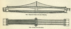
| Bridgemeister ID: | 1542 (added 2004-11-03) |
| Year Completed: | 1823 |
| Name: | (suspension bridge) |
| Location: | Réunion, France |
| Crossing: | Mat River |
| Principals: | Marc Brunel |
| References: | AAJ, ASB, CAB, MOS |
| Use: | Vehicular (two-lane) |
| Main Cables: | Chain (iron) |
| Suspended Spans: | 1 |
| Main Span: | 1 x 40.2 meters (131.75 feet) |
Notes:
- Réunion was known as "Isle of Bourbon" at this time.
- MOS: "These bridges were designed by Mr. Brunel, and executed in England, near Sheffield, where they were put together in January, 1823, before being sent out to the Isle de Bourbon."
- Built as part of same project as 1823 (suspension bridge) - Réunion, France.
| Bridgemeister ID: | 3250 (added 2019-11-16) |
| Year Completed: | 1824 |
| Name: | Delessert |
| Location: | Passy, Paris, France |
| Principals: | Benjamin Delessert |
| References: | GHD |
| Status: | Removed |
| Suspended Spans: | 1 |
| Main Span: | 1 x 52 meters (170.6 feet) |
Notes:
- GHD describes the interesting hybrid chain and cable suspension system of this bridge. GHD also notes the commonly available lithograph image of the Delessert bridge is factually inaccurate showing a cable system similar to the 1823 Saint Antoine bridge, not resembing the actual cable system of the Delessert bridge.
External Links:
1824: Galaure
Saint-Vallier, Drôme, France - Galaure River
| Bridgemeister ID: | 1824 (added 2005-05-30) |
| Year Completed: | 1824 |
| Name: | Galaure |
| Location: | Saint-Vallier, Drôme, France |
| Crossing: | Galaure River |
| Principals: | Seguin Brothers |
| References: | GHD, MOS |
| Status: | Collapsed, 1844 |
| Main Cables: | Wire (iron) |
| Suspended Spans: | 1 |
| Main Span: | 1 x 30 meters (98.4 feet) |
Notes:
- GHD: Built as an experimental bridge in preparation for the Tain-Tournon Bridge. Collapsed 1844.
- Sometimes "Galore".
- See 1825 Tain-Tournon - Tournon-sur-Rhône, Ardèche and Tain, Drôme, France.
External Links:
1825: Tain-Tournon
Tournon-sur-Rhône, Ardèche and Tain, Drôme, France - Rhône River
| Bridgemeister ID: | 378 (added before 2003) |
| Year Completed: | 1825 |
| Name: | Tain-Tournon |
| Location: | Tournon-sur-Rhône, Ardèche and Tain, Drôme, France |
| Crossing: | Rhône River |
| Principals: | Marc Seguin |
| References: | AAJ, ASB, BBR, BPF, GHD, LAB, MOS, PTS2, TTSB |
| Use: | Vehicular |
| Status: | Removed, 1965 |
| Main Cables: | Wire (iron) |
| Suspended Spans: | 2 |
| Main Spans: | 2 x 85 meters (278.88 feet) |
| Deck width: | 13.75 feet |
Notes:
- Often credited as being the first large wire suspension bridge in France (and elsewhere). Rebuilt 1847 as a footbridge. Removed 1965.
- Near 1849 Marc Seguin - Tournon-sur-Rhône, Ardèche and Tain-L'Hermitage, Drôme, France.
- Near 1958 Gustave Toursier - Tournon-sur-Rhône, Ardèche and Tain-L'Hermitage, Drôme, France.
External Links:
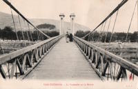
1826: Invalides
Paris, France - Seine River
| Bridgemeister ID: | 623 (added 2003-01-20) |
| Year Completed: | 1826 |
| Name: | Invalides |
| Location: | Paris, France |
| Crossing: | Seine River |
| Principals: | Claude Navier |
| References: | AAJ, MOS, PTS2 |
| Use: | Vehicular |
| Status: | Demolished, 1826 |
| Main Span: | 1 x 169.9 meters (557.5 feet) |
Notes:
- Failed when almost complete in 1826. MOS: "On the 6th of September, a water-pipe, which was laid in the ground on the side of the Champs Elysées, and came near the abutments on that side of the river, burst, and, softening the ground about the abutment, it gave way under the strain produced by the weight of the bridge."
- Replaced by 1829 Invalides (l'Allee-d'Antin) - Paris, France.
External Links:
1826: Jarnac
Jarnac, Charente, France - Charente River
| Bridgemeister ID: | 1729 (added 2005-04-06) |
| Year Completed: | 1826 |
| Name: | Jarnac |
| Location: | Jarnac, Charente, France |
| Crossing: | Charente River |
| Principals: | J. P. Quénot |
| References: | MOS |
| Use: | Vehicular |
| Status: | Removed |
| Main Cables: | Chain (iron) |
| Suspended Spans: | 1 |
| Main Span: | 1 x 70 meters (229.7 feet) |
| Deck width: | 7.75 meters |
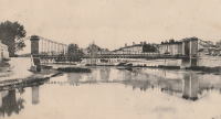
1827: Andance
Andance, Ardèche and Andancette, Drôme, France - Rhône River
| Bridgemeister ID: | 976 (added 2003-11-14) |
| Year Completed: | 1827 |
| Name: | Andance |
| Location: | Andance, Ardèche and Andancette, Drôme, France |
| Crossing: | Rhône River |
| Coordinates: | 45.242194 N 4.801638 E |
| Maps: | Acme, GeoHack, Google, OpenStreetMap |
| Principals: | Marc Seguin |
| References: | AAJ, ASB |
| Use: | Vehicular (one-lane) |
| Status: | In use (last checked: 2009) |
| Main Cables: | Wire (iron) |
| Suspended Spans: | 2 |
| Main Spans: | 2 |
Notes:
- Destroyed August 30, 1944. Rebuilt 1946.
External Links:
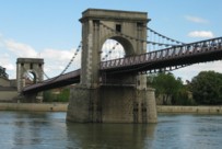
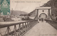
1827: L'île Barbe
Lyon, Métropole de Lyon, France - Saône River
| Bridgemeister ID: | 1535 (added 2004-10-31) |
| Year Completed: | 1827 |
| Name: | L'île Barbe |
| Location: | Lyon, Métropole de Lyon, France |
| Crossing: | Saône River |
| Coordinates: | 45.796883 N 4.83055 E |
| Maps: | Acme, GeoHack, Google, OpenStreetMap |
| Principals: | Favier |
| References: | AAJ, PQL, PTS2 |
| Use: | Vehicular (one-lane) |
| Status: | In use (last checked: 2005) |
| Main Cables: | Chain (iron) |
| Suspended Spans: | 2 |
| Main Spans: | 2 x 10² meters (334.66 feet) |
Notes:
- Originally built with iron chains. Later replaced with iron wire.
- Near 1831 Masaryk (Masarik, Mazarik, de la Gare) - Lyon vicinity, Métropole de Lyon, France.
External Links:
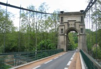
1828: Arcole
Paris, France - Seine River
| Bridgemeister ID: | 625 (added 2003-01-20) |
| Year Completed: | 1828 |
| Name: | Arcole |
| Also Known As: | de la Grève |
| Location: | Paris, France |
| Crossing: | Seine River |
| Principals: | Seguin Brothers |
| References: | AAJ, MOS, PTS2 |
| Status: | Replaced, 1854 |
| Main Cables: | Wire (iron) |
| Suspended Spans: | 2 |
| Main Spans: | 2 x 40.8 meters (133.86 feet) |
| Deck width: | 11.48 feet |
External Links:
1828: Auvers
Auvers-sur-Oise and Méry-sur-Oise, Val-d'Oise, France - Oise River
| Bridgemeister ID: | 1717 (added 2005-04-05) |
| Year Completed: | 1828 |
| Name: | Auvers |
| Location: | Auvers-sur-Oise and Méry-sur-Oise, Val-d'Oise, France |
| Crossing: | Oise River |
| Status: | Failed, 1887 |
Notes:
- Destroyed 1870. Rebuilt 1873.
External Links:
1828: Doux
St Jean de Muzols and Tournon-sur-Rhône, Ardèche, France - Doux River
| Bridgemeister ID: | 1984 (added 2005-12-02) |
| Year Completed: | 1828 |
| Name: | Doux |
| Location: | St Jean de Muzols and Tournon-sur-Rhône, Ardèche, France |
| Crossing: | Doux River |
| Coordinates: | 45.074384 N 4.816741 E |
| Maps: | Acme, GeoHack, Google, OpenStreetMap |
| Status: | Removed, 1857 |
Notes:
External Links:
1828: Sablons
Sablons, Isère and Serrières, Ardèche, France - Rhône River
| Bridgemeister ID: | 890 (added 2003-09-06) |
| Year Completed: | 1828 |
| Name: | Sablons |
| Location: | Sablons, Isère and Serrières, Ardèche, France |
| Crossing: | Rhône River |
| Principals: | Marc Seguin |
| References: | AAJ, ASB |
| Use: | Vehicular |
| Status: | Replaced, 1933 |
| Main Cables: | Wire (iron) |
| Main Spans: | 2 x 101 meters (331.38 feet) |
| Deck width: | 13.12 feet |
Notes:
External Links:
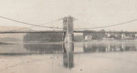
1828: Sassenage
Sassenage and Grenoble, Isère, France - Drac River
| Bridgemeister ID: | 1728 (added 2005-04-06) |
| Year Completed: | 1828 |
| Name: | Sassenage |
| Location: | Sassenage and Grenoble, Isère, France |
| Crossing: | Drac River |
| Use: | Vehicular |
| Status: | Replaced, 1938 |
| Main Cables: | Chain (iron) |
| Suspended Spans: | 1 |
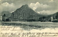
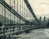
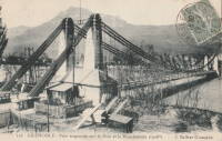
1829: Argentat
Argentat, Corrèze, France - Dordogne River
| Bridgemeister ID: | 627 (added 2003-01-20) |
| Year Completed: | 1829 |
| Name: | Argentat |
| Also Known As: | Marie |
| Location: | Argentat, Corrèze, France |
| Crossing: | Dordogne River |
| Principals: | L. T. Vicat |
| References: | AAJ, MOS, PTS2 |
| Use: | Vehicular, with walkway |
| Status: | Replaced, 1903 |
| Main Cables: | Wire (iron) |
| Suspended Spans: | 1 |
| Main Span: | 1 x 100 meters (328 feet) |
External Links:
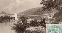
1829: Beaucaire
Beaucaire, Gard and Tarascon, Bouches-du-Rhône, France - Rhône River
| Bridgemeister ID: | 626 (added 2003-01-20) |
| Year Completed: | 1829 |
| Name: | Beaucaire |
| Location: | Beaucaire, Gard and Tarascon, Bouches-du-Rhône, France |
| Crossing: | Rhône River |
| Principals: | Jules Seguin, Joseph Chaley |
| References: | AAJ, ASB, GHD, PTS2 |
| Use: | Vehicular |
| Status: | Destroyed, August 6, 1944 |
| Main Cables: | Wire (iron) |
| Suspended Spans: | 4 |
| Main Spans: | 2 x 120 meters (393.72 feet) |
| Side Spans: | 2 x 93.6 meters (307.1 feet) |
Notes:
- 1887: Flooring failed.
- 1944: Bombed by Allied Forces, August 6.
External Links:
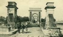
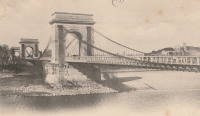
| Bridgemeister ID: | 3217 (added 2019-11-11) |
| Year Completed: | 1829 |
| Name: | Chazey |
| Location: | Chazey-sur-Ain, Ain, France |
| Crossing: | Ain River |
| Principals: | Joseph Chaley, Jules Seguin, Marc Seguin |
| Use: | Vehicular |
| Status: | Destroyed, December, 1944 |
| Main Cables: | Wire (iron) |
| Suspended Spans: | 1 |
| Main Span: | 1 x 125 meters (410.1 feet) |
External Links:
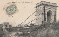
1829: Invalides
Paris, France - Seine River
| Bridgemeister ID: | 633 (added 2003-01-20) |
| Year Completed: | 1829 |
| Name: | Invalides |
| Also Known As: | l'Allee-d'Antin |
| Location: | Paris, France |
| Crossing: | Seine River |
| Principals: | Marie Fortuné de Vergès, Ferdinand Bayard de la Vingtrie |
| References: | AAJ, MOS, PTS2 |
| Use: | Vehicular, with walkway |
| Status: | Replaced, 1855 |
| Main Cables: | Chain (iron) |
| Main Span: | 1 x 72.1 meters (236.5 feet) |
| Deck width: | 25.6 feet |
Notes:
- Replaced 1826 Invalides - Paris, France.
External Links:
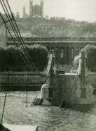
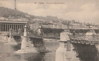
1829: Palais de Justice
Lyon, Métropole de Lyon, France - Saône River
| Bridgemeister ID: | 546 (added before 2003) |
| Year Completed: | 1829 |
| Name: | Palais de Justice |
| Location: | Lyon, Métropole de Lyon, France |
| Crossing: | Saône River |
| Principals: | Seguin Brothers |
| References: | PQL |
| Use: | Vehicular |
| Status: | Replaced, 1972 |
| Main Cables: | Wire (iron) |
Notes:
- Damaged by flood, 1840. Rebuilt. Bombed, 1944. Repaired, 1945. Location now occupied by a cable-stayed footbridge, completed 1986.
External Links:
1829: Port-Sainte-Foy
Port-Sainte-Foy-et-Ponchapt, Dordogne and Sainte-Foy-la-Grande, Gironde, France - Dordogne River
| Bridgemeister ID: | 7351 (added 2022-10-22) |
| Year Completed: | 1829 |
| Name: | Port-Sainte-Foy |
| Location: | Port-Sainte-Foy-et-Ponchapt, Dordogne and Sainte-Foy-la-Grande, Gironde, France |
| Crossing: | Dordogne River |
| Coordinates: | 44.842132 N 0.211552 E |
| Maps: | Acme, GeoHack, Google, OpenStreetMap |
| Use: | Vehicular (one-lane) |
| Status: | Replaced |
| Main Cables: | Wire |
| Suspended Spans: | 2 |
| Main Spans: | 2 |
Notes:
- Replaced by 1897 Port-Sainte-Foy - Port-Sainte-Foy-et-Ponchapt, Dordogne and Sainte-Foy-la-Grande, Gironde, France.
External Links:

| Bridgemeister ID: | 7574 (added 2023-04-21) |
| Year Completed: | 1829 |
| Name: | Thoirette |
| Location: | Thoirette, Jura and Ain, France |
| Crossing: | Ain River |
| Coordinates: | 46.268283 N 5.536277 E |
| Maps: | Acme, GeoHack, Google, OpenStreetMap |
| References: | AGP |
| Status: | Replaced |
| Suspended Spans: | 1 |
Notes:
- Replaced by 1858 Thoirette - Thoirette, Jura and Ain, France.
External Links:
1829: Vienne
Vienne, Isère and Sainte-Colombe, Rhône, France - Rhône River
| Bridgemeister ID: | 977 (added 2003-11-15) |
| Year Completed: | 1829 |
| Name: | Vienne |
| Location: | Vienne, Isère and Sainte-Colombe, Rhône, France |
| Crossing: | Rhône River |
| Coordinates: | 45.524867 N 4.87035 E |
| Maps: | Acme, GeoHack, Google, OpenStreetMap |
| Principals: | Marc Seguin |
| References: | AAJ, ASB |
| Use: | Vehicular (one-lane) |
| Status: | Restricted to foot traffic (last checked: 2005) |
| Main Cables: | Wire (iron) |
| Suspended Spans: | 2 |
| Main Spans: | 2 |
Notes:
- Damaged by flood in 1840. Rebuilt.
External Links:
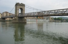
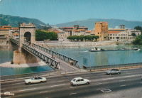
1830: Bourg-Saint-Andéol
Bourg-Saint-Andéol, Ardèche, France - Rhône River
| Bridgemeister ID: | 1719 (added 2005-04-05) |
| Year Completed: | 1830 |
| Name: | Bourg-Saint-Andéol |
| Location: | Bourg-Saint-Andéol, Ardèche, France |
| Crossing: | Rhône River |
| References: | AAJ |
| Use: | Vehicular |
| Status: | Replaced, 1971 |
| Main Cables: | Wire (iron) |
| Suspended Spans: | 3 |
| Main Spans: | 1 x 88.9 meters (291.7 feet), 1 x 85.7 meters (281.2 feet), 1 x 87 meters (285.4 feet) |
Notes:
- 1944: Heavily damaged.
- 1945: Repaired and reopened.
- Similar to Saint-Vallier - Saint-Vallier, Drôme, France.
External Links:

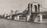
1830: Feurs
Feurs, Loire, France - Loire River
| Bridgemeister ID: | 1543 (added 2004-11-03) |
| Year Completed: | 1830 |
| Name: | Feurs |
| Location: | Feurs, Loire, France |
| Crossing: | Loire River |
| Principals: | Jules Seguin |
| References: | GHD |
| Use: | Vehicular |
| Status: | Demolished, 1925 |
| Main Cables: | Wire (iron) |
| Suspended Spans: | 2 |
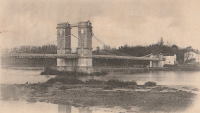
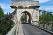
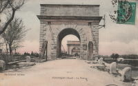
1830: Fourques
Fourques, Gard and Arles, Bouches-du-Rhône, France - Petit Rhône River
| Bridgemeister ID: | 1040 (added 2003-12-06) |
| Year Completed: | 1830 |
| Name: | Fourques |
| Location: | Fourques, Gard and Arles, Bouches-du-Rhône, France |
| Crossing: | Petit Rhône River |
| Coordinates: | 43.688722 N 4.613472 E |
| Maps: | Acme, GeoHack, Google, OpenStreetMap |
| Principals: | Seguin Brothers |
| References: | BPF |
| Use: | Vehicular (one-lane) |
| Status: | In use (last checked: 2020) |
| Main Cables: | Wire (iron) |
| Suspended Spans: | 2 |
| Main Spans: | 2 |
External Links:
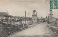
1830: Guîtres
Guîtres, Gironde, France - Isle River
| Bridgemeister ID: | 2072 (added 2006-06-07) |
| Year Completed: | 1830 |
| Name: | Guîtres |
| Location: | Guîtres, Gironde, France |
| Crossing: | Isle River |
| Use: | Vehicular |
| Status: | Removed |
| Main Cables: | Wire (iron) |
| Suspended Spans: | 2 |
| Main Spans: | 2 |
External Links:
| Bridgemeister ID: | 8507 (added 2024-03-23) |
| Year Completed: | 1830 |
| Name: | La Madeleine |
| Location: | La Madeleine, Faycelles, Lot and Causse-et-Diège, Aveyron, France |
| Crossing: | Lot River |
| Coordinates: | 44.557528 N 2.026278 E |
| Maps: | Acme, GeoHack, Google, OpenStreetMap |
| Use: | Vehicular |
| Status: | Removed |
| Main Cables: | Wire (iron) |
| Suspended Spans: | 2 |
| Main Spans: | 2 |
External Links:
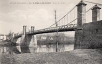
1830: Parentignat
Parentignat and Issoire, Puy-de-Dôme, France - Allier River
| Bridgemeister ID: | 1568 (added 2004-11-28) |
| Year Completed: | 1830 |
| Name: | Parentignat |
| Also Known As: | Orbeil |
| Location: | Parentignat and Issoire, Puy-de-Dôme, France |
| Crossing: | Allier River |
| Coordinates: | 45.543960 N 3.276289 E |
| Maps: | Acme, GeoHack, Google, OpenStreetMap |
| References: | AAJ, BPF |
| Use: | Vehicular (one-lane) |
| Status: | Closed (last checked: 2019) |
| Main Cables: | Wire (iron) |
| Suspended Spans: | 1 |
| Main Span: | 1 x 98.4 meters (322.8 feet) |
Notes:
- Bypassed, 1973.
External Links:
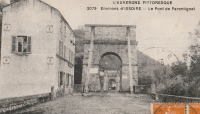
1830: Remoulins
Remoulins, Gard, France - Gardon River
| Bridgemeister ID: | 946 (added 2003-10-30) |
| Year Completed: | 1830 |
| Name: | Remoulins |
| Location: | Remoulins, Gard, France |
| Crossing: | Gardon River |
| Coordinates: | 43.936944 N 4.557333 E |
| Maps: | Acme, GeoHack, Google, OpenStreetMap |
| Principals: | Marc Seguin |
| References: | BPF |
| Use: | Vehicular |
| Status: | Only towers remain, since 1938 (last checked: 2002) |
| Main Cables: | Wire (iron) |
| Suspended Spans: | 1 |
| Main Span: | 1 x 120 meters (393.7 feet) |
Notes:
- Demolished, 1938. Only towers remain.
- Replaced by 1935 Remoulins - Remoulins, Gard, France.
External Links:
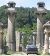
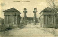
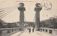
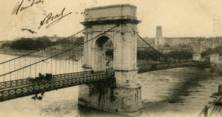
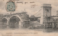
1830: Valence
Valence, Drôme and Guilherand-Granges, Ardèche, France - Rhône River
| Bridgemeister ID: | 631 (added 2003-01-20) |
| Year Completed: | 1830 |
| Name: | Valence |
| Location: | Valence, Drôme and Guilherand-Granges, Ardèche, France |
| Crossing: | Rhône River |
| Coordinates: | 44.932022 N 4.882951 E |
| Maps: | Acme, GeoHack, Google, OpenStreetMap |
| Principals: | Marc Seguin |
| References: | ASB, PTS2 |
| Use: | Vehicular |
| Status: | Removed |
| Main Cables: | Wire (iron) |
| Suspended Spans: | 2 |
| Main Spans: | 2 x 110 meters (360.9 feet) |
| Deck width: | 7 meters |
Notes:
- Two side spans meeting at a single midstream tower.
- Later at same location 1949 (footbridge) - Valence, Drôme and Guilherand-Granges, Ardèche, France.
External Links:
1830: Vic-sur-Aisne
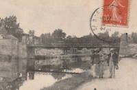
Vic-sur-Aisne, Aisne, France - Aisne River
| Bridgemeister ID: | 7368 (added 2022-11-05) |
| Year Completed: | 1830 |
| Name: | Vic-sur-Aisne |
| Location: | Vic-sur-Aisne, Aisne, France |
| Crossing: | Aisne River |
| Status: | Removed, 1898 |
| Suspended Spans: | 1 |
External Links:
1831: Aguado
Ris-Orangis, Essonne, France - Seine River
| Bridgemeister ID: | 4925 (added 2020-07-27) |
| Year Completed: | 1831 |
| Name: | Aguado |
| Location: | Ris-Orangis, Essonne, France |
| Crossing: | Seine River |
| References: | AAJ |
| Status: | Destroyed, 1870 |
| Main Cables: | Chain (iron) |
| Suspended Spans: | 1 |
Notes:
- Destroyed to slow advancing Prussian troops during the Franco-Prussian war.
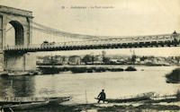
1831: Andrézieux
Andrézieux, Loire, France - Loire River
| Bridgemeister ID: | 978 (added 2003-11-15) |
| Year Completed: | 1831 |
| Name: | Andrézieux |
| Location: | Andrézieux, Loire, France |
| Crossing: | Loire River |
| Principals: | Seguin Brothers |
| Use: | Vehicular |
| Status: | Destroyed, October 17, 1907 |
| Main Cables: | Wire (iron) |
Notes:
- Badly wrecked by flood, October 17, 1907. Replaced, 1910.
- Near 1851 Saint-Just-sur-Loire - Saint-Just-sur-Loire and Saint-Just-Saint-Rambert, Loire, France.
External Links:
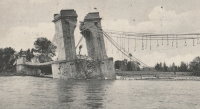
1831: Beauregard
Beauregard, Ain, France - Saône River
| Bridgemeister ID: | 1713 (added 2005-04-03) |
| Year Completed: | 1831 |
| Name: | Beauregard |
| Location: | Beauregard, Ain, France |
| Crossing: | Saône River |
| Coordinates: | 46.002033 N 4.749783 E |
| Maps: | Acme, GeoHack, Google, OpenStreetMap |
| Use: | Vehicular (one-lane) |
| Status: | Restricted to foot traffic (last checked: 2017) |
| Main Cables: | Wire (iron) |
| Suspended Spans: | 2 |
| Main Spans: | 2 |
External Links:
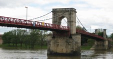
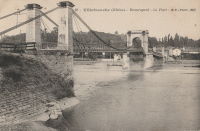
1831: Belleville
Belleville, Rhône and Ain, France - Saône River
| Bridgemeister ID: | 979 (added 2003-11-15) |
| Year Completed: | 1831 |
| Name: | Belleville |
| Also Known As: | Belleville-sur-Saône |
| Location: | Belleville, Rhône and Ain, France |
| Crossing: | Saône River |
| Use: | Vehicular |
| Suspended Spans: | 2 |
| Main Spans: | 2 |

1831: Bry-sur-Marne
Bry-sur-Marne, Val-de-Marne, France - Marne River
| Bridgemeister ID: | 1668 (added 2005-03-20) |
| Year Completed: | 1831 |
| Name: | Bry-sur-Marne |
| Location: | Bry-sur-Marne, Val-de-Marne, France |
| Crossing: | Marne River |
| Principals: | Jules Seguin |
| References: | AAJ, PTS2 |
| Use: | Vehicular |
| Status: | Destroyed, c.1870 |
| Main Cables: | Wire (iron) |
| Suspended Spans: | 1 |
| Main Span: | 1 x 76 meters (249.43 feet) |
External Links:
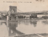
1831: Condrieu
Condrieu, Rhône and Les Roches-de-Condrieu, Isère, France - Rhône River
| Bridgemeister ID: | 981 (added 2003-11-15) |
| Year Completed: | 1831 |
| Name: | Condrieu |
| Location: | Condrieu, Rhône and Les Roches-de-Condrieu, Isère, France |
| Crossing: | Rhône River |
| Coordinates: | 45.457394 N 4.768694 E |
| Maps: | Acme, GeoHack, Google, OpenStreetMap |
| Use: | Vehicular |
| Status: | Replaced, 1935 |
| Main Cables: | Wire (iron) |
| Suspended Spans: | 2 |
| Main Spans: | 1 x 96 meters (315 feet), 1 x 96.8 meters (317.6 feet) |
Notes:
- Appears to have been replaced with another suspension bridge of similar proportions.
- Single midstream tower.
- Replaced by 1935 Condrieu - Condrieu, Rhône and Les Roches-de-Condrieu, Isère, France.
External Links:
1831: Decize
Decize, Nièvre, France - Loire River
| Bridgemeister ID: | 1725 (added 2005-04-05) |
| Year Completed: | 1831 |
| Name: | Decize |
| Location: | Decize, Nièvre, France |
| Crossing: | Loire River |
| Use: | Vehicular |
| Status: | Replaced, 1904 |
| Main Cables: | Wire (iron) |
| Suspended Spans: | 2 |
| Main Spans: | 2 |
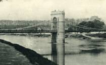

1831: La Feuillée
Lyon, Métropole de Lyon, France - Saône River
| Bridgemeister ID: | 1520 (added 2004-10-10) |
| Year Completed: | 1831 |
| Name: | La Feuillée |
| Location: | Lyon, Métropole de Lyon, France |
| Crossing: | Saône River |
| Coordinates: | 45.766642 N 4.829746 E |
| Maps: | Acme, GeoHack, Google, OpenStreetMap |
| References: | PQL |
| Use: | Vehicular, with walkway |
| Status: | Demolished, 1910 |
| Main Cables: | Wire (iron) |
| Suspended Spans: | 1 |
| Main Span: | 1 x 67 meters (219.8 feet) estimated |
| Deck width: | 7 meters |
Notes:
- Damaged by flood 1840, repaired 1841.
- Near 1832 Saint-Vincent - Lyon, Métropole de Lyon, France.
- Replaced by 1910 La Feuillée - Lyon, Métropole de Lyon, France.
External Links:
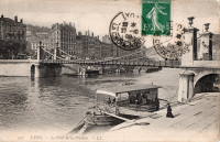
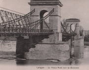
1831: Langon
Langon, Aquitaine, France - Garonne River
| Bridgemeister ID: | 1732 (added 2005-04-06) |
| Year Completed: | 1831 |
| Name: | Langon |
| Location: | Langon, Aquitaine, France |
| Crossing: | Garonne River |
| References: | PTS2 |
| Use: | Vehicular |
| Status: | Removed |
| Main Cables: | Chain (iron) |
| Suspended Spans: | 3 |
| Main Span: | 1 |
| Side Spans: | 2 |
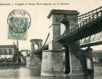
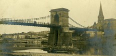
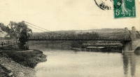
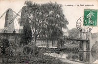
1831: Luzancy
Luzancy, Seine-et-Marne, France - Marne River
| Bridgemeister ID: | 4919 (added 2020-07-26) |
| Year Completed: | 1831 |
| Name: | Luzancy |
| Location: | Luzancy, Seine-et-Marne, France |
| Crossing: | Marne River |
| References: | AAJ |
| Use: | Vehicular |
| Status: | Replaced, 1925 |
| Main Cables: | Rod (iron) |
| Main Span: | 1 x 55 meters (180.4 feet) |
Notes:
- Original iron rod cables replaced by an Arnodin cable system, 1891. Replaced in 1925 with a "rigid suspension bridge of reinforced concrete".
- Replaced by 1925 Luzancy - Luzancy, Seine-et-Marne, France.
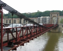
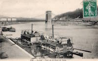
1831: Masaryk
Lyon vicinity, Métropole de Lyon, France - Saône River
| Bridgemeister ID: | 543 (added before 2003) |
| Year Completed: | 1831 |
| Name: | Masaryk |
| Also Known As: | Masarik, Mazarik, de la Gare |
| Location: | Lyon vicinity, Métropole de Lyon, France |
| Crossing: | Saône River |
| Coordinates: | 45.778267 N 4.809017 E |
| Maps: | Acme, GeoHack, Google, OpenStreetMap |
| References: | PQL |
| Use: | Vehicular (one-lane), with walkway |
| Status: | Restricted to foot traffic (last checked: 2022) |
| Main Cables: | Wire (iron) |
| Suspended Spans: | 2 |
| Main Spans: | 2 x 85.2 meters (279.5 feet) |
| Deck width: | 6.5 meters |
Notes:
- Bombed, 1944. Reopened 1945, but not fully restored until 1946.
- This bridge has been referenced by many spellings of "Masaryk", but the sign posted at the actual bridge reads "Masaryk".
- Next to 1844 Mouton - Lyon, Métropole de Lyon, France.
- Near 1827 L'île Barbe - Lyon, Métropole de Lyon, France.
External Links:
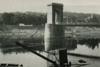
1831: Mirabeau
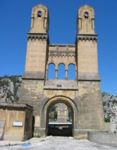
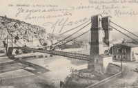
Mirabeau, Vaucluse and Bouches-du-Rhône, France - Durance River
| Bridgemeister ID: | 982 (added 2003-11-15) |
| Year Completed: | 1831 |
| Name: | Mirabeau |
| Location: | Mirabeau, Vaucluse and Bouches-du-Rhône, France |
| Crossing: | Durance River |
| Coordinates: | 43.68945 N 5.668267 E |
| Maps: | Acme, GeoHack, Google, OpenStreetMap |
| Principals: | Jean-François-Theophilus Sauzet |
| References: | AAJ, BPF |
| Use: | Vehicular |
| Status: | Only towers remain (last checked: 2005) |
| Suspended Spans: | 1 |
| Main Span: | 1 x 150 meters (492.1 feet) |
| Deck width: | 5.5 meters |
Notes:
- The towers from the older of the two Mirabeau suspension bridges are visible alongside the current crossing.
- Damaged by flood, 1843. Rebuilt.
- Replaced by 1935 Mirabeau - Mirabeau, Vaucluse and Bouches-du-Rhône, France. Unsure if this was an immediate replacement.
External Links:
1832: Bercy
Paris, France - Seine River
| Bridgemeister ID: | 1738 (added 2005-04-19) |
| Year Completed: | 1832 |
| Name: | Bercy |
| Location: | Paris, France |
| Crossing: | Seine River |
| Principals: | Marie Fortuné de Vergès |
| References: | AAJ |
| Use: | Vehicular, with walkway |
| Status: | Replaced, 1860's |
| Main Cables: | Eyebar (iron) |
| Suspended Spans: | 3 |
| Main Span: | 1 x 44 meters (144.36 feet) |
| Side Spans: | 2 x 45 meters (147.64 feet) |
| Deck width: | 26.25 feet |
External Links:
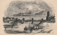
1832: L'Ile-Bouchard
Saint Maurice, L'Île-Bouchard and Saint-Gilles, L'Île-Bouchard, Indre-et-Loire, France - Vienne River
| Bridgemeister ID: | 1605 (added 2005-02-06) |
| Year Completed: | 1832 |
| Name: | L'Ile-Bouchard |
| Location: | Saint Maurice, L'Île-Bouchard and Saint-Gilles, L'Île-Bouchard, Indre-et-Loire, France |
| Crossing: | Vienne River |
| Coordinates: | 47.119399 N 0.424522 E |
| Maps: | Acme, GeoHack, Google, OpenStreetMap |
| References: | AAJ |
| Use: | Vehicular (one-lane), with walkway |
| Status: | Destroyed, 1944 |
| Main Cables: | Wire (iron) |
| Suspended Spans: | 2 |
| Main Span: | 1 x 80 meters (262.48 feet) |
| Deck width: | 13.12 feet |
Notes:
- One of two bridges separated by a short distance across an island.
- Connects to 1832 L'Ile-Bouchard - Saint Maurice, L'Île-Bouchard and Saint-Gilles, L'Île-Bouchard, Indre-et-Loire, France.
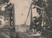
1832: L'Ile-Bouchard
Saint Maurice, L'Île-Bouchard and Saint-Gilles, L'Île-Bouchard, Indre-et-Loire, France - Vienne River
| Bridgemeister ID: | 6609 (added 2021-09-05) |
| Year Completed: | 1832 |
| Name: | L'Ile-Bouchard |
| Location: | Saint Maurice, L'Île-Bouchard and Saint-Gilles, L'Île-Bouchard, Indre-et-Loire, France |
| Crossing: | Vienne River |
| Coordinates: | 47.120994 N 0.425181 E |
| Maps: | Acme, GeoHack, Google, OpenStreetMap |
| References: | AAJ |
| Use: | Vehicular (one-lane), with walkway |
| Status: | Destroyed, 1944 |
| Main Cables: | Wire (iron) |
| Suspended Spans: | 1 |
| Main Span: | 1 x 85 meters (278.89 feet) |
| Deck width: | 13.12 feet |
Notes:
- One of two bridges separated by a short distance across an island.
- Connects to 1832 L'Ile-Bouchard - Saint Maurice, L'Île-Bouchard and Saint-Gilles, L'Île-Bouchard, Indre-et-Loire, France.
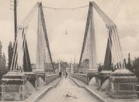
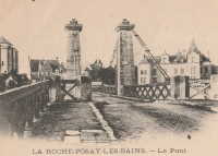
1832: La Roche-Posay
La Roche-Posay, Vienne and Indre-et-Loire, France - Creuse River
| Bridgemeister ID: | 1601 (added 2005-02-06) |
| Year Completed: | 1832 |
| Name: | La Roche-Posay |
| Also Known As: | La Roche-Posay-les-Bains |
| Location: | La Roche-Posay, Vienne and Indre-et-Loire, France |
| Crossing: | Creuse River |
| Use: | Vehicular |
| Status: | Replaced, 1937 |
| Main Cables: | Wire (iron) |
| Suspended Spans: | 1 |
Notes:

1832: Les Vans
Les Vans and Les Assions, Ardèche, France - Chassezac River
| Bridgemeister ID: | 2415 (added 2007-12-31) |
| Year Completed: | 1832 |
| Name: | Les Vans |
| Location: | Les Vans and Les Assions, Ardèche, France |
| Crossing: | Chassezac River |
| Coordinates: | 44.416248 N 4.155727 E |
| Maps: | Acme, GeoHack, Google, OpenStreetMap |
| Use: | Vehicular |
| Status: | Removed |
| Suspended Spans: | 1 |
External Links:

1832: Neuville-sur-Saône
Neuville-sur-Saône and Albigny-sur-Saône, Métropole de Lyon, France - Saône River
| Bridgemeister ID: | 1737 (added 2005-04-19) |
| Year Completed: | 1832 |
| Name: | Neuville-sur-Saône |
| Location: | Neuville-sur-Saône and Albigny-sur-Saône, Métropole de Lyon, France |
| Crossing: | Saône River |
| Coordinates: | 45.876840 N 4.836934 E |
| Maps: | Acme, GeoHack, Google, OpenStreetMap |
| Use: | Vehicular |
| Status: | Removed, 1934 |
| Suspended Spans: | 2 |
| Main Spans: | 2 |
External Links:
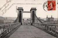
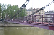
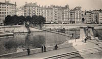
1832: Saint-Vincent
Lyon, Métropole de Lyon, France - Saône River
| Bridgemeister ID: | 1098 (added 2004-01-02) |
| Year Completed: | 1832 |
| Name: | Saint-Vincent |
| Location: | Lyon, Métropole de Lyon, France |
| Crossing: | Saône River |
| Coordinates: | 45.767583 N 4.827983 E |
| Maps: | Acme, GeoHack, Google, OpenStreetMap |
| References: | PQL |
| Use: | Footbridge |
| Status: | In use (last checked: 2022) |
| Main Cables: | Wire (iron) |
| Suspended Spans: | 1 |
Notes:
- Damaged by flood, 1840.
- Bridge appears to currently be suspended from a combination of wire rope and rigid rods.
- Near 1831 La Feuillée - Lyon, Métropole de Lyon, France.
External Links:
1832: Vailly-sur-Aisne
Vailly-sur-Aisne, Aisne, France - Aisne River
| Bridgemeister ID: | 6614 (added 2021-09-05) |
| Year Completed: | 1832 |
| Name: | Vailly-sur-Aisne |
| Location: | Vailly-sur-Aisne, Aisne, France |
| Crossing: | Aisne River |
| Use: | Vehicular |
| Status: | Destroyed, 1870 |
| Suspended Spans: | 1 |
Notes:
- 1870; Destroyed to slow advancing troops during the Franco-Prussian war.
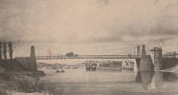
1832: Vals-les-bains
Vals-les-bains and Labégude, Ardèche, France - Ardèche River
| Bridgemeister ID: | 1761 (added 2005-04-22) |
| Year Completed: | 1832 |
| Name: | Vals-les-bains |
| Location: | Vals-les-bains and Labégude, Ardèche, France |
| Crossing: | Ardèche River |
| References: | AAJ |
| Use: | Vehicular |
| Main Cables: | Wire (iron) |
Notes:
- AAJ notes the contract was let in late 1831 and guesses at 1833 as the year of completion. 1832 is more likely given the rate at which these early iron wire French bridges were constructed.
1833: Chauvigny
Chauvigny, Vienne, France - Vienne River
1833: Collias
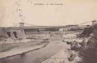
Collias, Gard, France - Gardon River
| Bridgemeister ID: | 1721 (added 2005-04-05) |
| Year Completed: | 1833 |
| Name: | Collias |
| Also Known As: | Louis-Philippe |
| Location: | Collias, Gard, France |
| Crossing: | Gardon River |
| Coordinates: | 43.953224 N 4.482269 E |
| Maps: | Acme, GeoHack, Google, OpenStreetMap |
| Use: | Vehicular |
| Status: | Removed |
| Main Cables: | Wire |
| Suspended Spans: | 1 |
| Main Span: | 1 |
External Links:
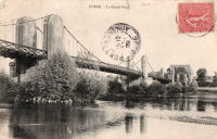
1833: Cosne-sur-Loire
Cosne-sur-Loire, Nièvre and Boulleret, Cher, France - Loire River
| Bridgemeister ID: | 1595 (added 2005-02-06) |
| Year Completed: | 1833 |
| Name: | Cosne-sur-Loire |
| Location: | Cosne-sur-Loire, Nièvre and Boulleret, Cher, France |
| Crossing: | Loire River |
| Coordinates: | 47.411396 N 2.918450 E |
| Maps: | Acme, GeoHack, Google, OpenStreetMap |
| References: | AAJ |
| Use: | Vehicular |
| Status: | Replaced, 1928 |
| Main Cables: | Chain (iron) |
Notes:
- The longer of two suspension bridges separated by a short distance, one over the large branch of the Loire and one over the small branch of the Loire where the river flows around an island.
- Similar to 1846 Mallemort - Mallemort, Bouches-du-Rhône and Mérindol, Vaucluse, France.
- Near 1833 Petit - Cosne-sur-Loire, Nièvre and Boulleret, Cher, France.
- Later at same location 1959 Cosne-sur-Loire - Cosne-Cours-sur-Loire, Nièvre and Cher, France.

1833: Coubon
Coubon and Volhac, Haute-Loire, France - Loire River
| Bridgemeister ID: | 1723 (added 2005-04-05) |
| Year Completed: | 1833 |
| Name: | Coubon |
| Location: | Coubon and Volhac, Haute-Loire, France |
| Crossing: | Loire River |
| Use: | Vehicular |
| Status: | Destroyed, 1866 |
| Main Cables: | Wire (iron) |
| Suspended Spans: | 1 |
Notes:
- Destroyed by flood, 1866.
- Replaced by 1871 Coubon - Coubon and Volhac, Haute-Loire, France.
1833: La Sône
La Sône, Isère, France - Isère River
| Bridgemeister ID: | 1730 (added 2005-04-06) |
| Year Completed: | 1833 |
| Name: | La Sône |
| Location: | La Sône, Isère, France |
| Crossing: | Isère River |
| Coordinates: | 45.109403 N 5.276853 E |
| Maps: | Acme, GeoHack, Google, OpenStreetMap |
| References: | AAJ |
| Use: | Vehicular, with walkway |
| Status: | Derelict (last checked: 2020) |
| Main Cables: | Wire (iron) |
| Suspended Spans: | 1 |
| Main Span: | 1 x 92 meters (301.85 feet) |
| Deck width: | 14.76 feet |
Notes:
- Towers and cables remain (as of 2020), though possibly from a replacement structure built later in the 1800s.
- Near La Sône - La Sône, Isère, France.
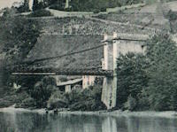
1833: Le Veurdre
Le Veurdre, Allier and Saint-Pierre-le-Moutier, Nièvre, France - Allier River
| Bridgemeister ID: | 2031 (added 2006-04-22) |
| Year Completed: | 1833 |
| Name: | Le Veurdre |
| Location: | Le Veurdre, Allier and Saint-Pierre-le-Moutier, Nièvre, France |
| Crossing: | Allier River |
| Coordinates: | 46.758333 N 3.049167 E |
| Maps: | Acme, GeoHack, Google, OpenStreetMap |
| Use: | Vehicular |
| Status: | Removed |
| Main Cables: | Wire (iron) |
| Suspended Spans: | 3 |
| Main Spans: | 3 |
Notes:
- Sometimes confused with the Allier River suspension bridges closer to Mornay-sur-Allier, the Pont du Veurdre was located at (or near) the alignment indicated by the coordinates here.
- See 1840 Mornay-sur-Allier - Mornay-sur-Allier, Cher and St-Pierre-le-Moûtier, Nièvre, France.
External Links:
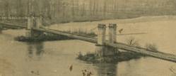
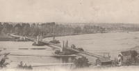
1833: Longues
Longues, Vic-le-Comte and Les Martres-de-Veyre, Puy-de-Dôme, France - Allier River
| Bridgemeister ID: | 1759 (added 2005-04-22) |
| Year Completed: | 1833 |
| Name: | Longues |
| Location: | Longues, Vic-le-Comte and Les Martres-de-Veyre, Puy-de-Dôme, France |
| Crossing: | Allier River |
| References: | AAJ |
| Use: | Vehicular |
| Status: | Replaced |
| Main Cables: | Chain (iron) |
| Suspended Spans: | 1 |
| Main Span: | 1 x 100 meters (328.1 feet) |
| Deck width: | 14.11 feet |
Notes:
- AAJ notes that this bridge collapsed during load testing, 1832. Another accident occurred when a hanger failed, December 6, 1832. The bridge opened February 1, 1833.
- Replaced by 1857 Longues - Longues, Vic-le-Comte and Les Martres-de-Veyre, Puy-de-Dôme, France.
1833: Petit
Cosne-sur-Loire, Nièvre and Boulleret, Cher, France - Loire River
| Bridgemeister ID: | 7156 (added 2022-06-25) |
| Year Completed: | 1833 |
| Name: | Petit |
| Location: | Cosne-sur-Loire, Nièvre and Boulleret, Cher, France |
| Crossing: | Loire River |
| Coordinates: | 47.411173 N 2.908176 E |
| Maps: | Acme, GeoHack, Google, OpenStreetMap |
| Use: | Vehicular |
| Status: | Removed |
| Main Cables: | Chain (iron) |
| Suspended Spans: | 2 |
| Main Spans: | 2 |
Notes:
- Known as the "Petit Pont", crossed a small arm of the Loire just west of the much longer Cosne-sur-Loire suspension bridge across the main channel of the Loire.
- Near 1833 Cosne-sur-Loire - Cosne-sur-Loire, Nièvre and Boulleret, Cher, France.
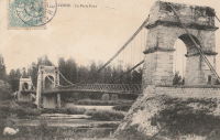
1833: Tonneins
Tonneins, Lot-et-Garonne, France - Garonne River
| Bridgemeister ID: | 1760 (added 2005-04-22) |
| Year Completed: | 1833 |
| Name: | Tonneins |
| Location: | Tonneins, Lot-et-Garonne, France |
| Crossing: | Garonne River |
| References: | AAJ |
| Use: | Vehicular (one-lane) |
| Status: | Removed |
| Main Cables: | Wire (iron) |
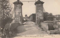
1833: Vichy
Vichy and Bellerive-sur-Allier, Allier, France - Allier River
| Bridgemeister ID: | 1762 (added 2005-04-22) |
| Year Completed: | 1833 |
| Name: | Vichy |
| Location: | Vichy and Bellerive-sur-Allier, Allier, France |
| Crossing: | Allier River |
| References: | AAJ |
| Use: | Vehicular |
| Status: | Replaced, 1870 |

1834: Bretenoux
Bretenoux and Biars-sur-Cère, Lot, France - Cère River
| Bridgemeister ID: | 4756 (added 2020-06-27) |
| Year Completed: | 1834 |
| Name: | Bretenoux |
| Location: | Bretenoux and Biars-sur-Cère, Lot, France |
| Crossing: | Cère River |
| Coordinates: | 44.916349 N 1.838218 E |
| Maps: | Acme, GeoHack, Google, OpenStreetMap |
| References: | AAJ |
| Use: | Vehicular (one-lane) |
| Status: | Removed |
| Main Cables: | Wire |
| Suspended Spans: | 1 |
External Links:
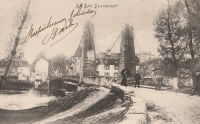
1834: Canada
Tréguier and Trédarzec, Côtes-d'Armor, France - Jaudy River
| Bridgemeister ID: | 1120 (added 2004-01-09) |
| Year Completed: | 1834 |
| Name: | Canada |
| Location: | Tréguier and Trédarzec, Côtes-d'Armor, France |
| Crossing: | Jaudy River |
| Coordinates: | 48.785102 N 3.220630 W |
| Maps: | Acme, GeoHack, Google, OpenStreetMap |
| Use: | Vehicular |
| Status: | Demolished, 1886 |
| Main Cables: | Wire (iron) |
| Suspended Spans: | 1 |
| Main Span: | 1 x 100 meters (328.1 feet) |
External Links:
1834: Clairac
Clairac, Lot-et-Garonne, France - Lot River
| Bridgemeister ID: | 7049 (added 2022-05-26) |
| Year Completed: | 1834 |
| Name: | Clairac |
| Location: | Clairac, Lot-et-Garonne, France |
| Crossing: | Lot River |
| Coordinates: | 44.358260 N 0.381738 E |
| Maps: | Acme, GeoHack, Google, OpenStreetMap |
| Use: | Vehicular |
| Status: | Removed |
| Suspended Spans: | 3 |
| Main Span: | 1 |
| Side Spans: | 2 |
Notes:
- Coordinates are for present-day (2022) crossing at Clairac. The suspension bridge was likely at this location.
- Near Roussanes (Clairac) - Roussanes, Clairac vicinity, Lot-et-Garonne, France.
External Links:
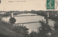
1834: Digoin
Digoin, Saône-et-Loire and Allier, France - Loire River
| Bridgemeister ID: | 1156 (added 2004-01-18) |
| Year Completed: | 1834 |
| Name: | Digoin |
| Location: | Digoin, Saône-et-Loire and Allier, France |
| Crossing: | Loire River |
| Coordinates: | 46.479272 N 3.969957 E |
| Maps: | Acme, GeoHack, Google, OpenStreetMap |
| References: | AAJ |
| Use: | Vehicular |
| Status: | Replaced, 1907 |
| Main Cables: | Wire (iron) |
| Main Spans: | 3 |
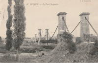
1834: Jargeau
Jargeau and Saint-Denis-de-l'Hôtel, Loiret, France - Loire River
| Bridgemeister ID: | 1042 (added 2003-12-06) |
| Year Completed: | 1834 |
| Name: | Jargeau |
| Also Known As: | Saint-Denis-de-l'Hôtel |
| Location: | Jargeau and Saint-Denis-de-l'Hôtel, Loiret, France |
| Crossing: | Loire River |
| Coordinates: | 47.869886 N 2.124662 E |
| Maps: | Acme, GeoHack, Google, OpenStreetMap |
| Use: | Vehicular |
| Status: | Replaced, 1927 |
| Main Cables: | Chain (iron) |
| Main Spans: | 5 x 54 meters (177.2 feet) |
Notes:
- 1847: Partially reconstructed.
- 1870: Partially destroyed during Franco-Prussian War.
- 1872: Repairs completed and bridge reopened.
- Replaced by 1927 Jargeau (Saint-Denis-de-l'Hôtel) - Jargeau and Saint-Denis-de-l'Hôtel, Loiret, France.
External Links:
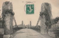
1834: Lamothe
Lamothe and Brioude, Haute-Loire, France - Allier River
| Bridgemeister ID: | 1763 (added 2005-04-22) |
| Year Completed: | 1834 |
| Name: | Lamothe |
| Location: | Lamothe and Brioude, Haute-Loire, France |
| Crossing: | Allier River |
| Coordinates: | 45.302910 N 3.403816 E |
| Maps: | Acme, GeoHack, Google, OpenStreetMap |
| References: | AAJ |
| Use: | Vehicular |
| Status: | Only towers remain (last checked: 2011) |
| Main Cables: | Wire (iron) |
| Suspended Spans: | 2 |
| Main Spans: | 2 |
Notes:
- 1866: A flood causes a major change in the course of the Allier River such that the main channel no longer flows under the bridge. The bridge, however, is not destroyed. A new suspension bridge is built in the 1880s over the main channel of the Allier just slightly east of the older bridge.
- All three pairs of pylons were still standing in the 2010s.
- Similar to 1833 Cosne-sur-Loire - Cosne-sur-Loire, Nièvre and Boulleret, Cher, France in appearance of towers.
- Similar to 1834 Jargeau (Saint-Denis-de-l'Hôtel) - Jargeau and Saint-Denis-de-l'Hôtel, Loiret, France in appearance of towers.
- Near 1884 Lamothe - Lamothe and Brioude, Haute-Loire, France.
External Links:
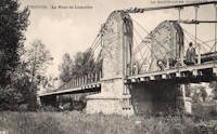
1834: Loubéjac
Loubéjac and Lamothe-Capdeville, Tarn-et-Garonne, France - Aveyron River
| Bridgemeister ID: | 2189 (added 2007-01-25) |
| Year Completed: | 1834 |
| Name: | Loubéjac |
| Location: | Loubéjac and Lamothe-Capdeville, Tarn-et-Garonne, France |
| Crossing: | Aveyron River |
| References: | AAJ |
1834: Louis-Philippe
Île St-Louis, Paris, France - Seine River
| Bridgemeister ID: | 983 (added 2003-11-15) |
| Year Completed: | 1834 |
| Name: | Louis-Philippe |
| Also Known As: | de la Reforme |
| Location: | Île St-Louis, Paris, France |
| Crossing: | Seine River |
| Principals: | Marc Seguin |
| References: | AAJ, PTS2 |
| Use: | Vehicular (one-lane), with walkway |
| Status: | Replaced |
| Main Cables: | Wire (iron) |
| Suspended Spans: | 2 |
| Main Spans: | 2 |
| Deck width: | 14.44 feet |
Notes:
- Badly damaged by fire 1848. Replaced 1860 (or soon after).
- Next to 1842 Cité (City, Île de la Cité) - Île de la Cité and Île St-Louis, Paris, France.
External Links:
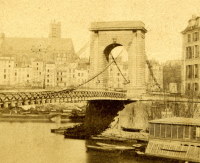
1834: Lussac-les-Châteaux
Lussac-les-Châteaux, Vienne, France - Vienne River
| Bridgemeister ID: | 4926 (added 2020-07-27) |
| Year Completed: | 1834 |
| Name: | Lussac-les-Châteaux |
| Location: | Lussac-les-Châteaux, Vienne, France |
| Crossing: | Vienne River |
| References: | AAJ |
| Status: | Removed |
| Main Cables: | Chain (iron) |
| Suspended Spans: | 1 |
Notes:
- Likely completed in 1834 based on contract let in 1832.
1834: Pontoise
Pontoise, Val-d'Oise, France - Oise River
| Bridgemeister ID: | 1770 (added 2005-04-22) |
| Year Completed: | 1834 |
| Name: | Pontoise |
| Location: | Pontoise, Val-d'Oise, France |
| Crossing: | Oise River |
| References: | AAJ |
| Use: | Vehicular (one-lane), with walkway |
| Suspended Spans: | 1 |
| Main Span: | 1 x 50 meters (164.05 feet) |
| Deck width: | 14.44 feet |
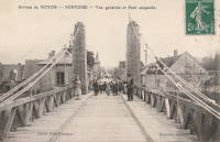
1834: Port-Sainte-Marie
Port-Sainte-Marie and Saint-Laurent, Lot-et-Garonne, France - Garonne River
| Bridgemeister ID: | 1765 (added 2005-04-22) |
| Year Completed: | 1834 |
| Name: | Port-Sainte-Marie |
| Location: | Port-Sainte-Marie and Saint-Laurent, Lot-et-Garonne, France |
| Crossing: | Garonne River |
| References: | AAJ |
| Use: | Vehicular |
| Status: | Replaced, 1899 |
| Suspended Spans: | 1 |
| Main Span: | 1 x 200 meters (656.2 feet) |
| Deck width: | 14.44 feet |
Notes:
- Failed, January 8, 1835. Rebuilt.
- Replaced by 1899 Port-Sainte-Marie - Port-Sainte-Marie and Saint-Laurent, Lot-et-Garonne, France.
1834: Saint Francois
Tréguier and Plouguiel, Côtes-d'Armor, France - Guindy River
| Bridgemeister ID: | 1122 (added 2004-01-09) |
| Year Completed: | 1834 |
| Name: | Saint Francois |
| Location: | Tréguier and Plouguiel, Côtes-d'Armor, France |
| Crossing: | Guindy River |
| Coordinates: | 48.789737 N 3.236838 W |
| Maps: | Acme, GeoHack, Google, OpenStreetMap |
| Use: | Footbridge |
| Status: | In use (last checked: 2019) |
| Main Cables: | Wire (iron) |
| Suspended Spans: | 1 |
| Main Span: | 1 x 71.2 meters (233.6 feet) |
External Links:
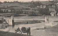
1834: Saint-Marcel-sur-Aude
Saint-Marcel-sur-Aude and Marcorignan, Aude, France - Aude River
| Bridgemeister ID: | 4927 (added 2020-07-27) |
| Year Completed: | 1834 |
| Name: | Saint-Marcel-sur-Aude |
| Location: | Saint-Marcel-sur-Aude and Marcorignan, Aude, France |
| Crossing: | Aude River |
| Coordinates: | 43.234368 N 2.926676 E |
| Maps: | Acme, GeoHack, Google, OpenStreetMap |
| References: | AAJ |
| Use: | Vehicular |
| Status: | Replaced, 1929 |
| Main Cables: | Wire (iron) |
| Main Span: | 1 |
Notes:
- AAJ supposes bridge was completed in 1834 based on a contract let in 1832 for a construction period of two years.
- Later at same location Saint-Marcel-sur-Aude - Saint-Marcel-sur-Aude and Marcorignan, Aude, France.
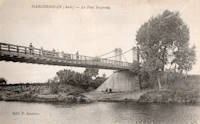
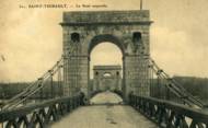
1834: Saint-Thibault
Saint-Thibault, Saint-Satur vicinity, Cher and Nièvre, France - Loire River
| Bridgemeister ID: | 1650 (added 2005-03-19) |
| Year Completed: | 1834 |
| Name: | Saint-Thibault |
| Location: | Saint-Thibault, Saint-Satur vicinity, Cher and Nièvre, France |
| Crossing: | Loire River |
| Coordinates: | 47.338358 N 2.868882 E |
| Maps: | Acme, GeoHack, Google, OpenStreetMap |
| References: | AAJ |
| Use: | Vehicular (one-lane) |
| Status: | Replaced, 1934 |
| Main Cables: | Chain (iron) |
| Suspended Spans: | 5 |
| Main Spans: | 5 |
| Deck width: | 14.44 feet |
External Links:
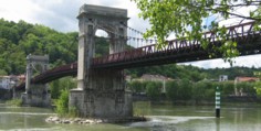
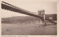
1835: Chasse
Chasse-sur-Rhône, Isère and Givors, Métropole De Lyon, France - Rhône River
| Bridgemeister ID: | 980 (added 2003-11-15) |
| Year Completed: | 1835 |
| Name: | Chasse |
| Also Known As: | Givors |
| Location: | Chasse-sur-Rhône, Isère and Givors, Métropole De Lyon, France |
| Crossing: | Rhône River |
| Coordinates: | 45.581666 N 4.780083 E |
| Maps: | Acme, GeoHack, Google, OpenStreetMap |
| References: | AAJ |
| Use: | Vehicular (one-lane) |
| Status: | In use (last checked: 2005) |
| Main Cables: | Wire (iron) |
| Suspended Spans: | 3 |
| Main Span: | 1 |
| Side Spans: | 2 |
Notes:
- Cables and deck appear to have been replaced (at least once).
- AAJ describes an accident in 1836: "...some of the iron-work, which was faulty, gave way and the platform fell into the river. Six persons were drowned."
External Links:
1835: La Réole
La Réole, Gironde, France - Garonne River
| Bridgemeister ID: | 1768 (added 2005-04-22) |
| Year Completed: | 1835 |
| Name: | La Réole |
| Location: | La Réole, Gironde, France |
| Crossing: | Garonne River |
| References: | AAJ |
| Use: | Vehicular |
| Suspended Spans: | 1 |
Notes:
- AAJ guesses this bridge was completed in 1835 due to contract let in 1833 specifying two-year construction period.
- See 1935 La Réole (Rouergue) - La Réole, Gironde, France. Unsure if the newer bridge is at the same location.
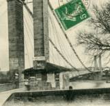
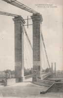
1835: Lagnieu
Lagnieu, Ain and Isère, France - Rhône River
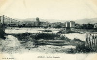
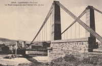
1835: Langeac
Langeac, Haute-Loire, France - Allier River
| Bridgemeister ID: | 1701 (added 2005-03-29) |
| Year Completed: | 1835 |
| Name: | Langeac |
| Location: | Langeac, Haute-Loire, France |
| Crossing: | Allier River |
| Coordinates: | 45.100706 N 3.498480 E |
| Maps: | Acme, GeoHack, Google, OpenStreetMap |
| References: | AAJ |
| Use: | Vehicular |
| Status: | Replaced, 1929 |
| Main Cables: | Wire (iron) |
| Suspended Spans: | 2 |
| Main Spans: | 2 |
Notes:
- AAJ guesses this bridge was completed in 1835 based on contract let in 1833 specifying a two-year construction period.
External Links:
- Art-et-Histoire - Troisième pont suspendu de Langeac - 1868. Indicates the bridge depicted here was competed 1868 after the first (1835) and second (1860) Langeac suspension bridges were destroyed by flood.
1835: Les Ormes
Les Ormes, Vienne, France - Vienne River
| Bridgemeister ID: | 2074 (added 2006-06-09) |
| Year Completed: | 1835 |
| Name: | Les Ormes |
| Location: | Les Ormes, Vienne, France |
| Crossing: | Vienne River |
| Use: | Vehicular |
| Suspended Spans: | 1 |
Notes:
- Replaced by Les Ormes - Les Ormes, Vienne, France.
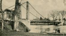
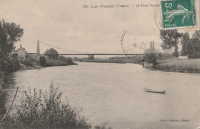
1835: Montmerle-sur-Saône
Montmerle-sur-Saône, Ain and Saint-Georges-de-Reneins, Rhône, France - Saône River
| Bridgemeister ID: | 1586 (added 2005-01-22) |
| Year Completed: | 1835 |
| Name: | Montmerle-sur-Saône |
| Location: | Montmerle-sur-Saône, Ain and Saint-Georges-de-Reneins, Rhône, France |
| Crossing: | Saône River |
| Coordinates: | 46.080483 N 4.754933 E |
| Maps: | Acme, GeoHack, Google, OpenStreetMap |
| References: | AGP |
| Use: | Vehicular (one-lane) |
| Status: | In use (last checked: 2022) |
| Main Cables: | Wire |
| Suspended Spans: | 2 |
| Main Spans: | 2 |
Notes:
- 1944: Heavily damaged during WWII. Repaired.
External Links:

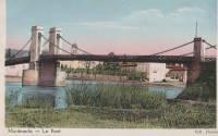
1835: Pertuis
Pertuis, Vaucluse and Bouches-du-Rhône, France - Durance River
| Bridgemeister ID: | 984 (added 2003-11-15) |
| Year Completed: | 1835 |
| Name: | Pertuis |
| Location: | Pertuis, Vaucluse and Bouches-du-Rhône, France |
| Crossing: | Durance River |
| Principals: | Seguin Brothers |
| References: | AAJ |
| Use: | Vehicular |
| Main Cables: | Wire (iron) |
| Suspended Spans: | 2 |
| Main Spans: | 2 x 10⁴ meters (341.2 feet) |
Notes:
- Repairs needed soon after opening. Damaged by flood 1843, reopened 1844.
- Replaced by 1952 Pertuis - Pertuis, Vaucluse and Bouches-du-Rhône, France.
External Links:
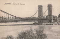
1835: Rognonas
Rognonas, Bouches-du-Rhône and Avignon, Vaucluse, France - Durance River
| Bridgemeister ID: | 2190 (added 2007-01-25) |
| Year Completed: | 1835 |
| Name: | Rognonas |
| Location: | Rognonas, Bouches-du-Rhône and Avignon, Vaucluse, France |
| Crossing: | Durance River |
| References: | AAJ |
| Use: | Vehicular |
| Status: | Removed |
| Main Cables: | Wire (iron) |
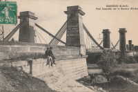
1835: Roquemaure
Roquemaure, Gard and Orange, Vaucluse, France - Rhône River
| Bridgemeister ID: | 1735 (added 2005-04-19) |
| Year Completed: | 1835 |
| Name: | Roquemaure |
| Location: | Roquemaure, Gard and Orange, Vaucluse, France |
| Crossing: | Rhône River |
| Coordinates: | 44.069467 N 4.7689 E |
| Maps: | Acme, GeoHack, Google, OpenStreetMap |
| References: | AAJ |
| Use: | Vehicular |
| Status: | Only towers remain (last checked: 2021) |
| Main Cables: | Wire (iron) |
| Suspended Spans: | 4 |
| Main Spans: | 4 |
Notes:
- One of the four spans, effectively a separate bridge over a small channel of the Rhône to an island that connected to the main river spans, was still standing in early 2005, but closed to all traffic. The deck and cables were removed or destroyed at some point in 2005 or 2006 leaving just the pylons of this span.
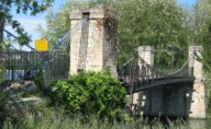
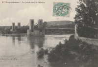
- Replaced by Roquemaure - Roquemaure, Gard and Orange, Vaucluse, France.
External Links:
1835: Saint-Jean-de-Blaignac
Saint-Jean-de-Blaignac and Lavagnac, Gironde, France - Dordogne River
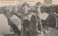
| Bridgemeister ID: | 2069 (added 2006-06-07) |
| Year Completed: | 1835 |
| Name: | Saint-Jean-de-Blaignac |
| Location: | Saint-Jean-de-Blaignac and Lavagnac, Gironde, France |
| Crossing: | Dordogne River |
| Coordinates: | 44.814153 N 0.138769 W |
| Maps: | Acme, GeoHack, Google, OpenStreetMap |
| Use: | Vehicular |
| Status: | Replaced, 1939 |
| Main Cables: | Wire (iron) |
| Suspended Spans: | 3 |
| Main Spans: | 3 |
Notes:
1836: Agde
Agde, Hérault, France - Hérault River
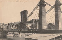
| Bridgemeister ID: | 1129 (added 2004-01-15) |
| Year Completed: | 1836 |
| Name: | Agde |
| Location: | Agde, Hérault, France |
| Crossing: | Hérault River |
| References: | AAJ |
| Use: | Vehicular |
| Status: | Removed |
| Main Cables: | Wire (iron) |
| Suspended Spans: | 1 |
| Main Span: | 1 |
External Links:
1836: Attichy
Attichy, Oise, France - Aisne River
| Bridgemeister ID: | 7444 (added 2022-12-23) |
| Year Completed: | 1836 |
| Name: | Attichy |
| Location: | Attichy, Oise, France |
| Crossing: | Aisne River |
| Status: | Removed, 1892 |
| Suspended Spans: | 1 |
External Links:
1836: Branne
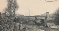
Branne, Gironde, France - Dordogne River
| Bridgemeister ID: | 6999 (added 2022-04-24) |
| Year Completed: | 1836 |
| Name: | Branne |
| Location: | Branne, Gironde, France |
| Crossing: | Dordogne River |
| Coordinates: | 44.832286 N 0.186143 W |
| Maps: | Acme, GeoHack, Google, OpenStreetMap |
| Use: | Vehicular |
| Status: | Removed, 1911 |
| Main Cables: | Wire (iron) |
| Main Spans: | 2 |
External Links:
1836: Choisy-au-bac
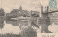
Choisy-au-bac, Oise, France - Aisne River
| Bridgemeister ID: | 1767 (added 2005-04-22) |
| Year Completed: | 1836 |
| Name: | Choisy-au-bac |
| Location: | Choisy-au-bac, Oise, France |
| Crossing: | Aisne River |
| Principals: | Seguin Brothers |
| References: | AAJ |
| Main Cables: | Wire (iron) |
External Links:
1836: Conflans
Conflans-Sainte-Honorine, Yvelines, France - Seine River
| Bridgemeister ID: | 1774 (added 2005-04-22) |
| Year Completed: | 1836 |
| Name: | Conflans |
| Location: | Conflans-Sainte-Honorine, Yvelines, France |
| Crossing: | Seine River |
| References: | AAJ |
| Use: | Vehicular |
| Status: | Removed |
External Links:
1836: Fourchambault
Fourchambault, Nièvre and Cher, France - Loire River
| Bridgemeister ID: | 1598 (added 2005-02-06) |
| Year Completed: | 1836 |
| Name: | Fourchambault |
| Location: | Fourchambault, Nièvre and Cher, France |
| Crossing: | Loire River |
| Coordinates: | 47.012339 N 3.073304 E |
| Maps: | Acme, GeoHack, Google, OpenStreetMap |
| References: | AAJ |
| Use: | Vehicular |
| Status: | Destroyed, c. 1940's |
| Main Cables: | Chain (iron) |
| Suspended Spans: | 6 |
| Main Spans: | 6 |
Notes:
- Dynamited in 1940 or 1941. Eventually replaced by a long low-lying truss bridge.
1836: Fourneau
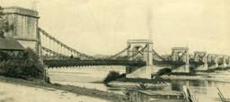
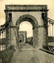
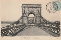
Le Fourneau, Bourbon-Lancy vicinity, Saône-et-Loire and Allier, France - Loire River
| Bridgemeister ID: | 1771 (added 2005-04-22) |
| Year Completed: | 1836 |
| Name: | Fourneau |
| Location: | Le Fourneau, Bourbon-Lancy vicinity, Saône-et-Loire and Allier, France |
| Crossing: | Loire River |
| References: | AAJ |
| Use: | Vehicular |
| Status: | Destroyed, October 1846, by flood. |
| Suspended Spans: | 2 |
| Main Spans: | 2 x 85 meters (278.88 feet) |
| Deck width: | 19.73 feet |
Notes:
1836: Le Guétin
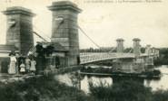
Le Guétin, Cuffy vicinity, Cher and Gimouille, Nièvre, France - Allier River
| Bridgemeister ID: | 1652 (added 2005-03-19) |
| Year Completed: | 1836 |
| Name: | Le Guétin |
| Location: | Le Guétin, Cuffy vicinity, Cher and Gimouille, Nièvre, France |
| Crossing: | Allier River |
| Coordinates: | 46.947218 N 3.074370 E |
| Maps: | Acme, GeoHack, Google, OpenStreetMap |
| References: | AAJ |
| Use: | Vehicular |
| Status: | Replaced, 1930 |
| Main Cables: | Wire (iron) |
| Suspended Spans: | 5 |
| Main Spans: | 5 x 62 meters (203.42 feet) |
Notes:
External Links:
1836: Meung-sur-Loire
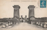
Meung-sur-Loire, Loiret, France - Loire River
| Bridgemeister ID: | 1537 (added 2004-10-31) |
| Year Completed: | 1836 |
| Name: | Meung-sur-Loire |
| Location: | Meung-sur-Loire, Loiret, France |
| Crossing: | Loire River |
| Use: | Vehicular |
| Status: | Destroyed, June, 1940 |
| Main Cables: | Wire (iron) |
| Suspended Spans: | 4 |
| Main Spans: | 4 |
Notes:
- 1872-1874: Bridge is partially rebuilt.
- 1925: Bridge undergoes heavy reconstruction, keeping the original piers, pillars, and abutments, but with modifications.
- 1935: Suspension system is reinforced.
- 1940: Destroyed June, 1940.
- Replaced by 1948 Meung-sur-Loire - Meung-sur-Loire, Loiret, France.
External Links:
1836: Pontavert
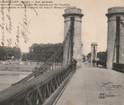
Pontavert, Aisne, France - Aisne River
| Bridgemeister ID: | 7714 (added 2023-07-07) |
| Year Completed: | 1836 |
| Name: | Pontavert |
| Location: | Pontavert, Aisne, France |
| Crossing: | Aisne River |
| Coordinates: | 49.403533 N 3.820659 E |
| Maps: | Acme, GeoHack, Google, OpenStreetMap |
| Status: | Removed, 1904 |
| Main Cables: | Wire |
| Suspended Spans: | 1 |
External Links:
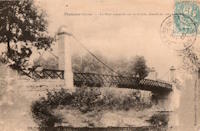
1836: Saint-Perreux
Saint-Perreux, Morbihan and Redon, Ille-et-Vilaine, France - L'Oust
1836: Saint-Sever
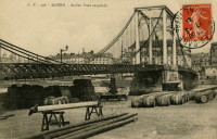
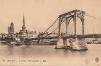
Rouen, Seine-Maritime, France - Seine River
| Bridgemeister ID: | 1154 (added 2004-01-18) |
| Year Completed: | 1836 |
| Name: | Saint-Sever |
| Location: | Rouen, Seine-Maritime, France |
| Crossing: | Seine River |
| Principals: | Marc Seguin |
| Status: | Destroyed, 1884 |
| Main Cables: | Wire (iron) |
| Suspended Spans: | 2 |
| Main Spans: | 2 |

1836: Sully-sur-Loire
Sully-sur-Loire and Saint-Père-sur-Loire, Loiret, France - Loire River
| Bridgemeister ID: | 7851 (added 2023-09-09) |
| Year Completed: | 1836 |
| Name: | Sully-sur-Loire |
| Location: | Sully-sur-Loire and Saint-Père-sur-Loire, Loiret, France |
| Crossing: | Loire River |
| Use: | Vehicular |
| Status: | Destroyed, 1856 |
| Main Cables: | Wire (iron) |
| Suspended Spans: | 3 |
| Main Span: | 1 |
| Side Spans: | 2 |
Notes:
- 1856: Heavily damaged by flood.
- Replaced by 1859 Sully-sur-Loire - Sully-sur-Loire and Saint-Père-sur-Loire, Loiret, France.
External Links:

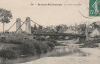
1837: Bruère-Allichamps
Bruère-Allichamps, Saint-Amand-Montrond vicinity, Cher, France - Cher River
| Bridgemeister ID: | 1437 (added 2004-07-30) |
| Year Completed: | 1837 |
| Name: | Bruère-Allichamps |
| Location: | Bruère-Allichamps, Saint-Amand-Montrond vicinity, Cher, France |
| Crossing: | Cher River |
| Use: | Vehicular |
| Status: | Removed |
| Main Cables: | Wire |
| Suspended Spans: | 1 |
External Links:
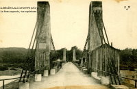
1837: Cavaillon
Cavaillon, Vaucluse and Bouches-du-Rhône, France - Durance River
| Bridgemeister ID: | 1012 (added 2003-11-21) |
| Year Completed: | 1837 |
| Name: | Cavaillon |
| Location: | Cavaillon, Vaucluse and Bouches-du-Rhône, France |
| Crossing: | Durance River |
| Principals: | Jules Seguin |
| References: | AAJ |
| Use: | Vehicular |
| Status: | Replaced |
| Main Cables: | Wire (iron) |
Notes:
- Destroyed by flood 1838, rebuilt 1840, wrecked by wind 1850, rebuilt 1851, damaged by floods 1886, rebuilt 1887, rebuilt 1914.
- Replaced by 1931 Cavaillon - Cavaillon, Vaucluse and Bouches-du-Rhône, France.
External Links:
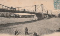
1837: Constantine
Paris, France - Seine River
| Bridgemeister ID: | 1775 (added 2005-04-22) |
| Year Completed: | 1837 |
| Name: | Constantine |
| Location: | Paris, France |
| Crossing: | Seine River |
| At or Near Feature: | left bank |
| References: | AAJ |
| Use: | Footbridge |
| Status: | Replaced, c. 1860's |
| Main Cables: | Wire (iron) |
| Suspended Spans: | 3 |
| Main Span: | 1 x 101.4 meters (332.69 feet) |
| Side Spans: | 2 x 25.8 meters (84.75 feet) |
Notes:
- Connected l'Ile Saint-Louis and Quai St. Bernard.
- AAJ says replaced in 1863, but the current bridge at this location (Pont Sully) was not completed until 1876.
- Companion to 1837 Damiette - Paris, France.
External Links:
1837: Damiette
Paris, France - Seine River
| Bridgemeister ID: | 1776 (added 2005-04-22) |
| Year Completed: | 1837 |
| Name: | Damiette |
| Location: | Paris, France |
| Crossing: | Seine River |
| At or Near Feature: | right bank |
| References: | AAJ |
| Use: | Footbridge |
| Status: | Destroyed, 1848 |
| Suspended Spans: | 2 |
| Main Spans: | 1 x 58 meters (190.3 feet), 1 x 76.8 meters (251.85 feet) |
Notes:
- AAJ: It connected "the Quai of Célestins with the l'Ile Saint-Louis on one side, and with the I'lle of Louviers on the other."
- Companion to 1837 Constantine - Paris, France.
External Links:
1837: La Balme
La Balme, Savoie and Virignin, Ain, France - Rhône River
1837: Novéant-Corny-sur-Moselle
Novéant-sur-Moselle and Corny-sur-Moselle, Moselle, France - Moselle/Mosel River
| Bridgemeister ID: | 1722 (added 2005-04-05) |
| Year Completed: | 1837 |
| Name: | Novéant-Corny-sur-Moselle |
| Location: | Novéant-sur-Moselle and Corny-sur-Moselle, Moselle, France |
| Crossing: | Moselle/Mosel River |
| Principals: | Seguin Brothers |
| Use: | Vehicular |
| Status: | Replaced, c. 1909 |
| Main Cables: | Wire (iron) |
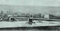
1837: Port-Boulet
Port-Boulet, Bourgueil vicinity, Indre-et-Loire, France - Loire River
| Bridgemeister ID: | 1773 (added 2005-04-22) |
| Year Completed: | 1837 |
| Name: | Port-Boulet |
| Location: | Port-Boulet, Bourgueil vicinity, Indre-et-Loire, France |
| Crossing: | Loire River |
| Principals: | Seguin Brothers |
| References: | AAJ |
| Status: | Destroyed, 1871 |
| Main Cables: | Wire (iron) |
External Links:
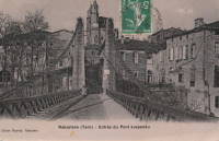
1837: Rabastens
Rabastens and Coufouleux, Tarn, France - Tarn River
| Bridgemeister ID: | 1599 (added 2005-02-06) |
| Year Completed: | 1837 |
| Name: | Rabastens |
| Location: | Rabastens and Coufouleux, Tarn, France |
| Crossing: | Tarn River |
| Use: | Vehicular (one-lane) |
| Status: | Replaced, 1924 |
| Suspended Spans: | 1 |
Notes:
- Eventually replaced by present-day arch bridge.
External Links:
1837: Trébaste
Château-Arnoux and L'Escale, Alpes-de-Haute-Provence, France - Durance River
| Bridgemeister ID: | 2003 (added 2005-12-26) |
| Year Completed: | 1837 |
| Name: | Trébaste |
| Location: | Château-Arnoux and L'Escale, Alpes-de-Haute-Provence, France |
| Crossing: | Durance River |
| Use: | Vehicular |
| Status: | Demolished, 1962 |
External Links:
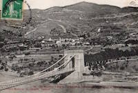
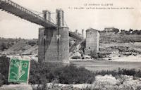
1837: Vallon
Vallon-Pont-D'arc and Salavas, Ardèche, France - Ardèche River
| Bridgemeister ID: | 1766 (added 2005-04-22) |
| Year Completed: | 1837 |
| Name: | Vallon |
| Also Known As: | Salavas |
| Location: | Vallon-Pont-D'arc and Salavas, Ardèche, France |
| Crossing: | Ardèche River |
| Coordinates: | 44.398624 N 4.385082 E |
| Maps: | Acme, GeoHack, Google, OpenStreetMap |
| References: | AAJ |
| Use: | Vehicular |
| Status: | Removed |
| Main Cables: | Wire |
| Main Spans: | 2 |
Notes:
- The current (2022) bridge at this location is built on the piers of the suspension bridge.
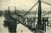
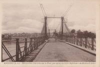
1838: Ancenis
Ancenis, Loire-Atlantique and Le Fourneau, Maine-et-Loire, France - Loire River
| Bridgemeister ID: | 1036 (added 2003-12-03) |
| Year Completed: | 1838 |
| Name: | Ancenis |
| Location: | Ancenis, Loire-Atlantique and Le Fourneau, Maine-et-Loire, France |
| Crossing: | Loire River |
| Principals: | Marc Seguin |
| References: | AAJ |
| Use: | Vehicular |
| Status: | Destroyed, 1944 |
| Main Cables: | Wire (iron) |
Notes:
- Destroyed 1940, temporarily rebuilt, destroyed 1944.
- Replaced by 1953 Ancenis - Ancenis, Loire-Atlantique and Le Fourneau, Maine-et-Loire, France.
External Links:

1838: Buzet-sur-Baïse
Buzet-sur-Baïse, Lot-et-Garonne, France - Petite Baïse River
| Bridgemeister ID: | 4909 (added 2020-07-19) |
| Year Completed: | 1838 |
| Name: | Buzet-sur-Baïse |
| Location: | Buzet-sur-Baïse, Lot-et-Garonne, France |
| Crossing: | Petite Baïse River |
| Principals: | Seguin Brothers |
| Status: | Removed |
| Main Cables: | Wire (iron) |
| Suspended Spans: | 1 |
External Links:
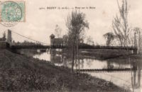
1838: Chambilly
Chambilly and Marcigny, Saône-et-Loire, France - Loire River
| Bridgemeister ID: | 7964 (added 2023-11-23) |
| Year Completed: | 1838 |
| Name: | Chambilly |
| Location: | Chambilly and Marcigny, Saône-et-Loire, France |
| Crossing: | Loire River |
| Use: | Vehicular |
| Status: | Removed |
| Main Cables: | Wire (iron) |
| Suspended Spans: | 3 |
External Links:
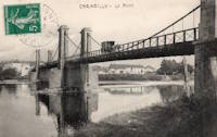
1838: Conflans
Andrésy and Conflans-Sainte-Honorine, Yvelines, France - Oise River
| Bridgemeister ID: | 1687 (added 2005-03-26) |
| Year Completed: | 1838 |
| Name: | Conflans |
| Also Known As: | Fin d'Oise |
| Location: | Andrésy and Conflans-Sainte-Honorine, Yvelines, France |
| Crossing: | Oise River |
| Principals: | Seguin Brothers |
| Use: | Vehicular |
| Status: | Replaced |
| Main Cables: | Wire (iron) |
| Suspended Spans: | 1 |
| Main Span: | 1 x 75 meters (246.1 feet) |
| Deck width: | 5.5 meters |
Notes:
- Likely replaced by the current concrete arch bridge at this location.
External Links:
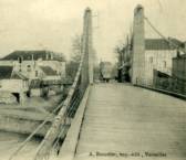
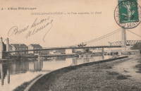
1838: La Roche-Guyon
La Roche-Guyon, Val-d'Oise and Yvelines, France - Seine River
| Bridgemeister ID: | 7649 (added 2023-06-10) |
| Year Completed: | 1838 |
| Name: | La Roche-Guyon |
| Location: | La Roche-Guyon, Val-d'Oise and Yvelines, France |
| Crossing: | Seine River |
| Coordinates: | 49.079205 N 1.631693 E |
| Maps: | Acme, GeoHack, Google, OpenStreetMap |
| Use: | Vehicular |
| Status: | Destroyed, 1882 |
| Main Cables: | Wire (iron) |
| Suspended Spans: | 1 |
| Main Span: | 1 x 161 meters (528.2 feet) |
Notes:
- 1882: Wrecked by wind. Rebuilt with two main suspension spans instead of one.
- Replaced by La Roche-Guyon - La Roche-Guyon, Val-d'Oise and Yvelines, France.
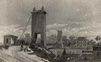
1838: Les Andelys
Les Andelys, Eure, France - Seine River
| Bridgemeister ID: | 4215 (added 2020-04-08) |
| Year Completed: | 1838 |
| Name: | Les Andelys |
| Location: | Les Andelys, Eure, France |
| Crossing: | Seine River |
| Coordinates: | 49.236464 N 1.397978 E |
| Maps: | Acme, GeoHack, Google, OpenStreetMap |
| Principals: | Marie Fortuné de Vergès, Ferdinand Bayard de la Vingtrie |
| Use: | Vehicular |
| Status: | Destroyed, 1870 |
| Main Cables: | Wire (iron) |
Notes:
- Likely destroyed in 1870 during Franco-Prussian war to prevent advance of the Prussian army.
- Later at same location 1920 Les Andelys - Les Andelys, Eure, France. The 1920 bridge was not an immediate replacement.
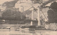
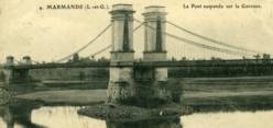
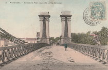
1838: Marmande
Marmande, Lot-et-Garonne, France - Garonne River
| Bridgemeister ID: | 1603 (added 2005-02-06) |
| Year Completed: | 1838 |
| Name: | Marmande |
| Location: | Marmande, Lot-et-Garonne, France |
| Crossing: | Garonne River |
| Coordinates: | 44.499538 N 0.156698 E |
| Maps: | Acme, GeoHack, Google, OpenStreetMap |
| References: | AAJ |
| Use: | Vehicular |
| Status: | Failed, 1930 |
| Main Cables: | Wire (iron) |
| Suspended Spans: | 2 |
| Side Spans: | 2 |
Notes:
- AAJ lists this bridge as completed in 1835.
- Near 1845 Couthures - Couthures-sur-Garonne, Lot-et-Garonne, France.
- Replaced by 1932 Marmande (Renaud Jean) - Marmande, Lot-et-Garonne, France.
1838: Mas-d'Agenais
Le Mas-d'Agenais, Lot-et-Garonne, France - Garonne River
| Bridgemeister ID: | 1033 (added 2003-11-30) |
| Year Completed: | 1838 |
| Name: | Mas-d'Agenais |
| Location: | Le Mas-d'Agenais, Lot-et-Garonne, France |
| Crossing: | Garonne River |
| Coordinates: | 44.412101 N 0.222131 E |
| Maps: | Acme, GeoHack, Google, OpenStreetMap |
| References: | AAJ |
| Use: | Vehicular |
| Status: | In use (last checked: 2016) |
| Main Cables: | Wire (iron) |
| Suspended Spans: | 3 |
| Main Spans: | 3 |
Notes:
- 1930: The bridge is strengthened. The suspension system is replaced, the deck is stiffened with a plate girder system, and the pairs of end pylons are transformed to (or replaced with) towers with gothic arches.
External Links:
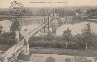
1838: Montfrin
Montfrin, Gard, France - Gardon River
| Bridgemeister ID: | 1934 (added 2005-10-28) |
| Year Completed: | 1838 |
| Name: | Montfrin |
| Location: | Montfrin, Gard, France |
| Crossing: | Gardon River |
| Use: | Vehicular (one-lane) |
| Status: | Removed |
| Main Cables: | Wire |
Notes:
- Replaced by 1906 Montfrin - Montfrin, Gard, France.
External Links:
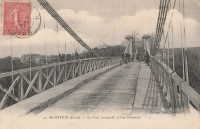
1838: Ruoms
Ruoms and Labeaume, Ardèche, France - Ardèche River
| Bridgemeister ID: | 7314 (added 2022-08-28) |
| Year Completed: | 1838 |
| Name: | Ruoms |
| Also Known As: | Les Brasseries |
| Location: | Ruoms and Labeaume, Ardèche, France |
| Crossing: | Ardèche River |
| Coordinates: | 44.456715 N 4.334095 E |
| Maps: | Acme, GeoHack, Google, OpenStreetMap |
| Use: | Vehicular |
| Status: | Only towers remain (last checked: 2022) |
| Main Span: | 1 |
External Links:
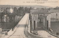
1838: Saint Laurent
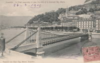
Grenoble, Isère, France - Isère River
| Bridgemeister ID: | 1158 (added 2004-01-18) |
| Year Completed: | 1838 |
| Name: | Saint Laurent |
| Location: | Grenoble, Isère, France |
| Crossing: | Isère River |
| Coordinates: | 45.194433 N 5.729017 E |
| Maps: | Acme, GeoHack, Google, OpenStreetMap |
| Use: | Vehicular |
| Status: | Restricted to foot traffic (last checked: 2022) |
| Main Cables: | Wire (iron) |
| Suspended Spans: | 1 |
| Main Span: | 1 x 61 meters (200.1 feet) estimated |
Notes:
- 1909: The bridge is extensively renovated.
External Links:
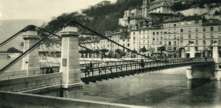
1838: Saint-Bernard
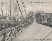
Saint-Bernard, Ain and Anse, Rhône, France - Saône River
| Bridgemeister ID: | 1716 (added 2005-04-05) |
| Year Completed: | 1838 |
| Name: | Saint-Bernard |
| Location: | Saint-Bernard, Ain and Anse, Rhône, France |
| Crossing: | Saône River |
| Principals: | Seguin Brothers |
| Use: | Vehicular |
| Status: | Replaced, 1940s |
| Main Cables: | Wire (iron) |
Notes:
- 1933, October 4: A section of the bridge deck collapses under the weight of a truck.
1838: Tournus
Tournus, Saône-et-Loire, France - Saône River
| Bridgemeister ID: | 5660 (added 2021-01-01) |
| Year Completed: | 1838 |
| Name: | Tournus |
| Location: | Tournus, Saône-et-Loire, France |
| Crossing: | Saône River |
| Coordinates: | 46.564107 N 4.912460 E |
| Maps: | Acme, GeoHack, Google, OpenStreetMap |
| References: | AAJ |
| Status: | Removed, 1869 |
| Main Cables: | Wire (iron) |
Notes:
- Later at same location 1950 Tournus - Tournus, Saône-et-Loire, France.
External Links:
1838: Triel-sur-Seine
Triel-sur-Seine and Vernouillet, Yvelines, France - Seine River
| Bridgemeister ID: | 1756 (added 2005-04-20) |
| Year Completed: | 1838 |
| Name: | Triel-sur-Seine |
| Location: | Triel-sur-Seine and Vernouillet, Yvelines, France |
| Crossing: | Seine River |
| Coordinates: | 48.978606 N 2.001981 E |
| Maps: | Acme, GeoHack, Google, OpenStreetMap |
| Principals: | Seguin Brothers |
| Use: | Vehicular |
| Status: | Destroyed, 1940 |
| Main Cables: | Wire (iron) |
| Suspended Spans: | 3 |
| Main Span: | 1 |
| Side Spans: | 2 |
Notes:
External Links:
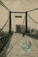
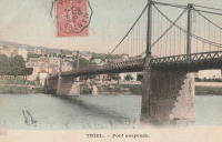
1838: Vianne
Vianne, Lot-et-Garonne, France - Baïse River
| Bridgemeister ID: | 1110 (added 2004-01-03) |
| Year Completed: | 1838 |
| Name: | Vianne |
| Location: | Vianne, Lot-et-Garonne, France |
| Crossing: | Baïse River |
| Coordinates: | 44.196545 N 0.324949 E |
| Maps: | Acme, GeoHack, Google, OpenStreetMap |
| Use: | Vehicular (one-lane), with walkway |
| Status: | In use (last checked: 2019) |
| Main Cables: | Wire |
| Suspended Spans: | 1 |
External Links:
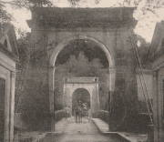
1839: Balbigny
Balbigny, Loire, France - Loire River
| Bridgemeister ID: | 1777 (added 2005-04-22) |
| Year Completed: | 1839 |
| Name: | Balbigny |
| Location: | Balbigny, Loire, France |
| Crossing: | Loire River |
| References: | AAJ |
| Use: | Vehicular |
| Status: | Destroyed, 1940 |
| Suspended Spans: | 2 |
External Links:
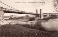
1839: Basse-Chaîne
Angers, Maine-et-Loire, France - Maine River
| Bridgemeister ID: | 993 (added 2003-11-16) |
| Year Completed: | 1839 |
| Name: | Basse-Chaîne |
| Also Known As: | Angers |
| Location: | Angers, Maine-et-Loire, France |
| Crossing: | Maine River |
| Principals: | Joseph Chaley |
| References: | AAJ, GHD, HBE, PTS2 |
| Status: | Collapsed, 1850 |
| Main Cables: | Wire (iron) |
| Suspended Spans: | 1 |
| Main Span: | 1 x 10² meters (334.66 feet) |
| Deck width: | 23.62 feet |
Notes:
- Collapsed under weight of maching troops, April 16, 1850, killing more than 200 soldiers. Collapse precipitated French virtual moratorium on suspension bridge building bringing to a close the prolific era of French wire cable suspension bridges.
External Links:
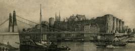
1839: Belleperche
Cordes-Tolosannes, Tarn-et-Garonne, France - Garonne River
| Bridgemeister ID: | 2101 (added 2006-07-23) |
| Year Completed: | 1839 |
| Name: | Belleperche |
| Location: | Cordes-Tolosannes, Tarn-et-Garonne, France |
| Crossing: | Garonne River |
| Coordinates: | 43.995722 N 1.125750 E |
| Maps: | Acme, GeoHack, Google, OpenStreetMap |
| Use: | Vehicular (one-lane) |
| Status: | Removed |
Notes:
- Later at same location 1941 Belleperche - Cordes-Tolosannes, Tarn-et-Garonne, France.
External Links:
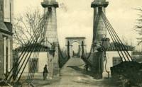
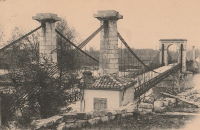
1839: Cadenet
Cadenet, Vaucluse and Bouches-du-Rhône, France - Durance River
| Bridgemeister ID: | 1008 (added 2003-11-21) |
| Year Completed: | 1839 |
| Name: | Cadenet |
| Location: | Cadenet, Vaucluse and Bouches-du-Rhône, France |
| Crossing: | Durance River |
| Coordinates: | 43.712117 N 5.365317 E |
| Maps: | Acme, GeoHack, Google, OpenStreetMap |
| Principals: | Adolphe Boulland |
| References: | AAJ |
| Use: | Vehicular |
| Status: | Only towers remain (last checked: 2005) |
Notes:
- Damaged by flood 1843, closed until 1844, destroyed 1944. Towers still standing, 2005.
External Links:
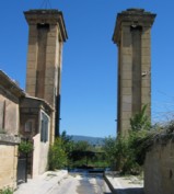
1839: Caille
Allonzier-La-Caille vicinity, Haute-Savoie, France - Usses Torrent
| Bridgemeister ID: | 859 (added 2003-08-09) |
| Year Completed: | 1839 |
| Name: | Caille |
| Also Known As: | Charles-Albert |
| Location: | Allonzier-La-Caille vicinity, Haute-Savoie, France |
| Crossing: | Usses Torrent |
| Coordinates: | 46.0126 N 6.111633 E |
| Maps: | Acme, GeoHack, Google, OpenStreetMap |
| Principals: | E. Belin |
| References: | AAJ, BPF, PTS2 |
| Use: | Vehicular |
| Status: | Restricted to foot traffic (last checked: 2019) |
| Main Cables: | Wire (iron) |
| Suspended Spans: | 1 |
| Main Span: | 1 x 192 meters (629.9 feet) |
External Links:
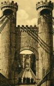
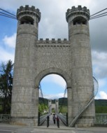
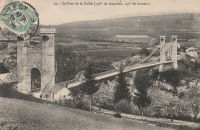
1839: Coudette
Peyrehorade, Landes, France - Gave de Pau River
| Bridgemeister ID: | 2310 (added 2007-05-02) |
| Year Completed: | 1839 |
| Name: | Coudette |
| Location: | Peyrehorade, Landes, France |
| Crossing: | Gave de Pau River |
| Use: | Vehicular (one-lane) |
| Status: | Replaced |
| Main Cables: | Wire (iron) |
| Suspended Spans: | 1 |
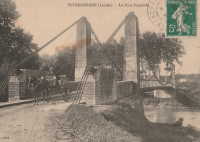
1839: Cournon
Pérignat-sur-Allier and Cournon-d'Auvergne, Puy-de-Dôme, France - Allier River
| Bridgemeister ID: | 1726 (added 2005-04-05) |
| Year Completed: | 1839 |
| Name: | Cournon |
| Location: | Pérignat-sur-Allier and Cournon-d'Auvergne, Puy-de-Dôme, France |
| Crossing: | Allier River |
| Coordinates: | 45.729820 N 3.213100 E |
| Maps: | Acme, GeoHack, Google, OpenStreetMap |
| Use: | Vehicular (one-lane), with walkway |
| Status: | Removed |
| Main Cables: | Wire (iron) |
| Suspended Spans: | 1 |
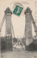
1839: L'Hôtel Dieu
Lyon, Métropole de Lyon, France - Rhône River
| Bridgemeister ID: | 966 (added 2003-11-01) |
| Year Completed: | 1839 |
| Name: | L'Hôtel Dieu |
| Location: | Lyon, Métropole de Lyon, France |
| Crossing: | Rhône River |
| Principals: | Clauzel |
| References: | AAJ, PQL |
| Use: | Vehicular |
| Status: | Demolished, 1912 |
| Main Cables: | Wire (iron) |
Notes:
- Was at location of present-day Pont Wilson.
- Rebuilt, 1850.
- Near 1845 College (Collège) - Lyon, Métropole de Lyon, France.
External Links:

1839: Lisle-sur-Tarn
Lisle-sur-Tarn, Tarn, France - Tarn River
| Bridgemeister ID: | 4556 (added 2020-06-01) |
| Year Completed: | 1839 |
| Name: | Lisle-sur-Tarn |
| Also Known As: | L'Isle-sur-Tarn |
| Location: | Lisle-sur-Tarn, Tarn, France |
| Crossing: | Tarn River |
| Coordinates: | 43.851028 N 1.812759 E |
| Maps: | Acme, GeoHack, Google, OpenStreetMap |
| Use: | Vehicular |
| Status: | Removed |
| Main Cables: | Wire |
| Suspended Spans: | 1 |
External Links:

1839: Loyettes
Loyettes, Ain and Isère, France - Rhône River
| Bridgemeister ID: | 2334 (added 2007-07-09) |
| Year Completed: | 1839 |
| Name: | Loyettes |
| Location: | Loyettes, Ain and Isère, France |
| Crossing: | Rhône River |
| Coordinates: | 45.772075 N 5.205653 E |
| Maps: | Acme, GeoHack, Google, OpenStreetMap |
| Use: | Vehicular |
| Status: | Replaced, 1940 |
| Main Cables: | Wire (iron) |
| Suspended Spans: | 2 |
| Main Spans: | 2 |
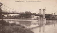
1839: Manosque
Manosque, Alpes-de-Haute-Provence, France - Durance River
| Bridgemeister ID: | 2001 (added 2005-12-26) |
| Year Completed: | 1839 |
| Name: | Manosque |
| Location: | Manosque, Alpes-de-Haute-Provence, France |
| Crossing: | Durance River |
| References: | AAJ |
| Use: | Vehicular |
| Status: | Replaced |
Notes:
- Heavily damaged by flood debris, 1843.
- Later at same location 1939 Manosque - Manosque, Alpes-de-Haute-Provence, France.
External Links:
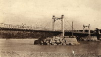
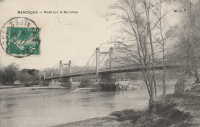
1839: Neuville-sur-Oise
Neuville-sur-Oise, Val-d'Oise, France - Oise River
| Bridgemeister ID: | 2081 (added 2006-06-10) |
| Year Completed: | 1839 |
| Name: | Neuville-sur-Oise |
| Location: | Neuville-sur-Oise, Val-d'Oise, France |
| Crossing: | Oise River |
| Use: | Vehicular |
| Status: | Removed |
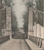
1839: Port-à-Binson
Port-à-Binson, Marne, France - Marne River
| Bridgemeister ID: | 2057 (added 2006-06-03) |
| Year Completed: | 1839 |
| Name: | Port-à-Binson |
| Location: | Port-à-Binson, Marne, France |
| Crossing: | Marne River |
| Principals: | Seguin Brothers |
| Use: | Vehicular |
| Status: | Destroyed, 1910s |
| Main Cables: | Wire (iron) |
| Suspended Spans: | 1 |
| Main Span: | 1 |
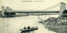
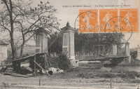
1839: Roche-Bernard
La Roche-Bernard, Morbihan, France - Vilaine River
| Bridgemeister ID: | 1027 (added 2003-11-22) |
| Year Completed: | 1839 |
| Name: | Roche-Bernard |
| Location: | La Roche-Bernard, Morbihan, France |
| Crossing: | Vilaine River |
| Principals: | P. Leblanc |
| References: | AAJ, HBE, PTS2 |
| Use: | Vehicular |
| Status: | Replaced, 1911 |
| Main Cables: | Wire (iron) |
| Suspended Spans: | 1 |
| Main Span: | 1 x 198 meters (649.6 feet) |
Notes:
- Wrecked by wind 1852, rebuilt, damaged 1866, 1869, 1870, and 1871. After the 1871 repairs, it was restricted to foot traffic. It was replaced in 1911 by an arch. Approaches extant (next to the later suspension bridge), 2004.
- Next to 1960 Roche-Bernard - La Roche-Bernard, Morbihan, France.
External Links:
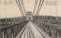
1839: Saint André-de-Cubzac
Saint André-de-Cubzac, Gironde, France - Dordogne River
| Bridgemeister ID: | 550 (added before 2003) |
| Year Completed: | 1839 |
| Name: | Saint André-de-Cubzac |
| Also Known As: | Cubzac |
| Location: | Saint André-de-Cubzac, Gironde, France |
| Crossing: | Dordogne River |
| Coordinates: | 44.962000 N 0.461444 W |
| Maps: | Acme, GeoHack, Google, OpenStreetMap |
| Principals: | Marie Fortuné de Vergès, Emil Martin |
| References: | AAJ, HBE, PTS2 |
| Use: | Vehicular |
| Status: | Destroyed, 1869 |
| Main Cables: | Wire (iron) |
| Suspended Spans: | 5 |
| Main Spans: | 5 x 10⁹ meters (357.6 feet) |
| Deck width: | 23 feet |
Notes:
- This is perhaps one of the most fanciful large suspension bridges ever built.
- Destroyed in a storm, 1869. Its replacement (a truss bridge) was completed in 1883. The approaches and the bottom halves of the suspension bridge towers were strengthened and used for the replacement.
- AAJ citing Engineering News-Record: "Vergès used inclined tie cables running from the top of the tower at one end of a span to a roadway-level connection on the opposite tower."
External Links:
- Structurae - Cubzac Bridge. Photos of the replacement truss structure.
- Structurae - Structure ID 20000898

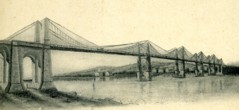
1839: Saint-Gervais
Saint-Gervais and L'Albenc, Isère, France - Isère River
| Bridgemeister ID: | 1753 (added 2005-04-20) |
| Year Completed: | 1839 |
| Name: | Saint-Gervais |
| Location: | Saint-Gervais and L'Albenc, Isère, France |
| Crossing: | Isère River |
| Coordinates: | 45.207083 N 5.465333 E |
| Maps: | Acme, GeoHack, Google, OpenStreetMap |
| Principals: | Escarraguel Brothers |
| Use: | Vehicular |
| Status: | Only towers remain, since 1940 (last checked: 2022) |
| Suspended Spans: | 1 |
| Main Span: | 1 x 93 meters (305.1 feet) |
Notes:
- 1940: Destroyed during WWII.
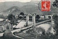
1839: Teil
Le Teil, Ardèche and Montélimar, Drôme, France - Rhône River
| Bridgemeister ID: | 1733 (added 2005-04-06) |
| Year Completed: | 1839 |
| Name: | Teil |
| Location: | Le Teil, Ardèche and Montélimar, Drôme, France |
| Crossing: | Rhône River |
| Coordinates: | 44.552213 N 4.691909 E |
| Maps: | Acme, GeoHack, Google, OpenStreetMap |
| References: | AAJ |
| Status: | Replaced, 1931 |
| Main Cables: | Wire (iron) |
| Suspended Spans: | 4 |
| Main Spans: | 4 |
| Deck width: | 19.68 feet |
Notes:
- Damaged by flood, 1840. Rebuilt and reopened, 1843. Damaged by floods, 1856 and 1881.
- Replaced by 1931 Teil - Le Teil, Ardèche and Montélimar, Drôme, France.
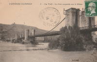
1839: Thoissey
Thoissey, Ain and Dracé, Rhône, France - Saône River
| Bridgemeister ID: | 5643 (added 2020-12-30) |
| Year Completed: | 1839 |
| Name: | Thoissey |
| Location: | Thoissey, Ain and Dracé, Rhône, France |
| Crossing: | Saône River |
| Coordinates: | 46.165206 N 4.789349 E |
| Maps: | Acme, GeoHack, Google, OpenStreetMap |
| References: | AAJ |
| Use: | Vehicular |
| Status: | Removed |
| Main Cables: | Wire (iron) |
| Suspended Spans: | 2 |
| Main Spans: | 2 |
Notes:
- Various sources suggest completed 1837-1839. The bridge may have initially failed upon its completion in 1837 and then opened in 1839.
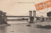
1840: Bigny
Saint-Loup-des-Chaumes and Bigny, Cher, France - Cher River
| Bridgemeister ID: | 2005 (added 2006-01-02) |
| Year Completed: | 1840 |
| Name: | Bigny |
| Location: | Saint-Loup-des-Chaumes and Bigny, Cher, France |
| Crossing: | Cher River |
| Coordinates: | 46.804972 N 2.371306 E |
| Maps: | Acme, GeoHack, Google, OpenStreetMap |
| Use: | Vehicular (one-lane) |
| Status: | Demolished, 1951 |
| Suspended Spans: | 1 |
External Links:
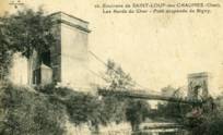
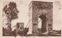
1840: Bono
Le Bono and Auray, Morbihan, France - Bono River
| Bridgemeister ID: | 997 (added 2003-11-16) |
| Year Completed: | 1840 |
| Name: | Bono |
| Location: | Le Bono and Auray, Morbihan, France |
| Crossing: | Bono River |
| Coordinates: | 47.640896 N 2.953463 W |
| Maps: | Acme, GeoHack, Google, OpenStreetMap |
| References: | BPF |
| Use: | Vehicular (one-lane) |
| Status: | Restricted to foot traffic (last checked: 2019) |
| Main Cables: | Wire (iron) |
| Suspended Spans: | 1 |
| Main Span: | 1 x 68.22 meters (223.8 feet) |
Notes:
- Located at the confluence of the Bono River with the Auray River.
- Substantial repairs 1859 and 1863, damaged by storm 1865, renovated 1867, traffic restricted 1869, more repairs 1869-1870, rebuilt 1925.
External Links:
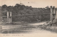
1840: Brignoud
Brignoud, Isère, France - Isère River
| Bridgemeister ID: | 2320 (added 2007-05-05) |
| Year Completed: | 1840 |
| Name: | Brignoud |
| Location: | Brignoud, Isère, France |
| Crossing: | Isère River |
| Use: | Vehicular |
| Status: | Removed |
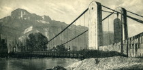
1840: Cordon
Brégnier-Cordon, Ain, France - Rhône River
| Bridgemeister ID: | 7050 (added 2022-05-26) |
| Year Completed: | 1840 |
| Name: | Cordon |
| Location: | Brégnier-Cordon, Ain, France |
| Crossing: | Rhône River |
| Use: | Vehicular |
| Status: | Destroyed, 1940 |
| Main Cables: | Wire |
Notes:
- Destroyed, 1940, during WWII.
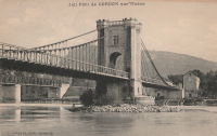
1840: Couzon
Couzon-au-Mont-d'Or and Rochetaillée-sur-Saône, Métropole de Lyon, France - Saône River
| Bridgemeister ID: | 1830 (added 2005-05-30) |
| Year Completed: | 1840 |
| Name: | Couzon |
| Location: | Couzon-au-Mont-d'Or and Rochetaillée-sur-Saône, Métropole de Lyon, France |
| Crossing: | Saône River |
| Coordinates: | 45.84503 N 4.83355 E |
| Maps: | Acme, GeoHack, Google, OpenStreetMap |
| Use: | Vehicular |
| Status: | In use (last checked: 2019) |
| Main Cables: | Wire |
| Suspended Spans: | 2 |
| Main Spans: | 2 |
External Links:
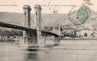
1840: Domène
Domène and Montbonnot-Saint-Martin, Isère, France - Isère River
| Bridgemeister ID: | 7573 (added 2023-04-16) |
| Year Completed: | 1840 |
| Name: | Domène |
| Location: | Domène and Montbonnot-Saint-Martin, Isère, France |
| Crossing: | Isère River |
| Coordinates: | 45.211855 N 5.829792 E |
| Maps: | Acme, GeoHack, Google, OpenStreetMap |
| Use: | Vehicular |
| Status: | Removed |
| Main Cables: | Wire (iron) |
| Main Span: | 1 |
External Links:
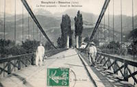
1840: La Gâche
Barraux and Pontcharra, Isère, France - Isère River
| Bridgemeister ID: | 7140 (added 2022-06-25) |
| Year Completed: | 1840 |
| Name: | La Gâche |
| Location: | Barraux and Pontcharra, Isère, France |
| Crossing: | Isère River |
| Coordinates: | 45.434917 N 6.004250 E |
| Maps: | Acme, GeoHack, Google, OpenStreetMap |
| Use: | Vehicular |
| Status: | Removed |
| Main Cables: | Wire |
| Suspended Spans: | 1 |
| Main Span: | 1 |
External Links:
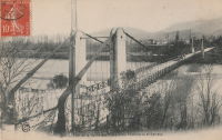
1840: Lézardrieux
Lézardrieux, Côtes-d'Armor, France - Trieux River
| Bridgemeister ID: | 1116 (added 2004-01-05) |
| Year Completed: | 1840 |
| Name: | Lézardrieux |
| Location: | Lézardrieux, Côtes-d'Armor, France |
| Crossing: | Trieux River |
| Coordinates: | 48.780778 N 3.106222 W |
| Maps: | Acme, GeoHack, Google, OpenStreetMap |
| Principals: | Seguin Brothers |
| References: | AAJ, PTS2 |
| Use: | Vehicular (one-lane) |
| Status: | Replaced, 1925 |
| Main Cables: | Wire (iron) |
| Suspended Spans: | 1 |
| Main Span: | 1 x 150 meters (492.1 feet) |
Notes:
- 1925: Replaced by a Gisclard suspension bridge reusing the approach spans and piers of the 1840 suspension bridge.
External Links:
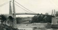
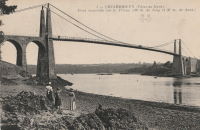
1840: Montjean-sur-Loire
Montjean-sur-Loire, Maine-et-Loire, France - Loire River
| Bridgemeister ID: | 1780 (added 2005-04-23) |
| Year Completed: | 1840 |
| Name: | Montjean-sur-Loire |
| Location: | Montjean-sur-Loire, Maine-et-Loire, France |
| Crossing: | Loire River |
| Coordinates: | 47.394880 N 0.859161 W |
| Maps: | Acme, GeoHack, Google, OpenStreetMap |
| References: | AAJ |
| Use: | Vehicular |
| Status: | Replaced, 1927 |
| Main Cables: | Wire (iron) |
Notes:
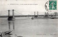
1840: Mornay-sur-Allier
Mornay-sur-Allier, Cher and St-Pierre-le-Moûtier, Nièvre, France - Allier River
| Bridgemeister ID: | 2342 (added 2007-08-12) |
| Year Completed: | 1840 |
| Name: | Mornay-sur-Allier |
| Location: | Mornay-sur-Allier, Cher and St-Pierre-le-Moûtier, Nièvre, France |
| Crossing: | Allier River |
| Coordinates: | 46.815250 N 3.043606 E |
| Maps: | Acme, GeoHack, Google, OpenStreetMap |
| Use: | Vehicular |
| Status: | Replaced |
| Main Cables: | Wire (iron) |
| Suspended Spans: | 3 |
| Main Span: | 1 x 80 meters (262.5 feet) |
| Side Spans: | 2 x 67 meters (219.8 feet) |
Notes:
- This was the larger of two suspension bridges separated by a small island in the Allier River.
- Connects to 1840 Mornay-sur-Allier - Mornay-sur-Allier, Cher and St-Pierre-le-Moûtier, Nièvre, France which was the smaller of the two bridges at this location separated by a small island. When the larger suspension bridge was replaced in 1936, the smaller bridge was replaced with a non-suspension bridge.
- Replaced by 1936 Mornay-sur-Allier - Mornay-sur-Allier, Cher and St-Pierre-le-Moûtier, Nièvre, France.
External Links:
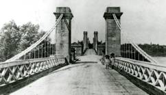
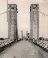
1840: Mornay-sur-Allier
Mornay-sur-Allier, Cher and St-Pierre-le-Moûtier, Nièvre, France - Allier River
| Bridgemeister ID: | 7901 (added 2023-10-15) |
| Year Completed: | 1840 |
| Name: | Mornay-sur-Allier |
| Location: | Mornay-sur-Allier, Cher and St-Pierre-le-Moûtier, Nièvre, France |
| Crossing: | Allier River |
| Coordinates: | 46.814793 N 3.045624 E |
| Maps: | Acme, GeoHack, Google, OpenStreetMap |
| Use: | Vehicular |
| Status: | Replaced, 1936 |
| Main Cables: | Wire (iron) |
| Suspended Spans: | 1 |
| Main Span: | 1 x 67.4 meters (221.1 feet) |
Notes:
- This was the smaller of two suspension bridges separated by a small island in the Allier River.
- Connects to 1840 Mornay-sur-Allier - Mornay-sur-Allier, Cher and St-Pierre-le-Moûtier, Nièvre, France which was the larger of the two suspension bridges. When it was replaced by another suspension in 1936, the smaller bridge was replaced with a non-suspension bridge.
External Links:

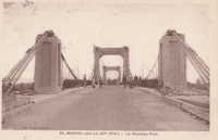
1840: Saint-Florent
Saint-Hilaire-Saint-Florent, Maine-et-Loire, France - Thouet River
| Bridgemeister ID: | 1779 (added 2005-04-23) |
| Year Completed: | 1840 |
| Name: | Saint-Florent |
| Location: | Saint-Hilaire-Saint-Florent, Maine-et-Loire, France |
| Crossing: | Thouet River |
| References: | AAJ |
| Suspended Spans: | 1 |
1840: Seveux
Seveux-Motey and Savoyeux, Haute-Saône, France - Savoyeux Diversion of the Saône
| Bridgemeister ID: | 8393 (added 2024-02-18) |
| Year Completed: | 1840 |
| Name: | Seveux |
| Also Known As: | Savoyeux |
| Location: | Seveux-Motey and Savoyeux, Haute-Saône, France |
| Crossing: | Savoyeux Diversion of the Saône |
| Coordinates: | 47.560583 N 5.739667 E |
| Maps: | Acme, GeoHack, Google, OpenStreetMap |
| Use: | Vehicular |
| Status: | Removed |
| Suspended Spans: | 1 |
External Links:
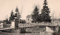
1840: Seyssel
Seyssel, Haute-Savoie and Seyssel, Ain, France - Rhône River
| Bridgemeister ID: | 3037 (added 2019-10-13) |
| Year Completed: | 1840 |
| Name: | Seyssel |
| Location: | Seyssel, Haute-Savoie and Seyssel, Ain, France |
| Crossing: | Rhône River |
| Coordinates: | 45.958542 N 5.832941 E |
| Maps: | Acme, GeoHack, Google, OpenStreetMap |
| References: | AGP |
| Use: | Vehicular |
| Status: | In use (last checked: 2019) |
| Main Cables: | Wire |
| Suspended Spans: | 2 |
| Main Span: | 1 |
| Side Span: | 1 |
External Links:
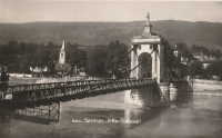
1840: St-Jean-de-Maruéjols
Saint-Jean-de-Maruéjols-et-Avéjan and Rochegude, Gard, France - Cèze River
| Bridgemeister ID: | 7755 (added 2023-07-23) |
| Year Completed: | 1840 |
| Name: | St-Jean-de-Maruéjols |
| Also Known As: | Rochegude |
| Location: | Saint-Jean-de-Maruéjols-et-Avéjan and Rochegude, Gard, France |
| Crossing: | Cèze River |
| Use: | Vehicular |
| Status: | Removed |
| Main Cables: | Wire (iron) |
| Suspended Spans: | 1 |
External Links:
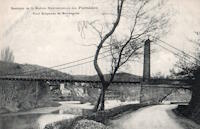
1840: Vicq-sur-Gartempe
Vicq-sur-Gartempe and Champagne, Vienne, France - Gartempe River
| Bridgemeister ID: | 2066 (added 2006-06-06) |
| Year Completed: | 1840 |
| Name: | Vicq-sur-Gartempe |
| Location: | Vicq-sur-Gartempe and Champagne, Vienne, France |
| Crossing: | Gartempe River |
| Use: | Vehicular (one-lane) |
| Status: | Destroyed, 1880 |
| Suspended Spans: | 1 |
Notes:
- Destroyed by flood, 1880.
- Replaced by 1881 Vicq-sur-Gartempe - Vicq-sur-Gartempe, Vienne, France.
1840: Villers-le-Lac
Villers-le-Lac, Doubs, France - Doubs River
| Bridgemeister ID: | 7679 (added 2023-06-24) |
| Year Completed: | 1840 |
| Name: | Villers-le-Lac |
| Location: | Villers-le-Lac, Doubs, France |
| Crossing: | Doubs River |
| Coordinates: | 47.059577 N 6.671714 E |
| Maps: | Acme, GeoHack, Google, OpenStreetMap |
| Use: | Vehicular |
| Status: | Removed |
| Suspended Spans: | 1 |
External Links:

1841: Agen
Agen, Lot-et-Garonne, France - Garonne River
| Bridgemeister ID: | 1031 (added 2003-11-30) |
| Year Completed: | 1841 |
| Name: | Agen |
| Location: | Agen, Lot-et-Garonne, France |
| Crossing: | Garonne River |
| Coordinates: | 44.201972 N 0.608861 E |
| Maps: | Acme, GeoHack, Google, OpenStreetMap |
| Use: | Footbridge |
| Status: | Replaced |
Notes:
- Replaced by 2002 Agen - Agen, Lot-et-Garonne, France.
External Links:
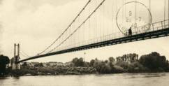
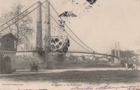
1841: Aiguilly
Roanne vicinity and Vougy vicinity, Loire, France - Loire River
| Bridgemeister ID: | 1566 (added 2004-11-28) |
| Year Completed: | 1841 |
| Name: | Aiguilly |
| Location: | Roanne vicinity and Vougy vicinity, Loire, France |
| Crossing: | Loire River |
| References: | AAJ |
| Status: | Replaced, 1937 |
| Main Cables: | Wire (iron) |
Notes:
External Links:
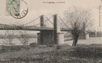
1841: Boran
Boran-sur-Oise, Oise, France - Oise River
| Bridgemeister ID: | 2064 (added 2006-06-06) |
| Year Completed: | 1841 |
| Name: | Boran |
| Location: | Boran-sur-Oise, Oise, France |
| Crossing: | Oise River |
| Coordinates: | 49.168388 N 2.366337 E |
| Maps: | Acme, GeoHack, Google, OpenStreetMap |
| Use: | Vehicular (one-lane), with walkway |
| Status: | Destroyed, 1914 |
| Main Cables: | Wire |
| Suspended Spans: | 1 |
Notes:
- Later at same location 1946 Boran - Boran-sur-Oise, Oise, France.
External Links:

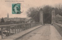
1841: Chalonnes
Chalonnes-sur-Loire, Maine-et-Loire, France - Loire River
| Bridgemeister ID: | 1419 (added 2004-07-17) |
| Year Completed: | 1841 |
| Name: | Chalonnes |
| Location: | Chalonnes-sur-Loire, Maine-et-Loire, France |
| Crossing: | Loire River |
| Coordinates: | 47.354170 N 0.761887 W |
| Maps: | Acme, GeoHack, Google, OpenStreetMap |
| Principals: | Seguin Brothers |
| Use: | Vehicular |
| Status: | Destroyed, June 20, 1940 |
| Main Cables: | Wire (iron) |
Notes:
- Near Saint-Georges-sur-Loire - Saint-Georges-sur-Loire and Chalonnes-sur-Loire, Maine-et-Loire, France.
- Later at same location 1948 Chalonnes - Chalonnes-sur-Loire, Maine-et-Loire, France.
External Links:

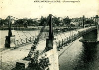
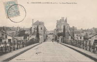
1841: Chauvort
Allerey-sur-Saône and Verdun-sur-le-Doubs, Saône-et-Loire, France - Saône River
| Bridgemeister ID: | 779 (added 2003-03-16) |
| Year Completed: | 1841 |
| Name: | Chauvort |
| Location: | Allerey-sur-Saône and Verdun-sur-le-Doubs, Saône-et-Loire, France |
| Crossing: | Saône River |
| Coordinates: | 46.906222 N 5.003611 E |
| Maps: | Acme, GeoHack, Google, OpenStreetMap |
| Use: | Vehicular |
| Status: | Only towers remain (last checked: 2023) |
| Main Cables: | Wire |
| Suspended Spans: | 1 |
Notes:
- Sometimes referred to as "Chaufort."
- Replaced, 1928.
- Near Bragny - Verdun-sur-le-Doubs and Bragny-sur-Saône, Saône-et-Loire, France.
External Links:
- >Ancien pont suspendu de Chauvort ⋅ Patrimoine en Bourgogne-Franche-Comté
- Art-et-Histoire - Pont suspendu de Chauvort d'Allerey-sur-Saone - 1841
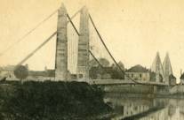
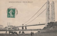
1841: Châteauneuf-sur-Loire
Châteauneuf-sur-Loire, Loiret, France - Loire River
| Bridgemeister ID: | 1016 (added 2003-11-22) |
| Year Completed: | 1841 |
| Name: | Châteauneuf-sur-Loire |
| Location: | Châteauneuf-sur-Loire, Loiret, France |
| Crossing: | Loire River |
| Coordinates: | 47.857889 N 2.223417 E |
| Maps: | Acme, GeoHack, Google, OpenStreetMap |
| Principals: | Seguin Brothers |
| References: | AAJ |
| Use: | Vehicular |
| Status: | Replaced |
| Main Cables: | Wire (iron) |
| Suspended Spans: | 5 |
| Main Spans: | 5 |
Notes:
- 1870: Heavily damaged during Franco-Prussian war.
- 1872: Repairs completed.
- Replaced by 1935 Châteauneuf-sur-Loire - Châteauneuf-sur-Loire, Loiret, France.
External Links:
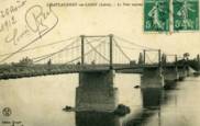
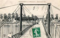
1841: Châtillon-sur-Loire
Châtillon-sur-Loire, Loiret, France - Loire River
| Bridgemeister ID: | 1017 (added 2003-11-22) |
| Year Completed: | 1841 |
| Name: | Châtillon-sur-Loire |
| Location: | Châtillon-sur-Loire, Loiret, France |
| Crossing: | Loire River |
| Principals: | Marc Seguin |
| References: | AAJ |
| Use: | Vehicular |
| Status: | Replaced, 1931 |
| Main Cables: | Wire (iron) |
| Suspended Spans: | 4 |
| Main Spans: | 2 x 92 meters (301.8 feet), 2 x 76 meters (249.3 feet) |
Notes:
- Destroyed by flood 1846, rebuilt 1848, damaged by flood 1856, rebuilt 1857.
- Replaced by 1931 Châtillon-sur-Loire - Châtillon-sur-Loire, Loiret, France. Built on same piers.
External Links:
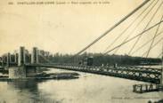
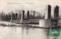
1841: Quincy
Quincy, Cher, France - Cher River
| Bridgemeister ID: | 5678 (added 2021-03-13) |
| Year Completed: | 1841 |
| Name: | Quincy |
| Location: | Quincy, Cher, France |
| Crossing: | Cher River |
| Coordinates: | 47.135019 N 2.163212 E |
| Maps: | Acme, GeoHack, Google, OpenStreetMap |
| Use: | Vehicular (one-lane) |
| Status: | Replaced, 1925 |
| Main Cables: | Wire (iron) |
| Suspended Spans: | 1 |
External Links:
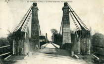
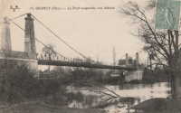
1841: Rotonde
Nantes, Loire-Atlantique, France - Saint-Félix Canal
| Bridgemeister ID: | 6830 (added 2021-12-26) |
| Year Completed: | 1841 |
| Name: | Rotonde |
| Also Known As: | Pont de la Rotonde, Saint-Félix |
| Location: | Nantes, Loire-Atlantique, France |
| Crossing: | Saint-Félix Canal |
| Coordinates: | 47.215556 N 1.546667 W |
| Maps: | Acme, GeoHack, Google, OpenStreetMap |
| Status: | Collapsed, July 21, 1866 |
| Main Cables: | Wire (iron) |
| Suspended Spans: | 1 |
| Main Span: | 1 |
Notes:
- Unclear if it crossed an arm of the Loire (since filled), the Saint-Félix Canal, or both.
- 1846: Renovated.
External Links:
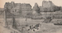
1841: Saintes
Saintes, Charente-Maritime, France - Charente River
| Bridgemeister ID: | 5662 (added 2021-01-01) |
| Year Completed: | 1841 |
| Name: | Saintes |
| Location: | Saintes, Charente-Maritime, France |
| Crossing: | Charente River |
| References: | AAJ |
| Use: | Vehicular |
| Status: | Removed, 1876 |
| Main Cables: | Wire (iron) |
| Suspended Spans: | 1 |
1841: Verdun-sur-Garonne
Verdun-sur-Garonne, Tarn-et-Garonne, France - Garonne River
| Bridgemeister ID: | 2158 (added 2006-12-10) |
| Year Completed: | 1841 |
| Name: | Verdun-sur-Garonne |
| Location: | Verdun-sur-Garonne, Tarn-et-Garonne, France |
| Crossing: | Garonne River |
| References: | AAJ, PTS2 |
| Use: | Vehicular |
| Suspended Spans: | 1 |
| Main Span: | 1 x 151 meters (495.4 feet) |
Notes:
- See 1931 Verdun-sur-Garonne - Verdun-sur-Garonne, Tarn-et-Garonne, France. The relationship between the older and current bridges is unclear.
External Links:
1841: Vernéjoux
Vernéjoux, Corrèze and Cantal, France - Dordogne River
| Bridgemeister ID: | 1988 (added 2005-12-02) |
| Year Completed: | 1841 |
| Name: | Vernéjoux |
| Location: | Vernéjoux, Corrèze and Cantal, France |
| Crossing: | Dordogne River |
| Coordinates: | 45.365917 N 2.367694 E |
| Maps: | Acme, GeoHack, Google, OpenStreetMap |
| Use: | Vehicular (one-lane) |
| Status: | Removed |
| Main Cables: | Wire |
| Suspended Spans: | 1 |
Notes:
- May have been replaced in 1929 by another suspension bridge that was destroyed in 1944 during WWII.
- 2023: Remnants of a former suspension bridge still exist below the current concrete arch bridge and are visible when the water level is low.
1842: Bourret
Bourret and Montech, Tarn-et-Garonne, France - Garonne River
| Bridgemeister ID: | 7576 (added 2023-04-21) |
| Year Completed: | 1842 |
| Name: | Bourret |
| Location: | Bourret and Montech, Tarn-et-Garonne, France |
| Crossing: | Garonne River |
| Coordinates: | 43.950069 N 1.171788 E |
| Maps: | Acme, GeoHack, Google, OpenStreetMap |
| Use: | Vehicular |
| Status: | Replaced, 1914 |
| Main Cables: | Wire (iron) |
| Main Spans: | 3 |
Notes:
- Replaced by a Gisclard suspension bridge.
External Links:
1842: Briollay
Briollay, Maine-et-Loire, France - Sarthe River
| Bridgemeister ID: | 6699 (added 2021-10-03) |
| Year Completed: | 1842 |
| Name: | Briollay |
| Location: | Briollay, Maine-et-Loire, France |
| Crossing: | Sarthe River |
| Use: | Vehicular |
| Status: | Replaced |
| Main Cables: | Wire (iron) |
| Suspended Spans: | 1 |
| Main Span: | 1 |
Notes:
- Replaced by 1927 Briollay - Briollay, Maine-et-Loire, France.
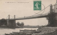
1842: Casseneuil
Casseneuil, Lot-et-Garonne, France - Lot River
| Bridgemeister ID: | 7081 (added 2022-05-28) |
| Year Completed: | 1842 |
| Name: | Casseneuil |
| Location: | Casseneuil, Lot-et-Garonne, France |
| Crossing: | Lot River |
| Use: | Vehicular |
| Status: | Removed, 1980 |
| Main Cables: | Wire |
| Suspended Spans: | 1 |
| Main Span: | 1 |
External Links:
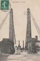
1842: Chissay
Chissay-en-Touraine, Loir-et-Cher, France - Cher River
| Bridgemeister ID: | 1972 (added 2005-11-27) |
| Year Completed: | 1842 |
| Name: | Chissay |
| Location: | Chissay-en-Touraine, Loir-et-Cher, France |
| Crossing: | Cher River |
| Status: | Removed |
| Main Cables: | Wire (iron) |
| Suspended Spans: | 1 |
1842: Cité
Île de la Cité and Île St-Louis, Paris, France - Seine River
1842: Fontaines-sur-Saône
Fontaines-sur-Saône, Métropole de Lyon, France - Saône River
| Bridgemeister ID: | 1987 (added 2005-12-02) |
| Year Completed: | 1842 |
| Name: | Fontaines-sur-Saône |
| Location: | Fontaines-sur-Saône, Métropole de Lyon, France |
| Crossing: | Saône River |
| Use: | Vehicular (one-lane) |
| Status: | Removed |
| Main Cables: | Wire (iron) |
| Suspended Spans: | 1 |
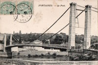
1842: Gennes
Gennes and Les Rosiers-sur-Loire, Maine-et-Loire, France - Loire River
| Bridgemeister ID: | 1172 (added 2004-01-23) |
| Year Completed: | 1842 |
| Name: | Gennes |
| Location: | Gennes and Les Rosiers-sur-Loire, Maine-et-Loire, France |
| Crossing: | Loire River |
| Coordinates: | 47.345559 N 0.230343 W |
| Maps: | Acme, GeoHack, Google, OpenStreetMap |
| Use: | Vehicular |
| Status: | Replaced |
| Main Cables: | Wire (iron) |
Notes:
- Connects to 1842 Les Rosiers-sur-Loire - Les Rosiers-sur-Loire and Gennes, Maine-et-Loire, France.
- Replaced by 1932 Gennes - Gennes and Les Rosiers-sur-Loire, Maine-et-Loire, France.
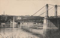
1842: Les Mées
Les Mées, Alpes-de-Haute-Provence, France - Durance River
| Bridgemeister ID: | 1734 (added 2005-04-19) |
| Year Completed: | 1842 |
| Name: | Les Mées |
| Location: | Les Mées, Alpes-de-Haute-Provence, France |
| Crossing: | Durance River |
| References: | AAJ |
| Use: | Vehicular |
| Status: | Destroyed, 1843 |
| Suspended Spans: | 3 |
Notes:
- Destroyed by flood, 1843.
- Replaced by 1856 Les Mées - Les Mées, Alpes-de-Haute-Provence, France.
External Links:
1842: Les Rosiers-sur-Loire
Les Rosiers-sur-Loire and Gennes, Maine-et-Loire, France - Loire River
| Bridgemeister ID: | 1943 (added 2005-10-29) |
| Year Completed: | 1842 |
| Name: | Les Rosiers-sur-Loire |
| Location: | Les Rosiers-sur-Loire and Gennes, Maine-et-Loire, France |
| Crossing: | Loire River |
| Coordinates: | 47.349195 N 0.227169 W |
| Maps: | Acme, GeoHack, Google, OpenStreetMap |
| Use: | Vehicular |
| Status: | Replaced |
| Main Cables: | Wire (iron) |
Notes:
- Connects to 1842 Gennes - Gennes and Les Rosiers-sur-Loire, Maine-et-Loire, France.
- Replaced by 1932 Les Rosiers-sur-Loire - Les Rosiers-sur-Loire and Gennes, Maine-et-Loire, France.
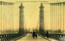
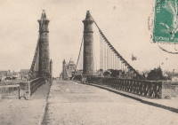
1842: Pertuiset
Pertuiset, Firminy vicinity, Loire, France - Loire River
| Bridgemeister ID: | 1165 (added 2004-01-19) |
| Year Completed: | 1842 |
| Name: | Pertuiset |
| Location: | Pertuiset, Firminy vicinity, Loire, France |
| Crossing: | Loire River |
| Principals: | M. Letrain |
| Use: | Vehicular (one-lane) |
| Status: | Removed |
| Main Cables: | Wire (iron) |
| Suspended Spans: | 1 |
Notes:
External Links:
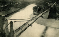
1842: Rochemaure
Rochemaure, Ardèche and Ancône, Drôme, France - Rhône River
| Bridgemeister ID: | 950 (added 2003-10-31) |
| Year Completed: | 1842 |
| Name: | Rochemaure |
| Location: | Rochemaure, Ardèche and Ancône, Drôme, France |
| Crossing: | Rhône River |
| Coordinates: | 44.583117 N 4.71035 E |
| Maps: | Acme, GeoHack, Google, OpenStreetMap |
| References: | BPF |
| Use: | Vehicular (one-lane) |
| Status: | Only towers remain (last checked: 2021) |
| Main Cables: | Wire |
| Suspended Spans: | 2 |
| Main Spans: | 2 |
Notes:
- Failed 1856, rebuilt 1858, destroyed 1940 (war), rebuilt 1942, destroyed 1944 (war), rebuilt 1946, restricted to pedestrians, 1983. Abandoned in the 1990s. Stood in a derelict state for several years.
- 2013: Work is completed to replace the derelict deck with a suspension footbridge that sits on the original piers but does not use the towers of the former suspension bridge. This new installation is tracked separately.
- Replaced by 2013 Himalayenne (Rochemaure, Himalayan) - Rochemaure, Ardèche, France.
External Links:
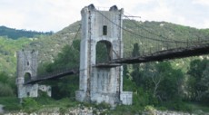
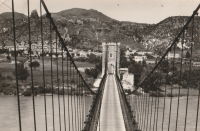
1842: Suresnes
Suresnes, Hauts-de-Seine, France - Seine River
| Bridgemeister ID: | 1929 (added 2005-10-23) |
| Year Completed: | 1842 |
| Name: | Suresnes |
| Location: | Suresnes, Hauts-de-Seine, France |
| Crossing: | Seine River |
| Coordinates: | 48.866905 N 2.229533 E |
| Maps: | Acme, GeoHack, Google, OpenStreetMap |
| Principals: | Charles Seguin, Paul Seguin, M. Surville |
| Use: | Vehicular |
| Status: | Destroyed, 1870 |
| Main Cables: | Wire (iron) |
External Links:
1842: Tonnay-Charente
Tonnay-Charente, Charente-Maritime, France - Charente River
| Bridgemeister ID: | 942 (added 2003-10-27) |
| Year Completed: | 1842 |
| Name: | Tonnay-Charente |
| Location: | Tonnay-Charente, Charente-Maritime, France |
| Crossing: | Charente River |
| Coordinates: | 45.940166 N 0.886 W |
| Maps: | Acme, GeoHack, Google, OpenStreetMap |
| References: | BPF, PTS2 |
| Use: | Vehicular |
| Status: | Replaced, 1884 |
| Main Cables: | Wire (iron) |
| Suspended Spans: | 3 |
| Main Span: | 1 x 90 meters (295.3 feet) |
| Side Spans: | 2 |
Notes:
- Deck failed, August 21, 1883, during a load test. Replacement built on the original piers.
- Replaced by 1884 Tonnay-Charente - Tonnay-Charente, Charente-Maritime, France.
External Links:
1843: Avignon
Avignon, Vaucluse and Villeneuve-lès-Avignon, Gard, France - Rhône River
| Bridgemeister ID: | 986 (added 2003-11-15) |
| Year Completed: | 1843 |
| Name: | Avignon |
| Location: | Avignon, Vaucluse and Villeneuve-lès-Avignon, Gard, France |
| Crossing: | Rhône River |
| Coordinates: | 43.951490 N 4.800048 E |
| Maps: | Acme, GeoHack, Google, OpenStreetMap |
| Principals: | Seguin Brothers |
| Use: | Vehicular |
| Status: | Demolished, c. 1960 |
| Main Cables: | Wire (iron) |
| Suspended Spans: | 3 |
| Main Span: | 1 |
| Side Spans: | 2 |
Notes:
- Coordinates are for the present day (2022) Pont Édouard Daladier. The suspension bridge was on an alignment immediately adjacent to it.
- 1888-1890: Strengthened, and perhaps largely rebuilt, by Ferdinand Arnodin. This introduced the hybrid cable-stayed/suspension system commonly seen in images of the bridge.
- 1944, June: Heavily damaged by US bombardment. Eventually repaired and reopened.
External Links:
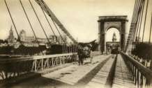

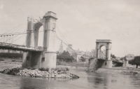
1843: Bassou
Bassou and Bonnard, Yonne, France - Yonne River
| Bridgemeister ID: | 2234 (added 2007-03-19) |
| Year Completed: | 1843 |
| Name: | Bassou |
| Location: | Bassou and Bonnard, Yonne, France |
| Crossing: | Yonne River |
| References: | AAJ |
| Use: | Vehicular |
| Status: | Replaced, 1967 |
| Main Cables: | Wire |
| Suspended Spans: | 1 |
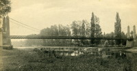
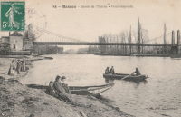
1843: Capens
Capens, Haute-Garonne, France - Garonne River
| Bridgemeister ID: | 6741 (added 2021-10-23) |
| Year Completed: | 1843 |
| Name: | Capens |
| Location: | Capens, Haute-Garonne, France |
| Crossing: | Garonne River |
| Use: | Vehicular |
| Status: | Replaced, 1930 |
| Main Cables: | Wire (iron) |
| Main Span: | 1 |
Notes:
- Replaced by 1930 Capens - Capens, Haute-Garonne, France.
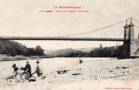
1843: Elbeuf
Elbeuf and Saint-Aubin-lès-Elbeuf, Seine-Maritime, France - Seine River
| Bridgemeister ID: | 989 (added 2003-11-16) |
| Year Completed: | 1843 |
| Name: | Elbeuf |
| Location: | Elbeuf and Saint-Aubin-lès-Elbeuf, Seine-Maritime, France |
| Crossing: | Seine River |
| Principals: | Seguin Brothers, Charles Levasseur |
| Use: | Vehicular |
| Status: | Destroyed, 1940 |
| Main Cables: | Wire (iron) |
| Suspended Spans: | 2 |
| Main Spans: | 2 |
Notes:
External Links:
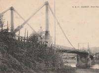
1843: Ingrandes
Ingrandes, Maine-et-Loire, France - Loire River
| Bridgemeister ID: | 1171 (added 2004-01-23) |
| Year Completed: | 1843 |
| Name: | Ingrandes |
| Location: | Ingrandes, Maine-et-Loire, France |
| Crossing: | Loire River |
| Coordinates: | 47.40075 N 0.918683 W |
| Maps: | Acme, GeoHack, Google, OpenStreetMap |
| References: | AAJ |
| Use: | Vehicular |
| Status: | In use (last checked: 2021) |
| Main Cables: | Wire (iron) |
| Suspended Spans: | 8 |
| Main Spans: | 8 |
Notes:
- Structurae has the bridge completed in 1922 (with a 1941 reconstruction) and AAJ suggests the bridge was completed 1924-1927, but older images of the bridge show an older bridge consistent with the 1843 date. The later dates represent reconstructions. The current bridge has steel cables.
External Links:
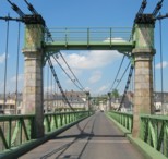
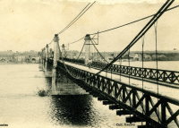
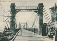
1843: Muides-sur-Loire
Muides-sur-Loire and Mer-sur-Loire, Loir-et-Cher, France - Loire River
| Bridgemeister ID: | 5664 (added 2021-01-02) |
| Year Completed: | 1843 |
| Name: | Muides-sur-Loire |
| Location: | Muides-sur-Loire and Mer-sur-Loire, Loir-et-Cher, France |
| Crossing: | Loire River |
| Coordinates: | 47.674739 N 1.526818 E |
| Maps: | Acme, GeoHack, Google, OpenStreetMap |
| Use: | Vehicular |
| Status: | Removed, 1931 |
| Main Cables: | Wire (iron) |
| Suspended Spans: | 2 |
| Main Spans: | 2 |
Notes:
- 1870: Cables cut during Franco-Prussian War. Later rebuilt, but unclear to what extent the original superstructure was reused.
External Links:
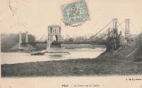
1843: Ondes
Ondes and Grenade, Haute-Garonne, France - Garonne River
| Bridgemeister ID: | 2231 (added 2007-03-19) |
| Year Completed: | 1843 |
| Name: | Ondes |
| Location: | Ondes and Grenade, Haute-Garonne, France |
| Crossing: | Garonne River |
| Use: | Vehicular (one-lane) |
| Status: | Removed |
| Main Cables: | Wire (iron) |
| Main Spans: | 3 |
External Links:
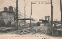
1843: Sautet
Corps vicinity and Mens vicinity, Isère, France - Drac River
| Bridgemeister ID: | 7442 (added 2022-12-23) |
| Year Completed: | 1843 |
| Name: | Sautet |
| Location: | Corps vicinity and Mens vicinity, Isère, France |
| Crossing: | Drac River |
| Use: | Vehicular |
| Status: | Removed |
| Main Cables: | Wire |
| Suspended Spans: | 1 |
Notes:
- Location now inundated behind the Sautet dam (Barrage du Sautet).
External Links:
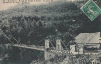
1843: Villeneuve-Saint-Georges
Villeneuve-Saint-Georges and Villeneuve-le-Roi, Val-de-Marne, France - Seine River
| Bridgemeister ID: | 1654 (added 2005-03-19) |
| Year Completed: | 1843 |
| Name: | Villeneuve-Saint-Georges |
| Location: | Villeneuve-Saint-Georges and Villeneuve-le-Roi, Val-de-Marne, France |
| Crossing: | Seine River |
| Use: | Vehicular |
| Status: | Replaced, 1939 |
| Main Cables: | Wire (iron) |
| Suspended Spans: | 1 |
External Links:


1844: Blagnac
Blagnac, Haute-Garonne, France - Garonne River
| Bridgemeister ID: | 2958 (added 2019-10-06) |
| Year Completed: | 1844 |
| Name: | Blagnac |
| Location: | Blagnac, Haute-Garonne, France |
| Crossing: | Garonne River |
| Coordinates: | 43.624959 N 1.400544 E |
| Maps: | Acme, GeoHack, Google, OpenStreetMap |
| Principals: | Marnac, J.Quenot |
| Use: | Vehicular |
| Status: | Replaced, 1923 |
| Main Cables: | Wire (iron) |
| Suspended Spans: | 1 |
Notes:
- Replaced by 1923 Blagnac - Blagnac, Haute-Garonne, France.
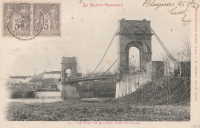
1844: Buzet-sur-Tarn
Buzet-sur-Tarn, Haute-Garonne, France - Tarn River
| Bridgemeister ID: | 6613 (added 2021-09-05) |
| Year Completed: | 1844 |
| Name: | Buzet-sur-Tarn |
| Location: | Buzet-sur-Tarn, Haute-Garonne, France |
| Crossing: | Tarn River |
| Coordinates: | 43.780638 N 1.634603 E |
| Maps: | Acme, GeoHack, Google, OpenStreetMap |
| Use: | Vehicular (one-lane) |
| Status: | Removed |
| Main Cables: | Wire (iron) |
Notes:
- Later at same location 1955 Buzet-sur-Tarn - Buzet-sur-Tarn, Haute-Garonne, France. Unclear if the 1955 bridge was a direct replacement.
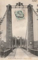
1844: Crevant à Maringues
Maringues and Crevant-Laveine, Puy-de-Dôme, France - Allier River
| Bridgemeister ID: | 1941 (added 2005-10-29) |
| Year Completed: | 1844 |
| Name: | Crevant à Maringues |
| Location: | Maringues and Crevant-Laveine, Puy-de-Dôme, France |
| Crossing: | Allier River |
| References: | AAJ |
| Use: | Vehicular |
| Status: | Removed |
| Main Cables: | Wire (iron) |
| Suspended Spans: | 3 |
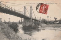
1844: Mouton
Lyon, Métropole de Lyon, France - Saône River
| Bridgemeister ID: | 544 (added before 2003) |
| Year Completed: | 1844 |
| Name: | Mouton |
| Location: | Lyon, Métropole de Lyon, France |
| Crossing: | Saône River |
| Coordinates: | 45.774187 N 4.810129 E |
| Maps: | Acme, GeoHack, Google, OpenStreetMap |
| References: | PQL |
| Use: | Vehicular (one-lane) |
| Status: | Replaced, 1952 |
| Main Cables: | Wire (iron) |
| Suspended Spans: | 1 |
Notes:
- Bombed, 1944. Rebuilt, 1946. Was located at the site of the current Pont Georges Clemenceau
- Next to 1831 Masaryk (Masarik, Mazarik, de la Gare) - Lyon vicinity, Métropole de Lyon, France.
External Links:
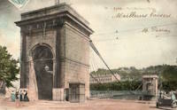
1844: Saint-Claude
Saint-Claude, Jura, France - Tacon River
| Bridgemeister ID: | 1200 (added 2004-01-31) |
| Year Completed: | 1844 |
| Name: | Saint-Claude |
| Location: | Saint-Claude, Jura, France |
| Crossing: | Tacon River |
| References: | AAJ |
| Use: | Vehicular |
| Status: | Replaced, 1939 |
| Main Cables: | Wire (iron) |
| Suspended Spans: | 1 |
Notes:
- Replaced by a concrete arch, 1939.
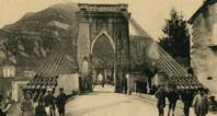

1844: Saint-Denis
Saint-Denis, Seine-Saint-Denis and Villeneuve-la-Garenne, Hauts-de-Seine, France - Seine River
| Bridgemeister ID: | 1686 (added 2005-03-26) |
| Year Completed: | 1844 |
| Name: | Saint-Denis |
| Location: | Saint-Denis, Seine-Saint-Denis and Villeneuve-la-Garenne, Hauts-de-Seine, France |
| Crossing: | Seine River |
| Use: | Vehicular |
| Status: | Destroyed, 1904 |
| Main Cables: | Wire |
| Suspended Spans: | 2 |
| Main Spans: | 2 |
External Links:
1844: Saint-Michel
Toulouse, Haute-Garonne, France - Garonne River
| Bridgemeister ID: | 2050 (added 2006-05-21) |
| Year Completed: | 1844 |
| Name: | Saint-Michel |
| Location: | Toulouse, Haute-Garonne, France |
| Crossing: | Garonne River |
| Principals: | Escarraguel Brothers |
| Use: | Vehicular |
| Status: | Destroyed, 1875, by flood |
External Links:
1844: Saula
Lafrançaise, Tarn-et-Garonne, France - Tarn River
| Bridgemeister ID: | 7186 (added 2022-07-02) |
| Year Completed: | 1844 |
| Name: | Saula |
| Location: | Lafrançaise, Tarn-et-Garonne, France |
| Crossing: | Tarn River |
| Use: | Vehicular |
| Status: | Replaced |
| Suspended Spans: | 1 |
Notes:
- Damaged or destroyed by flood, 1930.
- Replaced by 1938 Saula - Lafrançaise, Tarn-et-Garonne, France.
1845: Auvillar
Auvillar and Espalais, Tarn-et-Garonne, France - Garonne River
| Bridgemeister ID: | 1718 (added 2005-04-05) |
| Year Completed: | 1845 |
| Name: | Auvillar |
| Location: | Auvillar and Espalais, Tarn-et-Garonne, France |
| Crossing: | Garonne River |
| Use: | Vehicular |
| Status: | Removed, c. 1939 |
| Main Cables: | Wire (iron) |
| Suspended Spans: | 3 |
| Main Span: | 1 |
| Side Spans: | 2 |
Notes:
- Removed at some point during or after 1939.
- Later at same location Auvillar - Auvillar and Espalais, Tarn-et-Garonne, France. Unclear if the later bridge was a direct replacement for the older bridge.
External Links:

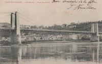
1845: Auzon
Auzon, Haute-Loire, France - Allier River
| Bridgemeister ID: | 6934 (added 2022-01-22) |
| Year Completed: | 1845 |
| Name: | Auzon |
| Location: | Auzon, Haute-Loire, France |
| Crossing: | Allier River |
| Coordinates: | 45.385847 N 3.356905 E |
| Maps: | Acme, GeoHack, Google, OpenStreetMap |
| Status: | Destroyed, October 18, 1846 |
Notes:
- Replaced by 1847 Auzon - Auzon, Haute-Loire, France.
External Links:
- Art-et-Histoire - Premier pont suspendu d'Auzon - 1845. Bridge is destroyed by flood, October 18, 1846.
1845: Canet
Canet and Le Pouget, Hérault, France - Hérault River
| Bridgemeister ID: | 7490 (added 2022-12-30) |
| Year Completed: | 1845 |
| Name: | Canet |
| Location: | Canet and Le Pouget, Hérault, France |
| Crossing: | Hérault River |
| Coordinates: | 43.597299 N 3.493113 E |
| Maps: | Acme, GeoHack, Google, OpenStreetMap |
| Status: | Replaced, 1874 |
| Main Cables: | Wire (iron) |
Notes:
- Replaced by 1874 Canet - Canet and Le Pouget, Hérault, France.
External Links:
- Art-et-Histoire - Pont de Canet - 1845. Indicates deck was destroyed by fire, precipitating replacement.
1845: Castelmoron-sur-Lot
Castelmoron-sur-Lot, Lot-et-Garonne, France - Lot River
| Bridgemeister ID: | 1720 (added 2005-04-05) |
| Year Completed: | 1845 |
| Name: | Castelmoron-sur-Lot |
| Location: | Castelmoron-sur-Lot, Lot-et-Garonne, France |
| Crossing: | Lot River |
| Coordinates: | 44.395673 N 0.494136 E |
| Maps: | Acme, GeoHack, Google, OpenStreetMap |
| References: | AAJ |
| Use: | Vehicular |
| Status: | Replaced, 1933 |
| Main Cables: | Wire (iron) |
| Main Span: | 1 |
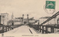
1845: College
Lyon, Métropole de Lyon, France - Rhône River
| Bridgemeister ID: | 1021 (added 2003-11-22) |
| Year Completed: | 1845 |
| Name: | College |
| Also Known As: | Collège |
| Location: | Lyon, Métropole de Lyon, France |
| Crossing: | Rhône River |
| Coordinates: | 45.765483 N 4.838717 E |
| Maps: | Acme, GeoHack, Google, OpenStreetMap |
| References: | BPF, PQL |
| Use: | Footbridge |
| Status: | Destroyed, 1944 |
| Main Cables: | Wire (iron) |
| Suspended Spans: | 3 |
| Main Span: | 1 |
| Side Spans: | 2 |
Notes:
- Destroyed 1944.
- Near 1839 L'Hôtel Dieu - Lyon, Métropole de Lyon, France.
- Near 1846 Saint Clair (Louis Philippe, Vaïsse) - Lyon, Métropole de Lyon, France.
- Replaced by 1945 College (Collège) - Lyon, Métropole de Lyon, France.
External Links:
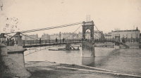
1845: Couthures
Couthures-sur-Garonne, Lot-et-Garonne, France - Garonne River
| Bridgemeister ID: | 1900 (added 2005-10-04) |
| Year Completed: | 1845 |
| Name: | Couthures |
| Location: | Couthures-sur-Garonne, Lot-et-Garonne, France |
| Crossing: | Garonne River |
| Coordinates: | 44.513600 N 0.080580 E |
| Maps: | Acme, GeoHack, Google, OpenStreetMap |
| References: | AAJ |
| Use: | Vehicular |
| Status: | Removed |
| Main Cables: | Wire |
| Suspended Spans: | 1 |
Notes:
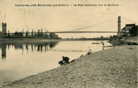
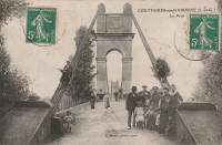
1845: Gué de Senac
Les Peintures and Chamadelle, Gironde, France - Dronne River
| Bridgemeister ID: | 7849 (added 2023-09-09) |
| Year Completed: | 1845 |
| Name: | Gué de Senac |
| Location: | Les Peintures and Chamadelle, Gironde, France |
| Crossing: | Dronne River |
| Coordinates: | 45.078793 N 0.087081 W |
| Maps: | Acme, GeoHack, Google, OpenStreetMap |
| Status: | Replaced |
| Main Cables: | Wire (iron) |
| Suspended Spans: | 1 |
| Main Span: | 1 |
Notes:
External Links:
- Art-et-Histoire - Pont de Gué de Senac à Chamadelle - 1845
- Dans le rétro : le pont du Gué de Sénac sur la Dronne. Article about the suspension bridges at this location. Published March 8, 2022.
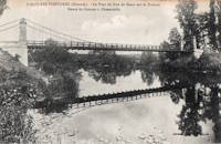
1845: Nogent-l'Artaud
Nogent-l'Artaud, Aisne, France - Marne River
| Bridgemeister ID: | 5554 (added 2020-12-17) |
| Year Completed: | 1845 |
| Name: | Nogent-l'Artaud |
| Location: | Nogent-l'Artaud, Aisne, France |
| Crossing: | Marne River |
| Coordinates: | 48.969762 N 3.320971 E |
| Maps: | Acme, GeoHack, Google, OpenStreetMap |
| References: | AAJ |
| Use: | Vehicular |
| Status: | Removed |
| Main Cables: | Wire (iron) |
| Suspended Spans: | 1 |
Notes:
- Destroyed 1870. Rebuilt 1875.
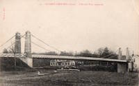
1845: Ris
Ris, Puy-de-Dôme, France - Allier River
| Bridgemeister ID: | 7476 (added 2022-12-25) |
| Year Completed: | 1845 |
| Name: | Ris |
| Location: | Ris, Puy-de-Dôme, France |
| Crossing: | Allier River |
| Status: | Removed |
| Main Cables: | Wire |
External Links:
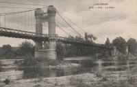
1845: Sauveterre-Saint-Denis
Lafox and Sauveterre-Saint-Denis, Lot-et-Garonne, France - Garonne River
| Bridgemeister ID: | 3715 (added 2020-02-14) |
| Year Completed: | 1845 |
| Name: | Sauveterre-Saint-Denis |
| Location: | Lafox and Sauveterre-Saint-Denis, Lot-et-Garonne, France |
| Crossing: | Garonne River |
| Coordinates: | 44.156792 N 0.706880 E |
| Maps: | Acme, GeoHack, Google, OpenStreetMap |
| Use: | Vehicular (one-lane) |
| Status: | In use (last checked: 2020) |
| Main Cables: | Wire |
| Suspended Spans: | 2 |
| Main Spans: | 2 |
External Links:
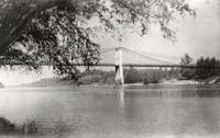
1845: Villemur-sur-Tarn
Villemur-sur-Tarn, Haute-Garonne, France - Tarn River
| Bridgemeister ID: | 1850 (added 2005-07-16) |
| Year Completed: | 1845 |
| Name: | Villemur-sur-Tarn |
| Location: | Villemur-sur-Tarn, Haute-Garonne, France |
| Crossing: | Tarn River |
| Use: | Vehicular (one-lane) |
| Status: | Replaced, 1924 |
| Main Spans: | 2 |
Notes:
- 1871: Damaged and rebuilt.
- Replaced by 1924 Villemur-sur-Tarn - Villemur-sur-Tarn, Haute-Garonne, France.
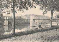
1845: Volonne
Volonne, Alpes-de-Haute-Provence, France - Durance River
| Bridgemeister ID: | 2002 (added 2005-12-26) |
| Year Completed: | 1845 |
| Name: | Volonne |
| Location: | Volonne, Alpes-de-Haute-Provence, France |
| Crossing: | Durance River |
| References: | AAJ |
| Use: | Vehicular (one-lane) |
| Status: | Replaced |
| Main Cables: | Wire |
Notes:
External Links:
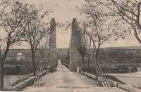
1846: Beaumont-sur-Sarthe
Beaumont-sur-Sarthe, Sarthe, France - Sarthe River
| Bridgemeister ID: | 780 (added 2003-03-16) |
| Year Completed: | 1846 |
| Name: | Beaumont-sur-Sarthe |
| Location: | Beaumont-sur-Sarthe, Sarthe, France |
| Crossing: | Sarthe River |
| Coordinates: | 48.223243 N 0.129007 E |
| Maps: | Acme, GeoHack, Google, OpenStreetMap |
| Use: | Vehicular |
| Status: | Removed |
| Main Cables: | Wire (iron) |
| Suspended Spans: | 1 |
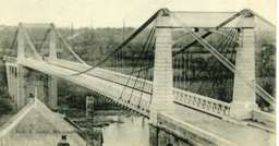
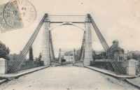
1846: Carennac
Carennac, Lot, France - Dordogne River
| Bridgemeister ID: | 7842 (added 2023-09-03) |
| Year Completed: | 1846 |
| Name: | Carennac |
| Location: | Carennac, Lot, France |
| Crossing: | Dordogne River |
| Coordinates: | 44.915091 N 1.743699 E |
| Maps: | Acme, GeoHack, Google, OpenStreetMap |
| Use: | Vehicular |
| Status: | Removed |
| Main Cables: | Wire (iron) |
| Suspended Spans: | 1 |
Notes:
- Replaced by 1941 Carennac - Carennac, Lot, France.
External Links:
- Pont de Carennac - 1846 - Art-et-Histoire
- Sur Lorand: Le pont suspendu de Carennac. History of the bridges at this location.
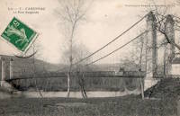
1846: Lacroix-Saint-Ouen
Lacroix-Saint-Ouen, Oise, France - Oise River
| Bridgemeister ID: | 2070 (added 2006-06-07) |
| Year Completed: | 1846 |
| Name: | Lacroix-Saint-Ouen |
| Location: | Lacroix-Saint-Ouen, Oise, France |
| Crossing: | Oise River |
| Coordinates: | 49.352930 N 2.766916 E |
| Maps: | Acme, GeoHack, Google, OpenStreetMap |
| Use: | Vehicular (one-lane) |
| Status: | Destroyed, 1940 |
| Main Cables: | Wire |
| Main Span: | 1 |
Notes:
- Later at same location 1949 Lacroix-Saint-Ouen - Lacroix-Saint-Ouen, Oise, France.
External Links:

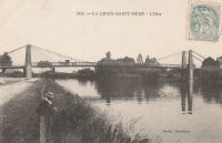
1846: Maison-Rouge
Courcelles-sur-Seine, Eure, France - Seine River
| Bridgemeister ID: | 5642 (added 2020-12-30) |
| Year Completed: | 1846 |
| Name: | Maison-Rouge |
| Location: | Courcelles-sur-Seine, Eure, France |
| Crossing: | Seine River |
| Coordinates: | 49.179082 N 1.353851 E |
| Maps: | Acme, GeoHack, Google, OpenStreetMap |
| Principals: | Escarraguel Brothers |
| References: | AAJ |
| Use: | Vehicular |
| Status: | Destroyed, October 15, 1870 |
| Main Cables: | Wire (iron) |
Notes:
- Coordinates indicate the approximate former location of this bridge.
1846: Mallemort
Mallemort, Bouches-du-Rhône and Mérindol, Vaucluse, France - Durance River
| Bridgemeister ID: | 985 (added 2003-11-15) |
| Year Completed: | 1846 |
| Name: | Mallemort |
| Location: | Mallemort, Bouches-du-Rhône and Mérindol, Vaucluse, France |
| Crossing: | Durance River |
| Coordinates: | 43.740533 N 5.176 E |
| Maps: | Acme, GeoHack, Google, OpenStreetMap |
| Use: | Vehicular |
| Status: | Closed (last checked: 2005) |
| Main Cables: | Wire (iron) |
| Suspended Spans: | 3 |
| Main Spans: | 3 |
Notes:
- Damaged 1872, 1880, 1882, 1886 by flood, 1940 by bombs. Extant 2005 but closed.
External Links:
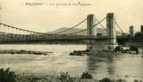
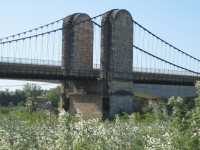
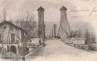
1846: Montpezat
Montpezat-sous-Bauzon, Ardèche, France - Fontaulière River
| Bridgemeister ID: | 2159 (added 2006-12-10) |
| Year Completed: | 1846 |
| Name: | Montpezat |
| Location: | Montpezat-sous-Bauzon, Ardèche, France |
| Crossing: | Fontaulière River |
| Coordinates: | 44.704903 N 4.216498 E |
| Maps: | Acme, GeoHack, Google, OpenStreetMap |
| Use: | Vehicular (one-lane) |
| Status: | Demolished, 1912 |
| Main Cables: | Wire |
| Suspended Spans: | 1 |
External Links:
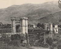
1846: Saint Clair
Lyon, Métropole de Lyon, France - Rhône River
| Bridgemeister ID: | 551 (added before 2003) |
| Year Completed: | 1846 |
| Name: | Saint Clair |
| Also Known As: | Louis Philippe, Vaïsse |
| Location: | Lyon, Métropole de Lyon, France |
| Crossing: | Rhône River |
| References: | AAJ, PQL |
| Use: | Vehicular |
| Status: | Demolished, 1953 |
| Main Cables: | Wire (iron) |
| Suspended Spans: | 2 |
| Deck width: | 7 meters |
Notes:
- Damaged by drifting boat, 1854. Rebuilt, 1856. Bombed, 1944. Rebuilt, 1946. Demolished, 1953.
- Crossed at present-day location of Pont Maréchal de Lattre de Tassigny.
- Originally constructed with two suspended spans. When it was rebuilt in 1856, towers were added increasing the number of suspended spans to six.
- Near 1845 College (Collège) - Lyon, Métropole de Lyon, France.
External Links:

1847: Auzon
Auzon, Haute-Loire, France - Allier River
| Bridgemeister ID: | 6935 (added 2022-01-22) |
| Year Completed: | 1847 |
| Name: | Auzon |
| Location: | Auzon, Haute-Loire, France |
| Crossing: | Allier River |
| Coordinates: | 45.385816 N 3.356742 E |
| Maps: | Acme, GeoHack, Google, OpenStreetMap |
| Status: | Destroyed, September 26, 1866 |
Notes:
- Replaced 1845 Auzon - Auzon, Haute-Loire, France.
- Replaced by 1870 Auzon - Auzon, Haute-Loire, France.
External Links:
- Art-et-Histoire - Premier pont suspendu d'Auzon - 1845. Deck is destroyed by windstorm, January 20, 1854. Weakened by flood, in 1856. Bridge is repaired, but is eventually destroyed by flood in 1866.
1847: Évieu
Évieu, Ain and Les Avenières Veyrins-Thuellin, Isère, France - Rhône River
| Bridgemeister ID: | 7098 (added 2022-06-03) |
| Year Completed: | 1847 |
| Name: | Évieu |
| Location: | Évieu, Ain and Les Avenières Veyrins-Thuellin, Isère, France |
| Crossing: | Rhône River |
| Use: | Vehicular |
| Status: | Damaged, 1885 |
| Main Cables: | Wire |
Notes:
External Links:
1847: Beauvoir
Beauvoir, Saint-Romans, Isère, France - Isère River
| Bridgemeister ID: | 7713 (added 2023-07-07) |
| Year Completed: | 1847 |
| Name: | Beauvoir |
| Location: | Beauvoir, Saint-Romans, Isère, France |
| Crossing: | Isère River |
| Coordinates: | 45.124700 N 5.330327 E |
| Maps: | Acme, GeoHack, Google, OpenStreetMap |
| Use: | Vehicular |
| Status: | Removed |
| Main Cables: | Wire |
| Suspended Spans: | 1 |
External Links:
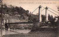
1847: Chusclan
Chusclan, Gard, France - Cèze River
| Bridgemeister ID: | 1606 (added 2005-02-06) |
| Year Completed: | 1847 |
| Name: | Chusclan |
| Location: | Chusclan, Gard, France |
| Crossing: | Cèze River |
| Use: | Vehicular (one-lane) |
| Status: | Removed |
| Main Cables: | Wire (iron) |
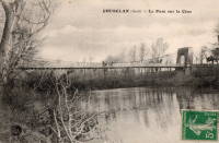
1847: Donzère
Donzère, Drôme and Viviers, Ardèche, France - Rhône River
| Bridgemeister ID: | 970 (added 2003-11-13) |
| Year Completed: | 1847 |
| Name: | Donzère |
| Also Known As: | Robinet |
| Location: | Donzère, Drôme and Viviers, Ardèche, France |
| Crossing: | Rhône River |
| Coordinates: | 44.452367 N 4.6981 E |
| Maps: | Acme, GeoHack, Google, OpenStreetMap |
| References: | AAJ, BPF |
| Use: | Vehicular (one-lane) |
| Status: | In use (last checked: 2021) |
| Main Cables: | Wire (iron) |
| Suspended Spans: | 3 |
| Main Spans: | 3 x 100 meters (328.1 feet) estimated |
External Links:
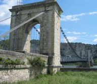
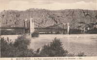
1847: Fombeton
Valernes, Alpes-de-Haute-Provence, France - Durance River
| Bridgemeister ID: | 4563 (added 2020-06-02) |
| Year Completed: | 1847 |
| Name: | Fombeton |
| Location: | Valernes, Alpes-de-Haute-Provence, France |
| Crossing: | Durance River |
| Coordinates: | 44.249224 N 5.921627 E |
| Maps: | Acme, GeoHack, Google, OpenStreetMap |
| Use: | Vehicular (one-lane) |
| Status: | Removed, 2014 |
| Suspended Spans: | 1 |
External Links:
1847: Saint-Mathurin-sur-Loire
Saint-Mathurin-sur-Loire, Maine-et-Loire, France - Loire River
| Bridgemeister ID: | 1589 (added 2005-01-27) |
| Year Completed: | 1847 |
| Name: | Saint-Mathurin-sur-Loire |
| Location: | Saint-Mathurin-sur-Loire, Maine-et-Loire, France |
| Crossing: | Loire River |
| Coordinates: | 47.406833 N 0.318722 W |
| Maps: | Acme, GeoHack, Google, OpenStreetMap |
| Use: | Vehicular |
| Status: | Destroyed, June 18, 1940 |
| Main Cables: | Wire (iron) |
| Main Spans: | 5 |
Notes:
- 1927: The bridge is reconstructed and strengthened.
External Links:
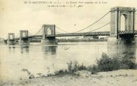
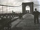
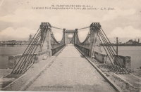
1847: Saint-Symphorien
Tours, Indre-et-Loire, France - Loire River
| Bridgemeister ID: | 1755 (added 2005-04-20) |
| Year Completed: | 1847 |
| Name: | Saint-Symphorien |
| Location: | Tours, Indre-et-Loire, France |
| Crossing: | Loire River |
| At or Near Feature: | l'Île Aucard |
| Coordinates: | 47.398776 N 0.692994 E |
| Maps: | Acme, GeoHack, Google, OpenStreetMap |
| Principals: | Seguin Brothers |
| References: | AAJ |
| Use: | Vehicular (one-lane), with walkway |
| Status: | Replaced |
| Main Cables: | Wire (iron) |
| Suspended Spans: | 3 |
| Main Spans: | 3 |
Notes:
- This was the three-span south section of the Saint-Symphorien bridge.
- 1940-1944: The Saint-Symphorien bridge is destroyed by French troops in June 1940 to slow the German army. Repaired in 1943. Destroyed again in 1944 by the German army. It is unclear whether both the north and south bridges were destroyed during these events.
- Connects to 1847 Saint-Symphorien - Tours, Indre-et-Loire, France.
- Replaced by Saint-Symphorien - Tours, Indre-et-Loire, France.
External Links:
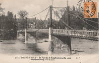
1847: Saint-Symphorien
Tours, Indre-et-Loire, France - Loire River
| Bridgemeister ID: | 7838 (added 2023-09-03) |
| Year Completed: | 1847 |
| Name: | Saint-Symphorien |
| Location: | Tours, Indre-et-Loire, France |
| Crossing: | Loire River |
| At or Near Feature: | l'Île Aucard |
| Coordinates: | 47.401440 N 0.693325 E |
| Maps: | Acme, GeoHack, Google, OpenStreetMap |
| Principals: | Seguin Brothers |
| Use: | Vehicular (one-lane) |
| Status: | Removed |
| Main Cables: | Wire (iron) |
| Suspended Spans: | 2 |
| Main Spans: | 2 |
Notes:
- This was the original two-span north section of the Saint-Symphorien bridge.
- 1875, June 12: The deck of the northern bridge is wrecked by wind. The bridge is repaired.
- 1940-1944: The Saint-Symphorien bridge is destroyed by French troops in June 1940 to slow the German army. Repaired in 1943. Destroyed again in 1944 by the German army. It is unclear whether both the north and south bridges were destroyed during these events.
- Connects to 1847 Saint-Symphorien - Tours, Indre-et-Loire, France.
- Connects to Saint-Symphorien - Tours, Indre-et-Loire, France.
- Replaced by 1963 Saint-Symphorien - Tours, Indre-et-Loire, France.
External Links:
1847: St. Christophe
Lorient, Morbihan, France - Scorff River
| Bridgemeister ID: | 1155 (added 2004-01-18) |
| Year Completed: | 1847 |
| Name: | St. Christophe |
| Also Known As: | Kérentrech, Nemours |
| Location: | Lorient, Morbihan, France |
| Crossing: | Scorff River |
| Principals: | Le Clerc and Noyon |
| References: | AAJ |
| Use: | Vehicular |
| Status: | Removed |
| Main Cables: | Wire (iron) |
| Main Span: | 1 x 180 meters (590.6 feet) |
Notes:
- Large masonry towers. Main span of 180 meters is unusually large for a French bridge of this decade.
External Links:
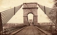
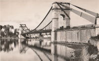
1847: Viviers
Viviers, Ardèche and Drôme, France - Rhône River
| Bridgemeister ID: | 1961 (added 2005-11-05) |
| Year Completed: | 1847 |
| Name: | Viviers |
| Location: | Viviers, Ardèche and Drôme, France |
| Crossing: | Rhône River |
| Coordinates: | 44.481667 N 4.699698 E |
| Maps: | Acme, GeoHack, Google, OpenStreetMap |
| References: | AAJ |
| Use: | Vehicular (one-lane) |
| Status: | Destroyed, 1944 |
| Main Cables: | Wire |
Notes:
- Later at same location 1954 Viviers - Viviers, Ardèche and Châteauneuf-Du-Rhône, Drôme, France.
External Links:
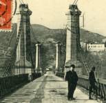
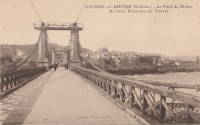
1848: Charreau
Charreau, La Chapelle-Montlinard, Cher, France - Canal Latéral à La Loire
| Bridgemeister ID: | 8391 (added 2024-02-18) |
| Year Completed: | 1848 |
| Name: | Charreau |
| Location: | Charreau, La Chapelle-Montlinard, Cher, France |
| Crossing: | Canal Latéral à La Loire |
| Coordinates: | 47.190667 N 2.982861 E |
| Maps: | Acme, GeoHack, Google, OpenStreetMap |
| Use: | Vehicular (one-lane) |
| Status: | In use (last checked: 2013) |
| Main Cables: | Wire (iron) |
| Suspended Spans: | 1 |
Notes:
External Links:
- Art-et-Histoire - Pont de Charreau à La Chapelle-Montlinard - 1848. Indicates the 1848 bridge replaced an 1840 suspension bridge destroyed in an 1846 flood.
1848: Nambault
Nambault, La Chapelle-Montlinard, Cher, France - Canal Latéral à La Loire
| Bridgemeister ID: | 8390 (added 2024-02-18) |
| Year Completed: | 1848 |
| Name: | Nambault |
| Location: | Nambault, La Chapelle-Montlinard, Cher, France |
| Crossing: | Canal Latéral à La Loire |
| Coordinates: | 47.179472 N 2.987139 E |
| Maps: | Acme, GeoHack, Google, OpenStreetMap |
| Use: | Vehicular (one-lane) |
| Status: | In use (last checked: 2019) |
| Main Cables: | Wire (iron) |
| Suspended Spans: | 1 |
Notes:
External Links:
- Art-et-Histoire - Pont de Nambault à La Chapelle-Montlinard - 1848. Indicates the 1848 bridge replaced an 1840 suspension bridge destroyed in an 1846 flood.
1848: Saint Jacques
Thouars and Saint-Jacques-de-Thouars, Deux-Sèvres, France - Thouet River
| Bridgemeister ID: | 7902 (added 2023-10-15) |
| Year Completed: | 1848 |
| Name: | Saint Jacques |
| Location: | Thouars and Saint-Jacques-de-Thouars, Deux-Sèvres, France |
| Crossing: | Thouet River |
| Coordinates: | 46.968944 N 0.218583 W |
| Maps: | Acme, GeoHack, Google, OpenStreetMap |
| Use: | Vehicular |
| Status: | Collapsed, January, 1890 |
Notes:
- 1890, January: Destroyed by wind during a storm.
External Links:
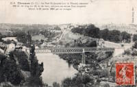
1848: Saint-Satur
Saint-Satur and Saint-Thibault-sur-Loire, Cher, France - Canal Latéral à La Loire
| Bridgemeister ID: | 8392 (added 2024-02-18) |
| Year Completed: | 1848 |
| Name: | Saint-Satur |
| Location: | Saint-Satur and Saint-Thibault-sur-Loire, Cher, France |
| Crossing: | Canal Latéral à La Loire |
| Coordinates: | 47.338639 N 2.858944 E |
| Maps: | Acme, GeoHack, Google, OpenStreetMap |
| Use: | Vehicular (one-lane) |
| Status: | Removed |
| Main Cables: | Wire (iron) |
| Suspended Spans: | 1 |
External Links:
- Art-et-Histoire - Pont de St-Satur sur la Canal latéral de la Loire - 1848. Indicates the 1848 bridge replaced an 1840 suspension bridge destroyed in an 1846 flood.
1849: Appoigny
Appoigny, Yonne, France - Yonne River
| Bridgemeister ID: | 6937 (added 2022-01-22) |
| Year Completed: | 1849 |
| Name: | Appoigny |
| Location: | Appoigny, Yonne, France |
| Crossing: | Yonne River |
| Coordinates: | 47.877464 N 3.535881 E |
| Maps: | Acme, GeoHack, Google, OpenStreetMap |
| Use: | Vehicular (one-lane) |
| Status: | Removed |
| Main Cables: | Wire |
External Links:
1849: Fourneau
Le Fourneau, Bourbon-Lancy vicinity, Saône-et-Loire and Allier, France - Loire River
| Bridgemeister ID: | 1772 (added 2005-04-22) |
| Year Completed: | 1849 |
| Name: | Fourneau |
| Location: | Le Fourneau, Bourbon-Lancy vicinity, Saône-et-Loire and Allier, France |
| Crossing: | Loire River |
| References: | AAJ |
| Use: | Vehicular |
| Status: | Replaced, 1932 |
| Main Spans: | 2 x 115 meters (377.32 feet) |
| Deck width: | 16.4 feet |
Notes:

1849: Galliéni
Lyon, Métropole de Lyon, France - Rhône River
| Bridgemeister ID: | 1164 (added 2004-01-19) |
| Year Completed: | 1849 |
| Name: | Galliéni |
| Also Known As: | Napoleon |
| Location: | Lyon, Métropole de Lyon, France |
| Crossing: | Rhône River |
| Principals: | Seguin Brothers |
| References: | PQL, PTS2 |
| Use: | Vehicular |
| Status: | Replaced |
| Main Cables: | Wire (iron) |
| Suspended Spans: | 3 |
| Main Span: | 1 x 60 meters (196.9 feet) |
| Side Spans: | 1 x 39 meters (128 feet), 1 x 67 meters (219.8 feet) |
| Deck width: | 7.4 meters |
Notes:
- Replaced by an arch bridge in the early 20th century. Built as part of the same project as the Kitchener-Marchand bridge; they were on the same alignment, with one crossing the Saône and the other the Rhône. Both were originally known as the Napoleon bridges.
- Companion to 1849 Kitchener-Marchand (Napoleon, Kitchener, Midi) - Lyon, Métropole de Lyon, France.
1849: Jaulgonne
Jaulgonne and Varennes, Aisne, France - Marne River
| Bridgemeister ID: | 1940 (added 2005-10-29) |
| Year Completed: | 1849 |
| Name: | Jaulgonne |
| Location: | Jaulgonne and Varennes, Aisne, France |
| Crossing: | Marne River |
| Principals: | Seguin Brothers |
| References: | AAJ |
| Use: | Vehicular |
| Status: | Removed |
| Main Cables: | Wire (iron) |
| Suspended Spans: | 1 |
| Main Span: | 1 x 75 meters (246.07 feet) |
Notes:
- Replaced by Jaulgonne - Jaulgonne and Varennes, Aisne, France.

1849: Kitchener-Marchand
Lyon, Métropole de Lyon, France - Saône River
| Bridgemeister ID: | 540 (added before 2003) |
| Year Completed: | 1849 |
| Name: | Kitchener-Marchand |
| Also Known As: | Napoleon, Kitchener, Midi |
| Location: | Lyon, Métropole de Lyon, France |
| Crossing: | Saône River |
| Coordinates: | 45.751418 N 4.822519 E |
| Maps: | Acme, GeoHack, Google, OpenStreetMap |
| Principals: | Ferdinand Seguin |
| References: | PQL |
| Use: | Vehicular |
| Status: | Replaced, 1950's |
| Main Cables: | Wire (iron) |
| Main Span: | 1 x 82.1 meters (269.22 feet) |
Notes:
- Refurbished, 1888. Bombed, 1944. Rebuilt. Replaced, 1950-1959.
- Companion to 1849 Galliéni (Napoleon) - Lyon, Métropole de Lyon, France.
External Links:
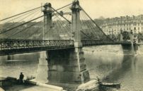
1849: Langeais
Langeais, Indre-et-Loire, France - Loire River
| Bridgemeister ID: | 6718 (added 2021-10-16) |
| Year Completed: | 1849 |
| Name: | Langeais |
| Location: | Langeais, Indre-et-Loire, France |
| Crossing: | Loire River |
| Coordinates: | 47.319030 N 0.404770 E |
| Maps: | Acme, GeoHack, Google, OpenStreetMap |
| References: | AAJ, BPF |
| Use: | Vehicular |
| Status: | Replaced |
| Main Spans: | 3 |
| Side Spans: | 2 |
Notes:
- Damaged by lightning 1859 and repaired. Cables cut during war 1870 and repaired in 1874.
- Replaced by 1937 Langeais - Langeais, Indre-et-Loire, France. However, the 1849 bridge may have been largely before the 1937 bridge.
External Links:
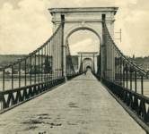
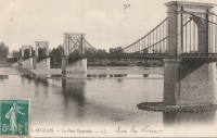
1849: Le Pouzin
Le Pouzin, Ardèche, France - Rhône River
| Bridgemeister ID: | 1153 (added 2004-01-18) |
| Year Completed: | 1849 |
| Name: | Le Pouzin |
| Location: | Le Pouzin, Ardèche, France |
| Crossing: | Rhône River |
| Principals: | Adolphe Boulland |
| References: | AAJ |
| Use: | Vehicular |
| Status: | Destroyed, 1940 |
| Main Cables: | Wire (iron) |
| Suspended Spans: | 3 |
| Main Spans: | 3 x 100 meters (328.1 feet) |
External Links:
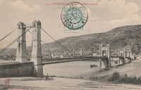
1849: Marc Seguin
Tournon-sur-Rhône, Ardèche and Tain-L'Hermitage, Drôme, France - Rhône River
| Bridgemeister ID: | 975 (added 2003-11-14) |
| Year Completed: | 1849 |
| Name: | Marc Seguin |
| Location: | Tournon-sur-Rhône, Ardèche and Tain-L'Hermitage, Drôme, France |
| Crossing: | Rhône River |
| Coordinates: | 45.068638 N 4.834972 E |
| Maps: | Acme, GeoHack, Google, OpenStreetMap |
| Principals: | Marc Seguin |
| References: | AAJ, BPF |
| Use: | Vehicular |
| Status: | Restricted to foot traffic (last checked: 2021) |
| Main Cables: | Wire (iron) |
| Suspended Spans: | 2 |
| Main Spans: | 2 |
Notes:
- A second bridge at Tournon, by Seguin, approximately 100 meters downstream from his 1825 bridge. Restored 1989.
- Near 1825 Tain-Tournon - Tournon-sur-Rhône, Ardèche and Tain, Drôme, France.
- Near 1958 Gustave Toursier - Tournon-sur-Rhône, Ardèche and Tain-L'Hermitage, Drôme, France.
External Links:
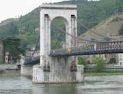
1849: Saint-Nicolas-de-la-Balerme
Saint-Nicolas-de-la-Balerme, Lot-et-Garonne, France
| Bridgemeister ID: | 7712 (added 2023-07-07) |
| Year Completed: | 1849 |
| Name: | Saint-Nicolas-de-la-Balerme |
| Location: | Saint-Nicolas-de-la-Balerme, Lot-et-Garonne, France |
| Use: | Vehicular |
| Status: | Removed, 2005 |
| Main Cables: | Wire |
External Links:
1849: Saint-Sulpice
Saint-Sulpice-la-Pointe, Tarn, France - Agout River
| Bridgemeister ID: | 1180 (added 2004-01-24) |
| Year Completed: | 1849 |
| Name: | Saint-Sulpice |
| Location: | Saint-Sulpice-la-Pointe, Tarn, France |
| Crossing: | Agout River |
| Coordinates: | 43.776706 N 1.686511 E |
| Maps: | Acme, GeoHack, Google, OpenStreetMap |
| Use: | Vehicular (one-lane), with walkway |
| Status: | Destroyed, 1930 |
| Main Cables: | Wire (iron) |
| Suspended Spans: | 1 |
Notes:
- 1930: Destroyed by flood.
- Replaced by 1931 Saint-Sulpice - Saint-Sulpice-la-Pointe, Tarn, France.
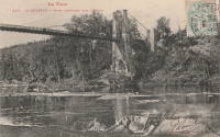
1849: Vallon-en-Sully
Vallon-en-Sully, Allier, France - Cher River
| Bridgemeister ID: | 7461 (added 2022-12-25) |
| Year Completed: | 1849 |
| Name: | Vallon-en-Sully |
| Location: | Vallon-en-Sully, Allier, France |
| Crossing: | Cher River |
| Coordinates: | 46.535271 N 2.614326 E |
| Maps: | Acme, GeoHack, Google, OpenStreetMap |
| Use: | Vehicular |
| Status: | Removed |
| Main Cables: | Wire (iron) |
| Suspended Spans: | 1 |
External Links:
1850: Basteyroux
Argentat, Corrèze, France - Maronne River
| Bridgemeister ID: | 1985 (added 2005-12-02) |
| Year Completed: | 1850 |
| Name: | Basteyroux |
| Location: | Argentat, Corrèze, France |
| Crossing: | Maronne River |
| Coordinates: | 45.082660 N 1.947985 E |
| Maps: | Acme, GeoHack, Google, OpenStreetMap |
| Use: | Vehicular (one-lane) |
| Status: | Restricted to foot traffic (last checked: 2019) |
| Main Cables: | Wire (iron) |
| Suspended Spans: | 2 |
| Main Spans: | 2 |
External Links:
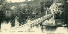
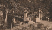
1850: Brivezac
Brivezac, Corrèze, France - Dordogne River
| Bridgemeister ID: | 1974 (added 2005-11-27) |
| Year Completed: | 1850 |
| Name: | Brivezac |
| Location: | Brivezac, Corrèze, France |
| Crossing: | Dordogne River |
| Status: | Removed |
| Suspended Spans: | 1 |
External Links:
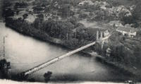
1850: Chambon
Saint-Merd-de-Lapleau, Auriac vicinity, Corrèze, France - Dordogne River
| Bridgemeister ID: | 7029 (added 2022-05-21) |
| Year Completed: | 1850 |
| Name: | Chambon |
| Location: | Saint-Merd-de-Lapleau, Auriac vicinity, Corrèze, France |
| Crossing: | Dordogne River |
| Use: | Vehicular (one-lane) |
| Status: | Removed |
| Main Cables: | Wire |
| Main Span: | 1 |
Notes:
- Later at same location Auriac (Chambon) - Saint-Merd-de-Lapleau, Auriac vicinity, Corrèze, France.
External Links:
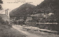
1850: Fleury-d'Aude
Fleury-d'Aude and Salles-d'Aude, Aude, France - Aude River
| Bridgemeister ID: | 1976 (added 2005-11-27) |
| Year Completed: | 1850 |
| Name: | Fleury-d'Aude |
| Also Known As: | Salles-d'Aude |
| Location: | Fleury-d'Aude and Salles-d'Aude, Aude, France |
| Crossing: | Aude River |
| Use: | Vehicular |
| Status: | Removed |
| Main Cables: | Wire |
| Suspended Spans: | 1 |
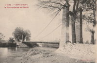
1850: Greffier
Le Mans, Sarthe, France - Sarthe River
| Bridgemeister ID: | 4916 (added 2020-07-19) |
| Year Completed: | 1850 |
| Name: | Greffier |
| Also Known As: | Clerk's, Wire |
| Location: | Le Mans, Sarthe, France |
| Crossing: | Sarthe River |
| Coordinates: | 48.001128 N 0.189991 E |
| Maps: | Acme, GeoHack, Google, OpenStreetMap |
| References: | AAJ |
| Use: | Vehicular |
| Status: | Destroyed |
| Main Cables: | Wire (iron) |
Notes:
- Destroyed, 1871, to slow the advancing Prussian army.
External Links:
1850: Lamagistère
Lamagistère, Tarn-et-Garonne, France - Garonne River
| Bridgemeister ID: | 7174 (added 2022-07-01) |
| Year Completed: | 1850 |
| Name: | Lamagistère |
| Location: | Lamagistère, Tarn-et-Garonne, France |
| Crossing: | Garonne River |
| Coordinates: | 44.123345 N 0.819394 E |
| Maps: | Acme, GeoHack, Google, OpenStreetMap |
| Use: | Vehicular |
| Status: | Destroyed, 1875 |
| Main Cables: | Wire |
| Suspended Spans: | 2 |
| Main Spans: | 2 |
Notes:
- 1875: Wrecked by flood
- Replaced by 1876 Lamagistère - Lamagistère, Tarn-et-Garonne, France.
External Links:
1850: Le Boulou
Le Boulou, Pyrénées-Orientales, France - Tech River
| Bridgemeister ID: | 1704 (added 2005-03-29) |
| Year Completed: | 1850 |
| Name: | Le Boulou |
| Location: | Le Boulou, Pyrénées-Orientales, France |
| Crossing: | Tech River |
| Use: | Vehicular |
| Status: | Demolished, 1962 |
| Main Cables: | Wire (iron) |
| Suspended Spans: | 1 |
| Main Span: | 1 x 120 meters (393.7 feet) |
| Deck width: | 5.74 meters |
External Links:
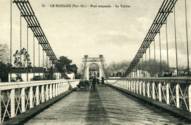
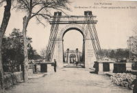
1850: Retournac
Retournac, Haute-Loire, France - Loire River
| Bridgemeister ID: | 4066 (added 2020-03-31) |
| Year Completed: | 1850 |
| Name: | Retournac |
| Location: | Retournac, Haute-Loire, France |
| Crossing: | Loire River |
| Use: | Vehicular |
| Status: | Destroyed, 1866 |
Notes:
- Destroyed by flood, 1866
- Replaced Retournac - Retournac, Haute-Loire, France.
1851: Chadrac
Chadrac, Haute-Loire, France - Loire River
| Bridgemeister ID: | 7864 (added 2023-09-15) |
| Year Completed: | 1851 |
| Name: | Chadrac |
| Location: | Chadrac, Haute-Loire, France |
| Crossing: | Loire River |
| Use: | Vehicular |
| Status: | Removed |
| Main Cables: | Wire (iron) |
| Suspended Spans: | 1 |
External Links:
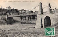
1851: Saint-Just-sur-Loire
Saint-Just-sur-Loire and Saint-Just-Saint-Rambert, Loire, France - Loire River
| Bridgemeister ID: | 2052 (added 2006-06-02) |
| Year Completed: | 1851 |
| Name: | Saint-Just-sur-Loire |
| Location: | Saint-Just-sur-Loire and Saint-Just-Saint-Rambert, Loire, France |
| Crossing: | Loire River |
| Use: | Vehicular |
| Status: | Removed, c. 1931 |
| Main Cables: | Wire (iron) |
| Suspended Spans: | 1 |
Notes:
- 1926: Part of the deck fails under a heavily loaded truck. A replacement is completed in 1931.
- Near 1831 Andrézieux - Andrézieux, Loire, France.
External Links:
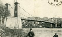
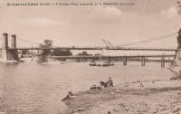
| Bridgemeister ID: | 2076 (added 2006-06-10) |
| Year Completed: | 1851 |
| Name: | Sérignan |
| Location: | Sérignan, Béziers vicinity, Hérault, France |
| Crossing: | Orb River |
| Coordinates: | 43.285011 N 3.281313 E |
| Maps: | Acme, GeoHack, Google, OpenStreetMap |
| Use: | Vehicular |
| Status: | Replaced, c. 1909 |
| Suspended Spans: | 1 |
Notes:
- Near future location of 2016 Sérignan - Sérignan, Béziers, Hérault, France.
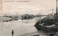
1851: Trévoux
Trévoux, Ain and Quincieux, Métropole de Lyon, France - Saône River
| Bridgemeister ID: | 1625 (added 2005-02-27) |
| Year Completed: | 1851 |
| Name: | Trévoux |
| Location: | Trévoux, Ain and Quincieux, Métropole de Lyon, France |
| Crossing: | Saône River |
| Coordinates: | 45.93945 N 4.772417 E |
| Maps: | Acme, GeoHack, Google, OpenStreetMap |
| Use: | Vehicular (one-lane) |
| Status: | Restricted to foot traffic (last checked: 2020) |
| Main Cables: | Wire (iron) |
| Suspended Spans: | 2 |
| Main Spans: | 2 |
Notes:
- Partially dismantled, 1982. Restored as a footbridge, 1985.
External Links:
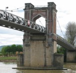
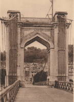
1852: Gaillac
Gaillac, Tarn, France - Tarn River
| Bridgemeister ID: | 1646 (added 2005-03-18) |
| Year Completed: | 1852 |
| Name: | Gaillac |
| Location: | Gaillac, Tarn, France |
| Crossing: | Tarn River |
| At or Near Feature: | Abbaye Saint-Michel |
| Coordinates: | 43.897361 N 1.894751 E |
| Maps: | Acme, GeoHack, Google, OpenStreetMap |
| Use: | Vehicular |
| Status: | Removed |
| Main Cables: | Wire (iron) |
| Suspended Spans: | 1 |
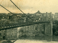

1852: Mazères-sur-Salat
Mazères-sur-Salat, Haute-Garonne, France - Salat River
| Bridgemeister ID: | 7201 (added 2022-07-04) |
| Year Completed: | 1852 |
| Name: | Mazères-sur-Salat |
| Location: | Mazères-sur-Salat, Haute-Garonne, France |
| Crossing: | Salat River |
| Coordinates: | 43.132556 N 0.975981 E |
| Maps: | Acme, GeoHack, Google, OpenStreetMap |
| Use: | Vehicular (one-lane) |
| Status: | Removed |
| Main Cables: | Wire (iron) |
Notes:
- Later at same location Mazères-sur-Salat - Mazères-sur-Salat, Haute-Garonne, France. Unclear if the later bridge was a direct replacement.
External Links:
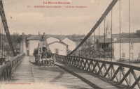
1852: Merle
Merle, Corrèze, France - Maronne River
| Bridgemeister ID: | 3030 (added 2019-10-13) |
| Year Completed: | 1852 |
| Name: | Merle |
| Location: | Merle, Corrèze, France |
| Crossing: | Maronne River |
| Coordinates: | 45.061779 N 2.080386 E |
| Maps: | Acme, GeoHack, Google, OpenStreetMap |
| Use: | Vehicular (one-lane) |
| Status: | Replaced, 1999 |
| Main Cables: | Wire (iron) |
| Suspended Spans: | 1 |
Notes:
- As of 2019, piers still present beyond the ends of its replacement bridge.
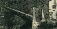
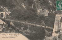
1852: Saint-Pierre
Toulouse, Haute-Garonne, France - Garonne River
| Bridgemeister ID: | 1169 (added 2004-01-23) |
| Year Completed: | 1852 |
| Name: | Saint-Pierre |
| Location: | Toulouse, Haute-Garonne, France |
| Crossing: | Garonne River |
| Coordinates: | 43.602179 N 1.434706 E |
| Maps: | Acme, GeoHack, Google, OpenStreetMap |
| References: | PTS2 |
| Use: | Vehicular |
| Status: | Demolished, 1927 |
| Main Cables: | Wire (iron) |
| Suspended Spans: | 4 |
| Main Spans: | 2 |
| Side Spans: | 2 |
Notes:
- Heavily damaged by flood, 1875. A metal arch bridge, completed 1987, is at this location now.
- Replaced by 1931 Saint-Pierre - Toulouse, Haute-Garonne, France.
External Links:
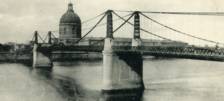
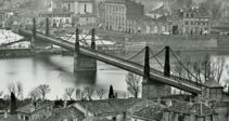
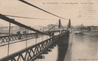
1852: Veurey
Veurey-Voroize, Isère, France - Isère River
| Bridgemeister ID: | 4880 (added 2020-07-18) |
| Year Completed: | 1852 |
| Name: | Veurey |
| Location: | Veurey-Voroize, Isère, France |
| Crossing: | Isère River |
| Coordinates: | 45.271117 N 5.621434 E |
| Maps: | Acme, GeoHack, Google, OpenStreetMap |
| References: | AAJ |
| Use: | Vehicular |
| Status: | Destroyed, 1928 |
| Main Cables: | Wire (iron) |
Notes:
- 1928: Destroyed by flood.
- Replaced by 1933 Veurey - Veurey-Voroize, Isère, France.
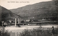
1853: Parcey
Parcey, Jura, France - Loue River
| Bridgemeister ID: | 2073 (added 2006-06-09) |
| Year Completed: | 1853 |
| Name: | Parcey |
| Location: | Parcey, Jura, France |
| Crossing: | Loue River |
| Use: | Vehicular |
| Status: | Removed |
| Main Cables: | Wire |
| Suspended Spans: | 1 |
External Links:
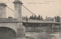
1853: Saint-Florent-le-Vieil
Saint-Florent-le-Vieil, Maine-et-Loire and Varades, Loire-Atlantique, France - Loire River
| Bridgemeister ID: | 1596 (added 2005-02-06) |
| Year Completed: | 1853 |
| Name: | Saint-Florent-le-Vieil |
| Location: | Saint-Florent-le-Vieil, Maine-et-Loire and Varades, Loire-Atlantique, France |
| Crossing: | Loire River |
| References: | AAJ |
| Use: | Vehicular (one-lane) |
| Status: | Removed |
| Main Cables: | Wire |
Notes:
- Multispan 19th-century suspension bridge distinct from the two 1965 cable-stayed and catenary suspension bridges connecting Varades and Saint-Florent-le-Vieil.
- Connects to 1853 Varades - Varades, Loire-Atlantique and Saint-Florent-le-Vieil, Maine-et-Loire, France.
- Later at same location 1954 Varades - Varades, Loire-Atlantique and Saint-Florent-le-Vieil, Maine-et-Loire, France.
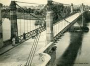

1853: Saint-Georges
Lyon, Métropole de Lyon, France - Saône River
| Bridgemeister ID: | 552 (added before 2003) |
| Year Completed: | 1853 |
| Name: | Saint-Georges |
| Also Known As: | Sala |
| Location: | Lyon, Métropole de Lyon, France |
| Crossing: | Saône River |
| Coordinates: | 45.757117 N 4.82615 E |
| Maps: | Acme, GeoHack, Google, OpenStreetMap |
| References: | AAJ, BPF, PQL |
| Use: | Footbridge |
| Status: | In use (last checked: 2022) |
| Main Cables: | Wire (iron) |
| Suspended Spans: | 1 |
| Main Span: | 1 x 75 meters (246.1 feet) |
Notes:
- Destroyed 1944, rebuilt same year. Reconstructed 1999.
External Links:
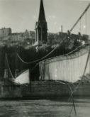
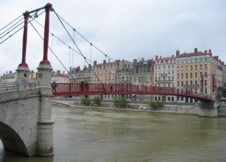

1853: Saint-Quentin-sur-Isère
Saint-Quentin-sur-Isère, Isère, France - Isère River
| Bridgemeister ID: | 2131 (added 2006-10-22) |
| Year Completed: | 1853 |
| Name: | Saint-Quentin-sur-Isère |
| Location: | Saint-Quentin-sur-Isère, Isère, France |
| Crossing: | Isère River |
| Use: | Vehicular |
| Status: | Removed |
| Main Cables: | Wire |
| Suspended Spans: | 1 |
External Links:
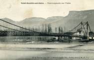
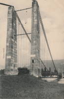
1853: Varades
Varades, Loire-Atlantique and Saint-Florent-le-Vieil, Maine-et-Loire, France - Loire River
| Bridgemeister ID: | 1962 (added 2005-11-06) |
| Year Completed: | 1853 |
| Name: | Varades |
| Location: | Varades, Loire-Atlantique and Saint-Florent-le-Vieil, Maine-et-Loire, France |
| Crossing: | Loire River |
| References: | AAJ |
| Status: | Removed |
Notes:
1854: Brion
Roissard and Lavars, Isère, France - Ebron River
| Bridgemeister ID: | 6998 (added 2022-04-24) |
| Year Completed: | 1854 |
| Name: | Brion |
| Location: | Roissard and Lavars, Isère, France |
| Crossing: | Ebron River |
| Coordinates: | 44.868078 N 5.671040 E |
| Maps: | Acme, GeoHack, Google, OpenStreetMap |
| Use: | Vehicular |
| Status: | Replaced, 1951 |
| Main Cables: | Wire |
| Suspended Spans: | 1 |
Notes:
- Replaced by 1951 Brion - Roissard and Lavars, Isère, France.
External Links:
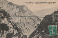
1855: Bessières
Bessières, Haute-Garonne, France - Tarn River
| Bridgemeister ID: | 7157 (added 2022-06-25) |
| Year Completed: | 1855 |
| Name: | Bessières |
| Location: | Bessières, Haute-Garonne, France |
| Crossing: | Tarn River |
| Coordinates: | 43.802017 N 1.609680 E |
| Maps: | Acme, GeoHack, Google, OpenStreetMap |
| Use: | Vehicular |
| Status: | Removed |
| Main Cables: | Wire |
| Suspended Spans: | 1 |
Notes:
- Later at same location 1955 Bessières - Bessières, Haute-Garonne, France.
External Links:
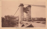
1855: Coudes
Coudes, Montpeyroux vicinity and Parent, Puy-de-Dôme, France - Allier River
| Bridgemeister ID: | 1942 (added 2005-10-29) |
| Year Completed: | 1855 |
| Name: | Coudes |
| Location: | Coudes, Montpeyroux vicinity and Parent, Puy-de-Dôme, France |
| Crossing: | Allier River |
| Coordinates: | 45.615255 N 3.211817 E |
| Maps: | Acme, GeoHack, Google, OpenStreetMap |
| Use: | Vehicular |
| Status: | Removed |
| Main Cables: | Wire |
| Suspended Spans: | 1 |
Notes:
- Later at same location Coudes - Coudes, Montpeyroux vicinity and Parent, Puy-de-Dôme, France.
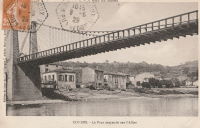
1855: Mirepoix-sur-Tarn
Mirepoix-sur-Tarn, Haute-Garonne, France - Tarn River
| Bridgemeister ID: | 7843 (added 2023-09-04) |
| Year Completed: | 1855 |
| Name: | Mirepoix-sur-Tarn |
| Location: | Mirepoix-sur-Tarn, Haute-Garonne, France |
| Crossing: | Tarn River |
| Coordinates: | 43.811766 N 1.571793 E |
| Maps: | Acme, GeoHack, Google, OpenStreetMap |
| Use: | Vehicular |
| Status: | Destroyed, 1930 |
| Main Cables: | Wire |
| Suspended Spans: | 1 |
| Main Span: | 1 |
Notes:
- 1930, March: Destroyed by flood.
- Replaced by 1935 Mirepoix-sur-Tarn - Mirepoix-sur-Tarn, Haute-Garonne, France.
External Links:
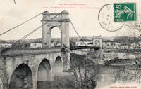
1855: Saint-Cyr
Tours and Saint-Cyr, Indre-et-Loire, France - Loire River
| Bridgemeister ID: | 1645 (added 2005-03-18) |
| Year Completed: | 1855 |
| Name: | Saint-Cyr |
| Also Known As: | Napoleon, Bonaparte |
| Location: | Tours and Saint-Cyr, Indre-et-Loire, France |
| Crossing: | Loire River |
| Principals: | Escarraguel Brothers |
| Use: | Vehicular |
| Status: | Demolished, 1943 |
| Main Cables: | Wire (iron) |
External Links:
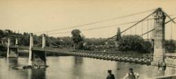
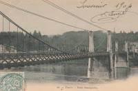
1856: Boutiron
Creuzier-les-Vieux, Allier, France - Allier River
| Bridgemeister ID: | 6951 (added 2022-02-06) |
| Year Completed: | 1856 |
| Name: | Boutiron |
| Location: | Creuzier-les-Vieux, Allier, France |
| Crossing: | Allier River |
| Coordinates: | 46.153816 N 3.410014 E |
| Maps: | Acme, GeoHack, Google, OpenStreetMap |
| Use: | Vehicular |
| Status: | Replaced, 1911 |
| Main Cables: | Wire |
| Main Spans: | 3 |
External Links:
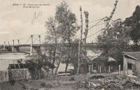
1856: Briord
Briord, Ain and Isère, France - Rhône River
| Bridgemeister ID: | 6997 (added 2022-04-24) |
| Year Completed: | 1856 |
| Name: | Briord |
| Location: | Briord, Ain and Isère, France |
| Crossing: | Rhône River |
| Use: | Vehicular |
| Status: | Removed |
| Main Cables: | Wire |
External Links:
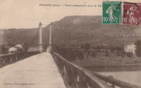
1856: Carbonne
Carbonne, Haute-Garonne, France - Garonne River
| Bridgemeister ID: | 1157 (added 2004-01-18) |
| Year Completed: | 1856 |
| Name: | Carbonne |
| Location: | Carbonne, Haute-Garonne, France |
| Crossing: | Garonne River |
| Coordinates: | 43.294537 N 1.228567 E |
| Maps: | Acme, GeoHack, Google, OpenStreetMap |
| Status: | Replaced, 1975 |
| Main Cables: | Wire (iron) |
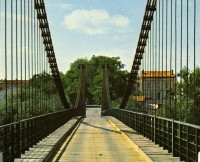
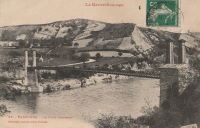
1856: Les Mées
Les Mées, Alpes-de-Haute-Provence, France - Durance River
| Bridgemeister ID: | 1522 (added 2004-10-10) |
| Year Completed: | 1856 |
| Name: | Les Mées |
| Location: | Les Mées, Alpes-de-Haute-Provence, France |
| Crossing: | Durance River |
| Use: | Vehicular |
| Status: | Replaced |
| Main Cables: | Wire (iron) |
| Suspended Spans: | 2 |
| Main Spans: | 2 |
Notes:
External Links:
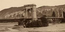

1856: Ollières
Les Ollières-sur-Eyrieux, Ardèche, France - Eyrieux River
| Bridgemeister ID: | 4882 (added 2020-07-18) |
| Year Completed: | 1856 |
| Name: | Ollières |
| Location: | Les Ollières-sur-Eyrieux, Ardèche, France |
| Crossing: | Eyrieux River |
| Coordinates: | 44.804655 N 4.614687 E |
| Maps: | Acme, GeoHack, Google, OpenStreetMap |
| References: | AAJ |
| Use: | Vehicular |
| Status: | Removed |
Notes:
- AAJ assumes completion in 1856 based on an 18-month contract let in August 1854. Appears to have been a quite dramatic bridge, with very large castellated towers, on an alignment adjacent to the current twin-arch bridge.
1857: Izeron
Izeron and Saint-Sauveur, Isère, France - Isère River
| Bridgemeister ID: | 7159 (added 2022-06-25) |
| Year Completed: | 1857 |
| Name: | Izeron |
| Location: | Izeron and Saint-Sauveur, Isère, France |
| Crossing: | Isère River |
| Coordinates: | 45.154651 N 5.363855 E |
| Maps: | Acme, GeoHack, Google, OpenStreetMap |
| Use: | Vehicular |
| Status: | Removed |
| Main Cables: | Wire (iron) |
| Suspended Spans: | 1 |
Notes:
External Links:
- Art-et-Histoire.com - Pont suspendu d'Izeron sur l'Isère - 1857. Art-et-Histoire also mentions a possible earlier suspension bridge that opened in 1849 and collapsed soon after due to a landslide.
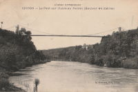
1857: Longues
Longues, Vic-le-Comte and Les Martres-de-Veyre, Puy-de-Dôme, France - Allier River
| Bridgemeister ID: | 7589 (added 2023-05-06) |
| Year Completed: | 1857 |
| Name: | Longues |
| Location: | Longues, Vic-le-Comte and Les Martres-de-Veyre, Puy-de-Dôme, France |
| Crossing: | Allier River |
| Use: | Vehicular |
| Status: | Replaced |
| Main Cables: | Chain (iron) |
| Main Span: | 1 |
Notes:
- Replaced 1833 Longues - Longues, Vic-le-Comte and Les Martres-de-Veyre, Puy-de-Dôme, France.
- Replaced by Longues - Longues, Vic-le-Comte and Les Martres-de-Veyre, Puy-de-Dôme, France.
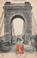
1857: Saint-Lattier
Saint-Lattier, Isère and Eymeux, Drôme, France - Isère River
| Bridgemeister ID: | 7385 (added 2022-11-24) |
| Year Completed: | 1857 |
| Name: | Saint-Lattier |
| Location: | Saint-Lattier, Isère and Eymeux, Drôme, France |
| Crossing: | Isère River |
| Use: | Vehicular |
| Status: | Replaced |
| Main Cables: | Wire |
| Suspended Spans: | 1 |
Notes:
- Later at same location Saint-Lattier (Eymeux) - Saint-Lattier, Isère and Eymeux, Drôme, France. Unclear if the newer bridge was a direct replacement for the older bridge.
External Links:
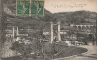
1858: Chaumont-sur-Loire
Chaumont-sur-Loire and Onzain, Loir-et-Cher, France - Loire River
| Bridgemeister ID: | 1703 (added 2005-03-29) |
| Year Completed: | 1858 |
| Name: | Chaumont-sur-Loire |
| Location: | Chaumont-sur-Loire and Onzain, Loir-et-Cher, France |
| Crossing: | Loire River |
| Use: | Vehicular |
| Status: | Replaced |
| Main Cables: | Wire (iron) |
| Main Spans: | 6 |
Notes:
- Damaged by troops, 1870. Repaired.
- Replaced by 1935 Chaumont-sur-Loire - Chaumont-sur-Loire and Onzain, Loir-et-Cher, France.
External Links:
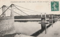
| Bridgemeister ID: | 1990 (added 2005-12-02) |
| Year Completed: | 1858 |
| Name: | Thoirette |
| Location: | Thoirette, Jura and Ain, France |
| Crossing: | Ain River |
| Coordinates: | 46.268464 N 5.536318 E |
| Maps: | Acme, GeoHack, Google, OpenStreetMap |
| References: | AGP |
| Use: | Vehicular (one-lane) |
| Status: | Replaced, 1922 |
| Main Cables: | Wire |
| Suspended Spans: | 1 |
Notes:
- One end of this bridge appears to have led directly into a building aptly named Hôtel Du Pont with the roadway possibly passing through the building. Remnants of the bridge are still present (as of 2022) on both sides of the river.
- Replaced 1829 Thoirette - Thoirette, Jura and Ain, France.
External Links:
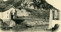
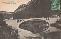
1859: Doux
St Jean de Muzols and Tournon-sur-Rhône, Ardèche, France - Doux River
| Bridgemeister ID: | 5661 (added 2021-01-01) |
| Year Completed: | 1859 |
| Name: | Doux |
| Location: | St Jean de Muzols and Tournon-sur-Rhône, Ardèche, France |
| Crossing: | Doux River |
| Coordinates: | 45.074919 N 4.816389 E |
| Maps: | Acme, GeoHack, Google, OpenStreetMap |
| References: | AAJ |
| Use: | Vehicular |
| Status: | Removed |
| Main Cables: | Wire |
| Suspended Spans: | 1 |
Notes:
External Links:
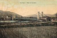
1859: Sully-sur-Loire
Sully-sur-Loire and Saint-Père-sur-Loire, Loiret, France - Loire River
| Bridgemeister ID: | 1709 (added 2005-03-30) |
| Year Completed: | 1859 |
| Name: | Sully-sur-Loire |
| Location: | Sully-sur-Loire and Saint-Père-sur-Loire, Loiret, France |
| Crossing: | Loire River |
| Use: | Vehicular |
| Status: | Collapsed, 1985 |
| Main Cables: | Chain (iron) |
| Main Spans: | 3 |
| Side Spans: | 2 |
Notes:
- 1859: The former three-span Sully-sur-Loire suspension bridge, heavily damaged by flood in 1856, is replaced with a suspension bridge having at least five suspended spans.
- 1933: Refurbished.
- 1940, June 18: Destroyed to slow advancing German troops.
- 1943: Repaired.
- 1944: Bombed by allied forces.
- 1947: Rebuilt.
- 1985, January 16: Collapsed.
- Replaced 1836 Sully-sur-Loire - Sully-sur-Loire and Saint-Père-sur-Loire, Loiret, France.
External Links:
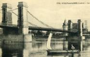
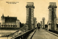
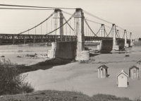
1859: Verdon
Gréoux-les-Bains, Alpes-de-Haute-Provence, France - Verdon River
| Bridgemeister ID: | 3215 (added 2019-11-11) |
| Year Completed: | 1859 |
| Name: | Verdon |
| Location: | Gréoux-les-Bains, Alpes-de-Haute-Provence, France |
| Crossing: | Verdon River |
| Use: | Vehicular |
| Status: | Destroyed, August, 1944 |
| Main Cables: | Wire |
| Suspended Spans: | 1 |
| Main Span: | 1 |
External Links:
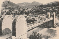
1861: Gray
Gray, Haute-Saône, France - Saône River
| Bridgemeister ID: | 1127 (added 2004-01-14) |
| Year Completed: | 1861 |
| Name: | Gray |
| Location: | Gray, Haute-Saône, France |
| Crossing: | Saône River |
| Use: | Vehicular |
| Status: | Removed |
| Main Cables: | Wire (iron) |
| Suspended Spans: | 1 |

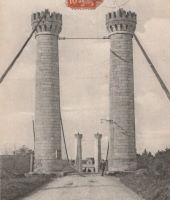
1862: Bessan
Bessan, Hérault, France - Hérault River
| Bridgemeister ID: | 1938 (added 2005-10-29) |
| Year Completed: | 1862 |
| Name: | Bessan |
| Location: | Bessan, Hérault, France |
| Crossing: | Hérault River |
| Status: | Removed |
| Main Cables: | Wire |
| Suspended Spans: | 1 |
External Links:
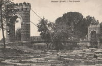
1863: Confolent
Confolent, Beauzac vicinity and Saint-Marice-de-Lignon, Haute-Loire, France - Loire River
| Bridgemeister ID: | 412 (added before 2003) |
| Year Completed: | 1863 |
| Name: | Confolent |
| Also Known As: | Lignon |
| Location: | Confolent, Beauzac vicinity and Saint-Marice-de-Lignon, Haute-Loire, France |
| Crossing: | Loire River |
| Coordinates: | 45.258031 N 4.144228 E |
| Maps: | Acme, GeoHack, Google, OpenStreetMap |
| Principals: | Adolphe Boulland |
| References: | BPF |
| Use: | Vehicular (one-lane), with walkway |
| Status: | In use (last checked: 2019) |
| Main Cables: | Wire (iron) |
| Suspended Spans: | 1 |
Notes:
- Cables damaged 1913, 1921. Refurbished 1922.
External Links:
1863: Ponsonnas
Ponsonnas, Isère, France - Drac River
| Bridgemeister ID: | 1079 (added 2003-12-29) |
| Year Completed: | 1863 |
| Name: | Ponsonnas |
| Location: | Ponsonnas, Isère, France |
| Crossing: | Drac River |
| Use: | Vehicular |
| Status: | Replaced, 1941 |
| Suspended Spans: | 1 |
| Main Span: | 1 x 123 meters (403.5 feet) |
Notes:
- Replaced by a 1941 arch bridge that is popular with bungee jumpers.
External Links:
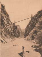
1863: Rousset
Rousset, Curbans vicinity, Alpes-de-Haute-Provence and Hautes-Alpes, France - Durance River
| Bridgemeister ID: | 2063 (added 2006-06-06) |
| Year Completed: | 1863 |
| Name: | Rousset |
| Location: | Rousset, Curbans vicinity, Alpes-de-Haute-Provence and Hautes-Alpes, France |
| Crossing: | Durance River |
| Use: | Vehicular |
| Status: | Removed |
| Main Cables: | Wire |
| Suspended Spans: | 1 |
External Links:
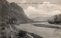
1864: Archidiacre
Venterol, Alpes-de-Haute-Provence and Valserres, Hautes-Alpes, France - Durance River
| Bridgemeister ID: | 4690 (added 2020-06-20) |
| Year Completed: | 1864 |
| Name: | Archidiacre |
| Also Known As: | Venterol |
| Location: | Venterol, Alpes-de-Haute-Provence and Valserres, Hautes-Alpes, France |
| Crossing: | Durance River |
| Coordinates: | 44.475805 N 6.111924 E |
| Maps: | Acme, GeoHack, Google, OpenStreetMap |
| Use: | Vehicular (one-lane) |
| Status: | Demolished, 2010 |
| Main Cables: | Wire |
| Suspended Spans: | 1 |
External Links:
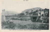
1865: Moulin
Vernosc-lès-Annonay, Ardèche, France - Cance River
| Bridgemeister ID: | 4553 (added 2020-05-31) |
| Year Completed: | 1865 |
| Name: | Moulin |
| Location: | Vernosc-lès-Annonay, Ardèche, France |
| Crossing: | Cance River |
| Coordinates: | 45.210908 N 4.703327 E |
| Maps: | Acme, GeoHack, Google, OpenStreetMap |
| Status: | Removed |
| Main Cables: | Wire (iron) |
| Suspended Spans: | 1 |
Notes:
- Structurae equates this bridge (which was replaced in 2012-2013) to the famous Seguin Brothers test structure at Annonay. Other sources suggest the derelict bridge replaced in 2012-2013 only dated to the 1860s. The detailed description and depiction of the Seguin's Annonay bridge in Tom F. Peters book on early 19th-century suspension bridges definitely does not resemble the 19th-century Moulin bridge. Peters describes the 1822-1823 Seguin bridge as a very narrow, very light, catwalk-style bridge. Peters additionally describes the main cables: "It had a single continuous parallel wire cable made of eight 1.23mm (no. 8 gauge) wires."
- Replaced by 2013 Moulin - Vernosc-lès-Annonay, Ardèche, France.
- See 1822 (footbridge) - Annonay, Ardèche, France.
External Links:
| Bridgemeister ID: | 7460 (added 2022-12-24) |
| Year Completed: | 1866 |
| Name: | Cessenon-sur-Orb |
| Location: | Cessenon-sur-Orb, Hérault, France |
| Crossing: | Orb River |
| Coordinates: | 43.451360 N 3.046595 E |
| Maps: | Acme, GeoHack, Google, OpenStreetMap |
| Use: | Vehicular (one-lane) |
| Status: | Replaced |
| Main Cables: | Wire |
| Suspended Spans: | 1 |
Notes:
- Replaced by Cessenon-sur-Orb - Cessenon-sur-Orb, Hérault, France.
External Links:
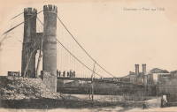
| Bridgemeister ID: | 516 (added before 2003) |
| Year Completed: | 1867 |
| Name: | Parc des Buttes-Chaumont |
| Location: | Paris, France |
| At or Near Feature: | Parc des Buttes-Chaumont |
| Coordinates: | 48.880933 N 2.381533 E |
| Maps: | Acme, GeoHack, Google, OpenStreetMap |
| References: | AAJ |
| Use: | Footbridge |
| Status: | In use (last checked: 2021) |
| Main Cables: | Wire |
| Suspended Spans: | 1 |
| Main Span: | 1 x 61 meters (200 feet) |
External Links:
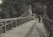
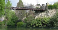
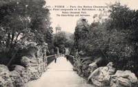
1869: Chavanay
Chavanay, Loire and Isère, France - Rhône River
| Bridgemeister ID: | 1702 (added 2005-03-29) |
| Year Completed: | 1869 |
| Name: | Chavanay |
| Location: | Chavanay, Loire and Isère, France |
| Crossing: | Rhône River |
| Coordinates: | 45.417327 N 4.740458 E |
| Maps: | Acme, GeoHack, Google, OpenStreetMap |
| Use: | Vehicular |
| Status: | Only towers remain (last checked: 2019) |
| Main Cables: | Wire (iron) |
| Suspended Spans: | 1 |
Notes:
- In 2019, one pair of pylons were still standing on the west bank of the Rhône.
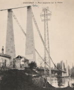
1870: Auzon
Auzon, Haute-Loire, France - Allier River
| Bridgemeister ID: | 6936 (added 2022-01-22) |
| Year Completed: | 1870 |
| Name: | Auzon |
| Location: | Auzon, Haute-Loire, France |
| Crossing: | Allier River |
| Coordinates: | 45.385908 N 3.357088 E |
| Maps: | Acme, GeoHack, Google, OpenStreetMap |
| Use: | Vehicular (one-lane) |
| Status: | Removed, c. 1934 |
| Main Cables: | Wire |
| Main Span: | 1 |
Notes:
- Replaced by an arch bridge in 1934.
- Replaced 1847 Auzon - Auzon, Haute-Loire, France.
External Links:
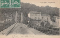
| Bridgemeister ID: | 7962 (added 2023-11-23) |
| Year Completed: | 1870 |
| Name: | Touzac |
| Location: | Touzac, Lot, France |
| Crossing: | Lot River |
| Coordinates: | 44.496083 N 1.049472 E |
| Maps: | Acme, GeoHack, Google, OpenStreetMap |
| Use: | Vehicular (one-lane) |
| Status: | Closed, January 2022 (last checked: 2023) |
| Main Cables: | Wire |
| Suspended Spans: | 1 |
| Main Span: | 1 x 110 meters (360.9 feet) estimated |
Notes:
- 2022, January 21: Bridge is severely damaged by a 40-ton truck attempting to cross. The bridge had a weight restriction of 16 tons since 1932. The long truck was also unable to negotiate the turn at the far end of the bridge and damaged the pylons attempting to reverse.
- 2023, June: Repair work is expected to start in September 2023 and complete in late 2024.
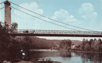
1871: Coubon
Coubon and Volhac, Haute-Loire, France - Loire River
| Bridgemeister ID: | 1724 (added 2005-04-05) |
| Year Completed: | 1871 |
| Name: | Coubon |
| Location: | Coubon and Volhac, Haute-Loire, France |
| Crossing: | Loire River |
| Use: | Vehicular |
| Status: | Destroyed, 1930 |
| Main Cables: | Wire |
| Suspended Spans: | 1 |
Notes:
External Links:
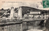
1874: Canet
Canet and Le Pouget, Hérault, France - Hérault River
| Bridgemeister ID: | 7491 (added 2022-12-30) |
| Year Completed: | 1874 |
| Name: | Canet |
| Location: | Canet and Le Pouget, Hérault, France |
| Crossing: | Hérault River |
| Coordinates: | 43.597444 N 3.493061 E |
| Maps: | Acme, GeoHack, Google, OpenStreetMap |
| Use: | Vehicular |
| Status: | Replaced |
| Main Cables: | Wire (iron) |
| Suspended Spans: | 1 |
Notes:
- Replaced 1845 Canet - Canet and Le Pouget, Hérault, France.
- Replaced by Canet - Canet and Le Pouget, Hérault, France.
External Links:
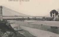
1874: Châtel-de-Neuvre
Châtel-de-Neuvre and La Ferté-Hauterive, Allier, France - Allier River
| Bridgemeister ID: | 4905 (added 2020-07-18) |
| Year Completed: | 1874 |
| Name: | Châtel-de-Neuvre |
| Location: | Châtel-de-Neuvre and La Ferté-Hauterive, Allier, France |
| Crossing: | Allier River |
| Coordinates: | 46.402296 N 3.317844 E |
| Maps: | Acme, GeoHack, Google, OpenStreetMap |
| References: | AAJ |
| Use: | Vehicular |
| Status: | Replaced, 1923 |
| Main Cables: | Wire |
| Suspended Spans: | 2 |
| Main Spans: | 2 |
External Links:
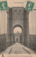
1875: Saint-Nazaire
Saint-Nazaire-en-Royans, Drôme and Saint-Hilaire-du-Rosier, Isère, France - Isère River
| Bridgemeister ID: | 7328 (added 2022-09-02) |
| Year Completed: | 1875 |
| Name: | Saint-Nazaire |
| Location: | Saint-Nazaire-en-Royans, Drôme and Saint-Hilaire-du-Rosier, Isère, France |
| Crossing: | Isère River |
| Coordinates: | 45.067313 N 5.243247 E |
| Maps: | Acme, GeoHack, Google, OpenStreetMap |
| Use: | Vehicular |
| Status: | Removed |
| Main Cables: | Wire |
| Suspended Spans: | 1 |
External Links:
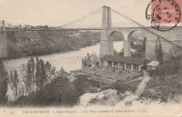
1876: Laissey
Laissey, Doubs, France - Doubs River
| Bridgemeister ID: | 2171 (added 2007-01-13) |
| Year Completed: | 1876 |
| Name: | Laissey |
| Location: | Laissey, Doubs, France |
| Crossing: | Doubs River |
| Coordinates: | 47.298411 N 6.236290 E |
| Maps: | Acme, GeoHack, Google, OpenStreetMap |
| Use: | Vehicular |
| Status: | Removed |
External Links:
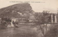
1876: Lamagistère
Lamagistère, Tarn-et-Garonne, France - Garonne River
| Bridgemeister ID: | 7175 (added 2022-07-01) |
| Year Completed: | 1876 |
| Name: | Lamagistère |
| Location: | Lamagistère, Tarn-et-Garonne, France |
| Crossing: | Garonne River |
| Coordinates: | 44.122921 N 0.819276 E |
| Maps: | Acme, GeoHack, Google, OpenStreetMap |
| Use: | Vehicular |
| Status: | Destroyed, 1930 |
| Main Cables: | Wire |
| Suspended Spans: | 2 |
| Main Spans: | 2 |
Notes:
- 1930: Destroyed by flood.
- Replaced 1850 Lamagistère - Lamagistère, Tarn-et-Garonne, France.
- Replaced by 1933 Lamagistère - Lamagistère, Tarn-et-Garonne, France.
External Links:
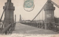
1877: Canet
Ventenac-en-Minervois and Canet, Aude, France - Aude River
| Bridgemeister ID: | 5658 (added 2021-01-01) |
| Year Completed: | 1877 |
| Name: | Canet |
| Location: | Ventenac-en-Minervois and Canet, Aude, France |
| Crossing: | Aude River |
| Coordinates: | 43.240039 N 2.855134 E |
| Maps: | Acme, GeoHack, Google, OpenStreetMap |
| References: | AAJ |
| Use: | Vehicular |
| Status: | Removed |
| Main Cables: | Wire |
| Suspended Spans: | 1 |
Notes:
- Piers are still present (in 2020) next to the current Aude River crossing at this location.
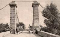
1879: Saint-Ilpize
Saint-Ilpize, Haute-Loire, France - Allier River
| Bridgemeister ID: | 1097 (added 2004-01-02) |
| Year Completed: | 1879 |
| Name: | Saint-Ilpize |
| Location: | Saint-Ilpize, Haute-Loire, France |
| Crossing: | Allier River |
| Coordinates: | 45.198556 N 3.386866 E |
| Maps: | Acme, GeoHack, Google, OpenStreetMap |
| Principals: | Ferdinand Arnodin |
| References: | AAJ, BPF, HBE, PTS2 |
| Use: | Vehicular (one-lane) |
| Status: | In use (last checked: 2020) |
| Main Cables: | Wire |
| Suspended Spans: | 3 |
| Main Span: | 1 x 70.35 meters (230.8 feet) |
| Side Spans: | 2 |
| Deck width: | 18 feet |
Notes:
- The side spans are supported solely by inclined stays, not suspenders from the main cables.
- Closed to all traffic on July 15, 2004 due to damage to the deck, possibly caused by an overloaded truck. Repaired and reopened.
External Links:
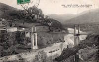
1881: Vicq-sur-Gartempe
Vicq-sur-Gartempe, Vienne, France - Gartempe River
| Bridgemeister ID: | 3996 (added 2020-03-27) |
| Year Completed: | 1881 |
| Name: | Vicq-sur-Gartempe |
| Location: | Vicq-sur-Gartempe, Vienne, France |
| Crossing: | Gartempe River |
| Use: | Vehicular |
| Status: | Removed |
| Main Cables: | Wire |
Notes:
- Replaced 1840 Vicq-sur-Gartempe - Vicq-sur-Gartempe and Champagne, Vienne, France.
- Replaced by 1931 Vicq-sur-Gartempe - Vicq-sur-Gartempe, Vienne, France.
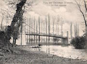
1883: Chilhac
Chilhac, Haute-Loire, France - Allier River
| Bridgemeister ID: | 1131 (added 2004-01-15) |
| Year Completed: | 1883 |
| Name: | Chilhac |
| Location: | Chilhac, Haute-Loire, France |
| Crossing: | Allier River |
| Coordinates: | 45.154731 N 3.437122 E |
| Maps: | Acme, GeoHack, Google, OpenStreetMap |
| Use: | Vehicular (one-lane) |
| Status: | In use (last checked: 2019) |
| Main Cables: | Wire |
| Suspended Spans: | 1 |
External Links:
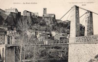
1883: Yenne
Yenne, Savoie and Ain, France - Rhône River
| Bridgemeister ID: | 1968 (added 2005-11-26) |
| Year Completed: | 1883 |
| Name: | Yenne |
| Location: | Yenne, Savoie and Ain, France |
| Crossing: | Rhône River |
| Coordinates: | 45.706294 N 5.751086 E |
| Maps: | Acme, GeoHack, Google, OpenStreetMap |
| References: | AGP |
| Use: | Vehicular (one-lane) |
| Status: | Destroyed, 1940 |
| Main Cables: | Wire |
| Suspended Spans: | 1 |
Notes:
- 1940: Destroyed during WWII.
- Later at same location 1951 Yenne - Yenne, Savoie and Ain, France.
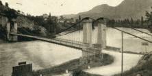
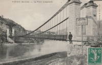
1884: Lamothe
Lamothe and Brioude, Haute-Loire, France - Allier River
| Bridgemeister ID: | 1764 (added 2005-04-22) |
| Year Completed: | 1884 |
| Name: | Lamothe |
| Location: | Lamothe and Brioude, Haute-Loire, France |
| Crossing: | Allier River |
| Coordinates: | 45.302968 N 3.406201 E |
| Maps: | Acme, GeoHack, Google, OpenStreetMap |
| References: | PTS2 |
| Use: | Vehicular |
| Status: | Only towers remain, since 1977 (last checked: 2019) |
| Main Cables: | Wire |
| Suspended Spans: | 1 |
| Main Span: | 1 |
Notes:
- Next to 1834 Lamothe - Lamothe and Brioude, Haute-Loire, France. In 1866, a flood caused a major change in the course of the Allier River such that the main channel no longer flowed under the older bridge. The newer bridge crossed the main channel of the Allier just slightly east of the older bridge.
External Links:
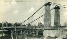
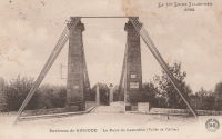
1884: Tonnay-Charente
Tonnay-Charente, Charente-Maritime, France - Charente River
| Bridgemeister ID: | 7337 (added 2022-09-04) |
| Year Completed: | 1884 |
| Name: | Tonnay-Charente |
| Location: | Tonnay-Charente, Charente-Maritime, France |
| Crossing: | Charente River |
| Coordinates: | 45.940048 N 0.886059 W |
| Maps: | Acme, GeoHack, Google, OpenStreetMap |
| Use: | Vehicular |
| Status: | Replaced, 1934 |
| Main Cables: | Wire |
| Suspended Spans: | 3 |
| Main Span: | 1 x 90 meters (295.3 feet) |
| Side Spans: | 2 |
Notes:
- Replaced 1842 Tonnay-Charente - Tonnay-Charente, Charente-Maritime, France.
- Replaced by 1934 Tonnay-Charente - Tonnay-Charente, Charente-Maritime, France.
External Links:
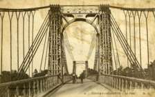
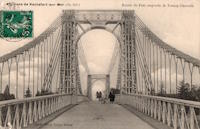
1887: de l'Abîme
Cusy and Gruffy, Haute-Savoie, France - Chéran River
| Bridgemeister ID: | 418 (added before 2003) |
| Year Completed: | 1887 |
| Name: | de l'Abîme |
| Location: | Cusy and Gruffy, Haute-Savoie, France |
| Crossing: | Chéran River |
| Coordinates: | 45.764583 N 6.057117 E |
| Maps: | Acme, GeoHack, Google, OpenStreetMap |
| Principals: | Ferdinand Arnodin |
| References: | BPF |
| Use: | Vehicular (one-lane) |
| Status: | In use (last checked: 2021) |
| Main Cables: | Wire |
| Suspended Spans: | 1 |
| Main Span: | 1 x 64 meters (210 feet) |
External Links:
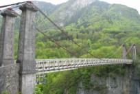
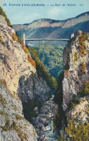
1888: Évieu
Évieu, Ain and Les Avenières Veyrins-Thuellin, Isère, France - Rhône River
| Bridgemeister ID: | 7099 (added 2022-06-03) |
| Year Completed: | 1888 |
| Name: | Évieu |
| Location: | Évieu, Ain and Les Avenières Veyrins-Thuellin, Isère, France |
| Crossing: | Rhône River |
| Status: | Removed |
| Main Cables: | Wire |
| Main Spans: | 2 |
Notes:
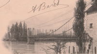
1889: La Voulte-sur-Rhône
La Voulte-sur-Rhône, Rhône, France - Rhône River
| Bridgemeister ID: | 1521 (added 2004-10-10) |
| Year Completed: | 1889 |
| Name: | La Voulte-sur-Rhône |
| Location: | La Voulte-sur-Rhône, Rhône, France |
| Crossing: | Rhône River |
| Coordinates: | 44.800217 N 4.784367 E |
| Maps: | Acme, GeoHack, Google, OpenStreetMap |
| Use: | Vehicular |
| Status: | In use (last checked: 2022) |
| Main Cables: | Wire |
| Suspended Spans: | 3 |
| Main Span: | 1 |
| Side Spans: | 2 |
Notes:
External Links:
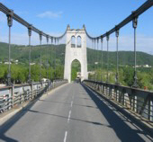
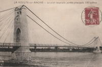
1889: Rivière de l'Est
Sainte Rose, Réunion, France - Rivière de l'Est
| Bridgemeister ID: | 992 (added 2003-11-16) |
| Year Completed: | 1889 |
| Name: | Rivière de l'Est |
| Also Known As: | River of the East |
| Location: | Sainte Rose, Réunion, France |
| Crossing: | Rivière de l'Est |
| Coordinates: | 21.125067 S 55.7484896 E |
| Maps: | Acme, GeoHack, Google, OpenStreetMap |
| Principals: | Ferdinand Arnodin |
| References: | PTS2 |
| Use: | Vehicular (one-lane) |
| Status: | In use (last checked: 2019) |
| Main Cables: | Wire |
| Suspended Spans: | 1 |
External Links:
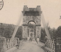
1890: Sylvéréal
Sylvéréal, Gard and Bouches-du-Rhône, France - Petit Rhône River
| Bridgemeister ID: | 7319 (added 2022-08-31) |
| Year Completed: | 1890 |
| Name: | Sylvéréal |
| Location: | Sylvéréal, Gard and Bouches-du-Rhône, France |
| Crossing: | Petit Rhône River |
| Coordinates: | 43.546406 N 4.350111 E |
| Maps: | Acme, GeoHack, Google, OpenStreetMap |
| Use: | Vehicular |
| Status: | Removed |
| Main Cables: | Wire |
| Suspended Spans: | 1 |
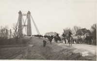
1891: Livron
Livron-sur-Drôme, Drôme and La Voulte-sur-Rhône, Ardèche, France - Petit Rhône River
| Bridgemeister ID: | 1806 (added 2005-05-19) |
| Year Completed: | 1891 |
| Name: | Livron |
| Location: | Livron-sur-Drôme, Drôme and La Voulte-sur-Rhône, Ardèche, France |
| Crossing: | Petit Rhône River |
| Coordinates: | 44.795194 N 4.796055 E |
| Maps: | Acme, GeoHack, Google, OpenStreetMap |
| Use: | Vehicular (one-lane) |
| Status: | In use (last checked: 2022) |
| Main Cables: | Wire |
| Suspended Spans: | 1 |
| Main Span: | 1 x 101 meters (331.4 feet) estimated |
Notes:
External Links:
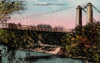
1892: Aurec-sur-Loire
Aurec-sur-Loire, Haute-Loire, France - Loire River
| Bridgemeister ID: | 1607 (added 2005-02-06) |
| Year Completed: | 1892 |
| Name: | Aurec-sur-Loire |
| Location: | Aurec-sur-Loire, Haute-Loire, France |
| Crossing: | Loire River |
| Coordinates: | 45.369475 N 4.196837 E |
| Maps: | Acme, GeoHack, Google, OpenStreetMap |
| Use: | Vehicular (one-lane) |
| Status: | Only towers remain (last checked: 2021) |
| Main Cables: | Wire |
| Suspended Spans: | 3 |
| Main Span: | 1 |
| Side Spans: | 2 |
Notes:
- Approaches, abutments, piers, and pylons still in existence, 2018, but the original deck and cables are completely gone. A newer pedestrian suspension bridge is effectively sitting on the original bridge's piers between the original pylons.
- Later at same location (footbridge) - Aurec-sur-Loire, Haute-Loire, France.

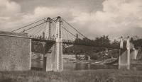
1894: Bonpas
Bonpas, Vaucluse and Bouches-du-Rhône, France - Durance River
| Bridgemeister ID: | 2082 (added 2006-06-11) |
| Year Completed: | 1894 |
| Name: | Bonpas |
| Location: | Bonpas, Vaucluse and Bouches-du-Rhône, France |
| Crossing: | Durance River |
| Coordinates: | 43.887445 N 4.916439 E |
| Maps: | Acme, GeoHack, Google, OpenStreetMap |
| Use: | Vehicular |
| Status: | Destroyed, 1944 |
| Suspended Spans: | 4 |
| Main Spans: | 2 |
| Side Spans: | 2 |
External Links:
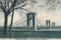
1897: Pailhès
Pézenas and Castelnau-de-Guers, Hérault, France - Hérault River
| Bridgemeister ID: | 4689 (added 2020-06-20) |
| Year Completed: | 1897 |
| Name: | Pailhès |
| Also Known As: | Castelnau |
| Location: | Pézenas and Castelnau-de-Guers, Hérault, France |
| Crossing: | Hérault River |
| Coordinates: | 43.449256 N 3.436369 E |
| Maps: | Acme, GeoHack, Google, OpenStreetMap |
| Use: | Vehicular |
| Status: | Demolished (last checked: 2009) |
| Main Cables: | Wire (steel) |
| Suspended Spans: | 1 |
| Main Span: | 1 x 101.47 meters (332.9 feet) |
Notes:
- Likely replaced an older suspension bridge.
External Links:
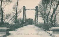
1897: Port-Sainte-Foy
Port-Sainte-Foy-et-Ponchapt, Dordogne and Sainte-Foy-la-Grande, Gironde, France - Dordogne River
| Bridgemeister ID: | 1594 (added 2005-02-06) |
| Year Completed: | 1897 |
| Name: | Port-Sainte-Foy |
| Location: | Port-Sainte-Foy-et-Ponchapt, Dordogne and Sainte-Foy-la-Grande, Gironde, France |
| Crossing: | Dordogne River |
| Coordinates: | 44.842400 N 0.211233 E |
| Maps: | Acme, GeoHack, Google, OpenStreetMap |
| Use: | Vehicular (two-lane) |
| Status: | Only towers remain (last checked: 2019) |
| Main Cables: | Wire |
| Suspended Spans: | 2 |
| Main Spans: | 2 |
Notes:
- Replaced by a nearby suspension bridge, but the end pylons are still present at the ends of the replacement span as of 2019.
- Replaced 1829 Port-Sainte-Foy - Port-Sainte-Foy-et-Ponchapt, Dordogne and Sainte-Foy-la-Grande, Gironde, France.
- Near future location of 1961 Saint-Foy-la-Grande - Saint-Foy-la-Grande, Gironde and Port-Sainte-Foy-et-Ponchapt, Dordogne, France.
External Links:
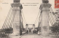
1898: Margeaix
Beaulieu and Saint-Vincent, Haute-Loire, France - Loire River
| Bridgemeister ID: | 1539 (added 2004-10-31) |
| Year Completed: | 1898 |
| Name: | Margeaix |
| Also Known As: | Marjeaix, Margeix |
| Location: | Beaulieu and Saint-Vincent, Haute-Loire, France |
| Crossing: | Loire River |
| Coordinates: | 45.15324 N 3.924896 E |
| Maps: | Acme, GeoHack, Google, OpenStreetMap |
| References: | BPF |
| Use: | Vehicular (one-lane) |
| Status: | In use (last checked: 2019) |
| Main Cables: | Wire |
| Suspended Spans: | 1 |
| Main Span: | 1 x 66 meters (216.5 feet) |
Notes:
- Repaired, 1935 and 1975.
External Links:
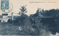
1898: Rouen Transporter
Rouen, Seine-Maritime, France
| Bridgemeister ID: | 953 (added 2003-10-31) |
| Year Completed: | 1898 |
| Name: | Rouen Transporter |
| Location: | Rouen, Seine-Maritime, France |
| Principals: | Ferdinand Arnodin |
| Use: | Transporter |
| Status: | Destroyed, 1940 |
| Suspended Spans: | 1 |
External Links:
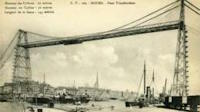
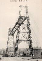
1899: Port-Sainte-Marie
Port-Sainte-Marie and Saint-Laurent, Lot-et-Garonne, France - Garonne River
| Bridgemeister ID: | 1781 (added 2005-04-23) |
| Year Completed: | 1899 |
| Name: | Port-Sainte-Marie |
| Location: | Port-Sainte-Marie and Saint-Laurent, Lot-et-Garonne, France |
| Crossing: | Garonne River |
| Use: | Vehicular |
| Status: | Removed |
| Main Cables: | Wire |
| Suspended Spans: | 1 |
| Main Span: | 1 x 180 meters (590.6 feet) |
Notes:
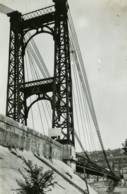
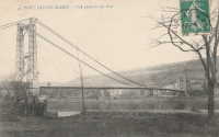
1900: Rochefort-Martrou Transporter
Rochefort, Charente-Maritime, France - Charente River
| Bridgemeister ID: | 949 (added 2003-10-30) |
| Year Completed: | 1900 |
| Name: | Rochefort-Martrou Transporter |
| Also Known As: | Matrou Transporter |
| Location: | Rochefort, Charente-Maritime, France |
| Crossing: | Charente River |
| Coordinates: | 45.91613 N 0.960638 W |
| Maps: | Acme, GeoHack, Google, OpenStreetMap |
| Principals: | Ferdinand Arnodin |
| References: | AAJ, BPF |
| Use: | Transporter |
| Status: | In use (last checked: 2022) |
| Main Cables: | Wire (steel) |
| Suspended Spans: | 1 |
| Main Span: | 1 x 129 meters (423.2 feet) |
Notes:
- Eckhard Bernstorff notes (data from the information table at the machinery building, where the motor to pull the platform is installed): Main Span 129 m (the high truss towers have a wide basis, the length from saddle to saddle is 139.75 m, and the length of the whole "tableau" including side parts is 175.5m), width between rails 8m. The Rochefort Transporter is well in use [2005], in the summer on all days people can use the "ferry" which is attached to the rails under the bridge.
External Links:
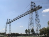
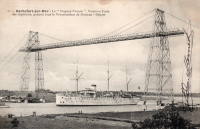
1901: Aramon
Aramon, Gard, France - Rhône River
| Bridgemeister ID: | 6432 (added 2021-08-12) |
| Year Completed: | 1901 |
| Name: | Aramon |
| Location: | Aramon, Gard, France |
| Crossing: | Rhône River |
| References: | PTS2 |
| Use: | Vehicular |
| Status: | Destroyed, August 15, 1944 |
| Main Cables: | Wire (steel) |
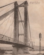
1902: Bonny-sur-Loire
Bonny-sur-Loire and Beaulieu-sur-Loire, Loiret, France - Loire River
| Bridgemeister ID: | 1178 (added 2004-01-24) |
| Year Completed: | 1902 |
| Name: | Bonny-sur-Loire |
| Location: | Bonny-sur-Loire and Beaulieu-sur-Loire, Loiret, France |
| Crossing: | Loire River |
| Use: | Vehicular |
| Status: | Replaced |
| Main Cables: | Wire |
| Suspended Spans: | 3 |
| Main Spans: | 3 |
Notes:
External Links:

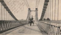
1902: Vernaison
Vernaison, Métropole de Lyon, France - Rhône River
| Bridgemeister ID: | 6431 (added 2021-08-11) |
| Year Completed: | 1902 |
| Name: | Vernaison |
| Location: | Vernaison, Métropole de Lyon, France |
| Crossing: | Rhône River |
| Coordinates: | 45.646369 N 4.815423 E |
| Maps: | Acme, GeoHack, Google, OpenStreetMap |
| Principals: | Ferdinand Arnodin |
| References: | AAJ, PTS2 |
| Use: | Vehicular |
| Status: | Destroyed, June 1940 |
| Main Cables: | Wire (steel) |
Notes:
- Later at same location 1959 Vernaison - Vernaison and Solaize, Métropole de Lyon, France.
External Links:

1904: Bonhomme
Kervignac, Morbihan, France - Blavet River
| Bridgemeister ID: | 1115 (added 2004-01-05) |
| Year Completed: | 1904 |
| Name: | Bonhomme |
| Location: | Kervignac, Morbihan, France |
| Crossing: | Blavet River |
| Coordinates: | 47.764878 N 3.302251 W |
| Maps: | Acme, GeoHack, Google, OpenStreetMap |
| Principals: | Ferdinand Arnodin |
| References: | AAJ, BPF, PTS2 |
| Use: | Vehicular |
| Status: | Only towers remain, since 1980 (last checked: 2019) |
| Main Cables: | Wire |
| Suspended Spans: | 3 |
| Main Span: | 1 x 163.1 meters (535 feet) |
| Side Spans: | 2 x 36.9 meters (121 feet) |
Notes:
- Deck and cables removed, 1980.
External Links:

1904: Desmons
Brignon, Gard, France - Gardon River
| Bridgemeister ID: | 6982 (added 2022-04-03) |
| Year Completed: | 1904 |
| Name: | Desmons |
| Location: | Brignon, Gard, France |
| Crossing: | Gardon River |
| Use: | Vehicular |
| Status: | Destroyed, October, 1907 |
| Main Cables: | Wire |
| Suspended Spans: | 1 |
| Main Span: | 1 |
Notes:
- 1907, October: Destroyed by flood.
- Replaced by 1913 Desmons - Brignon, Gard, France.
External Links:
1904: Jons-Niévroz
Jons, Rhône and Niévroz, Ain, France - Rhône River
| Bridgemeister ID: | 2033 (added 2006-04-23) |
| Year Completed: | 1904 |
| Name: | Jons-Niévroz |
| Location: | Jons, Rhône and Niévroz, Ain, France |
| Crossing: | Rhône River |
| References: | AAJ |
| Use: | Vehicular |
| Status: | Destroyed, 1940 |
| Suspended Spans: | 1 |
| Main Span: | 1 x 200 meters (656.2 feet) |
Notes:
- Destroyed, 1940, during WWII.
- Similar to 1912 Groslée - Groslée, Ain and Brangues, Isère, France.
1905: Saint-Martin
Saint-Martin-d'Ardèche, Ardèche and Aiguèze, Gard, France - Ardèche River
| Bridgemeister ID: | 1523 (added 2004-10-10) |
| Year Completed: | 1905 |
| Name: | Saint-Martin |
| Location: | Saint-Martin-d'Ardèche, Ardèche and Aiguèze, Gard, France |
| Crossing: | Ardèche River |
| Coordinates: | 44.3007 N 4.567283 E |
| Maps: | Acme, GeoHack, Google, OpenStreetMap |
| Use: | Vehicular (one-lane) |
| Status: | In use (last checked: 2005) |
| Main Cables: | Wire |
| Suspended Spans: | 1 |
External Links:
1906: Montfrin
Montfrin, Gard, France - Gardon River
| Bridgemeister ID: | 7275 (added 2022-07-22) |
| Year Completed: | 1906 |
| Name: | Montfrin |
| Location: | Montfrin, Gard, France |
| Crossing: | Gardon River |
| Use: | Vehicular |
| Status: | Removed |
| Main Cables: | Wire |
| Main Spans: | 2 |
Notes:
- Replaced 1838 Montfrin - Montfrin, Gard, France.
External Links:
- Art-et-Histoire - Nouveau pont suspendu de Montfrin - 1907. Suspects the bridge opened in 1907. The year 1906 is seen very prominently on the bridge tower, but the bridge may not have opened in 1906.
1906: Trellins
Vinay vicinity, Isère, France - Isère River
| Bridgemeister ID: | 1423 (added 2004-07-17) |
| Year Completed: | 1906 |
| Name: | Trellins |
| Location: | Vinay vicinity, Isère, France |
| Crossing: | Isère River |
| Coordinates: | 45.19536 N 5.42482 E |
| Maps: | Acme, GeoHack, Google, OpenStreetMap |
| References: | AAJ |
| Use: | Vehicular |
| Status: | Derelict (last checked: 2009) |
| Main Cables: | Wire |
| Suspended Spans: | 3 |
| Main Span: | 1 x 146.6 meters (481 feet) |
| Side Spans: | 2 x 25.3 meters (83 feet) |
Notes:
- 2022: Still standing, but suspenders and deck have been removed.
External Links:
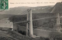
| Bridgemeister ID: | 996 (added 2003-11-16) |
| Year Completed: | 1909 |
| Name: | Brest Transporter |
| Location: | Brest, Finistère, France |
| Use: | Transporter |
| Status: | Removed, 1947 |
| Main Cables: | Wire (steel) |
| Suspended Spans: | 1 |
| Main Span: | 1 x 10⁹ meters (357.6 feet) |
Notes:
- Moved from 1898 Bizerte Transporter (Bizerta) - Bizerte, Tunisia. The bridge was dismantled and reassembled at Brest.
External Links:
1910: Bouchemaine
Bouchemaine, Maine-et-Loire, France - Maine River
| Bridgemeister ID: | 1324 (added 2004-04-26) |
| Year Completed: | 1910 |
| Name: | Bouchemaine |
| Location: | Bouchemaine, Maine-et-Loire, France |
| Crossing: | Maine River |
| Coordinates: | 47.420130 N 0.608157 W |
| Maps: | Acme, GeoHack, Google, OpenStreetMap |
| Use: | Vehicular |
| Status: | Destroyed, 1944 |
| Main Cables: | Wire (iron) |
| Suspended Spans: | 3 |
| Main Span: | 1 |
| Side Spans: | 2 |
Notes:
- Note the interesting stay and suspender arrangement in image. The side spans and much of the center span appear to be supported by stays. Only the center portion of the main span appears to be supported by verticle suspenders.
- Replaced by 1951 Bouchemaine - Bouchemaine, Maine-et-Loire, France.
1910: La Feuillée
Lyon, Métropole de Lyon, France - Saône River
| Bridgemeister ID: | 6424 (added 2021-08-10) |
| Year Completed: | 1910 |
| Name: | La Feuillée |
| Location: | Lyon, Métropole de Lyon, France |
| Crossing: | Saône River |
| Coordinates: | 45.766389 N 4.829081 E |
| Maps: | Acme, GeoHack, Google, OpenStreetMap |
| References: | PQL |
| Use: | Footbridge |
| Status: | Destroyed, 1944 |
| Main Cables: | Wire (steel) |
| Suspended Spans: | 1 |
Notes:
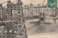
1911: Massena
Saint-Blaise, Alpes-Maritimes, France
| Bridgemeister ID: | 7202 (added 2022-07-05) |
| Year Completed: | 1911 |
| Name: | Massena |
| Location: | Saint-Blaise, Alpes-Maritimes, France |
| Coordinates: | 43.822410 N 7.241796 E |
| Maps: | Acme, GeoHack, Google, OpenStreetMap |
| Use: | Vehicular |
| Status: | Destroyed, 1944 |
| Main Cables: | Wire (steel) |
| Main Span: | 1 |
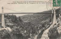
1911: Pessac-sur-Dordogne
Pessac-sur-Dordogne, Gironde and Dordogne, France - Dordogne River
| Bridgemeister ID: | 2333 (added 2007-07-09) |
| Year Completed: | 1911 |
| Name: | Pessac-sur-Dordogne |
| Location: | Pessac-sur-Dordogne, Gironde and Dordogne, France |
| Crossing: | Dordogne River |
| Status: | Removed |
| Main Cables: | Wire |
Notes:
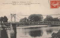
1912: Groslée
Groslée, Ain and Brangues, Isère, France - Rhône River
| Bridgemeister ID: | 1536 (added 2004-10-31) |
| Year Completed: | 1912 |
| Name: | Groslée |
| Location: | Groslée, Ain and Brangues, Isère, France |
| Crossing: | Rhône River |
| Coordinates: | 45.712333 N 5.548533 E |
| Maps: | Acme, GeoHack, Google, OpenStreetMap |
| Principals: | Ferdinand Arnodin |
| References: | BPF |
| Use: | Vehicular, with walkway |
| Status: | In use (last checked: 2019) |
| Main Cables: | Wire (steel) |
| Suspended Spans: | 1 |
| Main Span: | 1 x 177 meters (580.7 feet) estimated |
Notes:
External Links:
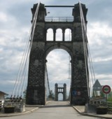
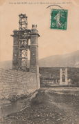
1912: Miret
Saint-Denis-lès-Martel, Lot, France - Dordogne River
| Bridgemeister ID: | 1986 (added 2005-12-02) |
| Year Completed: | 1912 |
| Name: | Miret |
| Also Known As: | Mezels |
| Location: | Saint-Denis-lès-Martel, Lot, France |
| Crossing: | Dordogne River |
| Coordinates: | 44.927380 N 1.670215 E |
| Maps: | Acme, GeoHack, Google, OpenStreetMap |
| Use: | Vehicular (one-lane) |
| Status: | In use (last checked: 2019) |
| Main Cables: | Wire |
| Suspended Spans: | 1 |
| Main Span: | 1 x 140 meters (459.3 feet) |
Notes:
- Possibly completed 1914, not 1912.
- In vicinity of Mezels and Floirac.
External Links:
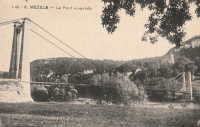
1913: Desmons
Brignon, Gard, France - Gardon River
| Bridgemeister ID: | 6983 (added 2022-04-03) |
| Year Completed: | 1913 |
| Name: | Desmons |
| Location: | Brignon, Gard, France |
| Crossing: | Gardon River |
| Use: | Vehicular |
| Status: | Demolished, March, 1989 |
| Main Cables: | Wire |
| Suspended Spans: | 1 |
| Main Span: | 1 |
Notes:
- Replaced 1904 Desmons - Brignon, Gard, France.
External Links:
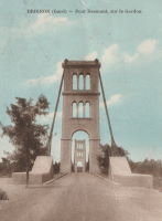
1914: Verdalle
Verdalle, Ayssenes vicinity, Aveyron, France - Tarn River
| Bridgemeister ID: | 3164 (added 2019-11-03) |
| Year Completed: | 1914 |
| Name: | Verdalle |
| Location: | Verdalle, Ayssenes vicinity, Aveyron, France |
| Crossing: | Tarn River |
| Coordinates: | 44.058557 N 2.788122 E |
| Maps: | Acme, GeoHack, Google, OpenStreetMap |
| Use: | Vehicular (one-lane) |
| Status: | In use (last checked: 2023) |
| Main Cables: | Wire |
| Suspended Spans: | 1 |
| Main Span: | 1 x 101 meters (331.4 feet) estimated |
External Links:
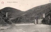
1915: (suspension bridge)
Esbly and Isles-lès-Villenoy, Seine-et-Marne, France - Marne River
| Bridgemeister ID: | 8086 (added 2023-12-25) |
| Year Completed: | 1915 |
| Name: | (suspension bridge) |
| Location: | Esbly and Isles-lès-Villenoy, Seine-et-Marne, France |
| Crossing: | Marne River |
| Coordinates: | 48.911917 N 2.815222 E |
| Maps: | Acme, GeoHack, Google, OpenStreetMap |
| Status: | Removed |
| Main Cables: | Wire |
| Suspended Spans: | 1 |
Notes:
- Temporary footbridge or pipeline bridge (or both) built after the destruction of the vehicular bridge at this location during WWI in 1914. Likely in service until a replacement bridge was completed in 1922.
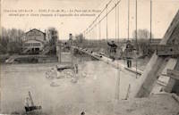
1920: Les Andelys
Les Andelys, Eure, France - Seine River
| Bridgemeister ID: | 1597 (added 2005-02-06) |
| Year Completed: | 1920 |
| Name: | Les Andelys |
| Location: | Les Andelys, Eure, France |
| Crossing: | Seine River |
| Coordinates: | 49.236737 N 1.399657 E |
| Maps: | Acme, GeoHack, Google, OpenStreetMap |
| Principals: | Ferdinand Arnodin |
| Use: | Vehicular |
| Status: | Demolished, June 9, 1940 |
| Main Cables: | Wire (steel) |
| Suspended Spans: | 1 |
Notes:
- Completed in 1914 but not opened until 1920.
- The present-day Les Andelys bridge appears to have been constructed on the same piers as this predecessor.
- Demolished in June 1940 by the French army to slow advancing German troops during WWII.
- At former location of 1838 Les Andelys - Les Andelys, Eure, France. The 1920 bridge was not an immediate replacement. A stone arch bridge replaced the 1838 suspension bridge destroyed in 1870. The arch bridge was replaced by this (1920) suspension bridge.
- Replaced by 1947 Les Andelys - Les Andelys, Eure, France.
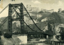
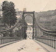
1921: St. Marien
St. Marien, Budelière vicinity, Évaux-les-Bains and Budelière, Creuse, France - Tardes River
| Bridgemeister ID: | 1159 (added 2004-01-18) |
| Year Completed: | 1921 |
| Name: | St. Marien |
| Location: | St. Marien, Budelière vicinity, Évaux-les-Bains and Budelière, Creuse, France |
| Crossing: | Tardes River |
| Coordinates: | 46.233320 N 2.508124 E |
| Maps: | Acme, GeoHack, Google, OpenStreetMap |
| Use: | Vehicular (one-lane) |
| Status: | In use (last checked: 2017) |
| Suspended Spans: | 1 |
Notes:
- Located just before the Tardes flows into the Cher. Sometimes noted as near Evaux-les-Bains.
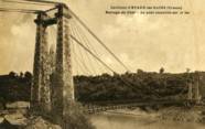
1923: Blagnac
Blagnac, Haute-Garonne, France - Garonne River
| Bridgemeister ID: | 2959 (added 2019-10-06) |
| Year Completed: | 1923 |
| Name: | Blagnac |
| Location: | Blagnac, Haute-Garonne, France |
| Crossing: | Garonne River |
| Coordinates: | 43.624930 N 1.401531 E |
| Maps: | Acme, GeoHack, Google, OpenStreetMap |
| Use: | Vehicular |
| Status: | Replaced, 1983 |
| Main Cables: | Wire (steel) |
| Suspended Spans: | 3 |
| Main Spans: | 3 |
Notes:
1924: Saint-Leu
Saint-Leu-d'Esserent, Oise, France - Oise River
| Bridgemeister ID: | 1947 (added 2005-11-04) |
| Year Completed: | 1924 |
| Name: | Saint-Leu |
| Location: | Saint-Leu-d'Esserent, Oise, France |
| Crossing: | Oise River |
| Coordinates: | 49.213680 N 2.422861 E |
| Maps: | Acme, GeoHack, Google, OpenStreetMap |
| References: | AAJ |
| Use: | Vehicular (two-lane) |
| Status: | In use (last checked: 2022) |
| Main Cables: | Wire (steel) |
| Suspended Spans: | 1 |
External Links:
1924: Villemur-sur-Tarn
Villemur-sur-Tarn, Haute-Garonne, France - Tarn River
| Bridgemeister ID: | 1851 (added 2005-07-16) |
| Year Completed: | 1924 |
| Name: | Villemur-sur-Tarn |
| Location: | Villemur-sur-Tarn, Haute-Garonne, France |
| Crossing: | Tarn River |
| Use: | Vehicular |
| Status: | Destroyed, 1930 |
| Main Cables: | Wire (steel) |
Notes:
- 1930: Destroyed by flood.
- Replaced 1845 Villemur-sur-Tarn - Villemur-sur-Tarn, Haute-Garonne, France.
- Replaced by 1932 Villemur-sur-Tarn - Villemur-sur-Tarn, Haute-Garonne, France.
1925: Luzancy
Luzancy, Seine-et-Marne, France - Marne River
| Bridgemeister ID: | 4920 (added 2020-07-26) |
| Year Completed: | 1925 |
| Name: | Luzancy |
| Location: | Luzancy, Seine-et-Marne, France |
| Crossing: | Marne River |
| References: | AAJ, PTS2 |
| Use: | Vehicular |
| Status: | Destroyed |
| Main Cables: | Reinforced Concrete |
| Suspended Spans: | 1 |
Notes:
- Described as a "rigid suspension bridge of reinforced concrete."
- Replaced 1831 Luzancy - Luzancy, Seine-et-Marne, France.
- Similar to 1926 Laon - Laon, Aisne, France.
- Similar to Pommiers - Pommiers, Aisne, France.
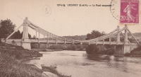
1925: Térénez
Landévennec vicinity and Rosnoen vicinity, Finistère, France - Aulne River
| Bridgemeister ID: | 1912 (added 2005-10-08) |
| Year Completed: | 1925 |
| Name: | Térénez |
| Location: | Landévennec vicinity and Rosnoen vicinity, Finistère, France |
| Crossing: | Aulne River |
| Coordinates: | 48.269120 N 4.262766 W |
| Maps: | Acme, GeoHack, Google, OpenStreetMap |
| Use: | Vehicular |
| Status: | Destroyed, 1944 |
| Main Cables: | Wire |
| Main Span: | 1 x 272 meters (892.4 feet) |
Notes:
- Coordinates are approximate, adjacent to the two subsequent replacement bridges.
- Replaced by 1952 Térénez - Landévennec vicinity and Rosnoen vicinity, Finistère, France.
External Links:
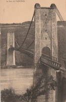
| Bridgemeister ID: | 8219 (added 2024-02-06) |
| Year Completed: | 1926 |
| Name: | Laon |
| Location: | Laon, Aisne, France |
| Coordinates: | 49.571000 N 3.635639 E |
| Maps: | Acme, GeoHack, Google, OpenStreetMap |
| References: | PTS2 |
| Use: | Vehicular |
| Status: | In use (last checked: 2023) |
| Main Cables: | Reinforced Concrete |
| Suspended Spans: | 2 |
| Side Spans: | 2 |
Notes:
- Rigid reinforced concrete suspension bridge.
- Similar to 1925 Luzancy - Luzancy, Seine-et-Marne, France.
- Similar to Pommiers - Pommiers, Aisne, France.
External Links:
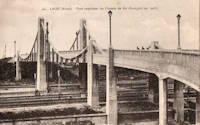
| Bridgemeister ID: | 7273 (added 2022-07-22) |
| Year Completed: | 1926 |
| Name: | Oiselay |
| Location: | Sorgues, Vaucluse, France |
| Coordinates: | 44.023850 N 4.843694 E |
| Maps: | Acme, GeoHack, Google, OpenStreetMap |
| Use: | Vehicular (one-lane) |
| Status: | Closed (last checked: 2021) |
| Main Cables: | Wire (steel) |
| Suspended Spans: | 1 |
| Main Span: | 1 x 151 meters (495.4 feet) estimated |
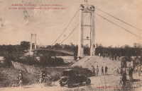
1927: Briollay
Briollay, Maine-et-Loire, France - Sarthe River
| Bridgemeister ID: | 6700 (added 2021-10-03) |
| Year Completed: | 1927 |
| Name: | Briollay |
| Location: | Briollay, Maine-et-Loire, France |
| Crossing: | Sarthe River |
| Use: | Vehicular |
| Status: | Removed |
| Main Cables: | Wire |
Notes:
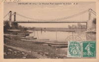
1927: Chartrouse
Arles, Bouches-du-Rhône, France - Rhône River
| Bridgemeister ID: | 4846 (added 2020-07-11) |
| Year Completed: | 1927 |
| Name: | Chartrouse |
| Location: | Arles, Bouches-du-Rhône, France |
| Crossing: | Rhône River |
| At or Near Feature: | Lône des Pilotes |
| Coordinates: | 43.463752 N 4.743590 E |
| Maps: | Acme, GeoHack, Google, OpenStreetMap |
| Use: | Vehicular (one-lane) |
| Status: | In use (last checked: 2019) |
| Main Cables: | Wire (steel) |
| Suspended Spans: | 1 |
External Links:
1927: Jargeau
Jargeau and Saint-Denis-de-l'Hôtel, Loiret, France - Loire River
| Bridgemeister ID: | 6805 (added 2021-11-21) |
| Year Completed: | 1927 |
| Name: | Jargeau |
| Also Known As: | Saint-Denis-de-l'Hôtel |
| Location: | Jargeau and Saint-Denis-de-l'Hôtel, Loiret, France |
| Crossing: | Loire River |
| Coordinates: | 47.868650 N 2.124035 E |
| Maps: | Acme, GeoHack, Google, OpenStreetMap |
| Use: | Vehicular |
| Status: | Replaced, 1965 |
| Main Cables: | Wire (steel) |
Notes:
- 1937: Strengthened.
- 1940: Partially destroyed to slow advancing German troops.
- 1943: Repairs completed and bridge reopened.
- 1944: Partially destroyed.
- 1944-1945: Repaired and reopened.
- 1965: Closed and replaced due to concerns about deteriorating main cable strength.
- Replaced 1834 Jargeau (Saint-Denis-de-l'Hôtel) - Jargeau and Saint-Denis-de-l'Hôtel, Loiret, France.
External Links:
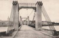
1927: Montjean-sur-Loire
Montjean-sur-Loire, Maine-et-Loire, France - Loire River
| Bridgemeister ID: | 1602 (added 2005-02-06) |
| Year Completed: | 1927 |
| Name: | Montjean-sur-Loire |
| Location: | Montjean-sur-Loire, Maine-et-Loire, France |
| Crossing: | Loire River |
| Coordinates: | 47.395958 N 0.858340 W |
| Maps: | Acme, GeoHack, Google, OpenStreetMap |
| References: | AAJ, PTS2 |
| Use: | Vehicular |
| Status: | Destroyed, 1936 |
| Main Cables: | Wire |
| Suspended Spans: | 6 |
| Main Spans: | 4 |
| Side Spans: | 2 |
Notes:
- 1935: One of the towers fails in a windstorm causing part of the bridge to collapse.
- 1936: The remainder of the derelict bridge is wrecked by a flood.
- Replaced 1840 Montjean-sur-Loire - Montjean-sur-Loire, Maine-et-Loire, France.
- Replaced by 1938 Montjean-sur-Loire - Montjean-sur-Loire, Maine-et-Loire, France.
External Links:
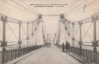
1927: Port à l'Anglais
Alfortville and Vitry-sur-Seine, Val-de-Marne, France - Seine River
| Bridgemeister ID: | 1114 (added 2004-01-05) |
| Year Completed: | 1927 |
| Name: | Port à l'Anglais |
| Location: | Alfortville and Vitry-sur-Seine, Val-de-Marne, France |
| Crossing: | Seine River |
| Coordinates: | 48.797333 N 2.41875 E |
| Maps: | Acme, GeoHack, Google, OpenStreetMap |
| References: | AAJ, BC3, BPF, PTS2 |
| Use: | Vehicular (three-lane), with walkway |
| Status: | In use (last checked: 2021) |
| Main Cables: | Wire |
| Suspended Spans: | 3 |
| Main Span: | 1 x 124 meters (406.8 feet) |
| Side Spans: | 1 x 54 meters (177.2 feet), 1 x 52 meters (170.6 feet) |
| Deck width: | 40 feet |
Notes:
- This bridge was originally built with the Gisclard suspension system. Such bridges are not included in the Bridgemeister suspension bridge inventory. However, at some point the suspension system was modified to be more similar to a standard suspension bridge. It isn't clear when this modification occurred.
- Near Créteil (Saint-Maur) - Créteil-sur-Marne and Saint-Maur-des-Fossés, Val-de-Marne, France.
External Links:
1928: Saint-Hubert
Port Saint-Hubert, Plouër-sur-Rance vicinity and La Ville-es-Nonais, Côtes-d'Armor, France - Rance River
| Bridgemeister ID: | 1492 (added 2004-09-19) |
| Year Completed: | 1928 |
| Name: | Saint-Hubert |
| Location: | Port Saint-Hubert, Plouër-sur-Rance vicinity and La Ville-es-Nonais, Côtes-d'Armor, France |
| Crossing: | Rance River |
| Use: | Vehicular |
| Status: | Destroyed, 1944 |
| Main Cables: | Wire |
| Suspended Spans: | 1 |
Notes:
- Replaced by 1959 Saint-Hubert - Port Saint-Hubert, Plouër-sur-Rance vicinity and La Ville-es-Nonais, Côtes-d'Armor, France.
External Links:
| Bridgemeister ID: | 1449 (added 2004-07-31) |
| Year Completed: | 1928 |
| Name: | Tarassac |
| Location: | St. Martin-de-l'Arcon vicinity, Hérault, France |
| Crossing: | Orb River |
| Coordinates: | 43.564766 N 2.974529 E |
| Maps: | Acme, GeoHack, Google, OpenStreetMap |
| References: | BC3 |
| Use: | Vehicular (one-lane) |
| Status: | In use (last checked: 2019) |
| Main Cables: | Wire (steel) |
| Suspended Spans: | 1 |
| Main Span: | 1 x 104.2 meters (342 feet) |
Notes:
External Links:
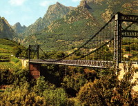
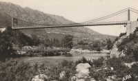
1928: Volonne
Volonne, Alpes-de-Haute-Provence, France - Durance River
| Bridgemeister ID: | 2004 (added 2005-12-26) |
| Year Completed: | 1928 |
| Name: | Volonne |
| Location: | Volonne, Alpes-de-Haute-Provence, France |
| Crossing: | Durance River |
| Use: | Vehicular |
| Status: | Destroyed, 1944 |
Notes:
- Replaced 1845 Volonne - Volonne, Alpes-de-Haute-Provence, France.
- Replaced by 1949 Volonne - Volonne, Alpes-de-Haute-Provence, France.
External Links:
1930: Capens
Capens, Haute-Garonne, France - Garonne River
| Bridgemeister ID: | 6742 (added 2021-10-23) |
| Year Completed: | 1930 |
| Name: | Capens |
| Location: | Capens, Haute-Garonne, France |
| Crossing: | Garonne River |
| Use: | Vehicular |
| Status: | Removed |
| Main Cables: | Wire (steel) |
| Main Span: | 1 |
Notes:
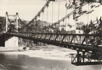
1930: Layrac-sur-Tarn
Layrac-sur-Tarn, Haute-Garonne, France - Tarn River
| Bridgemeister ID: | 7184 (added 2022-07-02) |
| Year Completed: | 1930 |
| Name: | Layrac-sur-Tarn |
| Location: | Layrac-sur-Tarn, Haute-Garonne, France |
| Crossing: | Tarn River |
| Use: | Vehicular |
| Status: | Removed |
| Main Cables: | Wire (steel) |
| Suspended Spans: | 1 |
| Main Span: | 1 |
Notes:
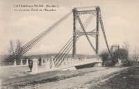
1930: Le Guétin
Le Guétin, Cuffy vicinity, Cher and Gimouille, Nièvre, France - Allier River
| Bridgemeister ID: | 2844 (added 2005-03-19) |
| Year Completed: | 1930 |
| Name: | Le Guétin |
| Location: | Le Guétin, Cuffy vicinity, Cher and Gimouille, Nièvre, France |
| Crossing: | Allier River |
| Coordinates: | 46.947881 N 3.073013 E |
| Maps: | Acme, GeoHack, Google, OpenStreetMap |
| References: | AAJ |
| Use: | Vehicular |
| Status: | Replaced |
| Main Cables: | Wire (steel) |
| Suspended Spans: | 5 |
| Main Spans: | 5 |
Notes:

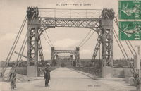
1930: Riscle
Riscle, Gers, France - Adour River
| Bridgemeister ID: | 7316 (added 2022-08-28) |
| Year Completed: | 1930 |
| Name: | Riscle |
| Location: | Riscle, Gers, France |
| Crossing: | Adour River |
| Coordinates: | 43.663878 N 0.081895 W |
| Maps: | Acme, GeoHack, Google, OpenStreetMap |
| Use: | Vehicular |
| Status: | Destroyed, 1944 |
| Main Cables: | Wire (steel) |
| Main Span: | 1 |
Notes:
- Replaced by 1955 Riscle - Riscle, Gers, France.
External Links:
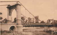
1931: Cavaillon
Cavaillon, Vaucluse and Bouches-du-Rhône, France - Durance River
| Bridgemeister ID: | 1013 (added 2003-11-22) |
| Year Completed: | 1931 |
| Name: | Cavaillon |
| Location: | Cavaillon, Vaucluse and Bouches-du-Rhône, France |
| Crossing: | Durance River |
| Use: | Vehicular |
| Status: | Destroyed, 1944 |
| Main Cables: | Wire |
| Suspended Spans: | 1 |
Notes:
- Destroyed August 24, 1944.
- Replaced 1837 Cavaillon - Cavaillon, Vaucluse and Bouches-du-Rhône, France.
External Links:
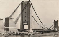
1931: Châtillon-sur-Loire
Châtillon-sur-Loire, Loiret, France - Loire River
| Bridgemeister ID: | 1018 (added 2003-11-22) |
| Year Completed: | 1931 |
| Name: | Châtillon-sur-Loire |
| Location: | Châtillon-sur-Loire, Loiret, France |
| Crossing: | Loire River |
| Coordinates: | 47.598786 N 2.761769 E |
| Maps: | Acme, GeoHack, Google, OpenStreetMap |
| Use: | Vehicular |
| Status: | Destroyed, June, 1940 |
| Main Cables: | Wire (steel) |
| Suspended Spans: | 4 |
| Main Spans: | 4 |
Notes:
- Replaced 1841 Châtillon-sur-Loire - Châtillon-sur-Loire, Loiret, France.
- Replaced by 1951 Châtillon-sur-Loire - Châtillon-sur-Loire, Loiret, France.
External Links:
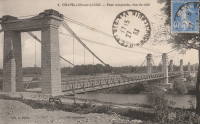
1931: Feneyrols
Feneyrols, Tarn-et-Garonne, France - Aveyron River
| Bridgemeister ID: | 1551 (added 2004-11-13) |
| Year Completed: | 1931 |
| Name: | Feneyrols |
| Location: | Feneyrols, Tarn-et-Garonne, France |
| Crossing: | Aveyron River |
| Coordinates: | 44.129389 N 1.819662 E |
| Maps: | Acme, GeoHack, Google, OpenStreetMap |
| Use: | Vehicular (two-lane) |
| Status: | In use (last checked: 2022) |
| Main Cables: | Wire (steel) |
| Suspended Spans: | 1 |
| Main Span: | 1 x 86 meters (282.2 feet) estimated |
External Links:
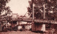
1931: Saint-Pierre
Toulouse, Haute-Garonne, France - Garonne River
| Bridgemeister ID: | 2049 (added 2006-05-21) |
| Year Completed: | 1931 |
| Name: | Saint-Pierre |
| Location: | Toulouse, Haute-Garonne, France |
| Crossing: | Garonne River |
| Coordinates: | 43.602833 N 1.435199 E |
| Maps: | Acme, GeoHack, Google, OpenStreetMap |
| Use: | Vehicular |
| Status: | Demolished, 1986 |
| Main Cables: | Wire |
Notes:
External Links:

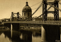
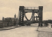
1931: Saint-Sulpice
Saint-Sulpice-la-Pointe, Tarn, France - Agout River
| Bridgemeister ID: | 7489 (added 2022-12-30) |
| Year Completed: | 1931 |
| Name: | Saint-Sulpice |
| Location: | Saint-Sulpice-la-Pointe, Tarn, France |
| Crossing: | Agout River |
| Coordinates: | 43.777048 N 1.686685 E |
| Maps: | Acme, GeoHack, Google, OpenStreetMap |
| Use: | Vehicular, with walkway |
| Status: | In use (last checked: 2022) |
| Main Cables: | Wire (steel) |
| Suspended Spans: | 1 |
Notes:
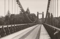
1931: Teil
Le Teil, Ardèche and Montélimar, Drôme, France - Rhône River
| Bridgemeister ID: | 1549 (added 2004-11-13) |
| Year Completed: | 1931 |
| Name: | Teil |
| Location: | Le Teil, Ardèche and Montélimar, Drôme, France |
| Crossing: | Rhône River |
| Coordinates: | 44.5519 N 4.692617 E |
| Maps: | Acme, GeoHack, Google, OpenStreetMap |
| References: | AAJ, BPF |
| Use: | Vehicular (two-lane, heavy vehicles), with walkway |
| Status: | In use (last checked: 2005) |
| Main Cables: | Wire (steel) |
| Suspended Spans: | 1 |
| Main Span: | 1 x 235 meters (771 feet) |
Notes:
- Destroyed, 1944. Rebuilt, 1950.
- Replaced 1839 Teil - Le Teil, Ardèche and Montélimar, Drôme, France.
External Links:
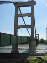
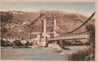
1931: Verdun-sur-Garonne
Verdun-sur-Garonne, Tarn-et-Garonne, France - Garonne River
| Bridgemeister ID: | 2347 (added 2007-08-18) |
| Year Completed: | 1931 |
| Name: | Verdun-sur-Garonne |
| Location: | Verdun-sur-Garonne, Tarn-et-Garonne, France |
| Crossing: | Garonne River |
| Coordinates: | 43.854713 N 1.242315 E |
| Maps: | Acme, GeoHack, Google, OpenStreetMap |
| Use: | Vehicular |
| Status: | Replaced, 2010 |
| Main Cables: | Wire (steel) |
| Suspended Spans: | 1 |
Notes:
- Coordinates are for the 2010 replacement suspension bridge, but construction photos of the newer bridge show the 1931 bridge was extremely close to the 2010 bridge.
- Replaced by 2010 Verdun-sur-Garonne - Verdun-sur-Garonne, Tarn-et-Garonne, France.
- See 1841 Verdun-sur-Garonne - Verdun-sur-Garonne, Tarn-et-Garonne, France. The relationship between the older and current bridges is unclear.
External Links:
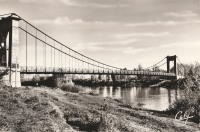
1931: Vicq-sur-Gartempe
Vicq-sur-Gartempe, Vienne, France - Gartempe River
| Bridgemeister ID: | 3997 (added 2020-03-27) |
| Year Completed: | 1931 |
| Name: | Vicq-sur-Gartempe |
| Location: | Vicq-sur-Gartempe, Vienne, France |
| Crossing: | Gartempe River |
| References: | AAJ |
| Use: | Vehicular |
| Status: | Replaced, 1989 |
| Main Cables: | Wire (steel) |
| Suspended Spans: | 1 |
Notes:
- 1989: Replaced and subsequently removed.
- Replaced 1881 Vicq-sur-Gartempe - Vicq-sur-Gartempe, Vienne, France.
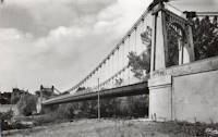
1932: Bonneuil-Matours
Bonneuil-Matours, Vienne, France - Vienne River
| Bridgemeister ID: | 2356 (added 2007-08-19) |
| Year Completed: | 1932 |
| Name: | Bonneuil-Matours |
| Location: | Bonneuil-Matours, Vienne, France |
| Crossing: | Vienne River |
| Coordinates: | 46.681758 N 0.575535 E |
| Maps: | Acme, GeoHack, Google, OpenStreetMap |
| References: | AAJ |
| Use: | Vehicular (two-lane) |
| Status: | Closed, January 4, 2021 (last checked: 2022) |
| Main Cables: | Wire (steel) |
| Suspended Spans: | 1 |
Notes:
- 2021, January: Closed for replacement of deck and suspension system.
- 2021: While undergoing reconstruction, one of the piers settles abnormally.
- 2022, September: Work expected to be completed in November 2023.
- At former location of Bonneuil-Matours - Bonneuil-Matours, Vienne, France. Unclear if the newer bridge was a direct replacement.
1932: Gennes
Gennes and Les Rosiers-sur-Loire, Maine-et-Loire, France - Loire River
| Bridgemeister ID: | 1173 (added 2004-01-23) |
| Year Completed: | 1932 |
| Name: | Gennes |
| Location: | Gennes and Les Rosiers-sur-Loire, Maine-et-Loire, France |
| Crossing: | Loire River |
| Coordinates: | 47.345895 N 0.230081 W |
| Maps: | Acme, GeoHack, Google, OpenStreetMap |
| Use: | Vehicular |
| Status: | Destroyed, 1940 |
Notes:
- Replaced 1842 Gennes - Gennes and Les Rosiers-sur-Loire, Maine-et-Loire, France.
- Connects to 1932 Les Rosiers-sur-Loire - Les Rosiers-sur-Loire and Gennes, Maine-et-Loire, France.
- Replaced by 1948 Gennes - Gennes and Les Rosiers-sur-Loire, Maine-et-Loire, France.
1932: Gué de Senac
Les Peintures and Chamadelle, Gironde, France - Dronne River
| Bridgemeister ID: | 7850 (added 2023-09-09) |
| Year Completed: | 1932 |
| Name: | Gué de Senac |
| Location: | Les Peintures and Chamadelle, Gironde, France |
| Crossing: | Dronne River |
| Coordinates: | 45.078922 N 0.087016 W |
| Maps: | Acme, GeoHack, Google, OpenStreetMap |
| Use: | Vehicular |
| Status: | Demolished, 2011 |
| Main Cables: | Wire (steel) |
| Suspended Spans: | 1 |
| Main Span: | 1 |
Notes:
External Links:
- Art-et-Histoire - Pont de Gué de Senac à Chamadelle - 1845
- Dans le rétro : le pont du Gué de Sénac sur la Dronne. Article about the suspension bridges at this location. Published March 8, 2022.
1932: Les Rosiers-sur-Loire
Les Rosiers-sur-Loire and Gennes, Maine-et-Loire, France - Loire River
| Bridgemeister ID: | 6763 (added 2021-10-25) |
| Year Completed: | 1932 |
| Name: | Les Rosiers-sur-Loire |
| Location: | Les Rosiers-sur-Loire and Gennes, Maine-et-Loire, France |
| Crossing: | Loire River |
| Coordinates: | 47.348253 N 0.227990 W |
| Maps: | Acme, GeoHack, Google, OpenStreetMap |
| Use: | Vehicular |
| Status: | Destroyed, 1940 |
| Main Cables: | Wire |
| Main Span: | 1 |
Notes:
- Replaced 1842 Les Rosiers-sur-Loire - Les Rosiers-sur-Loire and Gennes, Maine-et-Loire, France.
- Connects to 1932 Les Rosiers-sur-Loire - Les Rosiers-sur-Loire and Gennes, Maine-et-Loire, France.
- Replaced by 1948 Les Rosiers-sur-Loire - Les Rosiers-sur-Loire and Gennes, Maine-et-Loire, France.
1932: Marmande
Marmande, Lot-et-Garonne, France - Garonne River
| Bridgemeister ID: | 1604 (added 2005-02-06) |
| Year Completed: | 1932 |
| Name: | Marmande |
| Also Known As: | Renaud Jean |
| Location: | Marmande, Lot-et-Garonne, France |
| Crossing: | Garonne River |
| Coordinates: | 44.498957 N 0.155951 E |
| Maps: | Acme, GeoHack, Google, OpenStreetMap |
| Use: | Vehicular (two-lane), with walkway |
| Status: | In use (last checked: 2020) |
| Main Cables: | Wire (steel) |
| Suspended Spans: | 1 |
Notes:
External Links:
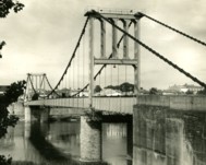
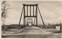
| Bridgemeister ID: | 4546 (added 2020-05-30) |
| Year Completed: | 1932 |
| Name: | Poujol |
| Location: | Le Poujol-sur-Orb, Lamalou-les-Bains vicinity, Hérault, France |
| Crossing: | Orb River |
| Coordinates: | 43.575381 N 3.063561 E |
| Maps: | Acme, GeoHack, Google, OpenStreetMap |
| Use: | Vehicular (one-lane) |
| Status: | In use (last checked: 2019) |
| Main Cables: | Wire (steel) |
| Suspended Spans: | 1 |
| Main Span: | 1 x 114.5 meters (375.7 feet) estimated |
External Links:
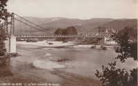
1932: Villebrumier
Villebrumier, Tarn-et-Garonne, France - Tarn River
| Bridgemeister ID: | 1708 (added 2005-03-30) |
| Year Completed: | 1932 |
| Name: | Villebrumier |
| Location: | Villebrumier, Tarn-et-Garonne, France |
| Crossing: | Tarn River |
| Coordinates: | 43.903905 N 1.453091 E |
| Maps: | Acme, GeoHack, Google, OpenStreetMap |
| Use: | Vehicular (two-lane) |
| Status: | In use (last checked: 2019) |
| Main Cables: | Wire (steel) |
| Suspended Spans: | 1 |
Notes:
External Links:
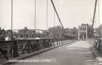
1932: Villemur-sur-Tarn
Villemur-sur-Tarn, Haute-Garonne, France - Tarn River
| Bridgemeister ID: | 1852 (added 2005-07-16) |
| Year Completed: | 1932 |
| Name: | Villemur-sur-Tarn |
| Location: | Villemur-sur-Tarn, Haute-Garonne, France |
| Crossing: | Tarn River |
| Coordinates: | 43.862459 N 1.505214 E |
| Maps: | Acme, GeoHack, Google, OpenStreetMap |
| Use: | Vehicular (two-lane), with walkway |
| Status: | In use (last checked: 2016) |
| Main Cables: | Wire (steel) |
| Suspended Spans: | 1 |
Notes:
External Links:
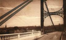
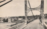
1932: Viterbe
Viterbe, Saint-Paul-Cap-de-Joux vicinity and Brazis, Tarn, France - Agout River
| Bridgemeister ID: | 2312 (added 2007-05-03) |
| Year Completed: | 1932 |
| Name: | Viterbe |
| Location: | Viterbe, Saint-Paul-Cap-de-Joux vicinity and Brazis, Tarn, France |
| Crossing: | Agout River |
| Coordinates: | 43.67635 N 1.93136 E |
| Maps: | Acme, GeoHack, Google, OpenStreetMap |
| Use: | Vehicular (one-lane) |
| Status: | In use (last checked: 2019) |
| Suspended Spans: | 1 |
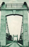
1933: Lamagistère
Lamagistère, Tarn-et-Garonne, France - Garonne River
| Bridgemeister ID: | 2963 (added 2019-10-06) |
| Year Completed: | 1933 |
| Name: | Lamagistère |
| Location: | Lamagistère, Tarn-et-Garonne, France |
| Crossing: | Garonne River |
| Coordinates: | 44.123552 N 0.819466 E |
| Maps: | Acme, GeoHack, Google, OpenStreetMap |
| Use: | Vehicular (two-lane) |
| Status: | In use (last checked: 2019) |
| Main Cables: | Wire (steel) |
| Suspended Spans: | 2 |
| Main Spans: | 2 |
Notes:
External Links:
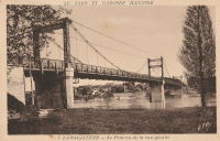
1933: Mont-Olympe
Charleville-Mézières, Ardennes, France - Meuse River
| Bridgemeister ID: | 1052 (added 2003-12-08) |
| Year Completed: | 1933 |
| Name: | Mont-Olympe |
| Location: | Charleville-Mézières, Ardennes, France |
| Crossing: | Meuse River |
| Coordinates: | 49.776650 N 4.722679 E |
| Maps: | Acme, GeoHack, Google, OpenStreetMap |
| Use: | Footbridge |
| Status: | In use (last checked: 2019) |
| Main Cables: | Wire |
| Suspended Spans: | 3 |
| Main Spans: | 2 |
| Side Span: | 1 |
Notes:
- Near former location of Charleville - Charleville-Mézières, Ardennes, France.
External Links:
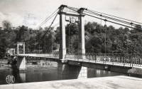
1933: Pertuiset
Pertuiset, Firminy vicinity, Loire, France - Loire River
| Bridgemeister ID: | 1166 (added 2004-01-19) |
| Year Completed: | 1933 |
| Name: | Pertuiset |
| Location: | Pertuiset, Firminy vicinity, Loire, France |
| Crossing: | Loire River |
| Coordinates: | 45.408785 N 4.248029 E |
| Maps: | Acme, GeoHack, Google, OpenStreetMap |
| Use: | Vehicular (one-lane) |
| Status: | Demolished, 1990 |
| Main Cables: | Wire (steel) |
| Suspended Spans: | 1 |
Notes:
- Bypassed by a cable-stayed bridge, 1989.
- Replaced 1842 Pertuiset - Pertuiset, Firminy vicinity, Loire, France.
External Links:
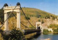
1933: Sablons
Sablons, Isère and Serrières, Ardèche, France - Rhône River
| Bridgemeister ID: | 891 (added 2003-09-06) |
| Year Completed: | 1933 |
| Name: | Sablons |
| Location: | Sablons, Isère and Serrières, Ardèche, France |
| Crossing: | Rhône River |
| Status: | Destroyed, 1944 |
Notes:
- Replaced 1828 Sablons - Sablons, Isère and Serrières, Ardèche, France.
- Replaced by 1951 Sablons - Sablons, Isère and Serrières, Ardèche, France.
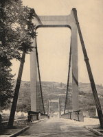
1933: Veurey
Veurey-Voroize, Isère, France - Isère River
| Bridgemeister ID: | 4881 (added 2020-07-18) |
| Year Completed: | 1933 |
| Name: | Veurey |
| Location: | Veurey-Voroize, Isère, France |
| Crossing: | Isère River |
| References: | AAJ |
| Use: | Vehicular |
| Status: | Removed |
| Main Cables: | Wire (steel) |
Notes:
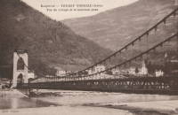
1934: Tonnay-Charente
Tonnay-Charente, Charente-Maritime, France - Charente River
| Bridgemeister ID: | 7338 (added 2022-09-04) |
| Year Completed: | 1934 |
| Name: | Tonnay-Charente |
| Location: | Tonnay-Charente, Charente-Maritime, France |
| Crossing: | Charente River |
| Coordinates: | 45.939992 N 0.886099 W |
| Maps: | Acme, GeoHack, Google, OpenStreetMap |
| Use: | Vehicular |
| Status: | Restricted to foot traffic |
| Main Cables: | Wire (steel) |
| Main Span: | 1 x 90 meters (295.3 feet) |
| Side Spans: | 2 |
Notes:
External Links:
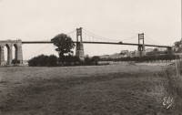
1935: Chaumont-sur-Loire
Chaumont-sur-Loire and Onzain, Loir-et-Cher, France - Loire River
| Bridgemeister ID: | 6719 (added 2021-10-16) |
| Year Completed: | 1935 |
| Name: | Chaumont-sur-Loire |
| Location: | Chaumont-sur-Loire and Onzain, Loir-et-Cher, France |
| Crossing: | Loire River |
| Use: | Vehicular |
| Status: | Destroyed, 1940 |
| Main Cables: | Wire (steel) |
| Main Spans: | 6 |
Notes:
External Links:
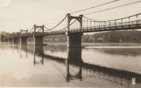
1935: Châteauneuf-sur-Loire
Châteauneuf-sur-Loire, Loiret, France - Loire River
| Bridgemeister ID: | 6790 (added 2021-10-30) |
| Year Completed: | 1935 |
| Name: | Châteauneuf-sur-Loire |
| Location: | Châteauneuf-sur-Loire, Loiret, France |
| Crossing: | Loire River |
| Coordinates: | 47.858608 N 2.223392 E |
| Maps: | Acme, GeoHack, Google, OpenStreetMap |
| Use: | Vehicular |
| Status: | Destroyed, June 17, 1940 |
| Main Cables: | Wire (steel) |
| Suspended Spans: | 5 |
| Main Spans: | 5 |
Notes:
- 1940, June 17: Destroyed to slow advancing German troops.
- Replaced 1841 Châteauneuf-sur-Loire - Châteauneuf-sur-Loire, Loiret, France.
- Replaced by 1946 Châteauneuf-sur-Loire - Châteauneuf-sur-Loire, Loiret, France.
External Links:
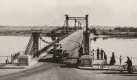
1935: Condrieu
Condrieu, Rhône and Les Roches-de-Condrieu, Isère, France - Rhône River
| Bridgemeister ID: | 1494 (added 2004-09-19) |
| Year Completed: | 1935 |
| Name: | Condrieu |
| Location: | Condrieu, Rhône and Les Roches-de-Condrieu, Isère, France |
| Crossing: | Rhône River |
| Coordinates: | 45.45655 N 4.768722 E |
| Maps: | Acme, GeoHack, Google, OpenStreetMap |
| References: | AAJ |
| Use: | Vehicular (two-lane), with walkway |
| Status: | Destroyed, June 1940 |
| Main Cables: | Wire (steel) |
| Suspended Spans: | 2 |
| Main Spans: | 2 |
Notes:
- Replaced 1831 Condrieu - Condrieu, Rhône and Les Roches-de-Condrieu, Isère, France.
- Replaced by Condrieu - Condrieu, Rhône and Les Roches-de-Condrieu, Isère, France.
External Links:
- Pont de Condrieu - Wikipedia
- Pont entre Condrieu et les Roches detruit le 20 juin 1940 - Wikimedia. Image of the destroyed bridge.
- Structurae - Structure ID 20013233
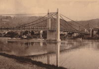
1935: Devèze
Thérondels vicinity, Aveyron and Paulhenc, Cantal, France - Lac de Sarrans
| Bridgemeister ID: | 2321 (added 2007-05-05) |
| Year Completed: | 1935 |
| Name: | Devèze |
| Also Known As: | Laussac |
| Location: | Thérondels vicinity, Aveyron and Paulhenc, Cantal, France |
| Crossing: | Lac de Sarrans |
| At or Near Feature: | Presqu'île De Laussac |
| Coordinates: | 44.861586 N 2.769710 E |
| Maps: | Acme, GeoHack, Google, OpenStreetMap |
| Use: | Vehicular (one-lane) |
| Status: | In use (last checked: 2020) |
| Main Cables: | Wire (steel) |
| Suspended Spans: | 1 |
Notes:
External Links:
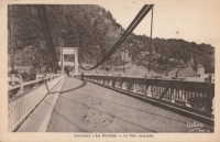
1935: La Réole
La Réole, Gironde, France - Garonne River
| Bridgemeister ID: | 1769 (added 2005-04-22) |
| Year Completed: | 1935 |
| Name: | La Réole |
| Also Known As: | Rouergue |
| Location: | La Réole, Gironde, France |
| Crossing: | Garonne River |
| Coordinates: | 44.578853 N 0.034028 W |
| Maps: | Acme, GeoHack, Google, OpenStreetMap |
| Use: | Vehicular (two-lane), with walkway |
| Status: | In use (last checked: 2019) |
| Suspended Spans: | 1 |
Notes:
- See 1835 La Réole - La Réole, Gironde, France. Unsure if the newer bridge is at the same location.
External Links:

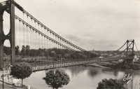
1935: Mirabeau
Mirabeau, Vaucluse and Bouches-du-Rhône, France - Durance River
| Bridgemeister ID: | 900 (added 2003-09-07) |
| Year Completed: | 1935 |
| Name: | Mirabeau |
| Location: | Mirabeau, Vaucluse and Bouches-du-Rhône, France |
| Crossing: | Durance River |
| Principals: | Auguste Rey |
| References: | BPF |
| Use: | Vehicular |
| Status: | Replaced, 1991 |
| Suspended Spans: | 1 |
| Main Span: | 1 x 175 meters (574.1 feet) |
| Deck width: | 8 meters |
Notes:
- Dismantled 1991. The towers from the older of the two Mirabeau suspension bridges are visible at the current crossing.
- Replaced 1831 Mirabeau - Mirabeau, Vaucluse and Bouches-du-Rhône, France.
External Links:
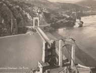
1935: Mirepoix-sur-Tarn
Mirepoix-sur-Tarn, Haute-Garonne, France - Tarn River
| Bridgemeister ID: | 3196 (added 2019-11-10) |
| Year Completed: | 1935 |
| Name: | Mirepoix-sur-Tarn |
| Location: | Mirepoix-sur-Tarn, Haute-Garonne, France |
| Crossing: | Tarn River |
| Coordinates: | 43.811976 N 1.571879 E |
| Maps: | Acme, GeoHack, Google, OpenStreetMap |
| Use: | Vehicular (two-lane) |
| Status: | Collapsed, November 18, 2019 |
| Main Cables: | Wire (steel) |
| Suspended Spans: | 1 |
| Main Span: | 1 x 152 meters (498.7 feet) |
Notes:
- Collapsed November 18, 2019 as an overweight vehicle crossed, killing two people.
- Replaced 1855 Mirepoix-sur-Tarn - Mirepoix-sur-Tarn, Haute-Garonne, France.
External Links:
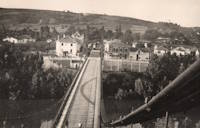
1935: Remoulins
Remoulins, Gard, France - Gardon River
| Bridgemeister ID: | 4910 (added 2020-07-19) |
| Year Completed: | 1935 |
| Name: | Remoulins |
| Location: | Remoulins, Gard, France |
| Crossing: | Gardon River |
| Coordinates: | 43.937978 N 4.556684 E |
| Maps: | Acme, GeoHack, Google, OpenStreetMap |
| Use: | Vehicular |
| Status: | Removed |
| Main Cables: | Wire (steel) |
Notes:
- Remnants of this bridge are preserved in a car park at the eastern end of the present day (2020s) Pont de Remoulins.
- Replaced 1830 Remoulins - Remoulins, Gard, France. The later bridge appears to have been built on an alignment about 175 meters north of the 1830 bridge.
External Links:
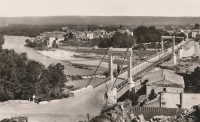
1935: Tréboul
Thérondels vicinity, Aveyron and Sainte-Marie, Cantal, France - Lac de Sarrans
| Bridgemeister ID: | 1989 (added 2005-12-02) |
| Year Completed: | 1935 |
| Name: | Tréboul |
| Location: | Thérondels vicinity, Aveyron and Sainte-Marie, Cantal, France |
| Crossing: | Lac de Sarrans |
| Coordinates: | 44.872780 N 2.867253 E |
| Maps: | Acme, GeoHack, Google, OpenStreetMap |
| Use: | Vehicular (one-lane) |
| Status: | In use (last checked: 2014) |
| Main Cables: | Wire (steel) |
| Suspended Spans: | 1 |
Notes:
External Links:

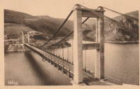
1936: Mornay-sur-Allier
Mornay-sur-Allier, Cher and St-Pierre-le-Moûtier, Nièvre, France - Allier River
| Bridgemeister ID: | 1550 (added 2004-11-13) |
| Year Completed: | 1936 |
| Name: | Mornay-sur-Allier |
| Location: | Mornay-sur-Allier, Cher and St-Pierre-le-Moûtier, Nièvre, France |
| Crossing: | Allier River |
| Coordinates: | 46.815265 N 3.043460 E |
| Maps: | Acme, GeoHack, Google, OpenStreetMap |
| References: | BPF |
| Use: | Vehicular |
| Status: | Removed, circa 1970s |
| Main Cables: | Wire (steel) |
| Suspended Spans: | 3 |
| Main Span: | 1 x 80 meters (262.5 feet) |
| Side Spans: | 1 x 67.57 meters (221.7 feet), 1 x 64.27 meters (210.9 feet) |
Notes:
External Links:
- Art-et-Histoire - Nouveau pont de Mornay - St-Pierre-le-Moûtier - 1937
- Structurae - Structure ID 20003000

1936: Saint-Didier-sous-Aubenas
Saint-Didier-sous-Aubenas, Ardèche, France - Ardèche River
| Bridgemeister ID: | 2930 (added 2019-09-16) |
| Year Completed: | 1936 |
| Name: | Saint-Didier-sous-Aubenas |
| Location: | Saint-Didier-sous-Aubenas, Ardèche, France |
| Crossing: | Ardèche River |
| Coordinates: | 44.604219 N 4.419136 E |
| Maps: | Acme, GeoHack, Google, OpenStreetMap |
| Use: | Vehicular (two-lane) |
| Status: | Collapsed, 1995 |
| Main Cables: | Wire (steel) |
Notes:
- Collapsed, 1995. One tower remains.
- Replaced Saint-Didier-sous-Aubenas - Saint-Didier-sous-Aubenas, Ardèche, France.
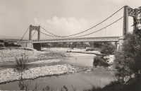
1937: Aiguilly
Roanne vicinity and Vougy vicinity, Loire, France - Loire River
| Bridgemeister ID: | 1567 (added 2004-11-28) |
| Year Completed: | 1937 |
| Name: | Aiguilly |
| Location: | Roanne vicinity and Vougy vicinity, Loire, France |
| Crossing: | Loire River |
| References: | AAJ, BPF |
| Use: | Vehicular |
| Status: | Destroyed, 1940 |
| Main Cables: | Wire (steel) |
| Suspended Spans: | 1 |
| Main Span: | 1 x 135 meters (442.9 feet) |
Notes:
- Destroyed to slow advancing German troops, 1940.
- Replaced 1841 Aiguilly - Roanne vicinity and Vougy vicinity, Loire, France.
- Replaced by 1945 Aiguilly - Roanne vicinity and Vougy vicinity, Loire, France.
External Links:
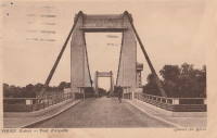
1937: Lacq
Lacq and Abidos, Pyrénées-Atlantiques, France - Ousse River
| Bridgemeister ID: | 7968 (added 2023-11-25) |
| Year Completed: | 1937 |
| Name: | Lacq |
| Location: | Lacq and Abidos, Pyrénées-Atlantiques, France |
| Crossing: | Ousse River |
| Coordinates: | 43.404111 N 0.624083 W |
| Maps: | Acme, GeoHack, Google, OpenStreetMap |
| Use: | Vehicular (two-lane) |
| Status: | In use (last checked: 2023) |
| Main Cables: | Wire (steel) |
| Suspended Spans: | 1 |
| Main Span: | 1 x 77 meters (252.6 feet) estimated |
Notes:
- Next to (pipeline bridge) - Lacq and Abidos, Pyrénées-Atlantiques, France.
- Near (pipeline bridge) - Lacq and Abidos, Pyrénées-Atlantiques, France.
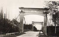
1937: Langeais
Langeais, Indre-et-Loire, France - Loire River
| Bridgemeister ID: | 1029 (added 2003-11-30) |
| Year Completed: | 1937 |
| Name: | Langeais |
| Location: | Langeais, Indre-et-Loire, France |
| Crossing: | Loire River |
| Coordinates: | 47.319667 N 0.404217 E |
| Maps: | Acme, GeoHack, Google, OpenStreetMap |
| References: | AAJ, BPF |
| Use: | Vehicular (two-lane), with walkway |
| Status: | In use (last checked: 2021) |
| Main Cables: | Wire (steel) |
| Suspended Spans: | 5 |
| Main Spans: | 3 x 90 meters (295.29 feet) |
| Side Spans: | 2 x 45 meters (147.64 feet) |
Notes:
- 1940: Deck collapsed.
- 1946: Repaired, but carrying just a footbridge.
- 1950: Rebuilt as a vehicular bridge.
- 1983: Reinforced to support heavier traffic.
- Replaced 1849 Langeais - Langeais, Indre-et-Loire, France.
External Links:
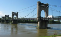
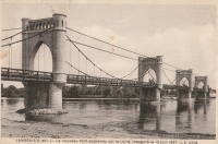
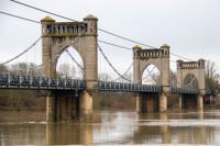
1938: Assat
Assat and Narcastet, Pyrénées-Atlantiques, France - Ousse
| Bridgemeister ID: | 4687 (added 2020-06-20) |
| Year Completed: | 1938 |
| Name: | Assat |
| Location: | Assat and Narcastet, Pyrénées-Atlantiques, France |
| Crossing: | Ousse |
| Coordinates: | 43.244390 N 0.308003 W |
| Maps: | Acme, GeoHack, Google, OpenStreetMap |
| Use: | Vehicular (two-lane) |
| Status: | In use (last checked: 2020) |
| Main Cables: | Wire (steel) |
| Suspended Spans: | 1 |
Notes:
- See Assat - Assat, Pyrénées-Atlantiques, France. The relationship between the two bridges is unclear, but likely the 1938 bridge was a direct replacement.
External Links:
1938: Montjean-sur-Loire
Montjean-sur-Loire, Maine-et-Loire, France - Loire River
| Bridgemeister ID: | 6422 (added 2021-08-09) |
| Year Completed: | 1938 |
| Name: | Montjean-sur-Loire |
| Location: | Montjean-sur-Loire, Maine-et-Loire, France |
| Crossing: | Loire River |
| Coordinates: | 47.392675 N 0.860650 W |
| Maps: | Acme, GeoHack, Google, OpenStreetMap |
| Use: | Vehicular |
| Status: | Destroyed, June, 1940 |
| Main Cables: | Wire (steel) |
| Suspended Spans: | 6 |
| Main Spans: | 4 |
| Side Spans: | 2 |
Notes:
- 1940, June: Intentionally destroyed to slow advancing German troops.
- Replaced 1927 Montjean-sur-Loire - Montjean-sur-Loire, Maine-et-Loire, France.
- Later at same location 1949 Montjean-sur-Loire - Montjean-sur-Loire, Maine-et-Loire, France.
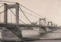
1938: Roquefort-sur-Garonne
Fourc and Roquefort-sur-Garonne, Haute-Garonne, France - Salat River
| Bridgemeister ID: | 7399 (added 2022-12-03) |
| Year Completed: | 1938 |
| Name: | Roquefort-sur-Garonne |
| Location: | Fourc and Roquefort-sur-Garonne, Haute-Garonne, France |
| Crossing: | Salat River |
| Coordinates: | 43.158060 N 0.968714 E |
| Maps: | Acme, GeoHack, Google, OpenStreetMap |
| Use: | Vehicular (two-lane) |
| Status: | In use (last checked: 2021) |
| Main Cables: | Wire (steel) |
| Suspended Spans: | 1 |
| Main Span: | 1 x 67 meters (219.8 feet) estimated |
Notes:
1938: Saint-Gilles
Saint-Gilles-du-Gard, Gard, France - Petit Rhône River
| Bridgemeister ID: | 6743 (added 2021-10-23) |
| Year Completed: | 1938 |
| Name: | Saint-Gilles |
| Location: | Saint-Gilles-du-Gard, Gard, France |
| Crossing: | Petit Rhône River |
| Coordinates: | 43.665675 N 4.452997 E |
| Maps: | Acme, GeoHack, Google, OpenStreetMap |
| Use: | Vehicular |
| Status: | Replaced, 1985 |
| Main Cables: | Wire (steel) |
| Suspended Spans: | 1 |
| Main Span: | 1 |
Notes:
External Links:
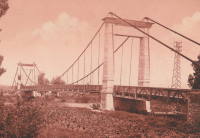
1938: Saula
Lafrançaise, Tarn-et-Garonne, France - Tarn River
| Bridgemeister ID: | 7185 (added 2022-07-02) |
| Year Completed: | 1938 |
| Name: | Saula |
| Location: | Lafrançaise, Tarn-et-Garonne, France |
| Crossing: | Tarn River |
| Coordinates: | 44.113997 N 1.247532 E |
| Maps: | Acme, GeoHack, Google, OpenStreetMap |
| Use: | Vehicular (two-lane) |
| Status: | In use (last checked: 2019) |
| Main Cables: | Wire (steel) |
| Suspended Spans: | 1 |
| Main Span: | 1 x 120 meters (393.7 feet) estimated |
Notes:
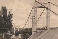
1939: Manosque
Manosque, Alpes-de-Haute-Provence, France - Durance River
| Bridgemeister ID: | 897 (added 2003-09-07) |
| Year Completed: | 1939 |
| Name: | Manosque |
| Location: | Manosque, Alpes-de-Haute-Provence, France |
| Crossing: | Durance River |
| Coordinates: | 43.8047 N 5.8238 E |
| Maps: | Acme, GeoHack, Google, OpenStreetMap |
| Use: | Vehicular (two-lane, heavy vehicles), with walkway |
| Status: | Replaced, 2019 |
| Main Cables: | Wire (steel) |
| Suspended Spans: | 1 |
Notes:
- At former location of 1839 Manosque - Manosque, Alpes-de-Haute-Provence, France.
External Links:
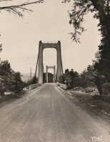
1939: Saint-Jean-de-Blaignac
Saint-Jean-de-Blaignac and Lavagnac, Gironde, France - Dordogne River
| Bridgemeister ID: | 7336 (added 2022-09-03) |
| Year Completed: | 1939 |
| Name: | Saint-Jean-de-Blaignac |
| Location: | Saint-Jean-de-Blaignac and Lavagnac, Gironde, France |
| Crossing: | Dordogne River |
| Use: | Vehicular |
| Status: | Destroyed |
| Suspended Spans: | 3 |
| Main Spans: | 3 |
Notes:
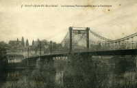
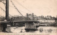
1941: Belleperche
Cordes-Tolosannes, Tarn-et-Garonne, France - Garonne River
| Bridgemeister ID: | 3193 (added 2019-11-10) |
| Year Completed: | 1941 |
| Name: | Belleperche |
| Location: | Cordes-Tolosannes, Tarn-et-Garonne, France |
| Crossing: | Garonne River |
| Coordinates: | 43.995616 N 1.125695 E |
| Maps: | Acme, GeoHack, Google, OpenStreetMap |
| Use: | Vehicular (two-lane) |
| Status: | In use (last checked: 2019) |
| Main Cables: | Wire (steel) |
| Suspended Spans: | 1 |
| Main Span: | 1 x 150 meters (492.1 feet) |
Notes:
- At former location of 1839 Belleperche - Cordes-Tolosannes, Tarn-et-Garonne, France.
External Links:
1941: Carennac
Carennac, Lot, France - Dordogne River
| Bridgemeister ID: | 3067 (added 2019-10-26) |
| Year Completed: | 1941 |
| Name: | Carennac |
| Location: | Carennac, Lot, France |
| Crossing: | Dordogne River |
| Coordinates: | 44.915186 N 1.743939 E |
| Maps: | Acme, GeoHack, Google, OpenStreetMap |
| Use: | Vehicular (two-lane) |
| Status: | In use (last checked: 2019) |
| Main Cables: | Wire (steel) |
| Suspended Spans: | 1 |
| Main Span: | 1 x 134 meters (439.6 feet) estimated |
Notes:
- Likely completed in 1941, possibly 1940.
- Replaced 1846 Carennac - Carennac, Lot, France.
External Links:
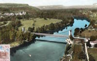
1941: Rangiport
Épône and Gargenville, Yvelines, France - Seine River
| Bridgemeister ID: | 6421 (added 2021-07-31) |
| Year Completed: | 1941 |
| Name: | Rangiport |
| Location: | Épône and Gargenville, Yvelines, France |
| Crossing: | Seine River |
| At or Near Feature: | Île de Rangiport |
| Coordinates: | 48.971502 N 1.808905 E |
| Maps: | Acme, GeoHack, Google, OpenStreetMap |
| Use: | Footbridge |
| Status: | Removed, c. 1965 |
| Main Cables: | Wire (steel) |
Notes:
- Large temporary footbridge built on the piers of the arch bridge destroyed in 1941. This was likely two separate, similar suspension bridges crossing the channels on both sides of Rangiport Island.
External Links:

1941: Saint-Denis-de-Pile
Saint-Denis-de-Pile and Bonzac, Gironde, France - Isle River
| Bridgemeister ID: | 2962 (added 2019-10-06) |
| Year Completed: | 1941 |
| Name: | Saint-Denis-de-Pile |
| Location: | Saint-Denis-de-Pile and Bonzac, Gironde, France |
| Crossing: | Isle River |
| Coordinates: | 44.993221 N 0.207261 W |
| Maps: | Acme, GeoHack, Google, OpenStreetMap |
| References: | AAJ |
| Use: | Vehicular (two-lane) |
| Status: | In use (last checked: 2019) |
| Main Cables: | Wire (steel) |
| Suspended Spans: | 1 |
Notes:
- 1931, June 3, 1931: Deck and hangers fail during load testing when a truck hits a cable. Ten people die in the accident.
- 1935: Construction starts on a replacement bridge.
- Replaced Saint-Denis-de-Pile - Saint-Denis-de-Pile and Bonzac, Gironde, France.
External Links:
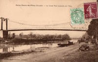
1943: Izeron
Izeron and Saint-Sauveur, Isère, France - Isère River
| Bridgemeister ID: | 7160 (added 2022-06-25) |
| Year Completed: | 1943 |
| Name: | Izeron |
| Location: | Izeron and Saint-Sauveur, Isère, France |
| Crossing: | Isère River |
| Coordinates: | 45.154525 N 5.364199 E |
| Maps: | Acme, GeoHack, Google, OpenStreetMap |
| Use: | Vehicular (one-lane) |
| Status: | Demolished, 2013 |
| Main Cables: | Wire (steel) |
| Suspended Spans: | 1 |
| Main Span: | 1 x 166 meters (544.6 feet) |
Notes:
1945: Aiguilly
Roanne vicinity and Vougy vicinity, Loire, France - Loire River
| Bridgemeister ID: | 4923 (added 2020-07-26) |
| Year Completed: | 1945 |
| Name: | Aiguilly |
| Location: | Roanne vicinity and Vougy vicinity, Loire, France |
| Crossing: | Loire River |
| Use: | Vehicular |
| Status: | Demolished, 1982 |
| Main Cables: | Wire (steel) |
| Suspended Spans: | 1 |
| Main Span: | 1 x 135 meters (442.9 feet) |
Notes:
External Links:
1945: College
Lyon, Métropole de Lyon, France - Rhône River
| Bridgemeister ID: | 6423 (added 2021-08-09) |
| Year Completed: | 1945 |
| Name: | College |
| Also Known As: | Collège |
| Location: | Lyon, Métropole de Lyon, France |
| Crossing: | Rhône River |
| Coordinates: | 45.765661 N 4.840563 E |
| Maps: | Acme, GeoHack, Google, OpenStreetMap |
| References: | BPF, PQL |
| Use: | Footbridge |
| Status: | In use (last checked: 2021) |
| Main Cables: | Wire (steel) |
| Suspended Spans: | 3 |
| Main Span: | 1 x 109.7 meters (359.9 feet) |
| Side Spans: | 2 |
Notes:
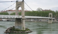
1945: Saint-Esprit
Pont-Saint-Esprit, Gard and Mondragon, Vaucluse, France - Rhône River
| Bridgemeister ID: | 8139 (added 2024-01-20) |
| Year Completed: | 1945 |
| Name: | Saint-Esprit |
| Location: | Pont-Saint-Esprit, Gard and Mondragon, Vaucluse, France |
| Crossing: | Rhône River |
| Coordinates: | 44.258917 N 4.650833 E |
| Maps: | Acme, GeoHack, Google, OpenStreetMap |
| Use: | Vehicular |
| Status: | Replaced, 1954 |
| Main Cables: | Wire (steel) |
| Suspended Spans: | 1 |
Notes:
- This suspension span replaced one arch of the Saint-Espirit bridge that had been destroyed in 1944 during WWII. It was replaced by a new concrete arch in 1954.
External Links:
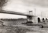
1945: Triel-sur-Seine
Triel-sur-Seine and Vernouillet, Yvelines, France - Seine River
| Bridgemeister ID: | 7810 (added 2023-09-01) |
| Year Completed: | 1945 |
| Name: | Triel-sur-Seine |
| Location: | Triel-sur-Seine and Vernouillet, Yvelines, France |
| Crossing: | Seine River |
| Coordinates: | 48.978374 N 2.001012 E |
| Maps: | Acme, GeoHack, Google, OpenStreetMap |
| Use: | Footbridge |
| Status: | Replaced, 1956 |
| Main Cables: | Wire (steel) |
| Suspended Spans: | 3 |
| Main Span: | 1 |
| Side Spans: | 2 |
Notes:
- A temporary suspension footbridge erected on the piers of the former Triel-sur-Seine suspension bridge.
- Replaced 1838 Triel-sur-Seine - Triel-sur-Seine and Vernouillet, Yvelines, France.
- Replaced by 1956 Triel-sur-Seine - Triel-sur-Seine and Vernouillet, Yvelines, France.
External Links:
1946: Boran
Boran-sur-Oise, Oise, France - Oise River
| Bridgemeister ID: | 6952 (added 2022-02-13) |
| Year Completed: | 1946 |
| Name: | Boran |
| Location: | Boran-sur-Oise, Oise, France |
| Crossing: | Oise River |
| Coordinates: | 49.168337 N 2.366662 E |
| Maps: | Acme, GeoHack, Google, OpenStreetMap |
| Use: | Vehicular, with walkway |
| Status: | In use (last checked: 2017) |
| Main Cables: | Wire (steel) |
| Suspended Spans: | 1 |
| Main Span: | 1 |
Notes:
- At former location of 1841 Boran - Boran-sur-Oise, Oise, France.
External Links:
1946: Châteauneuf-sur-Loire
Châteauneuf-sur-Loire, Loiret, France - Loire River
| Bridgemeister ID: | 1015 (added 2003-11-22) |
| Year Completed: | 1946 |
| Name: | Châteauneuf-sur-Loire |
| Location: | Châteauneuf-sur-Loire, Loiret, France |
| Crossing: | Loire River |
| Coordinates: | 47.8581 N 2.22345 E |
| Maps: | Acme, GeoHack, Google, OpenStreetMap |
| Use: | Vehicular (two-lane), with walkway |
| Status: | In use (last checked: 2021) |
| Main Cables: | Wire (steel) |
| Suspended Spans: | 5 |
| Main Spans: | 2 x 49.15 meters (161.3 feet), 3 x 59.5 meters (195.2 feet) |
| Deck width: | 7 meters |
Notes:
External Links:
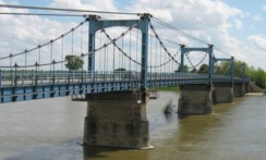
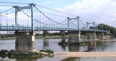
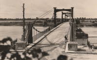
1947: Grésin
Bellegarde-sur-Valserine vicinity, Ain and Haute-Savoie, France - Rhône River
| Bridgemeister ID: | 1003 (added 2003-11-18) |
| Year Completed: | 1947 |
| Name: | Grésin |
| Location: | Bellegarde-sur-Valserine vicinity, Ain and Haute-Savoie, France |
| Crossing: | Rhône River |
| Coordinates: | 46.085407 N 5.861124 E |
| Maps: | Acme, GeoHack, Google, OpenStreetMap |
| Use: | Footbridge |
| Status: | In use (last checked: 2018) |
| Main Cables: | Wire (steel) |
| Suspended Spans: | 1 |
External Links:
1947: Jean Jacquet
Rivesaltes, Pyrénées-Orientales, France - Agly River
| Bridgemeister ID: | 2467 (added 2008-12-19) |
| Year Completed: | 1947 |
| Name: | Jean Jacquet |
| Also Known As: | Jacquet |
| Location: | Rivesaltes, Pyrénées-Orientales, France |
| Crossing: | Agly River |
| Coordinates: | 42.771912 N 2.871446 E |
| Maps: | Acme, GeoHack, Google, OpenStreetMap |
| Use: | Vehicular (two-lane) |
| Status: | In use (last checked: 2019) |
| Main Cables: | Wire (steel) |
| Suspended Spans: | 3 |
| Main Span: | 1 |
| Side Spans: | 2 |
External Links:
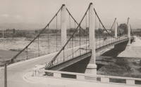
1947: Les Andelys
Les Andelys, Eure, France - Seine River
| Bridgemeister ID: | 456 (added before 2003) |
| Year Completed: | 1947 |
| Name: | Les Andelys |
| Location: | Les Andelys, Eure, France |
| Crossing: | Seine River |
| Coordinates: | 49.236625 N 1.398946 E |
| Maps: | Acme, GeoHack, Google, OpenStreetMap |
| References: | BPF |
| Use: | Vehicular (two-lane, heavy vehicles), with walkway |
| Status: | In use (last checked: 2021) |
| Main Cables: | Wire (steel) |
| Suspended Spans: | 1 |
| Main Span: | 1 x 146 meters (479 feet) |
Notes:
- 1988: Suspension system refurbished. Main cables and suspenders may have been replaced at this time.
- Replaced 1920 Les Andelys - Les Andelys, Eure, France.
External Links:
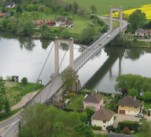
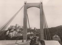
1948: Chalonnes
Chalonnes-sur-Loire, Maine-et-Loire, France - Loire River
| Bridgemeister ID: | 1014 (added 2003-11-22) |
| Year Completed: | 1948 |
| Name: | Chalonnes |
| Location: | Chalonnes-sur-Loire, Maine-et-Loire, France |
| Crossing: | Loire River |
| Coordinates: | 47.354367 N 0.761583 W |
| Maps: | Acme, GeoHack, Google, OpenStreetMap |
| Use: | Vehicular (two-lane, heavy vehicles), with walkway |
| Status: | In use (last checked: 2019) |
| Main Cables: | Wire (steel) |
| Suspended Spans: | 1 |
| Main Span: | 1 x 109.65 meters (359.7 feet) |
Notes:
- At former location of 1841 Chalonnes - Chalonnes-sur-Loire, Maine-et-Loire, France.
External Links:
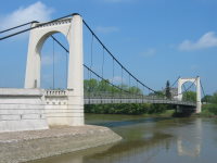
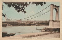
1948: Ennery
Ennery and Hauconcourt, Maizières-lès-Metz vicinity, Moselle, France - Moselle/Mosel River
| Bridgemeister ID: | 2377 (added 2007-10-14) |
| Year Completed: | 1948 |
| Name: | Ennery |
| Location: | Ennery and Hauconcourt, Maizières-lès-Metz vicinity, Moselle, France |
| Crossing: | Moselle/Mosel River |
| Coordinates: | 49.223593 N 6.197988 E |
| Maps: | Acme, GeoHack, Google, OpenStreetMap |
| Use: | Vehicular |
| Status: | Removed, 2012-2014 |
| Main Cables: | Wire (steel) |
| Suspended Spans: | 3 |
| Main Span: | 1 |
| Side Spans: | 2 |
Notes:
- Removed, c. 2012-2014. Replaced with a non-suspension bridge in 2014.
External Links:
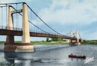
1948: Gennes
Gennes and Les Rosiers-sur-Loire, Maine-et-Loire, France - Loire River
| Bridgemeister ID: | 1174 (added 2004-01-23) |
| Year Completed: | 1948 |
| Name: | Gennes |
| Location: | Gennes and Les Rosiers-sur-Loire, Maine-et-Loire, France |
| Crossing: | Loire River |
| Coordinates: | 47.345283 N 0.230567 W |
| Maps: | Acme, GeoHack, Google, OpenStreetMap |
| Use: | Vehicular (two-lane, heavy vehicles), with walkway |
| Status: | In use (last checked: 2005) |
| Main Cables: | Wire (steel) |
| Suspended Spans: | 3 |
| Main Span: | 1 |
| Side Spans: | 2 |
Notes:
- Replaced 1932 Gennes - Gennes and Les Rosiers-sur-Loire, Maine-et-Loire, France.
- Connects to 1948 Les Rosiers-sur-Loire - Les Rosiers-sur-Loire and Gennes, Maine-et-Loire, France.
External Links:
1948: Les Rosiers-sur-Loire
Les Rosiers-sur-Loire and Gennes, Maine-et-Loire, France - Loire River
| Bridgemeister ID: | 1534 (added 2004-10-31) |
| Year Completed: | 1948 |
| Name: | Les Rosiers-sur-Loire |
| Location: | Les Rosiers-sur-Loire and Gennes, Maine-et-Loire, France |
| Crossing: | Loire River |
| Coordinates: | 47.348533 N 0.2277 W |
| Maps: | Acme, GeoHack, Google, OpenStreetMap |
| Use: | Vehicular (two-lane, heavy vehicles), with walkway |
| Status: | In use (last checked: 2005) |
| Main Cables: | Wire (steel) |
| Suspended Spans: | 3 |
| Main Span: | 1 |
| Side Spans: | 2 |
Notes:
- Replaced 1932 Les Rosiers-sur-Loire - Les Rosiers-sur-Loire and Gennes, Maine-et-Loire, France.
- Connects to 1948 Gennes - Gennes and Les Rosiers-sur-Loire, Maine-et-Loire, France.
External Links:
1948: Meung-sur-Loire
Meung-sur-Loire, Loiret, France - Loire River
| Bridgemeister ID: | 1175 (added 2004-01-23) |
| Year Completed: | 1948 |
| Name: | Meung-sur-Loire |
| Location: | Meung-sur-Loire, Loiret, France |
| Crossing: | Loire River |
| Coordinates: | 47.822517 N 1.7026 E |
| Maps: | Acme, GeoHack, Google, OpenStreetMap |
| Use: | Vehicular (two-lane, heavy vehicles), with walkway |
| Status: | In use (last checked: 2021) |
| Main Cables: | Wire (steel) |
| Suspended Spans: | 4 |
| Main Spans: | 2 x 74 meters (242.8 feet) |
| Side Spans: | 2 x 70.5 meters (231.3 feet) |
Notes:
External Links:
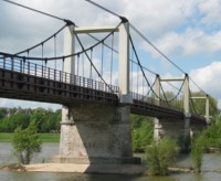
1949: (footbridge)
Valence, Drôme and Guilherand-Granges, Ardèche, France - Rhône River
| Bridgemeister ID: | 6517 (added 2021-08-27) |
| Year Completed: | 1949 |
| Name: | (footbridge) |
| Location: | Valence, Drôme and Guilherand-Granges, Ardèche, France |
| Crossing: | Rhône River |
| Coordinates: | 44.931773 N 4.883700 E |
| Maps: | Acme, GeoHack, Google, OpenStreetMap |
| Use: | Footbridge |
| Status: | Removed, 1960s |
| Main Cables: | Wire (steel) |
| Main Spans: | 2 |
Notes:
- At former location of 1830 Valence - Valence, Drôme and Guilherand-Granges, Ardèche, France.
1949: Lacroix-Saint-Ouen
Lacroix-Saint-Ouen, Oise, France - Oise River
| Bridgemeister ID: | 7082 (added 2022-05-28) |
| Year Completed: | 1949 |
| Name: | Lacroix-Saint-Ouen |
| Location: | Lacroix-Saint-Ouen, Oise, France |
| Crossing: | Oise River |
| Coordinates: | 49.352884 N 2.767171 E |
| Maps: | Acme, GeoHack, Google, OpenStreetMap |
| Use: | Vehicular (one-lane) |
| Status: | In use (last checked: 2019) |
| Main Cables: | Wire (steel) |
| Suspended Spans: | 1 |
| Main Span: | 1 x 65 meters (213.3 feet) estimated |
Notes:
- At former location of 1846 Lacroix-Saint-Ouen - Lacroix-Saint-Ouen, Oise, France.
External Links:
1949: Montjean-sur-Loire
Montjean-sur-Loire, Maine-et-Loire, France - Loire River
| Bridgemeister ID: | 1538 (added 2004-10-31) |
| Year Completed: | 1949 |
| Name: | Montjean-sur-Loire |
| Location: | Montjean-sur-Loire, Maine-et-Loire, France |
| Crossing: | Loire River |
| Coordinates: | 47.393783 N 0.859783 W |
| Maps: | Acme, GeoHack, Google, OpenStreetMap |
| Use: | Vehicular (two-lane, heavy vehicles), with walkway |
| Status: | In use (last checked: 2021) |
| Main Cables: | Wire (steel) |
| Suspended Spans: | 6 |
| Main Spans: | 4 |
| Side Spans: | 2 |
Notes:
- At former location of 1938 Montjean-sur-Loire - Montjean-sur-Loire, Maine-et-Loire, France.
External Links:

1949: Volonne
Volonne, Alpes-de-Haute-Provence, France - Durance River
| Bridgemeister ID: | 1491 (added 2004-09-19) |
| Year Completed: | 1949 |
| Name: | Volonne |
| Location: | Volonne, Alpes-de-Haute-Provence, France |
| Crossing: | Durance River |
| Coordinates: | 44.108633 N 6.00785 E |
| Maps: | Acme, GeoHack, Google, OpenStreetMap |
| Use: | Vehicular (one-lane), with walkway |
| Status: | Removed, c. 2006 |
| Main Cables: | Wire (steel) |
| Suspended Spans: | 1 |
Notes:
- Replaced by a cable-stayed bridge in the mid 2000s.
- Replaced 1928 Volonne - Volonne, Alpes-de-Haute-Provence, France.
External Links:
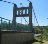
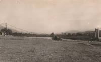
1950: (suspension bridge)
Saint-Germain-au-Mont-d'Or, Métropole de Lyon, France
| Bridgemeister ID: | 3214 (added 2019-11-11) |
| Year Completed: | 1950 |
| Name: | (suspension bridge) |
| Location: | Saint-Germain-au-Mont-d'Or, Métropole de Lyon, France |
| Coordinates: | 45.898758 N 4.794597 E |
| Maps: | Acme, GeoHack, Google, OpenStreetMap |
| Use: | Vehicular (two-lane) |
| Status: | In use (last checked: 2011) |
| Main Cables: | Wire (steel) |
| Suspended Spans: | 3 |
| Main Span: | 1 |
| Side Spans: | 2 |
External Links:
1950: Rognonas
Rognonas, Bouches-du-Rhône and Avignon, Vaucluse, France - Durance River
| Bridgemeister ID: | 549 (added before 2003) |
| Year Completed: | 1950 |
| Name: | Rognonas |
| Location: | Rognonas, Bouches-du-Rhône and Avignon, Vaucluse, France |
| Crossing: | Durance River |
| Coordinates: | 43.914624 N 4.808279 E |
| Maps: | Acme, GeoHack, Google, OpenStreetMap |
| References: | BC2, BPF |
| Use: | Vehicular (two-lane, heavy vehicles), with walkway |
| Status: | In use (last checked: 2019) |
| Main Cables: | Wire (steel) |
| Suspended Spans: | 3 |
| Main Span: | 1 x 255 meters (836.6 feet) |
| Side Spans: | 2 |
External Links:
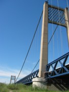
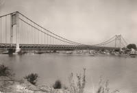
1950: Tournus
Tournus, Saône-et-Loire, France - Saône River
| Bridgemeister ID: | 5659 (added 2021-01-01) |
| Year Completed: | 1950 |
| Name: | Tournus |
| Location: | Tournus, Saône-et-Loire, France |
| Crossing: | Saône River |
| Coordinates: | 46.564335 N 4.913185 E |
| Maps: | Acme, GeoHack, Google, OpenStreetMap |
| Use: | Vehicular (two-lane) |
| Status: | Removed |
| Main Cables: | Wire (steel) |
| Suspended Spans: | 3 |
| Main Span: | 1 |
| Side Spans: | 2 |
Notes:
- At former location of 1838 Tournus - Tournus, Saône-et-Loire, France.
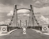
1951: Bonny-sur-Loire
Bonny-sur-Loire and Beaulieu-sur-Loire, Loiret, France - Loire River
| Bridgemeister ID: | 1783 (added 2005-05-13) |
| Year Completed: | 1951 |
| Name: | Bonny-sur-Loire |
| Location: | Bonny-sur-Loire and Beaulieu-sur-Loire, Loiret, France |
| Crossing: | Loire River |
| Coordinates: | 47.5505 N 2.835633 E |
| Maps: | Acme, GeoHack, Google, OpenStreetMap |
| Use: | Vehicular (two-lane, heavy vehicles), with walkway |
| Status: | In use (last checked: 2019) |
| Main Cables: | Wire (steel) |
| Suspended Spans: | 3 |
| Main Spans: | 3 x 120 meters (393.7 feet) |
| Deck width: | 7.9 meters |
Notes:
External Links:
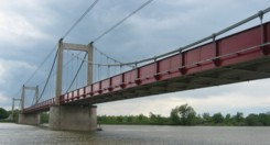
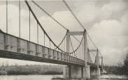
1951: Bouchemaine
Bouchemaine, Maine-et-Loire, France - Maine River
| Bridgemeister ID: | 1782 (added 2005-05-12) |
| Year Completed: | 1951 |
| Name: | Bouchemaine |
| Location: | Bouchemaine, Maine-et-Loire, France |
| Crossing: | Maine River |
| Coordinates: | 47.420383 N 0.608567 W |
| Maps: | Acme, GeoHack, Google, OpenStreetMap |
| Use: | Vehicular (two-lane, heavy vehicles), with walkway |
| Status: | In use (last checked: 2021) |
| Main Cables: | Wire (steel) |
| Suspended Spans: | 3 |
| Main Span: | 1 |
| Side Spans: | 2 |
Notes:
- 2018: Major renovation completed.
- Replaced 1910 Bouchemaine - Bouchemaine, Maine-et-Loire, France.
External Links:
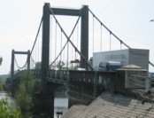
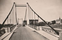
1951: Brion
Roissard and Lavars, Isère, France - Ebron River
| Bridgemeister ID: | 1805 (added 2005-05-19) |
| Year Completed: | 1951 |
| Name: | Brion |
| Location: | Roissard and Lavars, Isère, France |
| Crossing: | Ebron River |
| Coordinates: | 44.868143 N 5.670883 E |
| Maps: | Acme, GeoHack, Google, OpenStreetMap |
| Use: | Vehicular (one-lane) |
| Status: | In use (last checked: 2019) |
| Main Cables: | Wire |
| Suspended Spans: | 1 |
Notes:
External Links:
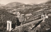
1951: Châtillon-sur-Loire
Châtillon-sur-Loire, Loiret, France - Loire River
| Bridgemeister ID: | 1925 (added 2005-10-23) |
| Year Completed: | 1951 |
| Name: | Châtillon-sur-Loire |
| Location: | Châtillon-sur-Loire, Loiret, France |
| Crossing: | Loire River |
| Coordinates: | 47.597657 N 2.760439 E |
| Maps: | Acme, GeoHack, Google, OpenStreetMap |
| Use: | Vehicular (two-lane, heavy vehicles), with walkway |
| Status: | In use (last checked: 2005) |
| Main Cables: | Wire (steel) |
| Suspended Spans: | 4 |
| Main Spans: | 2 x 92 meters (301.8 feet), 2 x 76 meters (249.3 feet) |
| Deck width: | 6.9 meters |
Notes:
External Links:
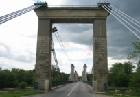
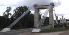
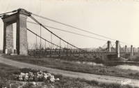
1951: Sablons
Sablons, Isère and Serrières, Ardèche, France - Rhône River
| Bridgemeister ID: | 892 (added 2003-09-06) |
| Year Completed: | 1951 |
| Name: | Sablons |
| Location: | Sablons, Isère and Serrières, Ardèche, France |
| Crossing: | Rhône River |
| Coordinates: | 45.318183 N 4.766867 E |
| Maps: | Acme, GeoHack, Google, OpenStreetMap |
| References: | BPF |
| Use: | Vehicular (two-lane, heavy vehicles), with walkway |
| Status: | In use (last checked: 2005) |
| Main Cables: | Wire (steel) |
| Suspended Spans: | 1 |
| Main Span: | 1 x 185 meters (607 feet) |
Notes:
External Links:
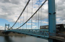
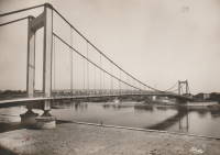
1951: Yenne
Yenne, Savoie and Ain, France - Rhône River
| Bridgemeister ID: | 1969 (added 2005-11-26) |
| Year Completed: | 1951 |
| Name: | Yenne |
| Location: | Yenne, Savoie and Ain, France |
| Crossing: | Rhône River |
| Coordinates: | 45.705713 N 5.750965 E |
| Maps: | Acme, GeoHack, Google, OpenStreetMap |
| Use: | Vehicular (one-lane) |
| Status: | In use (last checked: 2019) |
| Main Cables: | Wire (steel) |
| Suspended Spans: | 1 |
| Main Span: | 1 x 10⁶ meters (347.8 feet) estimated |
Notes:
- At former location of 1883 Yenne - Yenne, Savoie and Ain, France.
External Links:
1952: François Baud
Morzine, Haute-Savoie, France
| Bridgemeister ID: | 2447 (added 2008-04-23) |
| Year Completed: | 1952 |
| Name: | François Baud |
| Location: | Morzine, Haute-Savoie, France |
| Coordinates: | 46.184141 N 6.704373 E |
| Maps: | Acme, GeoHack, Google, OpenStreetMap |
| Use: | Footbridge |
| Status: | In use (last checked: 2019) |
| Main Cables: | Wire (steel) |
External Links:
1952: Pertuis
Pertuis, Vaucluse and Bouches-du-Rhône, France - Durance River
| Bridgemeister ID: | 901 (added 2003-09-07) |
| Year Completed: | 1952 |
| Name: | Pertuis |
| Location: | Pertuis, Vaucluse and Bouches-du-Rhône, France |
| Crossing: | Durance River |
| Coordinates: | 43.66735 N 5.496117 E |
| Maps: | Acme, GeoHack, Google, OpenStreetMap |
| Use: | Vehicular (two-lane, heavy vehicles), with walkway |
| Status: | Removed, 2013 |
| Main Cables: | Wire (steel) |
| Suspended Spans: | 2 |
| Main Spans: | 2 |
Notes:
External Links:
1952: Térénez
Landévennec vicinity and Rosnoen vicinity, Finistère, France - Aulne River
| Bridgemeister ID: | 1454 (added 2004-08-14) |
| Year Completed: | 1952 |
| Name: | Térénez |
| Location: | Landévennec vicinity and Rosnoen vicinity, Finistère, France |
| Crossing: | Aulne River |
| Coordinates: | 48.268980 N 4.262381 W |
| Maps: | Acme, GeoHack, Google, OpenStreetMap |
| References: | BPF |
| Use: | Vehicular (two-lane, heavy vehicles), with walkway |
| Status: | Removed, 2015 |
| Main Cables: | Wire (steel) |
| Suspended Spans: | 1 |
| Main Span: | 1 x 272 meters (892.4 feet) |
Notes:
- Bypassed by a cable-stayed bridge, 2011.
- Replaced 1925 Térénez - Landévennec vicinity and Rosnoen vicinity, Finistère, France.
External Links:
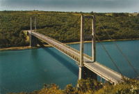
1953: Ancenis
Ancenis, Loire-Atlantique and Le Fourneau, Maine-et-Loire, France - Loire River
| Bridgemeister ID: | 1037 (added 2003-12-03) |
| Year Completed: | 1953 |
| Name: | Ancenis |
| Location: | Ancenis, Loire-Atlantique and Le Fourneau, Maine-et-Loire, France |
| Crossing: | Loire River |
| Coordinates: | 47.36195 N 1.176417 W |
| Maps: | Acme, GeoHack, Google, OpenStreetMap |
| References: | BPF |
| Use: | Vehicular (two-lane, heavy vehicles) |
| Status: | In use (last checked: 2021) |
| Main Cables: | Wire (steel) |
| Suspended Spans: | 3 |
| Main Span: | 1 x 238 meters (780.8 feet) |
| Side Spans: | 2 |
Notes:
External Links:
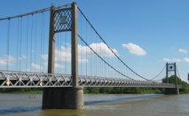
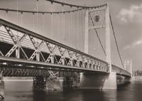
1953: Guynemer
Elbeuf and Saint-Aubin-lès-Elbeuf, Seine-Maritime, France - Seine River
| Bridgemeister ID: | 1518 (added 2004-10-10) |
| Year Completed: | 1953 |
| Name: | Guynemer |
| Location: | Elbeuf and Saint-Aubin-lès-Elbeuf, Seine-Maritime, France |
| Crossing: | Seine River |
| Coordinates: | 49.29415 N 1.00475 E |
| Maps: | Acme, GeoHack, Google, OpenStreetMap |
| Use: | Vehicular (two-lane), with walkway |
| Status: | In use (last checked: 2005) |
| Main Cables: | Wire (steel) |
| Suspended Spans: | 3 |
| Main Span: | 1 x 152 meters (498.7 feet) |
| Side Spans: | 2 |
Notes:
External Links:
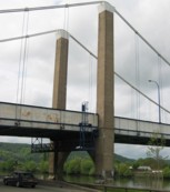
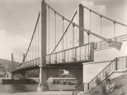
1954: Varades
Varades, Loire-Atlantique and Saint-Florent-le-Vieil, Maine-et-Loire, France - Loire River
| Bridgemeister ID: | 1106 (added 2004-01-03) |
| Year Completed: | 1954 |
| Name: | Varades |
| Location: | Varades, Loire-Atlantique and Saint-Florent-le-Vieil, Maine-et-Loire, France |
| Crossing: | Loire River |
| Coordinates: | 47.36965 N 1.015717 W |
| Maps: | Acme, GeoHack, Google, OpenStreetMap |
| Use: | Vehicular (two-lane, heavy vehicles), with walkway |
| Status: | In use (last checked: 2021) |
| Main Cables: | Wire (steel) |
| Suspended Spans: | 3 |
| Main Span: | 1 |
| Side Spans: | 2 |
Notes:
- 2020: Bridge is strengthened to continue carrying heavy trucks.
- At former location of 1853 Saint-Florent-le-Vieil - Saint-Florent-le-Vieil, Maine-et-Loire and Varades, Loire-Atlantique, France.
- At former location of 1853 Varades - Varades, Loire-Atlantique and Saint-Florent-le-Vieil, Maine-et-Loire, France.
External Links:
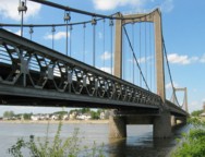
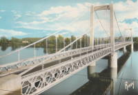
1954: Viviers
Viviers, Ardèche and Châteauneuf-Du-Rhône, Drôme, France - Rhône River
| Bridgemeister ID: | 1545 (added 2004-11-05) |
| Year Completed: | 1954 |
| Name: | Viviers |
| Location: | Viviers, Ardèche and Châteauneuf-Du-Rhône, Drôme, France |
| Crossing: | Rhône River |
| Coordinates: | 44.481583 N 4.698717 E |
| Maps: | Acme, GeoHack, Google, OpenStreetMap |
| Use: | Vehicular (two-lane, heavy vehicles), with walkway |
| Status: | In use (last checked: 2021) |
| Main Cables: | Wire (steel) |
| Suspended Spans: | 3 |
| Main Span: | 1 |
| Side Spans: | 2 |
Notes:
- At former location of 1847 Viviers - Viviers, Ardèche and Drôme, France.
External Links:
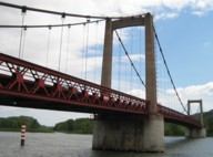
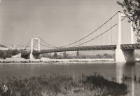
1955: Bessières
Bessières, Haute-Garonne, France - Tarn River
| Bridgemeister ID: | 3197 (added 2019-11-10) |
| Year Completed: | 1955 |
| Name: | Bessières |
| Location: | Bessières, Haute-Garonne, France |
| Crossing: | Tarn River |
| Coordinates: | 43.801612 N 1.609436 E |
| Maps: | Acme, GeoHack, Google, OpenStreetMap |
| Principals: | Baudin-Châteauneuf |
| Use: | Vehicular (two-lane) |
| Status: | In use (last checked: 2021) |
| Main Cables: | Wire (steel) |
| Suspended Spans: | 1 |
| Main Span: | 1 x 119.4 meters (391.7 feet) estimated |
Notes:
External Links:
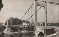
1955: Buzet-sur-Tarn
Buzet-sur-Tarn, Haute-Garonne, France - Tarn River
| Bridgemeister ID: | 6612 (added 2021-09-05) |
| Year Completed: | 1955 |
| Name: | Buzet-sur-Tarn |
| Location: | Buzet-sur-Tarn, Haute-Garonne, France |
| Crossing: | Tarn River |
| Coordinates: | 43.781136 N 1.634988 E |
| Maps: | Acme, GeoHack, Google, OpenStreetMap |
| Principals: | Baudin Chateauneuf |
| Use: | Vehicular (one-lane), with walkway |
| Status: | In use (last checked: 2021) |
| Main Cables: | Wire (steel) |
| Suspended Spans: | 1 |
| Main Span: | 1 |
Notes:
- At former location of 1844 Buzet-sur-Tarn - Buzet-sur-Tarn, Haute-Garonne, France. Unclear if the 1955 bridge was a direct replacement.
External Links:
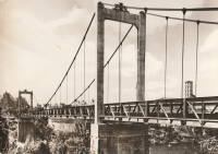
1955: Riscle
Riscle, Gers, France - Adour River
| Bridgemeister ID: | 7315 (added 2022-08-28) |
| Year Completed: | 1955 |
| Name: | Riscle |
| Location: | Riscle, Gers, France |
| Crossing: | Adour River |
| Coordinates: | 43.663989 N 0.081795 W |
| Maps: | Acme, GeoHack, Google, OpenStreetMap |
| Use: | Vehicular (two-lane), with walkway |
| Status: | In use (last checked: 2021) |
| Main Cables: | Wire (steel) |
| Suspended Spans: | 1 |
| Main Span: | 1 x 102.5 meters (336.3 feet) estimated |
Notes:
- Replaced 1930 Riscle - Riscle, Gers, France.
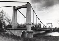
1956: Lorois
Plouhinec vicinity, Morbihan, France - Etel River
| Bridgemeister ID: | 1080 (added 2003-12-29) |
| Year Completed: | 1956 |
| Name: | Lorois |
| Location: | Plouhinec vicinity, Morbihan, France |
| Crossing: | Etel River |
| Coordinates: | 47.675905 N 3.200095 W |
| Maps: | Acme, GeoHack, Google, OpenStreetMap |
| References: | BPF |
| Use: | Vehicular (two-lane) |
| Status: | In use (last checked: 2019) |
| Main Cables: | Wire (steel) |
| Suspended Spans: | 1 |
| Main Span: | 1 x 237 meters (777.6 feet) |
Notes:
External Links:
1956: Triel-sur-Seine
Triel-sur-Seine and Vernouillet, Yvelines, France - Seine River
| Bridgemeister ID: | 1540 (added 2004-10-31) |
| Year Completed: | 1956 |
| Name: | Triel-sur-Seine |
| Location: | Triel-sur-Seine and Vernouillet, Yvelines, France |
| Crossing: | Seine River |
| Coordinates: | 48.978517 N 2.0015 E |
| Maps: | Acme, GeoHack, Google, OpenStreetMap |
| Use: | Vehicular (two-lane, heavy vehicles), with walkway |
| Status: | In use (last checked: 2022) |
| Main Cables: | Wire (steel) |
| Suspended Spans: | 3 |
| Main Span: | 1 x 105.5 meters (346.1 feet) estimated |
| Side Spans: | 2 |
| Characteristics: | Self-anchored |
Notes:
External Links:
1958: Gustave Toursier
Tournon-sur-Rhône, Ardèche and Tain-L'Hermitage, Drôme, France - Rhône River
| Bridgemeister ID: | 1455 (added 2004-08-14) |
| Year Completed: | 1958 |
| Name: | Gustave Toursier |
| Location: | Tournon-sur-Rhône, Ardèche and Tain-L'Hermitage, Drôme, France |
| Crossing: | Rhône River |
| Coordinates: | 45.066638 N 4.840666 E |
| Maps: | Acme, GeoHack, Google, OpenStreetMap |
| Use: | Vehicular (two-lane, heavy vehicles), with walkway |
| Status: | In use (last checked: 2022) |
| Main Cables: | Wire (steel) |
| Suspended Spans: | 3 |
| Main Span: | 1 x 144 meters (472.4 feet) estimated |
| Side Spans: | 2 |
Notes:
- Near 1825 Tain-Tournon - Tournon-sur-Rhône, Ardèche and Tain, Drôme, France.
- Near 1849 Marc Seguin - Tournon-sur-Rhône, Ardèche and Tain-L'Hermitage, Drôme, France.
External Links:
1959: Cosne-sur-Loire
Cosne-Cours-sur-Loire, Nièvre and Cher, France - Loire River
| Bridgemeister ID: | 1179 (added 2004-01-24) |
| Year Completed: | 1959 |
| Name: | Cosne-sur-Loire |
| Location: | Cosne-Cours-sur-Loire, Nièvre and Cher, France |
| Crossing: | Loire River |
| Coordinates: | 47.411367 N 2.921417 E |
| Maps: | Acme, GeoHack, Google, OpenStreetMap |
| Use: | Vehicular (two-lane, heavy vehicles), with walkway |
| Status: | In use (last checked: 2005) |
| Main Cables: | Wire (steel) |
| Suspended Spans: | 3 |
| Main Span: | 1 x 157 meters (515.1 feet) |
| Side Spans: | 2 x 63 meters (206.7 feet) |
| Deck width: | 9.5 meters |
Notes:
- At former location of 1833 Cosne-sur-Loire - Cosne-sur-Loire, Nièvre and Boulleret, Cher, France.
External Links:
1959: Saint-Hubert
Port Saint-Hubert, Plouër-sur-Rance vicinity and La Ville-es-Nonais, Côtes-d'Armor, France - Rance River
| Bridgemeister ID: | 1493 (added 2004-09-19) |
| Year Completed: | 1959 |
| Name: | Saint-Hubert |
| Location: | Port Saint-Hubert, Plouër-sur-Rance vicinity and La Ville-es-Nonais, Côtes-d'Armor, France |
| Crossing: | Rance River |
| Coordinates: | 48.535455 N 1.970929 W |
| Maps: | Acme, GeoHack, Google, OpenStreetMap |
| Use: | Vehicular (two-lane, heavy vehicles), with walkway |
| Status: | In use (last checked: 2019) |
| Main Cables: | Wire (steel) |
| Suspended Spans: | 1 |
Notes:
External Links:
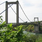
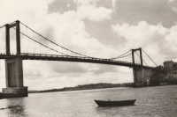
1959: Tancarville
Tancarville, Seine-Maritime and Marais-Vernier, Eure, France - Seine River
| Bridgemeister ID: | 460 (added before 2003) |
| Year Completed: | 1959 |
| Name: | Tancarville |
| Location: | Tancarville, Seine-Maritime and Marais-Vernier, Eure, France |
| Crossing: | Seine River |
| Coordinates: | 49.47 N 0.467267 E |
| Maps: | Acme, GeoHack, Google, OpenStreetMap |
| References: | AOB, BPF |
| Use: | Vehicular (major highway), with walkway |
| Status: | In use (last checked: 2021) |
| Main Cables: | Wire (steel) |
| Suspended Spans: | 3 |
| Main Span: | 1 x 608 meters (1,994.8 feet) |
| Side Spans: | 2 x 176 meters (577.4 feet) |
| Deck width: | 12.5 meters |
Notes:
- Main cables replaced, 1999.
External Links:
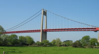
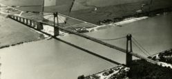
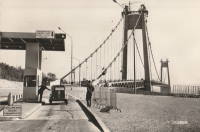
1959: Vernaison
Vernaison and Solaize, Métropole de Lyon, France - Rhône River
| Bridgemeister ID: | 1832 (added 2005-05-30) |
| Year Completed: | 1959 |
| Name: | Vernaison |
| Location: | Vernaison and Solaize, Métropole de Lyon, France |
| Crossing: | Rhône River |
| Coordinates: | 45.645621 N 4.816518 E |
| Maps: | Acme, GeoHack, Google, OpenStreetMap |
| Use: | Vehicular (two-lane) |
| Status: | In use (last checked: 2019) |
| Main Cables: | Wire (steel) |
| Suspended Spans: | 3 |
| Main Span: | 1 |
| Side Spans: | 2 |
Notes:
- At former location of 1902 Vernaison - Vernaison, Métropole de Lyon, France.
- Connects to Solaize - Solaize and Vernaison, Métropole de Lyon, France.
External Links:
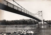
1960: Roche-Bernard
La Roche-Bernard, Morbihan, France - Vilaine River
| Bridgemeister ID: | 896 (added 2003-09-07) |
| Year Completed: | 1960 |
| Name: | Roche-Bernard |
| Location: | La Roche-Bernard, Morbihan, France |
| Crossing: | Vilaine River |
| Coordinates: | 47.524359 N 2.304873 W |
| Maps: | Acme, GeoHack, Google, OpenStreetMap |
| References: | BPF |
| Use: | Vehicular (two-lane), with walkway |
| Status: | In use (last checked: 2021) |
| Main Cables: | Wire (steel) |
| Suspended Spans: | 3 |
| Main Span: | 1 x 244.8 meters (803.1 feet) |
| Side Spans: | 2 x 81 meters (265.7 feet) |
Notes:
External Links:
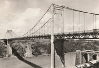
1961: Saint-Foy-la-Grande
Saint-Foy-la-Grande, Gironde and Port-Sainte-Foy-et-Ponchapt, Dordogne, France - Dordogne River
| Bridgemeister ID: | 1970 (added 2005-11-26) |
| Year Completed: | 1961 |
| Name: | Saint-Foy-la-Grande |
| Location: | Saint-Foy-la-Grande, Gironde and Port-Sainte-Foy-et-Ponchapt, Dordogne, France |
| Crossing: | Dordogne River |
| Coordinates: | 44.840960 N 0.208675 E |
| Maps: | Acme, GeoHack, Google, OpenStreetMap |
| Use: | Vehicular (two-lane), with walkway |
| Status: | In use (last checked: 2019) |
| Main Cables: | Wire (steel) |
| Suspended Spans: | 3 |
| Main Span: | 1 |
| Side Spans: | 2 |
Notes:
- Near former location of 1897 Port-Sainte-Foy - Port-Sainte-Foy-et-Ponchapt, Dordogne and Sainte-Foy-la-Grande, Gironde, France.
External Links:
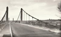
1963: Saint-Symphorien
Tours, Indre-et-Loire, France - Loire River
| Bridgemeister ID: | 7840 (added 2023-09-03) |
| Year Completed: | 1963 |
| Name: | Saint-Symphorien |
| Location: | Tours, Indre-et-Loire, France |
| Crossing: | Loire River |
| At or Near Feature: | l'Île Aucard |
| Coordinates: | 47.399002 N 0.693011 E |
| Maps: | Acme, GeoHack, Google, OpenStreetMap |
| Status: | Restricted to foot traffic (last checked: 2023) |
| Main Cables: | Wire (steel) |
| Suspended Spans: | 3 |
| Main Spans: | 3 |
Notes:
- This is the present-day (2020s) three-span southern Saint-Symphorien bridge.
- Replaced Saint-Symphorien - Tours, Indre-et-Loire, France.
- Connects to 1963 Saint-Symphorien - Tours, Indre-et-Loire, France.
External Links:
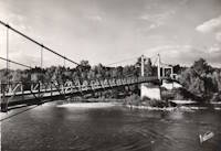
1963: Saint-Symphorien
Tours, Indre-et-Loire, France - Loire River
| Bridgemeister ID: | 7841 (added 2023-09-03) |
| Year Completed: | 1963 |
| Name: | Saint-Symphorien |
| Location: | Tours, Indre-et-Loire, France |
| Crossing: | Loire River |
| At or Near Feature: | l'Île Aucard |
| Coordinates: | 47.401695 N 0.693334 E |
| Maps: | Acme, GeoHack, Google, OpenStreetMap |
| Status: | Restricted to foot traffic (last checked: 2023) |
| Main Cables: | Wire (steel) |
| Suspended Spans: | 2 |
| Main Spans: | 2 |
Notes:
- This is the present-day (2020s) two-span northern Saint-Symphorien bridge.
- Replaced 1847 Saint-Symphorien - Tours, Indre-et-Loire, France.
- Connects to 1963 Saint-Symphorien - Tours, Indre-et-Loire, France.
External Links:
1964: Saint-Bachi Aqueduct
Rians, Var, France - Ruisseau de Saint-Bachi
| Bridgemeister ID: | 4691 (added 2020-06-20) |
| Year Completed: | 1964 |
| Name: | Saint-Bachi Aqueduct |
| Location: | Rians, Var, France |
| Crossing: | Ruisseau de Saint-Bachi |
| Coordinates: | 43.613862 N 5.687426 E |
| Maps: | Acme, GeoHack, Google, OpenStreetMap |
| Use: | Aqueduct |
| Status: | In use |
| Main Cables: | Wire (steel) |
| Suspended Spans: | 1 |
External Links:
1967: Aquitaine
Bordeaux, Gironde, France - Garonne River
| Bridgemeister ID: | 466 (added before 2003) |
| Year Completed: | 1967 |
| Name: | Aquitaine |
| Location: | Bordeaux, Gironde, France |
| Crossing: | Garonne River |
| Coordinates: | 44.879916 N 0.537012 W |
| Maps: | Acme, GeoHack, Google, OpenStreetMap |
| References: | BPF |
| Use: | Vehicular (major highway) |
| Status: | In use (last checked: 2019) |
| Main Cables: | Wire (steel) |
| Suspended Spans: | 3 |
| Main Span: | 1 x 394 meters (1,292.7 feet) |
| Side Spans: | 2 x 143 meters (469.2 feet) |
External Links:
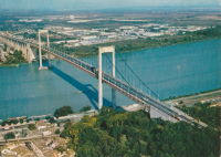
1985: Val-Joly
Eppe-Sauvage vicinity, Nord, France - Lac du Val-Joly
| Bridgemeister ID: | 2137 (added 2006-10-28) |
| Year Completed: | 1985 |
| Name: | Val-Joly |
| Location: | Eppe-Sauvage vicinity, Nord, France |
| Crossing: | Lac du Val-Joly |
| Coordinates: | 50.122243 N 4.124874 E |
| Maps: | Acme, GeoHack, Google, OpenStreetMap |
| Use: | Footbridge |
| Status: | In use (last checked: 2019) |
| Main Cables: | Wire (steel) |
| Suspended Spans: | 1 |
External Links:
| Bridgemeister ID: | 1416 (added 2004-07-04) |
| Year Completed: | 1991 |
| Name: | Diable |
| Also Known As: | Devil's |
| Location: | Avrieux vicinity, Modane, Savoie, France |
| Crossing: | Arc River |
| Coordinates: | 45.210240 N 6.738880 E |
| Maps: | Acme, GeoHack, Google, OpenStreetMap |
| Use: | Footbridge |
| Status: | In use (last checked: 2019) |
| Main Cables: | Wire (steel) |
| Suspended Spans: | 1 |
| Main Span: | 1 x 45 meters (147.6 feet) |
Notes:
- Connecting the Marie-Thérèse and Victor Emmanuel II forts.
- Replaced Diable (Devil's) - Avrieux, L'Esseillon, and Modane vicinity, Savoie, France.
External Links:
2000: Chavanon Viaduct
Merlines, Corrèze and Messeix, Puy-de-Dôme, France - Chavanon Valley
| Bridgemeister ID: | 509 (added before 2003) |
| Year Completed: | 2000 |
| Name: | Chavanon Viaduct |
| Location: | Merlines, Corrèze and Messeix, Puy-de-Dôme, France |
| Crossing: | Chavanon Valley |
| Coordinates: | 45.62404 N 2.479349 E |
| Maps: | Acme, GeoHack, Google, OpenStreetMap |
| References: | BPF |
| Use: | Vehicular (major highway) |
| Status: | In use (last checked: 2019) |
| Main Cables: | Wire (steel) |
| Suspended Spans: | 1 |
| Main Span: | 1 x 300 meters (984.3 feet) |
Notes:
- Monocable across A-pylon towers.
External Links:
2001: (footbridge)
Sarreguemines, Moselle, France - Sarre River
| Bridgemeister ID: | 1889 (added 2005-10-01) |
| Year Completed: | 2001 |
| Name: | (footbridge) |
| Location: | Sarreguemines, Moselle, France |
| Crossing: | Sarre River |
| Coordinates: | 49.110183 N 7.072017 E |
| Maps: | Acme, GeoHack, Google, OpenStreetMap |
| Use: | Footbridge |
| Status: | In use (last checked: 2017) |
| Main Cables: | Wire (steel) |
| Suspended Spans: | 2 |
| Side Spans: | 2 |
| Characteristics: | Self-anchored |
Notes:
- Self-anchored. Inclined suspenders.
External Links:
2001: (footbridge)
Tours, Indre-et-Loire, France - Cher River
| Bridgemeister ID: | 1019 (added 2003-11-22) |
| Year Completed: | 2001 |
| Name: | (footbridge) |
| Location: | Tours, Indre-et-Loire, France |
| Crossing: | Cher River |
| Coordinates: | 47.37155 N 0.682467 E |
| Maps: | Acme, GeoHack, Google, OpenStreetMap |
| Principals: | Alain Spielmann |
| Use: | Footbridge |
| Status: | In use (last checked: 2005) |
| Main Cables: | Wire (steel) |
| Suspended Spans: | 1 |
Notes:
- Monocable from A-shaped towers.
External Links:
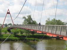
2002: Agen
Agen, Lot-et-Garonne, France - Garonne River
| Bridgemeister ID: | 1032 (added 2003-11-30) |
| Year Completed: | 2002 |
| Name: | Agen |
| Location: | Agen, Lot-et-Garonne, France |
| Crossing: | Garonne River |
| Coordinates: | 44.201950 N 0.608290 E |
| Maps: | Acme, GeoHack, Google, OpenStreetMap |
| Use: | Footbridge |
| Status: | In use (last checked: 2019) |
| Main Cables: | Wire (steel) |
| Suspended Spans: | 3 |
| Main Span: | 1 x 174.25 meters (571.7 feet) |
| Side Spans: | 1 x 29.5 meters (96.8 feet), 1 x 20.6 meters (67.6 feet) |
| Deck width: | 2.3 meters |
Notes:
- Replaced 1841 Agen - Agen, Lot-et-Garonne, France.
External Links:
2005: Poètes
Dole, Jura, France - Doubs River
| Bridgemeister ID: | 4904 (added 2020-07-18) |
| Year Completed: | 2005 |
| Name: | Poètes |
| Location: | Dole, Jura, France |
| Crossing: | Doubs River |
| Coordinates: | 47.088697 N 5.498601 E |
| Maps: | Acme, GeoHack, Google, OpenStreetMap |
| Use: | Footbridge |
| Status: | In use (last checked: 2020) |
| Main Cables: | Wire (steel) |
| Suspended Spans: | 1 |
External Links:
2008: Saint-Just-Saint-Rambert
Saint-Just-Saint-Rambert, Loire, France - Loire River
| Bridgemeister ID: | 3232 (added 2019-11-15) |
| Year Completed: | 2008 |
| Name: | Saint-Just-Saint-Rambert |
| Also Known As: | Grand |
| Location: | Saint-Just-Saint-Rambert, Loire, France |
| Crossing: | Loire River |
| Coordinates: | 45.516882 N 4.248869 E |
| Maps: | Acme, GeoHack, Google, OpenStreetMap |
| Use: | Vehicular (four-lane) |
| Status: | In use (last checked: 2019) |
| Main Cables: | Wire (steel) |
| Suspended Spans: | 1 |
External Links:
2009: Müller
Ivry-sur-Seine, Val-de-Marne, France
| Bridgemeister ID: | 4912 (added 2020-07-19) |
| Year Completed: | 2009 |
| Name: | Müller |
| Location: | Ivry-sur-Seine, Val-de-Marne, France |
| Coordinates: | 48.817871 N 2.388870 E |
| Maps: | Acme, GeoHack, Google, OpenStreetMap |
| Use: | Footbridge |
| Status: | In use (last checked: 2020) |
| Main Cables: | Wire (steel) |
| Suspended Spans: | 1 |
External Links:
2010: Verdun-sur-Garonne
Verdun-sur-Garonne, Tarn-et-Garonne, France - Garonne River
| Bridgemeister ID: | 2939 (added 2019-09-23) |
| Year Completed: | 2010 |
| Name: | Verdun-sur-Garonne |
| Location: | Verdun-sur-Garonne, Tarn-et-Garonne, France |
| Crossing: | Garonne River |
| Coordinates: | 43.855042 N 1.243785 E |
| Maps: | Acme, GeoHack, Google, OpenStreetMap |
| Use: | Vehicular (two-lane), with walkway |
| Status: | In use (last checked: 2019) |
| Main Cables: | Wire (steel) |
| Suspended Spans: | 1 |
| Characteristics: | Rocker towers |
Notes:
External Links:
2013: Himalayenne
Rochemaure, Ardèche, France - Rhône River
| Bridgemeister ID: | 6717 (added 2021-10-12) |
| Year Completed: | 2013 |
| Name: | Himalayenne |
| Also Known As: | Rochemaure, Himalayan |
| Location: | Rochemaure, Ardèche, France |
| Crossing: | Rhône River |
| At or Near Feature: | ViaRhôna Cycle Path |
| Coordinates: | 44.582660 N 4.711102 E |
| Maps: | Acme, GeoHack, Google, OpenStreetMap |
| Use: | Footbridge |
| Status: | In use (last checked: 2021) |
| Main Cables: | Wire (steel) |
Notes:
- Built on the rehabilitated piers of the older Rochemaure bridge.
- Replaced 1842 Rochemaure - Rochemaure, Ardèche and Ancône, Drôme, France.
External Links:
2013: Moulin
Vernosc-lès-Annonay, Ardèche, France - Cance River
| Bridgemeister ID: | 3195 (added 2019-11-10) |
| Year Completed: | 2013 |
| Name: | Moulin |
| Location: | Vernosc-lès-Annonay, Ardèche, France |
| Crossing: | Cance River |
| Coordinates: | 45.210761 N 4.703166 E |
| Maps: | Acme, GeoHack, Google, OpenStreetMap |
| Use: | Footbridge |
| Status: | In use (last checked: 2020) |
| Main Cables: | Wire |
| Suspended Spans: | 1 |
Notes:
- Effectively a reproduction of the prior Moulin bridge.
- Replaced 1865 Moulin - Vernosc-lès-Annonay, Ardèche, France.
External Links:
2013: Nelson Mandela
Décines-Charpieu, Métropole de Lyon, France - Jonage Canal
| Bridgemeister ID: | 4918 (added 2020-07-26) |
| Year Completed: | 2013 |
| Name: | Nelson Mandela |
| Location: | Décines-Charpieu, Métropole de Lyon, France |
| Crossing: | Jonage Canal |
| At or Near Feature: | Réservoir du Grand-Large |
| Coordinates: | 45.775461 N 4.953934 E |
| Maps: | Acme, GeoHack, Google, OpenStreetMap |
| Use: | Footbridge |
| Status: | In use (last checked: 2020) |
| Main Cables: | Wire (steel) |
| Suspended Spans: | 2 |
| Side Spans: | 2 |
External Links:
2013: Rethel
Rethel, Ardennes, France - Aisne River
| Bridgemeister ID: | 4558 (added 2020-06-01) |
| Year Completed: | 2013 |
| Name: | Rethel |
| Location: | Rethel, Ardennes, France |
| Crossing: | Aisne River |
| Coordinates: | 49.511419 N 4.356874 E |
| Maps: | Acme, GeoHack, Google, OpenStreetMap |
| Use: | Footbridge |
| Status: | In use (last checked: 2019) |
| Main Cables: | Wire (steel) |
| Suspended Spans: | 1 |
| Main Span: | 1 x 48 meters (157.5 feet) estimated |
External Links:
2015: Nelson Mandela
Creil, Oise, France - Oise River
| Bridgemeister ID: | 4914 (added 2020-07-19) |
| Year Completed: | 2015 |
| Name: | Nelson Mandela |
| Location: | Creil, Oise, France |
| Crossing: | Oise River |
| Coordinates: | 49.259205 N 2.466867 E |
| Maps: | Acme, GeoHack, Google, OpenStreetMap |
| Use: | Footbridge |
| Status: | In use (last checked: 2020) |
| Main Cables: | Wire (steel) |
| Suspended Spans: | 1 |
External Links:
| Bridgemeister ID: | 7386 (added 2022-11-24) |
| Year Completed: | 2016 |
| Name: | Sérignan |
| Location: | Sérignan, Béziers, Hérault, France |
| Crossing: | Orb River |
| Coordinates: | 43.283630 N 3.282533 E |
| Maps: | Acme, GeoHack, Google, OpenStreetMap |
| Use: | Footbridge |
| Status: | In use (last checked: 2022) |
| Main Cables: | Wire (steel) |
| Suspended Spans: | 1 |
Notes:
- Near former location of 1851 Sérignan - Sérignan, Béziers vicinity, Hérault, France.
2021: Virignin
La Balme, Savoie and Virignin, Ain, France - Rhône River
| Bridgemeister ID: | 7575 (added 2023-04-21) |
| Year Completed: | 2021 |
| Name: | Virignin |
| Location: | La Balme, Savoie and Virignin, Ain, France |
| Crossing: | Rhône River |
| At or Near Feature: | Véloroute ViaRhôna |
| Coordinates: | 45.710808 N 5.705120 E |
| Maps: | Acme, GeoHack, Google, OpenStreetMap |
| Use: | Footbridge |
| Status: | In use (last checked: 2022) |
| Main Cables: | Wire (steel) |
| Suspended Spans: | 1 |
| Main Span: | 1 x 164 meters (538.1 feet) estimated |
(conveyor bridge)
Loisy, Meurthe-et-Moselle, France - Moselle/Mosel River
| Bridgemeister ID: | 4716 (added 2020-06-26) |
| Name: | (conveyor bridge) |
| Location: | Loisy, Meurthe-et-Moselle, France |
| Crossing: | Moselle/Mosel River |
| Coordinates: | 48.874604 N 6.095162 E |
| Maps: | Acme, GeoHack, Google, OpenStreetMap |
| Use: | Conveyor |
| Status: | Extant (last checked: 2019) |
| Main Cables: | Wire (steel) |
| Suspended Spans: | 2 |
| Main Spans: | 2 x 115 meters (377.3 feet) estimated |
External Links:
(footbridge)
Auberives-en-Royans, Isère and Drôme, France - Bourne River
| Bridgemeister ID: | 5564 (added 2020-12-19) |
| Name: | (footbridge) |
| Location: | Auberives-en-Royans, Isère and Drôme, France |
| Crossing: | Bourne River |
| Coordinates: | 45.055189 N 5.325440 E |
| Maps: | Acme, GeoHack, Google, OpenStreetMap |
| Use: | Footbridge |
| Status: | In use (last checked: 2020) |
| Main Cables: | Wire (steel) |
(footbridge)
Aulnay, Châtenay-Malabry, Hauts-de-Seine, France
| Bridgemeister ID: | 5576 (added 2020-12-20) |
| Name: | (footbridge) |
| Location: | Aulnay, Châtenay-Malabry, Hauts-de-Seine, France |
| At or Near Feature: | Arboretum de la Vallée aux Loups |
| Coordinates: | 48.771694 N 2.271225 E |
| Maps: | Acme, GeoHack, Google, OpenStreetMap |
| Use: | Footbridge |
| Status: | In use (last checked: 2020) |
| Suspended Spans: | 1 |
Notes:
- This small garden footbridge appears to currently (2020) be aided by a substantial steel beam supporting the deck.
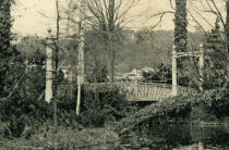
(footbridge)
Aurec-sur-Loire, Haute-Loire, France - Loire River
| Bridgemeister ID: | 6806 (added 2021-11-21) |
| Name: | (footbridge) |
| Location: | Aurec-sur-Loire, Haute-Loire, France |
| Crossing: | Loire River |
| Coordinates: | 45.369532 N 4.197222 E |
| Maps: | Acme, GeoHack, Google, OpenStreetMap |
| Use: | Footbridge |
| Status: | In use (last checked: 2021) |
| Main Cables: | Wire (steel) |
| Suspended Spans: | 3 |
| Main Span: | 1 |
| Side Spans: | 2 |
Notes:
- 2010s: This suspension footbridge is installed on the piers of the old vehicular suspension bridge at this location.
- At former location of 1892 Aurec-sur-Loire - Aurec-sur-Loire, Haute-Loire, France.
(footbridge)
Auzat-la-Combelle, Puy-de-Dôme, France
| Bridgemeister ID: | 7538 (added 2023-01-22) |
| Name: | (footbridge) |
| Location: | Auzat-la-Combelle, Puy-de-Dôme, France |
| Use: | Footbridge |
| Status: | Removed |
| Main Cables: | Wire (steel) |
| Suspended Spans: | 1 |
Notes:
- Location known as Auzat-sur-Allier at the time the bridge was completed.
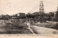
(footbridge)
Avignonet, Isère, France - Drac River
| Bridgemeister ID: | 8220 (added 2024-02-06) |
| Name: | (footbridge) |
| Location: | Avignonet, Isère, France |
| Crossing: | Drac River |
| At or Near Feature: | Avignonet Hydroelectric Plant |
| Use: | Footbridge |
| Main Span: | 1 |
Notes:
- Exact location of this bridge is unclear, but likely in close proximity to the current (as of 2023) Drac River dam at Avignonet.
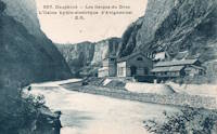
(footbridge)
Île de Bercy and Île de Reuilly, Paris, France - Lac Daumesnil
| Bridgemeister ID: | 7904 (added 2023-10-15) |
| Name: | (footbridge) |
| Location: | Île de Bercy and Île de Reuilly, Paris, France |
| Crossing: | Lac Daumesnil |
| Coordinates: | 48.831052 N 2.412569 E |
| Maps: | Acme, GeoHack, Google, OpenStreetMap |
| Use: | Footbridge |
| Status: | In use (last checked: 2023) |
| Main Cables: | Wire |
| Suspended Spans: | 1 |
Notes:
(footbridge)
Île de Reuilly, Paris, France - Lac Daumesnil
| Bridgemeister ID: | 7905 (added 2023-10-15) |
| Name: | (footbridge) |
| Location: | Île de Reuilly, Paris, France |
| Crossing: | Lac Daumesnil |
| Coordinates: | 48.829803 N 2.415193 E |
| Maps: | Acme, GeoHack, Google, OpenStreetMap |
| Use: | Footbridge |
| Status: | In use (last checked: 2023) |
| Main Cables: | Wire |
| Suspended Spans: | 1 |
Notes:

(footbridge)
Coupvray, Seine-et-Marne, France - Chalifert Canal
| Bridgemeister ID: | 1517 (added 2004-10-10) |
| Name: | (footbridge) |
| Location: | Coupvray, Seine-et-Marne, France |
| Crossing: | Chalifert Canal |
| Coordinates: | 48.896971 N 2.796701 E |
| Maps: | Acme, GeoHack, Google, OpenStreetMap |
| Principals: | Freyssinet International |
| Use: | Footbridge |
| Status: | Extant (last checked: 2019) |
| Main Cables: | Wire (steel) |
| Suspended Spans: | 1 |
| Main Span: | 1 x 34 meters (111.5 feet) |
External Links:
(footbridge)
Injoux-Génissiat, Ain and Franclens, Haute-Savoie, France - Rhône River
| Bridgemeister ID: | 7403 (added 2022-12-03) |
| Name: | (footbridge) |
| Location: | Injoux-Génissiat, Ain and Franclens, Haute-Savoie, France |
| Crossing: | Rhône River |
| At or Near Feature: | Barrage de Génissiat |
| Coordinates: | 46.050202 N 5.811581 E |
| Maps: | Acme, GeoHack, Google, OpenStreetMap |
| Use: | Footbridge |
| Status: | Removed |
| Main Cables: | Wire (steel) |
| Suspended Spans: | 1 |
Notes:
- Likely built around 1946-1947 during construction of the Génissiat dam.
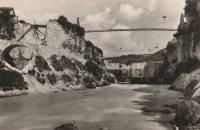
(footbridge)
Joué-lèz-Tours, Indre-et-Loire, France
| Bridgemeister ID: | 7758 (added 2023-07-23) |
| Name: | (footbridge) |
| Location: | Joué-lèz-Tours, Indre-et-Loire, France |
| Coordinates: | 47.335385 N 0.668899 E |
| Maps: | Acme, GeoHack, Google, OpenStreetMap |
| Use: | Footbridge |
| Status: | Removed |
| Main Cables: | Wire |
| Suspended Spans: | 1 |
Notes:
- Coordinates provided appear to be the approximate vicinity of the bridge, crossing the north/south rail line.
(footbridge)
Saint-Thibéry, Hérault, France - Hérault River
| Bridgemeister ID: | 4555 (added 2020-06-01) |
| Name: | (footbridge) |
| Location: | Saint-Thibéry, Hérault, France |
| Crossing: | Hérault River |
| Coordinates: | 43.398414 N 3.422952 E |
| Maps: | Acme, GeoHack, Google, OpenStreetMap |
| Use: | Footbridge |
| Status: | Extant (last checked: 2021) |
| Main Cables: | Wire |
| Suspended Spans: | 3 |
| Main Span: | 1 |
| Side Spans: | 2 |
External Links:
(footbridge)
Toulouse, Haute-Garonne, France - Canal de Brienne
| Bridgemeister ID: | 4565 (added 2020-06-02) |
| Name: | (footbridge) |
| Location: | Toulouse, Haute-Garonne, France |
| Crossing: | Canal de Brienne |
| Coordinates: | 43.608793 N 1.423906 E |
| Maps: | Acme, GeoHack, Google, OpenStreetMap |
| Use: | Footbridge |
| Status: | In use (last checked: 2018) |
| Main Cables: | Wire (steel) |
| Suspended Spans: | 1 |
External Links:
(footbridge)
Varreddes, Seine-et-Marne, France - Marne River
| Bridgemeister ID: | 7811 (added 2023-09-02) |
| Name: | (footbridge) |
| Location: | Varreddes, Seine-et-Marne, France |
| Crossing: | Marne River |
| Coordinates: | 48.994274 N 2.941771 E |
| Maps: | Acme, GeoHack, Google, OpenStreetMap |
| Use: | Footbridge |
| Status: | Removed |
| Main Cables: | Wire |
Notes:
- Appears to have been a temporary footbridge following the destruction of a multi-span arch bridge.
(pipeline bridge)
Argancy, Moselle, France - Moselle/Mosel River
| Bridgemeister ID: | 4688 (added 2020-06-20) |
| Name: | (pipeline bridge) |
| Location: | Argancy, Moselle, France |
| Crossing: | Moselle/Mosel River |
| Coordinates: | 49.193081 N 6.194095 E |
| Maps: | Acme, GeoHack, Google, OpenStreetMap |
| Use: | Pipeline |
| Status: | Extant (last checked: 2019) |
| Main Cables: | Wire (steel) |
| Suspended Spans: | 1 |
External Links:
(pipeline bridge)
Billère and Jurançon, Pyrénées-Atlantiques, France - Ousse River
| Bridgemeister ID: | 4564 (added 2020-06-02) |
| Name: | (pipeline bridge) |
| Location: | Billère and Jurançon, Pyrénées-Atlantiques, France |
| Crossing: | Ousse River |
| Coordinates: | 43.293272 N 0.395823 W |
| Maps: | Acme, GeoHack, Google, OpenStreetMap |
| Use: | Pipeline |
| Status: | Extant (last checked: 2019) |
| Main Cables: | Wire (steel) |
| Suspended Spans: | 1 |
External Links:
(pipeline bridge)
Blénod-lès-Pont-à-Mousson and Loisy, Meurthe-et-Moselle, France - Moselle/Mosel River
| Bridgemeister ID: | 4731 (added 2020-06-27) |
| Name: | (pipeline bridge) |
| Location: | Blénod-lès-Pont-à-Mousson and Loisy, Meurthe-et-Moselle, France |
| Crossing: | Moselle/Mosel River |
| Coordinates: | 48.878972 N 6.087439 E |
| Maps: | Acme, GeoHack, Google, OpenStreetMap |
| Use: | Pipeline |
| Status: | Extant (last checked: 2016) |
| Main Cables: | Wire (steel) |
| Main Spans: | 2 |
External Links:
(pipeline bridge)
Lacq and Abidos, Pyrénées-Atlantiques, France - Ousse River
| Bridgemeister ID: | 7969 (added 2023-11-25) |
| Name: | (pipeline bridge) |
| Location: | Lacq and Abidos, Pyrénées-Atlantiques, France |
| Crossing: | Ousse River |
| Coordinates: | 43.404000 N 0.624194 W |
| Maps: | Acme, GeoHack, Google, OpenStreetMap |
| Use: | Pipeline |
| Status: | Extant (last checked: 2023) |
| Main Cables: | Wire (steel) |
| Suspended Spans: | 1 |
| Main Span: | 1 x 77 meters (252.6 feet) estimated |
Notes:
(pipeline bridge)
Lacq and Abidos, Pyrénées-Atlantiques, France - Ousse River
| Bridgemeister ID: | 7970 (added 2023-11-25) |
| Name: | (pipeline bridge) |
| Location: | Lacq and Abidos, Pyrénées-Atlantiques, France |
| Crossing: | Ousse River |
| Coordinates: | 43.403083 N 0.624667 W |
| Maps: | Acme, GeoHack, Google, OpenStreetMap |
| Use: | Pipeline |
| Status: | Extant (last checked: 2023) |
| Main Cables: | Wire (steel) |
| Main Span: | 1 x 89 meters (292 feet) estimated |
Notes:
(suspension bridge)
Castillon-de-Castets, Gironde, France - Canal Latéral à la Garonne
| Bridgemeister ID: | 8384 (added 2024-02-12) |
| Name: | (suspension bridge) |
| Location: | Castillon-de-Castets, Gironde, France |
| Crossing: | Canal Latéral à la Garonne |
| Status: | Removed |
| Suspended Spans: | 1 |
(suspension bridge)
Fontet, Gironde, France - Canal Latéral à la Garonne
| Bridgemeister ID: | 8383 (added 2024-02-12) |
| Name: | (suspension bridge) |
| Location: | Fontet, Gironde, France |
| Crossing: | Canal Latéral à la Garonne |
| Status: | Removed |
| Suspended Spans: | 1 |
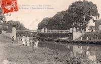
(suspension bridge)
Laragne-Montéglin, Hautes-Alpes, France - Buëch River
| Bridgemeister ID: | 8293 (added 2024-02-08) |
| Name: | (suspension bridge) |
| Location: | Laragne-Montéglin, Hautes-Alpes, France |
| Crossing: | Buëch River |
| Use: | Vehicular |
| Suspended Spans: | 1 |
(suspension bridge)
Martres-Tolosane, Haute-Garonne, France - Garonne River
| Bridgemeister ID: | 7397 (added 2022-12-03) |
| Name: | (suspension bridge) |
| Location: | Martres-Tolosane, Haute-Garonne, France |
| Crossing: | Garonne River |
| Coordinates: | 43.181757 N 0.991939 E |
| Maps: | Acme, GeoHack, Google, OpenStreetMap |
| Use: | Vehicular (one-lane), with walkway |
| Status: | Closed (last checked: 2022) |
| Main Cables: | Wire (steel) |
| Suspended Spans: | 1 |
| Main Span: | 1 x 135 meters (442.9 feet) estimated |
(suspension bridge)
Mont, Pyrénées-Atlantiques, France - Ousse River
| Bridgemeister ID: | 7971 (added 2023-11-25) |
| Name: | (suspension bridge) |
| Location: | Mont, Pyrénées-Atlantiques, France |
| Crossing: | Ousse River |
| Coordinates: | 43.427944 N 0.679028 W |
| Maps: | Acme, GeoHack, Google, OpenStreetMap |
| Use: | Vehicular (one-lane) and Pipeline |
| Status: | Removed, c. 2015-2017 |
| Main Cables: | Wire (steel) |
| Main Span: | 1 x 10⁴ meters (341.2 feet) estimated |
Notes:
- Industrial bridge removed at some point in the 2015-2017 time frame. Appears to have carried two pipelines and one lane for vehicles.
(suspension bridge)
Pompignan, Grisolles vicinity, Tarn-et-Garonne, France - Canal Latéral à la Garonne
| Bridgemeister ID: | 7462 (added 2022-12-25) |
| Name: | (suspension bridge) |
| Location: | Pompignan, Grisolles vicinity, Tarn-et-Garonne, France |
| Crossing: | Canal Latéral à la Garonne |
| Status: | Removed |
| Suspended Spans: | 1 |
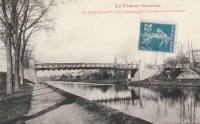
(suspension bridge)
Pont-de-Salars, Aveyron, France - Pont-de-Salars Lake
| Bridgemeister ID: | 5677 (added 2021-03-13) |
| Name: | (suspension bridge) |
| Location: | Pont-de-Salars, Aveyron, France |
| Crossing: | Pont-de-Salars Lake |
| Use: | Vehicular (one-lane) |
| Main Cables: | Wire (steel) |
| Suspended Spans: | 1 |
Notes:
- Appears to have once crossed an arm of the Lac de Pont-de-Salars, a reservoir formed by damming the Viaur River.
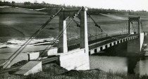
(suspension bridge)
Ribecourt, Oise, France - Oise River
| Bridgemeister ID: | 5049 (added 2020-08-25) |
| Name: | (suspension bridge) |
| Location: | Ribecourt, Oise, France |
| Crossing: | Oise River |
| Use: | Vehicular |
| Main Cables: | Wire |
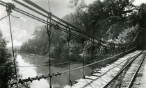
(suspension bridge)
Saint-Perreux, Morbihan, France - Nantes-Brest Canal
| Bridgemeister ID: | 8148 (added 2024-02-02) |
| Name: | (suspension bridge) |
| Location: | Saint-Perreux, Morbihan, France |
| Crossing: | Nantes-Brest Canal |
| Use: | Vehicular |
| Suspended Spans: | 1 |
Notes:
- Near 1836 Saint-Perreux - Saint-Perreux, Morbihan and Redon, Ille-et-Vilaine, France.
- See Redon - Redon, Ille-et-Vilaine, France which may be the same bridge as the one pictured here. The canal runs between the nearby towns of Redon and Saint-Perreux.
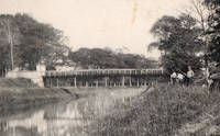
(suspension bridge)
Saint-Vit and Roset-Fluans, Doubs, France - Doubs River
| Bridgemeister ID: | 3225 (added 2019-11-11) |
| Name: | (suspension bridge) |
| Location: | Saint-Vit and Roset-Fluans, Doubs, France |
| Crossing: | Doubs River |
| Coordinates: | 47.165711 N 5.830071 E |
| Maps: | Acme, GeoHack, Google, OpenStreetMap |
| Use: | Vehicular |
| Status: | In use (last checked: 2016) |
| Main Cables: | Wire (steel) |
| Suspended Spans: | 3 |
| Main Span: | 1 x 79 meters (259.2 feet) estimated |
| Side Spans: | 2 |
Notes:
- See Saint-Vit - Saint-Vit and Roset-Fluans, Doubs, France. Unclear if the present-day (2019) bridge is at the same location.
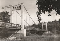
(suspension bridge)
Sainte-Marguerite-Lafigère, Ardèche and Gard, France - Chassezac River
| Bridgemeister ID: | 3180 (added 2019-11-09) |
| Name: | (suspension bridge) |
| Location: | Sainte-Marguerite-Lafigère, Ardèche and Gard, France |
| Crossing: | Chassezac River |
| Use: | Vehicular (one-lane) |
| Status: | Removed |
| Suspended Spans: | 1 |
(suspension bridge)
Tencin and La Terrasse, Isère, France - Isère River
| Bridgemeister ID: | 3194 (added 2019-11-10) |
| Name: | (suspension bridge) |
| Location: | Tencin and La Terrasse, Isère, France |
| Crossing: | Isère River |
| Coordinates: | 45.315937 N 5.945173 E |
| Maps: | Acme, GeoHack, Google, OpenStreetMap |
| Use: | Vehicular (one-lane) |
| Status: | In use (last checked: 2019) |
| Main Cables: | Wire (steel) |
| Suspended Spans: | 1 |
Notes:
- At former location of (suspension bridge) - Tencin and La Terrasse, Isère, France. Unclear if the newer bridge was an immediate replacement.
(suspension bridge)
Tencin and La Terrasse, Isère, France - Isère River
| Bridgemeister ID: | 5666 (added 2021-01-24) |
| Name: | (suspension bridge) |
| Location: | Tencin and La Terrasse, Isère, France |
| Crossing: | Isère River |
| Coordinates: | 45.315676 N 5.945550 E |
| Maps: | Acme, GeoHack, Google, OpenStreetMap |
| Use: | Vehicular (one-lane) |
| Status: | Removed |
| Main Cables: | Wire |
| Suspended Spans: | 1 |
Notes:
- Coordinates are for the present day (2021) suspension bridge at this location. This older suspension bridge appears to have been built on the same alignment or extremely close to it.
- Later at same location (suspension bridge) - Tencin and La Terrasse, Isère, France. Unclear if the later bridge was an immediate replacement.
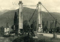
(suspension bridge)
Valence-d'Agen, Tarn-et-Garonne, France - Canal Latéral à la Garonne
| Bridgemeister ID: | 2065 (added 2006-06-06) |
| Name: | (suspension bridge) |
| Location: | Valence-d'Agen, Tarn-et-Garonne, France |
| Crossing: | Canal Latéral à la Garonne |
| Use: | Vehicular |
| Main Cables: | Wire |
| Suspended Spans: | 1 |
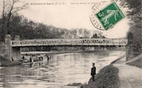
Ablancourt
Ablancourt, Marne, France - Marne River
| Bridgemeister ID: | 7389 (added 2022-11-25) |
| Name: | Ablancourt |
| Location: | Ablancourt, Marne, France |
| Crossing: | Marne River |
| Status: | Removed |
| Main Cables: | Wire |
| Suspended Spans: | 1 |
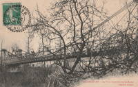
| Bridgemeister ID: | 1944 (added 2005-10-29) |
| Name: | Albas |
| Location: | Albas, Lot, France |
| Crossing: | Lot River |
| Coordinates: | 44.471604 N 1.236137 E |
| Maps: | Acme, GeoHack, Google, OpenStreetMap |
| Use: | Vehicular (one-lane) |
| Status: | In use (last checked: 2023) |
| Main Cables: | Wire (steel) |
| Suspended Spans: | 1 |
| Main Span: | 1 x 116 meters (380.6 feet) estimated |
External Links:
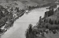
Assat
Assat, Pyrénées-Atlantiques, France - Ousse
| Bridgemeister ID: | 5575 (added 2020-12-20) |
| Name: | Assat |
| Location: | Assat, Pyrénées-Atlantiques, France |
| Crossing: | Ousse |
| Use: | Vehicular (one-lane) |
| Status: | Removed |
| Main Cables: | Wire |
| Suspended Spans: | 1 |
Notes:
- See 1938 Assat - Assat and Narcastet, Pyrénées-Atlantiques, France. The relationship between the two bridges is unclear, but likely the 1938 bridge was a direct replacement.
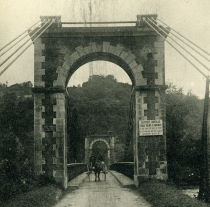
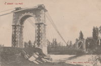
Auguste Dubois
Massoins and Malaussène, Alpes-Maritimes, France - Var River
| Bridgemeister ID: | 1995 (added 2005-12-18) |
| Name: | Auguste Dubois |
| Also Known As: | Massoins |
| Location: | Massoins and Malaussène, Alpes-Maritimes, France |
| Crossing: | Var River |
| Coordinates: | 43.933042 N 7.119215 E |
| Maps: | Acme, GeoHack, Google, OpenStreetMap |
| Use: | Vehicular (one-lane) |
| Status: | In use (last checked: 2021) |
| Main Cables: | Wire (steel) |
| Suspended Spans: | 1 |
External Links:
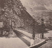
Auriac
Saint-Merd-de-Lapleau, Auriac vicinity, Corrèze, France - Dordogne River
| Bridgemeister ID: | 3066 (added 2019-10-26) |
| Name: | Auriac |
| Also Known As: | Chambon |
| Location: | Saint-Merd-de-Lapleau, Auriac vicinity, Corrèze, France |
| Crossing: | Dordogne River |
| Coordinates: | 45.219999 N 2.112607 E |
| Maps: | Acme, GeoHack, Google, OpenStreetMap |
| Use: | Vehicular |
| Status: | In use (last checked: 2019) |
| Main Cables: | Wire (steel) |
| Suspended Spans: | 1 |
Notes:
- At former location of 1850 Chambon - Saint-Merd-de-Lapleau, Auriac vicinity, Corrèze, France.
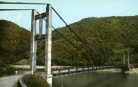
Autevielle
Autevielle-Saint-Martin-Bideren, Pyrénées-Atlantiques, France - Gave d'Oloron
| Bridgemeister ID: | 7813 (added 2023-09-02) |
| Name: | Autevielle |
| Location: | Autevielle-Saint-Martin-Bideren, Pyrénées-Atlantiques, France |
| Crossing: | Gave d'Oloron |
| Use: | Vehicular (one-lane) |
| Status: | Removed |
| Main Cables: | Wire |
| Main Span: | 1 |
Auvillar
Auvillar and Espalais, Tarn-et-Garonne, France - Garonne River
| Bridgemeister ID: | 3716 (added 2020-02-14) |
| Name: | Auvillar |
| Location: | Auvillar and Espalais, Tarn-et-Garonne, France |
| Crossing: | Garonne River |
| Coordinates: | 44.075099 N 0.897564 E |
| Maps: | Acme, GeoHack, Google, OpenStreetMap |
| Use: | Vehicular (two-lane) |
| Status: | In use (last checked: 2020) |
| Main Cables: | Wire (steel) |
| Suspended Spans: | 3 |
| Main Span: | 1 |
| Side Spans: | 2 |
Notes:
- At former location of 1845 Auvillar - Auvillar and Espalais, Tarn-et-Garonne, France. Unclear if the newer bridge was a direct replacement for the older bridge.
External Links:
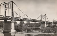
Bailly
Bailly, Oise, France - Oise River
| Bridgemeister ID: | 2985 (added 2019-10-12) |
| Name: | Bailly |
| Location: | Bailly, Oise, France |
| Crossing: | Oise River |
| Use: | Vehicular (one-lane) |
| Status: | Removed |
| Main Cables: | Wire |
| Suspended Spans: | 1 |
External Links:
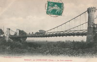
Bas-Monistrol
Bas-en-Basset and Monistrol-sur-Loire, Haute-Loire, France - Loire River
| Bridgemeister ID: | 3334 (added 2019-12-08) |
| Name: | Bas-Monistrol |
| Location: | Bas-en-Basset and Monistrol-sur-Loire, Haute-Loire, France |
| Crossing: | Loire River |
| Coordinates: | 45.294889 N 4.118132 E |
| Maps: | Acme, GeoHack, Google, OpenStreetMap |
| References: | AAJ |
| Use: | Vehicular |
| Status: | Only towers remain (last checked: 2018) |
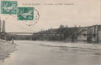
Beauchastel
Beauchastel, Ardèche, France - Eyrieux River
| Bridgemeister ID: | 4063 (added 2020-03-30) |
| Name: | Beauchastel |
| Location: | Beauchastel, Ardèche, France |
| Crossing: | Eyrieux River |
| References: | AAJ |
| Use: | Vehicular |
| Status: | Removed |
| Main Cables: | Wire (iron) |
Notes:
- AAJ supposes this bridge was completed in 1842 based on a contract let in 1840 proposing a two-year construction period, but other material suggest the bridge was built later.
External Links:
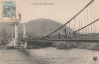
Beaulieu-sur-Dordogne
Beaulieu-sur-Dordogne, Corrèze, France - Dordogne River
| Bridgemeister ID: | 1177 (added 2004-01-24) |
| Name: | Beaulieu-sur-Dordogne |
| Location: | Beaulieu-sur-Dordogne, Corrèze, France |
| Crossing: | Dordogne River |
| Use: | Vehicular (one-lane) |
| Status: | Removed |
| Main Cables: | Wire (iron) |
| Suspended Spans: | 2 |
| Main Spans: | 2 |
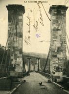
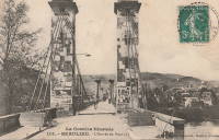
Bollène
Bollène, Vaucluse, France - Donzère Canal
| Bridgemeister ID: | 1583 (added 2005-01-22) |
| Name: | Bollène |
| Location: | Bollène, Vaucluse, France |
| Crossing: | Donzère Canal |
| Coordinates: | 44.284683 N 4.732283 E |
| Maps: | Acme, GeoHack, Google, OpenStreetMap |
| Use: | Vehicular (two-lane), with walkway |
| Status: | In use (last checked: 2023) |
| Main Cables: | Wire (steel) |
| Suspended Spans: | 3 |
| Main Span: | 1 |
| Side Spans: | 2 |
External Links:
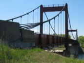
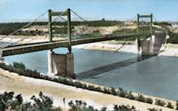
Bonneuil-Matours
Bonneuil-Matours, Vienne, France - Vienne River
| Bridgemeister ID: | 7556 (added 2023-03-19) |
| Name: | Bonneuil-Matours |
| Location: | Bonneuil-Matours, Vienne, France |
| Crossing: | Vienne River |
| Coordinates: | 46.681699 N 0.575330 E |
| Maps: | Acme, GeoHack, Google, OpenStreetMap |
| Use: | Vehicular |
| Status: | Removed |
| Main Cables: | Wire |
Notes:
- Later at same location 1932 Bonneuil-Matours - Bonneuil-Matours, Vienne, France. Unclear if the newer bridge is a direct replacement.
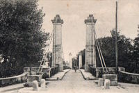
Bragny
Verdun-sur-le-Doubs and Bragny-sur-Saône, Saône-et-Loire, France - Saône River
| Bridgemeister ID: | 7370 (added 2022-11-05) |
| Name: | Bragny |
| Location: | Verdun-sur-le-Doubs and Bragny-sur-Saône, Saône-et-Loire, France |
| Crossing: | Saône River |
| Coordinates: | 46.902546 N 5.022619 E |
| Maps: | Acme, GeoHack, Google, OpenStreetMap |
| Use: | Vehicular |
| Status: | Removed |
| Main Cables: | Wire |
| Suspended Spans: | 3 |
| Main Span: | 1 |
| Side Spans: | 2 |
Notes:
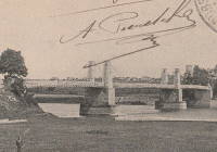
| Bridgemeister ID: | 2315 (added 2007-05-05) |
| Name: | Cajarc |
| Location: | Cajarc, Lot and Salvagnac-Cajarc, Aveyron, France |
| Crossing: | Lot River |
| Coordinates: | 44.482974 N 1.844528 E |
| Maps: | Acme, GeoHack, Google, OpenStreetMap |
| Use: | Vehicular (one-lane), with walkway |
| Status: | In use (last checked: 2021) |
| Main Cables: | Wire (steel) |
| Suspended Spans: | 1 |
| Main Span: | 1 x 100 meters (328.1 feet) estimated |
External Links:
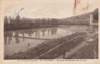
Cambo-les-Bains
Cambo-les-Bains, Pyrénées-Atlantiques, France - Nive River
| Bridgemeister ID: | 1170 (added 2004-01-23) |
| Name: | Cambo-les-Bains |
| Location: | Cambo-les-Bains, Pyrénées-Atlantiques, France |
| Crossing: | Nive River |
| Use: | Vehicular |
| Status: | Removed |
| Main Cables: | Wire (iron) |
| Suspended Spans: | 1 |
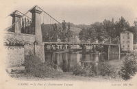
Canet
Canet and Le Pouget, Hérault, France - Hérault River
| Bridgemeister ID: | 4557 (added 2020-06-01) |
| Name: | Canet |
| Location: | Canet and Le Pouget, Hérault, France |
| Crossing: | Hérault River |
| Coordinates: | 43.597574 N 3.492968 E |
| Maps: | Acme, GeoHack, Google, OpenStreetMap |
| Use: | Vehicular (two-lane) |
| Status: | In use (last checked: 2018) |
| Main Cables: | Wire (steel) |
| Suspended Spans: | 1 |
| Main Span: | 1 x 110 meters (360.9 feet) estimated |
Notes:
- Completed in 1930 or late 1920s.
- 2017: A cable snaps. The bridge is closed for temporary repairs and reopened.
- 2020, October: Closed for more substantial repairs including replacement of all of the suspender cables and reinforcement of the anchorages.
- 2021, July: The bridge is reopened.
- Replaced 1874 Canet - Canet and Le Pouget, Hérault, France.
External Links:
| Bridgemeister ID: | 7860 (added 2023-09-15) |
| Name: | Canne |
| Location: | Cercy-la-Tour, Nièvre, France |
| Crossing: | La Canne |
| Coordinates: | 46.867109 N 3.640361 E |
| Maps: | Acme, GeoHack, Google, OpenStreetMap |
| Use: | Vehicular (one-lane) |
| Status: | Restricted to foot traffic (last checked: 2022) |
| Suspended Spans: | 1 |
| Main Span: | 1 x 14 meters (45.9 feet) estimated |
Notes:
External Links:
- Art-et-Histoire - Pont de Cercy-La-Tour sur la Canne - < 1835. Cites records mentioning a suspension bridge constructed here prior to 1835.
Cannes Écluse
Cannes Écluse, Montereau-Fault-Yonne vicinity, Seine-et-Marne, France - Yonne River
| Bridgemeister ID: | 2115 (added 2006-09-09) |
| Name: | Cannes Écluse |
| Location: | Cannes Écluse, Montereau-Fault-Yonne vicinity, Seine-et-Marne, France |
| Crossing: | Yonne River |
| Coordinates: | 48.366889 N 2.984011 E |
| Maps: | Acme, GeoHack, Google, OpenStreetMap |
| Use: | Vehicular |
| Status: | Destroyed, June 14, 1940 |
| Main Cables: | Wire |
| Suspended Spans: | 1 |
Notes:
- There may have been another suspension bridge in the Montereau vicinity crossing the Seine. The bridge pictured here was definitely located at the indicated coordinates, crossing the Yonne.
- Destroyed by French troops to slow the progression of the German army.
| Bridgemeister ID: | 1949 (added 2005-11-04) |
| Name: | Castelfranc |
| Location: | Castelfranc, Lot, France |
| Crossing: | Lot River |
| Coordinates: | 44.499927 N 1.220113 E |
| Maps: | Acme, GeoHack, Google, OpenStreetMap |
| Use: | Vehicular (one-lane) |
| Status: | In use (last checked: 2011) |
| Main Cables: | Wire (steel) |
| Suspended Spans: | 1 |
Notes:
- At former location of Castelfranc - Castelfranc, Lot, France. Unclear if one bridge was an immediate replacement for the other.
External Links:
| Bridgemeister ID: | 7478 (added 2022-12-25) |
| Name: | Castelfranc |
| Location: | Castelfranc, Lot, France |
| Crossing: | Lot River |
| Coordinates: | 44.500180 N 1.220295 E |
| Maps: | Acme, GeoHack, Google, OpenStreetMap |
| Use: | Vehicular |
| Status: | Removed |
| Main Cables: | Wire (iron) |
| Suspended Spans: | 1 |
Notes:
- Later at same location Castelfranc - Castelfranc, Lot, France. Unclear if the newer bridge was an immediate replacement.
Castillon
Castillon-la-Bataille, Gironde, France - Dordogne River
| Bridgemeister ID: | 2961 (added 2019-10-06) |
| Name: | Castillon |
| Location: | Castillon-la-Bataille, Gironde, France |
| Crossing: | Dordogne River |
| Use: | Vehicular |
| Status: | Removed |
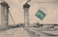
Caucalières
Caucalières, Tarn, France - Thoré River
| Bridgemeister ID: | 4845 (added 2020-07-11) |
| Name: | Caucalières |
| Location: | Caucalières, Tarn, France |
| Crossing: | Thoré River |
| Coordinates: | 43.521887 N 2.312212 E |
| Maps: | Acme, GeoHack, Google, OpenStreetMap |
| Use: | Vehicular (one-lane) |
| Status: | Removed |
| Main Cables: | Wire |
| Suspended Spans: | 1 |
Notes:
- Coordinates indicate likely location. It appears the present day (2020) truss bridge was installed on the former suspension bridge's abutments.
Cazals
Cazals, Tarn-et-Garonne, France - Aveyron River
| Bridgemeister ID: | 2348 (added 2007-08-18) |
| Name: | Cazals |
| Location: | Cazals, Tarn-et-Garonne, France |
| Crossing: | Aveyron River |
| Coordinates: | 44.117162 N 1.722510 E |
| Maps: | Acme, GeoHack, Google, OpenStreetMap |
| Use: | Vehicular (one-lane) |
| Status: | In use (last checked: 2016) |
| Main Cables: | Wire (steel) |
| Suspended Spans: | 1 |
External Links:
| Bridgemeister ID: | 4545 (added 2020-05-30) |
| Name: | Cazouls |
| Also Known As: | Gaston-Doumergue |
| Location: | Thézan-lès-Béziers, Hérault, France |
| Crossing: | Orb River |
| Coordinates: | 43.412204 N 3.131734 E |
| Maps: | Acme, GeoHack, Google, OpenStreetMap |
| Use: | Vehicular (one-lane) |
| Status: | In use (last checked: 2019) |
| Main Cables: | Wire (steel) |
| Suspended Spans: | 1 |
| Main Span: | 1 x 121.5 meters (398.6 feet) estimated |
External Links:
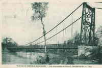
Cézy
Cézy and Saint-Aubin-sur-Yonne, Yonne, France - Yonne River
| Bridgemeister ID: | 2054 (added 2006-06-02) |
| Name: | Cézy |
| Also Known As: | Jacques Cœur |
| Location: | Cézy and Saint-Aubin-sur-Yonne, Yonne, France |
| Crossing: | Yonne River |
| Coordinates: | 47.993878 N 3.343591 E |
| Maps: | Acme, GeoHack, Google, OpenStreetMap |
| Use: | Vehicular (one-lane), with walkway |
| Status: | In use (last checked: 2019) |
| Main Cables: | Wire |
| Suspended Spans: | 1 |
Cendrecourt
Cendrecourt, Haute-Saône, France - Saône River
| Bridgemeister ID: | 4720 (added 2020-06-26) |
| Name: | Cendrecourt |
| Location: | Cendrecourt, Haute-Saône, France |
| Crossing: | Saône River |
| Coordinates: | 47.840527 N 5.917462 E |
| Maps: | Acme, GeoHack, Google, OpenStreetMap |
| References: | AAJ |
| Use: | Vehicular |
| Status: | Destroyed, 1940 |
| Main Cables: | Wire |
| Suspended Spans: | 1 |
Cercy-la-Tour
Cercy-la-Tour, Nièvre, France - Aron River
| Bridgemeister ID: | 2067 (added 2006-06-06) |
| Name: | Cercy-la-Tour |
| Location: | Cercy-la-Tour, Nièvre, France |
| Crossing: | Aron River |
| Use: | Vehicular |
| Status: | Removed |
| Suspended Spans: | 1 |
Notes:
External Links:
| Bridgemeister ID: | 2357 (added 2007-09-03) |
| Name: | Cessenon-sur-Orb |
| Location: | Cessenon-sur-Orb, Hérault, France |
| Crossing: | Orb River |
| Coordinates: | 43.451300 N 3.046790 E |
| Maps: | Acme, GeoHack, Google, OpenStreetMap |
| Use: | Vehicular (one-lane) |
| Status: | In use (last checked: 2019) |
| Main Cables: | Wire (steel) |
| Suspended Spans: | 1 |
Notes:
External Links:
Charles Albert
La Roquette-sur-Var, Alpes-Maritimes, France - Var River
| Bridgemeister ID: | 7861 (added 2023-09-15) |
| Name: | Charles Albert |
| Location: | La Roquette-sur-Var, Alpes-Maritimes, France |
| Crossing: | Var River |
| Coordinates: | 43.838089 N 7.192564 E |
| Maps: | Acme, GeoHack, Google, OpenStreetMap |
| Use: | Vehicular |
| Status: | Removed |
| Main Cables: | Wire (iron) |
| Main Span: | 1 |
| Side Spans: | 2 |
External Links:
Charleville
Charleville-Mézières, Ardennes, France - Meuse River
| Bridgemeister ID: | 7411 (added 2022-12-04) |
| Name: | Charleville |
| Location: | Charleville-Mézières, Ardennes, France |
| Crossing: | Meuse River |
| Coordinates: | 49.775831 N 4.725261 E |
| Maps: | Acme, GeoHack, Google, OpenStreetMap |
| Use: | Vehicular |
| Status: | Removed |
| Suspended Spans: | 1 |
Notes:
- Coordinates provided here appear to be the approximate location of this bridge.
- Near future location of 1933 Mont-Olympe - Charleville-Mézières, Ardennes, France.
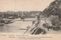
Châteauneuf-sur-Isère
Châteauneuf-sur-Isère and Beaumont-Monteux, Drôme, France - Isère River
| Bridgemeister ID: | 4879 (added 2020-07-18) |
| Name: | Châteauneuf-sur-Isère |
| Location: | Châteauneuf-sur-Isère and Beaumont-Monteux, Drôme, France |
| Crossing: | Isère River |
| Use: | Vehicular |
| Status: | Removed |
| Main Cables: | Wire (iron) |
External Links:
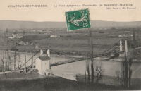
Chemin de l'Ile
Montélimar, Drôme and Le Teil, Ardèche, France - Canal de Dérivation de Montélimar
| Bridgemeister ID: | 2218 (added 2007-02-14) |
| Name: | Chemin de l'Ile |
| Location: | Montélimar, Drôme and Le Teil, Ardèche, France |
| Crossing: | Canal de Dérivation de Montélimar |
| Coordinates: | 44.534814 N 4.726179 E |
| Maps: | Acme, GeoHack, Google, OpenStreetMap |
| Use: | Vehicular (one-lane), with walkway |
| Status: | In use (last checked: 2018) |
| Main Cables: | Wire (steel) |
| Suspended Spans: | 3 |
| Main Span: | 1 |
| Side Spans: | 2 |
External Links:
Collonges
Collonges-au-Mont-d'Or, Métropole de Lyon, France - Saône River
| Bridgemeister ID: | 2964 (added 2019-10-10) |
| Name: | Collonges |
| Location: | Collonges-au-Mont-d'Or, Métropole de Lyon, France |
| Crossing: | Saône River |
| Use: | Vehicular |
| Status: | Destroyed, September 2, 1944 |
| Main Cables: | Wire |
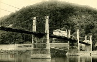
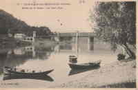
Condrieu
Condrieu, Rhône and Les Roches-de-Condrieu, Isère, France - Rhône River
| Bridgemeister ID: | 7506 (added 2023-01-02) |
| Name: | Condrieu |
| Location: | Condrieu, Rhône and Les Roches-de-Condrieu, Isère, France |
| Crossing: | Rhône River |
| Coordinates: | 45.456769 N 4.768646 E |
| Maps: | Acme, GeoHack, Google, OpenStreetMap |
| Use: | Vehicular |
| Status: | In use (last checked: 2022) |
| Main Cables: | Wire (steel) |
| Suspended Spans: | 2 |
| Main Spans: | 2 |
Notes:
- May have been completed in 1944.
- Replaced 1935 Condrieu - Condrieu, Rhône and Les Roches-de-Condrieu, Isère, France.
External Links:
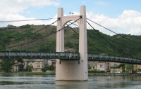

Conflandey
Conflandey, Haute-Saône, France - Saône River
| Bridgemeister ID: | 7388 (added 2022-11-24) |
| Name: | Conflandey |
| Location: | Conflandey, Haute-Saône, France |
| Crossing: | Saône River |
| Status: | Removed |
Cormery
Cormery and Truyes, Indre-et-Loire, France - Indre River
| Bridgemeister ID: | 1939 (added 2005-10-29) |
| Name: | Cormery |
| Location: | Cormery and Truyes, Indre-et-Loire, France |
| Crossing: | Indre River |
| Principals: | Joseph Chaley |
| References: | AAJ |
| Status: | Removed |
| Main Cables: | Wire (iron) |
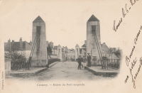
Coudes
Coudes, Montpeyroux vicinity and Parent, Puy-de-Dôme, France - Allier River
| Bridgemeister ID: | 3230 (added 2019-11-11) |
| Name: | Coudes |
| Location: | Coudes, Montpeyroux vicinity and Parent, Puy-de-Dôme, France |
| Crossing: | Allier River |
| Coordinates: | 45.615164 N 3.211313 E |
| Maps: | Acme, GeoHack, Google, OpenStreetMap |
| Use: | Vehicular |
| Status: | In use (last checked: 2013) |
| Main Cables: | Wire |
| Suspended Spans: | 1 |
Notes:
- At former location of 1855 Coudes - Coudes, Montpeyroux vicinity and Parent, Puy-de-Dôme, France. Unclear if the present-day (2019) bridge at Coudes replaced it.
Coutras
Coutras, Gironde, France - Dronne River
| Bridgemeister ID: | 2099 (added 2006-07-06) |
| Name: | Coutras |
| Location: | Coutras, Gironde, France |
| Crossing: | Dronne River |
| Coordinates: | 45.041857 N 0.132560 W |
| Maps: | Acme, GeoHack, Google, OpenStreetMap |
| Use: | Vehicular (one-lane) |
| Status: | Only towers remain (last checked: 2022) |
| Suspended Spans: | 1 |
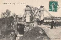
Coutras
Coutras, Gironde, France - Isle River
| Bridgemeister ID: | 7447 (added 2022-12-23) |
| Name: | Coutras |
| Location: | Coutras, Gironde, France |
| Crossing: | Isle River |
| At or Near Feature: | Canal de Laubardemont |
| Coordinates: | 45.033292 N 0.147358 W |
| Maps: | Acme, GeoHack, Google, OpenStreetMap |
| Status: | Only towers remain (last checked: 2022) |
| Suspended Spans: | 1 |
Créteil
Créteil-sur-Marne and Saint-Maur-des-Fossés, Val-de-Marne, France - Marne River
| Bridgemeister ID: | 2059 (added 2006-06-03) |
| Name: | Créteil |
| Also Known As: | Saint-Maur |
| Location: | Créteil-sur-Marne and Saint-Maur-des-Fossés, Val-de-Marne, France |
| Crossing: | Marne River |
| Use: | Vehicular (one-lane) |
| Status: | Removed |
| Main Cables: | Wire |
| Suspended Spans: | 1 |
Notes:
External Links:
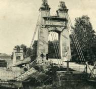
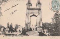
Dormans
Dormans, Marne and Aisne, France - Marne River
| Bridgemeister ID: | 1130 (added 2004-01-15) |
| Name: | Dormans |
| Location: | Dormans, Marne and Aisne, France |
| Crossing: | Marne River |
| Coordinates: | 49.075499 N 3.636878 E |
| Maps: | Acme, GeoHack, Google, OpenStreetMap |
| Use: | Vehicular (two-lane), with walkway |
| Status: | In use (last checked: 2016) |
| Main Cables: | Wire (steel) |
| Suspended Spans: | 1 |
| Main Span: | 1 x 81 meters (265.7 feet) estimated |
Notes:
External Links:
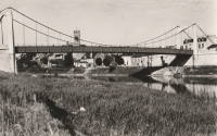
Dormans
Dormans, Marne and Aisne, France - Marne River
| Bridgemeister ID: | 1897 (added 2005-10-01) |
| Name: | Dormans |
| Location: | Dormans, Marne and Aisne, France |
| Crossing: | Marne River |
| Coordinates: | 49.075382 N 3.637095 E |
| Maps: | Acme, GeoHack, Google, OpenStreetMap |
| Use: | Vehicular |
| Status: | Removed |
| Suspended Spans: | 1 |
| Main Span: | 1 |
Notes:
- This is likely the second suspension bridge at Dormans bridge that was destroyed in 1918 and replaced with a Gisclard bridge, see Dormans Suspension Bridges
- At former location of Dormans - Dormans, Marne and Aisne, France.
- Later at same location Dormans - Dormans, Marne and Aisne, France.

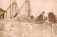
Dormans
Dormans, Marne and Aisne, France - Marne River
| Bridgemeister ID: | 7402 (added 2022-12-03) |
| Name: | Dormans |
| Location: | Dormans, Marne and Aisne, France |
| Crossing: | Marne River |
| Coordinates: | 49.075584 N 3.636702 E |
| Maps: | Acme, GeoHack, Google, OpenStreetMap |
| Use: | Vehicular |
| Status: | Replaced |
| Main Cables: | Wire (steel) |
| Suspended Spans: | 1 |
| Main Span: | 1 |
Notes:
- This bridge replaced the Gisclard bridge built at Dormans in 1918.
- At former location of Dormans - Dormans, Marne and Aisne, France.
- Replaced by Dormans - Dormans, Marne and Aisne, France.
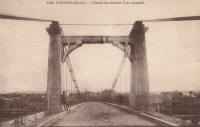
Dormans
Dormans, Marne and Aisne, France - Marne River
| Bridgemeister ID: | 7552 (added 2023-03-18) |
| Name: | Dormans |
| Location: | Dormans, Marne and Aisne, France |
| Crossing: | Marne River |
| Coordinates: | 49.075526 N 3.636749 E |
| Maps: | Acme, GeoHack, Google, OpenStreetMap |
| Use: | Vehicular |
| Status: | Replaced |
| Main Cables: | Wire (iron) |
| Suspended Spans: | 1 |
Notes:
- This is likely the first suspension bridge at Dormans
- Later at same location Dormans - Dormans, Marne and Aisne, France.
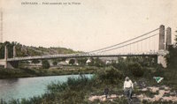
Esbly
Esbly, Seine-et-Marne, France - Chalifert Canal
| Bridgemeister ID: | 1448 (added 2004-07-31) |
| Name: | Esbly |
| Location: | Esbly, Seine-et-Marne, France |
| Crossing: | Chalifert Canal |
| Coordinates: | 48.90003 N 2.81762 E |
| Maps: | Acme, GeoHack, Google, OpenStreetMap |
| Use: | Vehicular (one-lane) |
| Status: | In use (last checked: 2021) |
| Main Cables: | Wire |
| Suspended Spans: | 1 |
Notes:
External Links:
Evry-Petit-Bourg
Étiolles, Soisy-sur-Seine vicinity and Évry, Essonne, France - Seine River
| Bridgemeister ID: | 2715 (added 2019-06-21) |
| Name: | Evry-Petit-Bourg |
| Location: | Étiolles, Soisy-sur-Seine vicinity and Évry, Essonne, France |
| Crossing: | Seine River |
| Coordinates: | 48.63661 N 2.455212 E |
| Maps: | Acme, GeoHack, Google, OpenStreetMap |
| Use: | Vehicular |
| Status: | Removed |
| Main Cables: | Wire |
| Suspended Spans: | 2 |
| Main Spans: | 2 |
Notes:
- Abutments still standing as of 2022.
External Links:

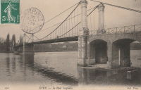
Eyguians
Lagrand and Eyguians, Hautes-Alpes, France - Buëch River
| Bridgemeister ID: | 2372 (added 2007-09-29) |
| Name: | Eyguians |
| Location: | Lagrand and Eyguians, Hautes-Alpes, France |
| Crossing: | Buëch River |
| Use: | Vehicular |
| Status: | Removed |
| Suspended Spans: | 1 |
Eylac
Saint-Martin-la-Méanne vicinity, Corrèze, France - Dordogne River
| Bridgemeister ID: | 3160 (added 2019-11-03) |
| Name: | Eylac |
| Location: | Saint-Martin-la-Méanne vicinity, Corrèze, France |
| Crossing: | Dordogne River |
| Coordinates: | 45.165692 N 2.007450 E |
| Maps: | Acme, GeoHack, Google, OpenStreetMap |
| Use: | Vehicular (one-lane) |
| Status: | Removed |
| Suspended Spans: | 1 |
Notes:
- Location inundated behind Chastang Dam. Coordinates are approximate location in the Dordogne valley. Unclear if the bridge was removed before the valley was inundated.

Feyzin
Feyzin, Métropole de Lyon, France - Rhône Canal
| Bridgemeister ID: | 6430 (added 2021-08-11) |
| Name: | Feyzin |
| Location: | Feyzin, Métropole de Lyon, France |
| Crossing: | Rhône Canal |
| Coordinates: | 45.666664 N 4.837612 E |
| Maps: | Acme, GeoHack, Google, OpenStreetMap |
| Use: | Vehicular (two-lane) |
| Status: | In use (last checked: 2019) |
| Main Cables: | Wire (steel) |
| Suspended Spans: | 1 |
Fourc
Fourc, Roquefort-sur-Garonne vicinity and Boussens, Haute-Garonne, France - Garonne River
| Bridgemeister ID: | 7398 (added 2022-12-03) |
| Name: | Fourc |
| Location: | Fourc, Roquefort-sur-Garonne vicinity and Boussens, Haute-Garonne, France |
| Crossing: | Garonne River |
| Coordinates: | 43.160816 N 0.962040 E |
| Maps: | Acme, GeoHack, Google, OpenStreetMap |
| Use: | Vehicular (two-lane), with walkway |
| Status: | In use (last checked: 2021) |
| Main Cables: | Wire (steel) |
| Suspended Spans: | 1 |
| Main Span: | 1 x 50 meters (164 feet) estimated |
Notes:
Fourc
Fourc, Roquefort-sur-Garonne vicinity and Boussens, Haute-Garonne, France - Garonne River
| Bridgemeister ID: | 7759 (added 2023-07-23) |
| Name: | Fourc |
| Location: | Fourc, Roquefort-sur-Garonne vicinity and Boussens, Haute-Garonne, France |
| Crossing: | Garonne River |
| Coordinates: | 43.160855 N 0.962032 E |
| Maps: | Acme, GeoHack, Google, OpenStreetMap |
| Status: | Removed |
Notes:
- Later at same location Fourc - Fourc, Roquefort-sur-Garonne vicinity and Boussens, Haute-Garonne, France.
Frans
Villefranche-sur-Saône, Rhône and Jassans-Riottier, Ain, France - Saône River
| Bridgemeister ID: | 5657 (added 2021-01-01) |
| Name: | Frans |
| Location: | Villefranche-sur-Saône, Rhône and Jassans-Riottier, Ain, France |
| Crossing: | Saône River |
| Coordinates: | 45.984570 N 4.750048 E |
| Maps: | Acme, GeoHack, Google, OpenStreetMap |
| References: | AAJ |
| Use: | Vehicular |
| Status: | Removed, 1900 |
| Main Cables: | Wire (iron) |
| Suspended Spans: | 2 |
| Main Spans: | 2 |
External Links:
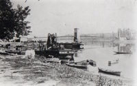
Fumel
Fumel, Lot-et-Garonne, France - Lot River
| Bridgemeister ID: | 2309 (added 2007-04-30) |
| Name: | Fumel |
| Location: | Fumel, Lot-et-Garonne, France |
| Crossing: | Lot River |
| Use: | Vehicular (one-lane) |
| Status: | Removed |
| Suspended Spans: | 1 |
Notes:
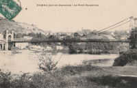
| Bridgemeister ID: | 7176 (added 2022-07-02) |
| Name: | Gaillac |
| Location: | Gaillac, Cajarc and Andressac, Cajarc, Lot, France |
| Crossing: | Lot River |
| Coordinates: | 44.469016 N 1.829985 E |
| Maps: | Acme, GeoHack, Google, OpenStreetMap |
| Use: | Vehicular |
| Status: | Only towers remain, since 2002 |
| Main Cables: | Wire |
| Suspended Spans: | 1 |
| Main Span: | 1 x 97 meters (318.2 feet) estimated |
Notes:
- Sometimes confused with the better known suspension bridge at Gaillac, Tarn.
- Demolished, 2002.
- Near Cajarc - Cajarc, Lot and Salvagnac-Cajarc, Aveyron, France.
- See 1852 Gaillac - Gaillac, Tarn, France.
External Links:
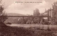
Galgon
Girard, Galgon, Gironde, France - Isle River
| Bridgemeister ID: | 7158 (added 2022-06-25) |
| Name: | Galgon |
| Location: | Girard, Galgon, Gironde, France |
| Crossing: | Isle River |
| Use: | Vehicular |
| Status: | Removed |
| Main Cables: | Wire |
| Suspended Spans: | 1 |
External Links:
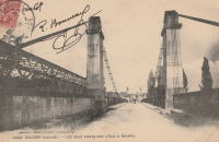
Gignac
Gignac and Lagamas, Hérault, France - Hérault River
| Bridgemeister ID: | 3188 (added 2019-11-10) |
| Name: | Gignac |
| Also Known As: | Lagamas |
| Location: | Gignac and Lagamas, Hérault, France |
| Crossing: | Hérault River |
| Coordinates: | 43.663873 N 3.537615 E |
| Maps: | Acme, GeoHack, Google, OpenStreetMap |
| References: | AAJ |
| Use: | Vehicular (one-lane) |
| Status: | In use (last checked: 2014) |
| Main Cables: | Wire |
| Suspended Spans: | 1 |
Notes:
- Likely completed in 1869 or early 1870s.
Gluges
Gluges, Lot, France - Dordogne River
| Bridgemeister ID: | 1584 (added 2005-01-22) |
| Name: | Gluges |
| Location: | Gluges, Lot, France |
| Crossing: | Dordogne River |
| Coordinates: | 44.907676 N 1.627499 E |
| Maps: | Acme, GeoHack, Google, OpenStreetMap |
| References: | AAJ |
| Use: | Vehicular (two-lane) |
| Status: | In use (last checked: 2022) |
| Main Cables: | Wire (steel) |
| Suspended Spans: | 1 |
Notes:
- This is the modern suspension bridge of 20th-century construction at Gluges. It is unclear if this bridge is at the same location as the older Gluges suspension bridge.
- See Gluges - Gluges, Lot, France.
External Links:
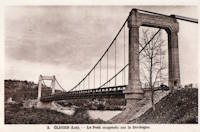
Gluges
Gluges, Lot, France - Dordogne River
| Bridgemeister ID: | 2326 (added 2007-05-12) |
| Name: | Gluges |
| Location: | Gluges, Lot, France |
| Crossing: | Dordogne River |
| Use: | Vehicular |
Notes:
- This is an older bridge of 19th-century construction that has likely been removed. It is unclear if this bridge was at the same location as the current Gluges suspension bridge.
- See Gluges - Gluges, Lot, France.
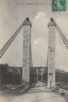
Goncelin
Goncelin, Isère, France - Isère River
| Bridgemeister ID: | 7137 (added 2022-06-20) |
| Name: | Goncelin |
| Location: | Goncelin, Isère, France |
| Crossing: | Isère River |
| Use: | Vehicular |
| Status: | Removed |
Goudargues
Goudargues and La Vérune, Gard, France - Cèze River
| Bridgemeister ID: | 7715 (added 2023-07-07) |
| Name: | Goudargues |
| Location: | Goudargues and La Vérune, Gard, France |
| Crossing: | Cèze River |
| Coordinates: | 44.218805 N 4.477071 E |
| Maps: | Acme, GeoHack, Google, OpenStreetMap |
| Use: | Vehicular |
| Status: | Removed |
| Main Cables: | Wire |
| Suspended Spans: | 1 |
External Links:
Groléjac
Groléjac, Dordogne, France - Dordogne River
| Bridgemeister ID: | 1930 (added 2005-10-27) |
| Name: | Groléjac |
| Location: | Groléjac, Dordogne, France |
| Crossing: | Dordogne River |
| References: | AAJ |
| Use: | Vehicular (one-lane) |
| Status: | Removed |
Notes:
- AAJ estimates completed in 1844 because of source indicating contract was let in 1841 with construction time set at three years.
- Currently, there is a bridge at Groléjac that has the shape of a suspension bridge, but appears to be a concrete cantilever. This newer bridge was completed in 1932.
Heuilley-sur-Saône
Heuilley-sur-Saône, Côte-d'Or, France - Canal entre Champagne et Bourgogne
| Bridgemeister ID: | 8395 (added 2024-02-18) |
| Name: | Heuilley-sur-Saône |
| Location: | Heuilley-sur-Saône, Côte-d'Or, France |
| Crossing: | Canal entre Champagne et Bourgogne |
| Status: | Removed |
| Suspended Spans: | 1 |
Notes:
- The canal at this location was previously known as "Canal de la Marne à la Saône".
Holzarte
Holzarte, Larrau, Pyrénées-Atlantiques, France
| Bridgemeister ID: | 2928 (added 2019-09-16) |
| Name: | Holzarte |
| Location: | Holzarte, Larrau, Pyrénées-Atlantiques, France |
| Coordinates: | 43.004626 N 0.923098 W |
| Maps: | Acme, GeoHack, Google, OpenStreetMap |
| Use: | Footbridge |
| Status: | In use (last checked: 2019) |
| Main Cables: | Wire (steel) |
| Suspended Spans: | 1 |
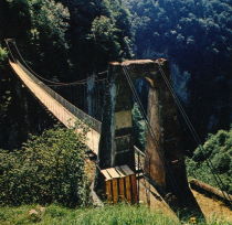
Hyèvre
Hyèvre-Magny and Hyèvre-Paroisse, Doubs, France - Doubs River
| Bridgemeister ID: | 7754 (added 2023-07-23) |
| Name: | Hyèvre |
| Location: | Hyèvre-Magny and Hyèvre-Paroisse, Doubs, France |
| Crossing: | Doubs River |
| Coordinates: | 47.367019 N 6.437186 E |
| Maps: | Acme, GeoHack, Google, OpenStreetMap |
| Use: | Vehicular |
| Status: | Removed |
| Main Cables: | Wire |
| Suspended Spans: | 1 |
Issoux
Les Issoux, Vals-des-Bains and Lalevade-d'Ardèche, Ardèche, France - Ardèche River
| Bridgemeister ID: | 7856 (added 2023-09-15) |
| Name: | Issoux |
| Location: | Les Issoux, Vals-des-Bains and Lalevade-d'Ardèche, Ardèche, France |
| Crossing: | Ardèche River |
| Use: | Footbridge |
| Status: | Removed |
| Suspended Spans: | 1 |
External Links:
- Facebook - Ancienne passerelle des Issoux. Image of the bridge.
- Facebook - Ancienne passerelle des Issoux. Image of the bridge.
- Facebook - Ancienne passerelle des Issoux. Image of the bridge.
- Facebook - La passerelle des Issoux 1962 Archives départementales. Image of the bridge.
- Facebook - La passerelle des Issoux 1962 Archives départementales. Image of the bridge.
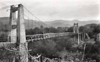
Itxassou
Itxassou, Pyrénées-Atlantiques, France - Nive River
| Bridgemeister ID: | 7760 (added 2023-07-23) |
| Name: | Itxassou |
| Location: | Itxassou, Pyrénées-Atlantiques, France |
| Crossing: | Nive River |
| Coordinates: | 43.327361 N 1.390138 W |
| Maps: | Acme, GeoHack, Google, OpenStreetMap |
| Use: | Vehicular |
| Status: | Removed |
| Main Cables: | Wire |
| Suspended Spans: | 1 |
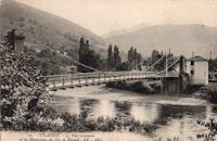
Jardin des Plantes
Toulouse, Haute-Garonne, France - Square Boulingrin
| Bridgemeister ID: | 7557 (added 2023-03-19) |
| Name: | Jardin des Plantes |
| Location: | Toulouse, Haute-Garonne, France |
| Crossing: | Square Boulingrin |
| Coordinates: | 43.594949 N 1.452085 E |
| Maps: | Acme, GeoHack, Google, OpenStreetMap |
| Use: | Footbridge |
| Status: | Removed |
| Suspended Spans: | 3 |
| Main Span: | 1 |
| Side Spans: | 2 |
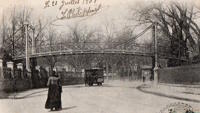
Jaulgonne
Jaulgonne and Varennes, Aisne, France - Marne River
| Bridgemeister ID: | 8175 (added 2024-02-04) |
| Name: | Jaulgonne |
| Location: | Jaulgonne and Varennes, Aisne, France |
| Crossing: | Marne River |
| Use: | Vehicular (one-lane) |
| Status: | Removed |
| Main Cables: | Wire |
Notes:
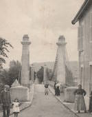
Jean Biondi
Verneuil-en-Halatte and Villers-Saint-Paul, Oise, France - Oise River
| Bridgemeister ID: | 4554 (added 2020-06-01) |
| Name: | Jean Biondi |
| Location: | Verneuil-en-Halatte and Villers-Saint-Paul, Oise, France |
| Crossing: | Oise River |
| Coordinates: | 49.280330 N 2.509134 E |
| Maps: | Acme, GeoHack, Google, OpenStreetMap |
| Use: | Footbridge |
| Status: | In use (last checked: 2019) |
| Main Cables: | Wire (steel) |
External Links:
Jumeaux
Jumeaux, Puy-de-Dôme, France - Allier River
| Bridgemeister ID: | 7170 (added 2022-06-26) |
| Name: | Jumeaux |
| Location: | Jumeaux, Puy-de-Dôme, France |
| Crossing: | Allier River |
| Use: | Vehicular |
| Status: | Removed |
| Main Cables: | Wire |
| Suspended Spans: | 1 |
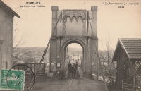
La Grand-Combe
La Grand-Combe, Gard, France - Gardon River
| Bridgemeister ID: | 2075 (added 2006-06-10) |
| Name: | La Grand-Combe |
| Location: | La Grand-Combe, Gard, France |
| Crossing: | Gardon River |
| Use: | Vehicular |
| Status: | Removed |
| Main Cables: | Wire |
| Suspended Spans: | 1 |
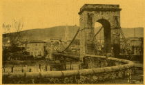
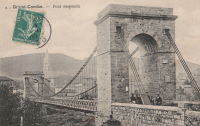
La Palisse
La Palisse, Cros-de-Géorand vicinity, Ardèche, France - Loire River
| Bridgemeister ID: | 2316 (added 2007-05-05) |
| Name: | La Palisse |
| Location: | La Palisse, Cros-de-Géorand vicinity, Ardèche, France |
| Crossing: | Loire River |
| Coordinates: | 44.779846 N 4.102626 E |
| Maps: | Acme, GeoHack, Google, OpenStreetMap |
| Use: | Vehicular (two-lane), with walkway |
| Status: | In use (last checked: 2021) |
| Main Cables: | Wire (steel) |
| Suspended Spans: | 1 |
External Links:
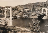
La Roche-Guyon
La Roche-Guyon, Val-d'Oise and Yvelines, France - Seine River
| Bridgemeister ID: | 1937 (added 2005-10-29) |
| Name: | La Roche-Guyon |
| Location: | La Roche-Guyon, Val-d'Oise and Yvelines, France |
| Crossing: | Seine River |
| Coordinates: | 49.078932 N 1.631776 E |
| Maps: | Acme, GeoHack, Google, OpenStreetMap |
| Use: | Vehicular |
| Status: | Removed |
| Main Cables: | Wire |
| Suspended Spans: | 2 |
| Main Spans: | 2 |
Notes:
- This record represents the bridge as rebuilt with the midspan pier in the 1880s.
- Ann Saul sent a synopsis of this bridge's history from La Roche-Guyon, Bourg Feodal de l'Ancien Vexin Francais by Ernest Colas. "The author states that the bridge was built in 1838, originally with two pylons, one on each bank of the Seine. In 1882, gale force winds turned over a wide stretch of the bridge floor. Afterwards, another pylon was placed in the middle of the river; however, the bridge was not considered stable enough for modern transportation (the automobile, perhaps). Plans were made for a new bridge and the old one was demolished. The new bridge was never built because of World War I."
- Replaced 1838 La Roche-Guyon - La Roche-Guyon, Val-d'Oise and Yvelines, France.
External Links:
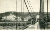
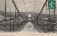
La Saulce
La Saulce, Hautes-Alpes, France - Durance River
| Bridgemeister ID: | 2311 (added 2007-05-02) |
| Name: | La Saulce |
| Location: | La Saulce, Hautes-Alpes, France |
| Crossing: | Durance River |
| Use: | Vehicular |
| Status: | Removed |
| Main Cables: | Wire |
| Suspended Spans: | 1 |
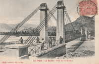
La Sône
La Sône, Isère, France - Isère River
| Bridgemeister ID: | 5563 (added 2020-12-19) |
| Name: | La Sône |
| Location: | La Sône, Isère, France |
| Crossing: | Isère River |
| Coordinates: | 45.111177 N 5.280148 E |
| Maps: | Acme, GeoHack, Google, OpenStreetMap |
| Use: | Vehicular (two-lane), with walkway |
| Status: | In use (last checked: 2020) |
| Main Cables: | Wire (steel) |
| Suspended Spans: | 1 |
Notes:
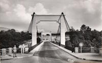
Lamarche-sur-Saône
Lamarche-sur-Saône, Côte-d'Or, France - Saône River
| Bridgemeister ID: | 7812 (added 2023-09-02) |
| Name: | Lamarche-sur-Saône |
| Location: | Lamarche-sur-Saône, Côte-d'Or, France |
| Crossing: | Saône River |
| Coordinates: | 47.270704 N 5.388976 E |
| Maps: | Acme, GeoHack, Google, OpenStreetMap |
| Use: | Vehicular |
| Status: | Removed |
| Main Cables: | Wire |
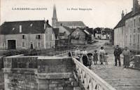
Layrac
Layrac, Lot-et-Garonne, France - Garonne River
| Bridgemeister ID: | 7477 (added 2022-12-25) |
| Name: | Layrac |
| Location: | Layrac, Lot-et-Garonne, France |
| Crossing: | Garonne River |
| Use: | Vehicular |
| Status: | Removed |
| Main Cables: | Wire (iron) |
| Suspended Spans: | 3 |
| Main Spans: | 3 |
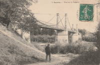
Layrac-sur-Tarn
Layrac-sur-Tarn and La Magdelaine-sur-Tarn, Haute-Garonne, France - Tarn River
| Bridgemeister ID: | 7183 (added 2022-07-02) |
| Name: | Layrac-sur-Tarn |
| Location: | Layrac-sur-Tarn and La Magdelaine-sur-Tarn, Haute-Garonne, France |
| Crossing: | Tarn River |
| Use: | Vehicular |
| Status: | Destroyed, 1930 |
| Main Cables: | Wire (iron) |
| Suspended Spans: | 3 |
| Main Span: | 1 |
| Side Spans: | 2 |
Notes:
- 1930: Destroyed by flood.
- Replaced by 1930 Layrac-sur-Tarn - Layrac-sur-Tarn, Haute-Garonne, France.

Les Ormes
Les Ormes, Vienne, France - Vienne River
| Bridgemeister ID: | 7276 (added 2022-07-22) |
| Name: | Les Ormes |
| Location: | Les Ormes, Vienne, France |
| Crossing: | Vienne River |
| Use: | Vehicular |
| Status: | Removed |
| Main Cables: | Wire (steel) |
| Suspended Spans: | 1 |
| Main Span: | 1 |
Notes:
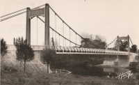
Les Taillades
Branoux-Les-Taillades and La Levade, Gard, France - Gardon d'Alès
| Bridgemeister ID: | 2032 (added 2006-04-23) |
| Name: | Les Taillades |
| Location: | Branoux-Les-Taillades and La Levade, Gard, France |
| Crossing: | Gardon d'Alès |
| Use: | Vehicular |
| Status: | Removed |
| Main Cables: | Wire |
| Suspended Spans: | 1 |
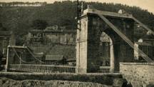
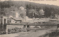
Lesigny
Lesigny, Vienne and Indre-et-Loire, France - Creuse River
| Bridgemeister ID: | 2230 (added 2007-03-19) |
| Name: | Lesigny |
| Location: | Lesigny, Vienne and Indre-et-Loire, France |
| Crossing: | Creuse River |
| Use: | Vehicular |
| Status: | Removed |
| Main Cables: | Chain (iron) |
| Suspended Spans: | 1 |
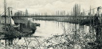
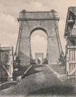
Libourne
Libourne, Gironde, France - Isle River
| Bridgemeister ID: | 1975 (added 2005-11-27) |
| Name: | Libourne |
| Location: | Libourne, Gironde, France |
| Crossing: | Isle River |
| Use: | Vehicular (one-lane) |
| Status: | Removed |
| Main Cables: | Wire |
| Suspended Spans: | 1 |
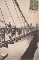
Longues
Longues, Vic-le-Comte and Les Martres-de-Veyre, Puy-de-Dôme, France - Allier River
| Bridgemeister ID: | 7590 (added 2023-05-06) |
| Name: | Longues |
| Location: | Longues, Vic-le-Comte and Les Martres-de-Veyre, Puy-de-Dôme, France |
| Crossing: | Allier River |
| Use: | Vehicular |
| Status: | Removed |
| Main Span: | 1 |
Notes:
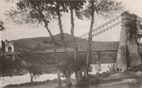
Lorois
Plouhinec vicinity, Morbihan, France - Etel River
| Bridgemeister ID: | 1739 (added 2005-04-19) |
| Name: | Lorois |
| Location: | Plouhinec vicinity, Morbihan, France |
| Crossing: | Etel River |
| Use: | Vehicular (one-lane) |
| Status: | Replaced |
| Main Cables: | Wire (iron) |
| Suspended Spans: | 1 |
Notes:
- Completed circa 1840s.
- Replaced by 1956 Lorois - Plouhinec vicinity, Morbihan, France.
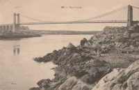
Manne
Saint-Thomas-en-Royans, Drôme and Saint-Just-de-Claix, Auberives-en-Royans vicinity, Isère, France - Bourne River
| Bridgemeister ID: | 8079 (added 2023-12-24) |
| Name: | Manne |
| Location: | Saint-Thomas-en-Royans, Drôme and Saint-Just-de-Claix, Auberives-en-Royans vicinity, Isère, France |
| Crossing: | Bourne River |
| Coordinates: | 45.061056 N 5.280528 E |
| Maps: | Acme, GeoHack, Google, OpenStreetMap |
| Use: | Vehicular |
| Status: | Removed |
| Suspended Spans: | 1 |
Notes:
- Presumably, a suspension bridge was built at this location in the 1840s. Later, the towers and abutments were reused for an unusual arch bridge.
External Links:
- Art-et-Histoire - Pont de Manne - 1846
- Bibliothèque numérique patrimoniale. Image of the unusual arch bridge.
- Saint-Thomas-en-Royans.- Le pont de Manne sur la rivière la Bourne, reliant Saint-Thomas et Saint-Juste-de-Claix (Isère).. Image of the unusual arch bridge.

Mareuil-sur-Ay
Mareuil-sur-Ay, Marne, France - Marne River
| Bridgemeister ID: | 2071 (added 2006-06-07) |
| Name: | Mareuil-sur-Ay |
| Location: | Mareuil-sur-Ay, Marne, France |
| Crossing: | Marne River |
| Use: | Vehicular (one-lane) |
| Status: | Destroyed, c. 1910s (WWI) |
| Suspended Spans: | 1 |
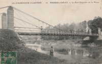
Mazères-sur-Salat
Mazères-sur-Salat, Haute-Garonne, France - Salat River
| Bridgemeister ID: | 3224 (added 2019-11-11) |
| Name: | Mazères-sur-Salat |
| Location: | Mazères-sur-Salat, Haute-Garonne, France |
| Crossing: | Salat River |
| Coordinates: | 43.132484 N 0.976271 E |
| Maps: | Acme, GeoHack, Google, OpenStreetMap |
| Use: | Vehicular (two-lane) |
| Status: | In use (last checked: 2018) |
| Main Cables: | Wire (steel) |
| Suspended Spans: | 1 |
Notes:
- At former location of 1852 Mazères-sur-Salat - Mazères-sur-Salat, Haute-Garonne, France. Unclear if the newer bridge was a direct replacement.
- Similar to 1938 Roquefort-sur-Garonne - Fourc and Roquefort-sur-Garonne, Haute-Garonne, France.
- Similar to Fourc - Fourc, Roquefort-sur-Garonne vicinity and Boussens, Haute-Garonne, France.
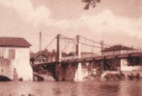
Meyronne
Meyronne and Saint-Sozy, Lot, France - Dordogne River
| Bridgemeister ID: | 2313 (added 2007-05-05) |
| Name: | Meyronne |
| Location: | Meyronne and Saint-Sozy, Lot, France |
| Crossing: | Dordogne River |
| Use: | Vehicular |
| Status: | Demolished, c. 1969 |
| Main Cables: | Wire |
Notes:
- Appears to have been dismantled following an accident that damaged the cables while the bridge was being restored, c. 1969.
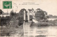
Moissac
Boudou and Saint-Nicolas-de-la-Grave, Tarn-et-Garonne, France - Garonne River
| Bridgemeister ID: | 5579 (added 2020-12-20) |
| Name: | Moissac |
| Also Known As: | Coudol, Boudou |
| Location: | Boudou and Saint-Nicolas-de-la-Grave, Tarn-et-Garonne, France |
| Crossing: | Garonne River |
| Coordinates: | 44.091900 N 1.028814 E |
| Maps: | Acme, GeoHack, Google, OpenStreetMap |
| Use: | Vehicular (one-lane) |
| Status: | In use (last checked: 2020) |
| Main Cables: | Wire (steel) |
| Suspended Spans: | 4 |
| Main Spans: | 4 |
Notes:
- The older images linked here show the original configuration of the bridge. The pylons have since been heightened and the deck and suspension system have been completely replaced.
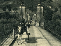
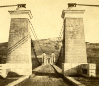
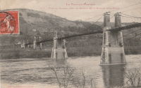
Monéteau
Monéteau, Yonne, France - Yonne River
| Bridgemeister ID: | 2335 (added 2007-07-09) |
| Name: | Monéteau |
| Location: | Monéteau, Yonne, France |
| Crossing: | Yonne River |
| Use: | Vehicular (one-lane), with walkway |
| Status: | Collapsed, September 1911 |
| Main Cables: | Wire |
Notes:
- Appears to have collapsed due to a construction accident during the erection of its adjacent replacement (an arch bridge) causing both bridges to collapse.
External Links:
Mondragon
Mondragon, Vaucluse, France - Donzère Canal
| Bridgemeister ID: | 4547 (added 2020-05-30) |
| Name: | Mondragon |
| Location: | Mondragon, Vaucluse, France |
| Crossing: | Donzère Canal |
| Coordinates: | 44.245210 N 4.701625 E |
| Maps: | Acme, GeoHack, Google, OpenStreetMap |
| Use: | Vehicular (two-lane) |
| Status: | In use (last checked: 2019) |
| Main Cables: | Wire (steel) |
| Suspended Spans: | 1 |
| Main Span: | 1 x 146 meters (479 feet) estimated |
Monsempron-Libos
Monsempron-Libos, Lot-et-Garonne, France - Lot River
| Bridgemeister ID: | 2198 (added 2007-01-27) |
| Name: | Monsempron-Libos |
| Location: | Monsempron-Libos, Lot-et-Garonne, France |
| Crossing: | Lot River |
| Use: | Vehicular (one-lane) |
| Status: | Removed |
| Suspended Spans: | 1 |
Notes:
External Links:
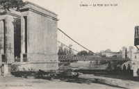
Monthermé
Monthermé, Ardennes, France - Meuse River
| Bridgemeister ID: | 1935 (added 2005-10-28) |
| Name: | Monthermé |
| Location: | Monthermé, Ardennes, France |
| Crossing: | Meuse River |
| Coordinates: | 49.887602 N 4.734902 E |
| Maps: | Acme, GeoHack, Google, OpenStreetMap |
| Use: | Vehicular (one-lane) |
| Status: | Removed |
| Main Cables: | Chain (iron) |
| Suspended Spans: | 1 |
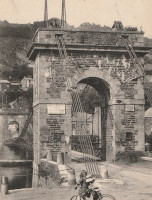
Morance
Les Chères and Chazay-d'Azergues, Rhône, France - Azergues River
| Bridgemeister ID: | 7390 (added 2022-11-25) |
| Name: | Morance |
| Also Known As: | Moulin Pottier, Chères |
| Location: | Les Chères and Chazay-d'Azergues, Rhône, France |
| Crossing: | Azergues River |
| Coordinates: | 45.887722 N 4.729861 E |
| Maps: | Acme, GeoHack, Google, OpenStreetMap |
| Use: | Vehicular |
| Status: | Removed |
| Main Cables: | Wire |
| Suspended Spans: | 1 |
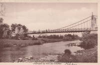
Moussac
Moussac, Gard, France - Gardon River
| Bridgemeister ID: | 7497 (added 2022-12-30) |
| Name: | Moussac |
| Location: | Moussac, Gard, France |
| Crossing: | Gardon River |
| Coordinates: | 43.978535 N 4.225417 E |
| Maps: | Acme, GeoHack, Google, OpenStreetMap |
| Status: | Removed |
| Main Cables: | Wire (iron) |
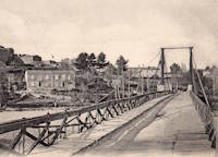
Nauzenac
Nauzenac, Mauriac vicinity, Cantal and Corrèze, France - Dordogne River
| Bridgemeister ID: | 1973 (added 2005-11-27) |
| Name: | Nauzenac |
| Location: | Nauzenac, Mauriac vicinity, Cantal and Corrèze, France |
| Crossing: | Dordogne River |
| Use: | Vehicular (one-lane) |
| Main Cables: | Wire |
| Suspended Spans: | 1 |
Notes:
- Village of Nauzenac was apparently inundated after construction of L'Aigle Dam.
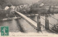
Nogent-sur-Loir
Nogent-sur-Loir, Chateau-sur-Loir vicinity, Sarthe, France - Loir River
| Bridgemeister ID: | 2068 (added 2006-06-07) |
| Name: | Nogent-sur-Loir |
| Location: | Nogent-sur-Loir, Chateau-sur-Loir vicinity, Sarthe, France |
| Crossing: | Loir River |
| Use: | Vehicular |
| Status: | Removed |
| Suspended Spans: | 1 |

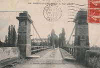
Nouvion
Nouvion-sur-Meuse, Ardennes, France - Meuse River
| Bridgemeister ID: | 7228 (added 2022-07-15) |
| Name: | Nouvion |
| Location: | Nouvion-sur-Meuse, Ardennes, France |
| Crossing: | Meuse River |
| Use: | Vehicular (one-lane) |
| Main Cables: | Wire |

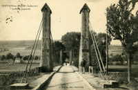
Onard
Onard, Landes, France - Adour River
| Bridgemeister ID: | 2957 (added 2019-10-05) |
| Name: | Onard |
| Location: | Onard, Landes, France |
| Crossing: | Adour River |
| Use: | Vehicular |
| Status: | Removed |
| Main Cables: | Wire |
| Suspended Spans: | 1 |
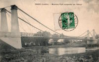
Orbeil
Orbeil and Issoire, Puy-de-Dôme, France - Allier River
| Bridgemeister ID: | 7274 (added 2022-07-22) |
| Name: | Orbeil |
| Location: | Orbeil and Issoire, Puy-de-Dôme, France |
| Crossing: | Allier River |
| Coordinates: | 45.563305 N 3.269521 E |
| Maps: | Acme, GeoHack, Google, OpenStreetMap |
| Use: | Vehicular (one-lane) |
| Status: | Removed (last checked: 2021) |
| Main Cables: | Wire |
Notes:
- Part of the northern tower is still standing (as of 2021).
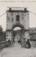
Paluden
Plouguerneau and Lannilis, Finistère, France - L'Aber Wrac'h
| Bridgemeister ID: | 1971 (added 2005-11-27) |
| Name: | Paluden |
| Location: | Plouguerneau and Lannilis, Finistère, France |
| Crossing: | L'Aber Wrac'h |
| Use: | Vehicular |
| Status: | Removed |
| Main Cables: | Wire |
| Suspended Spans: | 1 |
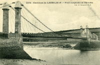
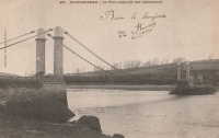
Peseux
Chaussin and Peseux, Jura, France - Doubs River
| Bridgemeister ID: | 1600 (added 2005-02-06) |
| Name: | Peseux |
| Location: | Chaussin and Peseux, Jura, France |
| Crossing: | Doubs River |
| References: | AAJ |
| Use: | Vehicular |
| Status: | Removed |
| Main Cables: | Wire |
| Suspended Spans: | 1 |
External Links:
- Art-et-Histoire - Pont de Peseux à Chaussin - 1846. Surmises bridge was completed in 1946.

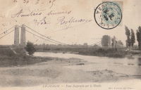
Pessac-sur-Dordogne
Pessac-sur-Dordogne, Gironde, France - Dordogne River
| Bridgemeister ID: | 8176 (added 2024-02-04) |
| Name: | Pessac-sur-Dordogne |
| Location: | Pessac-sur-Dordogne, Gironde, France |
| Crossing: | Dordogne River |
| Status: | Removed |
| Main Cables: | Wire |
Notes:
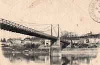
Petit
Elbeuf and Saint-Aubin-lès-Elbeuf, Seine-Maritime, France - Seine River
| Bridgemeister ID: | 7847 (added 2023-09-08) |
| Name: | Petit |
| Location: | Elbeuf and Saint-Aubin-lès-Elbeuf, Seine-Maritime, France |
| Crossing: | Seine River |
| Status: | Removed |
| Suspended Spans: | 1 |
Notes:
- Unclear where this bridge was located relative to the better known 1843 multi-span suspension bridge at Elbeuf. It appears to be crossing a smaller arm of the Seine between Elbeuf and Saint-Aubin.
- See 1843 Elbeuf - Elbeuf and Saint-Aubin-lès-Elbeuf, Seine-Maritime, France.
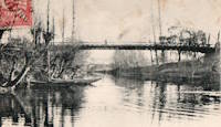
Phalip
Montézic vicinity, Aveyron, France - Truyère River - Lac de Couesque
| Bridgemeister ID: | 1585 (added 2005-01-22) |
| Name: | Phalip |
| Location: | Montézic vicinity, Aveyron, France |
| Crossing: | Truyère River - Lac de Couesque |
| Coordinates: | 44.728645 N 2.625953 E |
| Maps: | Acme, GeoHack, Google, OpenStreetMap |
| Use: | Vehicular (one-lane) |
| Status: | In use (last checked: 2011) |
| Main Cables: | Wire |
| Suspended Spans: | 1 |
External Links:
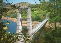
Pierrelatte
Pierrelatte, Drôme, France - Donzère Canal
| Bridgemeister ID: | 1587 (added 2005-01-22) |
| Name: | Pierrelatte |
| Location: | Pierrelatte, Drôme, France |
| Crossing: | Donzère Canal |
| Coordinates: | 44.364983 N 4.73105 E |
| Maps: | Acme, GeoHack, Google, OpenStreetMap |
| Use: | Vehicular (two-lane, heavy vehicles), with walkway |
| Status: | In use (last checked: 2005) |
| Main Cables: | Wire (steel) |
| Suspended Spans: | 3 |
| Main Span: | 1 |
| Side Spans: | 2 |
| Characteristics: | Self-anchored |
Notes:
- Self-anchored.
External Links:
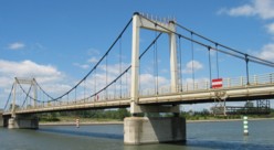
Pinet
Pinet, Aveyron, France - Tarn River
| Bridgemeister ID: | 3165 (added 2019-11-03) |
| Name: | Pinet |
| Location: | Pinet, Aveyron, France |
| Crossing: | Tarn River |
| Coordinates: | 44.070434 N 2.809541 E |
| Maps: | Acme, GeoHack, Google, OpenStreetMap |
| Status: | Removed |
| Suspended Spans: | 1 |
Notes:
- Appears to have been located just below the downstream face of the dam at Pinet.
Plessis-Brion
Le Plessis-Brion and Thourotte, Oise, France - Oise River
| Bridgemeister ID: | 3158 (added 2019-11-03) |
| Name: | Plessis-Brion |
| Location: | Le Plessis-Brion and Thourotte, Oise, France |
| Crossing: | Oise River |
| Coordinates: | 49.470268 N 2.889529 E |
| Maps: | Acme, GeoHack, Google, OpenStreetMap |
| Use: | Vehicular (one-lane) |
| Status: | In use (last checked: 2019) |
| Main Cables: | Wire (steel) |
| Suspended Spans: | 1 |
Notes:
- See Plessis-Brion - Le Plessis-Brion and Thourotte, Oise, France. Unclear if this later structure was an immediate replacement (or even at the same location) as the earlier 19th-century bridge.
Plessis-Brion
Le Plessis-Brion and Thourotte, Oise, France - Oise River
| Bridgemeister ID: | 3159 (added 2019-11-03) |
| Name: | Plessis-Brion |
| Location: | Le Plessis-Brion and Thourotte, Oise, France |
| Crossing: | Oise River |
| Use: | Vehicular |
| Status: | Removed |
Notes:
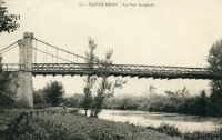

Pommevic
Pommevic, Tarn-et-Garonne, France - Canal Latéral à la Garonne
| Bridgemeister ID: | 8394 (added 2024-02-18) |
| Name: | Pommevic |
| Location: | Pommevic, Tarn-et-Garonne, France |
| Crossing: | Canal Latéral à la Garonne |
| Status: | Removed |
| Suspended Spans: | 1 |
Pommiers
Pommiers, Aisne, France - Aisne River
| Bridgemeister ID: | 8216 (added 2024-02-06) |
| Name: | Pommiers |
| Location: | Pommiers, Aisne, France |
| Crossing: | Aisne River |
| Use: | Vehicular |
| Status: | Removed |
| Main Cables: | Reinforced Concrete |
Notes:
- A reinforced concrete suspension bridge likely completed in the 1920s replacing a Gisclard bridge. There may have been an older suspension bridge at this site until 1870-1871 (destroyed during the Franco-Prussian war).
- Similar to 1925 Luzancy - Luzancy, Seine-et-Marne, France.
- Similar to 1926 Laon - Laon, Aisne, France.
| Bridgemeister ID: | 2187 (added 2007-01-18) |
| Name: | Port D'Agrès |
| Location: | Port D'Agrès, Aveyron, France |
| Crossing: | Lot River |
| References: | AAJ |
| Use: | Vehicular (one-lane), with walkway |
| Status: | Replaced, 1924 |
| Suspended Spans: | 1 |
| Main Span: | 1 x 90 meters (295.29 feet) |
| Deck width: | 14.44 feet |
Notes:
- AAJ suggests bridge was completed in 1837 based on contract being let in 1835 anticipating two years of construction.
Port-de-Penne
Penne-d'Agenais and Saint-Sylvestre-sur-Lot, Lot-et-Garonne, France - Lot River
| Bridgemeister ID: | 7327 (added 2022-09-02) |
| Name: | Port-de-Penne |
| Location: | Penne-d'Agenais and Saint-Sylvestre-sur-Lot, Lot-et-Garonne, France |
| Crossing: | Lot River |
| Use: | Vehicular (one-lane) |
| Status: | Removed |
| Main Cables: | Wire |
External Links:
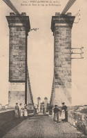
Pouilly-sous-Charlieu
Pouilly-sous-Charlieu and Briennon, Loire, France - Loire River
| Bridgemeister ID: | 2188 (added 2007-01-18) |
| Name: | Pouilly-sous-Charlieu |
| Location: | Pouilly-sous-Charlieu and Briennon, Loire, France |
| Crossing: | Loire River |
| References: | AAJ |
| Use: | Vehicular |
| Status: | Removed |
| Main Cables: | Wire (iron) |
Notes:
- AAJ suggests bridge was completed in 1836 based on contract for construction let in early 1835.
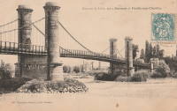
Préchacq-Navarrenx
Préchacq-Navarrenx, Pyrénées-Atlantiques, France - Gave d'Oloron
| Bridgemeister ID: | 7294 (added 2022-07-23) |
| Name: | Préchacq-Navarrenx |
| Location: | Préchacq-Navarrenx, Pyrénées-Atlantiques, France |
| Crossing: | Gave d'Oloron |
| Coordinates: | 43.271653 N 0.714088 W |
| Maps: | Acme, GeoHack, Google, OpenStreetMap |
| Use: | Vehicular |
| Status: | Only towers remain (last checked: 2021) |
| Main Cables: | Wire |
| Suspended Spans: | 1 |
Precy-sur-Oise
Precy-sur-Oise, Oise, France - Oise River
| Bridgemeister ID: | 2053 (added 2006-06-02) |
| Name: | Precy-sur-Oise |
| Location: | Precy-sur-Oise, Oise, France |
| Crossing: | Oise River |
| Coordinates: | 49.202340 N 2.376107 E |
| Maps: | Acme, GeoHack, Google, OpenStreetMap |
| Use: | Vehicular (one-lane) |
| Status: | Destroyed |
| Suspended Spans: | 1 |
Puichéric
Puichéric, Aude, France - Aude River
| Bridgemeister ID: | 2318 (added 2007-05-05) |
| Name: | Puichéric |
| Location: | Puichéric, Aude, France |
| Crossing: | Aude River |
| Coordinates: | 43.221745 N 2.627052 E |
| Maps: | Acme, GeoHack, Google, OpenStreetMap |
| Use: | Vehicular |
| Status: | Replaced, 1927 |
| Main Cables: | Wire |
| Suspended Spans: | 1 |
Notes:
- 1927: Replaced with a concrete bridge resembling a suspension bridge.
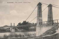
Puybrun
Puybrun, Corrèze and Girac, Lot, France - Dordogne River
| Bridgemeister ID: | 1932 (added 2005-10-27) |
| Name: | Puybrun |
| Location: | Puybrun, Corrèze and Girac, Lot, France |
| Crossing: | Dordogne River |
| Status: | Removed |
Redon
Redon, Ille-et-Vilaine, France - Nantes-Brest Canal
| Bridgemeister ID: | 3059 (added 2019-10-26) |
| Name: | Redon |
| Location: | Redon, Ille-et-Vilaine, France |
| Crossing: | Nantes-Brest Canal |
| Coordinates: | 47.654028 N 2.101087 W |
| Maps: | Acme, GeoHack, Google, OpenStreetMap |
| Use: | Vehicular (one-lane) |
| Status: | Closed (last checked: 2023) |
| Main Cables: | Wire |
| Suspended Spans: | 1 |
Notes:
- See (suspension bridge) - Saint-Perreux, Morbihan, France which may be the same bridge.
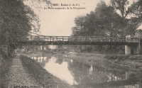
Retournac
Retournac, Haute-Loire, France - Loire River
| Bridgemeister ID: | 4065 (added 2020-03-31) |
| Name: | Retournac |
| Location: | Retournac, Haute-Loire, France |
| Crossing: | Loire River |
| References: | AAJ |
| Use: | Vehicular |
| Status: | Destroyed, 1846 |
Notes:
- AAJ supposes this bridge was completed in 1841 based a contract let in early 1839 for a two-year construction duration. Other sources suggest 1838 or 1839, but appear to be based on the contract date and not the completion of construction.
- Destroyed by flood, 1846.
- Replaced by 1850 Retournac - Retournac, Haute-Loire, France.
Revin
Revin, Ardennes, France - Meuse River
| Bridgemeister ID: | 1653 (added 2005-03-19) |
| Name: | Revin |
| Location: | Revin, Ardennes, France |
| Crossing: | Meuse River |
| Use: | Vehicular |
| Status: | Removed |
| Suspended Spans: | 1 |
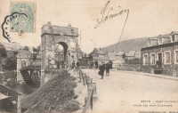
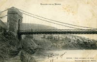
Rochebrune
Théus, Hautes-Alpes, France - Durance River
| Bridgemeister ID: | 7752 (added 2023-07-21) |
| Name: | Rochebrune |
| Location: | Théus, Hautes-Alpes, France |
| Crossing: | Durance River |
| Coordinates: | 44.460137 N 6.198517 E |
| Maps: | Acme, GeoHack, Google, OpenStreetMap |
| Use: | Vehicular |
| Status: | Removed |
| Main Cables: | Wire |
| Suspended Spans: | 1 |
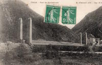
Roquemaure
Roquemaure, Gard and Orange, Vaucluse, France - Rhône River
| Bridgemeister ID: | 1736 (added 2005-04-19) |
| Name: | Roquemaure |
| Location: | Roquemaure, Gard and Orange, Vaucluse, France |
| Crossing: | Rhône River |
| Coordinates: | 44.071967 N 4.768917 E |
| Maps: | Acme, GeoHack, Google, OpenStreetMap |
| Use: | Vehicular (two-lane, heavy vehicles), with walkway |
| Status: | In use (last checked: 2019) |
| Main Cables: | Wire (steel) |
| Suspended Spans: | 3 |
| Main Span: | 1 |
| Side Spans: | 2 |
Notes:
- Replaced 1835 Roquemaure - Roquemaure, Gard and Orange, Vaucluse, France. One span of the older bridge is still standing next to the replacement.
External Links:

Roquestéron-Grasse
Roquestéron and La Roque-en-Provence, Alpes-Maritimes, France - L'Esteron
| Bridgemeister ID: | 7933 (added 2023-10-28) |
| Name: | Roquestéron-Grasse |
| Location: | Roquestéron and La Roque-en-Provence, Alpes-Maritimes, France |
| Crossing: | L'Esteron |
| Coordinates: | 43.871917 N 7.005972 E |
| Maps: | Acme, GeoHack, Google, OpenStreetMap |
| Use: | Footbridge |
| Status: | In use (last checked: 2023) |
| Main Cables: | Wire (steel) |
| Suspended Spans: | 1 |
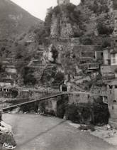
Rouazes
Mareuil-lès-Meaux, Voisins vicinity, Seine-et-Marne, France - Chalifert Canal
| Bridgemeister ID: | 7369 (added 2022-11-05) |
| Name: | Rouazes |
| Location: | Mareuil-lès-Meaux, Voisins vicinity, Seine-et-Marne, France |
| Crossing: | Chalifert Canal |
| Coordinates: | 48.908282 N 2.849197 E |
| Maps: | Acme, GeoHack, Google, OpenStreetMap |
| Use: | Vehicular (one-lane) |
| Status: | Removed |
| Main Cables: | Wire |
| Suspended Spans: | 1 |
Notes:
- 2022: Remnants of the pylons and anchorages are present.
- Similar to Esbly - Esbly, Seine-et-Marne, France.
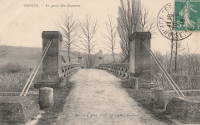
Roudoule
La Croix-sur-Roudoule, Puget-Théniers vicinity, Alpes-Maritimes, France - Roudoule River
| Bridgemeister ID: | 4552 (added 2020-05-31) |
| Name: | Roudoule |
| Location: | La Croix-sur-Roudoule, Puget-Théniers vicinity, Alpes-Maritimes, France |
| Crossing: | Roudoule River |
| Coordinates: | 43.986245 N 6.869900 E |
| Maps: | Acme, GeoHack, Google, OpenStreetMap |
| Use: | Vehicular (one-lane) |
| Status: | In use (last checked: 2019) |
| Main Cables: | Wire |
| Suspended Spans: | 1 |
External Links:
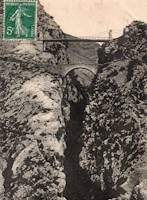
Roussanes
Roussanes, Clairac vicinity, Lot-et-Garonne, France - Lot River
| Bridgemeister ID: | 3747 (added 2020-02-16) |
| Name: | Roussanes |
| Also Known As: | Clairac |
| Location: | Roussanes, Clairac vicinity, Lot-et-Garonne, France |
| Crossing: | Lot River |
| Coordinates: | 44.372753 N 0.438374 E |
| Maps: | Acme, GeoHack, Google, OpenStreetMap |
| Use: | Vehicular (one-lane), with walkway |
| Status: | In use (last checked: 2016) |
| Main Cables: | Wire |
| Suspended Spans: | 1 |
Notes:
External Links:
Saint-Ambroix
Saint-Ambroix, Gard, France - Cèze River
| Bridgemeister ID: | 4064 (added 2020-03-30) |
| Name: | Saint-Ambroix |
| Location: | Saint-Ambroix, Gard, France |
| Crossing: | Cèze River |
| References: | AAJ |
| Use: | Vehicular |
| Status: | Removed |
| Main Cables: | Wire (iron) |
| Suspended Spans: | 1 |
Notes:
- AAJ supposes this bridge was completed in 1841 based on a contract let in 1840 proposing an 18-month construction period.
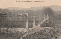
Saint-Bauzille-de-Putois
Saint-Bauzille-de-Putois, Hérault, France - Hérault River
| Bridgemeister ID: | 1096 (added 2004-01-02) |
| Name: | Saint-Bauzille-de-Putois |
| Location: | Saint-Bauzille-de-Putois, Hérault, France |
| Crossing: | Hérault River |
| Coordinates: | 43.890409 N 3.731778 E |
| Maps: | Acme, GeoHack, Google, OpenStreetMap |
| Use: | Vehicular (one-lane) |
| Status: | In use (last checked: 2018) |
| Main Cables: | Wire |
| Suspended Spans: | 1 |
Notes:
External Links:
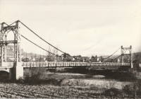
Saint-Bauzille-de-Putois
Saint-Bauzille-de-Putois, Hérault, France - Hérault River
| Bridgemeister ID: | 1933 (added 2005-10-28) |
| Name: | Saint-Bauzille-de-Putois |
| Location: | Saint-Bauzille-de-Putois, Hérault, France |
| Crossing: | Hérault River |
| Status: | Replaced |
Notes:

Saint-Denis-de-Pile
Saint-Denis-de-Pile and Bonzac, Gironde, France - Isle River
| Bridgemeister ID: | 7507 (added 2023-01-02) |
| Name: | Saint-Denis-de-Pile |
| Location: | Saint-Denis-de-Pile and Bonzac, Gironde, France |
| Crossing: | Isle River |
| Coordinates: | 44.993251 N 0.207369 W |
| Maps: | Acme, GeoHack, Google, OpenStreetMap |
| Use: | Vehicular |
| Status: | Replaced |
| Main Cables: | Wire (iron) |
Notes:
External Links:
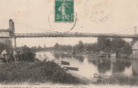
Saint-Didier-sous-Aubenas
Saint-Didier-sous-Aubenas, Ardèche, France - Ardèche River
| Bridgemeister ID: | 2929 (added 2019-09-16) |
| Name: | Saint-Didier-sous-Aubenas |
| Location: | Saint-Didier-sous-Aubenas, Ardèche, France |
| Crossing: | Ardèche River |
| Coordinates: | 44.603719 N 4.419774 E |
| Maps: | Acme, GeoHack, Google, OpenStreetMap |
| Use: | Vehicular |
| Status: | Replaced, 1936 |
Notes:
Saint-Fontunat-sur-Eyrieux
Saint-Fontunat-sur-Eyrieux, Ardèche, France - Eyrieux River
| Bridgemeister ID: | 1565 (added 2004-11-28) |
| Name: | Saint-Fontunat-sur-Eyrieux |
| Also Known As: | Pourchaire |
| Location: | Saint-Fontunat-sur-Eyrieux, Ardèche, France |
| Crossing: | Eyrieux River |
| Coordinates: | 44.815748 N 4.707325 E |
| Maps: | Acme, GeoHack, Google, OpenStreetMap |
| Principals: | Camille Seguin, Marc Seguin |
| References: | BPF |
| Use: | Footbridge |
| Status: | Only towers remain (last checked: 2021) |
| Main Cables: | Wire (iron) |
| Main Span: | 1 |
| Side Span: | 1 |
Notes:
- BPF and other sources list this bridge as having been completed in 1821 or 1823, but it is very unlikely the bridge was completed that early. An abandoned pier for another bridge is visible in some images of the bridge. It is possible there was another, earlier, bridge at this location for which the early 1820s completion date may be applicable. Other sources suggest the suspension bridge represented here was completed in 1893.
External Links:
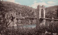
Saint-Gaultier
Saint-Gaultier, Indre, France - Creuse River
| Bridgemeister ID: | 7384 (added 2022-11-24) |
| Name: | Saint-Gaultier |
| Location: | Saint-Gaultier, Indre, France |
| Crossing: | Creuse River |
| Status: | Removed |
| Suspended Spans: | 1 |
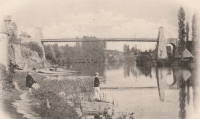
Saint-Georges-de-Commiers
Saint-Georges-de-Commiers and Vif, Isère, France - Drac River
| Bridgemeister ID: | 7318 (added 2022-08-31) |
| Name: | Saint-Georges-de-Commiers |
| Location: | Saint-Georges-de-Commiers and Vif, Isère, France |
| Crossing: | Drac River |
| Coordinates: | 45.043942 N 5.694915 E |
| Maps: | Acme, GeoHack, Google, OpenStreetMap |
| Use: | Vehicular |
| Status: | Removed |
| Suspended Spans: | 1 |
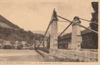
Saint-Georges-sur-Cher
Saint-Georges-sur-Cher, Loir-et-Cher, France - Cher River
| Bridgemeister ID: | 7321 (added 2022-09-01) |
| Name: | Saint-Georges-sur-Cher |
| Location: | Saint-Georges-sur-Cher, Loir-et-Cher, France |
| Crossing: | Cher River |
| Use: | Vehicular |
| Status: | Removed |
| Main Cables: | Wire |
| Suspended Spans: | 1 |
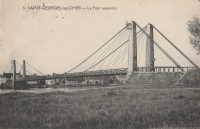
Saint-Georges-sur-Loire
Saint-Georges-sur-Loire and Chalonnes-sur-Loire, Maine-et-Loire, France - Loire River
| Bridgemeister ID: | 8039 (added 2023-12-23) |
| Name: | Saint-Georges-sur-Loire |
| Location: | Saint-Georges-sur-Loire and Chalonnes-sur-Loire, Maine-et-Loire, France |
| Crossing: | Loire River |
| Coordinates: | 47.368389 N 0.754194 W |
| Maps: | Acme, GeoHack, Google, OpenStreetMap |
| Use: | Vehicular |
| Status: | Removed |
| Suspended Spans: | 4 |
| Main Spans: | 2 |
| Side Spans: | 2 |
Notes:
- Near 1841 Chalonnes - Chalonnes-sur-Loire, Maine-et-Loire, France. Both bridges were likely completed around the same time by the Seguin Brothers.
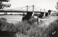
Saint-Gilles
Saint-Gilles-du-Gard, Gard and Arles, Bouches-du-Rhône, France - Petit Rhône River
| Bridgemeister ID: | 4908 (added 2020-07-19) |
| Name: | Saint-Gilles |
| Location: | Saint-Gilles-du-Gard, Gard and Arles, Bouches-du-Rhône, France |
| Crossing: | Petit Rhône River |
| Coordinates: | 43.665899 N 4.452714 E |
| Maps: | Acme, GeoHack, Google, OpenStreetMap |
| Use: | Vehicular |
| Status: | Replaced, 1938 |
| Main Cables: | Wire |
| Suspended Spans: | 1 |
Notes:
External Links:
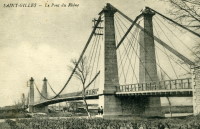
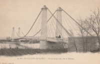
Saint-Julien
Saint-Julien, Haute-Garonne, France - Garonne River
| Bridgemeister ID: | 1685 (added 2005-03-26) |
| Name: | Saint-Julien |
| Location: | Saint-Julien, Haute-Garonne, France |
| Crossing: | Garonne River |
| Use: | Vehicular (one-lane) |
| Status: | Removed |
| Main Cables: | Wire |
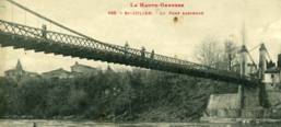
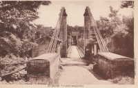
Saint-Lattier
Saint-Lattier, Isère and Eymeux, Drôme, France - Isère River
| Bridgemeister ID: | 4913 (added 2020-07-19) |
| Name: | Saint-Lattier |
| Also Known As: | Eymeux |
| Location: | Saint-Lattier, Isère and Eymeux, Drôme, France |
| Crossing: | Isère River |
| Coordinates: | 45.084972 N 5.183313 E |
| Maps: | Acme, GeoHack, Google, OpenStreetMap |
| Use: | Vehicular (one-lane) |
| Status: | In use (last checked: 2020) |
| Main Cables: | Wire (steel) |
| Suspended Spans: | 1 |
| Main Span: | 1 x 10⁸ meters (354.3 feet) estimated |
Notes:
- At former location of 1857 Saint-Lattier - Saint-Lattier, Isère and Eymeux, Drôme, France.
External Links:
Saint-Léger
Saint-Léger and Aiguillon, Lot-et-Garonne, France - Garonne River
| Bridgemeister ID: | 7322 (added 2022-09-01) |
| Name: | Saint-Léger |
| Location: | Saint-Léger and Aiguillon, Lot-et-Garonne, France |
| Crossing: | Garonne River |
| Coordinates: | 44.289545 N 0.320319 E |
| Maps: | Acme, GeoHack, Google, OpenStreetMap |
| Use: | Vehicular |
| Status: | Removed |
| Main Cables: | Wire |
| Suspended Spans: | 1 |
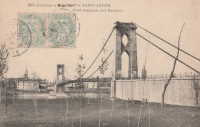
Saint-Marcel-sur-Aude
Saint-Marcel-sur-Aude and Marcorignan, Aude, France - Aude River
| Bridgemeister ID: | 6744 (added 2021-10-23) |
| Name: | Saint-Marcel-sur-Aude |
| Location: | Saint-Marcel-sur-Aude and Marcorignan, Aude, France |
| Crossing: | Aude River |
| Coordinates: | 43.234206 N 2.926368 E |
| Maps: | Acme, GeoHack, Google, OpenStreetMap |
| Status: | Removed |
| Main Cables: | Wire (steel) |
| Suspended Spans: | 1 |
Notes:
- This bridge was likely a tempoary replacement for the 1929 concrete bridge that collapsed at this location in 1954.
- At former location of 1834 Saint-Marcel-sur-Aude - Saint-Marcel-sur-Aude and Marcorignan, Aude, France.
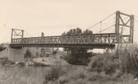
Saint-Mesmin
Saint-Mesmin, Dordogne, France - Auvézère River
| Bridgemeister ID: | 5592 (added 2020-12-23) |
| Name: | Saint-Mesmin |
| Location: | Saint-Mesmin, Dordogne, France |
| Crossing: | Auvézère River |
| At or Near Feature: | Cascade du Saut Ruban |
| Coordinates: | 45.354308 N 1.208481 E |
| Maps: | Acme, GeoHack, Google, OpenStreetMap |
| Use: | Footbridge |
| Status: | In use (last checked: 2020) |
| Main Cables: | Wire (steel) |
Saint-Projet
Arches, Mauriac vicinity, Cantal and Neuvic, Corrèze, France - Dordogne River
| Bridgemeister ID: | 5578 (added 2020-12-20) |
| Name: | Saint-Projet |
| Location: | Arches, Mauriac vicinity, Cantal and Neuvic, Corrèze, France |
| Crossing: | Dordogne River |
| Coordinates: | 45.286816 N 2.279728 E |
| Maps: | Acme, GeoHack, Google, OpenStreetMap |
| Use: | Vehicular (two-lane) |
| Status: | In use (last checked: 2021) |
| Main Cables: | Wire (steel) |
| Suspended Spans: | 1 |
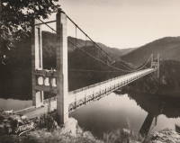
Saint-Romain-des-Iles
Saint-Romain-des-Iles, Saône-et-Loire and Ain, France - Saône River
| Bridgemeister ID: | 2130 (added 2006-10-22) |
| Name: | Saint-Romain-des-Iles |
| Location: | Saint-Romain-des-Iles, Saône-et-Loire and Ain, France |
| Crossing: | Saône River |
| References: | AAJ |
| Use: | Vehicular |
| Status: | Removed |
| Main Cables: | Wire |
Notes:
- Completed during or before 1840.
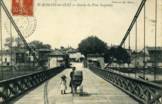
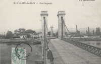
Saint-Symphorien
Tours, Indre-et-Loire, France - Loire River
| Bridgemeister ID: | 7839 (added 2023-09-03) |
| Name: | Saint-Symphorien |
| Location: | Tours, Indre-et-Loire, France |
| Crossing: | Loire River |
| At or Near Feature: | l'Île Aucard |
| Coordinates: | 47.398291 N 0.692937 E |
| Maps: | Acme, GeoHack, Google, OpenStreetMap |
| Status: | Replaced |
| Main Cables: | Wire (steel) |
| Suspended Spans: | 3 |
| Main Spans: | 3 |
Notes:
- This is a replacement for the three-span southern Saint-Symphorien bridge. It's unclear if this wood-towered bridge is a result of the 1943 reconstruction following the 1940 French army destruction of the bridge or the reconstruction following the 1944 German army destruction of the bridge.
- Replaced 1847 Saint-Symphorien - Tours, Indre-et-Loire, France.
- Connects to 1847 Saint-Symphorien - Tours, Indre-et-Loire, France. It's unclear whether the northern two-span Saint-Symphorien bridge was similarly reconstructed in the 1940s.
- Replaced by 1963 Saint-Symphorien - Tours, Indre-et-Loire, France.
External Links:
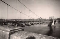
Saint-Vallier
Saint-Vallier, Drôme, France - Rhône River
| Bridgemeister ID: | 1754 (added 2005-04-20) |
| Name: | Saint-Vallier |
| Location: | Saint-Vallier, Drôme, France |
| Crossing: | Rhône River |
| Use: | Vehicular |
| Status: | Removed |
| Main Cables: | Wire (iron) |
Notes:
- Likely completed early 1830s.
- Similar to 1830 Bourg-Saint-Andéol - Bourg-Saint-Andéol, Ardèche, France.
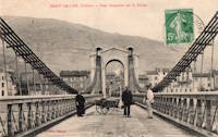
Saint-Vit
Saint-Vit and Roset-Fluans, Doubs, France - Doubs River
| Bridgemeister ID: | 2228 (added 2007-03-18) |
| Name: | Saint-Vit |
| Location: | Saint-Vit and Roset-Fluans, Doubs, France |
| Crossing: | Doubs River |
| Use: | Vehicular |
| Status: | Removed |
| Main Cables: | Wire |
Notes:
- See (suspension bridge) - Saint-Vit and Roset-Fluans, Doubs, France. Unclear if one bridge replaced the other at the same location.
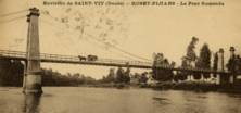
Sainte-Livrade
Sainte-Livrade-sur-Lot, Lot-et-Garonne, France - Lot River
| Bridgemeister ID: | 7317 (added 2022-08-30) |
| Name: | Sainte-Livrade |
| Location: | Sainte-Livrade-sur-Lot, Lot-et-Garonne, France |
| Crossing: | Lot River |
| Coordinates: | 44.402316 N 0.586925 E |
| Maps: | Acme, GeoHack, Google, OpenStreetMap |
| Use: | Vehicular |
| Status: | Removed |
External Links:
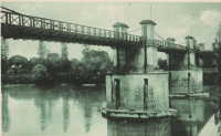
Salies-du-Salat
Salies-du-Salat, Haute-Garonne, France - Salat River
| Bridgemeister ID: | 2058 (added 2006-06-03) |
| Name: | Salies-du-Salat |
| Location: | Salies-du-Salat, Haute-Garonne, France |
| Crossing: | Salat River |
| Use: | Vehicular (one-lane) |
| Status: | Removed |
| Main Cables: | Wire |
| Suspended Spans: | 1 |
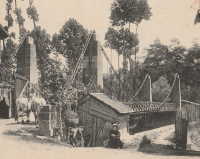
Samain
Saint-léger-aux-Bois vicinity, Oise, France - Oise River
| Bridgemeister ID: | 1817 (added 2005-05-21) |
| Name: | Samain |
| Location: | Saint-léger-aux-Bois vicinity, Oise, France |
| Crossing: | Oise River |
| Use: | Vehicular (one-lane) |
| Status: | Derelict |
External Links:
- Balade vers les étangs et l'Oise (link reported not working). Built during World War I by the Germans.
Saut du Loup
Le Saut Du Loup and Beaulieu, Puy-De-Dôme, France - Allier River
| Bridgemeister ID: | 1648 (added 2005-03-19) |
| Name: | Saut du Loup |
| Location: | Le Saut Du Loup and Beaulieu, Puy-De-Dôme, France |
| Crossing: | Allier River |
| Coordinates: | 45.452584 N 3.303547 E |
| Maps: | Acme, GeoHack, Google, OpenStreetMap |
| Use: | Vehicular (one-lane), with walkway |
| Status: | Removed, c. 1960s |
| Main Cables: | Wire |
| Suspended Spans: | 1 |
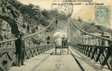
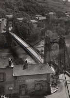
Savignac-de-l'Isle
Savignac-de-l'Isle, Gironde, France - Isle River
| Bridgemeister ID: | 7846 (added 2023-09-04) |
| Name: | Savignac-de-l'Isle |
| Location: | Savignac-de-l'Isle, Gironde, France |
| Crossing: | Isle River |
| Coordinates: | 44.987175 N 0.233164 W |
| Maps: | Acme, GeoHack, Google, OpenStreetMap |
| Use: | Vehicular |
| Status: | Removed |
| Suspended Spans: | 1 |
Notes:
- Completed in the 1890s. It likely replaced another suspension bridge completed in 1840.
External Links:
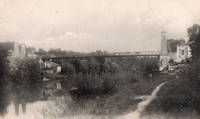
Solaize
Solaize and Vernaison, Métropole de Lyon, France - Rhône Canal
| Bridgemeister ID: | 1831 (added 2005-05-30) |
| Name: | Solaize |
| Location: | Solaize and Vernaison, Métropole de Lyon, France |
| Crossing: | Rhône Canal |
| Coordinates: | 45.643584 N 4.824690 E |
| Maps: | Acme, GeoHack, Google, OpenStreetMap |
| Use: | Vehicular (two-lane) |
| Status: | In use (last checked: 2019) |
| Main Cables: | Wire (steel) |
| Suspended Spans: | 1 |
Notes:
External Links:
Tamaris-les-Forges
Alès vicinity, Gard, France - Gardon River
| Bridgemeister ID: | 2986 (added 2019-10-12) |
| Name: | Tamaris-les-Forges |
| Location: | Alès vicinity, Gard, France |
| Crossing: | Gardon River |
| Coordinates: | 44.145589 N 4.075216 E |
| Maps: | Acme, GeoHack, Google, OpenStreetMap |
| Use: | Vehicular |
| Status: | Removed |
| Main Cables: | Wire |
| Suspended Spans: | 1 |
Notes:
- Coordinates are for one of the remaining piers of the rail tracks that sat on top of the suspension bridge. This highly unusual hybrid structure had a rail bridge supported by the suspension bridge towers and a suspension bridge mid-span tower. From a distance, it had the appearance of a deck suspended from a rail bridge, but this was not the case.
- See 1854 Sarp (Sarpsbro, Sarpsbrua) - Sarpsborg, Viken, Norway. Another interesting hybrid rail and suspension bridge.
External Links:
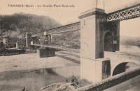
| Bridgemeister ID: | 7445 (added 2022-12-23) |
| Name: | Tercis-les-Bains |
| Location: | Tercis-les-Bains, Landes, France |
| Crossing: | Luy River |
| Coordinates: | 43.663829 N 1.101447 W |
| Maps: | Acme, GeoHack, Google, OpenStreetMap |
| Use: | Vehicular (one-lane) |
| Status: | Only towers remain (last checked: 2013) |
| Main Cables: | Wire (iron) |
| Suspended Spans: | 1 |
External Links:
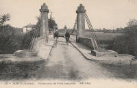
Tercis-les-Bains
Tercis-les-Bains, Landes, France - Adour River
| Bridgemeister ID: | 7446 (added 2022-12-23) |
| Name: | Tercis-les-Bains |
| Location: | Tercis-les-Bains, Landes, France |
| Crossing: | Adour River |
| Coordinates: | 43.673966 N 1.135208 W |
| Maps: | Acme, GeoHack, Google, OpenStreetMap |
| Use: | Vehicular |
| Status: | Removed |
| Main Cables: | Wire (iron) |
| Suspended Spans: | 3 |
| Main Span: | 1 |
| Side Spans: | 2 |
External Links:
- Art-et-Histoire - Pont entre Tercis-les-bains et Riviere-Saas-et-Gourby sur l'Adour à Vimport - 1853
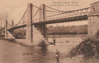
Tournon-Saint-Martin
Tournon-Saint-Martin, Indre, France - Creuse River
| Bridgemeister ID: | 7756 (added 2023-07-23) |
| Name: | Tournon-Saint-Martin |
| Location: | Tournon-Saint-Martin, Indre, France |
| Crossing: | Creuse River |
| Use: | Vehicular |
| Status: | Removed |
| Main Cables: | Wire (iron) |
| Suspended Spans: | 1 |
External Links:
Trés-Cassés
Castelsarrasin, Tarn-et-Garonne, France - Garonne River
| Bridgemeister ID: | 7080 (added 2022-05-28) |
| Name: | Trés-Cassés |
| Location: | Castelsarrasin, Tarn-et-Garonne, France |
| Crossing: | Garonne River |
| Use: | Vehicular |
| Status: | Removed |
| Main Cables: | Wire |
| Main Spans: | 3 |
Vaure
Vaures and Bransac, Haute-Loire, France - Loire River
| Bridgemeister ID: | 7555 (added 2023-03-19) |
| Name: | Vaure |
| Location: | Vaures and Bransac, Haute-Loire, France |
| Crossing: | Loire River |
| Coordinates: | 45.234554 N 4.094460 E |
| Maps: | Acme, GeoHack, Google, OpenStreetMap |
| Use: | Vehicular |
| Status: | Removed |
| Suspended Spans: | 1 |
Villebrumier
Villebrumier, Tarn-et-Garonne, France - Tarn River
| Bridgemeister ID: | 1707 (added 2005-03-30) |
| Name: | Villebrumier |
| Location: | Villebrumier, Tarn-et-Garonne, France |
| Crossing: | Tarn River |
| Use: | Vehicular (one-lane) |
| Status: | Replaced |
| Main Cables: | Wire |
| Suspended Spans: | 1 |
Notes:
- Likely completed in 1800s.
- Replaced by 1932 Villebrumier - Villebrumier, Tarn-et-Garonne, France.
Villefranche-sur-Cher
Villefranche-sur-Cher and Saint-Julien-sur-Cher, Loir-et-Cher, France - Cher River
| Bridgemeister ID: | 4755 (added 2020-06-27) |
| Name: | Villefranche-sur-Cher |
| Location: | Villefranche-sur-Cher and Saint-Julien-sur-Cher, Loir-et-Cher, France |
| Crossing: | Cher River |
| Use: | Vehicular |
| Status: | Removed |
| Main Cables: | Wire |
| Suspended Spans: | 1 |
External Links:
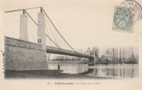
Villevallier
Villevallier and Saint-Julien-du-Sault, Yonne, France - Yonne River
| Bridgemeister ID: | 1999 (added 2005-12-25) |
| Name: | Villevallier |
| Location: | Villevallier and Saint-Julien-du-Sault, Yonne, France |
| Crossing: | Yonne River |
| Use: | Vehicular |
| Status: | Removed |
| Main Cables: | Chain (iron) |
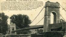
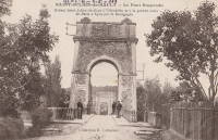
Violès
Violès, Vaucluse, France - Ouvèze River
| Bridgemeister ID: | 4754 (added 2020-06-27) |
| Name: | Violès |
| Location: | Violès, Vaucluse, France |
| Crossing: | Ouvèze River |
| Use: | Vehicular (one-lane) |
| Status: | Removed |
| Main Cables: | Wire |
| Suspended Spans: | 1 |
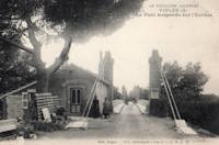
Vireux
Vireux, Ardennes, France - Meuse River
| Bridgemeister ID: | 1160 (added 2004-01-18) |
| Name: | Vireux |
| Location: | Vireux, Ardennes, France |
| Crossing: | Meuse River |
| Use: | Vehicular |
| Status: | Removed |
| Main Cables: | Chain |
| Suspended Spans: | 1 |
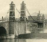
Do you have any information or photos for these bridges that you would like to share? Please email david.denenberg@bridgemeister.com.
