Suspension Bridges of Wales
This is a list of all 27 bridges from the suspension bridge inventory for Wales in United Kingdom. Wherever you see a Bridgemeister ID number click it to isolate the bridge on its own page.
Related Lists:
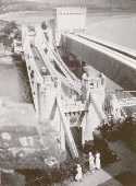
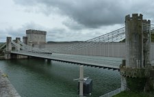
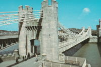
1826: Conwy
Conwy, Wales, United Kingdom - River Conwy
| Bridgemeister ID: | 380 (added before 2003) |
| Year Completed: | 1826 |
| Name: | Conwy |
| Also Known As: | Conway |
| Location: | Conwy, Wales, United Kingdom |
| Crossing: | River Conwy |
| Coordinates: | 53.280476 N 3.823742 W |
| Maps: | Acme, GeoHack, Google, OpenStreetMap |
| Principals: | Thomas Telford |
| References: | AAJ, BBR, BC3, BCO, BEM, HBE, MOS, NTB, PTS2 |
| Use: | Vehicular |
| Status: | Restricted to foot traffic (last checked: 2021) |
| Main Cables: | Chain (iron) |
| Suspended Spans: | 1 |
| Main Span: | 1 x 99.7 meters (327 feet) |
Notes:
- 1904: Major reinforcement and strengthening project.
- 2008, February: Major refurbishment project completed.
- Next to 1904 (footbridge) - Conwy, Wales, United Kingdom.
Annotated Citations:
- "Conway Suspension Bridge." The Engineer, 20 May 1904.
Details regarding the 1904 reinforcement project: "...It was therefore decided to renew all the suspension rods, and pins, and to fix steel cables above the suspension links, to supplement them so that the maximum stress in the links due to any possible travelling load should not exceed 5 tons per square inch. It was also decided to build a stiffening girder coupled to the suspension rod on each side of the bridge, and at the same time to widen the bridge by building a footway 6ft. wide outside the suspenders on the north side of the bridge."
External Links:
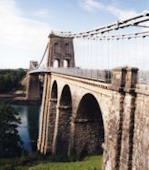
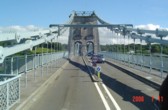
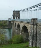
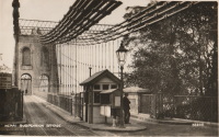
1826: Menai Strait
Menai Bridge and Bangor vicinity, Wales, United Kingdom - Menai Strait
| Bridgemeister ID: | 382 (added before 2003) |
| Year Completed: | 1826 |
| Name: | Menai Strait |
| Location: | Menai Bridge and Bangor vicinity, Wales, United Kingdom |
| Crossing: | Menai Strait |
| Coordinates: | 53.221367 N 4.1646 W |
| Maps: | Acme, GeoHack, Google, OpenStreetMap |
| Principals: | Thomas Telford |
| References: | AAJ, BBR, BC3, BCO, BDU, BEM, BOU, HBE, MOS, NTB, PTS2 |
| Use: | Vehicular (two-lane), with walkway |
| Status: | In use (last checked: 2022) |
| Main Cables: | Chain (iron) |
| Suspended Spans: | 1 |
| Main Span: | 1 x 176.5 meters (579 feet) |
Notes:
- 1839 (or 1840): Restored. Deck strengthened.
- 1893: Original wood deck replaced with a steel deck.
- 1938-1940: Original wrought-iron chains replaced with steel eyebars, deck strengthened.
- 1999: Deck resurfaced and other improvements to strengthen bridge.
- 2020: Major maintenance project planned to start January, 2021.
- 2022, October: Closed due to serious structural concerns. Expected to reopen January 2023 with a weight restriction.
- Became longest suspension bridge by eclipsing 1820 Union - Horncliffe, Berwick-upon-Tweed vicinity, England and Fishwick, Scotland, United Kingdom.
- Eclipsed by new longest suspension bridge 1834 Zaehringen (Grand Pont Suspendu) - Fribourg, Switzerland.
External Links:

1828: South Stack
Holyhead, Wales, United Kingdom
| Bridgemeister ID: | 1212 (added 2004-02-08) |
| Year Completed: | 1828 |
| Name: | South Stack |
| Location: | Holyhead, Wales, United Kingdom |
| At or Near Feature: | Goleudy Ynys Lawd (Ynys Lawd Lighthouse) |
| Coordinates: | 53.306972 N 4.696822 W |
| Maps: | Acme, GeoHack, Google, OpenStreetMap |
| Use: | Footbridge |
| Status: | Only towers remain |
| Main Cables: | Chain |
| Suspended Spans: | 1 |
| Main Span: | 1 x 37 meters (121.4 feet) estimated |
Notes:
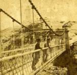
- Provided access to the lighthouse at South Stack. Iron chain suspension system replaced in 1964, surviving until until 1983, but unclear if it was still functioning as a suspension bridge. Towers are now used as abutments for a pedestrian truss bridge.


1829: Chain
Kemeys Commander, Wales, United Kingdom - River Usk
| Bridgemeister ID: | 7961 (added 2023-11-22) |
| Year Completed: | 1829 |
| Name: | Chain |
| Location: | Kemeys Commander, Wales, United Kingdom |
| Crossing: | River Usk |
| Coordinates: | 51.745000 N 2.948227 W |
| Maps: | Acme, GeoHack, Google, OpenStreetMap |
| Use: | Vehicular |
| Status: | Replaced, 1906 |
| Main Cables: | Chain (iron) |
| Suspended Spans: | 1 |
Notes:
- 1906: Replaced by a non-suspension bridge still referred to as "Chainbridge".
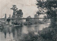
1839: Builth Wells
Builth Wells, Wales, United Kingdom - River Irfon
| Bridgemeister ID: | 1916 (added 2005-10-09) |
| Year Completed: | 1839 |
| Name: | Builth Wells |
| Location: | Builth Wells, Wales, United Kingdom |
| Crossing: | River Irfon |
| Coordinates: | 52.153074 N 3.414589 W |
| Maps: | Acme, GeoHack, Google, OpenStreetMap |
| Use: | Footbridge |
| Status: | Removed, 1983 |
Notes:
- Replaced by a stayed footbridge, opened 1984.
- See 1922 Llanstephan - Llanstephan, Wales, United Kingdom. This small vehicular bridge in nearby Llanstephan is sometimes misattributed as being located at Builth Wells. It is not.
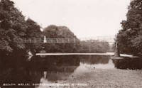
1854: Caerhowel
Caerhowel, Wales, United Kingdom - River Severn
| Bridgemeister ID: | 407 (added before 2003) |
| Year Completed: | 1854 |
| Name: | Caerhowel |
| Location: | Caerhowel, Wales, United Kingdom |
| Crossing: | River Severn |
| Status: | Collapsed, 1858 |
Notes:
- Based on Dredge's patent.
1867: Doldowlod
Doldowlod, Llandrindod Wells, Wales, United Kingdom - River Wye
| Bridgemeister ID: | 5085 (added 2020-09-04) |
| Year Completed: | 1867 |
| Name: | Doldowlod |
| Also Known As: | Llanwrthyl, Ystrad |
| Location: | Doldowlod, Llandrindod Wells, Wales, United Kingdom |
| Crossing: | River Wye |
| Coordinates: | 52.244210 N 3.462324 W |
| Maps: | Acme, GeoHack, Google, OpenStreetMap |
| Principals: | William Dredge |
| Use: | Footbridge |
| Status: | In use (last checked: 2018) |
| Main Cables: | Rod (iron) |
| Suspended Spans: | 1 |
Notes:
- Dredge patent bridge, possibly completed by his son William Dredge.
External Links:
- The Happy Pontist: Welsh Bridges: 10. Doldowlod Bridge. Photos and discussion of its history and uncertainty about the year it was completed.
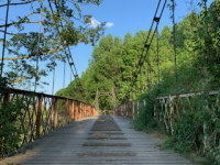
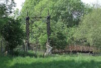
1903: Pickhill
Pickhill, Wales, United Kingdom - River Dee
| Bridgemeister ID: | 4562 (added 2020-06-01) |
| Year Completed: | 1903 |
| Name: | Pickhill |
| Also Known As: | Pickhill Meadows |
| Location: | Pickhill, Wales, United Kingdom |
| Crossing: | River Dee |
| Coordinates: | 53.017265 N 2.884666 W |
| Maps: | Acme, GeoHack, Google, OpenStreetMap |
| Principals: | David Rowell & Co. |
| Use: | Vehicular (one-lane) |
| Status: | Restricted to foot traffic (last checked: 2020) |
| Main Cables: | Wire (steel) |
| Suspended Spans: | 1 |
| Main Span: | 1 x 41 meters (134.5 feet) |
| Deck width: | 3 meters |
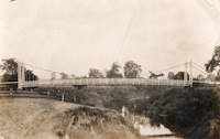
1904: (footbridge)
Conwy, Wales, United Kingdom - River Conwy
| Bridgemeister ID: | 512 (added before 2003) |
| Year Completed: | 1904 |
| Name: | (footbridge) |
| Location: | Conwy, Wales, United Kingdom |
| Crossing: | River Conwy |
| Coordinates: | 53.280346 N 3.823733 W |
| Maps: | Acme, GeoHack, Google, OpenStreetMap |
| Principals: | Alfred Thorne |
| Use: | Footbridge |
| Status: | Removed |
| Main Cables: | Wire (steel) |
| Suspended Spans: | 1 |
Notes:
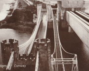
- This entry refers to the steel suspension footbridge nestled between Telford's suspension bridge and Stephenson's rail bridge. Click the photo to get a better view of this bridge. According to Susan Ellis, Senior Archivist of the Conwy County Borough Council, the bridge was built on the recommendation of John J. Webster who was hired to inspect Telford's suspension bridge in 1902 "following fears about the safety of its condition. He reported back making various recommendation for strengthening the bridge, including that a separate footbridge be constructed."
- This footbridge was in existence until at least 1957.
- Next to 1826 Conwy (Conway) - Conwy, Wales, United Kingdom.
Annotated Citations:
- "Conway Suspension Bridge." The Engineer, 20 May 1904.
This detailed account of the 1904 reinforcement of Telford's adjacent bridge does not mention the existence of, or building of, an additional footbridge. It does describe adding a cantilevered walkway to one side of Telford's bridge. This walkway was, indeed, built, and can be seen in the linked image on the left side of the older bridge. Thus, it is not entirely clear whether this bridge was actually constructed in 1904 and the work of Alfred Thorne (who was very much associated with the Telford bridge reinforcement project)

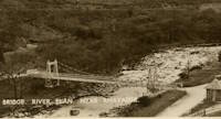
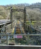
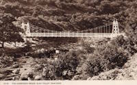
1904: Elan Village
Elan, Rhayader, Wales, United Kingdom - River Elan
| Bridgemeister ID: | 1255 (added 2004-02-28) |
| Year Completed: | 1904 |
| Name: | Elan Village |
| Location: | Elan, Rhayader, Wales, United Kingdom |
| Crossing: | River Elan |
| Coordinates: | 52.27099 N 3.56900 W |
| Maps: | Acme, GeoHack, Google, OpenStreetMap |
| Principals: | Birmingham Water Corporation |
| Status: | Closed, 1988 (last checked: 2013) |
| Suspended Spans: | 1 |
Notes:
- Rebuilt twice.
External Links:
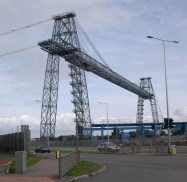
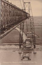
1906: Newport Transporter
Newport, Wales, United Kingdom - River Usk
| Bridgemeister ID: | 939 (added 2003-10-25) |
| Year Completed: | 1906 |
| Name: | Newport Transporter |
| Location: | Newport, Wales, United Kingdom |
| Crossing: | River Usk |
| Coordinates: | 51.570642 N 2.985246 W |
| Maps: | Acme, GeoHack, Google, OpenStreetMap |
| Principals: | Ferdinand Arnodin |
| References: | AAJ, NTB |
| Use: | Transporter |
| Status: | In use (last checked: 2011) |
| Main Cables: | Wire (steel) |
| Suspended Spans: | 1 |
| Main Span: | 1 x 196.6 meters (645 feet) |
External Links:
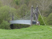
1911: Swing
Llandeilo, Wales, United Kingdom - Towy River
| Bridgemeister ID: | 1399 (added 2004-07-04) |
| Year Completed: | 1911 |
| Name: | Swing |
| Also Known As: | King's, Shaky |
| Location: | Llandeilo, Wales, United Kingdom |
| Crossing: | Towy River |
| Coordinates: | 51.884462 N 3.986061 W |
| Maps: | Acme, GeoHack, Google, OpenStreetMap |
| Use: | Footbridge |
| Status: | In use (last checked: 2018) |
| Main Cables: | Wire (steel) |
| Suspended Spans: | 1 |
External Links:
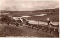
1922: Llanstephan
Llanstephan, Wales, United Kingdom - River Wye
| Bridgemeister ID: | 1964 (added 2005-11-12) |
| Year Completed: | 1922 |
| Name: | Llanstephan |
| Location: | Llanstephan, Wales, United Kingdom |
| Crossing: | River Wye |
| Coordinates: | 52.06604 N 3.29614 W |
| Maps: | Acme, GeoHack, Google, OpenStreetMap |
| Principals: | David Rowell & Co. |
| Use: | Vehicular (one-lane) |
| Status: | In use (last checked: 2021) |
| Main Cables: | Wire (steel) |
| Suspended Spans: | 1 |
External Links:
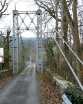
1926: Fron
Fron, Llandyssil, Wales, United Kingdom - River Severn
| Bridgemeister ID: | 4617 (added 2020-06-07) |
| Year Completed: | 1926 |
| Name: | Fron |
| Location: | Fron, Llandyssil, Wales, United Kingdom |
| Crossing: | River Severn |
| Coordinates: | 52.568132 N 3.207281 W |
| Maps: | Acme, GeoHack, Google, OpenStreetMap |
| Principals: | David Rowell & Co. |
| Use: | Footbridge |
| Status: | Extant (last checked: 2009) |
| Main Cables: | Wire (steel) |
External Links:
1929: Chainbridge
Berwyn, Llangollen, Wales, United Kingdom - River Dee
| Bridgemeister ID: | 1303 (added 2004-04-09) |
| Year Completed: | 1929 |
| Name: | Chainbridge |
| Also Known As: | Chain |
| Location: | Berwyn, Llangollen, Wales, United Kingdom |
| Crossing: | River Dee |
| Coordinates: | 52.98025 N 3.1946 W |
| Maps: | Acme, GeoHack, Google, OpenStreetMap |
| Principals: | Sir Henry Robertson |
| Use: | Footbridge |
| Status: | In use (last checked: 2019) |
| Main Cables: | Chain |
| Suspended Spans: | 1 |
| Main Span: | 1 |
Notes:
- Crosses both River Dee and Llangollen Canal
- A thorough report on these bridges was published in 2010 by the Royal Commission on the Ancient and Historical Monuments of Wales (RCAHMW), Chain Bridge, Llantysilio, Denbighshire. The Pickering bridge (built 1817, according to the report) was contructed with the deck laid on the chains. This bridge was removed in 1870 but appears not to have been replaced until at least 1876. The new bridge, not simply refurbished, was constructed with the deck supported by the chains underneath, but in an "underspanned" fashion with small pillars resting on the chains, supporting a level deck. This bridge was destroyed by flood on Feb. 16, 1928. The report also investigates whether the chains of the current (1929) bridge are the original chains from the 1817 Pickering bridge and concludes there is evidence "supporting the hypothesis that the chains we see on the bridge today are same as those put on the bridge in 1817" and adds "If the present chains are the originals, there is little reason to doubt that they are the oldest suspension bridge chains in the western world."
- 2015: Underwent major restoration and reopened.
External Links:
- Chainbridge Hotel. The bridge is situated next to the hotel. Their web site notes the original "chain bridge" at this location was built in 1814 by Exuperious Pickering and was refurbished in 1870 and rebuilt in 1929.
- Structurae - Structure ID 20074318
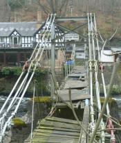
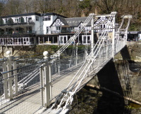
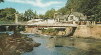
1930: Sappers'
Betws-y-Coed, Wales, United Kingdom - River Conwy
| Bridgemeister ID: | 445 (added before 2003) |
| Year Completed: | 1930 |
| Name: | Sappers' |
| Location: | Betws-y-Coed, Wales, United Kingdom |
| Crossing: | River Conwy |
| Coordinates: | 53.09221 N 3.79928 W |
| Maps: | Acme, GeoHack, Google, OpenStreetMap |
| Principals: | David Rowell & Co. |
| Use: | Footbridge |
| Status: | Closed, December 2021 (last checked: 2023) |
| Main Cables: | Wire (steel) |
| Suspended Spans: | 1 |
Notes:
- 2021, December: Closed due to deteriorating condition. Repairs expected to start in April 2022.
- 2023, February: Still closed. May be replaced.
Annotated Citations:
- Evans, Hari. "Near century old Snowdonia wobbly bridge that's rotting away and may soon be replaced." North Wales Live, 9 Feb. 2023, https://www.dailypost.co.uk/news/north-wales-news/near-century-old-snowdonia-wobbly-26198160.
"The suspension bridge used to be renowned for its wobbly midpoint and was a key shortcut across the River Conwy for locals and tourists. However, structural reviews conducted last year found that virtually the entire bridge would need to be refurbished, with the entire timber deck as well as other parts replaced completely."
External Links:

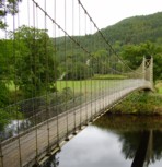
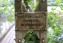
1951: Festival
Aberhafesp, Wales, United Kingdom - River Severn
| Bridgemeister ID: | 1921 (added 2005-10-09) |
| Year Completed: | 1951 |
| Name: | Festival |
| Location: | Aberhafesp, Wales, United Kingdom |
| Crossing: | River Severn |
| Coordinates: | 52.521329 N 3.389172 W |
| Maps: | Acme, GeoHack, Google, OpenStreetMap |
| Principals: | David Rowell & Co. |
| Use: | Footbridge |
| Status: | In use (last checked: 2016) |
| Main Cables: | Wire (steel) |
| Suspended Spans: | 1 |
External Links:
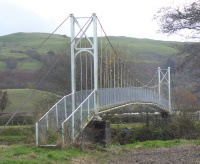
1958: (footbridge)
Glanamman, Ammanford, Wales, United Kingdom - Amman River
| Bridgemeister ID: | 1398 (added 2004-07-04) |
| Year Completed: | 1958 |
| Name: | (footbridge) |
| Location: | Glanamman, Ammanford, Wales, United Kingdom |
| Crossing: | Amman River |
| Coordinates: | 51.8007 N 3.95425 W |
| Maps: | Acme, GeoHack, Google, OpenStreetMap |
| Principals: | David Rowell & Co. |
| Use: | Footbridge |
| Status: | In use (last checked: 2013) |
| Main Cables: | Wire (steel) |
| Suspended Spans: | 1 |
Notes:
- Allan Agate writes: "I was the Project Engineer for this footbridge and can therefore confirm it was designed and built by David Rowell Ltd and almost certainly the last suspension bridge they built. It was a hybrid of earlier bridges making use of new bolted hot rolled sections instead of riveted composite tower construction. The date was about 1962/3." I am not sure of the provenance of the 1958 date associated with this bridge and I don't have reason to question Mr. Agate's recollection of the bridge completed a few years later.
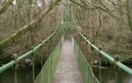
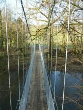
1973: (footbridge)
Newtown, Wales, United Kingdom - River Severn
| Bridgemeister ID: | 4616 (added 2020-06-07) |
| Year Completed: | 1973 |
| Name: | (footbridge) |
| Location: | Newtown, Wales, United Kingdom |
| Crossing: | River Severn |
| At or Near Feature: | Dolerw Park |
| Coordinates: | 52.514964 N 3.319958 W |
| Maps: | Acme, GeoHack, Google, OpenStreetMap |
| Use: | Footbridge |
| Status: | In use (last checked: 2018) |
| Main Cables: | Wire (steel) |
| Suspended Spans: | 1 |
External Links:
(footbridge)
Cwmcrawnon, Powys, Wales, United Kingdom - River Usk
| Bridgemeister ID: | 2933 (added 2019-09-16) |
| Name: | (footbridge) |
| Location: | Cwmcrawnon, Powys, Wales, United Kingdom |
| Crossing: | River Usk |
| At or Near Feature: | Buckland Old Mill |
| Coordinates: | 51.873303 N 3.257608 W |
| Maps: | Acme, GeoHack, Google, OpenStreetMap |
| Use: | Footbridge |
| Status: | Extant (last checked: 2009) |
| Main Cables: | Wire (steel) |
(footbridge)
Landetty, Talybont-on-Usk vicinity, Powys, Wales, United Kingdom - River Usk
| Bridgemeister ID: | 917 (added 2003-10-12) |
| Name: | (footbridge) |
| Location: | Landetty, Talybont-on-Usk vicinity, Powys, Wales, United Kingdom |
| Crossing: | River Usk |
| At or Near Feature: | Brecon Beacons National Park |
| Coordinates: | 51.88075 N 3.26747 W |
| Maps: | Acme, GeoHack, Google, OpenStreetMap |
| Principals: | David Rowell & Co. |
| Use: | Footbridge |
| Status: | Derelict (last checked: 2013) |
| Main Cables: | Wire |
| Suspended Spans: | 1 |
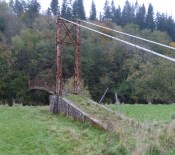
(footbridge)
Llanilar, Wales, United Kingdom - River Ystwyth
| Bridgemeister ID: | 2355 (added 2007-08-19) |
| Name: | (footbridge) |
| Location: | Llanilar, Wales, United Kingdom |
| Crossing: | River Ystwyth |
| Coordinates: | 52.35817 N 4.01410 W |
| Maps: | Acme, GeoHack, Google, OpenStreetMap |
| Use: | Footbridge |
| Status: | In use (last checked: 2018) |
| Main Cables: | Wire |
External Links:
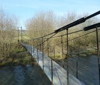
(footbridge)
Merthyr Mawr, Wales, United Kingdom - Ogmore River
| Bridgemeister ID: | 1879 (added 2005-09-24) |
| Name: | (footbridge) |
| Location: | Merthyr Mawr, Wales, United Kingdom |
| Crossing: | Ogmore River |
| Coordinates: | 51.48425 N 3.609 W |
| Maps: | Acme, GeoHack, Google, OpenStreetMap |
| Use: | Footbridge |
| Status: | In use (last checked: 2013) |
| Main Cables: | Wire (steel) |
| Suspended Spans: | 1 |
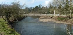
Gower
Llanrwst and Trefriw, Wales, United Kingdom - River Conwy
| Bridgemeister ID: | 514 (added before 2003) |
| Name: | Gower |
| Also Known As: | Gower Road |
| Location: | Llanrwst and Trefriw, Wales, United Kingdom |
| Crossing: | River Conwy |
| Coordinates: | 53.14310 N 3.80687 W |
| Maps: | Acme, GeoHack, Google, OpenStreetMap |
| References: | BEM |
| Use: | Footbridge |
| Status: | In use (last checked: 2013) |
| Main Cables: | Wire (steel) |
| Suspended Spans: | 1 |

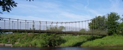
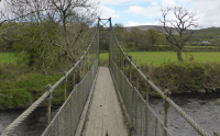
Swing
Pantyffynnon, Ammanford vicinity, Wales, United Kingdom - Amman River
| Bridgemeister ID: | 1420 (added 2004-07-17) |
| Name: | Swing |
| Location: | Pantyffynnon, Ammanford vicinity, Wales, United Kingdom |
| Crossing: | Amman River |
| Coordinates: | 51.778483 N 3.994317 W |
| Maps: | Acme, GeoHack, Google, OpenStreetMap |
| Use: | Footbridge |
| Status: | In use (last checked: 2014) |
| Main Cables: | Wire (steel) |
| Suspended Spans: | 1 |
Taff Valley
Abercynon, Wales, United Kingdom - River Taff
| Bridgemeister ID: | 2179 (added 2007-01-13) |
| Name: | Taff Valley |
| Location: | Abercynon, Wales, United Kingdom |
| Crossing: | River Taff |
| Principals: | Louis Harper |
| References: | HARPER |
| Use: | Footbridge |
| Status: | Destroyed, by flood, 1942 |
| Main Cables: | Wire |
| Suspended Spans: | 1 |
Notes:
- HARPER: Completed circa 1900.
External Links:
Trelewis
Treharris and Trelewis, Wales, United Kingdom - Bargod Taf
| Bridgemeister ID: | 3024 (added 2019-10-13) |
| Name: | Trelewis |
| Location: | Treharris and Trelewis, Wales, United Kingdom |
| Crossing: | Bargod Taf |
| Coordinates: | 51.667242 N 3.300125 W |
| Maps: | Acme, GeoHack, Google, OpenStreetMap |
| Use: | Footbridge |
| Status: | In use (last checked: 2019) |
| Suspended Spans: | 1 |
External Links:
Do you have any information or photos for these bridges that you would like to share? Please email david.denenberg@bridgemeister.com.