Suspension Bridges of Washington
This is a list of all 48 bridges from the suspension bridge inventory for Washington in USA. Wherever you see a Bridgemeister ID number click it to isolate the bridge on its own page.
Related Lists:
1899: Baring
Baring, Washington, USA - Skykomish River
| Bridgemeister ID: | 1902 (added 2005-10-07) |
| Year Completed: | 1899 |
| Name: | Baring |
| Location: | Baring, Washington, USA |
| Crossing: | Skykomish River |
| Coordinates: | 47.765407 N 121.480206 W |
| Maps: | Acme, GeoHack, Google, OpenStreetMap |
| References: | SPW |
| Use: | Vehicular |
| Status: | Collapsed, 1952 |
Notes:
- Replaced by 1953 Baring - Baring, Washington, USA.
1905: Kelso
Kelso, Washington, USA - Cowlitz River
| Bridgemeister ID: | 1651 (added 2005-03-19) |
| Year Completed: | 1905 |
| Name: | Kelso |
| Location: | Kelso, Washington, USA |
| Crossing: | Cowlitz River |
| References: | AAJ, PTS2 |
| Use: | Vehicular |
| Status: | Collapsed, Jan. 3, 1923 |
| Main Cables: | Wire (steel) |
| Suspended Spans: | 1 |
| Main Span: | 1 x 91.4 meters (300 feet) |
Notes:
- Washed out, 1906. Rebuilt, 1907. Collapsed, 1923, killing "12 to 15 persons" when one of the cables parted with the anchorage.
External Links:
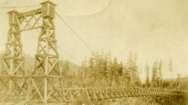
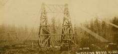
1913: Wind River
Carson, Washington, USA - Wind River
| Bridgemeister ID: | 1005 (added 2003-11-21) |
| Year Completed: | 1913 |
| Name: | Wind River |
| Location: | Carson, Washington, USA |
| Crossing: | Wind River |
| References: | SPW |
| Use: | Vehicular (one-lane) |
| Status: | Replaced |
| Main Cables: | Wire |
| Suspended Spans: | 1 |
Notes:
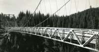
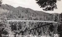
- The bridge appears identical in the two photos except for the tops of the towers. In one of the photos, it appears some protective housing has been added to cover the cable saddles and an extra brace has been added across the tower.
- Replaced by 1925 Wind River - Carson, Washington, USA.
1915: (footbridge)
Chiwaukum vicinity, Washington, USA - Wenatchee River
| Bridgemeister ID: | 1424 (added 2004-07-18) |
| Year Completed: | 1915 |
| Name: | (footbridge) |
| Location: | Chiwaukum vicinity, Washington, USA |
| Crossing: | Wenatchee River |
| Principals: | National Forest Service |
| References: | AAJ, PTS2 |
| Use: | Footbridge |
| Main Cables: | Wire (steel) |
| Suspended Spans: | 1 |
| Main Span: | 1 x 57.9 meters (190 feet) |
1919: Beebe
Beebe and Chelan, Washington, USA - Columbia River
| Bridgemeister ID: | 1188 (added 2004-01-24) |
| Year Completed: | 1919 |
| Name: | Beebe |
| Location: | Beebe and Chelan, Washington, USA |
| Crossing: | Columbia River |
| Coordinates: | 47.81308 N 119.97245 W |
| Maps: | Acme, GeoHack, Google, OpenStreetMap |
| Principals: | A. Munster, Wenatchee-Beebe Orchard Co. |
| References: | AAJ, PTS2, SPW |
| Use: | Pipeline and Vehicular |
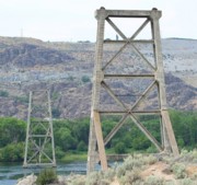
| Status: | Only towers remain, since 1963 (last checked: 2022) |
| Main Cables: | Wire (steel) |
| Suspended Spans: | 1 |
| Main Span: | 1 x 192.6 meters (632 feet) |
| Deck width: | 12 feet |
Notes:
- The towers are still standing next to the current US97 crossing at Beebe.
- AAJ: Private bridge, built primarily to carry water to the owner's orchard, but also carried a roadway.
External Links:
- The Beebe Bridge | Empire Press | wenatcheeworld.com. Article about the history of the bridge.
- Structurae - Structure ID 20052092
1924: Longmire
Packwood vicinity, Washington, USA - Nisqually River
| Bridgemeister ID: | 142 (added before 2003) |
| Year Completed: | 1924 |
| Name: | Longmire |
| Location: | Packwood vicinity, Washington, USA |
| Crossing: | Nisqually River |
| At or Near Feature: | Mt. Rainier National Park |
| Coordinates: | 46.74903 N 121.80777 W |
| Maps: | Acme, GeoHack, Google, OpenStreetMap |
| Principals: | James A. French |
| Use: | Vehicular (one-lane) and Pipeline |
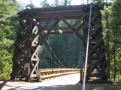
| Status: | In use (last checked: 2006) |
| Main Cables: | Wire (steel) |
| Suspended Spans: | 1 |
| Main Span: | 1 x 55.8 meters (183 feet) estimated |
Notes:
- Reconstructed, 1950.
External Links:
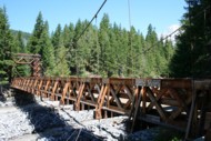
1925: Wind River
Carson, Washington, USA - Wind River
| Bridgemeister ID: | 1004 (added 2003-11-21) |
| Year Completed: | 1925 |
| Name: | Wind River |
| Location: | Carson, Washington, USA |
| Crossing: | Wind River |
| References: | SPW |
| Use: | Vehicular |
| Status: | Replaced, 1961 |
| Main Cables: | Wire (steel) |
| Suspended Spans: | 1 |
Notes:
- Circa 1930's steel vehicular suspension bridge. Bypassed, 1961 (by the Conrad Lundy Jr. bridge) and removed some time after.
- Replaced 1913 Wind River - Carson, Washington, USA.

1932: Lewis River
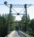
Yale, Washington, USA - Lewis River
| Bridgemeister ID: | 176 (added before 2003) |
| Year Completed: | 1932 |
| Name: | Lewis River |
| Also Known As: | Yale |
| Location: | Yale, Washington, USA |
| Crossing: | Lewis River |
| Coordinates: | 45.96167 N 122.37167 W |
| Maps: | Acme, GeoHack, Google, OpenStreetMap |
| Principals: | Harold H. Gilbert, Gilpin Construction Co. |
| References: | AAJ, SPW, SSS |
| Use: | Vehicular (one-lane) |
| Status: | In use (last checked: 2005) |
| Main Cables: | Wire (steel) |
| Suspended Spans: | 1 |
| Main Span: | 1 x 91.4 meters (300 feet) |
| Deck width: | 17 feet |
Notes:
- Rebuilt 1957, 1958.
External Links:
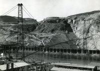
1935: Grand Coulee Dam
Grand Coulee, Washington, USA - Columbia River
| Bridgemeister ID: | 3157 (added 2019-11-03) |
| Year Completed: | 1935 |
| Name: | Grand Coulee Dam |
| Location: | Grand Coulee, Washington, USA |
| Crossing: | Columbia River |
| Use: | Conveyor |
| Status: | Removed |
| Main Cables: | Wire (steel) |
| Main Span: | 1 x 438 meters (1,437 feet) |
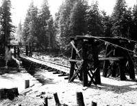
1935: Trude
Trude, Washington, USA - Cedar River
| Bridgemeister ID: | 1956 (added 2005-11-04) |
| Year Completed: | 1935 |
| Name: | Trude |
| Location: | Trude, Washington, USA |
| Crossing: | Cedar River |
| Use: | Vehicular (one-lane) |
| Main Cables: | Wire |
| Suspended Spans: | 1 |
Notes:
- Likely removed.
External Links:
- Seattle Municipal Archives Digital Collections : Image Record : Trude bridge Cedar River [under construction] [50628]. Several other images available in this collection.
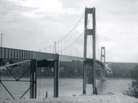
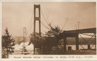
1940: Tacoma Narrows
Tacoma and Gig Harbor, Washington, USA - Puget Sound
| Bridgemeister ID: | 198 (added before 2003) |
| Year Completed: | 1940 |
| Name: | Tacoma Narrows |
| Also Known As: | Galloping Gertie |
| Location: | Tacoma and Gig Harbor, Washington, USA |
| Crossing: | Puget Sound |
| Coordinates: | 47.267015 N 122.548462 W |
| Maps: | Acme, GeoHack, Google, OpenStreetMap |
| Principals: | Leon Moisseiff |
| References: | AAJ, BAR, BBR, BFL, BMA, BPL, COB, CTT, GBD, IT1999F, SPW |
| Use: | Vehicular (two-lane, heavy vehicles), with walkway |
| Status: | Collapsed, 1940 |
| Main Cables: | Wire (steel) |
| Suspended Spans: | 3 |
| Main Span: | 1 x 853.4 meters (2,800 feet) |
| Side Spans: | 2 x 335.3 meters (1,100 feet) |
| Deck width: | 39 feet |
Notes:
- Famously destroyed by wind, November 7, 1940.
- Replaced by 1950 Tacoma Narrows (Sturdy Gertie, Second Tacoma Narrows) - Tacoma and Gig Harbor, Washington, USA.
- See 1944 Liard River - Liard River Hot Springs vicinity, British Columbia, Canada. According to CTT, "Two sections from the Tacoma bridge's east approach were [re]used in the Liard span."
External Links:



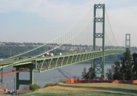
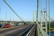
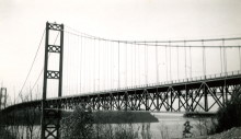
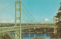
1950: Tacoma Narrows
Tacoma and Gig Harbor, Washington, USA - Puget Sound
| Bridgemeister ID: | 206 (added before 2003) |
| Year Completed: | 1950 |
| Name: | Tacoma Narrows |
| Also Known As: | Sturdy Gertie, Second Tacoma Narrows |
| Location: | Tacoma and Gig Harbor, Washington, USA |
| Crossing: | Puget Sound |
| Coordinates: | 47.270540 N 122.552895 W |
| Maps: | Acme, GeoHack, Google, OpenStreetMap |
| Principals: | Dexter R. Smith |
| References: | BBR, BC3, BCO, BFL, COB, CTT, SPW |
| Use: | Vehicular (major highway), with walkway |
| Status: | In use (last checked: 2022) |
| Main Cables: | Wire (steel) |
| Suspended Spans: | 3 |
| Main Span: | 1 x 853.4 meters (2,800 feet) |
| Side Spans: | 2 x 335.3 meters (1,100 feet) |
| Deck width: | 46f 8in |
Notes:
- Retrofit scheduled for completion, spring 2008.
- Replaced 1940 Tacoma Narrows (Galloping Gertie) - Tacoma and Gig Harbor, Washington, USA.
- Next to 2007 Third Tacoma Narrows - Tacoma and Gig Harbor, Washington, USA.
External Links:

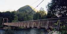
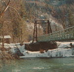
1953: Baring
Baring, Washington, USA - Skykomish River
| Bridgemeister ID: | 894 (added 2003-09-07) |
| Year Completed: | 1953 |
| Name: | Baring |
| Location: | Baring, Washington, USA |
| Crossing: | Skykomish River |
| Coordinates: | 47.765158 N 121.480893 W |
| Maps: | Acme, GeoHack, Google, OpenStreetMap |
| References: | SPW |
| Use: | Vehicular (one-lane) |
| Status: | In use (last checked: 2003) |
| Main Cables: | Wire (steel) |
| Suspended Spans: | 1 |
| Main Span: | 1 x 106.7 meters (350 feet) |
Notes:
- Towers replaced, 1958. Substantially rehabilitated 1978, 1993.
- Replaced 1899 Baring - Baring, Washington, USA.
1969: Gorge Inn
Newhalem, Washington, USA - Skagit River
| Bridgemeister ID: | 225 (added before 2003) |
| Year Completed: | 1969 |
| Name: | Gorge Inn |
| Location: | Newhalem, Washington, USA |
| Crossing: | Skagit River |
| At or Near Feature: | Trail of the Cedars |
| Coordinates: | 48.672167 N 121.246333 W |
| Maps: | Acme, GeoHack, Google, OpenStreetMap |
| Principals: | Seattle City Light |
| Use: | Footbridge |
| Status: | In use (last checked: 2009) |
| Main Cables: | Wire (steel) |
| Suspended Spans: | 1 |
| Main Span: | 1 x 76.2 meters (250 feet) |
Notes:
- Tower collapsed October, 2000 under weight of thirty pedestrians and the entire bridge buckled. Repaired by Sahale, 2001.
- Near (footbridge) - Newhalem, Washington, USA.
External Links:

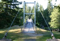
1992: Jordan
Jordan, Arlington vicinity, Washington, USA - Stillaguamish River South Fork
| Bridgemeister ID: | 1669 (added 2005-03-21) |
| Year Completed: | 1992 |
| Name: | Jordan |
| Location: | Jordan, Arlington vicinity, Washington, USA |
| Crossing: | Stillaguamish River South Fork |
| At or Near Feature: | Jordan Bridge County Park |
| Coordinates: | 48.147583 N 122.0382 W |
| Maps: | Acme, GeoHack, Google, OpenStreetMap |
| Use: | Footbridge |
| Status: | In use (last checked: 2006) |
| Main Cables: | Wire (steel) |
| Suspended Spans: | 1 |
| Main Span: | 1 x 78.6 meters (258 feet) estimated |
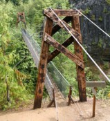
1993: Lava Canyon
Mt. St. Helens National Volcanic Monument, Washington, USA - Muddy River
| Bridgemeister ID: | 895 (added 2003-09-07) |
| Year Completed: | 1993 |
| Name: | Lava Canyon |
| Location: | Mt. St. Helens National Volcanic Monument, Washington, USA |
| Crossing: | Muddy River |
| At or Near Feature: | Lava Canyon Falls |
| Coordinates: | 46.169267 N 122.0832 W |
| Maps: | Acme, GeoHack, Google, OpenStreetMap |
| Principals: | Sahale, LLC |
| Use: | Footbridge |
| Status: | Closed, 2019 (last checked: 2019) |
| Main Cables: | Wire (steel) |
| Suspended Spans: | 1 |
| Main Span: | 1 x 30.5 meters (100 feet) |
| Deck width: | 3 feet |
Notes:
- Closed in 2019 (or perhaps soon before) after a cable snapped. Cause of the damage is unclear.
External Links:
1995: Tahoma Creek
Mt. Rainier National Park, Washington, USA - Tahoma Creek
| Bridgemeister ID: | 1433 (added 2004-07-30) |
| Year Completed: | 1995 |
| Name: | Tahoma Creek |
| Location: | Mt. Rainier National Park, Washington, USA |
| Crossing: | Tahoma Creek |
| At or Near Feature: | Wonderland Trail |
| Coordinates: | 46.80479 N 121.84812 W |
| Maps: | Acme, GeoHack, Google, OpenStreetMap |
| Use: | Footbridge |
| Status: | In use (last checked: 2006) |
| Main Cables: | Wire (steel) |
| Suspended Spans: | 1 |
| Main Span: | 1 x 61.9 meters (203 feet) estimated |
Notes:
- Damaged by flooding, November 2006. From a News Tribune (Tacoma, Washington) article on June 11, 2007: "Trail crews last week discovered that supporting cables at one end of the suspension bridge may have been weakened by flooding last November."
- Replaced a drooping catwalk-style suspension bridge that was anchored on different foundations still present at the bridge site. Both bridges appear to have coexisted for some time around 1995.
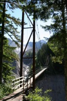
1995: Tawlks-Foster
Mazama vicinity, Washington, USA - Methow River
| Bridgemeister ID: | 240 (added before 2003) |
| Year Completed: | 1995 |
| Name: | Tawlks-Foster |
| Location: | Mazama vicinity, Washington, USA |
| Crossing: | Methow River |
| Coordinates: | 48.570617 N 120.369183 W |
| Maps: | Acme, GeoHack, Google, OpenStreetMap |
| Principals: | Sahale, LLC |
| Use: | Footbridge and Pack |
| Status: | In use (last checked: 2015) |
| Main Cables: | Wire (steel) |
| Suspended Spans: | 1 |
| Main Span: | 1 x 85.3 meters (280 feet) |
| Deck width: | 11 feet |
External Links:
- Sahale, LLC. The Sahale site shows the bridge being load tested with a Chevy Suburban, so the deck is wide enough for vehicular traffic, but the bridge appears to be restricted to foot and hoof traffic.
- Structurae - Structure ID 20008196
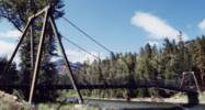
2002: Islandwood
Islandwood, Port Blakely, Washington, USA
| Bridgemeister ID: | 854 (added 2003-08-07) |
| Year Completed: | 2002 |
| Name: | Islandwood |
| Location: | Islandwood, Port Blakely, Washington, USA |
| Coordinates: | 47.60382 N 122.52683 W |
| Maps: | Acme, GeoHack, Google, OpenStreetMap |
| Principals: | Sahale, LLC |
| Use: | Footbridge |
| Status: | In use (last checked: 2007) |
| Main Cables: | Wire (steel) |
| Suspended Spans: | 1 |
| Main Span: | 1 x 57.9 meters (190 feet) |
| Deck width: | 4 feet |
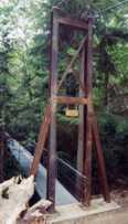
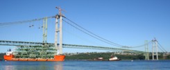
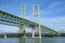
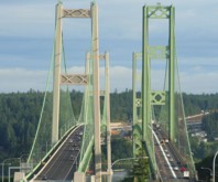
2007: Third Tacoma Narrows
Tacoma and Gig Harbor, Washington, USA - Puget Sound
| Bridgemeister ID: | 1952 (added 2005-11-04) |
| Year Completed: | 2007 |
| Name: | Third Tacoma Narrows |
| Location: | Tacoma and Gig Harbor, Washington, USA |
| Crossing: | Puget Sound |
| Coordinates: | 47.26803 N 122.55121 W |
| Maps: | Acme, GeoHack, Google, OpenStreetMap |
| References: | CTT |
| Use: | Vehicular (major highway) |
| Status: | In use (last checked: 2020) |
| Main Cables: | Wire (steel) |
| Suspended Spans: | 3 |
| Main Span: | 1 x 853.4 meters (2,800 feet) |
| Side Spans: | 1 x 365.8 meters (1,200 feet), 1 x 426.7 meters (1,400 feet) |
| Deck width: | 78 feet |
Notes:
- At former location of 1940 Tacoma Narrows (Galloping Gertie) - Tacoma and Gig Harbor, Washington, USA.
- Next to 1950 Tacoma Narrows (Sturdy Gertie, Second Tacoma Narrows) - Tacoma and Gig Harbor, Washington, USA.
External Links:
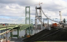

2012: Bellevue Botanical Garden
Bellevue, Washington, USA
| Bridgemeister ID: | 2668 (added 2019-03-15) |
| Year Completed: | 2012 |
| Name: | Bellevue Botanical Garden |
| Location: | Bellevue, Washington, USA |
| At or Near Feature: | Ravine Experience Trail |
| Coordinates: | 47.606556 N 122.176972 W |
| Maps: | Acme, GeoHack, Google, OpenStreetMap |
| Principals: | Seattle Bridge LLC |
| Use: | Footbridge |
| Status: | In use (last checked: 2018) |
| Main Cables: | Wire (steel) |
| Main Span: | 1 x 46.3 meters (152 feet) |
External Links:
2013: North Fork Skokomish River Trail
Olympic National Park, Washington, USA - North Fork Skokomish River
| Bridgemeister ID: | 3991 (added 2020-03-22) |
| Year Completed: | 2013 |
| Name: | North Fork Skokomish River Trail |
| Also Known As: | Staircase Rapids Trail |
| Location: | Olympic National Park, Washington, USA |
| Crossing: | North Fork Skokomish River |
| At or Near Feature: | Skokomish River Trail |
| Coordinates: | 47.524521 N 123.341875 W |
| Maps: | Acme, GeoHack, Google, OpenStreetMap |
| Principals: | MACNAK Construction |
| Use: | Footbridge |
| Status: | In use (last checked: 2020) |
| Main Cables: | Wire (steel) |
| Main Span: | 1 x 64 meters (210 feet) estimated |
(conveyor bridge)
Pasco vicinity, Washington, USA - Snake River
| Bridgemeister ID: | 2034 (added 2006-05-01) |
| Name: | (conveyor bridge) |
| Location: | Pasco vicinity, Washington, USA |
| Crossing: | Snake River |
| At or Near Feature: | Ice Harbor Lock and Dam |
| Principals: | John A. Roebling's Sons |
| Use: | Conveyor |
| Status: | Removed |
| Main Cables: | Wire (steel) |
| Suspended Spans: | 1 |
| Main Span: | 1 x 304.8 meters (1,000 feet) |
Notes:
- Built late 1950s or 1960. Pictured and described in Roebling ad in July 1960 issue of Civil Engineering. Built to transport concrete aggregate during construction of the dam. Likely removed.
(footbridge)
Auburn, Washington, USA - Green River
| Bridgemeister ID: | 2169 (added 2007-01-12) |
| Name: | (footbridge) |
| Location: | Auburn, Washington, USA |
| Crossing: | Green River |
| At or Near Feature: | Isaac Evans Park |
| Coordinates: | 47.32745 N 122.21021 W |
| Maps: | Acme, GeoHack, Google, OpenStreetMap |
| Use: | Footbridge |
| Status: | In use (last checked: 2007) |
| Main Cables: | Wire (steel) |
| Suspended Spans: | 1 |
| Main Span: | 1 x 50 meters (164 feet) estimated |
(footbridge)
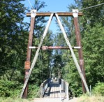
Carnation, Washington, USA - Snoqualmie River
| Bridgemeister ID: | 773 (added 2003-03-14) |
| Name: | (footbridge) |
| Location: | Carnation, Washington, USA |
| Crossing: | Snoqualmie River |
| At or Near Feature: | Tolt-McDonald Park |
| Coordinates: | 47.64391 N 121.9251 W |
| Maps: | Acme, GeoHack, Google, OpenStreetMap |
| Use: | Footbridge |
| Status: | In use (last checked: 2015) |
| Main Cables: | Wire (steel) |
| Suspended Spans: | 1 |
| Main Span: | 1 x 90.5 meters (297 feet) estimated |
External Links:
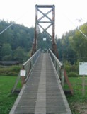
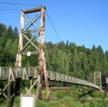
(footbridge)
Colville vicinity, Washington, USA - Mill Creek
| Bridgemeister ID: | 1884 (added 2005-09-24) |
| Name: | (footbridge) |
| Location: | Colville vicinity, Washington, USA |
| Crossing: | Mill Creek |
| At or Near Feature: | Douglas Falls Grange Park |
| Coordinates: | 48.6146 N 117.899917 W |
| Maps: | Acme, GeoHack, Google, OpenStreetMap |
| Use: | Footbridge |
| Status: | In use (last checked: 2005) |
(footbridge)
Diablo vicinity, Washington, USA
| Bridgemeister ID: | 1955 (added 2005-11-04) |
| Name: | (footbridge) |
| Location: | Diablo vicinity, Washington, USA |
| Use: | Footbridge |
| Main Cables: | Wire |
Notes:
- Circa 1930's, distinct from other Diablo-area suspension bridges listed.
(footbridge)
Mt. Rainier National Park, Washington, USA - Carbon River
| Bridgemeister ID: | 262 (added before 2003) |
| Name: | (footbridge) |
| Location: | Mt. Rainier National Park, Washington, USA |
| Crossing: | Carbon River |
| At or Near Feature: | Carbon Glacier Trail |
| Coordinates: | 46.94956 N 121.79537 W |
| Maps: | Acme, GeoHack, Google, OpenStreetMap |
| Use: | Footbridge |
| Status: | In use (last checked: 2006) |
| Main Cables: | Wire (steel) |
| Suspended Spans: | 1 |
| Main Span: | 1 x 61 meters (200 feet) estimated |
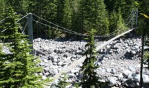
(footbridge)
Mt. Rainier National Park, Washington, USA - Ohanapecosh River
| Bridgemeister ID: | 651 (added 2003-02-22) |
| Name: | (footbridge) |
| Location: | Mt. Rainier National Park, Washington, USA |
| Crossing: | Ohanapecosh River |
| At or Near Feature: | Grove of the Patriarchs vicinity |
| Coordinates: | 46.76299 N 121.55637 W |
| Maps: | Acme, GeoHack, Google, OpenStreetMap |
| Use: | Footbridge |
| Status: | Closed, November 2021 (last checked: 2021) |
| Main Cables: | Wire (steel) |
| Suspended Spans: | 1 |
| Main Span: | 1 x 34.4 meters (113 feet) estimated |
Notes:
- 2021, November: Closed due to recent flood damage. Timeline for repair or replacement unclear.
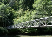
(footbridge)
Newhalem, Washington, USA - Skagit River
| Bridgemeister ID: | 1305 (added 2004-04-09) |
| Name: | (footbridge) |
| Location: | Newhalem, Washington, USA |
| Crossing: | Skagit River |
| Coordinates: | 48.67490 N 121.24074 W |
| Maps: | Acme, GeoHack, Google, OpenStreetMap |
| Use: | Footbridge |
| Status: | In use |
| Main Cables: | Wire (steel) |
| Suspended Spans: | 1 |
| Main Span: | 1 x 112.8 meters (370 feet) estimated |
Notes:
- Localted one half-mile upstream of the Gorge Inn bridge at the Seattle City Light Gorge Powerhouse.
- Near 1969 Gorge Inn - Newhalem, Washington, USA.
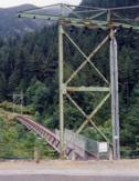
(footbridge)
Olympic National Park, Washington, USA - Elwha River
| Bridgemeister ID: | 2336 (added 2007-08-11) |
| Name: | (footbridge) |
| Location: | Olympic National Park, Washington, USA |
| Crossing: | Elwha River |
| At or Near Feature: | Long Ridge Trail |
| Coordinates: | 47.94223 N 123.54115 W |
| Maps: | Acme, GeoHack, Google, OpenStreetMap |
| Use: | Footbridge |
| Status: | In use (last checked: 2007) |
| Main Cables: | Wire (steel) |
| Suspended Spans: | 1 |
| Main Span: | 1 x 37.5 meters (123 feet) |
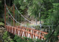
(footbridge)
Palmer vicinity, Washington, USA - Green River
| Bridgemeister ID: | 1619 (added 2005-02-26) |
| Name: | (footbridge) |
| Location: | Palmer vicinity, Washington, USA |
| Crossing: | Green River |
| At or Near Feature: | Tacoma Water Supply Intake Diversion Dam |
| Coordinates: | 47.301141 N 121.842975 W |
| Maps: | Acme, GeoHack, Google, OpenStreetMap |
| Use: | Footbridge |
| Status: | In use (last checked: 2016) |
| Main Cables: | Wire |
| Suspended Spans: | 1 |
(footbridge)
Snoqualmie Falls, Washington, USA - Snoqualmie River
| Bridgemeister ID: | 893 (added 2003-09-07) |
| Name: | (footbridge) |
| Location: | Snoqualmie Falls, Washington, USA |
| Crossing: | Snoqualmie River |
| Coordinates: | 47.54112 N 121.83679 W |
| Maps: | Acme, GeoHack, Google, OpenStreetMap |
| Use: | Footbridge |
| Status: | In use (last checked: 2004) |
| Main Cables: | Wire |

(pipeline bridge)
Spokane, Washington, USA - Spokane River
| Bridgemeister ID: | 2132 (added 2006-10-22) |
| Name: | (pipeline bridge) |
| Location: | Spokane, Washington, USA |
| Crossing: | Spokane River |
| Coordinates: | 47.69664 N 117.47906 W |
| Maps: | Acme, GeoHack, Google, OpenStreetMap |
| Use: | Pipeline and Footbridge |
| Status: | Extant (last checked: 2022) |
| Main Cables: | Wire (steel) |
| Suspended Spans: | 1 |
| Main Span: | 1 x 106.7 meters (350 feet) estimated |
Notes:
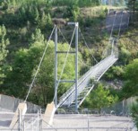
(suspension bridge)
Diablo vicinity, Washington, USA - Skagit River
| Bridgemeister ID: | 1618 (added 2005-02-26) |
| Name: | (suspension bridge) |
| Location: | Diablo vicinity, Washington, USA |
| Crossing: | Skagit River |
| Status: | Removed |
| Main Cables: | Wire |
| Suspended Spans: | 1 |
Notes:
- This bridge crossed the Skagit River near Ruby Creek prior to the inundation of the area.
(suspension bridge)
Toutle, Washington, USA - Toutle River
| Bridgemeister ID: | 1665 (added 2005-03-20) |
| Name: | (suspension bridge) |
| Location: | Toutle, Washington, USA |
| Crossing: | Toutle River |
| Use: | Vehicular (one-lane) |
| Main Cables: | Wire |
Notes:
- Vehicular bridge with small wooden towers. At least two main spans. Described as "on the Castle Rock and Spirit Lake wagon road." Likely removed.
Big Beaver Creek
Ross Lake National Recreation Area, Washington, USA - Big Beaver Creek
| Bridgemeister ID: | 2185 (added 2007-01-14) |
| Name: | Big Beaver Creek |
| Location: | Ross Lake National Recreation Area, Washington, USA |
| Crossing: | Big Beaver Creek |
| At or Near Feature: | North Cascades National Park |
| Coordinates: | 48.77475 N 121.06659 W |
| Maps: | Acme, GeoHack, Google, OpenStreetMap |
| Use: | Footbridge |
| Status: | In use (last checked: 2006) |
| Main Cables: | Wire (steel) |
| Suspended Spans: | 1 |
| Main Span: | 1 x 38.4 meters (126 feet) estimated |
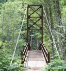
Castle Rock
Castle Rock, Washington, USA - Cowlitz River
| Bridgemeister ID: | 7588 (added 2023-05-06) |
| Name: | Castle Rock |
| Location: | Castle Rock, Washington, USA |
| Crossing: | Cowlitz River |
| Use: | Vehicular |
| Status: | Destroyed, September 17, 1906 |
| Main Cables: | Wire |
| Main Span: | 1 |
Notes:
- Destroyed by fire, September 17, 1906.
External Links:
- Photo Gallery • Cowlitz County, WA • CivicEngage. Image of the bridge.
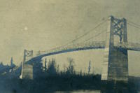
Devils Creek
Ross Lake National Recreation Area, Washington, USA - Devils Creek
| Bridgemeister ID: | 2183 (added 2007-01-14) |
| Name: | Devils Creek |
| Location: | Ross Lake National Recreation Area, Washington, USA |
| Crossing: | Devils Creek |
| At or Near Feature: | North Cascades National Park |
| Coordinates: | 48.82405 N 121.03226 W |
| Maps: | Acme, GeoHack, Google, OpenStreetMap |
| Use: | Footbridge |
| Status: | In use (last checked: 2006) |
| Main Cables: | Wire (steel) |
| Suspended Spans: | 1 |
| Main Span: | 1 x 55.5 meters (182 feet) |
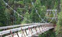
Diablo Lake Trail
Ross Lake National Recreation Area, Washington, USA - Skagit River
| Bridgemeister ID: | 2184 (added 2007-01-14) |
| Name: | Diablo Lake Trail |
| Location: | Ross Lake National Recreation Area, Washington, USA |
| Crossing: | Skagit River |
| At or Near Feature: | North Cascades National Park |
| Coordinates: | 48.72857 N 121.07277 W |
| Maps: | Acme, GeoHack, Google, OpenStreetMap |
| Use: | Footbridge |
| Status: | In use (last checked: 2006) |
| Main Cables: | Wire (steel) |
| Suspended Spans: | 1 |
| Main Span: | 1 x 75.9 meters (249 feet) |
Notes:
- Spans the Skagit River at the extreme northern end of Lake Diablo near the Ross Dam power house.
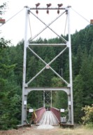
Enchanted Valley
Jefferson County, Washington, USA - Quinault River
| Bridgemeister ID: | 875 (added 2003-08-31) |
| Name: | Enchanted Valley |
| Location: | Jefferson County, Washington, USA |
| Crossing: | Quinault River |
| At or Near Feature: | Olympic National Forest |
| Coordinates: | 47.667470 N 123.394488 W |
| Maps: | Acme, GeoHack, Google, OpenStreetMap |
| Use: | Footbridge |
| Status: | Removed, c. 2005 |
| Suspended Spans: | 1 |
Notes:
- 2005: Reported as damaged. Appears to have been replaced with a non-suspension bridge.
- Coordinates provided here are likely location of the former suspension bridge.
External Links:
- Jay's Journeys - Enchanted Valley Backpack. Travelog with images of the bridge, from 1994.
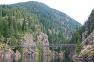
Lightning Creek
Ross Lake National Recreation Area, Washington, USA - Lightning Creek
| Bridgemeister ID: | 2182 (added 2007-01-14) |
| Name: | Lightning Creek |
| Location: | Ross Lake National Recreation Area, Washington, USA |
| Crossing: | Lightning Creek |
| At or Near Feature: | North Cascades National Park |
| Coordinates: | 48.87465 N 121.01784 W |
| Maps: | Acme, GeoHack, Google, OpenStreetMap |
| Use: | Footbridge |
| Status: | In use (last checked: 2006) |
| Main Cables: | Wire (steel) |
| Suspended Spans: | 1 |
| Main Span: | 1 x 59.6 meters (195.5 feet) |
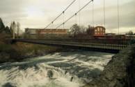
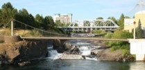
Spokane Falls I
Spokane, Washington, USA - Spokane River
| Bridgemeister ID: | 354 (added before 2003) |
| Name: | Spokane Falls I |
| Location: | Spokane, Washington, USA |
| Crossing: | Spokane River |
| Coordinates: | 47.66276 N 117.42269 W |
| Maps: | Acme, GeoHack, Google, OpenStreetMap |
| Use: | Footbridge |
| Status: | In use (last checked: 2024) |
| Main Cables: | Wire (steel) |
| Suspended Spans: | 1 |
| Main Span: | 1 x 68.9 meters (226 feet) estimated |
Notes:
- This entry refers to the southernmost of the two footbridges at this location.
- 2022, March 30: Reopened, but in need of further repairs. Unclear if it was closed because its companion bridge was also closed for repairs or for other safety reasons.
- 2023, May: Closed for extensive repairs.
- 2024, March: Reopened upon complation of repairs.
- Connects to Spokane Falls II - Spokane, Washington, USA.
External Links:
Spokane Falls II
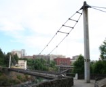
Spokane, Washington, USA - Spokane River
| Bridgemeister ID: | 355 (added before 2003) |
| Name: | Spokane Falls II |
| Location: | Spokane, Washington, USA |
| Crossing: | Spokane River |
| Coordinates: | 47.66374 N 117.42298 W |
| Maps: | Acme, GeoHack, Google, OpenStreetMap |
| Use: | Footbridge |
| Status: | In use (last checked: 2022) |
| Main Cables: | Wire (steel) |
| Suspended Spans: | 1 |
| Main Span: | 1 x 90.2 meters (296 feet) estimated |
Notes:
- This entry refers to the northernmost of the two footbridges at this location.
- 2019, April: Closed awaiting deck repairs.
- 2022, March 30: Reopened following completion of repairs including deck replacement.
- Connects to Spokane Falls I - Spokane, Washington, USA.
External Links:

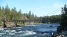
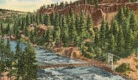
Swinging
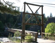
Spokane vicinity, Washington, USA - Spokane River
| Bridgemeister ID: | 315 (added before 2003) |
| Name: | Swinging |
| Location: | Spokane vicinity, Washington, USA |
| Crossing: | Spokane River |
| At or Near Feature: | Riverside State Park, "Bowl And Pitcher" area |
| Coordinates: | 47.69668 N 117.49828 W |
| Maps: | Acme, GeoHack, Google, OpenStreetMap |
| Principals: | Civilian Conservation Corps |
| Use: | Footbridge |
| Status: | In use (last checked: 2009) |
| Main Cables: | Wire (steel) |
| Suspended Spans: | 1 |
| Main Span: | 1 x 61 meters (200 feet) estimated |
Notes:
- Location also described "Down River Park" and "Downriver Park".
- Near (pipeline bridge) - Spokane, Washington, USA.
External Links:
- Riverside State Park Foundation. Built in the 1930s. Rebuilt, 1998.
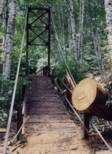
Thunder Creek
Ross Lake National Recreation Area, Washington, USA - Thunder Creek
| Bridgemeister ID: | 1283 (added 2004-03-14) |
| Name: | Thunder Creek |
| Location: | Ross Lake National Recreation Area, Washington, USA |
| Crossing: | Thunder Creek |
| At or Near Feature: | Diablo Lake vicinity, North Cascades National Park |
| Coordinates: | 48.67825 N 121.07848 W |
| Maps: | Acme, GeoHack, Google, OpenStreetMap |
| Use: | Footbridge |
| Status: | Destroyed, October 2003 |
| Main Cables: | Wire (steel) |
| Main Span: | 1 x 39.6 meters (130 feet) estimated |
Notes:
- Damaged by fallen tree, summer 2003. Soon repaired. Destroyed during storm, October 2003. According to a June 2004 National Park Service web page advising as to storm damage in North Cascade National Park: "The suspension bridge over Thunder Creek one-mile from the trailhead in Colonial Creek Campground was destroyed. This large bridge was in a location which flooded at the beginning of many summer seasons. Planning for a better location, environmental assessment of alternatives, and application for funding will take place this year with construction happening in 2005. The log jam at the former bridge site is closed to crossing because of safety considerations." The bridge was indeed replaced with a non-suspension bridge at a different location.
Tieton Nature Trail
Tieton, Naches vicinity, Washington, USA - Tieton River
| Bridgemeister ID: | 6142 (added 2021-07-06) |
| Name: | Tieton Nature Trail |
| Location: | Tieton, Naches vicinity, Washington, USA |
| Crossing: | Tieton River |
| Coordinates: | 46.718284 N 120.834342 W |
| Maps: | Acme, GeoHack, Google, OpenStreetMap |
| Use: | Footbridge |
| Status: | In use (last checked: 2021) |
| Main Cables: | Wire (steel) |
| Suspended Spans: | 1 |
| Main Span: | 1 |
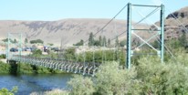
Umtanum
Yakima and Ellensburg, Washington, USA - Yakima River
| Bridgemeister ID: | 865 (added 2003-08-23) |
| Name: | Umtanum |
| Location: | Yakima and Ellensburg, Washington, USA |
| Crossing: | Yakima River |
| Coordinates: | 46.85555 N 120.48405 W |
| Maps: | Acme, GeoHack, Google, OpenStreetMap |
| Use: | Footbridge |
| Status: | In use (last checked: 2021) |
| Main Cables: | Wire (steel) |
| Suspended Spans: | 1 |
| Main Span: | 1 x 67.1 meters (220 feet) estimated |
Notes:
- 2021, February: Closed for planned repairs. Expected to reopen in May.
- 2021, June: Bridge reopened following rehabilitation project.
Do you have any information or photos for these bridges that you would like to share? Please email david.denenberg@bridgemeister.com.