Inventory Search Results (101-200 of 700)
700 suspension bridges were found for search criteria: David completed between 1700 and 2010 including undated bridges. Bridges 101 through 200 (of 700 total) appear below. Click the Bridgemeister ID number to isolate the bridge on its own page. If you don't see what you were looking for, try an image search with the same criteria: David. This will find the bridge if it is pictured on the site, but is not a catenary suspension bridge.
Related:
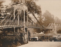
1845: Ballievey
Banbridge, Northern Ireland, United Kingdom - River Bann
| Bridgemeister ID: | 2172 (added 2007-01-13) |
| Year Completed: | 1845 |
| Name: | Ballievey |
| Also Known As: | Ballievy |
| Location: | Banbridge, Northern Ireland, United Kingdom |
| Crossing: | River Bann |
| Coordinates: | 54.341862 N 6.219803 W |
| Maps: | Acme, GeoHack, Google, OpenStreetMap |
| Principals: | James Dredge |
| Use: | Vehicular |
| Status: | Collapsed, September 12, 1988 |
| Suspended Spans: | 1 |
| Main Span: | 1 x 22 meters (72.3 feet) |
Notes:
- Collapsed, September 12, 1988, under weight of truck that exceeded the posted weight limit.

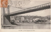
1845: Couthures
Couthures-sur-Garonne, Lot-et-Garonne, France - Garonne River
| Bridgemeister ID: | 1900 (added 2005-10-04) |
| Year Completed: | 1845 |
| Name: | Couthures |
| Location: | Couthures-sur-Garonne, Lot-et-Garonne, France |
| Crossing: | Garonne River |
| Coordinates: | 44.513600 N 0.080580 E |
| Maps: | Acme, GeoHack, Google, OpenStreetMap |
| References: | AAJ |
| Use: | Vehicular |
| Status: | Removed |
| Main Cables: | Wire |
| Suspended Spans: | 1 |
Notes:
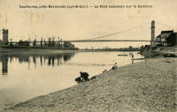
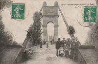
1846: Beaumont-sur-Sarthe
Beaumont-sur-Sarthe, Sarthe, France - Sarthe River
| Bridgemeister ID: | 780 (added 2003-03-16) |
| Year Completed: | 1846 |
| Name: | Beaumont-sur-Sarthe |
| Location: | Beaumont-sur-Sarthe, Sarthe, France |
| Crossing: | Sarthe River |
| Coordinates: | 48.223243 N 0.129007 E |
| Maps: | Acme, GeoHack, Google, OpenStreetMap |
| Use: | Vehicular |
| Status: | Removed |
| Main Cables: | Wire (iron) |
| Suspended Spans: | 1 |
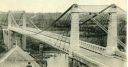
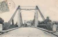
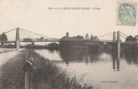
1846: Lacroix-Saint-Ouen
Lacroix-Saint-Ouen, Oise, France - Oise River
| Bridgemeister ID: | 2070 (added 2006-06-07) |
| Year Completed: | 1846 |
| Name: | Lacroix-Saint-Ouen |
| Location: | Lacroix-Saint-Ouen, Oise, France |
| Crossing: | Oise River |
| Coordinates: | 49.352930 N 2.766916 E |
| Maps: | Acme, GeoHack, Google, OpenStreetMap |
| Use: | Vehicular (one-lane) |
| Status: | Destroyed, 1940 |
| Main Cables: | Wire |
| Main Span: | 1 |
Notes:
- Later at same location 1949 Lacroix-Saint-Ouen - Lacroix-Saint-Ouen, Oise, France.
External Links:

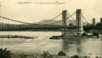
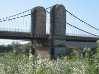
1846: Mallemort
Mallemort, Bouches-du-Rhône and Mérindol, Vaucluse, France - Durance River
| Bridgemeister ID: | 985 (added 2003-11-15) |
| Year Completed: | 1846 |
| Name: | Mallemort |
| Location: | Mallemort, Bouches-du-Rhône and Mérindol, Vaucluse, France |
| Crossing: | Durance River |
| Coordinates: | 43.740533 N 5.176 E |
| Maps: | Acme, GeoHack, Google, OpenStreetMap |
| Use: | Vehicular |
| Status: | Closed (last checked: 2005) |
| Main Cables: | Wire (iron) |
| Suspended Spans: | 3 |
| Main Spans: | 3 |
Notes:
- Damaged 1872, 1880, 1882, 1886 by flood, 1940 by bombs. Extant 2005 but closed.
External Links:
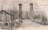
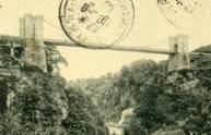
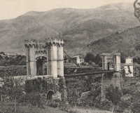
1846: Montpezat
Montpezat-sous-Bauzon, Ardèche, France - Fontaulière River
| Bridgemeister ID: | 2159 (added 2006-12-10) |
| Year Completed: | 1846 |
| Name: | Montpezat |
| Location: | Montpezat-sous-Bauzon, Ardèche, France |
| Crossing: | Fontaulière River |
| Coordinates: | 44.704903 N 4.216498 E |
| Maps: | Acme, GeoHack, Google, OpenStreetMap |
| Use: | Vehicular (one-lane) |
| Status: | Demolished, 1912 |
| Main Cables: | Wire |
| Suspended Spans: | 1 |
External Links:
1846: Saint Clair
Lyon, Métropole de Lyon, France - Rhône River
| Bridgemeister ID: | 551 (added before 2003) |
| Year Completed: | 1846 |
| Name: | Saint Clair |
| Also Known As: | Louis Philippe, Vaïsse |
| Location: | Lyon, Métropole de Lyon, France |
| Crossing: | Rhône River |
| References: | AAJ, PQL |
| Use: | Vehicular |
| Status: | Demolished, 1953 |
| Main Cables: | Wire (iron) |
| Suspended Spans: | 2 |
| Deck width: | 7 meters |
Notes:
- Damaged by drifting boat, 1854. Rebuilt, 1856. Bombed, 1944. Rebuilt, 1946. Demolished, 1953.
- Crossed at present-day location of Pont Maréchal de Lattre de Tassigny.
- Originally constructed with two suspended spans. When it was rebuilt in 1856, towers were added increasing the number of suspended spans to six.
- Near 1845 College (Collège) - Lyon, Métropole de Lyon, France.
External Links:

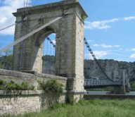
1847: Donzère
Donzère, Drôme and Viviers, Ardèche, France - Rhône River
| Bridgemeister ID: | 970 (added 2003-11-13) |
| Year Completed: | 1847 |
| Name: | Donzère |
| Also Known As: | Robinet |
| Location: | Donzère, Drôme and Viviers, Ardèche, France |
| Crossing: | Rhône River |
| Coordinates: | 44.452367 N 4.6981 E |
| Maps: | Acme, GeoHack, Google, OpenStreetMap |
| References: | AAJ, BPF |
| Use: | Vehicular (one-lane) |
| Status: | In use (last checked: 2021) |
| Main Cables: | Wire (iron) |
| Suspended Spans: | 3 |
| Main Spans: | 3 x 100 meters (328.1 feet) estimated |
External Links:
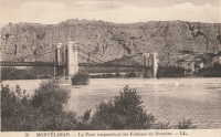
1847: Saint-Mathurin-sur-Loire
Saint-Mathurin-sur-Loire, Maine-et-Loire, France - Loire River
| Bridgemeister ID: | 1589 (added 2005-01-27) |
| Year Completed: | 1847 |
| Name: | Saint-Mathurin-sur-Loire |
| Location: | Saint-Mathurin-sur-Loire, Maine-et-Loire, France |
| Crossing: | Loire River |
| Coordinates: | 47.406833 N 0.318722 W |
| Maps: | Acme, GeoHack, Google, OpenStreetMap |
| Use: | Vehicular |
| Status: | Destroyed, June 18, 1940 |
| Main Cables: | Wire (iron) |
| Main Spans: | 5 |
Notes:
- 1927: The bridge is reconstructed and strengthened.
External Links:
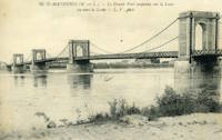
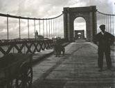
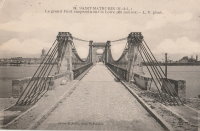
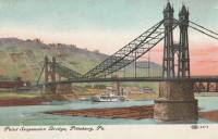
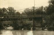
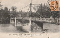
1847: Saint-Symphorien
Tours, Indre-et-Loire, France - Loire River
| Bridgemeister ID: | 1755 (added 2005-04-20) |
| Year Completed: | 1847 |
| Name: | Saint-Symphorien |
| Location: | Tours, Indre-et-Loire, France |
| Crossing: | Loire River |
| At or Near Feature: | l'Île Aucard |
| Coordinates: | 47.398776 N 0.692994 E |
| Maps: | Acme, GeoHack, Google, OpenStreetMap |
| Principals: | Seguin Brothers |
| References: | AAJ |
| Use: | Vehicular (one-lane), with walkway |
| Status: | Replaced |
| Main Cables: | Wire (iron) |
| Suspended Spans: | 3 |
| Main Spans: | 3 |
Notes:
- This was the three-span south section of the Saint-Symphorien bridge.
- 1940-1944: The Saint-Symphorien bridge is destroyed by French troops in June 1940 to slow the German army. Repaired in 1943. Destroyed again in 1944 by the German army. It is unclear whether both the north and south bridges were destroyed during these events.
- Connects to 1847 Saint-Symphorien - Tours, Indre-et-Loire, France.
- Replaced by Saint-Symphorien - Tours, Indre-et-Loire, France.
External Links:
1847: St. Christophe
Lorient, Morbihan, France - Scorff River
| Bridgemeister ID: | 1155 (added 2004-01-18) |
| Year Completed: | 1847 |
| Name: | St. Christophe |
| Also Known As: | Kérentrech, Nemours |
| Location: | Lorient, Morbihan, France |
| Crossing: | Scorff River |
| Principals: | Le Clerc and Noyon |
| References: | AAJ |
| Use: | Vehicular |
| Status: | Removed |
| Main Cables: | Wire (iron) |
| Main Span: | 1 x 180 meters (590.6 feet) |
Notes:
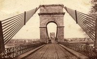
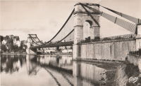
- Large masonry towers. Main span of 180 meters is unusually large for a French bridge of this decade.
External Links:
1847: Viviers
Viviers, Ardèche and Drôme, France - Rhône River
| Bridgemeister ID: | 1961 (added 2005-11-05) |
| Year Completed: | 1847 |
| Name: | Viviers |
| Location: | Viviers, Ardèche and Drôme, France |
| Crossing: | Rhône River |
| Coordinates: | 44.481667 N 4.699698 E |
| Maps: | Acme, GeoHack, Google, OpenStreetMap |
| References: | AAJ |
| Use: | Vehicular (one-lane) |
| Status: | Destroyed, 1944 |
| Main Cables: | Wire |
Notes:
- Later at same location 1954 Viviers - Viviers, Ardèche and Châteauneuf-Du-Rhône, Drôme, France.
External Links:
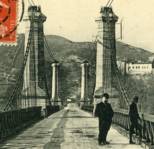
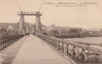
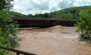
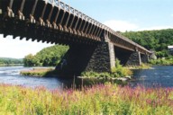
1848: Delaware Aqueduct
Lackawaxen, Pennsylvania and Minisink Ford, New York, USA - Delaware River
| Bridgemeister ID: | 30 (added before 2003) |
| Year Completed: | 1848 |
| Name: | Delaware Aqueduct |
| Also Known As: | Roebling Aqueduct |
| Location: | Lackawaxen, Pennsylvania and Minisink Ford, New York, USA |
| Crossing: | Delaware River |
| Coordinates: | 41.48262 N 74.98461 W |
| Maps: | Acme, GeoHack, Google, OpenStreetMap |
| Principals: | John A. Roebling |
| References: | AAJ, BDR, BOB, BPL, GBD, LAB, LACE, RDH, SJR |
| Use: | Aqueduct and Vehicular (one-lane), with walkway |
| Status: | In use (last checked: 2006) |
| Main Cables: | Wire (iron) |
| Suspended Spans: | 4 |
| Main Spans: | 1 x 43.3 meters (142 feet), 3 x 39.9 meters (131 feet) |
Notes:
- BPL: Completed 1848. RDH/BDR: Completed 1848, not used until 1849.
- Originally constructed to carry the Delaware and Hudson Canal. Converted to a one-lane vehicular bridge soon after the canal closed in 1898. Substantially restored in 1980's and 1990's, but retains original cables.
- Built as part of same project as 1849 Lackawaxen Aqueduct - Lackawaxen, Pennsylvania, USA.
- Built as part of same project as 1851 High Falls Aqueduct - High Falls, New York, USA.
- Built as part of same project as 1851 Neversink Aqueduct - Cuddebackville, New York, USA.
- Near 1849 Lackawaxen Aqueduct - Lackawaxen, Pennsylvania, USA.
External Links:
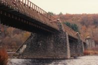
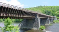
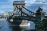
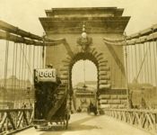
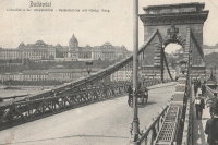
1849: Chain
Budapest, Hungary - Danube River
| Bridgemeister ID: | 402 (added before 2003) |
| Year Completed: | 1849 |
| Name: | Chain |
| Also Known As: | Széchenyi Lánchíd |
| Location: | Budapest, Hungary |
| Crossing: | Danube River |
| Coordinates: | 47.49945 N 19.046567 E |
| Maps: | Acme, GeoHack, Google, OpenStreetMap |
| Principals: | William Tierney Clark, Adam Clark |
| References: | AAJ, BC3, BCO, CTW, HBE, ONF |
| Use: | Vehicular |
| Status: | In use (last checked: 2021) |
| Main Cables: | Chain (iron) |
| Suspended Spans: | 3 |
| Main Span: | 1 x 203 meters (666 feet) |
| Side Spans: | 2 x 90.8 meters (298 feet) |
Notes:
- Don Sayenga notes, the bridge was designed by W.T. Clark, but built by Adam Clark (no relation).
- 1945: Destroyed during WWII, rebuilt 1949.
- 2020: Major rehabilitation project expected to start May, 2021.
External Links:

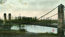
1849: Fourneau
Le Fourneau, Bourbon-Lancy vicinity, Saône-et-Loire and Allier, France - Loire River
| Bridgemeister ID: | 1772 (added 2005-04-22) |
| Year Completed: | 1849 |
| Name: | Fourneau |
| Location: | Le Fourneau, Bourbon-Lancy vicinity, Saône-et-Loire and Allier, France |
| Crossing: | Loire River |
| References: | AAJ |
| Use: | Vehicular |
| Status: | Replaced, 1932 |
| Main Spans: | 2 x 115 meters (377.32 feet) |
| Deck width: | 16.4 feet |
Notes:
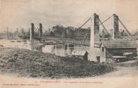
1849: Jaulgonne
Jaulgonne and Varennes, Aisne, France - Marne River
| Bridgemeister ID: | 1940 (added 2005-10-29) |
| Year Completed: | 1849 |
| Name: | Jaulgonne |
| Location: | Jaulgonne and Varennes, Aisne, France |
| Crossing: | Marne River |
| Principals: | Seguin Brothers |
| References: | AAJ |
| Use: | Vehicular |
| Status: | Removed |
| Main Cables: | Wire (iron) |
| Suspended Spans: | 1 |
| Main Span: | 1 x 75 meters (246.07 feet) |
Notes:
- Replaced by Jaulgonne - Jaulgonne and Varennes, Aisne, France.

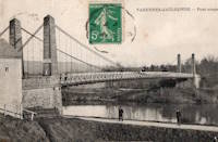
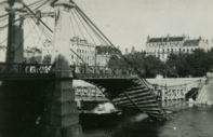
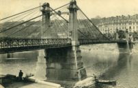
1849: Kitchener-Marchand
Lyon, Métropole de Lyon, France - Saône River
| Bridgemeister ID: | 540 (added before 2003) |
| Year Completed: | 1849 |
| Name: | Kitchener-Marchand |
| Also Known As: | Napoleon, Kitchener, Midi |
| Location: | Lyon, Métropole de Lyon, France |
| Crossing: | Saône River |
| Coordinates: | 45.751418 N 4.822519 E |
| Maps: | Acme, GeoHack, Google, OpenStreetMap |
| Principals: | Ferdinand Seguin |
| References: | PQL |
| Use: | Vehicular |
| Status: | Replaced, 1950's |
| Main Cables: | Wire (iron) |
| Main Span: | 1 x 82.1 meters (269.22 feet) |
Notes:
- Refurbished, 1888. Bombed, 1944. Rebuilt. Replaced, 1950-1959.
- Companion to 1849 Galliéni (Napoleon) - Lyon, Métropole de Lyon, France.
External Links:
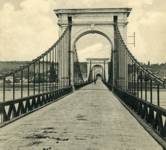
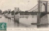
1849: Langeais
Langeais, Indre-et-Loire, France - Loire River
| Bridgemeister ID: | 6718 (added 2021-10-16) |
| Year Completed: | 1849 |
| Name: | Langeais |
| Location: | Langeais, Indre-et-Loire, France |
| Crossing: | Loire River |
| Coordinates: | 47.319030 N 0.404770 E |
| Maps: | Acme, GeoHack, Google, OpenStreetMap |
| References: | AAJ, BPF |
| Use: | Vehicular |
| Status: | Replaced |
| Main Spans: | 3 |
| Side Spans: | 2 |
Notes:
- Damaged by lightning 1859 and repaired. Cables cut during war 1870 and repaired in 1874.
- Replaced by 1937 Langeais - Langeais, Indre-et-Loire, France. However, the 1849 bridge may have been largely before the 1937 bridge.
External Links:
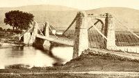
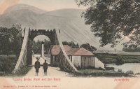
1849: Lochy
Inverlochy, Fort William vicinity, Scotland, United Kingdom - River Lochy
| Bridgemeister ID: | 6209 (added 2021-07-16) |
| Year Completed: | 1849 |
| Name: | Lochy |
| Also Known As: | Lochybridge, Victoria |
| Location: | Inverlochy, Fort William vicinity, Scotland, United Kingdom |
| Crossing: | River Lochy |
| Coordinates: | 56.835137 N 5.076679 W |
| Maps: | Acme, GeoHack, Google, OpenStreetMap |
| Principals: | James Dredge |
| Use: | Vehicular |
| Status: | Removed |
| Main Cables: | Rod (iron) |
| Main Span: | 1 |
Notes:
- 1928: Deck replaced. The aging suspension system was bypassed and the new deck supported by additional piers.
- Similar to 1854 Oich (Aberchalder) - Invergarry vicinity, Scotland, United Kingdom.
1849: Marc Seguin
Tournon-sur-Rhône, Ardèche and Tain-L'Hermitage, Drôme, France - Rhône River
| Bridgemeister ID: | 975 (added 2003-11-14) |
| Year Completed: | 1849 |
| Name: | Marc Seguin |
| Location: | Tournon-sur-Rhône, Ardèche and Tain-L'Hermitage, Drôme, France |
| Crossing: | Rhône River |
| Coordinates: | 45.068638 N 4.834972 E |
| Maps: | Acme, GeoHack, Google, OpenStreetMap |
| Principals: | Marc Seguin |
| References: | AAJ, BPF |
| Use: | Vehicular |
| Status: | Restricted to foot traffic (last checked: 2021) |
| Main Cables: | Wire (iron) |
| Suspended Spans: | 2 |
| Main Spans: | 2 |
Notes:
- A second bridge at Tournon, by Seguin, approximately 100 meters downstream from his 1825 bridge. Restored 1989.
- Near 1825 Tain-Tournon - Tournon-sur-Rhône, Ardèche and Tain, Drôme, France.
- Near 1958 Gustave Toursier - Tournon-sur-Rhône, Ardèche and Tain-L'Hermitage, Drôme, France.
External Links:
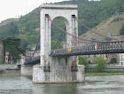
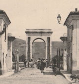
1849: Saint-Sulpice
Saint-Sulpice-la-Pointe, Tarn, France - Agout River
| Bridgemeister ID: | 1180 (added 2004-01-24) |
| Year Completed: | 1849 |
| Name: | Saint-Sulpice |
| Location: | Saint-Sulpice-la-Pointe, Tarn, France |
| Crossing: | Agout River |
| Coordinates: | 43.776706 N 1.686511 E |
| Maps: | Acme, GeoHack, Google, OpenStreetMap |
| Use: | Vehicular (one-lane), with walkway |
| Status: | Destroyed, 1930 |
| Main Cables: | Wire (iron) |
| Suspended Spans: | 1 |
Notes:
- 1930: Destroyed by flood.
- Replaced by 1931 Saint-Sulpice - Saint-Sulpice-la-Pointe, Tarn, France.
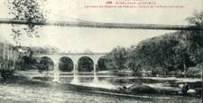
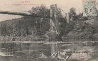
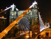
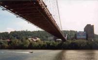
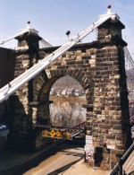
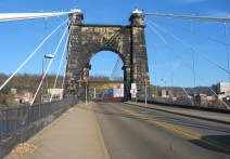
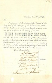
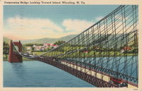
1849: Wheeling
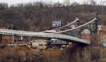
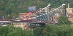
Wheeling, West Virginia, USA - Ohio River
| Bridgemeister ID: | 32 (added before 2003) |
| Year Completed: | 1849 |
| Name: | Wheeling |
| Also Known As: | Wheeling and Belmont |
| Location: | Wheeling, West Virginia, USA |
| Crossing: | Ohio River |
| Coordinates: | 40.07167 N 80.72667 W |
| Maps: | Acme, GeoHack, Google, OpenStreetMap |
| Principals: | Charles Ellet |
| References: | AAJ, BBR, BC3, BOB, BPL, CEJ, COB, GBD, HBE, LAB, LACE, ONF, PTS2, RWS, WCC, WHSB |
| Use: | Vehicular (two-lane, light vehicles only) |
| Status: | Restricted to foot traffic, since September 2019 (last checked: 2020) |
| Main Cables: | Wire (iron) |
| Suspended Spans: | 1 |
| Main Span: | 1 x 307.8 meters (1,010 feet) |
Notes:
- Was still part of Virginia at time of completion.
- 1854: Rebuilt after it was wrecked by a windstorm. Contrary to popular myth, the rebuilding was undertaken by Ellet and his assistant William K. McComas, not by John A. Roebling.
- 1860: Overhauled. Popular myth often attributes this work to the Roeblings. WHSB attributes this work to William K. McComas. After this overhaul, the bridge still does not have the distinctive diagonal cable stays that give it the appearance of a Roebling bridge.
- 1872: Overhauled according to a design by Washington Roebling. John A. Roebling had died in 1869 and was not involved with this work. WHSB notes, "The design essentially Roeblingized the bridge with the diagonal cable stays that are such a prominent feature of the bridge."
- 2019, September: Closed to vehicular traffic indefinitely due to safety concerns after repeated overweight vehicle violations.
- 2020, November: Bids being evaluated for renovation project. Bridge remains closed to vehicular traffic.
- 2021, April: Single bid received was rejected. Bids expected to be resolicited in June. The bridge remains closed to all vehicular traffic.
- 2022, February: $17.9 million renovation project expected to start soon.
- Became longest suspension bridge by eclipsing 1834 Zaehringen (Grand Pont Suspendu) - Fribourg, Switzerland.
- Eclipsed by new longest suspension bridge 1867 John A. Roebling (Cincinnati, Cincinnati and Covington) - Cincinnati, Ohio and Covington, Kentucky, USA.
External Links:
1850: (suspension bridge)
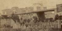
Nashville and Edgefield, Tennessee, USA - Cumberland River
| Bridgemeister ID: | 33 (added before 2003) |
| Year Completed: | 1850 |
| Name: | (suspension bridge) |
| Location: | Nashville and Edgefield, Tennessee, USA |
| Crossing: | Cumberland River |
| Principals: | Adolphus Heiman, Mathew Dickinson Field |
| References: | AAJ |
| Use: | Vehicular |
| Status: | Destroyed, 1862 |
| Main Cables: | Wire (iron) |
| Main Span: | 1 x 164 meters (538 feet) |
Notes:
- Collapsed 1855, rebuilt, destroyed 1862 (possibly 1863). Was at site of present-day Woodland Street Bridge.
- Replaced by 1866 (suspension bridge) - Nashville and Edgefield, Tennessee, USA.
External Links:
1850: Basteyroux
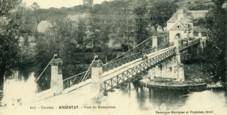
Argentat, Corrèze, France - Maronne River
| Bridgemeister ID: | 1985 (added 2005-12-02) |
| Year Completed: | 1850 |
| Name: | Basteyroux |
| Location: | Argentat, Corrèze, France |
| Crossing: | Maronne River |
| Coordinates: | 45.082660 N 1.947985 E |
| Maps: | Acme, GeoHack, Google, OpenStreetMap |
| Use: | Vehicular (one-lane) |
| Status: | Restricted to foot traffic (last checked: 2019) |
| Main Cables: | Wire (iron) |
| Suspended Spans: | 2 |
| Main Spans: | 2 |
External Links:
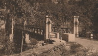
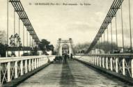
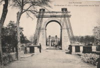
1850: Le Boulou
Le Boulou, Pyrénées-Orientales, France - Tech River
| Bridgemeister ID: | 1704 (added 2005-03-29) |
| Year Completed: | 1850 |
| Name: | Le Boulou |
| Location: | Le Boulou, Pyrénées-Orientales, France |
| Crossing: | Tech River |
| Use: | Vehicular |
| Status: | Demolished, 1962 |
| Main Cables: | Wire (iron) |
| Suspended Spans: | 1 |
| Main Span: | 1 x 120 meters (393.7 feet) |
| Deck width: | 5.74 meters |
External Links:
1851: Lewiston-Queenston
Lewiston, New York, USA and Queenston, Ontario, Canada - Niagara River
| Bridgemeister ID: | 35 (added before 2003) |
| Year Completed: | 1851 |
| Name: | Lewiston-Queenston |
| Location: | Lewiston, New York, USA and Queenston, Ontario, Canada |
| Crossing: | Niagara River |
| Principals: | Edward Serrell |
| References: | AAJ, BOB, BPL, HBE, PTS2 |
| Use: | Vehicular |
| Status: | Wrecked, 1864 |
| Main Cables: | Wire (iron) |
| Suspended Spans: | 1 |
| Main Span: | 1 x 258.8 meters (849 feet) |
| Deck width: | 21 feet (AAJ: 19.5 feet) |
Notes:
- Wrecked by wind February 1, 1864. Stay cables beneath the bridge had been disconnected to avoid damage from rising ice. Portions of the cables and deck remained, in a derelict state, as late as 1895. Replacement was not started until the late 1890's.
- The February 3, 1864 edition of Niagara Falls Gazette describes the wind event: "Partial Destruction Of The Lewiston Suspension Bridge -- A portion of the flooring and other wood-work of the Lewiston Suspension Bridge was blown down during the gale Monday forenoon. It seems that the long guys had been cut during the late ice jam to prevent injury to the structure and thus its strength to withstand a gale was much weakened. The wind swept through the gorge on Monday with terrific force and swayed the bridge so that some of the cross timbers, near the centre were loosened from their fastenings, and fell, of course carrying the floor with them. A large portion at each end, remains without material injury. The extent of the damage -- financially -- we have not yet learned, but we judge from what we hear that it may be about $10,000. The bridge was built in 1852 and cost not far from $40,000. It will doubtless soon be repaired and in use."
- Later at same location 1899 Lewiston-Queenston - Lewiston, New York, USA and Queenston, Ontario, Canada.
- See 1849 Wheeling (Wheeling and Belmont) - Wheeling, West Virginia, USA. The 1851 Lewiston-Queenston bridge is sometimes claimed to have become the longest in the world with a main span surpassing the length of the Wheeling suspension bridge. However, Don Sayenga notes the length of the suspended span of the Lewiston-Queenston bridge was only 849 feet, not the 1,043 feet sometimes cited. Don writes: "[1,043 feet] was the distance between the towers built high up on the cliffs above the crossing - because there was no space for them below. The roadway suspended from the towers was only 849 feet span over the water from abutment to abutment." Thus, Roebling's Cincinnati bridge should be considered the first to eclipse Wheeling's record main span.
External Links:
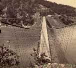
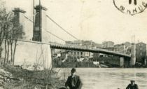
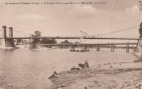
1851: Saint-Just-sur-Loire
Saint-Just-sur-Loire and Saint-Just-Saint-Rambert, Loire, France - Loire River
| Bridgemeister ID: | 2052 (added 2006-06-02) |
| Year Completed: | 1851 |
| Name: | Saint-Just-sur-Loire |
| Location: | Saint-Just-sur-Loire and Saint-Just-Saint-Rambert, Loire, France |
| Crossing: | Loire River |
| Use: | Vehicular |
| Status: | Removed, c. 1931 |
| Main Cables: | Wire (iron) |
| Suspended Spans: | 1 |
Notes:
- 1926: Part of the deck fails under a heavily loaded truck. A replacement is completed in 1931.
- Near 1831 Andrézieux - Andrézieux, Loire, France.
External Links:
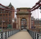
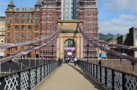
1851: South Portland
Glasgow, Scotland, United Kingdom - River Clyde
| Bridgemeister ID: | 404 (added before 2003) |
| Year Completed: | 1851 |
| Name: | South Portland |
| Also Known As: | Carlton |
| Location: | Glasgow, Scotland, United Kingdom |
| Crossing: | River Clyde |
| Coordinates: | 55.85433 N 4.25618 W |
| Maps: | Acme, GeoHack, Google, OpenStreetMap |
| Principals: | Alexander Kirkland, George Martin |
| References: | BEM, NTB |
| Use: | Footbridge |
| Status: | In use (last checked: 2019) |
| Main Cables: | Eyebar (iron) |
| Suspended Spans: | 1 |
Notes:
- 1853 sometimes cited as the year it opened.
External Links:
1851: Trévoux
Trévoux, Ain and Quincieux, Métropole de Lyon, France - Saône River
| Bridgemeister ID: | 1625 (added 2005-02-27) |
| Year Completed: | 1851 |
| Name: | Trévoux |
| Location: | Trévoux, Ain and Quincieux, Métropole de Lyon, France |
| Crossing: | Saône River |
| Coordinates: | 45.93945 N 4.772417 E |
| Maps: | Acme, GeoHack, Google, OpenStreetMap |
| Use: | Vehicular (one-lane) |
| Status: | Restricted to foot traffic (last checked: 2020) |
| Main Cables: | Wire (iron) |
| Suspended Spans: | 2 |
| Main Spans: | 2 |
Notes:
- Partially dismantled, 1982. Restored as a footbridge, 1985.
External Links:
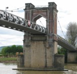
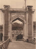
1852: Charleston
Charleston, West Virginia, USA - Elk River
| Bridgemeister ID: | 38 (added before 2003) |
| Year Completed: | 1852 |
| Name: | Charleston |
| Also Known As: | Lovell Street |
| Location: | Charleston, West Virginia, USA |
| Crossing: | Elk River |
| Principals: | W. O. Buchanan, William Kuhn, Abraham Wright |
| References: | AAJ, EOV, HBE, PTS2 |
| Use: | Vehicular |
| Status: | Collapsed, December 15, 1904 |
| Main Cables: | Wire (iron) |
| Suspended Spans: | 1 |
| Main Span: | 1 x 145.7 meters (478 feet) |
| Deck width: | 17 feet |
Notes:
- Was still part of Virginia at time of completion.
- Damaged during Civil War. An article in the August 2, 1861 issue of the New York Times mentions: "A junction of our forces having now been effected, the army at once moved on to Elk River, which debouches into the Kanawha at Charleston, where the army encamped for the night. We would have crossed the stream at once, and marched through the town the same evening, but for the fact that the rebels had partially destroyed the beautiful suspension bridge which spans Elk River at this spot, rendering it unsafe for passage. Not content with burning a portion of the flooring, they nearly severed the strands which support the structure, and aid their work, too, in the most bungling manner. A more shameless piece of vandalism I never witnessed. While the army slept, a company of sappers and miners repaired the damage, and yesterday the army, nearly five thousand strong, marched through the streets of Charleston."
- Near 1884 (suspension bridge) - Charleston, West Virginia, USA.
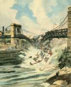
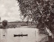
1852: Fairmont and Palatine
Fairmont, West Virginia, USA - Monongahela River
| Bridgemeister ID: | 39 (added before 2003) |
| Year Completed: | 1852 |
| Name: | Fairmont and Palatine |
| Location: | Fairmont, West Virginia, USA |
| Crossing: | Monongahela River |
| Principals: | James L. Randolph |
| References: | EOV, PTS2 |
| Status: | Removed |
| Main Cables: | Wire (iron) |
Notes:
- Was still part of Virginia at time of completion.
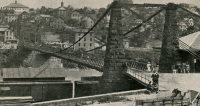
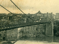
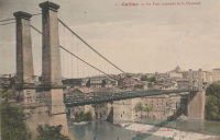
1852: Gaillac
Gaillac, Tarn, France - Tarn River
| Bridgemeister ID: | 1646 (added 2005-03-18) |
| Year Completed: | 1852 |
| Name: | Gaillac |
| Location: | Gaillac, Tarn, France |
| Crossing: | Tarn River |
| At or Near Feature: | Abbaye Saint-Michel |
| Coordinates: | 43.897361 N 1.894751 E |
| Maps: | Acme, GeoHack, Google, OpenStreetMap |
| Use: | Vehicular |
| Status: | Removed |
| Main Cables: | Wire (iron) |
| Suspended Spans: | 1 |
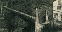
1852: Merle
Merle, Corrèze, France - Maronne River
| Bridgemeister ID: | 3030 (added 2019-10-13) |
| Year Completed: | 1852 |
| Name: | Merle |
| Location: | Merle, Corrèze, France |
| Crossing: | Maronne River |
| Coordinates: | 45.061779 N 2.080386 E |
| Maps: | Acme, GeoHack, Google, OpenStreetMap |
| Use: | Vehicular (one-lane) |
| Status: | Replaced, 1999 |
| Main Cables: | Wire (iron) |
| Suspended Spans: | 1 |
Notes:
- As of 2019, piers still present beyond the ends of its replacement bridge.
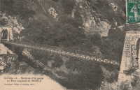
1852: Queens Park
Chester and Handbridge, England, United Kingdom - River Dee
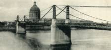
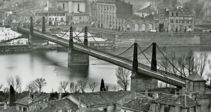
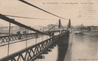
1852: Saint-Pierre
Toulouse, Haute-Garonne, France - Garonne River
| Bridgemeister ID: | 1169 (added 2004-01-23) |
| Year Completed: | 1852 |
| Name: | Saint-Pierre |
| Location: | Toulouse, Haute-Garonne, France |
| Crossing: | Garonne River |
| Coordinates: | 43.602179 N 1.434706 E |
| Maps: | Acme, GeoHack, Google, OpenStreetMap |
| References: | PTS2 |
| Use: | Vehicular |
| Status: | Demolished, 1927 |
| Main Cables: | Wire (iron) |
| Suspended Spans: | 4 |
| Main Spans: | 2 |
| Side Spans: | 2 |
Notes:
- Heavily damaged by flood, 1875. A metal arch bridge, completed 1987, is at this location now.
- Replaced by 1931 Saint-Pierre - Toulouse, Haute-Garonne, France.
External Links:
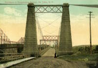
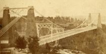
1852: St. John
St. John, New Brunswick, Canada - St. John River
| Bridgemeister ID: | 37 (added before 2003) |
| Year Completed: | 1852 |
| Name: | St. John |
| Location: | St. John, New Brunswick, Canada |
| Crossing: | St. John River |
| Principals: | Edward Serrell |
| References: | AAJ, BPL, HBE, PTS2 |
| Use: | Vehicular (one-lane) |
| Status: | Removed, 1915 |
| Main Cables: | Wire (iron) |
| Suspended Spans: | 1 |
| Main Span: | 1 x 195.1 meters (640 feet) |
Notes:
- Rebuilt 1857.
External Links:
1853: Dresden
Dresden, Ohio, USA - Muskingum River
| Bridgemeister ID: | 43 (added before 2003) |
| Year Completed: | 1853 |
| Name: | Dresden |
| Location: | Dresden, Ohio, USA |
| Crossing: | Muskingum River |
| Principals: | George Copland |
| References: | EOV, GBD, OCEN198202 |
| Use: | Vehicular |
| Status: | Destroyed, 1913 |
| Main Cables: | Wire (iron) |
| Suspended Spans: | 1 |
Notes:
- Destroyed by flood 1913.
- Replaced by 1914 Dresden - Dresden, Ohio, USA.
External Links:
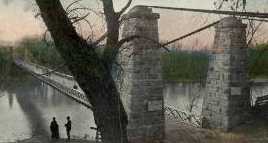
1853: Fort Hunter
Tribes Hill and Fort Hunter, New York, USA - Mohawk River
| Bridgemeister ID: | 44 (added before 2003) |
| Year Completed: | 1853 |
| Name: | Fort Hunter |
| Also Known As: | Fonda |
| Location: | Tribes Hill and Fort Hunter, New York, USA |
| Crossing: | Mohawk River |
| Principals: | John W. Murphy, Thomas R. Hulett |
| References: | ONC, PTS2 |
| Use: | Vehicular |
| Status: | Dismantled, 1935 |
| Main Cables: | Wire (iron) |
| Suspended Spans: | 1 |
| Main Span: | 1 x 169.5 meters (556 feet) |
Notes:
- According to ONC: Designed by John W. Murphy (who designed several suspension bridges in the 1850s and 1860s in New York and Pennsylvania). Fort Hunter Suspension Bridge Company incorporated in 1852, but cables were not installed until 1853.
- 1935: Bridge is dismantled (ONC).
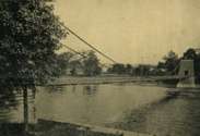

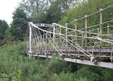
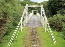
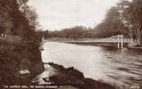
1853: General's Well
Inverness, Scotland, United Kingdom - River Ness
| Bridgemeister ID: | 406 (added before 2003) |
| Year Completed: | 1853 |
| Name: | General's Well |
| Location: | Inverness, Scotland, United Kingdom |
| Crossing: | River Ness |
| At or Near Feature: | Ness Islands |
| Coordinates: | 57.460944 N 4.237166 W |
| Maps: | Acme, GeoHack, Google, OpenStreetMap |
| Principals: | James Dredge |
| References: | HBR |
| Use: | Footbridge |
| Status: | In use (last checked: 2014) |
| Main Cables: | Rod (iron) |
| Suspended Spans: | 3 |
| Main Span: | 1 |
| Side Spans: | 2 |
Notes:
- Relocated to a nearby park (Whin Park) where it carries a miniature railway, 1988. The coordinates listed here are for that later (miniature railway park) location.
- Companion to 1853 Island Bank Road - Inverness, Scotland, United Kingdom.
- See 1988 (footbridge) - Inverness, Scotland, United Kingdom.
- See 1988 (footbridge) - Inverness, Scotland, United Kingdom.
External Links:

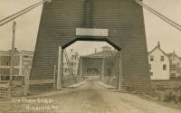
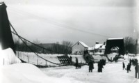
1853: Mill Pond
Kingfield, Maine, USA - Carrabasset River
| Bridgemeister ID: | 45 (added before 2003) |
| Year Completed: | 1853 |
| Name: | Mill Pond |
| Location: | Kingfield, Maine, USA |
| Crossing: | Carrabasset River |
| Principals: | Daniel Beedy |
| References: | AAJ, BPL |
| Use: | Vehicular (one-lane), with walkway |
| Status: | Replaced, 1916 |
| Main Cables: | Chain (iron) |
| Main Span: | 1 x 57.9 meters (190 feet) |
| Deck width: | 15 feet |
Notes:
- Similar to 1856 Strong - Strong, Maine, USA.
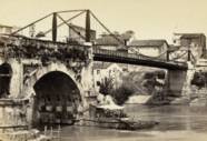
1853: Rotto
Rome, Italy - Tiber River
| Bridgemeister ID: | 6833 (added 2021-12-31) |
| Year Completed: | 1853 |
| Name: | Rotto |
| Location: | Rome, Italy |
| Crossing: | Tiber River |
| Coordinates: | 41.889321 N 12.479023 E |
| Maps: | Acme, GeoHack, Google, OpenStreetMap |
| Principals: | Pietro Lanciani |
| Status: | Removed, 1887 |
| Suspended Spans: | 1 |
| Characteristics: | Braced (trussed) chain/cable |
Notes:
- This was a somewhat temporary suspension bridge built on the piers of the ancient Ponte Rotto (Broken Bridge). It appears to have had a braced chain suspension cable design.
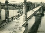
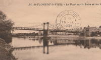
1853: Saint-Florent-le-Vieil
Saint-Florent-le-Vieil, Maine-et-Loire and Varades, Loire-Atlantique, France - Loire River
| Bridgemeister ID: | 1596 (added 2005-02-06) |
| Year Completed: | 1853 |
| Name: | Saint-Florent-le-Vieil |
| Location: | Saint-Florent-le-Vieil, Maine-et-Loire and Varades, Loire-Atlantique, France |
| Crossing: | Loire River |
| References: | AAJ |
| Use: | Vehicular (one-lane) |
| Status: | Removed |
| Main Cables: | Wire |
Notes:
- Multispan 19th-century suspension bridge distinct from the two 1965 cable-stayed and catenary suspension bridges connecting Varades and Saint-Florent-le-Vieil.
- Connects to 1853 Varades - Varades, Loire-Atlantique and Saint-Florent-le-Vieil, Maine-et-Loire, France.
- Later at same location 1954 Varades - Varades, Loire-Atlantique and Saint-Florent-le-Vieil, Maine-et-Loire, France.
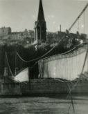
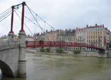
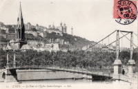
1853: Saint-Georges
Lyon, Métropole de Lyon, France - Saône River
| Bridgemeister ID: | 552 (added before 2003) |
| Year Completed: | 1853 |
| Name: | Saint-Georges |
| Also Known As: | Sala |
| Location: | Lyon, Métropole de Lyon, France |
| Crossing: | Saône River |
| Coordinates: | 45.757117 N 4.82615 E |
| Maps: | Acme, GeoHack, Google, OpenStreetMap |
| References: | AAJ, BPF, PQL |
| Use: | Footbridge |
| Status: | In use (last checked: 2022) |
| Main Cables: | Wire (iron) |
| Suspended Spans: | 1 |
| Main Span: | 1 x 75 meters (246.1 feet) |
Notes:
- Destroyed 1944, rebuilt same year. Reconstructed 1999.
External Links:
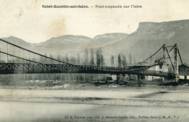
1853: Saint-Quentin-sur-Isère
Saint-Quentin-sur-Isère, Isère, France - Isère River
| Bridgemeister ID: | 2131 (added 2006-10-22) |
| Year Completed: | 1853 |
| Name: | Saint-Quentin-sur-Isère |
| Location: | Saint-Quentin-sur-Isère, Isère, France |
| Crossing: | Isère River |
| Use: | Vehicular |
| Status: | Removed |
| Main Cables: | Wire |
| Suspended Spans: | 1 |
External Links:
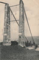
1853: Tsar Nicholas I
Kiev, Ukraine - Dnieper River
| Bridgemeister ID: | 409 (added before 2003) |
| Year Completed: | 1853 |
| Name: | Tsar Nicholas I |
| Location: | Kiev, Ukraine |
| Crossing: | Dnieper River |
| Principals: | Charles Blacker Vignoles |
| References: | AAJ, HBE, IEA, PTS2 |
| Use: | Vehicular |
| Status: | Destroyed, c. 1920 |
| Main Cables: | Chain (iron, flat link) |
| Suspended Spans: | 6 |
| Main Spans: | 4 x 134.1 meters (440 feet) |
| Side Spans: | 2 x 68.6 meters (225 feet) |
External Links:
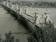
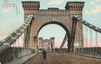
1854: Morgantown
Morgantown, West Virginia, USA - Monongahela River
| Bridgemeister ID: | 49 (added before 2003) |
| Year Completed: | 1854 |
| Name: | Morgantown |
| Location: | Morgantown, West Virginia, USA |
| Crossing: | Monongahela River |
| References: | AAJ, EN19070918, EOV, HBE, PTS2 |
| Use: | Vehicular, with walkway |
| Status: | Removed |
| Main Cables: | Wire (iron) |
| Suspended Spans: | 1 |
| Main Span: | 1 x 185.3 meters (608 feet) |
| Deck width: | 20 feet |
Notes:
- Was still part of Virginia at time of completion.
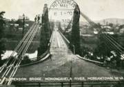
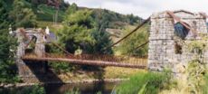
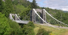
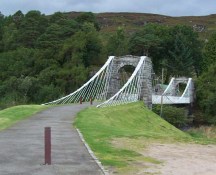
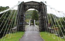
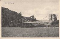
1854: Oich
Invergarry vicinity, Scotland, United Kingdom - River Oich
| Bridgemeister ID: | 403 (added before 2003) |
| Year Completed: | 1854 |
| Name: | Oich |
| Also Known As: | Aberchalder |
| Location: | Invergarry vicinity, Scotland, United Kingdom |
| Crossing: | River Oich |
| Coordinates: | 57.093377 N 4.745271 W |
| Maps: | Acme, GeoHack, Google, OpenStreetMap |
| Principals: | James Dredge |
| References: | BC3, HBR |
| Use: | Vehicular (one-lane) |
| Status: | Restricted to foot traffic (last checked: 2014) |
| Main Cables: | Rod (iron) |
| Suspended Spans: | 1 |
Notes:
- Restored and re-opened, late 1990's.
External Links:
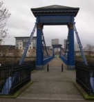
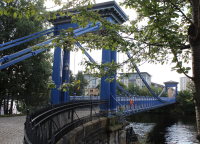
1854: Saint Andrew's
Glasgow, Scotland, United Kingdom - River Clyde
| Bridgemeister ID: | 408 (added before 2003) |
| Year Completed: | 1854 |
| Name: | Saint Andrew's |
| Location: | Glasgow, Scotland, United Kingdom |
| Crossing: | River Clyde |
| Coordinates: | 55.84883 N 4.23835 W |
| Maps: | Acme, GeoHack, Google, OpenStreetMap |
| Principals: | Neil Robson |
| References: | NTB |
| Use: | Footbridge |
| Status: | In use (last checked: 2019) |
| Main Cables: | Eyebar |
| Suspended Spans: | 1 |
| Main Span: | 1 x 67.1 meters (220 feet) |
| Deck width: | 13 feet |
Notes:
- Also sometimes attributed to Neil "Robinson" and completed 1853. May have originally been a narrow vehicular bridge.
External Links:
1855: Coudes
Coudes, Montpeyroux vicinity and Parent, Puy-de-Dôme, France - Allier River
| Bridgemeister ID: | 1942 (added 2005-10-29) |
| Year Completed: | 1855 |
| Name: | Coudes |
| Location: | Coudes, Montpeyroux vicinity and Parent, Puy-de-Dôme, France |
| Crossing: | Allier River |
| Coordinates: | 45.615255 N 3.211817 E |
| Maps: | Acme, GeoHack, Google, OpenStreetMap |
| Use: | Vehicular |
| Status: | Removed |
| Main Cables: | Wire |
| Suspended Spans: | 1 |
Notes:
- Later at same location Coudes - Coudes, Montpeyroux vicinity and Parent, Puy-de-Dôme, France.
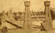
1855: Minneapolis
Minneapolis, Minnesota, USA - Mississippi River
| Bridgemeister ID: | 50 (added before 2003) |
| Year Completed: | 1855 |
| Name: | Minneapolis |
| Also Known As: | St. Anthony's Falls |
| Location: | Minneapolis, Minnesota, USA |
| Crossing: | Mississippi River |
| At or Near Feature: | Nicollet Island |
| Principals: | Thomas M. Griffith |
| References: | AAJ, BPL, HBE, PTS2 |
| Use: | Vehicular |
| Status: | Demolished, 1876 |
| Main Cables: | Wire (iron) |
| Suspended Spans: | 1 |
| Main Span: | 1 x 189 meters (620 feet) |
| Deck width: | 17 feet |
Notes:
- Replaced by 1877 Minneapolis - Minneapolis, Minnesota, USA.
- Later at same location 1990 Hennepin Avenue (Father Louis Hennepin) - Minneapolis, Minnesota, USA.
External Links:
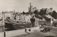
1855: Ness
Inverness, Scotland, United Kingdom - River Ness
| Bridgemeister ID: | 526 (added before 2003) |
| Year Completed: | 1855 |
| Name: | Ness |
| Location: | Inverness, Scotland, United Kingdom |
| Crossing: | River Ness |
| Use: | Vehicular |
| Status: | Demolished, 1961 |
| Main Cables: | Eyebar (iron) |
| Suspended Spans: | 1 |
Notes:
- Near 1881 Greig Street (Wobbly) - Inverness, Scotland, United Kingdom. In some photos, the two bridges are visible within a few hundred yards of each other.
External Links:

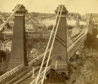
1855: Niagara Suspension
Niagara Falls, New York, USA and Niagara Falls, Ontario, Canada - Niagara River
| Bridgemeister ID: | 51 (added before 2003) |
| Year Completed: | 1855 |
| Name: | Niagara Suspension |
| Location: | Niagara Falls, New York, USA and Niagara Falls, Ontario, Canada |
| Crossing: | Niagara River |
| Principals: | John A. Roebling |
| References: | AAJ, BAAW, BBR, BFL, BMA, BOB, BPL, HBE, LIR, NSB, ONF, PTS2, SA18810716, SJR |
| Use: | Rail (heavy rail) and Vehicular (double-deck), with walkway |
| Status: | Replaced, 1897 |
| Main Cables: | Wire (iron) |
| Suspended Spans: | 1 |
| Main Span: | 1 x 250.3 meters (821.3 feet) |
Notes:
- Cables renovated, 1877. Wooden stiffening trusses replaced, 1880. Towers replaced, c. 1886. Bridge replaced with steel arch, 1897.
- AAJ notes the roadway deck opened in 1854, but the railway deck did not open until 1855.
- Replaced 1848 Niagara Suspension - Niagara Falls, New York, USA and Niagara Falls, Ontario, Canada.
External Links:
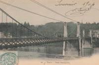
1855: Saint-Cyr
Tours and Saint-Cyr, Indre-et-Loire, France - Loire River
| Bridgemeister ID: | 1645 (added 2005-03-18) |
| Year Completed: | 1855 |
| Name: | Saint-Cyr |
| Also Known As: | Napoleon, Bonaparte |
| Location: | Tours and Saint-Cyr, Indre-et-Loire, France |
| Crossing: | Loire River |
| Principals: | Escarraguel Brothers |
| Use: | Vehicular |
| Status: | Demolished, 1943 |
| Main Cables: | Wire (iron) |
External Links:
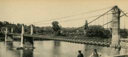
1855: Shohola
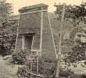
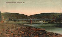
Barryville, New York and Shohola, Pennsylvania, USA - Delaware River
| Bridgemeister ID: | 41 (added before 2003) |
| Year Completed: | 1855 |
| Name: | Shohola |
| Also Known As: | Barryville-Shohola, Shohola-Barryville |
| Location: | Barryville, New York and Shohola, Pennsylvania, USA |
| Crossing: | Delaware River |
| Principals: | Chauncy Thomas, John A. Roebling |
| References: | BDR, SHO |
| Use: | Vehicular |
| Status: | Dismantled, 1941 |
| Main Cables: | Wire (iron) |
| Suspended Spans: | 1 |
Notes:
- BDR: Built 1856, severely damaged 1859, rebuilt, collapsed Jan. 1st 1865, rebuilt 1866. Dale writes: "A respected historian, John Willard Johnston, who knew Chauncey Thomas personally and visited the area during his ownership of the toll bridge, insisted that Thomas, as the builder, was grossly incompetent."
- Originally constructed with one main span, the center pier was added during the 1866 reconstruction.
- Don Sayenga's research leads him to conclude the bridge was completed in the fall of 1855. He notes an article from the Pike County Democrat (June 21, 1872) stating the bridge was completed in 1855. The article also notes the 1859 collapse occurred on July 2, 1859. Don's interest in this bridge is piqued by the connection to John Roebling, "...this bridge seems to be the only John Roebling bridge that failed in service..." Roebling prepared plans, for the original bridge, for Chauncy Thomas (who, by Dale's account was inexperienced).
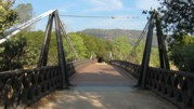
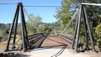
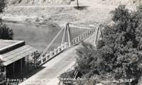
1856: Bidwell Bar
Oroville, California, USA - Feather River
| Bridgemeister ID: | 52 (added before 2003) |
| Year Completed: | 1856 |
| Name: | Bidwell Bar |
| Location: | Oroville, California, USA |
| Crossing: | Feather River |
| Coordinates: | 39.537483 N 121.45415 W |
| Maps: | Acme, GeoHack, Google, OpenStreetMap |
| Principals: | Bidwell Bridge Co. |
| References: | BPL, DSL200106, LACE |
| Use: | Vehicular (one-lane) |
| Status: | Restricted to foot traffic (last checked: 2020) |
| Main Cables: | Wire (iron) |
| Suspended Spans: | 1 |
| Main Span: | 1 x 67.1 meters (220 feet) estimated |
Notes:
- Dismantled before completion of Oroville Dam and replaced by the 1965 high-level Bidwell Bar suspension bridge. The 1856 structure was later reassembled about 1.5 miles south of the new Bidwell Bar bridge. Coordinates provided here are for the current location of the bridge at Kelly Ridge.
- Replaced by 1965 Bidwell Bar - Oroville, California, USA.
External Links:
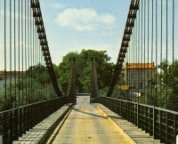
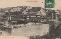
1856: Carbonne
Carbonne, Haute-Garonne, France - Garonne River
| Bridgemeister ID: | 1157 (added 2004-01-18) |
| Year Completed: | 1856 |
| Name: | Carbonne |
| Location: | Carbonne, Haute-Garonne, France |
| Crossing: | Garonne River |
| Coordinates: | 43.294537 N 1.228567 E |
| Maps: | Acme, GeoHack, Google, OpenStreetMap |
| Status: | Replaced, 1975 |
| Main Cables: | Wire (iron) |
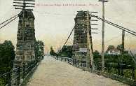
1856: Guyandotte
Guyandotte and Huntington, West Virginia, USA - Guyandotte River
| Bridgemeister ID: | 40 (added before 2003) |
| Year Completed: | 1856 |
| Name: | Guyandotte |
| Location: | Guyandotte and Huntington, West Virginia, USA |
| Crossing: | Guyandotte River |
| Coordinates: | 38.430083 N 82.391694 W |
| Maps: | Acme, GeoHack, Google, OpenStreetMap |
| Principals: | George Wilson Mason |
| References: | AAJ, EOV, PTS2 |
| Use: | Vehicular |
| Status: | Removed, 1907 |
| Main Cables: | Wire (iron) |
| Suspended Spans: | 1 |
| Main Span: | 1 x 137.2 meters (450 feet) |
Notes:
- EOV cites a source claiming the bridge was begun in 1853, but not completed until 1858. AAJ says completed in 1848. Other sources claim it was completed in 1852 and 1856.
- Was still part of Virginia at time of completion.
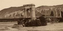
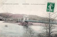
1856: Les Mées
Les Mées, Alpes-de-Haute-Provence, France - Durance River
| Bridgemeister ID: | 1522 (added 2004-10-10) |
| Year Completed: | 1856 |
| Name: | Les Mées |
| Location: | Les Mées, Alpes-de-Haute-Provence, France |
| Crossing: | Durance River |
| Use: | Vehicular |
| Status: | Replaced |
| Main Cables: | Wire (iron) |
| Suspended Spans: | 2 |
| Main Spans: | 2 |
Notes:
External Links:
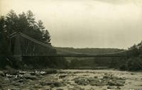
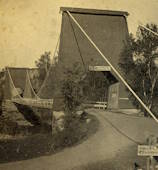
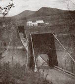
1856: Strong
Strong, Maine, USA - Sandy River
| Bridgemeister ID: | 53 (added before 2003) |
| Year Completed: | 1856 |
| Name: | Strong |
| Location: | Strong, Maine, USA |
| Crossing: | Sandy River |
| Principals: | Daniel Beedy |
| References: | BPL |
| Use: | Vehicular (one-lane) |
| Status: | Replaced (last checked: 1922) |
| Main Cables: | Wire (iron) |
| Suspended Spans: | 1 |
| Main Span: | 1 x 77.4 meters (254 feet) |
| Deck width: | 13 feet |
Notes:
- Similar to 1853 Mill Pond - Kingfield, Maine, USA.
1857: Black River
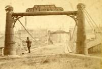
Watertown, New York, USA - Black River
| Bridgemeister ID: | 55 (added before 2003) |
| Year Completed: | 1857 |
| Name: | Black River |
| Also Known As: | Bradford, Mill Street |
| Location: | Watertown, New York, USA |
| Crossing: | Black River |
| Principals: | Gilbert Bradford |
| References: | AAJ, HBE, ONC |
| Use: | Vehicular |
| Status: | Removed, 1890's |
| Main Cables: | Wire (iron) |
| Suspended Spans: | 1 |
| Main Span: | 1 x 53 meters (173.9 feet) |
| Deck width: | 18 feet |
Notes:
- Replaced in 1890's (ONC).
1857: Change
Glendon, Pennsylvania, USA - Lehigh River
| Bridgemeister ID: | 56 (added before 2003) |
| Year Completed: | 1857 |
| Name: | Change |
| Also Known As: | Chain, Lehigh Canal Swinging, Wire Towing Path at Pool No. 8 |
| Location: | Glendon, Pennsylvania, USA |
| Crossing: | Lehigh River |
| Coordinates: | 40.65382 N 75.24774 W |
| Maps: | Acme, GeoHack, Google, OpenStreetMap |
| Principals: | Lehigh Coal and Navigation Co., E.A. Douglas |
| References: | HAERPA461, HBP |
| Use: | Footbridge and Change |
| Status: | Derelict (last checked: 2007) |
| Main Cables: | Wire (iron) |
| Suspended Spans: | 2 |
| Main Spans: | 2 |
Notes:
- Often mistakenly called a "chain" bridge, this is a "change" bridge.
External Links:
- Aldrich Change Bridge. Dale Oswald explains (in the context of the Aldrich Change Bridge, a non-suspension bridge in Palmyra, New York): "A change bridge is one with low railings and an underpass that allowed draft teams to move from one side of the canal to the other without unhitching, cloverleaf-style."
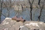
| Bridgemeister ID: | 1990 (added 2005-12-02) |
| Year Completed: | 1858 |
| Name: | Thoirette |
| Location: | Thoirette, Jura and Ain, France |
| Crossing: | Ain River |
| Coordinates: | 46.268464 N 5.536318 E |
| Maps: | Acme, GeoHack, Google, OpenStreetMap |
| References: | AGP |
| Use: | Vehicular (one-lane) |
| Status: | Replaced, 1922 |
| Main Cables: | Wire |
| Suspended Spans: | 1 |
Notes:
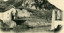
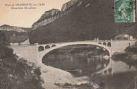
- One end of this bridge appears to have led directly into a building aptly named Hôtel Du Pont with the roadway possibly passing through the building. Remnants of the bridge are still present (as of 2022) on both sides of the river.
- Replaced 1829 Thoirette - Thoirette, Jura and Ain, France.
External Links:
1859: General Dean
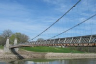
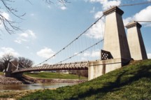
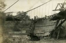
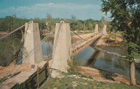
Carlyle, Illinois, USA - Kaskaskia River
| Bridgemeister ID: | 58 (added before 2003) |
| Year Completed: | 1859 |
| Name: | General Dean |
| Also Known As: | Carlyle |
| Location: | Carlyle, Illinois, USA |
| Crossing: | Kaskaskia River |
| Coordinates: | 38.611125 N 89.357476 W |
| Maps: | Acme, GeoHack, Google, OpenStreetMap |
| Principals: | D. Griffith Smith |
| References: | BPL, GBD |
| Use: | Vehicular (one-lane) |
| Status: | Restricted to foot traffic (last checked: 2021) |
| Main Cables: | Wire (iron) |
| Suspended Spans: | 1 |
| Main Span: | 1 x 80.5 meters (264 feet) |
Notes:
- Rebuilt 1920s, 1970s. Restored, 1950's, for use as a footbridge.
- Bypassed, 1924.
External Links:
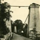
1859: Sully-sur-Loire
Sully-sur-Loire and Saint-Père-sur-Loire, Loiret, France - Loire River
| Bridgemeister ID: | 1709 (added 2005-03-30) |
| Year Completed: | 1859 |
| Name: | Sully-sur-Loire |
| Location: | Sully-sur-Loire and Saint-Père-sur-Loire, Loiret, France |
| Crossing: | Loire River |
| Use: | Vehicular |
| Status: | Collapsed, 1985 |
| Main Cables: | Chain (iron) |
| Main Spans: | 3 |
| Side Spans: | 2 |
Notes:
- 1859: The former three-span Sully-sur-Loire suspension bridge, heavily damaged by flood in 1856, is replaced with a suspension bridge having at least five suspended spans.
- 1933: Refurbished.
- 1940, June 18: Destroyed to slow advancing German troops.
- 1943: Repaired.
- 1944: Bombed by allied forces.
- 1947: Rebuilt.
- 1985, January 16: Collapsed.
- Replaced 1836 Sully-sur-Loire - Sully-sur-Loire and Saint-Père-sur-Loire, Loiret, France.
External Links:
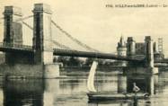
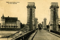
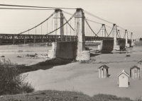
1860: Allegheny River
Pittsburgh, Pennsylvania, USA - Allegheny River
| Bridgemeister ID: | 59 (added before 2003) |
| Year Completed: | 1860 |
| Name: | Allegheny River |
| Also Known As: | Sixth Street, St. Clair |
| Location: | Pittsburgh, Pennsylvania, USA |
| Crossing: | Allegheny River |
| Principals: | John A. Roebling |
| References: | BOB, BOP, BPL, HBE, PBR, PTS2, SJR |
| Use: | Vehicular, with walkway |
| Status: | Replaced, 1892 |
| Main Cables: | Wire (iron) |
| Suspended Spans: | 4 |
| Main Spans: | 2 x 104.9 meters (344 feet) |
| Side Spans: | 2 x 52.1 meters (171 feet) |
| Deck width: | 40 feet |
Notes:
- BPL cites this bridge as the first suspension bridge with metal towers. However, at least two earlier suspension bridges (1857 Watertown, New York and 1856 Bidwell Bar, California) are known to have metal towers and even Roebling's 1846 Smithfield Street Bridge in Pittsburgh had cast iron towers.
- Next to 1884 North Side (Seventh Street) - Pittsburgh, Pennsylvania, USA.
External Links:
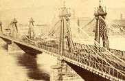
1860: Grand Falls
Grand Falls, New Brunswick, Canada - St. John River
| Bridgemeister ID: | 60 (added before 2003) |
| Year Completed: | 1860 |
| Name: | Grand Falls |
| Location: | Grand Falls, New Brunswick, Canada |
| Crossing: | St. John River |
| Principals: | James Tomlinson |
| References: | AAJ |
| Use: | Vehicular (two-lane) |
| Status: | Replaced, 1915 |
| Main Cables: | Wire (iron) |
| Suspended Spans: | 1 |
| Main Span: | 1 x 63.9 meters (209.75 feet) |
| Deck width: | 16 feet |
Notes:
- Out of use, 1912.
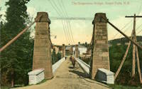
1861: Connellsville
Connellsville and New Haven, Pennsylvania, USA - Youghiogheny River
| Bridgemeister ID: | 278 (added before 2003) |
| Year Completed: | 1861 |
| Name: | Connellsville |
| Location: | Connellsville and New Haven, Pennsylvania, USA |
| Crossing: | Youghiogheny River |
| Use: | Vehicular (one-lane) |
| Status: | Removed |
| Main Cables: | Wire |
| Suspended Spans: | 1 |
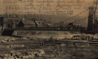
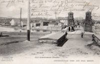
1861: Gray
Gray, Haute-Saône, France - Saône River
| Bridgemeister ID: | 1127 (added 2004-01-14) |
| Year Completed: | 1861 |
| Name: | Gray |
| Location: | Gray, Haute-Saône, France |
| Crossing: | Saône River |
| Use: | Vehicular |
| Status: | Removed |
| Main Cables: | Wire (iron) |
| Suspended Spans: | 1 |

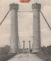
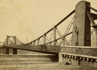
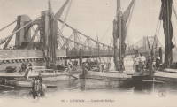
1862: Lambeth
London, England, United Kingdom - River Thames
| Bridgemeister ID: | 829 (added 2003-05-31) |
| Year Completed: | 1862 |
| Name: | Lambeth |
| Location: | London, England, United Kingdom |
| Crossing: | River Thames |
| Principals: | P. W. Barlow |
| References: | BRB, HBE, ONF, PTS2 |
| Use: | Vehicular, with walkway |
| Status: | Replaced, 1932 |
| Suspended Spans: | 3 |
| Main Spans: | 3 x 81.7 meters (268 feet) |
External Links:
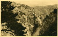
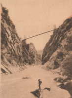
1863: Ponsonnas
Ponsonnas, Isère, France - Drac River
| Bridgemeister ID: | 1079 (added 2003-12-29) |
| Year Completed: | 1863 |
| Name: | Ponsonnas |
| Location: | Ponsonnas, Isère, France |
| Crossing: | Drac River |
| Use: | Vehicular |
| Status: | Replaced, 1941 |
| Suspended Spans: | 1 |
| Main Span: | 1 x 123 meters (403.5 feet) |
Notes:
- Replaced by a 1941 arch bridge that is popular with bungee jumpers.
External Links:
1864: (suspension bridge)
Porta Westfalica, Germany - Weser River
| Bridgemeister ID: | 637 (added 2003-02-13) |
| Year Completed: | 1864 |
| Name: | (suspension bridge) |
| Location: | Porta Westfalica, Germany |
| Crossing: | Weser River |
| References: | BRU, PTS2 |
| Use: | Rail and Vehicular |
| Status: | Destroyed, April 3, 1945 |
| Main Cables: | Eyebar (iron) |
| Suspended Spans: | 1 |
Notes:
- At the time of completion, the bridge connected the villages of Barkhausen and Hausberge, later merged into Porta Westfalica.
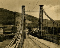
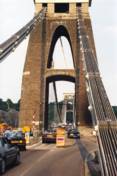
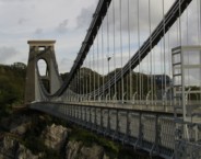
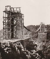
1864: Clifton
Bristol, England, United Kingdom - River Avon
| Bridgemeister ID: | 413 (added before 2003) |
| Year Completed: | 1864 |
| Name: | Clifton |
| Location: | Bristol, England, United Kingdom |
| Crossing: | River Avon |
| Coordinates: | 51.45496 N 2.62781 W |
| Maps: | Acme, GeoHack, Google, OpenStreetMap |
| Principals: | Isambard K. Brunel, P.W. Barlow, Hawkshaw |
| References: | AOB, BBR, BC3, BEM, BMA, BOU, BRB, CTW, HBE, NTB, ONF, PTS2 |
| Use: | Vehicular, with walkway |
| Status: | In use (last checked: 2021) |
| Main Cables: | Eyebar (iron) |
| Suspended Spans: | 1 |
| Main Span: | 1 x 214 meters (702 feet) |
Notes:
- Built with chain cables reused from the Hungerford bridge.
- See 1845 Hungerford - London, England, United Kingdom.
External Links:

1865: Market Street
Williamsport, Pennsylvania, USA - Susquehanna River
| Bridgemeister ID: | 64 (added before 2003) |
| Year Completed: | 1865 |
| Name: | Market Street |
| Location: | Williamsport, Pennsylvania, USA |
| Crossing: | Susquehanna River |
| Principals: | Alfred P. Boller |
| References: | AAJ, JFI186604 |
| Use: | Vehicular |
| Status: | Destroyed, June 1, 1889 |
| Main Cables: | Wire (iron) |
| Suspended Spans: | 5 |
| Main Spans: | 5 x 61 meters (200 feet) |
Notes:
- JFI186604 (in which Boller mentions about the bridge's "peculiar system of trussing": "This general arrangement for suspension bridges was first practised by John Murphy, Esq., C.E., over the Gauley, in West Virginia, and also at Franklin, Pennsylvania.")
- Destroyed by flood June 1, 1889.
- Near 1878 Maynard Street - Williamsport, Pennsylvania, USA.
- Replaced by 1889 Market Street - Williamsport, Pennsylvania, USA.
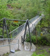
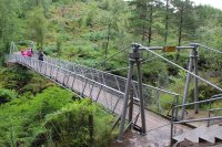
1867: Corrieshalloch
Braemore, Scotland, United Kingdom - Corrieshalloch Gorge
| Bridgemeister ID: | 1308 (added 2004-04-10) |
| Year Completed: | 1867 |
| Name: | Corrieshalloch |
| Location: | Braemore, Scotland, United Kingdom |
| Crossing: | Corrieshalloch Gorge |
| At or Near Feature: | Falls of Measach |
| Coordinates: | 57.755753 N 5.021048 W |
| Maps: | Acme, GeoHack, Google, OpenStreetMap |
| Principals: | John Fowler |
| References: | AAJ, HBR |
| Use: | Footbridge |
| Status: | In use (last checked: 2022) |
| Main Cables: | Wire |
| Suspended Spans: | 1 |
| Main Span: | 1 x 25.1 meters (82.5 feet) |
Notes:
- 2022, May: Closed again for maintenance and inspection, reopened by month's end.
- AAJ lists the bridge at "Corry Halloch" bridge completed in 1875. Other sources mention 1867, and 1874.
- 1977: Anchorages replaced (HBR).
- 2021: Closed September 10 due to safety concerns. Repaired and re-opened in October.
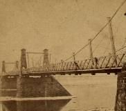
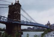
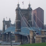
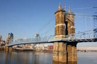
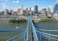
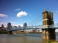
1867: John A. Roebling
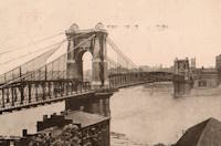
Cincinnati, Ohio and Covington, Kentucky, USA - Ohio River
| Bridgemeister ID: | 65 (added before 2003) |
| Year Completed: | 1867 |
| Name: | John A. Roebling |
| Also Known As: | Cincinnati, Cincinnati and Covington |
| Location: | Cincinnati, Ohio and Covington, Kentucky, USA |
| Crossing: | Ohio River |
| Coordinates: | 39.09167 N 84.50833 W |
| Maps: | Acme, GeoHack, Google, OpenStreetMap |
| Principals: | John A. Roebling |
| References: | BAAW, BC3, BOB, BPL, COB, EOV, HBE, LAB, LACE, ONF, PTS2, SJR, TOB |
| Use: | Vehicular (two-lane), with walkway |
| Status: | Closed, February, 2021 (last checked: 2021) |
| Main Cables: | Wire (iron) |
| Suspended Spans: | 3 |
| Main Span: | 1 x 322.2 meters (1,057 feet) |
| Side Spans: | 2 |
Notes:
- 1892: Cable ends restored.
- 1899: Steel cables added to assist original cables.
- 2021, February: Closed to all vehicular traffic for a nine-month restoration project.
- Became longest suspension bridge by eclipsing 1849 Wheeling (Wheeling and Belmont) - Wheeling, West Virginia, USA.
- Eclipsed by new longest suspension bridge 1869 Clifton (Niagara-Clifton, Falls View, First Falls View) - Niagara Falls, New York, USA and Niagara Falls, Ontario, Canada.
External Links:
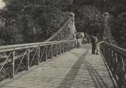
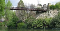
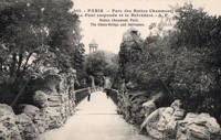
| Bridgemeister ID: | 516 (added before 2003) |
| Year Completed: | 1867 |
| Name: | Parc des Buttes-Chaumont |
| Location: | Paris, France |
| At or Near Feature: | Parc des Buttes-Chaumont |
| Coordinates: | 48.880933 N 2.381533 E |
| Maps: | Acme, GeoHack, Google, OpenStreetMap |
| References: | AAJ |
| Use: | Footbridge |
| Status: | In use (last checked: 2021) |
| Main Cables: | Wire |
| Suspended Spans: | 1 |
| Main Span: | 1 x 61 meters (200 feet) |
External Links:
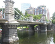
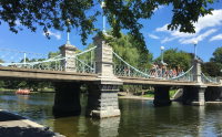
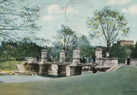
1867: Public Garden
Boston, Massachusetts, USA - Public Garden lagoon
| Bridgemeister ID: | 245 (added before 2003) |
| Year Completed: | 1867 |
| Name: | Public Garden |
| Location: | Boston, Massachusetts, USA |
| Crossing: | Public Garden lagoon |
| Coordinates: | 42.354119 N 71.069920 W |
| Maps: | Acme, GeoHack, Google, OpenStreetMap |
| Principals: | William Gibbons Preston, Clemens Herschel |
| References: | HBE |
| Use: | Footbridge |
| Status: | In use (last checked: 2019) |
| Main Cables: | Eyebar (iron) |
| Suspended Spans: | 3 |
| Main Span: | 1 x 15.2 meters (50 feet) estimated |
| Side Spans: | 2 |
Notes:
- Often claimed to have been the shortest "functioning" suspension bridge up until 1921 when a steel girder was added as the primary means of support. However this was not true. There were shorter suspension bridges, some of which are still in existence. For example, see Schaukelbrücke Ilmpark completed in 1833, still in use as of the 2010s, and only 48.6 feet long. Likely the shortest functioning suspension bridge ever built was at Castle Bergedorf in Hamburg, Germany with a main span of 22.6 feet (6.9 meters).
External Links:

1868: (suspension bridge)
Afton, New York, USA - Susquehanna River
| Bridgemeister ID: | 66 (added before 2003) |
| Year Completed: | 1868 |
| Name: | (suspension bridge) |
| Location: | Afton, New York, USA |
| Crossing: | Susquehanna River |
| Principals: | G. W. & J. V. V. Fishler, James Crowell |
| Use: | Vehicular |
| Status: | Removed |
| Main Cables: | Wire (iron) |
| Suspended Spans: | 1 |
| Main Span: | 1 x 110.3 meters (362 feet) |
| Deck width: | 16 feet |
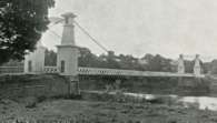
1868: Calloway's Ford
Elizabethtown vicinity, Hamilton County, Ohio, USA - Whitewater River
| Bridgemeister ID: | 68 (added before 2003) |
| Year Completed: | 1868 |
| Name: | Calloway's Ford |
| Also Known As: | Whitewater, Harrison's |
| Location: | Elizabethtown vicinity, Hamilton County, Ohio, USA |
| Crossing: | Whitewater River |
| Coordinates: | 39.183116 N 84.792638 W |
| Maps: | Acme, GeoHack, Google, OpenStreetMap |
| Principals: | John Gray, Morse, Young |
| References: | EOV |
| Use: | Vehicular |
| Status: | Removed, 1920 |
| Main Cables: | Wire (iron) |
| Main Span: | 1 x 144.8 meters (475 feet) |
| Deck width: | 22 feet |
Notes:
- This bridge was located where present-day Suspension Bridge Road crosses the Whitewater River next to I-275 and north of US50. According to information provided by Sharon Lutz from Marjorie Byrnside Burress, this bridge was renamed "Harrison's Suspension Bridge" in 1891. This should not be confused with the nearby suspension bridge at Harrison.
- According to the information provided by Sharon Lutz from Marjorie Byrnside Burress, "Crossing this bridge was the main thoroughfare from Indiana into Ohio for many years (US 50 was not completed by then). [In 1920] it was decided that the Suspension Bridge had become obsolete and could no longer safely withstand the weight of vehicles. [On May 19, 1920] the cables were severed by means of an oxygen flame, the weight of the cables pulled down some towers. Other towers were weakened by dynamite at their bases and later they were pulled down by the weight of the cables severed at one end with an oxygen flame."
- See 1873 Harrison - Harrison, Ohio and Dearborn County, Indiana, USA.
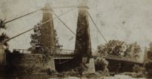

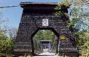
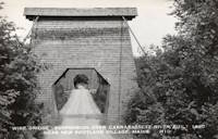
1868: Wire
New Portland, Maine, USA - Carrabasset River
| Bridgemeister ID: | 69 (added before 2003) |
| Year Completed: | 1868 |
| Name: | Wire |
| Location: | New Portland, Maine, USA |
| Crossing: | Carrabasset River |
| Coordinates: | 44.890783 N 70.0925 W |
| Maps: | Acme, GeoHack, Google, OpenStreetMap |
| References: | BC3, BPL, GBD, LAB, RDH |
| Use: | Vehicular (one-lane) |
| Status: | In use (last checked: 2023) |
| Main Cables: | Wire (iron) |
| Suspended Spans: | 1 |
| Main Span: | 1 x 60.5 meters (198.4 feet) |
Notes:
- BPL says c. 1866. Historic landmark plaque at bridge also says 1866.
- Extensive repairs, 1960.
External Links:
1869: Clifton
Niagara Falls, New York, USA and Niagara Falls, Ontario, Canada - Niagara River
| Bridgemeister ID: | 70 (added before 2003) |
| Year Completed: | 1869 |
| Name: | Clifton |
| Also Known As: | Niagara-Clifton, Falls View, First Falls View |
| Location: | Niagara Falls, New York, USA and Niagara Falls, Ontario, Canada |
| Crossing: | Niagara River |
| Principals: | Samuel Keefer |
| References: | AAJ, BPL, HBE, PTS2 |
| Use: | Vehicular |
| Status: | Replaced, 1889 |
| Main Cables: | Wire (iron) |
| Main Span: | 1 x 386.6 meters (1,268.3 feet) |
| Deck width: | 10 feet |
Notes:
- Opened January 2nd, 1869. Wooden towers replaced with steel towers, 1884. Widened to 17 feet, 1888. Wrecked by wind, January, 1889. Some of the images here may show the replacement bridge.
- Became longest suspension bridge by eclipsing 1867 John A. Roebling (Cincinnati, Cincinnati and Covington) - Cincinnati, Ohio and Covington, Kentucky, USA.
- Eclipsed by new longest suspension bridge 1883 Brooklyn (Great East River) - New York and Brooklyn, New York, USA.
- Replaced by 1889 Second Falls View - Niagara Falls, New York, USA and Niagara Falls, Ontario, Canada.
External Links:
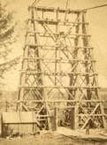
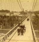
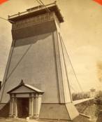
1869: Lordville
Lordville, New York and Equinunk, Pennsylvania, USA - Delaware River
| Bridgemeister ID: | 71 (added before 2003) |
| Year Completed: | 1869 |
| Name: | Lordville |
| Location: | Lordville, New York and Equinunk, Pennsylvania, USA |
| Crossing: | Delaware River |
| Coordinates: | 41.867938 N 75.213785 W |
| Maps: | Acme, GeoHack, Google, OpenStreetMap |
| Principals: | E.F. Farrington |
| References: | BDR, BOL, PTS2 |
| Use: | Vehicular (one-lane) |
| Status: | Destroyed, 1903 |
| Main Cables: | Wire (iron) |
Notes:
- Destroyed by flood 1903.
- Replaced by 1904 Lordville-Equinunk - Lordville, New York and Equinunk, Pennsylvania, USA.
1870: Chehocton
Hancock, New York and Wayne County, Pennsylvania, USA - Delaware River
| Bridgemeister ID: | 284 (added before 2003) |
| Year Completed: | 1870 |
| Name: | Chehocton |
| Location: | Hancock, New York and Wayne County, Pennsylvania, USA |
| Crossing: | Delaware River |
| Principals: | E.F. Farrington, John A. Roebling's Sons Co. |
| Use: | Vehicular |
| Status: | Removed, 1937 |
| Main Cables: | Wire (iron) |
| Suspended Spans: | 1 |
| Main Span: | 1 x 144.8 meters (475 feet) estimated |
Notes:
- Replaced 1937.
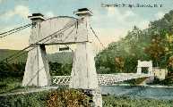
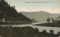
1870: Finck's
Little Falls, New York, USA - Mohawk River
| Bridgemeister ID: | 328 (added before 2003) |
| Year Completed: | 1870 |
| Name: | Finck's |
| Also Known As: | Fink's |
| Location: | Little Falls, New York, USA |
| Crossing: | Mohawk River |
| Coordinates: | 43.034102 N 74.830185 W |
| Maps: | Acme, GeoHack, Google, OpenStreetMap |
| References: | ONC |
| Use: | Vehicular |
| Status: | Destroyed, 1917 |
| Main Cables: | Wire |
Notes:
- Heavily damaged by fire, 1917.
- Coordinates reflect where modern Fincks Basin Road meets the Mohawk River, likely approximate location of this bridge.
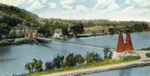
1871: Ferry Street
Binghamton, New York, USA - Chenango River
| Bridgemeister ID: | 276 (added before 2003) |
| Year Completed: | 1871 |
| Name: | Ferry Street |
| Location: | Binghamton, New York, USA |
| Crossing: | Chenango River |
| Principals: | John A. Roebling's Sons, Co. |
| Use: | Vehicular (one-lane) |
| Status: | Removed, 1897 |
| Main Cables: | Wire |
| Suspended Spans: | 1 |
| Main Span: | 1 x 109.7 meters (360 feet) |
Notes:
- This bridge was close to the alignment of Binghamton's present Clinton Street bridge. It replaced a bridge that was destroyed by flood in 1865. It was condemned in 1896 and removed in 1897. History Of Broome County indicates an act was passed March 13th, 1871 authorizing the bridge with the contract let to "W.A. Roebling & Son" each cable consisting of seven steel wire ropes, each two inches in diameter.
- An article from the Binghamton Democrat, July 20, 1871: "The Suspension Bridge -- The work on the west abutment of the suspension bridge has been commenced and will be rapidly as advisable pushed forward to completion, and soon thereafter the wire cables will be placed in position, the stays, supports and girders made fast, and ready for the flooring. In the course of six or eight weeks it is hoped that the bridge will be completed, and our people given another way of passing from the 1st to the 2nd wards, and the old-pleasant driveway re-opened, of which we have been debarred since the flood of St-Patrick's Day in the morning in [1865]. Upon the completion of this enterprise, surely no one will ever regret having voted in favor of the free suspension bridge."
- An article from the Binghamton Democrat, Nov. 30, 1871: "The New Bridge -- Its Cost -- For the suspenssion [sic] bridge, the tax-payers voted $28,000. It is finished, and in the Common Council last evening it was asserted that it cost over $30,000 and still all the claims are not satisfied. Mr. Jas. Fanning, contractor for building abutments, seeks relief for $1,000 or upwards which he is out no account of his contract. His petition was after considerable skirmishing finally referred to a committee. We hold that this is wrong, the Common Council has nothing to do with this matter. Mayor Dwight published a card binding himself to pay all over $28,000 that the bridge would cost. The people voted that amount and their representatives have nothing to do with any further cost or expense arrising [sic] from that source."
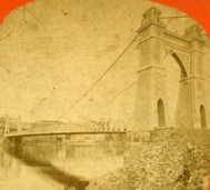
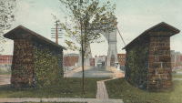
- Internet searches for this bridge often lead to an image on page 32 of the book "Binghamton", from the "Images of America" series, by Ed Aswad and Suzanne M. Meredith. However, that image is of the Warren Pensylvania suspension bridge and is erroneously captioned as the Binghamton Ferry Street bridge. The bridges may be sometimes confused because of similar surroundings and similar towers. Both are often depicted with a large warehouse building on the far side of the bridge, to the right. Both had "walk-through" towers where the pedestrian walkway passed through portals in the towers. Closer comparisons reveal the Warren towers are substantially larger than the Ferry Street towers. This is not surprising given the Warren bridge was substantially longer than the Ferry Street bridge. All this being said, there are different images purporting to be the Ferry Street bridge that show different towers. The stereoview image linked here appears to show the original towers. Later photos appear to show either replaced towers or, perhaps, the original towers clad in protective housing.
- See 1871 Warren (Hickory Street) - Warren, Pennsylvania, USA. The two bridges are sometimes confused despite the significant size difference.
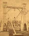
1871: Warren
Warren, Pennsylvania, USA - Allegheny River
| Bridgemeister ID: | 75 (added before 2003) |
| Year Completed: | 1871 |
| Name: | Warren |
| Also Known As: | Hickory Street |
| Location: | Warren, Pennsylvania, USA |
| Crossing: | Allegheny River |
| Principals: | George W. Fishler |
| References: | AAJ, EOV, HAERPA461, HBE, PTS2 |
| Use: | Vehicular, with walkway |
| Status: | Replaced, 1918 |
| Main Cables: | Wire (iron) |
| Suspended Spans: | 1 |
| Main Span: | 1 x 143.3 meters (470 feet) |
| Deck width: | 29 feet |
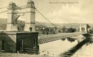
1872: Barrett
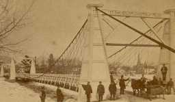
Port Jervis, New York and Matamoras, Pennsylvania, USA - Delaware River
| Bridgemeister ID: | 76 (added before 2003) |
| Year Completed: | 1872 |
| Name: | Barrett |
| Location: | Port Jervis, New York and Matamoras, Pennsylvania, USA |
| Crossing: | Delaware River |
| References: | BDR |
| Use: | Vehicular |
| Status: | Destroyed, October 11, 1903 |
| Main Cables: | Wire (iron) |
| Suspended Spans: | 2 |
| Main Spans: | 2 |
Notes:
- BDR: Destroyed by ice March 17, 1875, rebuilt, destroyed by flood October 11, 1903.
1872: Chemung
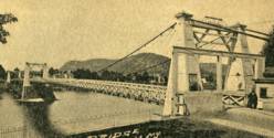
Chemung, New York, USA - Chemung River
| Bridgemeister ID: | 78 (added before 2003) |
| Year Completed: | 1872 |
| Name: | Chemung |
| Location: | Chemung, New York, USA |
| Crossing: | Chemung River |
| Principals: | J.V. Fishler, J.R. Crowell |
| Use: | Vehicular |
| Status: | Removed |
| Main Cables: | Wire (iron) |

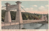
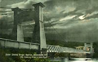
1872: Fulsom Landing
Riparius, New York, USA - Hudson River
| Bridgemeister ID: | 330 (added before 2003) |
| Year Completed: | 1872 |
| Name: | Fulsom Landing |
| Also Known As: | Riverside, Folsom Landing, Riparius |
| Location: | Riparius, New York, USA |
| Crossing: | Hudson River |
| Coordinates: | 43.661963 N 73.898194 W |
| Maps: | Acme, GeoHack, Google, OpenStreetMap |
| Use: | Vehicular (one-lane) |
| Status: | Removed |
| Main Cables: | Wire |
| Suspended Spans: | 1 |
| Main Span: | 1 |
Notes:
- The location of this bridge was originally known as "Folsom Landing" and later became known as "Riverside." In 1886 the name was changed to "Riparius" to avoid confusion with another New York "Riverside" location. The suspension bridge is sometimes referenced by each of these names. To make matters even more confusing, the bridge was known as the "Fulsom Landing" bridge (instead of Folsom).
- Removed at some point after 1919.
- Near 1871 (suspension bridge) - Washburn's Eddy, New York, USA.
1872: Gilead
Gilead, Maine, USA - Androscoggin River
| Bridgemeister ID: | 2157 (added 2006-12-10) |
| Year Completed: | 1872 |
| Name: | Gilead |
| Location: | Gilead, Maine, USA |
| Crossing: | Androscoggin River |
| Use: | Vehicular |
| Status: | Replaced, 1923 |
| Main Cables: | Wire |
| Main Span: | 1 x 58.5 meters (192 feet) |
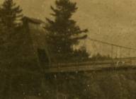
1872: Lower
Turners Falls, Montague, Massachusetts, USA - Connecticut River
| Bridgemeister ID: | 340 (added before 2003) |
| Year Completed: | 1872 |
| Name: | Lower |
| Also Known As: | White |
| Location: | Turners Falls, Montague, Massachusetts, USA |
| Crossing: | Connecticut River |
| Coordinates: | 42.609165 N 72.561433 W |
| Maps: | Acme, GeoHack, Google, OpenStreetMap |
| References: | CCR, PTS2 |
| Use: | Vehicular |
| Status: | Removed, circa 1936 |
| Main Cables: | Wire |
| Suspended Spans: | 1 |
Notes:
- Damaged by flood, 1936 and removed soon after.
- Near 1878 Upper (Red) - Turners Falls, Montague, Massachusetts, USA.
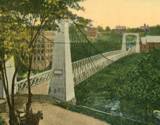
1873: Franklin
Franklin, Ohio, USA - Great Miami River
| Bridgemeister ID: | 80 (added before 2003) |
| Year Completed: | 1873 |
| Name: | Franklin |
| Location: | Franklin, Ohio, USA |
| Crossing: | Great Miami River |
| Principals: | J. W. Shipman & Co., John A. Roebling's Sons Co. |
| References: | EOV, HWCO |
| Use: | Vehicular (one-lane) |
| Status: | Replaced, 1933 |
| Main Cables: | Wire |
| Suspended Spans: | 1 |
Notes:
- Traffic restricted to foot traffic, 1931. Closed, 1933, after the bridge sagged significantly.
- From HWCO: "The towers are thirty-eight feet high, and each consists of four columns, of Phoenix column iron. The cables are of steel wire and each is composed of 343 strands, the whole cable having a diameter of seven inches. The masonry is constructed of Dayton stone, and is of a very substantial character... The wire and iron work was done in the summer of 1873 under the superintendence of Roebling & Sons, of Trenton, N. J. The bridge is stayed by strong wire cables and stiffened by an iron truss. The whole cost was $43,900."
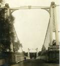
1873: Harrison
Harrison, Ohio and Dearborn County, Indiana, USA - Whitewater River
| Bridgemeister ID: | 81 (added before 2003) |
| Year Completed: | 1873 |
| Name: | Harrison |
| Location: | Harrison, Ohio and Dearborn County, Indiana, USA |
| Crossing: | Whitewater River |
| Principals: | James W. Shipman and Co. |
| References: | EOV |
| Use: | Vehicular (one-lane) |
| Status: | Destroyed, 1913, by flood |
| Main Cables: | Wire |
Notes:
- See 1868 Calloway's Ford (Whitewater, Harrison's) - Elizabethtown vicinity, Hamilton County, Ohio, USA.
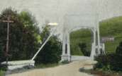
1873: South Street
Wilkes-Barre, Pennsylvania, USA - Lehigh Valley Railroad and North Branch Canal
| Bridgemeister ID: | 353 (added before 2003) |
| Year Completed: | 1873 |
| Name: | South Street |
| Also Known As: | Wire |
| Location: | Wilkes-Barre, Pennsylvania, USA |
| Crossing: | Lehigh Valley Railroad and North Branch Canal |
| Coordinates: | 41.239328 N 75.884643 W |
| Maps: | Acme, GeoHack, Google, OpenStreetMap |
| Use: | Vehicular |
| Status: | Removed, c. 1925 |
| Main Cables: | Wire |
Notes:
- In use until 1910, possibly longer. Replacement opened 1925.
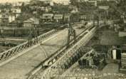
1875: Nith
Dumfries, Scotland, United Kingdom - River Nith
| Bridgemeister ID: | 524 (added before 2003) |
| Year Completed: | 1875 |
| Name: | Nith |
| Also Known As: | Biddall's |
| Location: | Dumfries, Scotland, United Kingdom |
| Crossing: | River Nith |
| Coordinates: | 55.065120 N 3.610292 W |
| Maps: | Acme, GeoHack, Google, OpenStreetMap |
| Principals: | J. Willett |
| Use: | Footbridge |
| Status: | In use (last checked: 2022) |
| Main Cables: | Chain (iron) |
| Suspended Spans: | 1 |
| Main Span: | 1 |
External Links:

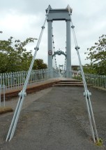
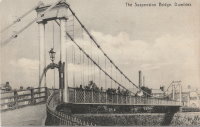
1875: Swinging
Arroyo Grande, California, USA - Arroyo Grande Creek
| Bridgemeister ID: | 307 (added before 2003) |
| Year Completed: | 1875 |
| Name: | Swinging |
| Location: | Arroyo Grande, California, USA |
| Crossing: | Arroyo Grande Creek |
| Coordinates: | 35.12336 N 120.57703 W |
| Maps: | Acme, GeoHack, Google, OpenStreetMap |
| Principals: | Newton Short |
| Use: | Footbridge |
| Status: | In use (last checked: 2007) |
| Main Cables: | Wire |
| Suspended Spans: | 1 |
| Main Span: | 1 x 52.1 meters (171 feet) |
Notes:
- A rotary club plaque at the bridge reads, "To connect his properties, Newton Short built this swinging bridge without sides about 1875. Sides were added after 1902. The bridge was given to the City of Arroyo Grande on July 14, 1911,... Due to severe storm damage, the bridge was rebuilt in 1995."
1875: Swinging
Frederick, Maryland, USA - Carroll Creek
| Bridgemeister ID: | 253 (added before 2003) |
| Year Completed: | 1875 |
| Name: | Swinging |
| Location: | Frederick, Maryland, USA |
| Crossing: | Carroll Creek |
| At or Near Feature: | Baker Park |
| Coordinates: | 39.415033 N 77.4208 W |
| Maps: | Acme, GeoHack, Google, OpenStreetMap |
| Use: | Footbridge |
| Status: | In use (last checked: 2022) |
| Main Cables: | Wire |
| Suspended Spans: | 1 |
Notes:
- The black and white photo shows the same bridge at its original location on Bentz Street (then Mill Alley). It was later moved to Baker Park, and then moved again (in 1927, 1928, or 1930 according to various sources) to its present location, another location in Baker Park.
- Local legend states this bridge was used by Stonewall Jackson and his troops when they entered Frederick on September 10, 1862.
- Closed March, 2008 due to safety concerns. Eventually reopened.
- Near 2006 William O. Lee (Carroll Creek Park) - Frederick, Maryland, USA.
External Links:
- Baker Park - Maryland Historic District. States bridge was built in 1875.
- Structurae - Structure ID 20011117
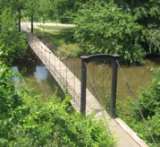
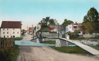
1876: Brunner
Brunner, New Zealand - Grey River / Māwheranui
| Bridgemeister ID: | 414 (added before 2003) |
| Year Completed: | 1876 |
| Name: | Brunner |
| Location: | Brunner, New Zealand |
| Crossing: | Grey River / Māwheranui |
| Coordinates: | 42.433068 S 171.324420 E |
| Maps: | Acme, GeoHack, Google, OpenStreetMap |
| Principals: | John Carruthers |
| References: | GAP |
| Use: | Vehicular and Rail |
| Status: | Restricted to foot traffic (last checked: 2017) |
| Main Cables: | Wire |
| Suspended Spans: | 1 |
Notes:
- GAP: Collapsed just before opening due to anchor plate failure, rebuilt. Rebuilt again 1925-1926. Towers replaced 1963-1964.

1876: Laissey
Laissey, Doubs, France - Doubs River
| Bridgemeister ID: | 2171 (added 2007-01-13) |
| Year Completed: | 1876 |
| Name: | Laissey |
| Location: | Laissey, Doubs, France |
| Crossing: | Doubs River |
| Coordinates: | 47.298411 N 6.236290 E |
| Maps: | Acme, GeoHack, Google, OpenStreetMap |
| Use: | Vehicular |
| Status: | Removed |
External Links:
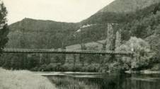
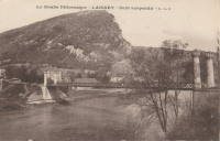
1876: Point
Pittsburgh, Pennsylvania, USA - Monongahela River
| Bridgemeister ID: | 84 (added before 2003) |
| Year Completed: | 1876 |
| Name: | Point |
| Location: | Pittsburgh, Pennsylvania, USA |
| Crossing: | Monongahela River |
| Principals: | Edward Hemberle |
| References: | AAJ, BOP, BPL, HBE, IEA, ONF, PBR, PTS2, SA19000106 |
| Use: | Vehicular and Rail (streetcar) |
| Status: | Demolished, 1927 |
| Main Cables: | Eyebar |
| Suspended Spans: | 1 |
| Main Span: | 1 x 243.8 meters (800 feet) |
| Deck width: | 34 feet |
Notes:
- Partial floor collapse requiring extensive repairs, December 24, 1903. Repaired, 1904. Demolished 1927.
External Links:
