Inventory Search Results (1-100 of 700)
700 suspension bridges were found for search criteria: David completed between 1700 and 2010 including undated bridges. Bridges 1 through 100 (of 700 total) appear below. Click the Bridgemeister ID number to isolate the bridge on its own page. If you don't see what you were looking for, try an image search with the same criteria: David. This will find the bridge if it is pictured on the site, but is not a catenary suspension bridge.
Related:
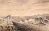
1810: Chain
Newburyport, Massachusetts, USA - Merrimack River
| Bridgemeister ID: | 14 (added before 2003) |
| Year Completed: | 1810 |
| Name: | Chain |
| Also Known As: | Essex-Merrimack |
| Location: | Newburyport, Massachusetts, USA |
| Crossing: | Merrimack River |
| At or Near Feature: | Deer Island |
| Coordinates: | 42.833947 N 70.906811 W |
| Maps: | Acme, GeoHack, Google, OpenStreetMap |
| Principals: | John Templeman |
| References: | AAJ, BBR, CAB, GBD, HBE, POPE, PTS2, RDH |
| Use: | Vehicular (two-lane, light vehicles only) |
| Status: | Replaced, 1909 |
| Main Cables: | Chain (iron) |
| Suspended Spans: | 1 |
| Main Span: | 1 x 74.1 meters (243 feet) |
| Deck width: | 30 feet (2 roadways of 15 feet) |
Notes:
- John Templeman built several bridges (like this one) using James Finley's design.
- Repaired in 1827 after 5 of 10 chains snapped under weight of a team of oxen.
- The complete description from Thomas Pope's 1811 Treatise (POPE):
"The chain Bridge lately thrown over the Merrimack, three miles above Newburyport, in the state of Massachusetts, is now in constant use. This Bridge consists of a single arc, two hundred and forty-four feet span. The abutments are of stone, forty-seven feet long, and thirty-seven high; the uprights, or framed work, which stand on the abutments, are thirty-five feet high, over which are suspended ten distinct chains, the ends of which on both sides of the river are buried deep in pits and secured by large stones: each chain is five hundred and sixteen feet long; and, where they pass over the uprights, they are treble, and made in short links, which is said to be more secure than saddles made of plates of iron. The four middle joists rest on the chains; all the rest are suspended to the main chains to equalize the floor. This Bridge has two passage-ways of fifteen feet in width each, and the floor is so solid as to admit of horses, carriages, etc. to travel at any speed, with very little perceptible motion of the floors. The railing is stout and strong, which adds much firmness to the floor. There are three chains in each range on each side, and four in the middle range: they are calculated to support nearly five hundred tons. From the surface of the water to the middle of the floor is forty feet; and from the top of the abutments to the top of the uprights is thirty-five feet high, making seventy-two feet. The magnitude and power of the abutments, the width and length of the floors, the elevation of the work, the evident powers of the chains, etc. all conspire to make it a wonderful work. Every expense attending it did not amount to twenty-five thousand dollars. The abutment being of stone, the uprights covered, and the chains painted to prevent rust, leaves nothing but the flooring to decay. This Bridge was constructed by John Templeman, Esq. of the district of Columbia, whose talents for the productions of such work, and the various improvements suggested and used by him, have been highly beneficial, and do him great credit."
- Gregory W. Buff sent a transcription of an article describing the 1827 failure. The article was in the Saturday, February 24, 1827 issue (Volume IV, Number 31) of the Canadian Spectator (Montreal, Quebec) newspaper:
"Newburyport, Feb 9. Disastrious [sic] Accident. - On Tuesday morning last, the Essex Merrimack Bridge gave way in the centre, from the parting of the chains that support it. On the Bridge, at the moment, was a loaded team, drawn by six oxen and two horses, driven by two men, Messrs. Garlton [sic] and Jackman, all of whom were precipitated, forty feet, into the river beneath. The teamsters preserved themselves by means of swimming, and the support of fragments of the bridge; the team were all of them except one of the horses, swept beneath the ice a few rods below, and drowned. Five of the ten chains which supported the Bridge, were snapped in different places, and now remain upholding the broken and shattered timber altogether as sad a wreck as we ever witnessed. At the moment of the crash, the light evolved from the friction of the chains resembled the the vivid streaming of a meteor. Various excuses are assigned for the accident, and none, with more probability, than the united effect of the incumbent pressure of the immense body of snow lying upon the bridge, and the frost which had contracted the particles of iron. These produced a tenseness in the chains, which was incapable of resisting the additional pressure of the loaded team, and the whole gave way. The estimated expense of repairing the breach is about 4000 dollars; and the Directors, as we understand, plan to set about it immediately. It will be built up as before. To those who have been losers by this accident the corporation intend to make generous inumeration. The traveling will be uninterrupted, as the solidity of the ice above the bridge forms a safe passage way - and for the conveyance of carriages and heavy baggage the proprietors have promptly provided suitable boats. If any aversion to chain bridges has been produced by this accident, we should be sorry, for ourselves we feel yet unshaken faith in their superior security. The misfortune in this case was no doubt owing to the causes above stated, and not to any defect in the construction of the bridge. Probably hundreds of individuals, including each sex and all ages, have visited the ruins of the bridge. They present a sad and melancholy appearance - crushed and broken timbers suspended by the massy chains, which hang lazily from the pyramidical abutments, while the beholder instinctly shrinks back in terror at the reflection of the situation of the two human beings who were precipitated into the abyss beneath. The preservation of these two men is almost miraculous. Although hurled down 40 feet amid crashing and falling timber, entangled with their cattle, they fell without receiving the least injury, and attained the shore, after being for nearly half an hour, immerse in water chilled to the freezing point. Mr. Jackman is far advanced in years - and suffered somewhat from the exposure to the cold. Mr. Carlton [sic], escaped unhurt. The Chain Bridge has been built for about fifteen years, the span is 220 feet. We believe this was the second or third Chain Bridge built in the United States; and this is probably the first that has met with a similar accident. We understand the proprieters of the Rooks Bridge intend to rebuild theirs as a Chain Bridge."
- Replaced by 1909 Chain - Newburyport, Massachusetts, USA. The 1909 structure was almost entirely new (except for portions of the piers and abutments).
External Links:
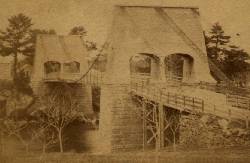
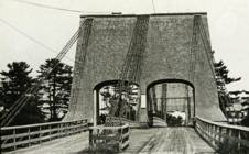
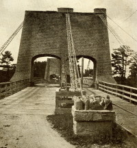
1818: Dryburgh Abbey
Dryburgh and St. Boswells, Scotland, United Kingdom - River Tweed
| Bridgemeister ID: | 1440 (added 2004-07-31) |
| Year Completed: | 1818 |
| Name: | Dryburgh Abbey |
| Location: | Dryburgh and St. Boswells, Scotland, United Kingdom |
| Crossing: | River Tweed |
| References: | AAJ, BEM, MOS |
| Use: | Footbridge |
| Status: | Collapsed, 1838 |
| Main Cables: | Chain (iron) |
| Suspended Spans: | 1 |
| Main Span: | 1 x 79.2 meters (260 feet) |
| Deck width: | 4.5 feet |
Notes:
- May have been rebuilt around 1850. History of the bridge is unclear between the 1838 collapse and replacement in 1872.
- This 1818 bridge was a replacement for the 1817 Dryburgh Abbey suspension bridge which appears to have been primarily a cable-stayed structure and is not included in the inventory. The 1817 bridge failed due to wind in early 1818.
- Later at same location 1872 Dryburgh Abbey - Dryburgh and St. Boswells, Scotland, United Kingdom.
External Links:

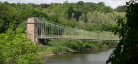
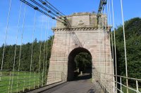
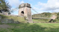
1820: Union
Horncliffe, Berwick-upon-Tweed vicinity, England and Fishwick, Scotland, United Kingdom - River Tweed
| Bridgemeister ID: | 373 (added before 2003) |
| Year Completed: | 1820 |
| Name: | Union |
| Location: | Horncliffe, Berwick-upon-Tweed vicinity, England and Fishwick, Scotland, United Kingdom |
| Crossing: | River Tweed |
| Coordinates: | 55.75256 N 2.10677 W |
| Maps: | Acme, GeoHack, Google, OpenStreetMap |
| Principals: | Sir Samuel Brown |
| References: | AAJ, BBR, BC3, BEM, BOB, HBE, MOS, NTB, PTS2, SBR |
| Use: | Vehicular (one-lane) |
| Status: | In use (last checked: 2023) |
| Main Cables: | Chain (iron) |
| Suspended Spans: | 1 |
| Main Span: | 1 x 136.9 meters (449 feet) |
| Deck width: | 18 feet |
Notes:
- 2007, March: Closed after a hanger snapped in high winds. Repaired and reopened August, 2007.
- 2020, October: Closed for major renovation and conservation project.
- 2023, April: The bridge is reopened.
- Eclipsed by new longest suspension bridge 1826 Menai Strait - Menai Bridge and Bangor vicinity, Wales, United Kingdom.
External Links:
- Conservation - Union Chain Bridge - unionchainbridge.org. Site devoted to the 2020-2023 renovation project. This page lists the highlights of the project.
- Structurae - Structure ID 20000162

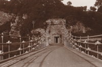
1823: (suspension bridge)
Réunion, France - Sainte-Suzanne River
| Bridgemeister ID: | 1541 (added 2004-11-03) |
| Year Completed: | 1823 |
| Name: | (suspension bridge) |
| Location: | Réunion, France |
| Crossing: | Sainte-Suzanne River |
| Principals: | Marc Brunel |
| References: | AAJ, ASB, CAB |
| Use: | Vehicular (two-lane) |
| Main Cables: | Chain (iron) |
| Suspended Spans: | 2 |
| Main Spans: | 2 x 40.2 meters (131.75 feet) |
Notes:
- Réunion was known as "Isle of Bourbon" at this time.
- Built as part of same project as 1823 (suspension bridge) - Réunion, France.
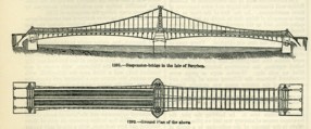
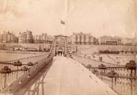
1823: Brighton Pier
Brighton, East Sussex, England, United Kingdom
| Bridgemeister ID: | 376 (added before 2003) |
| Year Completed: | 1823 |
| Name: | Brighton Pier |
| Location: | Brighton, East Sussex, England, United Kingdom |
| Principals: | Sir Samuel Brown |
| References: | AAJ, BEM, BOB, HBE, MOS, SBR |
| Use: | Footbridge |
| Status: | Destroyed, 1896 |
| Main Cables: | Chain (iron) |
| Suspended Spans: | 4 |
| Main Spans: | 4 x 77.7 meters (255 feet) |
Notes:
- SBR: Severely damaged 1833, 1836. Destroyed by storm 1896.
External Links:
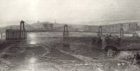
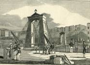
1826: Conwy
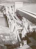
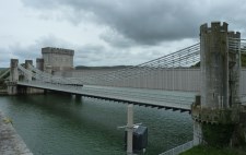
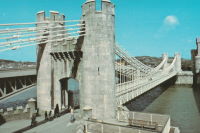
Conwy, Wales, United Kingdom - River Conwy
| Bridgemeister ID: | 380 (added before 2003) |
| Year Completed: | 1826 |
| Name: | Conwy |
| Also Known As: | Conway |
| Location: | Conwy, Wales, United Kingdom |
| Crossing: | River Conwy |
| Coordinates: | 53.280476 N 3.823742 W |
| Maps: | Acme, GeoHack, Google, OpenStreetMap |
| Principals: | Thomas Telford |
| References: | AAJ, BBR, BC3, BCO, BEM, HBE, MOS, NTB, PTS2 |
| Use: | Vehicular |
| Status: | Restricted to foot traffic (last checked: 2021) |
| Main Cables: | Chain (iron) |
| Suspended Spans: | 1 |
| Main Span: | 1 x 99.7 meters (327 feet) |
Notes:
- 1904: Major reinforcement and strengthening project.
- 2008, February: Major refurbishment project completed.
- Next to 1904 (footbridge) - Conwy, Wales, United Kingdom.
Annotated Citations:
- "Conway Suspension Bridge." The Engineer, 20 May 1904.
Details regarding the 1904 reinforcement project: "...It was therefore decided to renew all the suspension rods, and pins, and to fix steel cables above the suspension links, to supplement them so that the maximum stress in the links due to any possible travelling load should not exceed 5 tons per square inch. It was also decided to build a stiffening girder coupled to the suspension rod on each side of the bridge, and at the same time to widen the bridge by building a footway 6ft. wide outside the suspenders on the north side of the bridge."
External Links:
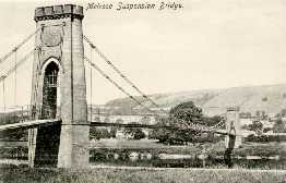
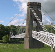
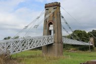
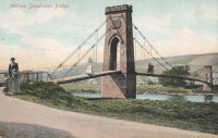
1826: Gattonside
Melrose, Scotland, United Kingdom - River Tweed
| Bridgemeister ID: | 381 (added before 2003) |
| Year Completed: | 1826 |
| Name: | Gattonside |
| Also Known As: | Melrose |
| Location: | Melrose, Scotland, United Kingdom |
| Crossing: | River Tweed |
| Coordinates: | 55.602830 N 2.723349 W |
| Maps: | Acme, GeoHack, Google, OpenStreetMap |
| Principals: | Redpath and Brown |
| References: | BC2, BSI, NTB |
| Use: | Footbridge |
| Status: | In use (last checked: 2014) |
| Main Cables: | Chain (iron) |
| Suspended Spans: | 3 |
| Main Span: | 1 x 91.4 meters (300 feet) |
| Side Spans: | 2 |
| Deck width: | 4 feet 4 inches |
Notes:
- Steel cables added, 1992.
External Links:
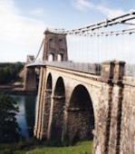
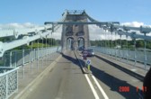
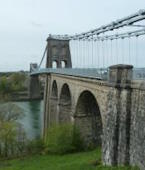
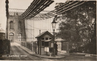
1826: Menai Strait
Menai Bridge and Bangor vicinity, Wales, United Kingdom - Menai Strait
| Bridgemeister ID: | 382 (added before 2003) |
| Year Completed: | 1826 |
| Name: | Menai Strait |
| Location: | Menai Bridge and Bangor vicinity, Wales, United Kingdom |
| Crossing: | Menai Strait |
| Coordinates: | 53.221367 N 4.1646 W |
| Maps: | Acme, GeoHack, Google, OpenStreetMap |
| Principals: | Thomas Telford |
| References: | AAJ, BBR, BC3, BCO, BDU, BEM, BOU, HBE, MOS, NTB, PTS2 |
| Use: | Vehicular (two-lane), with walkway |
| Status: | In use (last checked: 2022) |
| Main Cables: | Chain (iron) |
| Suspended Spans: | 1 |
| Main Span: | 1 x 176.5 meters (579 feet) |
Notes:
- 1839 (or 1840): Restored. Deck strengthened.
- 1893: Original wood deck replaced with a steel deck.
- 1938-1940: Original wrought-iron chains replaced with steel eyebars, deck strengthened.
- 1999: Deck resurfaced and other improvements to strengthen bridge.
- 2020: Major maintenance project planned to start January, 2021.
- 2022, October: Closed due to serious structural concerns. Expected to reopen January 2023 with a weight restriction.
- Became longest suspension bridge by eclipsing 1820 Union - Horncliffe, Berwick-upon-Tweed vicinity, England and Fishwick, Scotland, United Kingdom.
- Eclipsed by new longest suspension bridge 1834 Zaehringen (Grand Pont Suspendu) - Fribourg, Switzerland.
External Links:

1827: (suspension bridge)
Newburyport, Massachusetts, USA - Merrimack River
| Bridgemeister ID: | 23 (added before 2003) |
| Year Completed: | 1827 |
| Name: | (suspension bridge) |
| Location: | Newburyport, Massachusetts, USA |
| Crossing: | Merrimack River |
| Principals: | Thomas Haven |
| References: | AAJ, BPL, HBE, PTS2 |
| Status: | Replaced, 1840 |
| Main Cables: | Chain (iron) |
| Suspended Spans: | 5 |
| Main Spans: | 3 |
| Side Spans: | 2 |
Notes:
- Multi-span structure distinct from Templeman's 1810 Chain Bridge. Sometimes misidentified as an 1827 replacement to the 1810 Templeman Chain Bridge because of the significant damage to the Templeman bridge in 1827.
External Links:

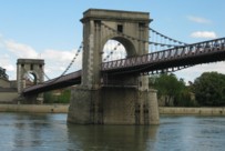
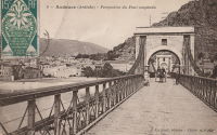
1827: Andance
Andance, Ardèche and Andancette, Drôme, France - Rhône River
| Bridgemeister ID: | 976 (added 2003-11-14) |
| Year Completed: | 1827 |
| Name: | Andance |
| Location: | Andance, Ardèche and Andancette, Drôme, France |
| Crossing: | Rhône River |
| Coordinates: | 45.242194 N 4.801638 E |
| Maps: | Acme, GeoHack, Google, OpenStreetMap |
| Principals: | Marc Seguin |
| References: | AAJ, ASB |
| Use: | Vehicular (one-lane) |
| Status: | In use (last checked: 2009) |
| Main Cables: | Wire (iron) |
| Suspended Spans: | 2 |
| Main Spans: | 2 |
Notes:
- Destroyed August 30, 1944. Rebuilt 1946.
External Links:
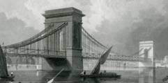
1827: Hammersmith
London, England, United Kingdom - River Thames
| Bridgemeister ID: | 386 (added before 2003) |
| Year Completed: | 1827 |
| Name: | Hammersmith |
| Location: | London, England, United Kingdom |
| Crossing: | River Thames |
| Principals: | William Tierney Clark |
| References: | AAJ, BEM, BTH, HBE, MOS, NTB, ONF, PTS2 |
| Use: | Vehicular, with walkway |
| Status: | Replaced |
| Main Cables: | Chain |
| Suspended Spans: | 3 |
| Main Span: | 1 x 121.9 meters (400 feet) |
| Side Spans: | 2 x 44.8 meters (147 feet) |
Notes:
- Replaced by 1887 Hammersmith - London, England, United Kingdom.
External Links:
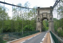
1827: L'île Barbe
Lyon, Métropole de Lyon, France - Saône River
| Bridgemeister ID: | 1535 (added 2004-10-31) |
| Year Completed: | 1827 |
| Name: | L'île Barbe |
| Location: | Lyon, Métropole de Lyon, France |
| Crossing: | Saône River |
| Coordinates: | 45.796883 N 4.83055 E |
| Maps: | Acme, GeoHack, Google, OpenStreetMap |
| Principals: | Favier |
| References: | AAJ, PQL, PTS2 |
| Use: | Vehicular (one-lane) |
| Status: | In use (last checked: 2005) |
| Main Cables: | Chain (iron) |
| Suspended Spans: | 2 |
| Main Spans: | 2 x 10² meters (334.66 feet) |
Notes:
- Originally built with iron chains. Later replaced with iron wire.
- Near 1831 Masaryk (Masarik, Mazarik, de la Gare) - Lyon vicinity, Métropole de Lyon, France.
External Links:
1828: Sassenage
Sassenage and Grenoble, Isère, France - Drac River
| Bridgemeister ID: | 1728 (added 2005-04-06) |
| Year Completed: | 1828 |
| Name: | Sassenage |
| Location: | Sassenage and Grenoble, Isère, France |
| Crossing: | Drac River |
| Use: | Vehicular |
| Status: | Replaced, 1938 |
| Main Cables: | Chain (iron) |
| Suspended Spans: | 1 |
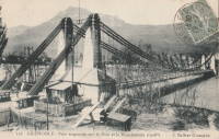
1828: South Stack
Holyhead, Wales, United Kingdom
| Bridgemeister ID: | 1212 (added 2004-02-08) |
| Year Completed: | 1828 |
| Name: | South Stack |
| Location: | Holyhead, Wales, United Kingdom |
| At or Near Feature: | Goleudy Ynys Lawd (Ynys Lawd Lighthouse) |
| Coordinates: | 53.306972 N 4.696822 W |
| Maps: | Acme, GeoHack, Google, OpenStreetMap |
| Use: | Footbridge |
| Status: | Only towers remain |
| Main Cables: | Chain |
| Suspended Spans: | 1 |
| Main Span: | 1 x 37 meters (121.4 feet) estimated |
Notes:
- Provided access to the lighthouse at South Stack. Iron chain suspension system replaced in 1964, surviving until until 1983, but unclear if it was still functioning as a suspension bridge. Towers are now used as abutments for a pedestrian truss bridge.


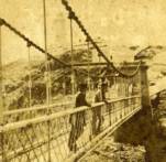
1829: Beaucaire
Beaucaire, Gard and Tarascon, Bouches-du-Rhône, France - Rhône River
| Bridgemeister ID: | 626 (added 2003-01-20) |
| Year Completed: | 1829 |
| Name: | Beaucaire |
| Location: | Beaucaire, Gard and Tarascon, Bouches-du-Rhône, France |
| Crossing: | Rhône River |
| Principals: | Jules Seguin, Joseph Chaley |
| References: | AAJ, ASB, GHD, PTS2 |
| Use: | Vehicular |
| Status: | Destroyed, August 6, 1944 |
| Main Cables: | Wire (iron) |
| Suspended Spans: | 4 |
| Main Spans: | 2 x 120 meters (393.72 feet) |
| Side Spans: | 2 x 93.6 meters (307.1 feet) |
Notes:
- 1887: Flooring failed.
- 1944: Bombed by Allied Forces, August 6.
External Links:
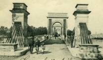
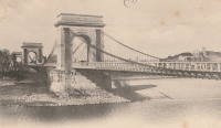
1829: Montrose
Montrose, Scotland, United Kingdom - South Esk River
| Bridgemeister ID: | 388 (added before 2003) |
| Year Completed: | 1829 |
| Name: | Montrose |
| Location: | Montrose, Scotland, United Kingdom |
| Crossing: | South Esk River |
| Coordinates: | 56.705802 N 2.475390 W |
| Maps: | Acme, GeoHack, Google, OpenStreetMap |
| Principals: | Sir Samuel Brown |
| References: | AAJ, BEM, BOB, HBE, PTS2, SBR |
| Use: | Vehicular |
| Status: | Demolished, 1929 |
| Main Cables: | Chain (iron) |
| Suspended Spans: | 1 |
Notes:
- SBR: March 19, 1830, with a "crowd of people, estimated at 700, ... watching a boat race," a chain broke "plunging most of the people into the river." Repaired.
- 1838: Wrecked by storm. Repaired.
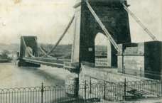

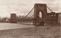
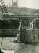
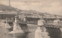
1829: Palais de Justice
Lyon, Métropole de Lyon, France - Saône River
| Bridgemeister ID: | 546 (added before 2003) |
| Year Completed: | 1829 |
| Name: | Palais de Justice |
| Location: | Lyon, Métropole de Lyon, France |
| Crossing: | Saône River |
| Principals: | Seguin Brothers |
| References: | PQL |
| Use: | Vehicular |
| Status: | Replaced, 1972 |
| Main Cables: | Wire (iron) |
Notes:
- Damaged by flood, 1840. Rebuilt. Bombed, 1944. Repaired, 1945. Location now occupied by a cable-stayed footbridge, completed 1986.
External Links:
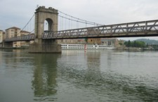
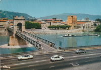
1829: Vienne
Vienne, Isère and Sainte-Colombe, Rhône, France - Rhône River
| Bridgemeister ID: | 977 (added 2003-11-15) |
| Year Completed: | 1829 |
| Name: | Vienne |
| Location: | Vienne, Isère and Sainte-Colombe, Rhône, France |
| Crossing: | Rhône River |
| Coordinates: | 45.524867 N 4.87035 E |
| Maps: | Acme, GeoHack, Google, OpenStreetMap |
| Principals: | Marc Seguin |
| References: | AAJ, ASB |
| Use: | Vehicular (one-lane) |
| Status: | Restricted to foot traffic (last checked: 2005) |
| Main Cables: | Wire (iron) |
| Suspended Spans: | 2 |
| Main Spans: | 2 |
Notes:
- Damaged by flood in 1840. Rebuilt.
External Links:
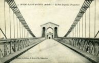
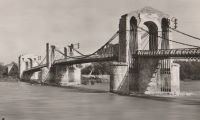
1830: Bourg-Saint-Andéol
Bourg-Saint-Andéol, Ardèche, France - Rhône River
| Bridgemeister ID: | 1719 (added 2005-04-05) |
| Year Completed: | 1830 |
| Name: | Bourg-Saint-Andéol |
| Location: | Bourg-Saint-Andéol, Ardèche, France |
| Crossing: | Rhône River |
| References: | AAJ |
| Use: | Vehicular |
| Status: | Replaced, 1971 |
| Main Cables: | Wire (iron) |
| Suspended Spans: | 3 |
| Main Spans: | 1 x 88.9 meters (291.7 feet), 1 x 85.7 meters (281.2 feet), 1 x 87 meters (285.4 feet) |
Notes:
- 1944: Heavily damaged.
- 1945: Repaired and reopened.
- Similar to Saint-Vallier - Saint-Vallier, Drôme, France.
External Links:
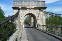
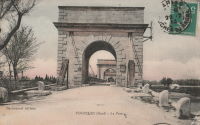
1830: Fourques
Fourques, Gard and Arles, Bouches-du-Rhône, France - Petit Rhône River
| Bridgemeister ID: | 1040 (added 2003-12-06) |
| Year Completed: | 1830 |
| Name: | Fourques |
| Location: | Fourques, Gard and Arles, Bouches-du-Rhône, France |
| Crossing: | Petit Rhône River |
| Coordinates: | 43.688722 N 4.613472 E |
| Maps: | Acme, GeoHack, Google, OpenStreetMap |
| Principals: | Seguin Brothers |
| References: | BPF |
| Use: | Vehicular (one-lane) |
| Status: | In use (last checked: 2020) |
| Main Cables: | Wire (iron) |
| Suspended Spans: | 2 |
| Main Spans: | 2 |
External Links:
1830: Remoulins
Remoulins, Gard, France - Gardon River
| Bridgemeister ID: | 946 (added 2003-10-30) |
| Year Completed: | 1830 |
| Name: | Remoulins |
| Location: | Remoulins, Gard, France |
| Crossing: | Gardon River |
| Coordinates: | 43.936944 N 4.557333 E |
| Maps: | Acme, GeoHack, Google, OpenStreetMap |
| Principals: | Marc Seguin |
| References: | BPF |
| Use: | Vehicular |
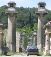
| Status: | Only towers remain, since 1938 (last checked: 2002) |
| Main Cables: | Wire (iron) |
| Suspended Spans: | 1 |
| Main Span: | 1 x 120 meters (393.7 feet) |
Notes:
- Demolished, 1938. Only towers remain.
- Replaced by 1935 Remoulins - Remoulins, Gard, France.
External Links:
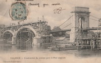
1830: Valence
Valence, Drôme and Guilherand-Granges, Ardèche, France - Rhône River
| Bridgemeister ID: | 631 (added 2003-01-20) |
| Year Completed: | 1830 |
| Name: | Valence |
| Location: | Valence, Drôme and Guilherand-Granges, Ardèche, France |
| Crossing: | Rhône River |
| Coordinates: | 44.932022 N 4.882951 E |
| Maps: | Acme, GeoHack, Google, OpenStreetMap |
| Principals: | Marc Seguin |
| References: | ASB, PTS2 |
| Use: | Vehicular |
| Status: | Removed |
| Main Cables: | Wire (iron) |
| Suspended Spans: | 2 |
| Main Spans: | 2 x 110 meters (360.9 feet) |
| Deck width: | 7 meters |
Notes:
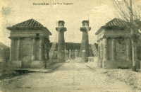
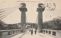
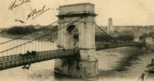
- Two side spans meeting at a single midstream tower.
- Later at same location 1949 (footbridge) - Valence, Drôme and Guilherand-Granges, Ardèche, France.
External Links:
1831: Andrézieux
Andrézieux, Loire, France - Loire River
| Bridgemeister ID: | 978 (added 2003-11-15) |
| Year Completed: | 1831 |
| Name: | Andrézieux |
| Location: | Andrézieux, Loire, France |
| Crossing: | Loire River |
| Principals: | Seguin Brothers |
| Use: | Vehicular |
| Status: | Destroyed, October 17, 1907 |
| Main Cables: | Wire (iron) |
Notes:
- Badly wrecked by flood, October 17, 1907. Replaced, 1910.
- Near 1851 Saint-Just-sur-Loire - Saint-Just-sur-Loire and Saint-Just-Saint-Rambert, Loire, France.
External Links:
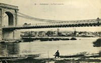
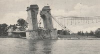
1831: Beauregard
Beauregard, Ain, France - Saône River
| Bridgemeister ID: | 1713 (added 2005-04-03) |
| Year Completed: | 1831 |
| Name: | Beauregard |
| Location: | Beauregard, Ain, France |
| Crossing: | Saône River |
| Coordinates: | 46.002033 N 4.749783 E |
| Maps: | Acme, GeoHack, Google, OpenStreetMap |
| Use: | Vehicular (one-lane) |
| Status: | Restricted to foot traffic (last checked: 2017) |
| Main Cables: | Wire (iron) |
| Suspended Spans: | 2 |
| Main Spans: | 2 |
External Links:
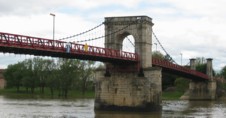
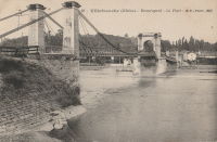
1831: Belleville
Belleville, Rhône and Ain, France - Saône River
| Bridgemeister ID: | 979 (added 2003-11-15) |
| Year Completed: | 1831 |
| Name: | Belleville |
| Also Known As: | Belleville-sur-Saône |
| Location: | Belleville, Rhône and Ain, France |
| Crossing: | Saône River |
| Use: | Vehicular |
| Suspended Spans: | 2 |
| Main Spans: | 2 |

1831: Decize
Decize, Nièvre, France - Loire River
| Bridgemeister ID: | 1725 (added 2005-04-05) |
| Year Completed: | 1831 |
| Name: | Decize |
| Location: | Decize, Nièvre, France |
| Crossing: | Loire River |
| Use: | Vehicular |
| Status: | Replaced, 1904 |
| Main Cables: | Wire (iron) |
| Suspended Spans: | 2 |
| Main Spans: | 2 |
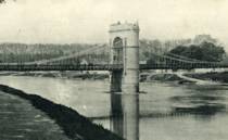

1831: Findhorn
Forres, Scotland, United Kingdom - River Findhorn
| Bridgemeister ID: | 391 (added before 2003) |
| Year Completed: | 1831 |
| Name: | Findhorn |
| Location: | Forres, Scotland, United Kingdom |
| Crossing: | River Findhorn |
| Coordinates: | 57.6018 N 3.6557 W |
| Maps: | Acme, GeoHack, Google, OpenStreetMap |
| Principals: | Sir Samuel Brown |
| References: | AAJ, MOS, SBR |
| Use: | Vehicular |
| Status: | Removed, 1938 |
| Main Cables: | Chain (iron) |
| Suspended Spans: | 1 |
Notes:
- Was still standing in 1938 when it was bypassed, but was likely demolished some time in 1938.
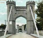
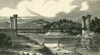
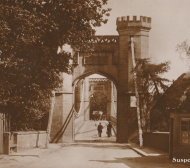
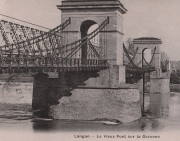
1831: Langon
Langon, Aquitaine, France - Garonne River
| Bridgemeister ID: | 1732 (added 2005-04-06) |
| Year Completed: | 1831 |
| Name: | Langon |
| Location: | Langon, Aquitaine, France |
| Crossing: | Garonne River |
| References: | PTS2 |
| Use: | Vehicular |
| Status: | Removed |
| Main Cables: | Chain (iron) |
| Suspended Spans: | 3 |
| Main Span: | 1 |
| Side Spans: | 2 |
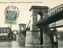
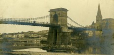
1831: Luzancy
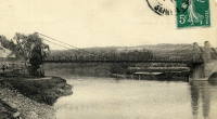
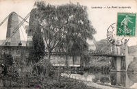
Luzancy, Seine-et-Marne, France - Marne River
| Bridgemeister ID: | 4919 (added 2020-07-26) |
| Year Completed: | 1831 |
| Name: | Luzancy |
| Location: | Luzancy, Seine-et-Marne, France |
| Crossing: | Marne River |
| References: | AAJ |
| Use: | Vehicular |
| Status: | Replaced, 1925 |
| Main Cables: | Rod (iron) |
| Main Span: | 1 x 55 meters (180.4 feet) |
Notes:
- Original iron rod cables replaced by an Arnodin cable system, 1891. Replaced in 1925 with a "rigid suspension bridge of reinforced concrete".
- Replaced by 1925 Luzancy - Luzancy, Seine-et-Marne, France.
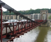
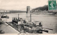
1831: Masaryk
Lyon vicinity, Métropole de Lyon, France - Saône River
| Bridgemeister ID: | 543 (added before 2003) |
| Year Completed: | 1831 |
| Name: | Masaryk |
| Also Known As: | Masarik, Mazarik, de la Gare |
| Location: | Lyon vicinity, Métropole de Lyon, France |
| Crossing: | Saône River |
| Coordinates: | 45.778267 N 4.809017 E |
| Maps: | Acme, GeoHack, Google, OpenStreetMap |
| References: | PQL |
| Use: | Vehicular (one-lane), with walkway |
| Status: | Restricted to foot traffic (last checked: 2022) |
| Main Cables: | Wire (iron) |
| Suspended Spans: | 2 |
| Main Spans: | 2 x 85.2 meters (279.5 feet) |
| Deck width: | 6.5 meters |
Notes:
- Bombed, 1944. Reopened 1945, but not fully restored until 1946.
- This bridge has been referenced by many spellings of "Masaryk", but the sign posted at the actual bridge reads "Masaryk".
- Next to 1844 Mouton - Lyon, Métropole de Lyon, France.
- Near 1827 L'île Barbe - Lyon, Métropole de Lyon, France.
External Links:
1831: Mirabeau
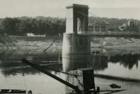
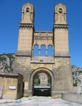
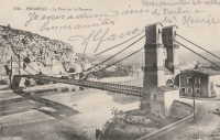
Mirabeau, Vaucluse and Bouches-du-Rhône, France - Durance River
| Bridgemeister ID: | 982 (added 2003-11-15) |
| Year Completed: | 1831 |
| Name: | Mirabeau |
| Location: | Mirabeau, Vaucluse and Bouches-du-Rhône, France |
| Crossing: | Durance River |
| Coordinates: | 43.68945 N 5.668267 E |
| Maps: | Acme, GeoHack, Google, OpenStreetMap |
| Principals: | Jean-François-Theophilus Sauzet |
| References: | AAJ, BPF |
| Use: | Vehicular |
| Status: | Only towers remain (last checked: 2005) |
| Suspended Spans: | 1 |
| Main Span: | 1 x 150 meters (492.1 feet) |
| Deck width: | 5.5 meters |
Notes:
- The towers from the older of the two Mirabeau suspension bridges are visible alongside the current crossing.
- Damaged by flood, 1843. Rebuilt.
- Replaced by 1935 Mirabeau - Mirabeau, Vaucluse and Bouches-du-Rhône, France. Unsure if this was an immediate replacement.
External Links:
1831: Wellington
Aberdeen, Scotland, United Kingdom - River Dee
| Bridgemeister ID: | 393 (added before 2003) |
| Year Completed: | 1831 |
| Name: | Wellington |
| Also Known As: | Craiglug |
| Location: | Aberdeen, Scotland, United Kingdom |
| Crossing: | River Dee |
| Coordinates: | 57.13559 N 2.09560 W |
| Maps: | Acme, GeoHack, Google, OpenStreetMap |
| Principals: | Sir Samuel Brown |
| References: | SBR |
| Use: | Vehicular (one-lane) |
| Status: | Restricted to foot traffic (last checked: 2014) |
| Main Cables: | Chain (iron) |
| Suspended Spans: | 1 |
Notes:
- Reconstructed, 1930. Closed to vehicular traffic, 1984. Closed to all traffic 2002. Underwent extensive refurbishment, 2008.
External Links:


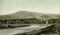
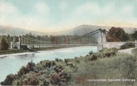
1832: Aboyne
Aboyne, Scotland, United Kingdom - River Dee
| Bridgemeister ID: | 2203 (added 2007-01-28) |
| Year Completed: | 1832 |
| Name: | Aboyne |
| Location: | Aboyne, Scotland, United Kingdom |
| Crossing: | River Dee |
| Use: | Vehicular |
| Status: | Removed |
1832: La Roche-Posay
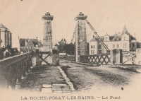
La Roche-Posay, Vienne and Indre-et-Loire, France - Creuse River
| Bridgemeister ID: | 1601 (added 2005-02-06) |
| Year Completed: | 1832 |
| Name: | La Roche-Posay |
| Also Known As: | La Roche-Posay-les-Bains |
| Location: | La Roche-Posay, Vienne and Indre-et-Loire, France |
| Crossing: | Creuse River |
| Use: | Vehicular |
| Status: | Replaced, 1937 |
| Main Cables: | Wire (iron) |
| Suspended Spans: | 1 |
Notes:

1832: Saint-Vincent
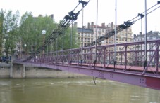
Lyon, Métropole de Lyon, France - Saône River
| Bridgemeister ID: | 1098 (added 2004-01-02) |
| Year Completed: | 1832 |
| Name: | Saint-Vincent |
| Location: | Lyon, Métropole de Lyon, France |
| Crossing: | Saône River |
| Coordinates: | 45.767583 N 4.827983 E |
| Maps: | Acme, GeoHack, Google, OpenStreetMap |
| References: | PQL |
| Use: | Footbridge |
| Status: | In use (last checked: 2022) |
| Main Cables: | Wire (iron) |
| Suspended Spans: | 1 |
Notes:
- Damaged by flood, 1840.
- Bridge appears to currently be suspended from a combination of wire rope and rigid rods.
- Near 1831 La Feuillée - Lyon, Métropole de Lyon, France.
External Links:
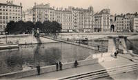
1833: Cosne-sur-Loire
Cosne-sur-Loire, Nièvre and Boulleret, Cher, France - Loire River
| Bridgemeister ID: | 1595 (added 2005-02-06) |
| Year Completed: | 1833 |
| Name: | Cosne-sur-Loire |
| Location: | Cosne-sur-Loire, Nièvre and Boulleret, Cher, France |
| Crossing: | Loire River |
| Coordinates: | 47.411396 N 2.918450 E |
| Maps: | Acme, GeoHack, Google, OpenStreetMap |
| References: | AAJ |
| Use: | Vehicular |
| Status: | Replaced, 1928 |
| Main Cables: | Chain (iron) |
Notes:
- The longer of two suspension bridges separated by a short distance, one over the large branch of the Loire and one over the small branch of the Loire where the river flows around an island.
- Similar to 1846 Mallemort - Mallemort, Bouches-du-Rhône and Mérindol, Vaucluse, France.
- Near 1833 Petit - Cosne-sur-Loire, Nièvre and Boulleret, Cher, France.
- Later at same location 1959 Cosne-sur-Loire - Cosne-Cours-sur-Loire, Nièvre and Cher, France.
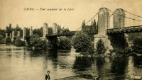
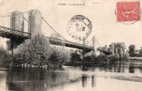
1833: Le Veurdre
Le Veurdre, Allier and Saint-Pierre-le-Moutier, Nièvre, France - Allier River
| Bridgemeister ID: | 2031 (added 2006-04-22) |
| Year Completed: | 1833 |
| Name: | Le Veurdre |
| Location: | Le Veurdre, Allier and Saint-Pierre-le-Moutier, Nièvre, France |
| Crossing: | Allier River |
| Coordinates: | 46.758333 N 3.049167 E |
| Maps: | Acme, GeoHack, Google, OpenStreetMap |
| Use: | Vehicular |
| Status: | Removed |
| Main Cables: | Wire (iron) |
| Suspended Spans: | 3 |
| Main Spans: | 3 |
Notes:
- Sometimes confused with the Allier River suspension bridges closer to Mornay-sur-Allier, the Pont du Veurdre was located at (or near) the alignment indicated by the coordinates here.
- See 1840 Mornay-sur-Allier - Mornay-sur-Allier, Cher and St-Pierre-le-Moûtier, Nièvre, France.
External Links:
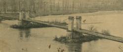
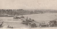
1833: Norfolk
Shoreham, England, United Kingdom - River Adur
| Bridgemeister ID: | 604 (added 2003-01-12) |
| Year Completed: | 1833 |
| Name: | Norfolk |
| Location: | Shoreham, England, United Kingdom |
| Crossing: | River Adur |
| Principals: | William Tierney Clark |
| References: | AAJ, MOS |
| Use: | Vehicular, with walkway |
| Status: | Replaced, 1923 |
| Main Cables: | Chain (iron) |
| Suspended Spans: | 3 |
| Main Span: | 1 x 86.6 meters (284 feet) |
| Side Spans: | 2 |
Notes:
- According to MOS, the 284 foot measurement given for this bridge is for the "chord line" of the chains, not the pier-to-pier deck length.
External Links:
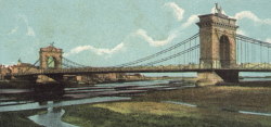
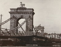
1834: Aranjuez
Aranjuez, Spain - Tagus River
| Bridgemeister ID: | 5111 (added 2020-09-05) |
| Year Completed: | 1834 |
| Name: | Aranjuez |
| Also Known As: | Barcas |
| Location: | Aranjuez, Spain |
| Crossing: | Tagus River |
| Principals: | Pedro Miranda |
| Use: | Vehicular |
| Status: | Removed, 1930 |
| Main Cables: | Eyebar (iron) |
| Suspended Spans: | 1 |
Notes:
- Sometimes claimed to be built in the 1820s, it appears to have been started in 1829 and completed in 1834. The bridge is attributed to Pedro Miranda who was born in 1808.
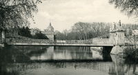
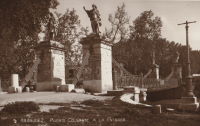
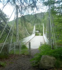
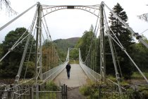
1834: Crathie
Crathie vicinity, Scotland, United Kingdom - River Dee
| Bridgemeister ID: | 1084 (added 2004-01-01) |
| Year Completed: | 1834 |
| Name: | Crathie |
| Location: | Crathie vicinity, Scotland, United Kingdom |
| Crossing: | River Dee |
| Coordinates: | 57.0335 N 3.211 W |
| Maps: | Acme, GeoHack, Google, OpenStreetMap |
| Principals: | Justice Junior and Co. |
| References: | AAJ, BSI, HBR |
| Use: | Vehicular (one-lane) |
| Status: | Closed, December 2015 (last checked: 2015) |
| Main Cables: | Eyebar (iron) |
| Suspended Spans: | 1 |
| Main Span: | 1 x 42.1 meters (138 feet) |
| Deck width: | 14 feet |
Notes:
- Small iron chain suspension bridge.
- BSI: Reported to have been "almost entirely renewed", 1885. Ruddock also suggests the bridge was originally constructed with just diagonal stays (as other Justice bridges) and the catenary chains were added during the renewal.
External Links:
- The Happy Pontist: Scottish Bridges: 56. Crathie Suspension Bridge (after the flood)
- Structurae - Structure ID 20070665
1834: Ile aux Barques
Ile aux Barques, Geneva, Switzerland
| Bridgemeister ID: | 1826 (added 2005-05-30) |
| Year Completed: | 1834 |
| Name: | Ile aux Barques |
| Also Known As: | Bergues |
| Location: | Ile aux Barques, Geneva, Switzerland |
| Principals: | Guillame Henri Dufour |
| References: | AAJ, GHD |
| Use: | Footbridge |
| Status: | Removed, 1881 |
| Main Cables: | Wire (iron) |
| Suspended Spans: | 1 |
| Main Span: | 1 x 33.5 meters (109.9 feet) |
Notes:
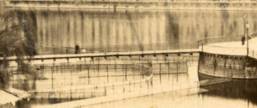
- GHD: "...asymmetrical bridge supported by a single pier."
- Ile aux Barques is now known as Ile Jean-Jacques Rousseau.
- This location is better known for the large underspanned suspension bridge completed in 1834 by Dufour (documented in great detail in reference GHD). The underspanned bridge is omitted from the Bridgemeister inventory. This entry is for the small footbridge that connected to the larger underspanned bridge. Follow the image link for more information.
External Links:
1834: Louis-Philippe
Île St-Louis, Paris, France - Seine River
| Bridgemeister ID: | 983 (added 2003-11-15) |
| Year Completed: | 1834 |
| Name: | Louis-Philippe |
| Also Known As: | de la Reforme |
| Location: | Île St-Louis, Paris, France |
| Crossing: | Seine River |
| Principals: | Marc Seguin |
| References: | AAJ, PTS2 |
| Use: | Vehicular (one-lane), with walkway |
| Status: | Replaced |
| Main Cables: | Wire (iron) |
| Suspended Spans: | 2 |
| Main Spans: | 2 |
| Deck width: | 14.44 feet |
Notes:
- Badly damaged by fire 1848. Replaced 1860 (or soon after).
- Next to 1842 Cité (City, Île de la Cité) - Île de la Cité and Île St-Louis, Paris, France.
External Links:
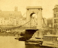
1834: Saint-Thibault
Saint-Thibault, Saint-Satur vicinity, Cher and Nièvre, France - Loire River
| Bridgemeister ID: | 1650 (added 2005-03-19) |
| Year Completed: | 1834 |
| Name: | Saint-Thibault |
| Location: | Saint-Thibault, Saint-Satur vicinity, Cher and Nièvre, France |
| Crossing: | Loire River |
| Coordinates: | 47.338358 N 2.868882 E |
| Maps: | Acme, GeoHack, Google, OpenStreetMap |
| References: | AAJ |
| Use: | Vehicular (one-lane) |
| Status: | Replaced, 1934 |
| Main Cables: | Chain (iron) |
| Suspended Spans: | 5 |
| Main Spans: | 5 |
| Deck width: | 14.44 feet |
External Links:
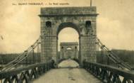
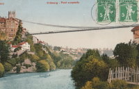
1834: Zaehringen
Fribourg, Switzerland - Sarine River
| Bridgemeister ID: | 395 (added before 2003) |
| Year Completed: | 1834 |
| Name: | Zaehringen |
| Also Known As: | Grand Pont Suspendu |
| Location: | Fribourg, Switzerland |
| Crossing: | Sarine River |
| Principals: | Joseph Chaley |
| References: | AAJ, BBR, BFL, HBE, LAB |
| Use: | Vehicular |
| Status: | Removed, 1920's |
| Main Cables: | Wire (iron) |
| Suspended Spans: | 1 |
| Main Span: | 1 x 273.1 meters (896 feet) |
Notes:
- Became longest suspension bridge by eclipsing 1826 Menai Strait - Menai Bridge and Bangor vicinity, Wales, United Kingdom.
- Eclipsed by new longest suspension bridge 1849 Wheeling (Wheeling and Belmont) - Wheeling, West Virginia, USA.
- Near 1840 Gotteron - Fribourg, Switzerland.
External Links:
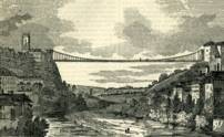
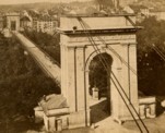
1835: Chasse
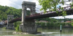
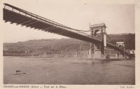
Chasse-sur-Rhône, Isère and Givors, Métropole De Lyon, France - Rhône River
| Bridgemeister ID: | 980 (added 2003-11-15) |
| Year Completed: | 1835 |
| Name: | Chasse |
| Also Known As: | Givors |
| Location: | Chasse-sur-Rhône, Isère and Givors, Métropole De Lyon, France |
| Crossing: | Rhône River |
| Coordinates: | 45.581666 N 4.780083 E |
| Maps: | Acme, GeoHack, Google, OpenStreetMap |
| References: | AAJ |
| Use: | Vehicular (one-lane) |
| Status: | In use (last checked: 2005) |
| Main Cables: | Wire (iron) |
| Suspended Spans: | 3 |
| Main Span: | 1 |
| Side Spans: | 2 |
Notes:
- Cables and deck appear to have been replaced (at least once).
- AAJ describes an accident in 1836: "...some of the iron-work, which was faulty, gave way and the platform fell into the river. Six persons were drowned."
External Links:
1835: La Réole
La Réole, Gironde, France - Garonne River
| Bridgemeister ID: | 1768 (added 2005-04-22) |
| Year Completed: | 1835 |
| Name: | La Réole |
| Location: | La Réole, Gironde, France |
| Crossing: | Garonne River |
| References: | AAJ |
| Use: | Vehicular |
| Suspended Spans: | 1 |
Notes:
- AAJ guesses this bridge was completed in 1835 due to contract let in 1833 specifying two-year construction period.
- See 1935 La Réole (Rouergue) - La Réole, Gironde, France. Unsure if the newer bridge is at the same location.
1835: Langeac
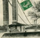
Langeac, Haute-Loire, France - Allier River
| Bridgemeister ID: | 1701 (added 2005-03-29) |
| Year Completed: | 1835 |
| Name: | Langeac |
| Location: | Langeac, Haute-Loire, France |
| Crossing: | Allier River |
| Coordinates: | 45.100706 N 3.498480 E |
| Maps: | Acme, GeoHack, Google, OpenStreetMap |
| References: | AAJ |
| Use: | Vehicular |
| Status: | Replaced, 1929 |
| Main Cables: | Wire (iron) |
| Suspended Spans: | 2 |
| Main Spans: | 2 |
Notes:
- AAJ guesses this bridge was completed in 1835 based on contract let in 1833 specifying a two-year construction period.
External Links:
- Art-et-Histoire - Troisième pont suspendu de Langeac - 1868. Indicates the bridge depicted here was competed 1868 after the first (1835) and second (1860) Langeac suspension bridges were destroyed by flood.
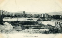
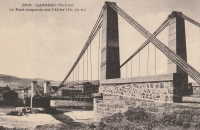
1835: Les Ormes
Les Ormes, Vienne, France - Vienne River
| Bridgemeister ID: | 2074 (added 2006-06-09) |
| Year Completed: | 1835 |
| Name: | Les Ormes |
| Location: | Les Ormes, Vienne, France |
| Crossing: | Vienne River |
| Use: | Vehicular |
| Suspended Spans: | 1 |
Notes:
- Replaced by Les Ormes - Les Ormes, Vienne, France.
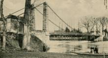
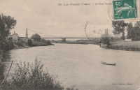
1835: Montmerle-sur-Saône
Montmerle-sur-Saône, Ain and Saint-Georges-de-Reneins, Rhône, France - Saône River
| Bridgemeister ID: | 1586 (added 2005-01-22) |
| Year Completed: | 1835 |
| Name: | Montmerle-sur-Saône |
| Location: | Montmerle-sur-Saône, Ain and Saint-Georges-de-Reneins, Rhône, France |
| Crossing: | Saône River |
| Coordinates: | 46.080483 N 4.754933 E |
| Maps: | Acme, GeoHack, Google, OpenStreetMap |
| References: | AGP |
| Use: | Vehicular (one-lane) |
| Status: | In use (last checked: 2022) |
| Main Cables: | Wire |
| Suspended Spans: | 2 |
| Main Spans: | 2 |
Notes:
- 1944: Heavily damaged during WWII. Repaired.
External Links:

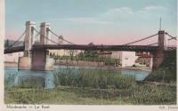
1835: Roquemaure
Roquemaure, Gard and Orange, Vaucluse, France - Rhône River
| Bridgemeister ID: | 1735 (added 2005-04-19) |
| Year Completed: | 1835 |
| Name: | Roquemaure |
| Location: | Roquemaure, Gard and Orange, Vaucluse, France |
| Crossing: | Rhône River |
| Coordinates: | 44.069467 N 4.7689 E |
| Maps: | Acme, GeoHack, Google, OpenStreetMap |
| References: | AAJ |
| Use: | Vehicular |
| Status: | Only towers remain (last checked: 2021) |
| Main Cables: | Wire (iron) |
| Suspended Spans: | 4 |
| Main Spans: | 4 |
Notes:
- One of the four spans, effectively a separate bridge over a small channel of the Rhône to an island that connected to the main river spans, was still standing in early 2005, but closed to all traffic. The deck and cables were removed or destroyed at some point in 2005 or 2006 leaving just the pylons of this span.
- Replaced by Roquemaure - Roquemaure, Gard and Orange, Vaucluse, France.
External Links:
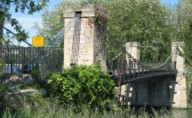
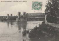
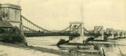
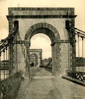
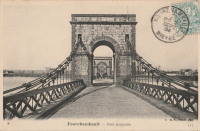
1836: Fourchambault
Fourchambault, Nièvre and Cher, France - Loire River
| Bridgemeister ID: | 1598 (added 2005-02-06) |
| Year Completed: | 1836 |
| Name: | Fourchambault |
| Location: | Fourchambault, Nièvre and Cher, France |
| Crossing: | Loire River |
| Coordinates: | 47.012339 N 3.073304 E |
| Maps: | Acme, GeoHack, Google, OpenStreetMap |
| References: | AAJ |
| Use: | Vehicular |
| Status: | Destroyed, c. 1940's |
| Main Cables: | Chain (iron) |
| Suspended Spans: | 6 |
| Main Spans: | 6 |
Notes:
- Dynamited in 1940 or 1941. Eventually replaced by a long low-lying truss bridge.
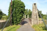
1836: Kalemouth
Eckford, Scotland, United Kingdom - River Teviot
| Bridgemeister ID: | 396 (added before 2003) |
| Year Completed: | 1836 |
| Name: | Kalemouth |
| Location: | Eckford, Scotland, United Kingdom |
| Crossing: | River Teviot |
| Coordinates: | 55.539902 N 2.463519 W |
| Maps: | Acme, GeoHack, Google, OpenStreetMap |
| Principals: | Sir Samuel Brown |
| References: | SBR |
| Use: | Vehicular (one-lane) |
| Status: | Restricted to foot traffic, since 2020 (last checked: 2022) |
| Main Cables: | Eyebar (iron) |
| Suspended Spans: | 1 |
| Main Span: | 1 x 64.6 meters (212 feet) |

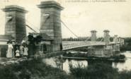
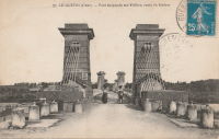
1836: Le Guétin
Le Guétin, Cuffy vicinity, Cher and Gimouille, Nièvre, France - Allier River
| Bridgemeister ID: | 1652 (added 2005-03-19) |
| Year Completed: | 1836 |
| Name: | Le Guétin |
| Location: | Le Guétin, Cuffy vicinity, Cher and Gimouille, Nièvre, France |
| Crossing: | Allier River |
| Coordinates: | 46.947218 N 3.074370 E |
| Maps: | Acme, GeoHack, Google, OpenStreetMap |
| References: | AAJ |
| Use: | Vehicular |
| Status: | Replaced, 1930 |
| Main Cables: | Wire (iron) |
| Suspended Spans: | 5 |
| Main Spans: | 5 x 62 meters (203.42 feet) |
Notes:
External Links:
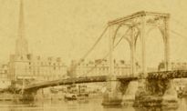
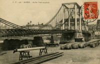
1836: Saint-Sever
Rouen, Seine-Maritime, France - Seine River
| Bridgemeister ID: | 1154 (added 2004-01-18) |
| Year Completed: | 1836 |
| Name: | Saint-Sever |
| Location: | Rouen, Seine-Maritime, France |
| Crossing: | Seine River |
| Principals: | Marc Seguin |
| Status: | Destroyed, 1884 |
| Main Cables: | Wire (iron) |
| Suspended Spans: | 2 |
| Main Spans: | 2 |
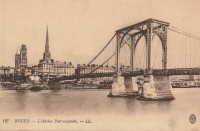
1837: Bruère-Allichamps
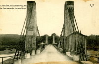
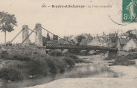
Bruère-Allichamps, Saint-Amand-Montrond vicinity, Cher, France - Cher River
| Bridgemeister ID: | 1437 (added 2004-07-30) |
| Year Completed: | 1837 |
| Name: | Bruère-Allichamps |
| Location: | Bruère-Allichamps, Saint-Amand-Montrond vicinity, Cher, France |
| Crossing: | Cher River |
| Use: | Vehicular |
| Status: | Removed |
| Main Cables: | Wire |
| Suspended Spans: | 1 |
External Links:
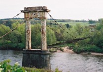
1837: Shakkin
Cults, Aberdeen, Scotland, United Kingdom - River Dee
| Bridgemeister ID: | 1546 (added 2004-11-13) |
| Year Completed: | 1837 |
| Name: | Shakkin |
| Also Known As: | Shakin, St. Devenick's, Morrison |
| Location: | Cults, Aberdeen, Scotland, United Kingdom |
| Crossing: | River Dee |
| Coordinates: | 57.11460 N 2.17056 W |
| Maps: | Acme, GeoHack, Google, OpenStreetMap |
| Principals: | John Smith |
| Use: | Footbridge |
| Status: | Derelict (last checked: 2014) |
| Main Cables: | Chain (iron) |
| Suspended Spans: | 3 |
| Main Span: | 1 x 54.9 meters (180.1 feet) |
| Side Spans: | 2 |
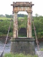
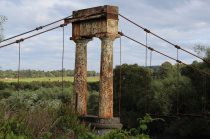
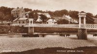
Notes:
- Damaged by flood, 1876, and 1920. Reconstructed, 1921-1922. "Stranded" by shift in river's course, 1970's and 1980's, sweeping away southern approach spans. Deck removed, 1984.
- Known locally as "Shakin' Briggie" or "Shakkin' Briggie," but also referred to as Morrison Bridge and St. Devenick's Bridge.
- Restoration under consideration, 2005.
External Links:
1838: Ancenis
Ancenis, Loire-Atlantique and Le Fourneau, Maine-et-Loire, France - Loire River
| Bridgemeister ID: | 1036 (added 2003-12-03) |
| Year Completed: | 1838 |
| Name: | Ancenis |
| Location: | Ancenis, Loire-Atlantique and Le Fourneau, Maine-et-Loire, France |
| Crossing: | Loire River |
| Principals: | Marc Seguin |
| References: | AAJ |
| Use: | Vehicular |
| Status: | Destroyed, 1944 |
| Main Cables: | Wire (iron) |
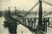
Notes:
- Destroyed 1940, temporarily rebuilt, destroyed 1944.
- Replaced by 1953 Ancenis - Ancenis, Loire-Atlantique and Le Fourneau, Maine-et-Loire, France.
External Links:

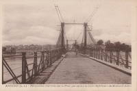
1838: Conflans
Andrésy and Conflans-Sainte-Honorine, Yvelines, France - Oise River
| Bridgemeister ID: | 1687 (added 2005-03-26) |
| Year Completed: | 1838 |
| Name: | Conflans |
| Also Known As: | Fin d'Oise |
| Location: | Andrésy and Conflans-Sainte-Honorine, Yvelines, France |
| Crossing: | Oise River |
| Principals: | Seguin Brothers |
| Use: | Vehicular |
| Status: | Replaced |
| Main Cables: | Wire (iron) |
| Suspended Spans: | 1 |
| Main Span: | 1 x 75 meters (246.1 feet) |
| Deck width: | 5.5 meters |
Notes:
- Likely replaced by the current concrete arch bridge at this location.
External Links:
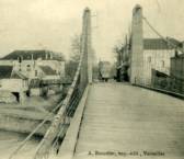
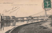
1838: Löwenbrücke
Berlin, Germany
| Bridgemeister ID: | 858 (added 2003-08-09) |
| Year Completed: | 1838 |
| Name: | Löwenbrücke |
| Also Known As: | Lion's Bridge |
| Location: | Berlin, Germany |
| At or Near Feature: | Tiergarten |
| Coordinates: | 52.512383 N 13.345667 E |
| Maps: | Acme, GeoHack, Google, OpenStreetMap |
| Principals: | Ludwig Ferdinand Hesse |
| References: | PTS2 |
| Use: | Footbridge |
| Status: | Closed (last checked: 2013) |
| Main Cables: | Chain |
| Suspended Spans: | 1 |
| Main Span: | 1 x 17.3 meters (56.8 feet) |
| Deck width: | 2 meters |
Notes:
- Now supported by wire cable.
- In the early 2010s, the bridge was closed and the deck was removed (see accompanying 2013 photo set). By 2019 it had been further dismantled awaiting rehabilitation.
External Links:


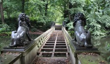
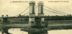
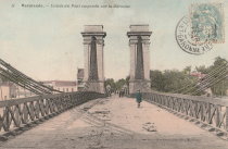
1838: Marmande
Marmande, Lot-et-Garonne, France - Garonne River
| Bridgemeister ID: | 1603 (added 2005-02-06) |
| Year Completed: | 1838 |
| Name: | Marmande |
| Location: | Marmande, Lot-et-Garonne, France |
| Crossing: | Garonne River |
| Coordinates: | 44.499538 N 0.156698 E |
| Maps: | Acme, GeoHack, Google, OpenStreetMap |
| References: | AAJ |
| Use: | Vehicular |
| Status: | Failed, 1930 |
| Main Cables: | Wire (iron) |
| Suspended Spans: | 2 |
| Side Spans: | 2 |
Notes:
- AAJ lists this bridge as completed in 1835.
- Near 1845 Couthures - Couthures-sur-Garonne, Lot-et-Garonne, France.
- Replaced by 1932 Marmande (Renaud Jean) - Marmande, Lot-et-Garonne, France.
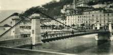
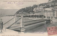
1838: Saint Laurent
Grenoble, Isère, France - Isère River
| Bridgemeister ID: | 1158 (added 2004-01-18) |
| Year Completed: | 1838 |
| Name: | Saint Laurent |
| Location: | Grenoble, Isère, France |
| Crossing: | Isère River |
| Coordinates: | 45.194433 N 5.729017 E |
| Maps: | Acme, GeoHack, Google, OpenStreetMap |
| Use: | Vehicular |
| Status: | Restricted to foot traffic (last checked: 2022) |
| Main Cables: | Wire (iron) |
| Suspended Spans: | 1 |
| Main Span: | 1 x 61 meters (200.1 feet) estimated |
Notes:
- 1909: The bridge is extensively renovated.
External Links:
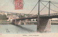
1838: Triel-sur-Seine
Triel-sur-Seine and Vernouillet, Yvelines, France - Seine River
| Bridgemeister ID: | 1756 (added 2005-04-20) |
| Year Completed: | 1838 |
| Name: | Triel-sur-Seine |
| Location: | Triel-sur-Seine and Vernouillet, Yvelines, France |
| Crossing: | Seine River |
| Coordinates: | 48.978606 N 2.001981 E |
| Maps: | Acme, GeoHack, Google, OpenStreetMap |
| Principals: | Seguin Brothers |
| Use: | Vehicular |
| Status: | Destroyed, 1940 |
| Main Cables: | Wire (iron) |
| Suspended Spans: | 3 |
| Main Span: | 1 |
| Side Spans: | 2 |
Notes:
External Links:
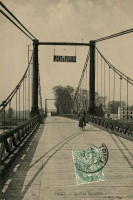
1839: Basse-Chaîne
Angers, Maine-et-Loire, France - Maine River
| Bridgemeister ID: | 993 (added 2003-11-16) |
| Year Completed: | 1839 |
| Name: | Basse-Chaîne |
| Also Known As: | Angers |
| Location: | Angers, Maine-et-Loire, France |
| Crossing: | Maine River |
| Principals: | Joseph Chaley |
| References: | AAJ, GHD, HBE, PTS2 |
| Status: | Collapsed, 1850 |
| Main Cables: | Wire (iron) |
| Suspended Spans: | 1 |
| Main Span: | 1 x 10² meters (334.66 feet) |
| Deck width: | 23.62 feet |
Notes:
- Collapsed under weight of maching troops, April 16, 1850, killing more than 200 soldiers. Collapse precipitated French virtual moratorium on suspension bridge building bringing to a close the prolific era of French wire cable suspension bridges.
External Links:
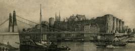
1839: Belleperche
Cordes-Tolosannes, Tarn-et-Garonne, France - Garonne River
| Bridgemeister ID: | 2101 (added 2006-07-23) |
| Year Completed: | 1839 |
| Name: | Belleperche |
| Location: | Cordes-Tolosannes, Tarn-et-Garonne, France |
| Crossing: | Garonne River |
| Coordinates: | 43.995722 N 1.125750 E |
| Maps: | Acme, GeoHack, Google, OpenStreetMap |
| Use: | Vehicular (one-lane) |
| Status: | Removed |
Notes:
- Later at same location 1941 Belleperche - Cordes-Tolosannes, Tarn-et-Garonne, France.
External Links:
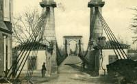
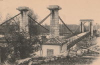
1839: Cadenet
Cadenet, Vaucluse and Bouches-du-Rhône, France - Durance River
| Bridgemeister ID: | 1008 (added 2003-11-21) |
| Year Completed: | 1839 |
| Name: | Cadenet |
| Location: | Cadenet, Vaucluse and Bouches-du-Rhône, France |
| Crossing: | Durance River |
| Coordinates: | 43.712117 N 5.365317 E |
| Maps: | Acme, GeoHack, Google, OpenStreetMap |
| Principals: | Adolphe Boulland |
| References: | AAJ |
| Use: | Vehicular |
| Status: | Only towers remain (last checked: 2005) |
Notes:
- Damaged by flood 1843, closed until 1844, destroyed 1944. Towers still standing, 2005.
External Links:
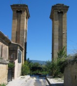
1839: Caille
Allonzier-La-Caille vicinity, Haute-Savoie, France - Usses Torrent
| Bridgemeister ID: | 859 (added 2003-08-09) |
| Year Completed: | 1839 |
| Name: | Caille |
| Also Known As: | Charles-Albert |
| Location: | Allonzier-La-Caille vicinity, Haute-Savoie, France |
| Crossing: | Usses Torrent |
| Coordinates: | 46.0126 N 6.111633 E |
| Maps: | Acme, GeoHack, Google, OpenStreetMap |
| Principals: | E. Belin |
| References: | AAJ, BPF, PTS2 |
| Use: | Vehicular |
| Status: | Restricted to foot traffic (last checked: 2019) |
| Main Cables: | Wire (iron) |
| Suspended Spans: | 1 |
| Main Span: | 1 x 192 meters (629.9 feet) |
External Links:
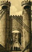
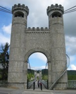
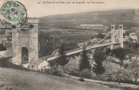
1839: Cournon
Pérignat-sur-Allier and Cournon-d'Auvergne, Puy-de-Dôme, France - Allier River
| Bridgemeister ID: | 1726 (added 2005-04-05) |
| Year Completed: | 1839 |
| Name: | Cournon |
| Location: | Pérignat-sur-Allier and Cournon-d'Auvergne, Puy-de-Dôme, France |
| Crossing: | Allier River |
| Coordinates: | 45.729820 N 3.213100 E |
| Maps: | Acme, GeoHack, Google, OpenStreetMap |
| Use: | Vehicular (one-lane), with walkway |
| Status: | Removed |
| Main Cables: | Wire (iron) |
| Suspended Spans: | 1 |
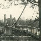
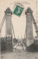
1839: Manosque
Manosque, Alpes-de-Haute-Provence, France - Durance River
| Bridgemeister ID: | 2001 (added 2005-12-26) |
| Year Completed: | 1839 |
| Name: | Manosque |
| Location: | Manosque, Alpes-de-Haute-Provence, France |
| Crossing: | Durance River |
| References: | AAJ |
| Use: | Vehicular |
| Status: | Replaced |
Notes:
- Heavily damaged by flood debris, 1843.
- Later at same location 1939 Manosque - Manosque, Alpes-de-Haute-Provence, France.
External Links:
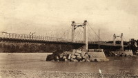
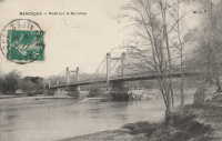
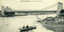
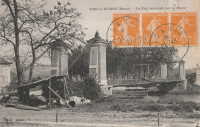
1839: Port-à-Binson
Port-à-Binson, Marne, France - Marne River
| Bridgemeister ID: | 2057 (added 2006-06-03) |
| Year Completed: | 1839 |
| Name: | Port-à-Binson |
| Location: | Port-à-Binson, Marne, France |
| Crossing: | Marne River |
| Principals: | Seguin Brothers |
| Use: | Vehicular |
| Status: | Destroyed, 1910s |
| Main Cables: | Wire (iron) |
| Suspended Spans: | 1 |
| Main Span: | 1 |
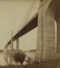
1839: Saint André-de-Cubzac
Saint André-de-Cubzac, Gironde, France - Dordogne River
| Bridgemeister ID: | 550 (added before 2003) |
| Year Completed: | 1839 |
| Name: | Saint André-de-Cubzac |
| Also Known As: | Cubzac |
| Location: | Saint André-de-Cubzac, Gironde, France |
| Crossing: | Dordogne River |
| Coordinates: | 44.962000 N 0.461444 W |
| Maps: | Acme, GeoHack, Google, OpenStreetMap |
| Principals: | Marie Fortuné de Vergès, Emil Martin |
| References: | AAJ, HBE, PTS2 |
| Use: | Vehicular |
| Status: | Destroyed, 1869 |
| Main Cables: | Wire (iron) |
| Suspended Spans: | 5 |
| Main Spans: | 5 x 10⁹ meters (357.6 feet) |
| Deck width: | 23 feet |
Notes:
- This is perhaps one of the most fanciful large suspension bridges ever built.
- Destroyed in a storm, 1869. Its replacement (a truss bridge) was completed in 1883. The approaches and the bottom halves of the suspension bridge towers were strengthened and used for the replacement.
- AAJ citing Engineering News-Record: "Vergès used inclined tie cables running from the top of the tower at one end of a span to a roadway-level connection on the opposite tower."
External Links:
- Structurae - Cubzac Bridge. Photos of the replacement truss structure.
- Structurae - Structure ID 20000898

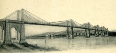
1840: Bigny
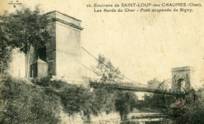
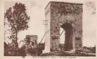
Saint-Loup-des-Chaumes and Bigny, Cher, France - Cher River
| Bridgemeister ID: | 2005 (added 2006-01-02) |
| Year Completed: | 1840 |
| Name: | Bigny |
| Location: | Saint-Loup-des-Chaumes and Bigny, Cher, France |
| Crossing: | Cher River |
| Coordinates: | 46.804972 N 2.371306 E |
| Maps: | Acme, GeoHack, Google, OpenStreetMap |
| Use: | Vehicular (one-lane) |
| Status: | Demolished, 1951 |
| Suspended Spans: | 1 |
External Links:
1840: Brignoud
Brignoud, Isère, France - Isère River
| Bridgemeister ID: | 2320 (added 2007-05-05) |
| Year Completed: | 1840 |
| Name: | Brignoud |
| Location: | Brignoud, Isère, France |
| Crossing: | Isère River |
| Use: | Vehicular |
| Status: | Removed |
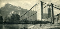
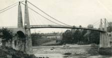
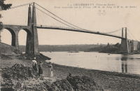
1840: Lézardrieux
Lézardrieux, Côtes-d'Armor, France - Trieux River
| Bridgemeister ID: | 1116 (added 2004-01-05) |
| Year Completed: | 1840 |
| Name: | Lézardrieux |
| Location: | Lézardrieux, Côtes-d'Armor, France |
| Crossing: | Trieux River |
| Coordinates: | 48.780778 N 3.106222 W |
| Maps: | Acme, GeoHack, Google, OpenStreetMap |
| Principals: | Seguin Brothers |
| References: | AAJ, PTS2 |
| Use: | Vehicular (one-lane) |
| Status: | Replaced, 1925 |
| Main Cables: | Wire (iron) |
| Suspended Spans: | 1 |
| Main Span: | 1 x 150 meters (492.1 feet) |
Notes:
- 1925: Replaced by a Gisclard suspension bridge reusing the approach spans and piers of the 1840 suspension bridge.
External Links:
1840: Mornay-sur-Allier
Mornay-sur-Allier, Cher and St-Pierre-le-Moûtier, Nièvre, France - Allier River
| Bridgemeister ID: | 2342 (added 2007-08-12) |
| Year Completed: | 1840 |
| Name: | Mornay-sur-Allier |
| Location: | Mornay-sur-Allier, Cher and St-Pierre-le-Moûtier, Nièvre, France |
| Crossing: | Allier River |
| Coordinates: | 46.815250 N 3.043606 E |
| Maps: | Acme, GeoHack, Google, OpenStreetMap |
| Use: | Vehicular |
| Status: | Replaced |
| Main Cables: | Wire (iron) |
| Suspended Spans: | 3 |
| Main Span: | 1 x 80 meters (262.5 feet) |
| Side Spans: | 2 x 67 meters (219.8 feet) |
Notes:
- This was the larger of two suspension bridges separated by a small island in the Allier River.
- Connects to 1840 Mornay-sur-Allier - Mornay-sur-Allier, Cher and St-Pierre-le-Moûtier, Nièvre, France which was the smaller of the two bridges at this location separated by a small island. When the larger suspension bridge was replaced in 1936, the smaller bridge was replaced with a non-suspension bridge.
- Replaced by 1936 Mornay-sur-Allier - Mornay-sur-Allier, Cher and St-Pierre-le-Moûtier, Nièvre, France.
External Links:
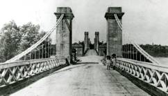
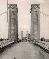
1840: Mornay-sur-Allier
Mornay-sur-Allier, Cher and St-Pierre-le-Moûtier, Nièvre, France - Allier River
| Bridgemeister ID: | 7901 (added 2023-10-15) |
| Year Completed: | 1840 |
| Name: | Mornay-sur-Allier |
| Location: | Mornay-sur-Allier, Cher and St-Pierre-le-Moûtier, Nièvre, France |
| Crossing: | Allier River |
| Coordinates: | 46.814793 N 3.045624 E |
| Maps: | Acme, GeoHack, Google, OpenStreetMap |
| Use: | Vehicular |
| Status: | Replaced, 1936 |
| Main Cables: | Wire (iron) |
| Suspended Spans: | 1 |
| Main Span: | 1 x 67.4 meters (221.1 feet) |
Notes:
- This was the smaller of two suspension bridges separated by a small island in the Allier River.
- Connects to 1840 Mornay-sur-Allier - Mornay-sur-Allier, Cher and St-Pierre-le-Moûtier, Nièvre, France which was the larger of the two suspension bridges. When it was replaced by another suspension in 1936, the smaller bridge was replaced with a non-suspension bridge.
External Links:

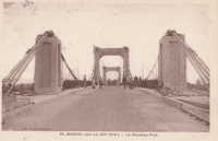
1841: Agen
Agen, Lot-et-Garonne, France - Garonne River
| Bridgemeister ID: | 1031 (added 2003-11-30) |
| Year Completed: | 1841 |
| Name: | Agen |
| Location: | Agen, Lot-et-Garonne, France |
| Crossing: | Garonne River |
| Coordinates: | 44.201972 N 0.608861 E |
| Maps: | Acme, GeoHack, Google, OpenStreetMap |
| Use: | Footbridge |
| Status: | Replaced |
Notes:
- Replaced by 2002 Agen - Agen, Lot-et-Garonne, France.
External Links:
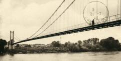
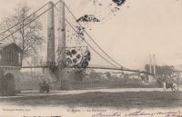
1841: Boran
Boran-sur-Oise, Oise, France - Oise River
| Bridgemeister ID: | 2064 (added 2006-06-06) |
| Year Completed: | 1841 |
| Name: | Boran |
| Location: | Boran-sur-Oise, Oise, France |
| Crossing: | Oise River |
| Coordinates: | 49.168388 N 2.366337 E |
| Maps: | Acme, GeoHack, Google, OpenStreetMap |
| Use: | Vehicular (one-lane), with walkway |
| Status: | Destroyed, 1914 |
| Main Cables: | Wire |
| Suspended Spans: | 1 |
Notes:
- Later at same location 1946 Boran - Boran-sur-Oise, Oise, France.
External Links:

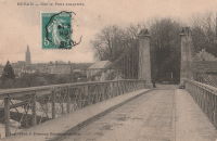
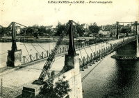
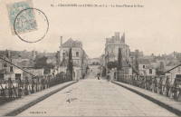
1841: Chalonnes
Chalonnes-sur-Loire, Maine-et-Loire, France - Loire River
| Bridgemeister ID: | 1419 (added 2004-07-17) |
| Year Completed: | 1841 |
| Name: | Chalonnes |
| Location: | Chalonnes-sur-Loire, Maine-et-Loire, France |
| Crossing: | Loire River |
| Coordinates: | 47.354170 N 0.761887 W |
| Maps: | Acme, GeoHack, Google, OpenStreetMap |
| Principals: | Seguin Brothers |
| Use: | Vehicular |
| Status: | Destroyed, June 20, 1940 |
| Main Cables: | Wire (iron) |
Notes:
- Near Saint-Georges-sur-Loire - Saint-Georges-sur-Loire and Chalonnes-sur-Loire, Maine-et-Loire, France.
- Later at same location 1948 Chalonnes - Chalonnes-sur-Loire, Maine-et-Loire, France.
External Links:

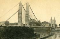
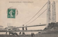
1841: Chauvort
Allerey-sur-Saône and Verdun-sur-le-Doubs, Saône-et-Loire, France - Saône River
| Bridgemeister ID: | 779 (added 2003-03-16) |
| Year Completed: | 1841 |
| Name: | Chauvort |
| Location: | Allerey-sur-Saône and Verdun-sur-le-Doubs, Saône-et-Loire, France |
| Crossing: | Saône River |
| Coordinates: | 46.906222 N 5.003611 E |
| Maps: | Acme, GeoHack, Google, OpenStreetMap |
| Use: | Vehicular |
| Status: | Only towers remain (last checked: 2023) |
| Main Cables: | Wire |
| Suspended Spans: | 1 |
Notes:
- Sometimes referred to as "Chaufort."
- Replaced, 1928.
- Near Bragny - Verdun-sur-le-Doubs and Bragny-sur-Saône, Saône-et-Loire, France.
External Links:
- >Ancien pont suspendu de Chauvort ⋅ Patrimoine en Bourgogne-Franche-Comté
- Art-et-Histoire - Pont suspendu de Chauvort d'Allerey-sur-Saone - 1841
1841: Châteauneuf-sur-Loire
Châteauneuf-sur-Loire, Loiret, France - Loire River
| Bridgemeister ID: | 1016 (added 2003-11-22) |
| Year Completed: | 1841 |
| Name: | Châteauneuf-sur-Loire |
| Location: | Châteauneuf-sur-Loire, Loiret, France |
| Crossing: | Loire River |
| Coordinates: | 47.857889 N 2.223417 E |
| Maps: | Acme, GeoHack, Google, OpenStreetMap |
| Principals: | Seguin Brothers |
| References: | AAJ |
| Use: | Vehicular |
| Status: | Replaced |
| Main Cables: | Wire (iron) |
| Suspended Spans: | 5 |
| Main Spans: | 5 |
Notes:
- 1870: Heavily damaged during Franco-Prussian war.
- 1872: Repairs completed.
- Replaced by 1935 Châteauneuf-sur-Loire - Châteauneuf-sur-Loire, Loiret, France.
External Links:
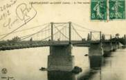
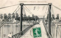
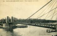
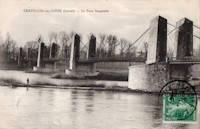
1841: Châtillon-sur-Loire
Châtillon-sur-Loire, Loiret, France - Loire River
| Bridgemeister ID: | 1017 (added 2003-11-22) |
| Year Completed: | 1841 |
| Name: | Châtillon-sur-Loire |
| Location: | Châtillon-sur-Loire, Loiret, France |
| Crossing: | Loire River |
| Principals: | Marc Seguin |
| References: | AAJ |
| Use: | Vehicular |
| Status: | Replaced, 1931 |
| Main Cables: | Wire (iron) |
| Suspended Spans: | 4 |
| Main Spans: | 2 x 92 meters (301.8 feet), 2 x 76 meters (249.3 feet) |
Notes:
- Destroyed by flood 1846, rebuilt 1848, damaged by flood 1856, rebuilt 1857.
- Replaced by 1931 Châtillon-sur-Loire - Châtillon-sur-Loire, Loiret, France. Built on same piers.
External Links:
1841: Kenmare
Kenmare, Ireland - Kenmare River
| Bridgemeister ID: | 399 (added before 2003) |
| Year Completed: | 1841 |
| Name: | Kenmare |
| Location: | Kenmare, Ireland |
| Crossing: | Kenmare River |
| Principals: | Sir Samuel Brown |
| Suspended Spans: | 2 |
| Main Spans: | 2 |
External Links:

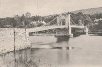
1841: Oban
Lavacherie, Sainte-Ode, Belgium - Ourthe River
| Bridgemeister ID: | 5577 (added 2020-12-20) |
| Year Completed: | 1841 |
| Name: | Oban |
| Location: | Lavacherie, Sainte-Ode, Belgium |
| Crossing: | Ourthe River |
| Coordinates: | 50.062789 N 5.507661 E |
| Maps: | Acme, GeoHack, Google, OpenStreetMap |
| Status: | Destroyed, December, 1944 |
| Suspended Spans: | 1 |
| Main Span: | 1 x 14 meters (45.9 feet) |
External Links:

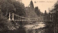
1841: Quincy
Quincy, Cher, France - Cher River
| Bridgemeister ID: | 5678 (added 2021-03-13) |
| Year Completed: | 1841 |
| Name: | Quincy |
| Location: | Quincy, Cher, France |
| Crossing: | Cher River |
| Coordinates: | 47.135019 N 2.163212 E |
| Maps: | Acme, GeoHack, Google, OpenStreetMap |
| Use: | Vehicular (one-lane) |
| Status: | Replaced, 1925 |
| Main Cables: | Wire (iron) |
| Suspended Spans: | 1 |
External Links:
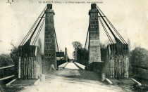
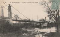
1841: Verdun-sur-Garonne
Verdun-sur-Garonne, Tarn-et-Garonne, France - Garonne River
| Bridgemeister ID: | 2158 (added 2006-12-10) |
| Year Completed: | 1841 |
| Name: | Verdun-sur-Garonne |
| Location: | Verdun-sur-Garonne, Tarn-et-Garonne, France |
| Crossing: | Garonne River |
| References: | AAJ, PTS2 |
| Use: | Vehicular |
| Suspended Spans: | 1 |
| Main Span: | 1 x 151 meters (495.4 feet) |
Notes:
- See 1931 Verdun-sur-Garonne - Verdun-sur-Garonne, Tarn-et-Garonne, France. The relationship between the older and current bridges is unclear.
External Links:
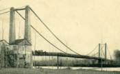
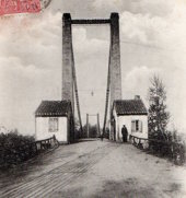
1842: Aywaille
Aywaille, Wallonia, Belgium - Amblève River
| Bridgemeister ID: | 6630 (added 2021-09-07) |
| Year Completed: | 1842 |
| Name: | Aywaille |
| Location: | Aywaille, Wallonia, Belgium |
| Crossing: | Amblève River |
| References: | IBB |
| Use: | Vehicular |
| Status: | Replaced, 1934 |
| Main Cables: | Eyebar (iron) |
| Suspended Spans: | 1 |
| Main Span: | 1 x 50 meters (164 feet) estimated |
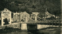
1842: Fairmount
Philadelphia, Pennsylvania, USA - Schuylkill River
| Bridgemeister ID: | 24 (added before 2003) |
| Year Completed: | 1842 |
| Name: | Fairmount |
| Also Known As: | Callowhill Street, Upper Ferry |
| Location: | Philadelphia, Pennsylvania, USA |
| Crossing: | Schuylkill River |
| Principals: | Charles Ellet |
| References: | BBR, BOB, BPL, HBE, LAB, PTS2, WHSB |
| Use: | Vehicular |
| Status: | Replaced, 1875 |
| Main Cables: | Wire (iron) |
| Suspended Spans: | 1 |
| Main Span: | 1 x 104.2 meters (342 feet) |
Notes:
- BBR and BOB say 1841.
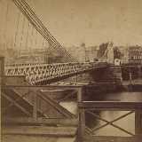
1842: Gennes
Gennes and Les Rosiers-sur-Loire, Maine-et-Loire, France - Loire River
| Bridgemeister ID: | 1172 (added 2004-01-23) |
| Year Completed: | 1842 |
| Name: | Gennes |
| Location: | Gennes and Les Rosiers-sur-Loire, Maine-et-Loire, France |
| Crossing: | Loire River |
| Coordinates: | 47.345559 N 0.230343 W |
| Maps: | Acme, GeoHack, Google, OpenStreetMap |
| Use: | Vehicular |
| Status: | Replaced |
| Main Cables: | Wire (iron) |
Notes:
- Connects to 1842 Les Rosiers-sur-Loire - Les Rosiers-sur-Loire and Gennes, Maine-et-Loire, France.
- Replaced by 1932 Gennes - Gennes and Les Rosiers-sur-Loire, Maine-et-Loire, France.
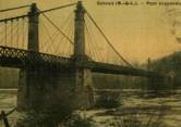
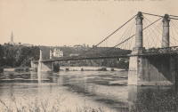
1842: Les Rosiers-sur-Loire
Les Rosiers-sur-Loire and Gennes, Maine-et-Loire, France - Loire River
| Bridgemeister ID: | 1943 (added 2005-10-29) |
| Year Completed: | 1842 |
| Name: | Les Rosiers-sur-Loire |
| Location: | Les Rosiers-sur-Loire and Gennes, Maine-et-Loire, France |
| Crossing: | Loire River |
| Coordinates: | 47.349195 N 0.227169 W |
| Maps: | Acme, GeoHack, Google, OpenStreetMap |
| Use: | Vehicular |
| Status: | Replaced |
| Main Cables: | Wire (iron) |
Notes:
- Connects to 1842 Gennes - Gennes and Les Rosiers-sur-Loire, Maine-et-Loire, France.
- Replaced by 1932 Les Rosiers-sur-Loire - Les Rosiers-sur-Loire and Gennes, Maine-et-Loire, France.
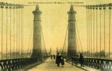
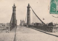
1842: Pertuiset
Pertuiset, Firminy vicinity, Loire, France - Loire River
| Bridgemeister ID: | 1165 (added 2004-01-19) |
| Year Completed: | 1842 |
| Name: | Pertuiset |
| Location: | Pertuiset, Firminy vicinity, Loire, France |
| Crossing: | Loire River |
| Principals: | M. Letrain |
| Use: | Vehicular (one-lane) |
| Status: | Removed |
| Main Cables: | Wire (iron) |
| Suspended Spans: | 1 |
Notes:
External Links:
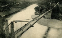
1842: Rochemaure
Rochemaure, Ardèche and Ancône, Drôme, France - Rhône River
| Bridgemeister ID: | 950 (added 2003-10-31) |
| Year Completed: | 1842 |
| Name: | Rochemaure |
| Location: | Rochemaure, Ardèche and Ancône, Drôme, France |
| Crossing: | Rhône River |
| Coordinates: | 44.583117 N 4.71035 E |
| Maps: | Acme, GeoHack, Google, OpenStreetMap |
| References: | BPF |
| Use: | Vehicular (one-lane) |
| Status: | Only towers remain (last checked: 2021) |
| Main Cables: | Wire |
| Suspended Spans: | 2 |
| Main Spans: | 2 |
Notes:
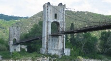
- Failed 1856, rebuilt 1858, destroyed 1940 (war), rebuilt 1942, destroyed 1944 (war), rebuilt 1946, restricted to pedestrians, 1983. Abandoned in the 1990s. Stood in a derelict state for several years.
- 2013: Work is completed to replace the derelict deck with a suspension footbridge that sits on the original piers but does not use the towers of the former suspension bridge. This new installation is tracked separately.
- Replaced by 2013 Himalayenne (Rochemaure, Himalayan) - Rochemaure, Ardèche, France.
External Links:
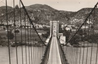
1842: Suresnes
Suresnes, Hauts-de-Seine, France - Seine River
| Bridgemeister ID: | 1929 (added 2005-10-23) |
| Year Completed: | 1842 |
| Name: | Suresnes |
| Location: | Suresnes, Hauts-de-Seine, France |
| Crossing: | Seine River |
| Coordinates: | 48.866905 N 2.229533 E |
| Maps: | Acme, GeoHack, Google, OpenStreetMap |
| Principals: | Charles Seguin, Paul Seguin, M. Surville |
| Use: | Vehicular |
| Status: | Destroyed, 1870 |
| Main Cables: | Wire (iron) |
External Links:
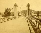
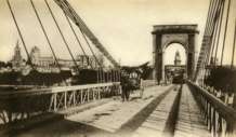
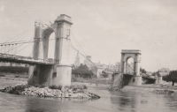
1843: Avignon
Avignon, Vaucluse and Villeneuve-lès-Avignon, Gard, France - Rhône River
| Bridgemeister ID: | 986 (added 2003-11-15) |
| Year Completed: | 1843 |
| Name: | Avignon |
| Location: | Avignon, Vaucluse and Villeneuve-lès-Avignon, Gard, France |
| Crossing: | Rhône River |
| Coordinates: | 43.951490 N 4.800048 E |
| Maps: | Acme, GeoHack, Google, OpenStreetMap |
| Principals: | Seguin Brothers |
| Use: | Vehicular |
| Status: | Demolished, c. 1960 |
| Main Cables: | Wire (iron) |
| Suspended Spans: | 3 |
| Main Span: | 1 |
| Side Spans: | 2 |
Notes:
- Coordinates are for the present day (2022) Pont Édouard Daladier. The suspension bridge was on an alignment immediately adjacent to it.
- 1888-1890: Strengthened, and perhaps largely rebuilt, by Ferdinand Arnodin. This introduced the hybrid cable-stayed/suspension system commonly seen in images of the bridge.
- 1944, June: Heavily damaged by US bombardment. Eventually repaired and reopened.
External Links:

1843: Bassou
Bassou and Bonnard, Yonne, France - Yonne River
| Bridgemeister ID: | 2234 (added 2007-03-19) |
| Year Completed: | 1843 |
| Name: | Bassou |
| Location: | Bassou and Bonnard, Yonne, France |
| Crossing: | Yonne River |
| References: | AAJ |
| Use: | Vehicular |
| Status: | Replaced, 1967 |
| Main Cables: | Wire |
| Suspended Spans: | 1 |
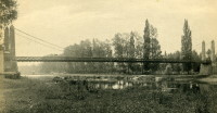
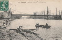
1843: Ingrandes
Ingrandes, Maine-et-Loire, France - Loire River
| Bridgemeister ID: | 1171 (added 2004-01-23) |
| Year Completed: | 1843 |
| Name: | Ingrandes |
| Location: | Ingrandes, Maine-et-Loire, France |
| Crossing: | Loire River |
| Coordinates: | 47.40075 N 0.918683 W |
| Maps: | Acme, GeoHack, Google, OpenStreetMap |
| References: | AAJ |
| Use: | Vehicular |
| Status: | In use (last checked: 2021) |
| Main Cables: | Wire (iron) |
| Suspended Spans: | 8 |
| Main Spans: | 8 |
Notes:
- Structurae has the bridge completed in 1922 (with a 1941 reconstruction) and AAJ suggests the bridge was completed 1924-1927, but older images of the bridge show an older bridge consistent with the 1843 date. The later dates represent reconstructions. The current bridge has steel cables.
External Links:
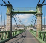
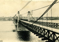
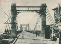
1843: Villeneuve-Saint-Georges
Villeneuve-Saint-Georges and Villeneuve-le-Roi, Val-de-Marne, France - Seine River
| Bridgemeister ID: | 1654 (added 2005-03-19) |
| Year Completed: | 1843 |
| Name: | Villeneuve-Saint-Georges |
| Location: | Villeneuve-Saint-Georges and Villeneuve-le-Roi, Val-de-Marne, France |
| Crossing: | Seine River |
| Use: | Vehicular |
| Status: | Replaced, 1939 |
| Main Cables: | Wire (iron) |
| Suspended Spans: | 1 |
External Links:


1844: Mouton
Lyon, Métropole de Lyon, France - Saône River
| Bridgemeister ID: | 544 (added before 2003) |
| Year Completed: | 1844 |
| Name: | Mouton |
| Location: | Lyon, Métropole de Lyon, France |
| Crossing: | Saône River |
| Coordinates: | 45.774187 N 4.810129 E |
| Maps: | Acme, GeoHack, Google, OpenStreetMap |
| References: | PQL |
| Use: | Vehicular (one-lane) |
| Status: | Replaced, 1952 |
| Main Cables: | Wire (iron) |
| Suspended Spans: | 1 |
Notes:
- Bombed, 1944. Rebuilt, 1946. Was located at the site of the current Pont Georges Clemenceau
- Next to 1831 Masaryk (Masarik, Mazarik, de la Gare) - Lyon vicinity, Métropole de Lyon, France.
External Links:
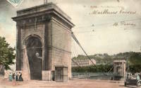
1844: Saint-Claude
Saint-Claude, Jura, France - Tacon River
| Bridgemeister ID: | 1200 (added 2004-01-31) |
| Year Completed: | 1844 |
| Name: | Saint-Claude |
| Location: | Saint-Claude, Jura, France |
| Crossing: | Tacon River |
| References: | AAJ |
| Use: | Vehicular |
| Status: | Replaced, 1939 |
| Main Cables: | Wire (iron) |
| Suspended Spans: | 1 |
Notes:
- Replaced by a concrete arch, 1939.
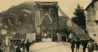

1844: Saint-Denis
Saint-Denis, Seine-Saint-Denis and Villeneuve-la-Garenne, Hauts-de-Seine, France - Seine River
| Bridgemeister ID: | 1686 (added 2005-03-26) |
| Year Completed: | 1844 |
| Name: | Saint-Denis |
| Location: | Saint-Denis, Seine-Saint-Denis and Villeneuve-la-Garenne, Hauts-de-Seine, France |
| Crossing: | Seine River |
| Use: | Vehicular |
| Status: | Destroyed, 1904 |
| Main Cables: | Wire |
| Suspended Spans: | 2 |
| Main Spans: | 2 |
External Links:
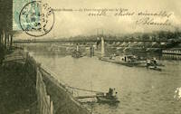
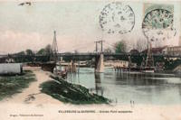
1844: Union
Ottawa, Ontario, Canada - Chaudière Falls
| Bridgemeister ID: | 26 (added before 2003) |
| Year Completed: | 1844 |
| Name: | Union |
| Location: | Ottawa, Ontario, Canada |
| Crossing: | Chaudière Falls |
| Principals: | Samuel Keefer |
| References: | AAJ |
| Use: | Vehicular |
| Status: | Replaced, 1889 |
| Main Cables: | Wire (iron) |
| Suspended Spans: | 1 |
| Main Span: | 1 x 74.2 meters (243.5 feet) |
Notes:
- At time of completion, Ottawa was still known as Bytown.
External Links:

