Inventory Search Results (201-300 of 700)
700 suspension bridges were found for search criteria: David completed between 1700 and 2010 including undated bridges. Bridges 201 through 300 (of 700 total) appear below. Click the Bridgemeister ID number to isolate the bridge on its own page. If you don't see what you were looking for, try an image search with the same criteria: David. This will find the bridge if it is pictured on the site, but is not a catenary suspension bridge.
Related:
1876: Zoar
Stevenson vicinity, Connecticut, USA - Housatonic River
| Bridgemeister ID: | 85 (added before 2003) |
| Year Completed: | 1876 |
| Name: | Zoar |
| Location: | Stevenson vicinity, Connecticut, USA |
| Crossing: | Housatonic River |
| Use: | Vehicular (one-lane) |
| Status: | Demolished, 1919 |
| Main Cables: | Wire |
| Suspended Spans: | 1 |
Notes:
- Located on the road connecting Monroe to Oxford, until 1919 when the Stevenson Dam was built.
- May have been significantly widened, c. 1910.

1877: Lead Mine
Gorham, New Hampshire, USA
| Bridgemeister ID: | 1198 (added 2004-01-28) |
| Year Completed: | 1877 |
| Name: | Lead Mine |
| Also Known As: | Hutchinson |
| Location: | Gorham, New Hampshire, USA |
| Principals: | Timothy H. Hutchinson |
| Use: | Vehicular (one-lane) |
| Status: | Collapsed, 1921 |
| Main Cables: | Wire |
| Suspended Spans: | 1 |
Notes:
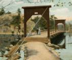
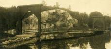
- Provided access to Mascot Mine. Collapsed, 1921.
1877: Minneapolis
Minneapolis, Minnesota, USA - Mississippi River
| Bridgemeister ID: | 86 (added before 2003) |
| Year Completed: | 1877 |
| Name: | Minneapolis |
| Location: | Minneapolis, Minnesota, USA |
| Crossing: | Mississippi River |
| At or Near Feature: | Nicollet Island |
| Principals: | Thomas M. Griffith |
| References: | AAJ, BPL, HBE, PTS2 |
| Use: | Vehicular, with walkway |
| Status: | Replaced, 1890 |
| Main Cables: | Wire (iron) |
| Suspended Spans: | 1 |
| Main Span: | 1 x 205.8 meters (675.1 feet) |
| Deck width: | 32 feet |
Notes:
- Replaced 1855 Minneapolis (St. Anthony's Falls) - Minneapolis, Minnesota, USA.
- Later at same location 1990 Hennepin Avenue (Father Louis Hennepin) - Minneapolis, Minnesota, USA.
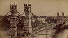
1878: Upper
Turners Falls, Montague, Massachusetts, USA - Connecticut River
| Bridgemeister ID: | 87 (added before 2003) |
| Year Completed: | 1878 |
| Name: | Upper |
| Also Known As: | Red |
| Location: | Turners Falls, Montague, Massachusetts, USA |
| Crossing: | Connecticut River |
| Principals: | J.W. Shipman |
| References: | CCR |
| Use: | Vehicular |
| Status: | Dismantled, 1942 |
| Main Cables: | Wire |
Notes:
External Links:
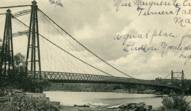
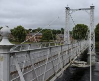
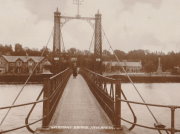
1879: Infirmary
Inverness, Scotland, United Kingdom - River Ness
| Bridgemeister ID: | 539 (added before 2003) |
| Year Completed: | 1879 |
| Name: | Infirmary |
| Location: | Inverness, Scotland, United Kingdom |
| Crossing: | River Ness |
| Coordinates: | 57.471653 N 4.228844 W |
| Maps: | Acme, GeoHack, Google, OpenStreetMap |
| Principals: | C. R. Manners |
| References: | HBR |
| Use: | Footbridge |
| Status: | In use (last checked: 2021) |
| Main Cables: | Wire |
| Suspended Spans: | 3 |
| Main Span: | 1 x 61 meters (200 feet) |
| Side Spans: | 2 x 12.8 meters (42 feet) |
Notes:
- 2020, November: Highland Council likely to close bridge if funding for urgent repairs cannot be raised.
- 2021, July: Reopened after interim repairs completed. Future major refurbishment expected.
- Companion to 1881 Greig Street (Wobbly) - Inverness, Scotland, United Kingdom.
Annotated Citations:
- Glen, Louise. “Closure Fears for Iconic Inverness Bridge Facing Huge Repair Bill.” Inverness Courier, 21 Apr. 2021, www.inverness-courier.co.uk/news/closure-fears-for-iconic-inverness-bridge-facing-huge-repair-235713/.
"Fears have been raised that decades of under investment in an iconic city bridge could see it closed permanently. Members of Ballifeary Community Council believe the cost of fixing and upgrading the Infirmary Bridge to bring it up to modern standards may be more than £1 million..."
- Duncan, Ian. "The future of Infirmary Bridge secured into the 2040s as Highland Council's Economy and Infrastructure Committee today agrees up to £550,000 in funding for repairs." Inverness Courier, 05 May 2021, www.inverness-courier.co.uk/news/the-future-of-infirmary-bridge-secured-into-the-2040s-237340/.
"Highland Council's Economy and Infrastructure Committee agreed today to include up to £550,000 for repairs for Infirmary Bridge… 'It will be 2022 before the repairs are completed, but once done the bridge's life will be extended for a further 20 to 25 years.'"
External Links:

1879: Shaky
Alexandra, New Zealand - Manuherikia River
| Bridgemeister ID: | 665 (added 2003-03-08) |
| Year Completed: | 1879 |
| Name: | Shaky |
| Also Known As: | Manuherikia |
| Location: | Alexandra, New Zealand |
| Crossing: | Manuherikia River |
| Coordinates: | 45.253846 S 169.398651 E |
| Maps: | Acme, GeoHack, Google, OpenStreetMap |
| Principals: | L.D. Macgeorge, William Grant, McKellar |
| References: | GAP |
| Use: | Vehicular (one-lane) |
| Status: | Restricted to foot traffic (last checked: 2017) |
| Main Cables: | Wire |
| Suspended Spans: | 1 |
Notes:
- Restored as a pedestrian-only bridge, 1952. Refurbished, 2009.
- Near 1882 Alexandra - Alexandra, New Zealand.
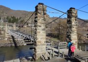
1879: Swing
Monymusk, Scotland, United Kingdom - River Don
| Bridgemeister ID: | 2192 (added 2007-01-26) |
| Year Completed: | 1879 |
| Name: | Swing |
| Location: | Monymusk, Scotland, United Kingdom |
| Crossing: | River Don |
| Principals: | Harper & Co. |
| References: | HARPER |
| Use: | Footbridge |
| Status: | Demolished, c. 2005 |
| Main Cables: | Wire |
| Suspended Spans: | 1 |
| Main Span: | 1 x 32.6 meters (107 feet) |
External Links:

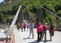
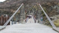
1880: Kawarau Gorge
Kawarau Gorge, Central Otago, New Zealand - Kawarau River Gorge
| Bridgemeister ID: | 667 (added 2003-03-08) |
| Year Completed: | 1880 |
| Name: | Kawarau Gorge |
| Location: | Kawarau Gorge, Central Otago, New Zealand |
| Crossing: | Kawarau River Gorge |
| Coordinates: | 45.008882 S 168.899938 E |
| Maps: | Acme, GeoHack, Google, OpenStreetMap |
| Principals: | H.P. Higginson, A.R.W Fulton, W.C. Edwards |
| References: | AAJ, GAP |
| Use: | Vehicular (one-lane) |
| Status: | Restricted to foot traffic (last checked: 2017) |
| Main Cables: | Wire (iron) |
| Suspended Spans: | 1 |
| Main Span: | 1 x 91.4 meters (300 feet) |
Notes:
- Appears to now be used solely as a bungee-jumping platform.
External Links:
1881: Clyde
Clyde, New Zealand - Clutha River
| Bridgemeister ID: | 663 (added 2003-03-08) |
| Year Completed: | 1881 |
| Name: | Clyde |
| Location: | Clyde, New Zealand |
| Crossing: | Clutha River |
| Coordinates: | 45.190387 S 169.315977 E |
| Maps: | Acme, GeoHack, Google, OpenStreetMap |
| Principals: | William Grant, McKellar |
| References: | GAP |
| Use: | Vehicular (one-lane) |
| Status: | Replaced, 1936 |
| Main Cables: | Wire |
| Suspended Spans: | 3 |
| Main Span: | 1 |
| Side Spans: | 2 |
Notes:
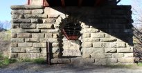
- Replaced by a large single-span truss bridge that sits on the suspension bridge piers.
- Replaced 1875 (suspension bridge) - Clyde, New Zealand.
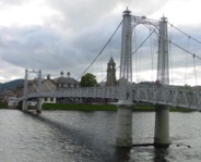
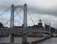
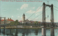
1881: Greig Street
Inverness, Scotland, United Kingdom - River Ness
| Bridgemeister ID: | 538 (added before 2003) |
| Year Completed: | 1881 |
| Name: | Greig Street |
| Also Known As: | Wobbly |
| Location: | Inverness, Scotland, United Kingdom |
| Crossing: | River Ness |
| Coordinates: | 57.479111 N 4.229796 W |
| Maps: | Acme, GeoHack, Google, OpenStreetMap |
| References: | HBR |
| Use: | Footbridge |
| Status: | In use (last checked: 2021) |
| Main Cables: | Wire |
| Suspended Spans: | 3 |
| Main Span: | 1 |
| Side Spans: | 2 |
Notes:
- Companion to 1879 Infirmary - Inverness, Scotland, United Kingdom.
- Near 1855 Ness - Inverness, Scotland, United Kingdom. In some photos, the two bridges are visible within a few hundred yards of each other.
External Links:
1882: Alexandra
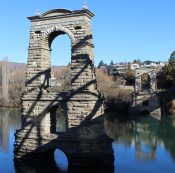
Alexandra, New Zealand - Clutha River
| Bridgemeister ID: | 668 (added 2003-03-08) |
| Year Completed: | 1882 |
| Name: | Alexandra |
| Location: | Alexandra, New Zealand |
| Crossing: | Clutha River |
| Coordinates: | 45.258245 S 169.391270 E |
| Maps: | Acme, GeoHack, Google, OpenStreetMap |
| Principals: | L.D. Macgeorge, Jeremiah Drummey, Robert Hay |
| References: | GAP |
| Use: | Vehicular (one-lane) |
| Status: | Only towers remain (last checked: 2017) |
| Main Cables: | Wire |
| Main Span: | 1 x 79.9 meters (262.1 feet) |
Notes:
- Bypassed, 1958, at which point the bridge deck and cables were removed leaving only the towers.
- Near 1879 Shaky (Manuherikia) - Alexandra, New Zealand.
External Links:
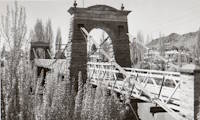
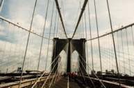
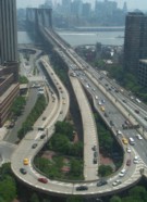
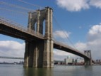
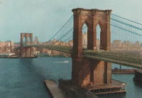
1883: Brooklyn
New York and Brooklyn, New York, USA - East River
| Bridgemeister ID: | 89 (added before 2003) |
| Year Completed: | 1883 |
| Name: | Brooklyn |
| Also Known As: | Great East River |
| Location: | New York and Brooklyn, New York, USA |
| Crossing: | East River |
| Coordinates: | 40.706 N 73.99667 W |
| Maps: | Acme, GeoHack, Google, OpenStreetMap |
| Principals: | John A. Roebling, Washington A. Roebling |
| References: | AAJ, BAAW, BBR, BBTS, BC3, BFL, BLD, BMA, BOB, BOU, BPL, COB, CTW, GB, GBD, HBE, LAB, LACE, NG198305, ONF, PTS2, SJR |
| Use: | Rail (light rail) and Vehicular (major highway), with walkway |
| Status: | In use (last checked: 2022) |
| Main Cables: | Wire (steel) |
| Suspended Spans: | 3 |
| Main Span: | 1 x 486.3 meters (1,595.5 feet) |
| Side Spans: | 2 x 283.5 meters (930 feet) |
| Deck width: | 85 feet |
Notes:
- Became longest suspension bridge by eclipsing 1869 Clifton (Niagara-Clifton, Falls View, First Falls View) - Niagara Falls, New York, USA and Niagara Falls, Ontario, Canada.
- Eclipsed by new longest suspension bridge 1903 Williamsburg - New York and Brooklyn, New York, USA.
- Next to 1909 Manhattan - New York and Brooklyn, New York, USA.
- Near 1903 Williamsburg - New York and Brooklyn, New York, USA.
External Links:
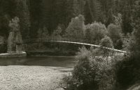
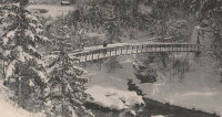
1883: Turrian
Château-d'Oex, Switzerland - Sarine River
| Bridgemeister ID: | 2878 (added 2019-09-13) |
| Year Completed: | 1883 |
| Name: | Turrian |
| Location: | Château-d'Oex, Switzerland |
| Crossing: | Sarine River |
| Coordinates: | 46.468703 N 7.135172 E |
| Maps: | Acme, GeoHack, Google, OpenStreetMap |
| Use: | Footbridge |
| Status: | In use (last checked: 2019) |
| Main Cables: | Wire (steel) |
| Suspended Spans: | 1 |
External Links:
1883: Yenne
Yenne, Savoie and Ain, France - Rhône River
| Bridgemeister ID: | 1968 (added 2005-11-26) |
| Year Completed: | 1883 |
| Name: | Yenne |
| Location: | Yenne, Savoie and Ain, France |
| Crossing: | Rhône River |
| Coordinates: | 45.706294 N 5.751086 E |
| Maps: | Acme, GeoHack, Google, OpenStreetMap |
| References: | AGP |
| Use: | Vehicular (one-lane) |
| Status: | Destroyed, 1940 |
| Main Cables: | Wire |
| Suspended Spans: | 1 |
Notes:
- 1940: Destroyed during WWII.
- Later at same location 1951 Yenne - Yenne, Savoie and Ain, France.
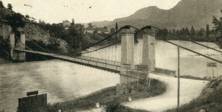
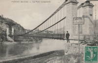
1884: Lamothe
Lamothe and Brioude, Haute-Loire, France - Allier River
| Bridgemeister ID: | 1764 (added 2005-04-22) |
| Year Completed: | 1884 |
| Name: | Lamothe |
| Location: | Lamothe and Brioude, Haute-Loire, France |
| Crossing: | Allier River |
| Coordinates: | 45.302968 N 3.406201 E |
| Maps: | Acme, GeoHack, Google, OpenStreetMap |
| References: | PTS2 |
| Use: | Vehicular |
| Status: | Only towers remain, since 1977 (last checked: 2019) |
| Main Cables: | Wire |
| Suspended Spans: | 1 |
| Main Span: | 1 |
Notes:
- Next to 1834 Lamothe - Lamothe and Brioude, Haute-Loire, France. In 1866, a flood caused a major change in the course of the Allier River such that the main channel no longer flowed under the older bridge. The newer bridge crossed the main channel of the Allier just slightly east of the older bridge.
External Links:
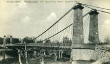
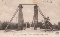
1884: Tonnay-Charente
Tonnay-Charente, Charente-Maritime, France - Charente River
| Bridgemeister ID: | 7337 (added 2022-09-04) |
| Year Completed: | 1884 |
| Name: | Tonnay-Charente |
| Location: | Tonnay-Charente, Charente-Maritime, France |
| Crossing: | Charente River |
| Coordinates: | 45.940048 N 0.886059 W |
| Maps: | Acme, GeoHack, Google, OpenStreetMap |
| Use: | Vehicular |
| Status: | Replaced, 1934 |
| Main Cables: | Wire |
| Suspended Spans: | 3 |
| Main Span: | 1 x 90 meters (295.3 feet) |
| Side Spans: | 2 |
Notes:
- Replaced 1842 Tonnay-Charente - Tonnay-Charente, Charente-Maritime, France.
- Replaced by 1934 Tonnay-Charente - Tonnay-Charente, Charente-Maritime, France.
External Links:
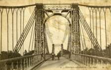
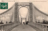
1885: Abergeldie Castle
Balmoral vicinity, Scotland, United Kingdom - River Dee
| Bridgemeister ID: | 1705 (added 2005-03-29) |
| Year Completed: | 1885 |
| Name: | Abergeldie Castle |
| Location: | Balmoral vicinity, Scotland, United Kingdom |
| Crossing: | River Dee |
| Coordinates: | 57.043806 N 3.176197 W |
| Maps: | Acme, GeoHack, Google, OpenStreetMap |
| Principals: | Blaikie Brothers |
| References: | AAJ, HBR |
| Use: | Footbridge |
| Status: | Derelict (last checked: 2016) |
| Main Cables: | Wire |
| Suspended Spans: | 1 |
Notes:
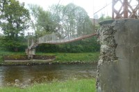
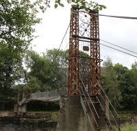
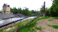
- William Craig describes the bridge, "A wood and angle iron deck supported from two pairs of wire cables and rod suspenders. The railings are of light woven wire. Pylons with ornamental heads are of lattice gider construction on concrete bases five miles west of Ballater, Scotland."
- Was already derelict before December 2015 flooding (Storm Frank) that severely damaged several River Dee bridges. Dave Cooper writes in early 2016: "The bridge's southern tower and its base are gone. The river bank has eroded back to within feet of the grade one listed Abergeldie Castle. Seat of Baron Abergeldie."
External Links:


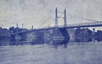
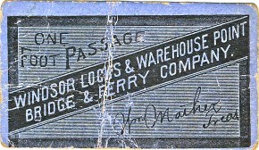
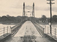
1886: (suspension bridge)
Windsor Locks and Warehouse Point, Connecticut, USA - Connecticut River
| Bridgemeister ID: | 306 (added before 2003) |
| Year Completed: | 1886 |
| Name: | (suspension bridge) |
| Location: | Windsor Locks and Warehouse Point, Connecticut, USA |
| Crossing: | Connecticut River |
| Principals: | James Shipman |
| References: | AAJ, PTS2 |
| Use: | Vehicular |
| Status: | Removed |
| Main Cables: | Wire |
| Suspended Spans: | 3 |
| Main Span: | 1 x 167.6 meters (550 feet) |
| Side Spans: | 2 x 91.4 meters (300 feet) |
External Links:
1886: Lower
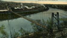
Easton, Pennsylvania, USA - Lehigh River
| Bridgemeister ID: | 813 (added 2003-05-29) |
| Year Completed: | 1886 |
| Name: | Lower |
| Location: | Easton, Pennsylvania, USA |
| Crossing: | Lehigh River |
| References: | DSL20030414, WGE20030513 |
| Use: | Footbridge |
| Status: | Demolished, 1951 |
| Main Cables: | Wire |
Notes:
- Damaged by windstorm 1950.
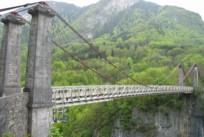
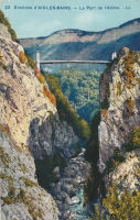
1887: de l'Abîme
Cusy and Gruffy, Haute-Savoie, France - Chéran River
| Bridgemeister ID: | 418 (added before 2003) |
| Year Completed: | 1887 |
| Name: | de l'Abîme |
| Location: | Cusy and Gruffy, Haute-Savoie, France |
| Crossing: | Chéran River |
| Coordinates: | 45.764583 N 6.057117 E |
| Maps: | Acme, GeoHack, Google, OpenStreetMap |
| Principals: | Ferdinand Arnodin |
| References: | BPF |
| Use: | Vehicular (one-lane) |
| Status: | In use (last checked: 2021) |
| Main Cables: | Wire |
| Suspended Spans: | 1 |
| Main Span: | 1 x 64 meters (210 feet) |
External Links:
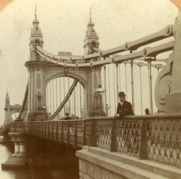
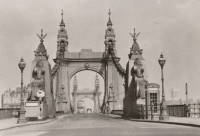
1887: Hammersmith
London, England, United Kingdom - River Thames
| Bridgemeister ID: | 419 (added before 2003) |
| Year Completed: | 1887 |
| Name: | Hammersmith |
| Location: | London, England, United Kingdom |
| Crossing: | River Thames |
| Coordinates: | 51.48845 N 0.23019 W |
| Maps: | Acme, GeoHack, Google, OpenStreetMap |
| Principals: | Sir Joseph Bazalgette |
| References: | BEM, BPL, HBE, NTB, PTS2 |
| Use: | Vehicular (two-lane), with walkway |
| Status: | Restricted to foot traffic, since 2021 (last checked: 2021) |
| Main Cables: | Eyebar |
| Suspended Spans: | 3 |
| Main Span: | 1 |
| Side Spans: | 2 |
Notes:
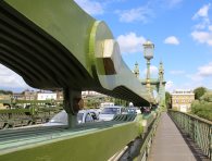
- 2019, April: Closed to vehicular traffic due to safety concerns after an inspection found fractures in the cast iron casings around the bridge pedestals. Some repair work followed, but was not fully funded or finished (as of mid-2020)
- 2020, August: Fractures found to have worsened during recent heatwave. Bridge is completely closed to all pedestrian and bicycle traffic. Pedestrian walkways under the bridge and all river traffic under the bridge are also prohibited (implying risk of collapse).
- 2020, December: Bridge may reopen to pedestrians and cyclists if deemed safe by maintenance contractor, Mott MacDonald.
- 2021, January: Plan discussed to "thread" a temporary truss along the length of the deck to permit traffic while the suspension bridge undergoes repairs.
- 2021, March: Feasibility study on "double-decker" temporary truss plan determines it is feasible, possibly opening to pedestrian and vehicular traffic by mid-2022.
- 2021, July: Reopened for pedestrian and bicycle use.
- Replaced 1827 Hammersmith - London, England, United Kingdom.
External Links:
- ENR - Engineers Ponder Solutions for Damaged London Bridge. February 22, 2021 Engineering News-Record article discusses proposal to thread a temporary truss between the towers to allow traffic while the larger suspension bridge repairs are completed. Recaps the issue: "Cracks have been found in the cast-iron pedestals that support suspension cable saddles at the abutments. Engineers suspect that roller bearings between the saddles and pedestals seized up at least 30 years ago…"
- Hammersmith Bridge | Temporary ‘double-decker’ proposal deemed technically feasible - New Civil Engineer. March 22, 2021
- The Happy Pontist: London Bridges: 33. Hammersmith Bridge
- Structurae - Structure ID 20008013
1887: Roxburgh
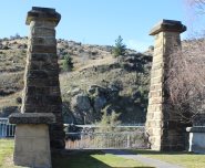
Roxburgh, New Zealand - Clutha River
| Bridgemeister ID: | 671 (added 2003-03-08) |
| Year Completed: | 1887 |
| Name: | Roxburgh |
| Location: | Roxburgh, New Zealand |
| Crossing: | Clutha River |
| Coordinates: | 45.542731 S 169.320220 E |
| Maps: | Acme, GeoHack, Google, OpenStreetMap |
| Principals: | J. McCormack |
| References: | GAP |
| Use: | Vehicular (one-lane) |
| Status: | Only towers remain (last checked: 2017) |
| Main Cables: | Wire |
| Suspended Spans: | 1 |
Notes:
- Bypassed, 1974.
External Links:
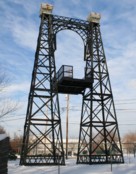
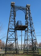
1887: Swinging
Reading, Pennsylvania, USA - Philadelphia and Reading Railroad tracks
| Bridgemeister ID: | 92 (added before 2003) |
| Year Completed: | 1887 |
| Name: | Swinging |
| Location: | Reading, Pennsylvania, USA |
| Crossing: | Philadelphia and Reading Railroad tracks |
| Coordinates: | 40.3405 N 75.923638 W |
| Maps: | Acme, GeoHack, Google, OpenStreetMap |
| Principals: | William Hildenbrand, John A. Roebling's Sons Co. |
| Use: | Footbridge |
| Status: | Dismantled, 1983 |
| Main Cables: | Wire |
| Suspended Spans: | 1 |
Notes:
- Dismantled 1983. One tower used in extant (2007) Workers Memorial Tower at Reading, PA.
- The coordinates provided are for the original location of the bridge. The memorial is located at N 40.3245 W 75.9263.
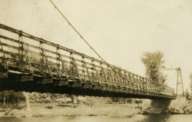
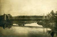
External Links:
1888: (suspension bridge)
Sheldon Springs, Vermont, USA - Missisquoi River
| Bridgemeister ID: | 94 (added before 2003) |
| Year Completed: | 1888 |
| Name: | (suspension bridge) |
| Location: | Sheldon Springs, Vermont, USA |
| Crossing: | Missisquoi River |
| Use: | Vehicular |
| Status: | Removed |
| Main Cables: | Wire |
| Suspended Spans: | 1 |
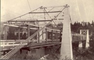
1888: Oregon City
Oregon City and West Linn, Oregon, USA - Willamette River
| Bridgemeister ID: | 295 (added before 2003) |
| Year Completed: | 1888 |
| Name: | Oregon City |
| Location: | Oregon City and West Linn, Oregon, USA |
| Crossing: | Willamette River |
| References: | AAJ |
| Use: | Vehicular |
| Status: | Dismantled, 1922 |
| Main Cables: | Wire |
| Suspended Spans: | 3 |
| Main Span: | 1 |
| Side Spans: | 2 |
Notes:
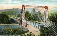
1889: (suspension bridge)
Chesterfield vicinity, New Hampshire and Brattleboro, Vermont, USA - Connecticut River
| Bridgemeister ID: | 95 (added before 2003) |
| Year Completed: | 1889 |
| Name: | (suspension bridge) |
| Location: | Chesterfield vicinity, New Hampshire and Brattleboro, Vermont, USA |
| Crossing: | Connecticut River |
| Principals: | Berlin Iron Bridge Co. |
| References: | AAJ, CCR |
| Use: | Vehicular |
| Status: | Destroyed, March 19, 1936 |
| Main Cables: | Wire |
| Suspended Spans: | 1 |
Notes:
- Destroyed by flood March 19, 1936.
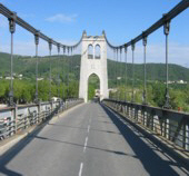
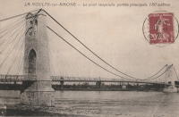
1889: La Voulte-sur-Rhône
La Voulte-sur-Rhône, Rhône, France - Rhône River
| Bridgemeister ID: | 1521 (added 2004-10-10) |
| Year Completed: | 1889 |
| Name: | La Voulte-sur-Rhône |
| Location: | La Voulte-sur-Rhône, Rhône, France |
| Crossing: | Rhône River |
| Coordinates: | 44.800217 N 4.784367 E |
| Maps: | Acme, GeoHack, Google, OpenStreetMap |
| Use: | Vehicular |
| Status: | In use (last checked: 2022) |
| Main Cables: | Wire |
| Suspended Spans: | 3 |
| Main Span: | 1 |
| Side Spans: | 2 |
Notes:
External Links:
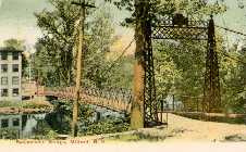
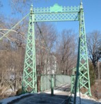
1889: Swing
Milford, New Hampshire, USA - Souhegan River
| Bridgemeister ID: | 293 (added before 2003) |
| Year Completed: | 1889 |
| Name: | Swing |
| Location: | Milford, New Hampshire, USA |
| Crossing: | Souhegan River |
| Coordinates: | 42.8366 N 71.645533 W |
| Maps: | Acme, GeoHack, Google, OpenStreetMap |
| Principals: | Berlin Iron Bridge Co. |
| Use: | Footbridge |
| Status: | In use (last checked: 2021) |
| Main Cables: | Wire (steel) |
| Suspended Spans: | 1 |
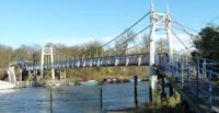
1889: Teddington
Teddington, England, United Kingdom - River Thames
| Bridgemeister ID: | 783 (added 2003-03-16) |
| Year Completed: | 1889 |
| Name: | Teddington |
| Location: | Teddington, England, United Kingdom |
| Crossing: | River Thames |
| Coordinates: | 51.42981 N 0.322517 W |
| Maps: | Acme, GeoHack, Google, OpenStreetMap |
| Use: | Footbridge |
| Status: | In use (last checked: 2015) |
| Main Cables: | Wire |
| Suspended Spans: | 2 |
| Main Span: | 1 |
| Side Span: | 1 |
External Links:

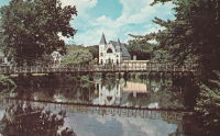
1890: Kellams
Kellams, New York and Stalker, Pennsylvania, USA - Delaware River
| Bridgemeister ID: | 7595 (added 2023-05-07) |
| Year Completed: | 1890 |
| Name: | Kellams |
| Also Known As: | Little Equinunk, Kellams-Stalker, Kellam |
| Location: | Kellams, New York and Stalker, Pennsylvania, USA |
| Crossing: | Delaware River |
| Coordinates: | 41.823641 N 75.113282 W |
| Maps: | Acme, GeoHack, Google, OpenStreetMap |
| Principals: | David Kellam |
| Use: | Vehicular |
| Status: | Replaced |
| Main Cables: | Wire |
| Main Span: | 1 |
Notes:
- Replaced by 1936 Kellams (Little Equinunk, Kellams-Stalker, Kellam) - Kellams, New York and Stalker, Pennsylvania, USA.
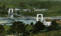
| Bridgemeister ID: | 264 (added before 2003) |
| Year Completed: | 1891 |
| Name: | (footbridge) |
| Location: | Lewiston, Maine, USA |
| At or Near Feature: | Island Garden Amusement Park |
| Use: | Footbridge |
| Status: | Dismantled, 1903 |
| Main Cables: | Wire |
| Suspended Spans: | 1 |
Notes:
- Nancy Fraser writes: "The pedestrian suspension bridge [was] located at Island Garden Amusement Park in Lewiston, Maine. It started at the water gate house that you can see and led to an island over the water falls where they had entertainment. It was in existence in Lewiston from 1891 to 1903. It was later sold to Amos Gerald of Fairfield, Maine to be used for the trolley line leading to Casco Castle and Amusement Park in South Freeport, Maine."
- Moved to (footbridge) - South Freeport, Maine, USA.

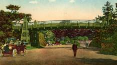
1891: (suspension bridge)
San Francisco, California, USA - South Drive
| Bridgemeister ID: | 98 (added before 2003) |
| Year Completed: | 1891 |
| Name: | (suspension bridge) |
| Location: | San Francisco, California, USA |
| Crossing: | South Drive |
| At or Near Feature: | Golden Gate Park |
| Principals: | John A. Roebling's Sons Co. |
| Use: | Footbridge |
| Status: | Removed |
| Main Cables: | Wire |
| Suspended Spans: | 1 |
Notes:
- Small footbridge. Replaced by tunnel by 1900.
1891: Lower
English Center Borough, Pennsylvania, USA - Little Pine Creek
| Bridgemeister ID: | 99 (added before 2003) |
| Year Completed: | 1891 |
| Name: | Lower |
| Location: | English Center Borough, Pennsylvania, USA |
| Crossing: | Little Pine Creek |
| Coordinates: | 41.4349 N 77.28887 W |
| Maps: | Acme, GeoHack, Google, OpenStreetMap |
| Principals: | Dean & Westbrook |
| References: | HAERPA461, HHP, SSB |
| Use: | Vehicular (one-lane) |
| Status: | In use (last checked: 2023) |
| Main Cables: | Eyebar (steel) |
| Suspended Spans: | 1 |
| Main Span: | 1 x 91.4 meters (300 feet) |
Notes:
- This bridge is an eyebar suspension and truss hybrid similar to the Florianopolis, Silver, and Saint Marys bridges.
- 2012, May: Closed for two weeks for repairs after a snapped support was discovered.
- Companion to 1891 Upper - English Center Borough, Pennsylvania, USA.
- See 1926 Hercilio Luz (Florianopolis) - Florianopolis, Santa Catarina, Brazil.
- See 1928 Point Pleasant (Silver) - Point Pleasant, West Virginia and Kanauga, Gallipolis vicinity, Ohio, USA.
- See 1928 Saint Marys (Hi Carpenter, Short Route) - Saint Marys, West Virginia and Newport, Ohio, USA.
Annotated Citations:
- Crossley, Pat. "Historic bridge on the list to be rehabbed." Williamsport Sun-Gazette, 9 Mar. 2023, https://www.sungazette.com/news/top-news/2023/03/historic-bridge-on-the-list-to-be-rehabbed/
$12 million rehabilitation project planned. "According to Maggie Baker, a spokesperson with PennDOT… 'After traffic is switched to the temporary bridge, the existing bridge will be carefully dismantled. The existing structural components of the bridge will be shipped to a fabricator to be cleaned and painted. Remedies for damaged components will be coordinated with the onsite cultural resource representative. Abutments will be carefully dismantled and reconstructed.'"
External Links:
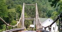
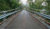
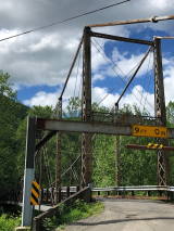
1892: Aurec-sur-Loire
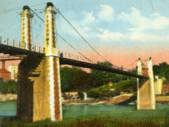
Aurec-sur-Loire, Haute-Loire, France - Loire River
| Bridgemeister ID: | 1607 (added 2005-02-06) |
| Year Completed: | 1892 |
| Name: | Aurec-sur-Loire |
| Location: | Aurec-sur-Loire, Haute-Loire, France |
| Crossing: | Loire River |
| Coordinates: | 45.369475 N 4.196837 E |
| Maps: | Acme, GeoHack, Google, OpenStreetMap |
| Use: | Vehicular (one-lane) |
| Status: | Only towers remain (last checked: 2021) |
| Main Cables: | Wire |
| Suspended Spans: | 3 |
| Main Span: | 1 |
| Side Spans: | 2 |
Notes:
- Approaches, abutments, piers, and pylons still in existence, 2018, but the original deck and cables are completely gone. A newer pedestrian suspension bridge is effectively sitting on the original bridge's piers between the original pylons.
- Later at same location (footbridge) - Aurec-sur-Loire, Haute-Loire, France.
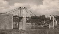
1892: Cammeray
Willoughby, New South Wales, Australia - Long Bay Gully
| Bridgemeister ID: | 421 (added before 2003) |
| Year Completed: | 1892 |
| Name: | Cammeray |
| Also Known As: | North Sydney, Northbridge |
| Location: | Willoughby, New South Wales, Australia |
| Crossing: | Long Bay Gully |
| Coordinates: | 33.816899 S 151.212336 E |
| Maps: | Acme, GeoHack, Google, OpenStreetMap |
| References: | PTS2, STC |
| Use: | Vehicular |
| Status: | Only towers remain, since 1939 (last checked: 2019) |
| Main Cables: | Wire |
| Suspended Spans: | 3 |
| Main Span: | 1 x 152.4 meters (500 feet) |
| Side Spans: | 2 x 38.1 meters (125 feet) |
Notes:
- Replaced with arch in 1939, but original towers retained. STC says replaced 1937.
External Links:
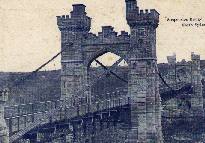
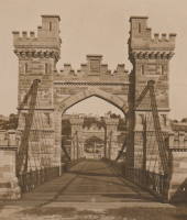
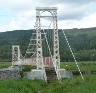
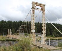
1892: Polhollick
Ballater vicinity, Aberdeenshire, Scotland, United Kingdom - River Dee
| Bridgemeister ID: | 1905 (added 2005-10-08) |
| Year Completed: | 1892 |
| Name: | Polhollick |
| Location: | Ballater vicinity, Aberdeenshire, Scotland, United Kingdom |
| Crossing: | River Dee |
| Coordinates: | 57.055048 N 3.083452 W |
| Maps: | Acme, GeoHack, Google, OpenStreetMap |
| Principals: | James Abernethy & Co. |
| References: | HARPER, HBR |
| Use: | Footbridge |
| Status: | In use (last checked: 2014) |
| Main Cables: | Wire (steel) |
| Suspended Spans: | 1 |
| Main Span: | 1 x 54.4 meters (178.5 feet) |
Notes:
- Closed May 2015 for repairs. Reopened October, 2015.
External Links:
- The Happy Pontist: Scottish Bridges: 19. Polhollick Suspension Bridge
- The Happy Pontist: Scottish Bridges: 44. Polhollick Bridge (revisited)
- Structurae - Structure ID 20021613
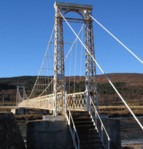
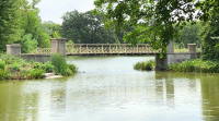
1893: Cable
Chicago, Illinois, USA - Garfield Park Lagoon
| Bridgemeister ID: | 320 (added before 2003) |
| Year Completed: | 1893 |
| Name: | Cable |
| Location: | Chicago, Illinois, USA |
| Crossing: | Garfield Park Lagoon |
| At or Near Feature: | Garfield Park |
| Coordinates: | 41.883548 N 87.714527 W |
| Maps: | Acme, GeoHack, Google, OpenStreetMap |
| References: | HBE |
| Use: | Footbridge |
| Status: | In use (last checked: 2021) |
| Main Cables: | Wire |
| Suspended Spans: | 1 |
Notes:
- 1870 and 1874 are also sometimes cited as year of completion.

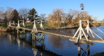
1893: Mandeville
Kaiapoi, New Zealand - Kaiapoi River
| Bridgemeister ID: | 673 (added 2003-03-08) |
| Year Completed: | 1893 |
| Name: | Mandeville |
| Also Known As: | Swing |
| Location: | Kaiapoi, New Zealand |
| Crossing: | Kaiapoi River |
| At or Near Feature: | Trousselot Park |
| Coordinates: | 43.3811 S 172.65584 E |
| Maps: | Acme, GeoHack, Google, OpenStreetMap |
| References: | GAP |
| Use: | Footbridge |
| Status: | In use (last checked: 2019) |
| Main Cables: | Wire |
| Suspended Spans: | 3 |
| Main Spans: | 3 |
Notes:
- Damaged by earthquake 2010, subsequently repaired.
- Similar to 1900 Mafeking (Revell's) - Raven Quay, New Zealand.
- Similar to Butcher's Ford (Durrell's Ford, Hassall's Ford, Butchers) - Kaiapoi, New Zealand.
External Links:
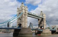
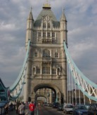
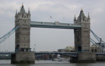
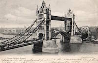
1894: Tower
London, England, United Kingdom - River Thames
| Bridgemeister ID: | 3845 (added 2020-03-07) |
| Year Completed: | 1894 |
| Name: | Tower |
| Location: | London, England, United Kingdom |
| Crossing: | River Thames |
| Coordinates: | 51.505837 N 0.075281 W |
| Maps: | Acme, GeoHack, Google, OpenStreetMap |
| References: | PTS2 |
| Use: | Vehicular |
| Status: | In use (last checked: 2023) |
| Suspended Spans: | 2 |
| Side Spans: | 2 x 82.3 meters (270 feet) |
1895: Drake
Warsaw, Missouri, USA - Osage River
| Bridgemeister ID: | 1069 (added 2003-12-27) |
| Year Completed: | 1895 |
| Name: | Drake |
| Location: | Warsaw, Missouri, USA |
| Crossing: | Osage River |
| Principals: | Dr. Daniel M. Eddy |
| References: | BOTO |
| Use: | Vehicular |
| Status: | Collapsed, 1913 |
| Main Cables: | Wire |
Notes:
- Collapsed under weight of cattle 1913.
- Replaced by 1913 Middle - Warsaw, Missouri, USA.
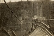
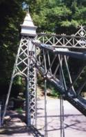
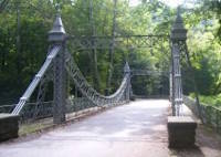
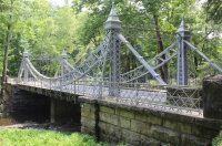
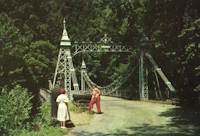
| Bridgemeister ID: | 343 (added before 2003) |
| Year Completed: | 1895 |
| Name: | Mill Creek Park |
| Also Known As: | White, Silver, Old Steel, Cinderella, Fairy Tale |
| Location: | Youngstown vicinity, Ohio, USA |
| At or Near Feature: | Mill Creek Park |
| Coordinates: | 41.07325 N 80.68886 W |
| Maps: | Acme, GeoHack, Google, OpenStreetMap |
| Principals: | Charles Evan Fowler |
| References: | AAJ, HBE, IEA, PTS2 |
| Use: | Vehicular (two-lane) |
| Status: | In use (last checked: 2021) |
| Main Cables: | Eyebar |
| Suspended Spans: | 1 |
| Main Span: | 1 x 27.4 meters (90 feet) |
| Characteristics: | Braced (trussed) chain/cable |
Notes:
- Short stiffened eyebar ("braced chain") of the style that Lindenthal often proposed. A mid-span support was added many years ago.
- Major rehabilitation started, June 2007. Reopened November, 2007.
External Links:
1897: Lincoln Highway
East Liverpool, Ohio and Chester, West Virginia, USA - Ohio River
| Bridgemeister ID: | 105 (added before 2003) |
| Year Completed: | 1897 |
| Name: | Lincoln Highway |
| Also Known As: | Chester |
| Location: | East Liverpool, Ohio and Chester, West Virginia, USA |
| Crossing: | Ohio River |
| Principals: | Hermann Laub, E.S. Fickes |
| References: | AAJ, BPL, HBE, PTS2 |
| Use: | Vehicular, with walkway |
| Status: | Removed, 1970 |
| Main Cables: | Wire (steel) |
| Suspended Spans: | 3 |
| Main Span: | 1 x 214.9 meters (705 feet) |
| Side Spans: | 1 x 109.7 meters (360 feet), 1 x 128 meters (420 feet) |
| Deck width: | 27 feet |
Notes:
- Rebuilt 1939 by David Steinman. Closed and demolished, 1970.
External Links:

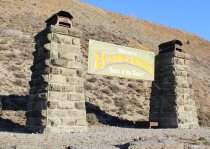
1897: Macandrew
Bannockburn, New Zealand - Kawarau River
| Bridgemeister ID: | 661 (added 2003-03-08) |
| Year Completed: | 1897 |
| Name: | Macandrew |
| Location: | Bannockburn, New Zealand |
| Crossing: | Kawarau River |
| References: | GAP |
| Use: | Vehicular (one-lane) |
| Status: | Replaced, 1964 |
| Main Cables: | Wire |
| Suspended Spans: | 1 |
Notes:
- One tower remains preserved near the former site of the bridge.
- Replaced 1874 (suspension bridge) - Bannockburn, New Zealand.
1897: Rochester
Rochester and Monaca, Pennsylvania, USA - Ohio River
| Bridgemeister ID: | 104 (added before 2003) |
| Year Completed: | 1897 |
| Name: | Rochester |
| Location: | Rochester and Monaca, Pennsylvania, USA |
| Crossing: | Ohio River |
| Principals: | Edwin Kirtland Morse |
| References: | AAJ, BPL, HBE, PTS2 |
| Use: | Vehicular, with walkway |
| Status: | Removed |
| Main Cables: | Wire (steel) |
| Suspended Spans: | 3 |
| Main Span: | 1 x 243.8 meters (800 feet) |
| Side Spans: | 1 x 121.9 meters (400 feet), 1 x 126.8 meters (416 feet) |
| Deck width: | 28 feet |
External Links:

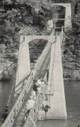
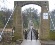
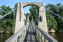
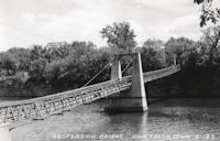
1897: Swinging
Iowa Falls, Iowa, USA - Iowa River
| Bridgemeister ID: | 106 (added before 2003) |
| Year Completed: | 1897 |
| Name: | Swinging |
| Location: | Iowa Falls, Iowa, USA |
| Crossing: | Iowa River |
| At or Near Feature: | Assembly Park |
| Coordinates: | 42.5215 N 93.2708 W |
| Maps: | Acme, GeoHack, Google, OpenStreetMap |
| Principals: | Commodore C.C. Bartlett, J.M. Eddy |
| Use: | Footbridge |
| Status: | In use (last checked: 2006) |
| Main Cables: | Wire |
| Suspended Spans: | 2 |
| Main Span: | 1 x 39 meters (128 feet) estimated |
| Side Span: | 1 x 20.7 meters (68 feet) estimated |
Notes:
- According to plaque at bridge, rebuilt 1909, 1925, 1956, 1989.
1898: (footbridge)
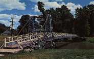
Pontiac, Illinois, USA - Vermilion River
| Bridgemeister ID: | 312 (added before 2003) |
| Year Completed: | 1898 |
| Name: | (footbridge) |
| Location: | Pontiac, Illinois, USA |
| Crossing: | Vermilion River |
| At or Near Feature: | Chautauqua Park |
| Coordinates: | 40.87696 N 88.62358 W |
| Maps: | Acme, GeoHack, Google, OpenStreetMap |
| Principals: | Joliet Bridge and Iron Co. |
| Use: | Footbridge |
| Status: | In use (last checked: 2005) |
| Main Cables: | Wire |
| Suspended Spans: | 2 |
| Main Span: | 1 |
| Side Span: | 1 |
Notes:
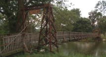
1898: Langenargen
Langenargen and Gohren, Kressbronn am Bodensee, Baden-Württemberg, Germany - Argen River
| Bridgemeister ID: | 929 (added 2003-10-24) |
| Year Completed: | 1898 |
| Name: | Langenargen |
| Location: | Langenargen and Gohren, Kressbronn am Bodensee, Baden-Württemberg, Germany |
| Crossing: | Argen River |
| Coordinates: | 47.59622 N 9.56208 E |
| Maps: | Acme, GeoHack, Google, OpenStreetMap |
| Principals: | Kubler, Leibbrand |
| References: | AAJ, HBE, PTS2 |
| Use: | Vehicular, with walkway |
| Status: | Restricted to foot traffic (last checked: 2022) |
| Main Cables: | Wire |
| Suspended Spans: | 1 |
| Main Span: | 1 x 71.9 meters (236 feet) |
Notes:
- Othmar Ammann worked as an intern on this bridge.
External Links:
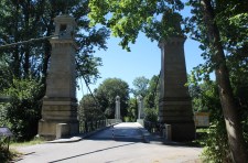
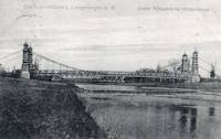
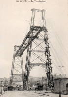
1898: Rouen Transporter
Rouen, Seine-Maritime, France
| Bridgemeister ID: | 953 (added 2003-10-31) |
| Year Completed: | 1898 |
| Name: | Rouen Transporter |
| Location: | Rouen, Seine-Maritime, France |
| Principals: | Ferdinand Arnodin |
| Use: | Transporter |
| Status: | Destroyed, 1940 |
| Suspended Spans: | 1 |
External Links:
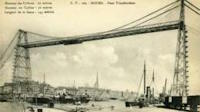
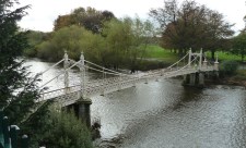
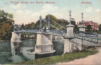
1898: Victoria
Hereford, England, United Kingdom - River Wye
| Bridgemeister ID: | 424 (added before 2003) |
| Year Completed: | 1898 |
| Name: | Victoria |
| Location: | Hereford, England, United Kingdom |
| Crossing: | River Wye |
| Coordinates: | 52.051075 N 2.712197 W |
| Maps: | Acme, GeoHack, Google, OpenStreetMap |
| Principals: | Alexander Findlay and Co. |
| References: | NTB |
| Use: | Footbridge |
| Status: | In use (last checked: 2018) |
| Main Cables: | Eyebar |
| Suspended Spans: | 3 |
| Main Span: | 1 x 24.4 meters (80 feet) |
| Side Spans: | 2 |

1899: Lewiston-Queenston
Lewiston, New York, USA and Queenston, Ontario, Canada - Niagara River
| Bridgemeister ID: | 108 (added before 2003) |
| Year Completed: | 1899 |
| Name: | Lewiston-Queenston |
| Location: | Lewiston, New York, USA and Queenston, Ontario, Canada |
| Crossing: | Niagara River |
| Principals: | L.L. Buck, R.S. Buck |
| References: | AAJ, BPL, HBE, PTS2 |
| Use: | Vehicular and Rail (streetcar) |
| Status: | Replaced, 1962 |
| Main Cables: | Wire (steel) |
| Suspended Spans: | 1 |
| Main Span: | 1 x 317 meters (1,040 feet) |
| Deck width: | 17 feet |
Notes:
- Reused parts from the recently dismantled Second Falls View Bridge.
- At former location of 1851 Lewiston-Queenston - Lewiston, New York, USA and Queenston, Ontario, Canada.
- See 1889 Second Falls View - Niagara Falls, New York, USA and Niagara Falls, Ontario, Canada.
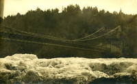
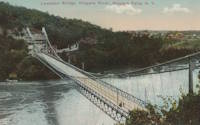
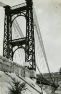
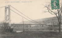
1899: Port-Sainte-Marie
Port-Sainte-Marie and Saint-Laurent, Lot-et-Garonne, France - Garonne River
| Bridgemeister ID: | 1781 (added 2005-04-23) |
| Year Completed: | 1899 |
| Name: | Port-Sainte-Marie |
| Location: | Port-Sainte-Marie and Saint-Laurent, Lot-et-Garonne, France |
| Crossing: | Garonne River |
| Use: | Vehicular |
| Status: | Removed |
| Main Cables: | Wire |
| Suspended Spans: | 1 |
| Main Span: | 1 x 180 meters (590.6 feet) |
Notes:
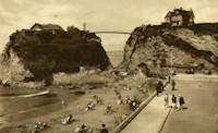
1900: Newquay
Newquay, Cornwall, England, United Kingdom
| Bridgemeister ID: | 800 (added 2003-03-29) |
| Year Completed: | 1900 |
| Name: | Newquay |
| Location: | Newquay, Cornwall, England, United Kingdom |
| Coordinates: | 50.415743 N 5.082486 W |
| Maps: | Acme, GeoHack, Google, OpenStreetMap |
| Principals: | Louis Harper |
| References: | HARPER |
| Use: | Footbridge |
| Status: | In use (last checked: 2019) |
| Main Cables: | Wire |
| Suspended Spans: | 1 |
| Main Span: | 1 x 30.5 meters (100 feet) estimated |
| Deck width: | 4 feet |
Notes:
- Douglas Harper notes: "The pylons have been swathed in concrete, presumably for protection against the elements."
External Links:
1900: Upper
Easton, Pennsylvania, USA - Lehigh River
| Bridgemeister ID: | 366 (added before 2003) |
| Year Completed: | 1900 |
| Name: | Upper |
| Location: | Easton, Pennsylvania, USA |
| Crossing: | Lehigh River |
| Principals: | Henry G. Tyrell, John McNeal |
| References: | AAJ, DSL20030414, EN19001122, HBE, PTS2, WGE20030513 |
| Use: | Footbridge |
| Status: | Demolished, 1955 |
| Main Cables: | Wire (steel) |
| Suspended Spans: | 3 |
| Main Spans: | 2 x 85 meters (279 feet) |
| Side Span: | 1 x 33.5 meters (110 feet) |
Notes:
- According to Tyrell, "[It] joins Dock Street on the lower side of the river with Glendon Avenue on the upper side, 90 feet above it. To overcome this difference in elevation of the two ends without incurring excessive expense for approach, the bridge floor was made to descend on a grade of 7.2 per cent from the upper bank to meet stairs rising from Dock Street..."
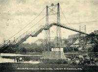
1901: Skippers
Maori Point vicinity, New Zealand - Upper Shotover River
| Bridgemeister ID: | 679 (added 2003-03-08) |
| Year Completed: | 1901 |
| Name: | Skippers |
| Location: | Maori Point vicinity, New Zealand |
| Crossing: | Upper Shotover River |
| At or Near Feature: | Skippers Canyon |
| Coordinates: | 44.844355 S 168.686769 E |
| Maps: | Acme, GeoHack, Google, OpenStreetMap |
| Principals: | John Black, A.J. Fraser Co. |
| References: | GAP |
| Use: | Vehicular (one-lane) |
| Status: | In use (last checked: 2017) |
| Main Cables: | Wire (steel) |
| Suspended Spans: | 1 |
| Main Span: | 1 x 96.3 meters (315.9 feet) |
Notes:
- Replaced 1868 Skippers Canyon - Maori Point vicinity, New Zealand at a nearby location.
External Links:
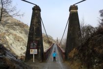
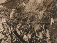
1902: (suspension bridge)
Chichibu, Saitama, Japan - Arakawa River
| Bridgemeister ID: | 5051 (added 2020-08-28) |
| Year Completed: | 1902 |
| Name: | (suspension bridge) |
| Location: | Chichibu, Saitama, Japan |
| Crossing: | Arakawa River |
| Coordinates: | 35.961412 N 138.975878 E |
| Maps: | Acme, GeoHack, Google, OpenStreetMap |
| Status: | Dismantled, 1980 |
| Main Cables: | Wire (steel) |
| Suspended Spans: | 1 |
Notes:
- Another suspension bridge was built on its piers (c. 2020) as part of the Gravity Park attraction.
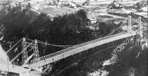
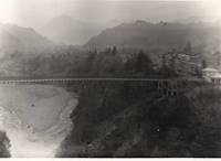
1902: Alexandra
Tain, Ross-Shire, Scotland, United Kingdom - River Tain
| Bridgemeister ID: | 2350 (added 2007-08-18) |
| Year Completed: | 1902 |
| Name: | Alexandra |
| Location: | Tain, Ross-Shire, Scotland, United Kingdom |
| Crossing: | River Tain |
| Coordinates: | 57.81496 N 4.04622 W |
| Maps: | Acme, GeoHack, Google, OpenStreetMap |
| Principals: | Rose Street Foundry (Inverness) |
| Use: | Footbridge |
| Status: | In use (last checked: 2018) |
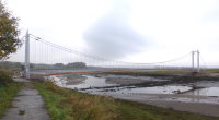
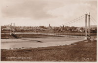
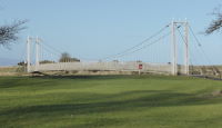
| Main Cables: | Wire (steel) |
| Suspended Spans: | 1 |
| Main Span: | 1 x 43 meters (141 feet) |
Notes:
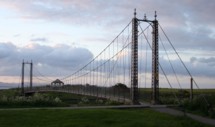
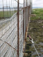
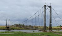
- Closed, 2011. Sign posted at the bridge in 2011 stated "No pedestrians beyond this point. Footbridge Closed. Imminent Danger of Collapse."
- Most news stories on the bridge's condition state it was closed continuously, due to deteriorating conditions, from 2011 through 2015, but this was not entirely accurate. The bridge was open in August 2014, but restricted to two people at a time (see accompanying photo sets). Closed again, sometime soon after. Contract awarded for refurbishment, April 2015.
1902: Bonny-sur-Loire
Bonny-sur-Loire and Beaulieu-sur-Loire, Loiret, France - Loire River
| Bridgemeister ID: | 1178 (added 2004-01-24) |
| Year Completed: | 1902 |
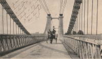
| Name: | Bonny-sur-Loire |
| Location: | Bonny-sur-Loire and Beaulieu-sur-Loire, Loiret, France |
| Crossing: | Loire River |
| Use: | Vehicular |
| Status: | Replaced |
| Main Cables: | Wire |
| Suspended Spans: | 3 |
| Main Spans: | 3 |
Notes:
External Links:

1902: Gobbins
Whitehead vicinity, Northern Ireland, United Kingdom
| Bridgemeister ID: | 1357 (added 2004-05-15) |
| Year Completed: | 1902 |
| Name: | Gobbins |
| Location: | Whitehead vicinity, Northern Ireland, United Kingdom |
| At or Near Feature: | Gobbins Cliff Path |
| Coordinates: | 54.808223 N 5.691737 W |
| Maps: | Acme, GeoHack, Google, OpenStreetMap |
| Use: | Footbridge |
| Status: | Replaced, 2015 |
| Main Cables: | Wire |
| Suspended Spans: | 1 |
Notes:
- 2014-2015: Gobbins Cliff Path restored to its original condition, including replacement of the suspension bridge.
- Replaced by 2015 Gobbins - Whitehead vicinity, Northern Ireland, United Kingdom.

1902: Wanakena
Wanakena, New York, USA - Oswegatchie River
| Bridgemeister ID: | 109 (added before 2003) |
| Year Completed: | 1902 |
| Name: | Wanakena |
| Location: | Wanakena, New York, USA |
| Crossing: | Oswegatchie River |
| Coordinates: | 44.133217 N 74.921317 W |
| Maps: | Acme, GeoHack, Google, OpenStreetMap |
| Principals: | Rich Lumber Co. |
| Use: | Footbridge |
| Status: | Removed, 2014 |
| Main Cables: | Wire |
| Suspended Spans: | 1 |
| Main Span: | 1 x 52.1 meters (171 feet) |
Notes:
- Heavily damaged by ice jam, January 2014. Later dismantled.
- Near (footbridge) - Fine, Wanakena vicinity, New York, USA.
- Replaced by 2017 Wanakena - Wanakena, New York, USA.
External Links:
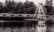
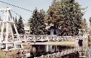
1903: Pickhill
Pickhill, Wales, United Kingdom - River Dee
| Bridgemeister ID: | 4562 (added 2020-06-01) |
| Year Completed: | 1903 |
| Name: | Pickhill |
| Also Known As: | Pickhill Meadows |
| Location: | Pickhill, Wales, United Kingdom |
| Crossing: | River Dee |
| Coordinates: | 53.017265 N 2.884666 W |
| Maps: | Acme, GeoHack, Google, OpenStreetMap |
| Principals: | David Rowell & Co. |
| Use: | Vehicular (one-lane) |
| Status: | Restricted to foot traffic (last checked: 2020) |
| Main Cables: | Wire (steel) |
| Suspended Spans: | 1 |
| Main Span: | 1 x 41 meters (134.5 feet) |
| Deck width: | 3 meters |
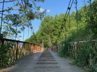
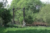
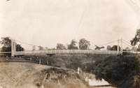
1903: Sands
Swalwell, England, United Kingdom - River Derwent
| Bridgemeister ID: | 1251 (added 2004-02-21) |
| Year Completed: | 1903 |
| Name: | Sands |
| Also Known As: | Hikey |
| Location: | Swalwell, England, United Kingdom |
| Crossing: | River Derwent |
| Coordinates: | 54.956267 N 1.6877 W |
| Maps: | Acme, GeoHack, Google, OpenStreetMap |
| Principals: | David Rowell & Co. |
| Use: | Footbridge |
| Status: | In use (last checked: 2007) |
| Main Cables: | Wire |
| Suspended Spans: | 1 |


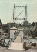
1903: Ticonic
Waterville, Maine, USA - Kennebec River
| Bridgemeister ID: | 110 (added before 2003) |
| Year Completed: | 1903 |
| Name: | Ticonic |
| Also Known As: | Tupenny, Two Cent |
| Location: | Waterville, Maine, USA |
| Crossing: | Kennebec River |
| Coordinates: | 44.55073 N 69.62728 W |
| Maps: | Acme, GeoHack, Google, OpenStreetMap |
| Principals: | Edwin D. Graves |
| References: | AAJ, HBE, PTS2 |
| Use: | Footbridge |
| Status: | In use (last checked: 2009) |
| Main Cables: | Wire |
| Suspended Spans: | 1 |
| Main Span: | 1 x 121.9 meters (400 feet) |
| Deck width: | 6 feet |
External Links:
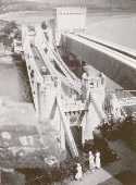
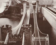
1904: (footbridge)
Conwy, Wales, United Kingdom - River Conwy
| Bridgemeister ID: | 512 (added before 2003) |
| Year Completed: | 1904 |
| Name: | (footbridge) |
| Location: | Conwy, Wales, United Kingdom |
| Crossing: | River Conwy |
| Coordinates: | 53.280346 N 3.823733 W |
| Maps: | Acme, GeoHack, Google, OpenStreetMap |
| Principals: | Alfred Thorne |
| Use: | Footbridge |
| Status: | Removed |
| Main Cables: | Wire (steel) |
| Suspended Spans: | 1 |
Notes:
- This entry refers to the steel suspension footbridge nestled between Telford's suspension bridge and Stephenson's rail bridge. Click the photo to get a better view of this bridge. According to Susan Ellis, Senior Archivist of the Conwy County Borough Council, the bridge was built on the recommendation of John J. Webster who was hired to inspect Telford's suspension bridge in 1902 "following fears about the safety of its condition. He reported back making various recommendation for strengthening the bridge, including that a separate footbridge be constructed."
- This footbridge was in existence until at least 1957.
- Next to 1826 Conwy (Conway) - Conwy, Wales, United Kingdom.
Annotated Citations:
- "Conway Suspension Bridge." The Engineer, 20 May 1904.
This detailed account of the 1904 reinforcement of Telford's adjacent bridge does not mention the existence of, or building of, an additional footbridge. It does describe adding a cantilevered walkway to one side of Telford's bridge. This walkway was, indeed, built, and can be seen in the linked image on the left side of the older bridge. Thus, it is not entirely clear whether this bridge was actually constructed in 1904 and the work of Alfred Thorne (who was very much associated with the Telford bridge reinforcement project)
1904: Alexandra
Launceston, Tasmania, Australia - South Esk River
| Bridgemeister ID: | 428 (added before 2003) |
| Year Completed: | 1904 |
| Name: | Alexandra |
| Also Known As: | Basin |
| Location: | Launceston, Tasmania, Australia |
| Crossing: | South Esk River |
| At or Near Feature: | First Basin Water, Cataract Gorge Reserve |
| Principals: | C. St John David, Salisbury's Foundry Co. |
| References: | STC |
| Use: | Footbridge |
| Status: | Destroyed, 1929 |
| Main Cables: | Wire |
| Suspended Spans: | 3 |
| Main Span: | 1 x 45.7 meters (149.9 feet) |
| Side Spans: | 2 x 10.7 meters (35.1 feet) |
Notes:
- Washed away by flood, 1929.
- Near 1895 Duck Reach - Launceston, Tasmania, Australia.
- Replaced by 1930 Alexandra (Basin) - Launceston, Tasmania, Australia of similar construction.
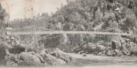
1904: Alum Chine
Bournemouth, England, United Kingdom - Alum Chine
| Bridgemeister ID: | 785 (added 2003-03-16) |
| Year Completed: | 1904 |
| Name: | Alum Chine |
| Location: | Bournemouth, England, United Kingdom |
| Crossing: | Alum Chine |
| Coordinates: | 50.7143 N 1.90058 W |
| Maps: | Acme, GeoHack, Google, OpenStreetMap |
| Principals: | David Rowell & Co. |
| Use: | Footbridge |
| Status: | In use (last checked: 2020) |
| Main Cables: | Wire |
| Suspended Spans: | 1 |
Notes:
- Renovated, 1973. Refurbished, 2004.
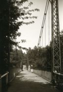
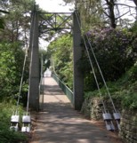
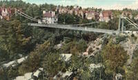
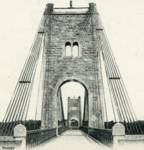
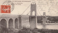
1904: Bonhomme
Kervignac, Morbihan, France - Blavet River
| Bridgemeister ID: | 1115 (added 2004-01-05) |
| Year Completed: | 1904 |
| Name: | Bonhomme |
| Location: | Kervignac, Morbihan, France |
| Crossing: | Blavet River |
| Coordinates: | 47.764878 N 3.302251 W |
| Maps: | Acme, GeoHack, Google, OpenStreetMap |
| Principals: | Ferdinand Arnodin |
| References: | AAJ, BPF, PTS2 |
| Use: | Vehicular |
| Status: | Only towers remain, since 1980 (last checked: 2019) |
| Main Cables: | Wire |
| Suspended Spans: | 3 |
| Main Span: | 1 x 163.1 meters (535 feet) |
| Side Spans: | 2 x 36.9 meters (121 feet) |
Notes:
- Deck and cables removed, 1980.
External Links:
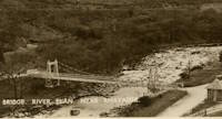
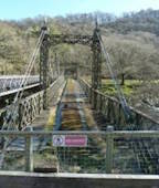
1904: Elan Village
Elan, Rhayader, Wales, United Kingdom - River Elan
| Bridgemeister ID: | 1255 (added 2004-02-28) |
| Year Completed: | 1904 |
| Name: | Elan Village |
| Location: | Elan, Rhayader, Wales, United Kingdom |
| Crossing: | River Elan |
| Coordinates: | 52.27099 N 3.56900 W |
| Maps: | Acme, GeoHack, Google, OpenStreetMap |
| Principals: | Birmingham Water Corporation |
| Status: | Closed, 1988 (last checked: 2013) |
| Suspended Spans: | 1 |
Notes:
- Rebuilt twice.
External Links:
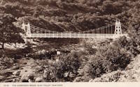
1904: Jons-Niévroz
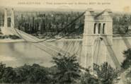
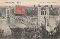
Jons, Rhône and Niévroz, Ain, France - Rhône River
| Bridgemeister ID: | 2033 (added 2006-04-23) |
| Year Completed: | 1904 |
| Name: | Jons-Niévroz |
| Location: | Jons, Rhône and Niévroz, Ain, France |
| Crossing: | Rhône River |
| References: | AAJ |
| Use: | Vehicular |
| Status: | Destroyed, 1940 |
| Suspended Spans: | 1 |
| Main Span: | 1 x 200 meters (656.2 feet) |
Notes:
- Destroyed, 1940, during WWII.
- Similar to 1912 Groslée - Groslée, Ain and Brangues, Isère, France.
1904: Lordville-Equinunk
Lordville, New York and Equinunk, Pennsylvania, USA - Delaware River
| Bridgemeister ID: | 112 (added before 2003) |
| Year Completed: | 1904 |
| Name: | Lordville-Equinunk |
| Location: | Lordville, New York and Equinunk, Pennsylvania, USA |
| Crossing: | Delaware River |
| Coordinates: | 41.867745 N 75.213789 W |
| Maps: | Acme, GeoHack, Google, OpenStreetMap |
| Principals: | Owego Bridge Company |
| References: | BDR, BOL, BPL, HHP |
| Use: | Vehicular (one-lane) |
| Status: | Demolished, 1986 |
| Main Cables: | Eyebar (steel) |
| Suspended Spans: | 2 |
| Main Span: | 1 x 105.8 meters (347 feet) |
| Side Span: | 1 x 17.1 meters (56 feet) |
Notes:
- Eyebar suspension bridge.
- Replaced 1869 Lordville - Lordville, New York and Equinunk, Pennsylvania, USA.
External Links:
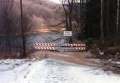
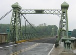
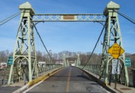
1904: Riegelsville
Riegelsville, Pennsylvania and Riegelsville, New Jersey, USA - Delaware River
| Bridgemeister ID: | 113 (added before 2003) |
| Year Completed: | 1904 |
| Name: | Riegelsville |
| Location: | Riegelsville, Pennsylvania and Riegelsville, New Jersey, USA |
| Crossing: | Delaware River |
| Coordinates: | 40.59427 N 75.19062 W |
| Maps: | Acme, GeoHack, Google, OpenStreetMap |
| Principals: | John A. Roebling's Sons Co., S. A. Cooney |
| References: | BDR, BPL, SSS |
| Use: | Vehicular (two-lane, heavy vehicles), with walkway |
| Status: | In use (last checked: 2007) |
| Main Cables: | Wire (steel) |
| Suspended Spans: | 3 |
| Main Spans: | 3 |
External Links:
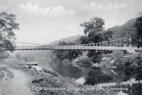
1905: Apley
Apley Park, England, United Kingdom - River Severn
| Bridgemeister ID: | 769 (added 2003-03-13) |
| Year Completed: | 1905 |
| Name: | Apley |
| Also Known As: | Linley |
| Location: | Apley Park, England, United Kingdom |
| Crossing: | River Severn |
| Coordinates: | 52.581949 N 2.434328 W |
| Maps: | Acme, GeoHack, Google, OpenStreetMap |
| Principals: | David Rowell & Co. |
| Use: | Vehicular (one-lane) |
| Status: | In use (last checked: 2011) |
| Main Cables: | Wire (steel) |
| Main Span: | 1 |
Notes:
- Capable of carrying light vehicular traffic.
External Links:

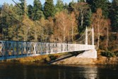
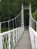
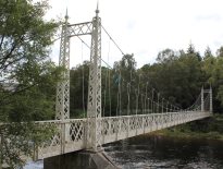
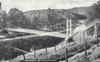
1905: Cambus O'May
Ballater, Scotland, United Kingdom - River Dee
| Bridgemeister ID: | 429 (added before 2003) |
| Year Completed: | 1905 |
| Name: | Cambus O'May |
| Also Known As: | Gordon |
| Location: | Ballater, Scotland, United Kingdom |
| Crossing: | River Dee |
| Coordinates: | 57.065803 N 2.956825 W |
| Maps: | Acme, GeoHack, Google, OpenStreetMap |
| Principals: | James Abernethy & Co. |
| References: | BC2, BC3, BEM, HARPER, HBR, NTB |
| Use: | Footbridge |
| Status: | In use (last checked: April, 2021) |
| Main Cables: | Wire (steel) |
| Suspended Spans: | 1 |
| Main Span: | 1 x 51.8 meters (170 feet) |
Notes:
- 1988: Refurbished (HBR)
- 2015, December: Damaged by the River Dee flood caused by Storm Frank. Closed indefinitely. Repairs expected to start in 2020.
- 2020, August 31: Repairs underway, expected to be completed in approximately 16 weeks.
- 2020, December: Storm Frank repairs now expected to be completed in January 2021.
- 2021, January: Completion of repairs delayed due to COVID-19 pandemic "stay at home" recommendations.
- 2021, April 1: Repairs completed, bridge reopened.
External Links:
- Cambus O' May | Harper Bridges
- The Happy Pontist: Scottish Bridges: 20. Cambus O'May Footbridge
- The Happy Pontist: Scottish Bridges: 43. Cambus O' May Bridge (revisited)
- The Happy Pontist: Scottish Bridges: 55. Cambus O'May Bridge (after the flood)
- Structurae - Structure ID 20019638

1905: Newell
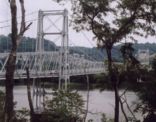
East Liverpool, Ohio and Newell, West Virginia, USA - Ohio River
| Bridgemeister ID: | 117 (added before 2003) |
| Year Completed: | 1905 |
| Name: | Newell |
| Location: | East Liverpool, Ohio and Newell, West Virginia, USA |
| Crossing: | Ohio River |
| Coordinates: | 40.62167 N 80.595 W |
| Maps: | Acme, GeoHack, Google, OpenStreetMap |
| Principals: | Edwin Kirtland Morse, Dravo Company |
| References: | AAJ, BPL, PTS2 |
| Use: | Vehicular (two-lane), with walkway |
| Status: | In use (last checked: 2022) |
| Main Cables: | Wire (steel) |
| Suspended Spans: | 3 |
| Main Span: | 1 x 228.6 meters (750 feet) |
| Side Spans: | 2 |
Annotated Citations:
- Huba, Stephen. "There’s a new owner for the Newell Bridge." The Weirton Daily Times, 6 May 2022, www.weirtondailytimes.com/news/local-news/2022/05/theres-a-new-owner-for-the-newell-bridge/.
"Frank Six of Six Enterprises in Newell, assumed ownership Wednesday of one of the oldest suspension bridges on the Ohio River for an undisclosed sum from HLC Holdings Inc., parent company of the Fiesta Tableware Co., formerly known as the Homer Laughlin China Co."
- Bobby-Gilbert, Jo-Ann., "Fiesta Tableware Parent Sells Iconic Newell Bridge." The Business Journal, 5 May 2022, businessjournaldaily.com/fiesta-tableware-parent-sells-iconic-newell-bridge/.
"After 116 years of ownership by HLC Holdings Inc., parent company of The Fiesta Tableware Co., the Newell Bridge and Railway Co. changed hands at midnight Wednesday. Officials of Fiesta Tableware, formerly known as Homer Laughlin China Co., announced that the bridge has been purchased by Frank Six, owner of Six Enterprises in Newell."
External Links:

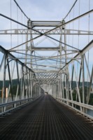
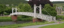
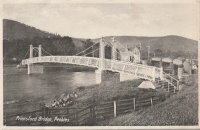
1905: Priorsford
Peebles, Scotland, United Kingdom - River Tweed
| Bridgemeister ID: | 1441 (added 2004-07-31) |
| Year Completed: | 1905 |
| Name: | Priorsford |
| Location: | Peebles, Scotland, United Kingdom |
| Crossing: | River Tweed |
| Coordinates: | 55.649532 N 3.187578 W |
| Maps: | Acme, GeoHack, Google, OpenStreetMap |
| Principals: | Robert Inglis |
| References: | BC3 |
| Use: | Footbridge |
| Status: | In use (last checked: 2014) |
| Main Cables: | Wire (steel) |
| Main Span: | 1 x 29.6 meters (97 feet) |
External Links:

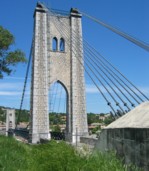
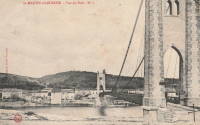
1905: Saint-Martin
Saint-Martin-d'Ardèche, Ardèche and Aiguèze, Gard, France - Ardèche River
| Bridgemeister ID: | 1523 (added 2004-10-10) |
| Year Completed: | 1905 |
| Name: | Saint-Martin |
| Location: | Saint-Martin-d'Ardèche, Ardèche and Aiguèze, Gard, France |
| Crossing: | Ardèche River |
| Coordinates: | 44.3007 N 4.567283 E |
| Maps: | Acme, GeoHack, Google, OpenStreetMap |
| Use: | Vehicular (one-lane) |
| Status: | In use (last checked: 2005) |
| Main Cables: | Wire |
| Suspended Spans: | 1 |
External Links:
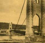
1905: Tuscumbia
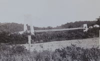
Tuscumbia, Missouri, USA - Osage River
| Bridgemeister ID: | 1977 (added 2005-11-27) |
| Year Completed: | 1905 |
| Name: | Tuscumbia |
| Location: | Tuscumbia, Missouri, USA |
| Crossing: | Osage River |
| Coordinates: | 38.23526 N 92.44763 W |
| Maps: | Acme, GeoHack, Google, OpenStreetMap |
| Principals: | Joseph Dice |
| References: | BOTO |
| Use: | Vehicular (one-lane) |
| Status: | Replaced, 1933 |
| Main Cables: | Wire |
| Main Span: | 1 |
| Side Spans: | 2 |
Notes:
- Some remains still visible at site, 2007.
- Near (suspension bridge) - Tuscumbia vicinity, Missouri, USA.
External Links:
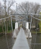
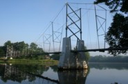
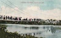
1906: Swinging
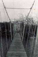
Charles City, Iowa, USA - Cedar River
| Bridgemeister ID: | 118 (added before 2003) |
| Year Completed: | 1906 |
| Name: | Swinging |
| Also Known As: | Charles City, Clark Street |
| Location: | Charles City, Iowa, USA |
| Crossing: | Cedar River |
| Coordinates: | 43.070433 N 92.685517 W |
| Maps: | Acme, GeoHack, Google, OpenStreetMap |
| Principals: | Charles Hart, O.B. Zimmerman |
| Use: | Footbridge |
| Status: | Destroyed (last checked: 2008) |
| Main Cables: | Wire |
| Suspended Spans: | 3 |
| Main Span: | 1 x 90.8 meters (298 feet) estimated |
| Side Spans: | 1 x 41.5 meters (136 feet) estimated, 1 x 9.1 meters (30 feet) estimated |
Notes:
- Bids accepted for refurbishment, expected to be completed October, 2007.
- Destroyed by floodwaters June 8, 2008.
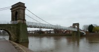
1906: Wilford
West Bridgford, Nottingham, England, United Kingdom - River Trent
| Bridgemeister ID: | 1087 (added 2004-01-01) |
| Year Completed: | 1906 |
| Name: | Wilford |
| Also Known As: | Nottingham, Meadows, Welbeck |
| Location: | West Bridgford, Nottingham, England, United Kingdom |
| Crossing: | River Trent |
| Coordinates: | 52.933167 N 1.137967 W |
| Maps: | Acme, GeoHack, Google, OpenStreetMap |
| Use: | Pipeline and Footbridge |
| Status: | In use (last checked: 2017) |
| Main Cables: | Wire |
| Suspended Spans: | 1 |
| Main Span: | 1 x 68.6 meters (225 feet) |
| Deck width: | 12 feet |
Notes:
- Designed primarily to carry water and gas mains, but also carries a wide footpath.
- Closed, July 2008, after reports of falling debris. In December 2008, Severn Trent Water announced plans to refurbish the bridge in 2009. Bridge was reopened February 12, 2010.
External Links:

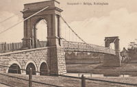
1907: Swinging
Kansas City, Missouri, USA - Blue River
| Bridgemeister ID: | 120 (added before 2003) |
| Year Completed: | 1907 |
| Name: | Swinging |
| Location: | Kansas City, Missouri, USA |
| Crossing: | Blue River |
| At or Near Feature: | Swope Park, Kansas City Zoo |
| Coordinates: | 39.00165 N 94.5244 W |
| Maps: | Acme, GeoHack, Google, OpenStreetMap |
| Principals: | Midland Bridge Co. |
| Use: | Footbridge |
| Status: | In use (last checked: 2020) |
| Main Cables: | Wire (steel) |
| Suspended Spans: | 1 |
| Main Span: | 1 x 69.2 meters (227 feet) |
| Deck width: | 8 feet |
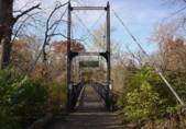
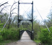
1908: (suspension bridge)
Aztec, New Mexico, USA - Las Animas River
| Bridgemeister ID: | 2505 (added 2009-03-07) |
| Year Completed: | 1908 |
| Name: | (suspension bridge) |
| Location: | Aztec, New Mexico, USA |
| Crossing: | Las Animas River |
| Principals: | Thurston and Co. |
| Use: | Vehicular (one-lane) |
| Status: | Removed |
| Main Cables: | Wire |
| Suspended Spans: | 1 |
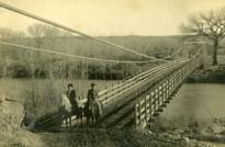
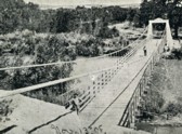
1908: Belisario Domínguez
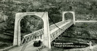
Tuxtla Gutiérrez, Chiapas, Mexico - Rio Grijalva
| Bridgemeister ID: | 3219 (added 2019-11-11) |
| Year Completed: | 1908 |
| Name: | Belisario Domínguez |
| Also Known As: | Porfirio Díaz |
| Location: | Tuxtla Gutiérrez, Chiapas, Mexico |
| Crossing: | Rio Grijalva |
| Coordinates: | 16.742344 N 93.034593 W |
| Maps: | Acme, GeoHack, Google, OpenStreetMap |
| Use: | Vehicular (two-lane) |
| Status: | Only towers remain (last checked: 2021) |
| Main Cables: | Wire (steel) |
| Suspended Spans: | 1 |
Notes:
- 1955: Failed due to a truck colliding with part of the bridge. Adjacent replacement was already under construction.
- 2021: Towers are still present and one set of suspension cables is carrying a small pipeline. Unclear how long the bridge has been in this state.
External Links:
- Puente Belisario Domínguez en Chiapa de Corzo, que atravesaba el Río Grijalva alrededor de 1955. - Facebook
- Puente Belisario Domínguez, Chiapas, México - YouTube
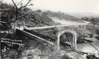
1908: Tyngs Island
Lowell vicinity, Massachusetts, USA - Merrimack River
| Bridgemeister ID: | 844 (added 2003-06-28) |
| Year Completed: | 1908 |
| Name: | Tyngs Island |
| Location: | Lowell vicinity, Massachusetts, USA |
| Crossing: | Merrimack River |
| At or Near Feature: | Vesper Country Club |
| Coordinates: | 42.65574 N 71.39971 W |
| Maps: | Acme, GeoHack, Google, OpenStreetMap |
| Principals: | Westinghouse, Church, Kerr, and Co., J.R. Worcester |
| References: | AAJ, HBE |
| Use: | Footbridge |
| Status: | Destroyed, 1936 |
| Main Cables: | Wire (steel) |
| Suspended Spans: | 1 |
| Main Span: | 1 x 167.6 meters (550 feet) |
| Deck width: | 4.5 feet |
Notes:
- Destroyed by flood, 1936.
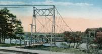
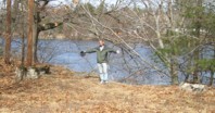
1908: Wardown Park
Luton, Bedfordshire, England, United Kingdom - River Lea
| Bridgemeister ID: | 784 (added 2003-03-16) |
| Year Completed: | 1908 |
| Name: | Wardown Park |
| Location: | Luton, Bedfordshire, England, United Kingdom |
| Crossing: | River Lea |
| At or Near Feature: | Wardown Park |
| Coordinates: | 51.89201 N 0.418833 W |
| Maps: | Acme, GeoHack, Google, OpenStreetMap |
| Use: | Footbridge |
| Status: | In use (last checked: 2015) |
| Main Cables: | Wire |
| Suspended Spans: | 1 |
Notes:
- 2015: Refurbished and reopened after having been closed for several years.
External Links:

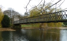
1909: Chain
Newburyport, Massachusetts, USA - Merrimack River
| Bridgemeister ID: | 122 (added before 2003) |
| Year Completed: | 1909 |
| Name: | Chain |
| Location: | Newburyport, Massachusetts, USA |
| Crossing: | Merrimack River |
| Coordinates: | 42.833459 N 70.906674 W |
| Maps: | Acme, GeoHack, Google, OpenStreetMap |
| Principals: | George F. Swain, Robert R. Evans |
| References: | PTS2 |
| Use: | Vehicular (two-lane), with walkway |
| Status: | In use (last checked: 2006) |
| Main Cables: | Wire (steel) |
| Suspended Spans: | 1 |
| Main Span: | 1 x 80.8 meters (265 feet) |
| Deck width: | 35.8 feet |
Notes:
- Deck replaced 1922, 1931, 1938, and 2002.
- Replaced 1810 Chain (Essex-Merrimack) - Newburyport, Massachusetts, USA.
External Links:
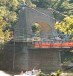
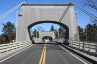
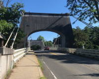
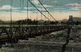
1909: Empire
Empire, Panama Canal Zone - Panama Canal
| Bridgemeister ID: | 525 (added before 2003) |
| Year Completed: | 1909 |
| Name: | Empire |
| Location: | Empire, Panama Canal Zone |
| Crossing: | Panama Canal |
| References: | PTS2 |
| Use: | Vehicular (one-lane) and Pipeline |
| Status: | Removed |
| Main Cables: | Wire (steel) |
| Suspended Spans: | 1 |
| Main Span: | 1 x 182.9 meters (600 feet) |
Notes:
- AAJ: Built to carry water and compressed air pipelines during canal construction, but also had a roadway.
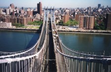
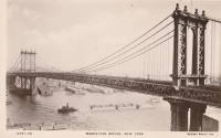
1909: Manhattan
New York and Brooklyn, New York, USA - East River
| Bridgemeister ID: | 123 (added before 2003) |
| Year Completed: | 1909 |
| Name: | Manhattan |
| Location: | New York and Brooklyn, New York, USA |
| Crossing: | East River |
| Coordinates: | 40.70667 N 73.99167 W |
| Maps: | Acme, GeoHack, Google, OpenStreetMap |
| Principals: | O.F. Nichols, Leon Moisseiff |
| References: | AAJ, BAAW, BBR, BC3, BPL, GBD, HBE, LAB, PTS2, SA19050909, SJR |
| Use: | Vehicular (double-deck) |
| Status: | In use (last checked: 2022) |
| Main Cables: | Wire (steel) |
| Suspended Spans: | 3 |
| Main Span: | 1 x 448.1 meters (1,470 feet) |
| Side Spans: | 2 x 221 meters (725 feet) |
Notes:
- Opened December 31, 1909, but not fully completed yet.
- Next to 1883 Brooklyn (Great East River) - New York and Brooklyn, New York, USA.
- Near 1903 Williamsburg - New York and Brooklyn, New York, USA.
External Links:


1909: Ripley
Ripley, Oklahoma, USA - Cimarron River
| Bridgemeister ID: | 298 (added before 2003) |
| Year Completed: | 1909 |
| Name: | Ripley |
| Location: | Ripley, Oklahoma, USA |
| Crossing: | Cimarron River |
| Principals: | Mitchell & Pigg |
| Use: | Vehicular (one-lane) |
| Status: | Wrecked, 1912 |
| Main Cables: | Wire (steel) |
| Suspended Spans: | 3 |
| Main Span: | 1 |
| Side Spans: | 2 |
Notes:
- The photo linked here is dated March 2, 1909. Part of the builders plate is legible. The first line appears to be: "Wfd Mch & Fo... Co." (the portion between the Fo and Co is obscured) for Weatherford Machine and Foundry Company. The next two lines are clear: "BUILDERS 1908" and "WEATHERFORD TEXAS". The last line is largely obscurred but it appears to say "MITCHELL & PIGG PAT'D 1..." with a year at the end. Mitchell & Pigg was a well-known builder of suspension bridges in Texas. Most sources cite 1909 as the year of completion.
- South tower washed out, 1912.
- Replaced by Ripley - Ripley, Oklahoma, USA.
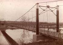
1909: Swinging
Wilmington, Delaware, USA - Brandywine Creek
| Bridgemeister ID: | 270 (added before 2003) |
| Year Completed: | 1909 |
| Name: | Swinging |
| Location: | Wilmington, Delaware, USA |
| Crossing: | Brandywine Creek |
| At or Near Feature: | Brandywine Park |
| Coordinates: | 39.76043 N 75.5564 W |
| Maps: | Acme, GeoHack, Google, OpenStreetMap |
| References: | FOWP1999S |
| Use: | Footbridge |
| Status: | In use (last checked: 2005) |
| Main Cables: | Wire (steel) |
| Suspended Spans: | 1 |
Notes:
- Replaced a nearby 1879 suspension footbridge.
External Links:
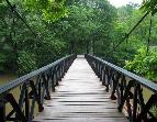
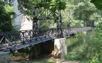
1910: Bouchemaine
Bouchemaine, Maine-et-Loire, France - Maine River
| Bridgemeister ID: | 1324 (added 2004-04-26) |
| Year Completed: | 1910 |
| Name: | Bouchemaine |
| Location: | Bouchemaine, Maine-et-Loire, France |
| Crossing: | Maine River |
| Coordinates: | 47.420130 N 0.608157 W |
| Maps: | Acme, GeoHack, Google, OpenStreetMap |
| Use: | Vehicular |
| Status: | Destroyed, 1944 |
| Main Cables: | Wire (iron) |
| Suspended Spans: | 3 |
| Main Span: | 1 |
| Side Spans: | 2 |
Notes:
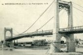
- Note the interesting stay and suspender arrangement in image. The side spans and much of the center span appear to be supported by stays. Only the center portion of the main span appears to be supported by verticle suspenders.
- Replaced by 1951 Bouchemaine - Bouchemaine, Maine-et-Loire, France.
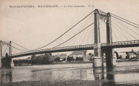
1910: Castle
Shrewsbury, England, United Kingdom
| Bridgemeister ID: | 1919 (added 2005-10-09) |
| Year Completed: | 1910 |
| Name: | Castle |
| Location: | Shrewsbury, England, United Kingdom |
| Principals: | David Rowell & Co. |
| Status: | Replaced, 1951 |
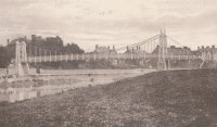
1910: Linn Creek
Linn Creek, Missouri, USA - Osage River
| Bridgemeister ID: | 289 (added before 2003) |
| Year Completed: | 1910 |
| Name: | Linn Creek |
| Location: | Linn Creek, Missouri, USA |
| Crossing: | Osage River |
| Principals: | T.S. Hart |
| References: | AAJ, PTS2 |
| Use: | Vehicular |
| Status: | Removed, 1931 |
| Main Cables: | Wire |
| Suspended Spans: | 1 |
| Main Span: | 1 x 160 meters (525 feet) |
Notes:
- Dismantled 1931 in preparation for inundation that created Lake Of The Ozarks.
External Links:
- www.LakeHistory.info. Michael Gillespie writes: "The supporting cables were cut and the tower was allowed to fall into the Osage River. The entire flood plain was being inundated by the waters of the newly created Lake of the Ozarks. During World War 2, the cables and tower were raised and sold for scrap. The shoreline of today's Lake of the Ozarks is just at the base of the bridge abutment. The toll house, seen in the photo just to the left of the bridge, is long gone, and everything below that has been underwater for 77 years. I have created a map of the road system at that location."
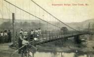
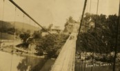
1911: Cameron
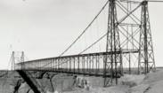
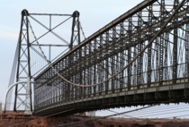
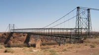
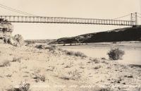
Cameron, Arizona, USA - Little Colorado River
| Bridgemeister ID: | 125 (added before 2003) |
| Year Completed: | 1911 |
| Name: | Cameron |
| Location: | Cameron, Arizona, USA |
| Crossing: | Little Colorado River |
| Coordinates: | 35.875733 N 111.412567 W |
| Maps: | Acme, GeoHack, Google, OpenStreetMap |
| Principals: | Midland Bridge Co., W.H. Code, John Charles |
| References: | GBD |
| Use: | Vehicular and Pipeline |
| Status: | Closed (last checked: 2012) |
| Main Cables: | Wire (steel) |
| Suspended Spans: | 1 |
| Main Span: | 1 x 201.2 meters (660 feet) |
Notes:
- The bridge currently carries a pipeline, but the road deck is closed to all traffic.
External Links:

1911: Dryburgh Abbey
Dryburgh and St. Boswells, Scotland, United Kingdom - River Tweed
| Bridgemeister ID: | 6218 (added 2021-07-16) |
| Year Completed: | 1911 |
| Name: | Dryburgh Abbey |
| Location: | Dryburgh and St. Boswells, Scotland, United Kingdom |
| Crossing: | River Tweed |
| Coordinates: | 55.580452 N 2.654235 W |
| Maps: | Acme, GeoHack, Google, OpenStreetMap |
| Use: | Footbridge |
| Status: | In use (last checked: 2021) |
| Main Cables: | Wire (steel) |
| Suspended Spans: | 1 |
Notes:
- Although the current (as of 2021) Dryburgh Abbey bridge is often attributed to 1872, it more closely resembles bridges built starting in the 1890s.
- Replaced 1872 Dryburgh Abbey - Dryburgh and St. Boswells, Scotland, United Kingdom.
- Near Mertoun Estate - Mertoun, Scotland, United Kingdom.
External Links:
- The Happy Pontist: Scottish Bridges: 15. Dryburgh Abbey Footbridge
- Structurae - Structure ID 20016083
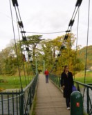
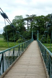
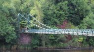
1912: Groslée
Groslée, Ain and Brangues, Isère, France - Rhône River
| Bridgemeister ID: | 1536 (added 2004-10-31) |
| Year Completed: | 1912 |
| Name: | Groslée |
| Location: | Groslée, Ain and Brangues, Isère, France |
| Crossing: | Rhône River |
| Coordinates: | 45.712333 N 5.548533 E |
| Maps: | Acme, GeoHack, Google, OpenStreetMap |
| Principals: | Ferdinand Arnodin |
| References: | BPF |
| Use: | Vehicular, with walkway |
| Status: | In use (last checked: 2019) |
| Main Cables: | Wire (steel) |
| Suspended Spans: | 1 |
| Main Span: | 1 x 177 meters (580.7 feet) estimated |
Notes:
External Links:
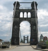
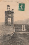
1912: Hagwilget
Hagwilget, British Columbia, Canada - Bulkley River
| Bridgemeister ID: | 1229 (added 2004-02-15) |
| Year Completed: | 1912 |
| Name: | Hagwilget |
| Also Known As: | Bulkley Canyon |
| Location: | Hagwilget, British Columbia, Canada |
| Crossing: | Bulkley River |
| At or Near Feature: | Hagwilget Canyon |
| Coordinates: | 55.257347 N 127.604616 W |
| Maps: | Acme, GeoHack, Google, OpenStreetMap |
| References: | AAJ |
| Use: | Vehicular (one-lane) |
| Status: | Replaced, 1931 |
| Main Cables: | Wire (steel) |
| Suspended Spans: | 1 |
| Main Span: | 1 x 137.5 meters (451 feet) |
| Deck width: | 9 feet |
Notes:
- AAJ: Restricted to foot traffic, 1929.
- Replaced by 1931 Hagwilget (Bulkley Canyon) - Hagwilget, British Columbia, Canada.
- See Walcott - Walcott, British Columbia, Canada. Part or all of the dismantled 1912 Hagwilget bridge may have been reused for this bridge at Walcott.

1912: Howley
Howley, Warrington, Cheshire and Latchford, England, United Kingdom - River Mersey
| Bridgemeister ID: | 1836 (added 2005-07-02) |
| Year Completed: | 1912 |
| Name: | Howley |
| Location: | Howley, Warrington, Cheshire and Latchford, England, United Kingdom |
| Crossing: | River Mersey |
| At or Near Feature: | Victoria Park |
| Coordinates: | 53.387333 N 2.57845 W |
| Maps: | Acme, GeoHack, Google, OpenStreetMap |
| Principals: | David Rowell & Co. |
| Use: | Footbridge |
| Status: | In use (last checked: 2012) |
| Main Cables: | Wire (steel) |
| Suspended Spans: | 1 |
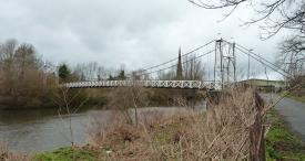
1912: Orleans
Orleans, California, USA - Klamath River
| Bridgemeister ID: | 126 (added before 2003) |
| Year Completed: | 1912 |
| Name: | Orleans |
| Location: | Orleans, California, USA |
| Crossing: | Klamath River |
| Use: | Vehicular (one-lane) |
| Status: | Destroyed, 1936? |
| Main Cables: | Wire |
Notes:
- Some accounts state this bridge was destroyed by fire in 1921. A brief mention in the July 18, 1926 edition of The Fresno Bee implies it was destroyed in June of 1926.
- Replaced by 1940 Orleans - Orleans, California, USA.
External Links:
- Catalog Number 1983/001/SBPM01034 - Sacramento Bee. This "Center for Sacramento History" catalog entry suggests the bridge survived until 1936. Given the bridge was ultimately replaced in 1940, this later date makes more sense than some of the earlier claims of it being destroyed in the 1920s unless there were some intermediate reconstructions.
- Klamath River at Orleans - California State Library. This image shows a bridge of similar construction but apparently shorter span than the other images linked here. However, matching buildings seen in the background of multiple images place it at the same location. Given the muddled suspension bridge chronology at this location and frequency of Klamath River floods, it seems likely there were multiple reconstructions of this bridge.
- Orleans Bridge 1910 - California State Library. Image purporting to be the Orleans bridge under construction in 1910, but it does not appear to be the same location.
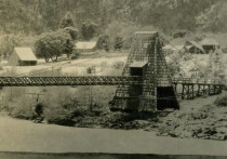
1912: Sidi M'Cid
Constantine, Algeria - Oued Rhumel
| Bridgemeister ID: | 1101 (added 2004-01-02) |
| Year Completed: | 1912 |
| Name: | Sidi M'Cid |
| Location: | Constantine, Algeria |
| Crossing: | Oued Rhumel |
| Coordinates: | 36.372592 N 6.614448 E |
| Maps: | Acme, GeoHack, Google, OpenStreetMap |
| Principals: | Ferdinand Arnodin |
| References: | AAJ |
| Use: | Vehicular (one-lane) |
| Status: | In use (last checked: 2019) |
| Main Cables: | Wire (steel) |
| Suspended Spans: | 1 |
| Main Span: | 1 x 164.6 meters (540 feet) |
| Deck width: | 19.5 feet |
External Links:

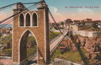
1912: Winkley
Heber Springs, Arkansas, USA - Little Red River
| Bridgemeister ID: | 127 (added before 2003) |
| Year Completed: | 1912 |
| Name: | Winkley |
| Also Known As: | Swinging |
| Location: | Heber Springs, Arkansas, USA |
| Crossing: | Little Red River |
| Coordinates: | 35.489833 N 91.973918 W |
| Maps: | Acme, GeoHack, Google, OpenStreetMap |
| Principals: | Henry Churchill |
| References: | GBD |
| Use: | Vehicular (one-lane) |
| Status: | Collapsed, 1989 |
| Main Cables: | Wire |
| Main Span: | 1 x 167.6 meters (550 feet) |
Notes:
- 1949: Wooden towers replaced by steel towers.
- 1972: Restricted to pedestrians.
- 1989, October 28: Collapsed killing 5 people and injuring 18 others.
- Location also known as "Winkley Ford" and "Turner's Ferry".
- Companion to 1912 Miller - Miller, Cleburne County, Arkansas, USA.
- Companion to 1912 Tumbling Shoals - Tumbling Shoals, Arkansas, USA.
External Links:
- Historic Bridges of the United States - Winkley Bridge - Cleburne County, Arkansas
- Structurae - Structure ID 20001341
