Inventory Search Results
68 suspension bridges were found for search criteria: BPL. All 68 bridges from the search results appear below. Click the Bridgemeister ID number to isolate the bridge on its own page. If you don't see what you were looking for, try an image search with the same criteria: BPL. This will find the bridge if it is pictured on the site, but is not a catenary suspension bridge.
Related:
1734: (suspension bridge)
Gliwice vicinity, Upper Silesia, Poland - Oder River
| Bridgemeister ID: | 371 (added before 2003) |
| Year Completed: | 1734 |
| Name: | (suspension bridge) |
| Location: | Gliwice vicinity, Upper Silesia, Poland |
| Crossing: | Oder River |
| Principals: | Army of the Palatinate of Saxony |
| References: | AAJ, BPL |
| Main Cables: | Chain (iron) |
Notes:
- Often claimed to be the first use of metal in a suspension structure in the Western world.
- Location always cited as "across the Oder near Glorywitz, Prussia" however the name "Glorywitz" only ever appears in citations of this bridge. Likely it was near the modern city of Gliwice in Poland, also known as Gleiwitz (German) and Glywicy (Silesian)
1741: Winch
Middleton-in-Teesdale, England, United Kingdom - River Tees
| Bridgemeister ID: | 372 (added before 2003) |
| Year Completed: | 1741 |
| Name: | Winch |
| Also Known As: | Wynch |
| Location: | Middleton-in-Teesdale, England, United Kingdom |
| Crossing: | River Tees |
| At or Near Feature: | Low Force |
| References: | AAJ, BEM, BPL, HBE, PTS2 |
| Use: | Footbridge |
| Main Cables: | Chain (iron) |
| Suspended Spans: | 1 |
| Main Span: | 1 x 21.3 meters (70 feet) |
Notes:
- Varying histories of this catwalk-style bridge exist. Some claim it was built 1704, a cable snapped in 1802 killing three people, and it was then rebuilt in 1830 (the present bridge). Others attribute the bridge to 1741 and have the 1802 incident killing "one or two people".
- Replaced by 1830 Wynch (Winch) - Middleton-in-Teesdale, England, United Kingdom.
External Links:
1801: Jacob's Creek
Iron Bridge, Mount Pleasant vicinity, Pennsylvania, USA - Jacob's Creek
| Bridgemeister ID: | 3 (added before 2003) |
| Year Completed: | 1801 |
| Name: | Jacob's Creek |
| Also Known As: | Iron Bridge, Chain Bridge |
| Location: | Iron Bridge, Mount Pleasant vicinity, Pennsylvania, USA |
| Crossing: | Jacob's Creek |
| Coordinates: | 40.112598 N 79.553186 W |
| Maps: | Acme, GeoHack, Google, OpenStreetMap |
| Principals: | Judge James Finley |
| References: | AAJ, ASB, BBR, BOB, BPL, CAB, DSE20000116, HBE, LAB, PTS2 |
| Use: | Vehicular |
| Status: | Removed, 1833 |
| Main Cables: | Chain (iron) |
| Suspended Spans: | 3 |
| Main Span: | 1 x 21.3 meters (70 feet) |
| Deck width: | 12.5 feet |
Notes:
- In an email dated January 16, 2000, Don Sayenga provided information about the location of this bridge. Generally attributed to Uniontown (the seat of Fayette County, PA), Mr. Sayenga offers some clues about the bridge's true location. "[James Finley] stated that he built it near the home of his friend Meason which implies a connection for the iron as Meason was making iron. Meason's home has survived by the way, a beautiful place. Finley stated it was a combination contract with the cost split between two counties, and he stated it was built over Jacob's Creek which is the county boundary. He also makes it clear it was on the road to Greensburg. The only place the old road crossed Jacob's Creek is just south of Mount Pleasant, Pennsylvania. On the geodetic survey maps this spot is marked "Iron Bridge" but there is no town there. The last time I was there I saw a sign that said 'Iron Bridge' on an automobile scrap yard. I found absolutely no trace of the bridge, but it was not very big, so there was no need for a huge abutment."
- First suspension bridge with a rigid level deck, often considered the world's first modern suspension bridge.
- Coordinates are for the likely location of the bridge, where present-day (2020) Pennsylvania route 3105 crosses Jacob's Creek.
External Links:
1809: Schuylkill Falls
Philadelphia, Pennsylvania, USA - Schuylkill River
| Bridgemeister ID: | 9 (added before 2003) |
| Year Completed: | 1809 |
| Name: | Schuylkill Falls |
| Location: | Philadelphia, Pennsylvania, USA |
| Crossing: | Schuylkill River |
| Principals: | John Templeman |
| References: | AAJ, BBR, BPL, CAB, DSE20000118, HBE, PTS2 |
| Status: | Removed |
| Main Cables: | Chain (iron) |
| Suspended Spans: | 2 |
| Main Spans: | 2 x 46.6 meters (153 feet) |
| Deck width: | 18 feet |
Notes:
- Failed 1811, 1816. HBE notes the 1811 was due to weight of cattle. The 1816 failure was due to weight of ice and snow.
External Links:
1816: Spider
Philadelphia, Pennsylvania, USA - Schuylkill River
| Bridgemeister ID: | 20 (added before 2003) |
| Year Completed: | 1816 |
| Name: | Spider |
| Location: | Philadelphia, Pennsylvania, USA |
| Crossing: | Schuylkill River |
| Principals: | Josiah White, Erskine Hazard |
| References: | AAJ, BOB, BPL, GHD, HBE, LAB, PTS2 |
| Use: | Footbridge |
| Status: | Removed |
| Main Cables: | Wire (iron) |
| Main Span: | 1 x 120 meters (393.75 feet) |
Notes:
- Narrow footbridge. First wire bridge in North America. HBE notes "first wire suspension bridge in any country."
- Often described as having collapsed under the weight of ice and snow, Don Sayenga notes that no contemporary sources confirm this demise. Since the nearby chain bridge did fail under weight of ice and snow, he believes this fate has been misattributed to the White and Hazard footbridge. Don believes the bridge was just dismantled at some point after June, 1816.
- Al Zagofsky also wrote to explain there was no evidence of this bridge collapsing under weight of ice and snow. Al writes: "According to an original source Captain Joshua Rowley Watson, who inspected the bridge on June 15, 1816: '...There was a bridge, but which by the weight of ice and snow, has been carried away.' This refers to the previous bridge that the cable bridge was temporarily replacing. I did not see any cause for failure of the wire rope bridge. My guess is that it was removed when the regular bridge was repaired. The same article shows a sketch that he made, showing the main span to be 407 feet. I am looking at the Canal History and Technology Proceedings Vol 5, March 22, 1986."
1827: (suspension bridge)
Newburyport, Massachusetts, USA - Merrimack River
| Bridgemeister ID: | 23 (added before 2003) |
| Year Completed: | 1827 |
| Name: | (suspension bridge) |
| Location: | Newburyport, Massachusetts, USA |
| Crossing: | Merrimack River |
| Principals: | Thomas Haven |
| References: | AAJ, BPL, HBE, PTS2 |
| Status: | Replaced, 1840 |
| Main Cables: | Chain (iron) |
| Suspended Spans: | 5 |
| Main Spans: | 3 |
| Side Spans: | 2 |
Notes:
- Multi-span structure distinct from Templeman's 1810 Chain Bridge. Sometimes misidentified as an 1827 replacement to the 1810 Templeman Chain Bridge because of the significant damage to the Templeman bridge in 1827.
External Links:

1842: Fairmount
Philadelphia, Pennsylvania, USA - Schuylkill River
| Bridgemeister ID: | 24 (added before 2003) |
| Year Completed: | 1842 |
| Name: | Fairmount |
| Also Known As: | Callowhill Street, Upper Ferry |
| Location: | Philadelphia, Pennsylvania, USA |
| Crossing: | Schuylkill River |
| Principals: | Charles Ellet |
| References: | BBR, BOB, BPL, HBE, LAB, PTS2, WHSB |
| Use: | Vehicular |
| Status: | Replaced, 1875 |
| Main Cables: | Wire (iron) |
| Suspended Spans: | 1 |
| Main Span: | 1 x 104.2 meters (342 feet) |
Notes:
- BBR and BOB say 1841.
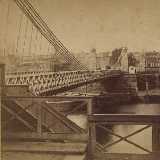
1845: Pittsburgh Aqueduct
Pittsburgh, Pennsylvania, USA - Allegheny River
| Bridgemeister ID: | 27 (added before 2003) |
| Year Completed: | 1845 |
| Name: | Pittsburgh Aqueduct |
| Location: | Pittsburgh, Pennsylvania, USA |
| Crossing: | Allegheny River |
| Principals: | John A. Roebling |
| References: | BOB, BOP, BPL, HBE, ONF, PTS2, RDH, SJR |
| Use: | Aqueduct |
| Status: | Removed, 1861 |
| Main Cables: | Wire (iron) |
| Suspended Spans: | 7 |
| Main Spans: | 7 x 49.4 meters (162 feet) |
Notes:
- In use until 1860.
External Links:
1846: Monongahela
Pittsburgh, Pennsylvania, USA - Monongahela River
| Bridgemeister ID: | 28 (added before 2003) |
| Year Completed: | 1846 |
| Name: | Monongahela |
| Also Known As: | Smithfield Street |
| Location: | Pittsburgh, Pennsylvania, USA |
| Crossing: | Monongahela River |
| Principals: | John A. Roebling |
| References: | BOB, BOP, BPL, HBE, ONF, PBR, PTS2 |
| Use: | Vehicular |
| Status: | Removed, 1882 |
| Main Cables: | Wire (iron) |
| Suspended Spans: | 8 |
| Main Spans: | 8 x 57.3 meters (188 feet) |
| Deck width: | 20 feet |
External Links:
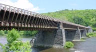
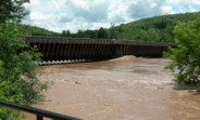
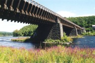
1848: Delaware Aqueduct
Lackawaxen, Pennsylvania and Minisink Ford, New York, USA - Delaware River
| Bridgemeister ID: | 30 (added before 2003) |
| Year Completed: | 1848 |
| Name: | Delaware Aqueduct |
| Also Known As: | Roebling Aqueduct |
| Location: | Lackawaxen, Pennsylvania and Minisink Ford, New York, USA |
| Crossing: | Delaware River |
| Coordinates: | 41.48262 N 74.98461 W |
| Maps: | Acme, GeoHack, Google, OpenStreetMap |
| Principals: | John A. Roebling |
| References: | AAJ, BDR, BOB, BPL, GBD, LAB, LACE, RDH, SJR |
| Use: | Aqueduct and Vehicular (one-lane), with walkway |
| Status: | In use (last checked: 2006) |
| Main Cables: | Wire (iron) |
| Suspended Spans: | 4 |
| Main Spans: | 1 x 43.3 meters (142 feet), 3 x 39.9 meters (131 feet) |
Notes:
- BPL: Completed 1848. RDH/BDR: Completed 1848, not used until 1849.
- Originally constructed to carry the Delaware and Hudson Canal. Converted to a one-lane vehicular bridge soon after the canal closed in 1898. Substantially restored in 1980's and 1990's, but retains original cables.
- Built as part of same project as 1849 Lackawaxen Aqueduct - Lackawaxen, Pennsylvania, USA.
- Built as part of same project as 1851 High Falls Aqueduct - High Falls, New York, USA.
- Built as part of same project as 1851 Neversink Aqueduct - Cuddebackville, New York, USA.
- Near 1849 Lackawaxen Aqueduct - Lackawaxen, Pennsylvania, USA.
External Links:
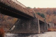
1848: Niagara Suspension
Niagara Falls, New York, USA and Niagara Falls, Ontario, Canada - Niagara River
| Bridgemeister ID: | 29 (added before 2003) |
| Year Completed: | 1848 |
| Name: | Niagara Suspension |
| Location: | Niagara Falls, New York, USA and Niagara Falls, Ontario, Canada |
| Crossing: | Niagara River |
| Principals: | Charles Ellet |
| References: | BOB, BPL, HBE, ONF, PTS2 |
| Use: | Vehicular (one-lane) |
| Status: | Removed |
| Main Cables: | Wire (iron) |
| Suspended Spans: | 1 |
| Main Span: | 1 x 234.7 meters (770 feet) |
| Deck width: | 7.5 feet |
Notes:
1849: Lackawaxen Aqueduct
Lackawaxen, Pennsylvania, USA - Lackawaxen River
| Bridgemeister ID: | 31 (added before 2003) |
| Year Completed: | 1849 |
| Name: | Lackawaxen Aqueduct |
| Location: | Lackawaxen, Pennsylvania, USA |
| Crossing: | Lackawaxen River |
| Principals: | John A. Roebling |
| References: | AAJ, BOB, BPL, RDH, SJR |
| Use: | Aqueduct |
| Status: | Removed |
| Main Cables: | Wire (iron) |
| Suspended Spans: | 2 |
| Main Spans: | 2 x 34.9 meters (114.37 feet) |
Notes:
- BPL says 1848, RDH says same, but not used until 1849.
- Built as part of same project as 1848 Delaware Aqueduct (Roebling Aqueduct) - Lackawaxen, Pennsylvania and Minisink Ford, New York, USA.
- Built as part of same project as 1851 High Falls Aqueduct - High Falls, New York, USA.
- Built as part of same project as 1851 Neversink Aqueduct - Cuddebackville, New York, USA.
- Near 1848 Delaware Aqueduct (Roebling Aqueduct) - Lackawaxen, Pennsylvania and Minisink Ford, New York, USA.
External Links:
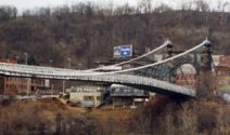
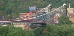
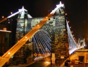
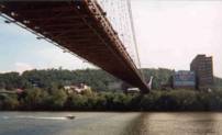
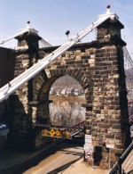
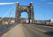
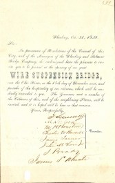
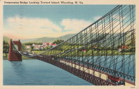
1849: Wheeling
Wheeling, West Virginia, USA - Ohio River
| Bridgemeister ID: | 32 (added before 2003) |
| Year Completed: | 1849 |
| Name: | Wheeling |
| Also Known As: | Wheeling and Belmont |
| Location: | Wheeling, West Virginia, USA |
| Crossing: | Ohio River |
| Coordinates: | 40.07167 N 80.72667 W |
| Maps: | Acme, GeoHack, Google, OpenStreetMap |
| Principals: | Charles Ellet |
| References: | AAJ, BBR, BC3, BOB, BPL, CEJ, COB, GBD, HBE, LAB, LACE, ONF, PTS2, RWS, WCC, WHSB |
| Use: | Vehicular (two-lane, light vehicles only) |
| Status: | Restricted to foot traffic, since September 2019 (last checked: 2020) |
| Main Cables: | Wire (iron) |
| Suspended Spans: | 1 |
| Main Span: | 1 x 307.8 meters (1,010 feet) |
Notes:
- Was still part of Virginia at time of completion.
- 1854: Rebuilt after it was wrecked by a windstorm. Contrary to popular myth, the rebuilding was undertaken by Ellet and his assistant William K. McComas, not by John A. Roebling.
- 1860: Overhauled. Popular myth often attributes this work to the Roeblings. WHSB attributes this work to William K. McComas. After this overhaul, the bridge still does not have the distinctive diagonal cable stays that give it the appearance of a Roebling bridge.
- 1872: Overhauled according to a design by Washington Roebling. John A. Roebling had died in 1869 and was not involved with this work. WHSB notes, "The design essentially Roeblingized the bridge with the diagonal cable stays that are such a prominent feature of the bridge."
- 2019, September: Closed to vehicular traffic indefinitely due to safety concerns after repeated overweight vehicle violations.
- 2020, November: Bids being evaluated for renovation project. Bridge remains closed to vehicular traffic.
- 2021, April: Single bid received was rejected. Bids expected to be resolicited in June. The bridge remains closed to all vehicular traffic.
- 2022, February: $17.9 million renovation project expected to start soon.
- Became longest suspension bridge by eclipsing 1834 Zaehringen (Grand Pont Suspendu) - Fribourg, Switzerland.
- Eclipsed by new longest suspension bridge 1867 John A. Roebling (Cincinnati, Cincinnati and Covington) - Cincinnati, Ohio and Covington, Kentucky, USA.
External Links:
1851: High Falls Aqueduct
High Falls, New York, USA - Rondout Creek
| Bridgemeister ID: | 34 (added before 2003) |
| Year Completed: | 1851 |
| Name: | High Falls Aqueduct |
| Location: | High Falls, New York, USA |
| Crossing: | Rondout Creek |
| Principals: | John A. Roebling |
| References: | AAJ, BOB, BPL, RDH, SJR |
| Use: | Aqueduct |
| Status: | Removed, August, 1921 |
| Main Cables: | Wire (iron) |
| Suspended Spans: | 1 |
| Main Span: | 1 x 44.2 meters (145 feet) |
Notes:
- BPL, AAJ say completed 1848, RDH says not used until 1851 canal season.
- Heavy damaged by fire, 1921.
- Built as part of same project as 1848 Delaware Aqueduct (Roebling Aqueduct) - Lackawaxen, Pennsylvania and Minisink Ford, New York, USA.
- Built as part of same project as 1849 Lackawaxen Aqueduct - Lackawaxen, Pennsylvania, USA.
- Built as part of same project as 1851 Neversink Aqueduct - Cuddebackville, New York, USA.
External Links:
1851: Lewiston-Queenston
Lewiston, New York, USA and Queenston, Ontario, Canada - Niagara River
| Bridgemeister ID: | 35 (added before 2003) |
| Year Completed: | 1851 |
| Name: | Lewiston-Queenston |
| Location: | Lewiston, New York, USA and Queenston, Ontario, Canada |
| Crossing: | Niagara River |
| Principals: | Edward Serrell |
| References: | AAJ, BOB, BPL, HBE, PTS2 |
| Use: | Vehicular |
| Status: | Wrecked, 1864 |
| Main Cables: | Wire (iron) |
| Suspended Spans: | 1 |
| Main Span: | 1 x 258.8 meters (849 feet) |
| Deck width: | 21 feet (AAJ: 19.5 feet) |
Notes:
- Wrecked by wind February 1, 1864. Stay cables beneath the bridge had been disconnected to avoid damage from rising ice. Portions of the cables and deck remained, in a derelict state, as late as 1895. Replacement was not started until the late 1890's.
- The February 3, 1864 edition of Niagara Falls Gazette describes the wind event: "Partial Destruction Of The Lewiston Suspension Bridge -- A portion of the flooring and other wood-work of the Lewiston Suspension Bridge was blown down during the gale Monday forenoon. It seems that the long guys had been cut during the late ice jam to prevent injury to the structure and thus its strength to withstand a gale was much weakened. The wind swept through the gorge on Monday with terrific force and swayed the bridge so that some of the cross timbers, near the centre were loosened from their fastenings, and fell, of course carrying the floor with them. A large portion at each end, remains without material injury. The extent of the damage -- financially -- we have not yet learned, but we judge from what we hear that it may be about $10,000. The bridge was built in 1852 and cost not far from $40,000. It will doubtless soon be repaired and in use."
- Later at same location 1899 Lewiston-Queenston - Lewiston, New York, USA and Queenston, Ontario, Canada.
- See 1849 Wheeling (Wheeling and Belmont) - Wheeling, West Virginia, USA. The 1851 Lewiston-Queenston bridge is sometimes claimed to have become the longest in the world with a main span surpassing the length of the Wheeling suspension bridge. However, Don Sayenga notes the length of the suspended span of the Lewiston-Queenston bridge was only 849 feet, not the 1,043 feet sometimes cited. Don writes: "[1,043 feet] was the distance between the towers built high up on the cliffs above the crossing - because there was no space for them below. The roadway suspended from the towers was only 849 feet span over the water from abutment to abutment." Thus, Roebling's Cincinnati bridge should be considered the first to eclipse Wheeling's record main span.
External Links:
1851: Neversink Aqueduct
Cuddebackville, New York, USA - Neversink River
| Bridgemeister ID: | 36 (added before 2003) |
| Year Completed: | 1851 |
| Name: | Neversink Aqueduct |
| Location: | Cuddebackville, New York, USA |
| Crossing: | Neversink River |
| Principals: | John A. Roebling |
| References: | AAJ, BOB, RDH, SJR |
| Use: | Aqueduct |
| Status: | Removed |
| Main Cables: | Wire (iron) |
| Suspended Spans: | 1 |
| Main Span: | 1 x 51.8 meters (170 feet) |
Notes:
- BPL says 1849, RDH says not used until 1851 canal season.
- Built as part of same project as 1848 Delaware Aqueduct (Roebling Aqueduct) - Lackawaxen, Pennsylvania and Minisink Ford, New York, USA.
- Built as part of same project as 1849 Lackawaxen Aqueduct - Lackawaxen, Pennsylvania, USA.
- Built as part of same project as 1851 High Falls Aqueduct - High Falls, New York, USA.
External Links:
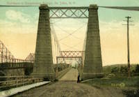
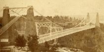
1852: St. John
St. John, New Brunswick, Canada - St. John River
| Bridgemeister ID: | 37 (added before 2003) |
| Year Completed: | 1852 |
| Name: | St. John |
| Location: | St. John, New Brunswick, Canada |
| Crossing: | St. John River |
| Principals: | Edward Serrell |
| References: | AAJ, BPL, HBE, PTS2 |
| Use: | Vehicular (one-lane) |
| Status: | Removed, 1915 |
| Main Cables: | Wire (iron) |
| Suspended Spans: | 1 |
| Main Span: | 1 x 195.1 meters (640 feet) |
Notes:
- Rebuilt 1857.
External Links:
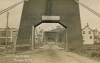
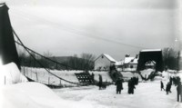
1853: Mill Pond
Kingfield, Maine, USA - Carrabasset River
| Bridgemeister ID: | 45 (added before 2003) |
| Year Completed: | 1853 |
| Name: | Mill Pond |
| Location: | Kingfield, Maine, USA |
| Crossing: | Carrabasset River |
| Principals: | Daniel Beedy |
| References: | AAJ, BPL |
| Use: | Vehicular (one-lane), with walkway |
| Status: | Replaced, 1916 |
| Main Cables: | Chain (iron) |
| Main Span: | 1 x 57.9 meters (190 feet) |
| Deck width: | 15 feet |
Notes:
- Similar to 1856 Strong - Strong, Maine, USA.
1854: Licking River I
Covington and Newport, Kentucky, USA - Licking River
| Bridgemeister ID: | 47 (added before 2003) |
| Year Completed: | 1854 |
| Name: | Licking River I |
| Location: | Covington and Newport, Kentucky, USA |
| Crossing: | Licking River |
| Principals: | John Gray, George C. Tarvin |
| References: | BOB, BPL, EOV |
| Status: | Collapsed, 1854 |
Notes:
- BPL: Collapsed under weight of cattle 1853. BOB: Indicates year of completion and collapse as 1854. EOV: Appears more authoritative on the matter, "Although the bridge was not quite finished, Tarvin and the mayor of Covington rode the first vehicle across it on December 28, 1853. Less than two weeks later... the bridge collapsed."
- The January 18, 1854 edition of The New York Times has a small article with a January 16, 1854 byline reporting the collapse of the bridge: "The... bridge... gave way this evening, while two men and eighteen cattle were crossing it... The keys which held the wire cable to the anchors gave way."
- Replaced by 1854 Licking River II - Covington and Newport, Kentucky, USA.
1855: Minneapolis
Minneapolis, Minnesota, USA - Mississippi River
| Bridgemeister ID: | 50 (added before 2003) |
| Year Completed: | 1855 |
| Name: | Minneapolis |
| Also Known As: | St. Anthony's Falls |
| Location: | Minneapolis, Minnesota, USA |
| Crossing: | Mississippi River |
| At or Near Feature: | Nicollet Island |
| Principals: | Thomas M. Griffith |
| References: | AAJ, BPL, HBE, PTS2 |
| Use: | Vehicular |
| Status: | Demolished, 1876 |
| Main Cables: | Wire (iron) |
| Suspended Spans: | 1 |
| Main Span: | 1 x 189 meters (620 feet) |
| Deck width: | 17 feet |
Notes:
- Replaced by 1877 Minneapolis - Minneapolis, Minnesota, USA.
- Later at same location 1990 Hennepin Avenue (Father Louis Hennepin) - Minneapolis, Minnesota, USA.
External Links:
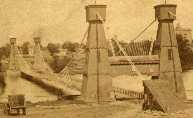
1855: Niagara Suspension
Niagara Falls, New York, USA and Niagara Falls, Ontario, Canada - Niagara River
| Bridgemeister ID: | 51 (added before 2003) |
| Year Completed: | 1855 |
| Name: | Niagara Suspension |
| Location: | Niagara Falls, New York, USA and Niagara Falls, Ontario, Canada |
| Crossing: | Niagara River |
| Principals: | John A. Roebling |
| References: | AAJ, BAAW, BBR, BFL, BMA, BOB, BPL, HBE, LIR, NSB, ONF, PTS2, SA18810716, SJR |
| Use: | Rail (heavy rail) and Vehicular (double-deck), with walkway |
| Status: | Replaced, 1897 |
| Main Cables: | Wire (iron) |
| Suspended Spans: | 1 |
| Main Span: | 1 x 250.3 meters (821.3 feet) |
Notes:
- Cables renovated, 1877. Wooden stiffening trusses replaced, 1880. Towers replaced, c. 1886. Bridge replaced with steel arch, 1897.
- AAJ notes the roadway deck opened in 1854, but the railway deck did not open until 1855.
- Replaced 1848 Niagara Suspension - Niagara Falls, New York, USA and Niagara Falls, Ontario, Canada.
External Links:
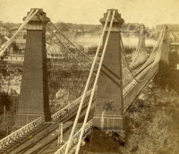
1856: Bidwell Bar
Oroville, California, USA - Feather River
| Bridgemeister ID: | 52 (added before 2003) |
| Year Completed: | 1856 |
| Name: | Bidwell Bar |
| Location: | Oroville, California, USA |
| Crossing: | Feather River |
| Coordinates: | 39.537483 N 121.45415 W |
| Maps: | Acme, GeoHack, Google, OpenStreetMap |
| Principals: | Bidwell Bridge Co. |
| References: | BPL, DSL200106, LACE |
| Use: | Vehicular (one-lane) |
| Status: | Restricted to foot traffic (last checked: 2020) |
| Main Cables: | Wire (iron) |
| Suspended Spans: | 1 |
| Main Span: | 1 x 67.1 meters (220 feet) estimated |
Notes:
- Dismantled before completion of Oroville Dam and replaced by the 1965 high-level Bidwell Bar suspension bridge. The 1856 structure was later reassembled about 1.5 miles south of the new Bidwell Bar bridge. Coordinates provided here are for the current location of the bridge at Kelly Ridge.
- Replaced by 1965 Bidwell Bar - Oroville, California, USA.
External Links:
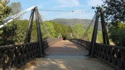
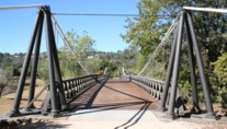
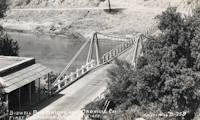
1856: Strong
Strong, Maine, USA - Sandy River
| Bridgemeister ID: | 53 (added before 2003) |
| Year Completed: | 1856 |
| Name: | Strong |
| Location: | Strong, Maine, USA |
| Crossing: | Sandy River |
| Principals: | Daniel Beedy |
| References: | BPL |
| Use: | Vehicular (one-lane) |
| Status: | Replaced (last checked: 1922) |
| Main Cables: | Wire (iron) |
| Suspended Spans: | 1 |
| Main Span: | 1 x 77.4 meters (254 feet) |
| Deck width: | 13 feet |
Notes:
- Similar to 1853 Mill Pond - Kingfield, Maine, USA.
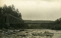
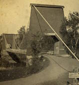
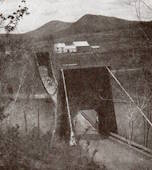
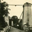
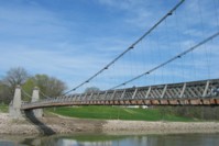
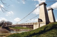
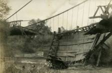
1859: General Dean
Carlyle, Illinois, USA - Kaskaskia River
| Bridgemeister ID: | 58 (added before 2003) |
| Year Completed: | 1859 |
| Name: | General Dean |
| Also Known As: | Carlyle |
| Location: | Carlyle, Illinois, USA |
| Crossing: | Kaskaskia River |
| Coordinates: | 38.611125 N 89.357476 W |
| Maps: | Acme, GeoHack, Google, OpenStreetMap |
| Principals: | D. Griffith Smith |
| References: | BPL, GBD |
| Use: | Vehicular (one-lane) |
| Status: | Restricted to foot traffic (last checked: 2021) |
| Main Cables: | Wire (iron) |
| Suspended Spans: | 1 |
| Main Span: | 1 x 80.5 meters (264 feet) |
Notes:
- Rebuilt 1920s, 1970s. Restored, 1950's, for use as a footbridge.
- Bypassed, 1924.
External Links:
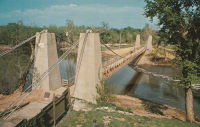
1860: Allegheny River
Pittsburgh, Pennsylvania, USA - Allegheny River
| Bridgemeister ID: | 59 (added before 2003) |
| Year Completed: | 1860 |
| Name: | Allegheny River |
| Also Known As: | Sixth Street, St. Clair |
| Location: | Pittsburgh, Pennsylvania, USA |
| Crossing: | Allegheny River |
| Principals: | John A. Roebling |
| References: | BOB, BOP, BPL, HBE, PBR, PTS2, SJR |
| Use: | Vehicular, with walkway |
| Status: | Replaced, 1892 |
| Main Cables: | Wire (iron) |
| Suspended Spans: | 4 |
| Main Spans: | 2 x 104.9 meters (344 feet) |
| Side Spans: | 2 x 52.1 meters (171 feet) |
| Deck width: | 40 feet |
Notes:
- BPL cites this bridge as the first suspension bridge with metal towers. However, at least two earlier suspension bridges (1857 Watertown, New York and 1856 Bidwell Bar, California) are known to have metal towers and even Roebling's 1846 Smithfield Street Bridge in Pittsburgh had cast iron towers.
- Next to 1884 North Side (Seventh Street) - Pittsburgh, Pennsylvania, USA.
External Links:
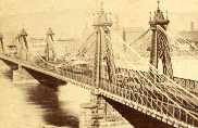
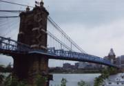
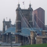
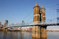
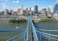
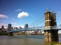
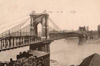
1867: John A. Roebling
Cincinnati, Ohio and Covington, Kentucky, USA - Ohio River
| Bridgemeister ID: | 65 (added before 2003) |
| Year Completed: | 1867 |
| Name: | John A. Roebling |
| Also Known As: | Cincinnati, Cincinnati and Covington |
| Location: | Cincinnati, Ohio and Covington, Kentucky, USA |
| Crossing: | Ohio River |
| Coordinates: | 39.09167 N 84.50833 W |
| Maps: | Acme, GeoHack, Google, OpenStreetMap |
| Principals: | John A. Roebling |
| References: | BAAW, BC3, BOB, BPL, COB, EOV, HBE, LAB, LACE, ONF, PTS2, SJR, TOB |
| Use: | Vehicular (two-lane), with walkway |
| Status: | Closed, February, 2021 (last checked: 2021) |
| Main Cables: | Wire (iron) |
| Suspended Spans: | 3 |
| Main Span: | 1 x 322.2 meters (1,057 feet) |
| Side Spans: | 2 |
Notes:
- 1892: Cable ends restored.
- 1899: Steel cables added to assist original cables.
- 2021, February: Closed to all vehicular traffic for a nine-month restoration project.
- Became longest suspension bridge by eclipsing 1849 Wheeling (Wheeling and Belmont) - Wheeling, West Virginia, USA.
- Eclipsed by new longest suspension bridge 1869 Clifton (Niagara-Clifton, Falls View, First Falls View) - Niagara Falls, New York, USA and Niagara Falls, Ontario, Canada.
External Links:
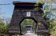
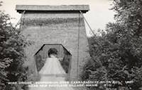
1868: Wire
New Portland, Maine, USA - Carrabasset River
| Bridgemeister ID: | 69 (added before 2003) |
| Year Completed: | 1868 |
| Name: | Wire |
| Location: | New Portland, Maine, USA |
| Crossing: | Carrabasset River |
| Coordinates: | 44.890783 N 70.0925 W |
| Maps: | Acme, GeoHack, Google, OpenStreetMap |
| References: | BC3, BPL, GBD, LAB, RDH |
| Use: | Vehicular (one-lane) |
| Status: | In use (last checked: 2023) |
| Main Cables: | Wire (iron) |
| Suspended Spans: | 1 |
| Main Span: | 1 x 60.5 meters (198.4 feet) |
Notes:
- BPL says c. 1866. Historic landmark plaque at bridge also says 1866.
- Extensive repairs, 1960.
External Links:
1869: Clifton
Niagara Falls, New York, USA and Niagara Falls, Ontario, Canada - Niagara River
| Bridgemeister ID: | 70 (added before 2003) |
| Year Completed: | 1869 |
| Name: | Clifton |
| Also Known As: | Niagara-Clifton, Falls View, First Falls View |
| Location: | Niagara Falls, New York, USA and Niagara Falls, Ontario, Canada |
| Crossing: | Niagara River |
| Principals: | Samuel Keefer |
| References: | AAJ, BPL, HBE, PTS2 |
| Use: | Vehicular |
| Status: | Replaced, 1889 |
| Main Cables: | Wire (iron) |
| Main Span: | 1 x 386.6 meters (1,268.3 feet) |
| Deck width: | 10 feet |
Notes:
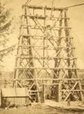
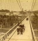
- Opened January 2nd, 1869. Wooden towers replaced with steel towers, 1884. Widened to 17 feet, 1888. Wrecked by wind, January, 1889. Some of the images here may show the replacement bridge.
- Became longest suspension bridge by eclipsing 1867 John A. Roebling (Cincinnati, Cincinnati and Covington) - Cincinnati, Ohio and Covington, Kentucky, USA.
- Eclipsed by new longest suspension bridge 1883 Brooklyn (Great East River) - New York and Brooklyn, New York, USA.
- Replaced by 1889 Second Falls View - Niagara Falls, New York, USA and Niagara Falls, Ontario, Canada.
External Links:
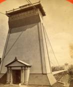
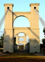
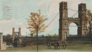
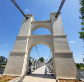
1869: Waco
Waco, Texas, USA - Brazos River
| Bridgemeister ID: | 72 (added before 2003) |
| Year Completed: | 1869 |
| Name: | Waco |
| Location: | Waco, Texas, USA |
| Crossing: | Brazos River |
| Coordinates: | 31.561314 N 97.127063 W |
| Maps: | Acme, GeoHack, Google, OpenStreetMap |
| Principals: | Thomas M. Griffith |
| References: | AAJ, BC3, BPL, BRAZ, GBD, HAERTX98, HBE, PTS2, WSB |
| Use: | Vehicular, with walkway |
| Status: | Restricted to foot traffic (last checked: 2023) |
| Main Cables: | Wire (iron) |
| Suspended Spans: | 1 |
| Main Span: | 1 x 144.8 meters (475 feet) |
| Deck width: | 18 feet |
Notes:
- 1915: Rebuilt.
- 2020, October: Closed for restoration project expecting to last 18-24 months.
- 2021, March: Major restoration project underway, led by Sparks Engineering, Inc.
- 2023, April: The restored bridge is rededicated on April 22. Patrick Sparks of Sparks Engineering reports: . The rededication was held April 22, 2023. "The project involved full rehabilitation including: replacement of the suspension system and anchor rods, strengthening of the anchorages, replacement of the saddle bearings, retrofit strengthening of the east tower, and deck replacement (concrete on the main deck, tropical hardwood on the side walks)."
External Links:
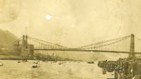
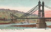
1876: Point
Pittsburgh, Pennsylvania, USA - Monongahela River
| Bridgemeister ID: | 84 (added before 2003) |
| Year Completed: | 1876 |
| Name: | Point |
| Location: | Pittsburgh, Pennsylvania, USA |
| Crossing: | Monongahela River |
| Principals: | Edward Hemberle |
| References: | AAJ, BOP, BPL, HBE, IEA, ONF, PBR, PTS2, SA19000106 |
| Use: | Vehicular and Rail (streetcar) |
| Status: | Demolished, 1927 |
| Main Cables: | Eyebar |
| Suspended Spans: | 1 |
| Main Span: | 1 x 243.8 meters (800 feet) |
| Deck width: | 34 feet |
Notes:
- Partial floor collapse requiring extensive repairs, December 24, 1903. Repaired, 1904. Demolished 1927.
External Links:
1877: Minneapolis
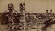
Minneapolis, Minnesota, USA - Mississippi River
| Bridgemeister ID: | 86 (added before 2003) |
| Year Completed: | 1877 |
| Name: | Minneapolis |
| Location: | Minneapolis, Minnesota, USA |
| Crossing: | Mississippi River |
| At or Near Feature: | Nicollet Island |
| Principals: | Thomas M. Griffith |
| References: | AAJ, BPL, HBE, PTS2 |
| Use: | Vehicular, with walkway |
| Status: | Replaced, 1890 |
| Main Cables: | Wire (iron) |
| Suspended Spans: | 1 |
| Main Span: | 1 x 205.8 meters (675.1 feet) |
| Deck width: | 32 feet |
Notes:
- Replaced 1855 Minneapolis (St. Anthony's Falls) - Minneapolis, Minnesota, USA.
- Later at same location 1990 Hennepin Avenue (Father Louis Hennepin) - Minneapolis, Minnesota, USA.
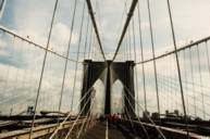
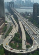
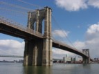
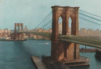
1883: Brooklyn
New York and Brooklyn, New York, USA - East River
| Bridgemeister ID: | 89 (added before 2003) |
| Year Completed: | 1883 |
| Name: | Brooklyn |
| Also Known As: | Great East River |
| Location: | New York and Brooklyn, New York, USA |
| Crossing: | East River |
| Coordinates: | 40.706 N 73.99667 W |
| Maps: | Acme, GeoHack, Google, OpenStreetMap |
| Principals: | John A. Roebling, Washington A. Roebling |
| References: | AAJ, BAAW, BBR, BBTS, BC3, BFL, BLD, BMA, BOB, BOU, BPL, COB, CTW, GB, GBD, HBE, LAB, LACE, NG198305, ONF, PTS2, SJR |
| Use: | Rail (light rail) and Vehicular (major highway), with walkway |
| Status: | In use (last checked: 2022) |
| Main Cables: | Wire (steel) |
| Suspended Spans: | 3 |
| Main Span: | 1 x 486.3 meters (1,595.5 feet) |
| Side Spans: | 2 x 283.5 meters (930 feet) |
| Deck width: | 85 feet |
Notes:
- Became longest suspension bridge by eclipsing 1869 Clifton (Niagara-Clifton, Falls View, First Falls View) - Niagara Falls, New York, USA and Niagara Falls, Ontario, Canada.
- Eclipsed by new longest suspension bridge 1903 Williamsburg - New York and Brooklyn, New York, USA.
- Next to 1909 Manhattan - New York and Brooklyn, New York, USA.
- Near 1903 Williamsburg - New York and Brooklyn, New York, USA.
External Links:
1884: North Side
Pittsburgh, Pennsylvania, USA - Allegheny River
| Bridgemeister ID: | 91 (added before 2003) |
| Year Completed: | 1884 |
| Name: | North Side |
| Also Known As: | Seventh Street |
| Location: | Pittsburgh, Pennsylvania, USA |
| Crossing: | Allegheny River |
| Principals: | Gustav Lindenthal |
| References: | AAJ, BPL, HBE, PBR, PTS2 |
| Use: | Vehicular |
| Status: | Removed, 1924 |
| Main Cables: | Eyebar |
| Suspended Spans: | 4 |
| Main Spans: | 2 x 97.5 meters (320 feet) |
| Side Spans: | 2 x 50.3 meters (165 feet) |
| Deck width: | 42 feet |
Notes:
- Next to 1860 Allegheny River (Sixth Street, St. Clair) - Pittsburgh, Pennsylvania, USA.
- Replaced by 1926 Andy Warhol (Seventh Street) - Pittsburgh, Pennsylvania, USA.
External Links:
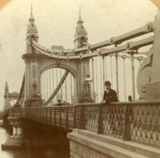
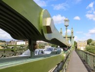
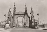
1887: Hammersmith
London, England, United Kingdom - River Thames
| Bridgemeister ID: | 419 (added before 2003) |
| Year Completed: | 1887 |
| Name: | Hammersmith |
| Location: | London, England, United Kingdom |
| Crossing: | River Thames |
| Coordinates: | 51.48845 N 0.23019 W |
| Maps: | Acme, GeoHack, Google, OpenStreetMap |
| Principals: | Sir Joseph Bazalgette |
| References: | BEM, BPL, HBE, NTB, PTS2 |
| Use: | Vehicular (two-lane), with walkway |
| Status: | Restricted to foot traffic, since 2021 (last checked: 2021) |
| Main Cables: | Eyebar |
| Suspended Spans: | 3 |
| Main Span: | 1 |
| Side Spans: | 2 |
Notes:
- 2019, April: Closed to vehicular traffic due to safety concerns after an inspection found fractures in the cast iron casings around the bridge pedestals. Some repair work followed, but was not fully funded or finished (as of mid-2020)
- 2020, August: Fractures found to have worsened during recent heatwave. Bridge is completely closed to all pedestrian and bicycle traffic. Pedestrian walkways under the bridge and all river traffic under the bridge are also prohibited (implying risk of collapse).
- 2020, December: Bridge may reopen to pedestrians and cyclists if deemed safe by maintenance contractor, Mott MacDonald.
- 2021, January: Plan discussed to "thread" a temporary truss along the length of the deck to permit traffic while the suspension bridge undergoes repairs.
- 2021, March: Feasibility study on "double-decker" temporary truss plan determines it is feasible, possibly opening to pedestrian and vehicular traffic by mid-2022.
- 2021, July: Reopened for pedestrian and bicycle use.
- Replaced 1827 Hammersmith - London, England, United Kingdom.
External Links:
- ENR - Engineers Ponder Solutions for Damaged London Bridge. February 22, 2021 Engineering News-Record article discusses proposal to thread a temporary truss between the towers to allow traffic while the larger suspension bridge repairs are completed. Recaps the issue: "Cracks have been found in the cast-iron pedestals that support suspension cable saddles at the abutments. Engineers suspect that roller bearings between the saddles and pedestals seized up at least 30 years ago…"
- Hammersmith Bridge | Temporary ‘double-decker’ proposal deemed technically feasible - New Civil Engineer. March 22, 2021
- The Happy Pontist: London Bridges: 33. Hammersmith Bridge
- Structurae - Structure ID 20008013
1897: Lincoln Highway
East Liverpool, Ohio and Chester, West Virginia, USA - Ohio River
| Bridgemeister ID: | 105 (added before 2003) |
| Year Completed: | 1897 |
| Name: | Lincoln Highway |
| Also Known As: | Chester |
| Location: | East Liverpool, Ohio and Chester, West Virginia, USA |
| Crossing: | Ohio River |
| Principals: | Hermann Laub, E.S. Fickes |
| References: | AAJ, BPL, HBE, PTS2 |
| Use: | Vehicular, with walkway |
| Status: | Removed, 1970 |
| Main Cables: | Wire (steel) |
| Suspended Spans: | 3 |
| Main Span: | 1 x 214.9 meters (705 feet) |
| Side Spans: | 1 x 109.7 meters (360 feet), 1 x 128 meters (420 feet) |
| Deck width: | 27 feet |
Notes:
- Rebuilt 1939 by David Steinman. Closed and demolished, 1970.
External Links:
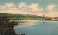
1897: Rochester
Rochester and Monaca, Pennsylvania, USA - Ohio River
| Bridgemeister ID: | 104 (added before 2003) |
| Year Completed: | 1897 |
| Name: | Rochester |
| Location: | Rochester and Monaca, Pennsylvania, USA |
| Crossing: | Ohio River |
| Principals: | Edwin Kirtland Morse |
| References: | AAJ, BPL, HBE, PTS2 |
| Use: | Vehicular, with walkway |
| Status: | Removed |
| Main Cables: | Wire (steel) |
| Suspended Spans: | 3 |
| Main Span: | 1 x 243.8 meters (800 feet) |
| Side Spans: | 1 x 121.9 meters (400 feet), 1 x 126.8 meters (416 feet) |
| Deck width: | 28 feet |
External Links:

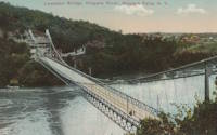
1899: Lewiston-Queenston
Lewiston, New York, USA and Queenston, Ontario, Canada - Niagara River
| Bridgemeister ID: | 108 (added before 2003) |
| Year Completed: | 1899 |
| Name: | Lewiston-Queenston |
| Location: | Lewiston, New York, USA and Queenston, Ontario, Canada |
| Crossing: | Niagara River |
| Principals: | L.L. Buck, R.S. Buck |
| References: | AAJ, BPL, HBE, PTS2 |
| Use: | Vehicular and Rail (streetcar) |
| Status: | Replaced, 1962 |
| Main Cables: | Wire (steel) |
| Suspended Spans: | 1 |
| Main Span: | 1 x 317 meters (1,040 feet) |
| Deck width: | 17 feet |
Notes:
- Reused parts from the recently dismantled Second Falls View Bridge.
- At former location of 1851 Lewiston-Queenston - Lewiston, New York, USA and Queenston, Ontario, Canada.
- See 1889 Second Falls View - Niagara Falls, New York, USA and Niagara Falls, Ontario, Canada.
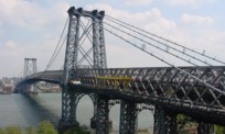
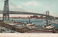
1903: Williamsburg
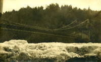
New York and Brooklyn, New York, USA - East River
| Bridgemeister ID: | 111 (added before 2003) |
| Year Completed: | 1903 |
| Name: | Williamsburg |
| Location: | New York and Brooklyn, New York, USA |
| Crossing: | East River |
| Coordinates: | 40.71355 N 73.97226 W |
| Maps: | Acme, GeoHack, Google, OpenStreetMap |
| Principals: | L.L. Buck |
| References: | AAJ, BAAW, BAR, BBR, BPL, GBD, HBE, PTS2, SJR |
| Use: | Rail (light rail) and Vehicular (major highway), with walkway |
| Status: | In use (last checked: 2022) |
| Main Cables: | Wire (steel) |
| Suspended Spans: | 1 |
| Main Span: | 1 x 487.7 meters (1,600 feet) |
Notes:
- Became longest suspension bridge by eclipsing 1883 Brooklyn (Great East River) - New York and Brooklyn, New York, USA.
- Eclipsed by new longest suspension bridge 1924 Bear Mountain - Anthony's Nose and Bear Mountain, New York, USA.
- Near 1883 Brooklyn (Great East River) - New York and Brooklyn, New York, USA.
- Near 1909 Manhattan - New York and Brooklyn, New York, USA.
External Links:
1904: Lordville-Equinunk
Lordville, New York and Equinunk, Pennsylvania, USA - Delaware River
| Bridgemeister ID: | 112 (added before 2003) |
| Year Completed: | 1904 |
| Name: | Lordville-Equinunk |
| Location: | Lordville, New York and Equinunk, Pennsylvania, USA |
| Crossing: | Delaware River |
| Coordinates: | 41.867745 N 75.213789 W |
| Maps: | Acme, GeoHack, Google, OpenStreetMap |
| Principals: | Owego Bridge Company |
| References: | BDR, BOL, BPL, HHP |
| Use: | Vehicular (one-lane) |
| Status: | Demolished, 1986 |
| Main Cables: | Eyebar (steel) |
| Suspended Spans: | 2 |
| Main Span: | 1 x 105.8 meters (347 feet) |
| Side Span: | 1 x 17.1 meters (56 feet) |
Notes:
- Eyebar suspension bridge.
- Replaced 1869 Lordville - Lordville, New York and Equinunk, Pennsylvania, USA.
External Links:
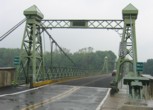
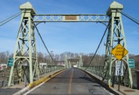
1904: Riegelsville
Riegelsville, Pennsylvania and Riegelsville, New Jersey, USA - Delaware River
| Bridgemeister ID: | 113 (added before 2003) |
| Year Completed: | 1904 |
| Name: | Riegelsville |
| Location: | Riegelsville, Pennsylvania and Riegelsville, New Jersey, USA |
| Crossing: | Delaware River |
| Coordinates: | 40.59427 N 75.19062 W |
| Maps: | Acme, GeoHack, Google, OpenStreetMap |
| Principals: | John A. Roebling's Sons Co., S. A. Cooney |
| References: | BDR, BPL, SSS |
| Use: | Vehicular (two-lane, heavy vehicles), with walkway |
| Status: | In use (last checked: 2007) |
| Main Cables: | Wire (steel) |
| Suspended Spans: | 3 |
| Main Spans: | 3 |
External Links:
1905: Market Street
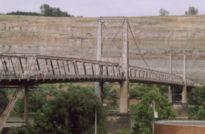
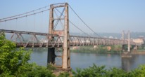
Steubenville, Ohio and East Steubenville, West Virginia, USA - Ohio River
| Bridgemeister ID: | 114 (added before 2003) |
| Year Completed: | 1905 |
| Name: | Market Street |
| Location: | Steubenville, Ohio and East Steubenville, West Virginia, USA |
| Crossing: | Ohio River |
| Coordinates: | 40.35833 N 80.61167 W |
| Maps: | Acme, GeoHack, Google, OpenStreetMap |
| Principals: | Hermann Laub |
| References: | AAJ, BPL, PTS2 |
| Use: | Vehicular (two-lane) |
| Status: | Closed, December 2023 |
| Main Cables: | Wire (steel) |
| Suspended Spans: | 3 |
| Main Span: | 1 x 207.3 meters (680 feet) |
| Side Spans: | 2 x 79.2 meters (260 feet) |
Notes:
- 2023, December: Closed by WVDOT because of safety concerns.
- Near 1928 Fort Steuben - Steubenville, Ohio and Weirton, West Virginia, USA.
External Links:
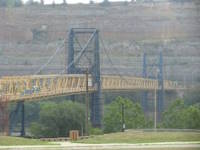
1905: Newell
East Liverpool, Ohio and Newell, West Virginia, USA - Ohio River
| Bridgemeister ID: | 117 (added before 2003) |
| Year Completed: | 1905 |
| Name: | Newell |
| Location: | East Liverpool, Ohio and Newell, West Virginia, USA |
| Crossing: | Ohio River |
| Coordinates: | 40.62167 N 80.595 W |
| Maps: | Acme, GeoHack, Google, OpenStreetMap |
| Principals: | Edwin Kirtland Morse, Dravo Company |
| References: | AAJ, BPL, PTS2 |
| Use: | Vehicular (two-lane), with walkway |
| Status: | In use (last checked: 2022) |
| Main Cables: | Wire (steel) |
| Suspended Spans: | 3 |
| Main Span: | 1 x 228.6 meters (750 feet) |
| Side Spans: | 2 |
Annotated Citations:
- Huba, Stephen. "There’s a new owner for the Newell Bridge." The Weirton Daily Times, 6 May 2022, www.weirtondailytimes.com/news/local-news/2022/05/theres-a-new-owner-for-the-newell-bridge/.
"Frank Six of Six Enterprises in Newell, assumed ownership Wednesday of one of the oldest suspension bridges on the Ohio River for an undisclosed sum from HLC Holdings Inc., parent company of the Fiesta Tableware Co., formerly known as the Homer Laughlin China Co."
- Bobby-Gilbert, Jo-Ann., "Fiesta Tableware Parent Sells Iconic Newell Bridge." The Business Journal, 5 May 2022, businessjournaldaily.com/fiesta-tableware-parent-sells-iconic-newell-bridge/.
"After 116 years of ownership by HLC Holdings Inc., parent company of The Fiesta Tableware Co., the Newell Bridge and Railway Co. changed hands at midnight Wednesday. Officials of Fiesta Tableware, formerly known as Homer Laughlin China Co., announced that the bridge has been purchased by Frank Six, owner of Six Enterprises in Newell."
External Links:

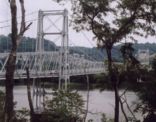
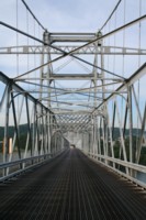
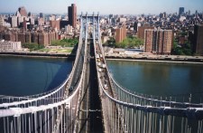
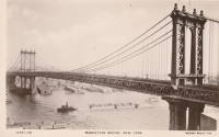
1909: Manhattan
New York and Brooklyn, New York, USA - East River
| Bridgemeister ID: | 123 (added before 2003) |
| Year Completed: | 1909 |
| Name: | Manhattan |
| Location: | New York and Brooklyn, New York, USA |
| Crossing: | East River |
| Coordinates: | 40.70667 N 73.99167 W |
| Maps: | Acme, GeoHack, Google, OpenStreetMap |
| Principals: | O.F. Nichols, Leon Moisseiff |
| References: | AAJ, BAAW, BBR, BC3, BPL, GBD, HBE, LAB, PTS2, SA19050909, SJR |
| Use: | Vehicular (double-deck) |
| Status: | In use (last checked: 2022) |
| Main Cables: | Wire (steel) |
| Suspended Spans: | 3 |
| Main Span: | 1 x 448.1 meters (1,470 feet) |
| Side Spans: | 2 x 221 meters (725 feet) |
Notes:
- Opened December 31, 1909, but not fully completed yet.
- Next to 1883 Brooklyn (Great East River) - New York and Brooklyn, New York, USA.
- Near 1903 Williamsburg - New York and Brooklyn, New York, USA.
External Links:
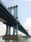

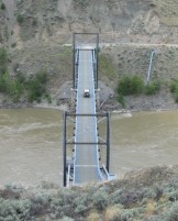
1914: Churn Creek
Gang Ranch, British Columbia, Canada - Fraser River
| Bridgemeister ID: | 131 (added before 2003) |
| Year Completed: | 1914 |
| Name: | Churn Creek |
| Location: | Gang Ranch, British Columbia, Canada |
| Crossing: | Fraser River |
| Coordinates: | 51.527494 N 122.285082 W |
| Maps: | Acme, GeoHack, Google, OpenStreetMap |
| Principals: | Waddell & Harrington |
| References: | BPL |
| Use: | Vehicular (one-lane) |
| Status: | In use (last checked: 2018) |
| Main Cables: | Wire (steel) |
| Suspended Spans: | 1 |
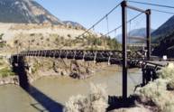
1914: Old
Lillooet, British Columbia, Canada - Fraser River
| Bridgemeister ID: | 130 (added before 2003) |
| Year Completed: | 1914 |
| Name: | Old |
| Location: | Lillooet, British Columbia, Canada |
| Crossing: | Fraser River |
| Coordinates: | 50.711493 N 121.911333 W |
| Maps: | Acme, GeoHack, Google, OpenStreetMap |
| Principals: | Waddell & Harrington |
| References: | BPL |
| Use: | Vehicular (one-lane) |
| Status: | Restricted to foot traffic (last checked: 2015) |
| Main Cables: | Wire (steel) |
| Suspended Spans: | 1 |
| Main Span: | 1 x 121.9 meters (400 feet) estimated |
Notes:
- Known locally as "The Old Bridge."
1916: Belpre-Parkersburg
Parkersburg, West Virginia and Belpre, Ohio, USA - Ohio River
| Bridgemeister ID: | 134 (added before 2003) |
| Year Completed: | 1916 |
| Name: | Belpre-Parkersburg |
| Location: | Parkersburg, West Virginia and Belpre, Ohio, USA |
| Crossing: | Ohio River |
| Principals: | Hermann Laub |
| References: | AAJ, BPL, PTS2, SJR |
| Use: | Vehicular, with walkway |
| Status: | Demolished, March 16, 1980 |
| Main Cables: | Wire (steel) |
| Suspended Spans: | 3 |
| Main Span: | 1 x 236.2 meters (775 feet) |
| Side Spans: | 1 x 114.3 meters (375 feet), 1 x 83.8 meters (275 feet) |
| Deck width: | 22 feet |
External Links:
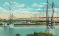
1926: Andy Warhol
Pittsburgh, Pennsylvania, USA - Allegheny River
| Bridgemeister ID: | 148 (added before 2003) |
| Year Completed: | 1926 |
| Name: | Andy Warhol |
| Also Known As: | Seventh Street |
| Location: | Pittsburgh, Pennsylvania, USA |
| Crossing: | Allegheny River |
| Coordinates: | 40.44626 N 80.00145 W |
| Maps: | Acme, GeoHack, Google, OpenStreetMap |
| Principals: | Vernon R. Covell, T.J. Wilkerson, A.D. Nutter, H.E. Dodge, Stanley L. Roush |
| References: | AAJ, BOP, BPL, PBR, PTS2, USS |
| Use: | Vehicular (four-lane), with walkway |
| Status: | In use (last checked: 2014) |
| Main Cables: | Eyebar (steel) |
| Suspended Spans: | 3 |
| Main Span: | 1 x 134.7 meters (442 feet) |
| Side Spans: | 2 x 67.4 meters (221 feet) |
| Deck width: | 62 feet |
| Characteristics: | Self-anchored |
Notes:
- Self-anchored.
- Replaced 1884 North Side (Seventh Street) - Pittsburgh, Pennsylvania, USA.
- Next to 1927 Rachel Carson (Ninth Street) - Pittsburgh, Pennsylvania, USA.
- Next to 1928 Roberto Clemente (Sixth Street) - Pittsburgh, Pennsylvania, USA.
External Links:
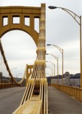
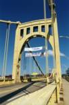
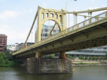
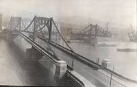
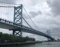
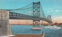
1926: Benjamin Franklin
Philadelphia, Pennsylvania and Camden, New Jersey, USA - Delaware River
| Bridgemeister ID: | 145 (added before 2003) |
| Year Completed: | 1926 |
| Name: | Benjamin Franklin |
| Also Known As: | Philadelphia-Camden |
| Location: | Philadelphia, Pennsylvania and Camden, New Jersey, USA |
| Crossing: | Delaware River |
| Coordinates: | 39.95333 N 75.135 W |
| Maps: | Acme, GeoHack, Google, OpenStreetMap |
| Principals: | Modjeski, Webster, Ball, Moiseff |
| References: | AAJ, BBR, BFL, BONJ, BPL, DRB, GBD, PTL, PTS2, USS |
| Use: | Vehicular (major highway) and Rail (subway), with walkway |
| Status: | In use (last checked: 2007) |
| Main Cables: | Wire (steel) |
| Suspended Spans: | 3 |
| Main Span: | 1 x 533.4 meters (1,750 feet) |
| Side Spans: | 2 x 219.3 meters (719.5 feet) |
| Deck width: | 125.5 feet |
Notes:
- Became longest suspension bridge by eclipsing 1924 Bear Mountain - Anthony's Nose and Bear Mountain, New York, USA.
- Eclipsed by new longest suspension bridge 1929 Ambassador - Detroit, Michigan, USA and Windsor, Ontario, Canada.
- Near 1957 Walt Whitman - Philadelphia, Pennsylvania and Camden, New Jersey, USA.
External Links:
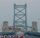
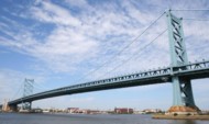
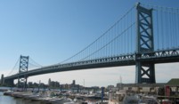
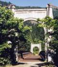
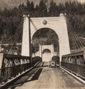
1926: Second Alexandra
Spuzzum, British Columbia, Canada - Fraser River
| Bridgemeister ID: | 147 (added before 2003) |
| Year Completed: | 1926 |
| Name: | Second Alexandra |
| Location: | Spuzzum, British Columbia, Canada |
| Crossing: | Fraser River |
| At or Near Feature: | Caribou Highway |
| Coordinates: | 49.70739 N 121.41669 W |
| Maps: | Acme, GeoHack, Google, OpenStreetMap |
| References: | BPL |
| Use: | Vehicular (one-lane) |
| Status: | Restricted to foot traffic (last checked: 2021) |
| Main Cables: | Wire (steel) |
| Suspended Spans: | 1 |
| Main Span: | 1 x 82.3 meters (270 feet) |
Notes:
1927: Rachel Carson
Pittsburgh, Pennsylvania, USA - Allegheny River
| Bridgemeister ID: | 150 (added before 2003) |
| Year Completed: | 1927 |
| Name: | Rachel Carson |
| Also Known As: | Ninth Street |
| Location: | Pittsburgh, Pennsylvania, USA |
| Crossing: | Allegheny River |
| Coordinates: | 40.44669 N 79.99980 W |
| Maps: | Acme, GeoHack, Google, OpenStreetMap |
| Principals: | Vernon R. Covell, T.J. Wilkerson, A.D. Nutter, H.E. Dodge, Stanley L. Roush |
| References: | AAJ, BOP, BPL, PBR, PTS2, USS |
| Use: | Vehicular (four-lane), with walkway |
| Status: | In use (last checked: 2014) |
| Main Cables: | Eyebar (steel) |
| Suspended Spans: | 3 |
| Main Span: | 1 x 131.1 meters (430 feet) |
| Side Spans: | 2 x 65.5 meters (215 feet) |
| Characteristics: | Self-anchored |
Notes:
- Self-anchored.
- Next to 1926 Andy Warhol (Seventh Street) - Pittsburgh, Pennsylvania, USA.
- Next to 1928 Roberto Clemente (Sixth Street) - Pittsburgh, Pennsylvania, USA.
External Links:

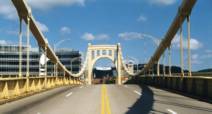
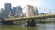

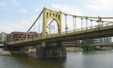
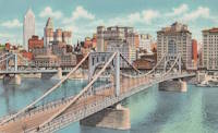
1928: Roberto Clemente
Pittsburgh, Pennsylvania, USA - Allegheny River
| Bridgemeister ID: | 158 (added before 2003) |
| Year Completed: | 1928 |
| Name: | Roberto Clemente |
| Also Known As: | Sixth Street |
| Location: | Pittsburgh, Pennsylvania, USA |
| Crossing: | Allegheny River |
| Coordinates: | 40.44558 N 80.00332 W |
| Maps: | Acme, GeoHack, Google, OpenStreetMap |
| Principals: | Vernon R. Covell, T.J. Wilkerson, A.D. Nutter, H.E. Dodge, Stanley L. Roush |
| References: | AAJ, BOP, BPL, PBR, PTS2, SSS, USS |
| Use: | Vehicular (four-lane), with walkway |
| Status: | In use (last checked: 2014) |
| Main Cables: | Eyebar (steel) |
| Suspended Spans: | 3 |
| Main Span: | 1 x 131.1 meters (430 feet) |
| Side Spans: | 2 x 65.5 meters (215 feet) |
| Characteristics: | Self-anchored |
Notes:
- Self-anchored.
- Next to 1926 Andy Warhol (Seventh Street) - Pittsburgh, Pennsylvania, USA.
- Next to 1927 Rachel Carson (Ninth Street) - Pittsburgh, Pennsylvania, USA.
External Links:

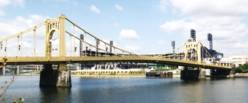
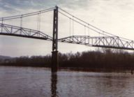
1928: Saint Marys
Saint Marys, West Virginia and Newport, Ohio, USA - Ohio River
| Bridgemeister ID: | 159 (added before 2003) |
| Year Completed: | 1928 |
| Name: | Saint Marys |
| Also Known As: | Hi Carpenter, Short Route |
| Location: | Saint Marys, West Virginia and Newport, Ohio, USA |
| Crossing: | Ohio River |
| Principals: | J.E. Greiner Co. |
| References: | BPL, GBD, PTS2 |
| Use: | Vehicular |
| Status: | Demolished, 1971 |
| Main Cables: | Eyebar (steel) |
| Suspended Spans: | 3 |
| Main Span: | 1 x 213.4 meters (700 feet) |
| Side Spans: | 2 |
Notes:
- Same design as the Silver Bridge that famously collapsed in 1967. Demolished 1971 as a precautionary measure because the engineers decided they could not tell if it suffered from the same flaw as the Silver Bridge without dismantling the eyebars.
- Companion to 1928 Point Pleasant (Silver) - Point Pleasant, West Virginia and Kanauga, Gallipolis vicinity, Ohio, USA.
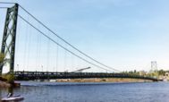
1929: Grand Mère
Grand-Mère, Quebec, Canada - St. Maurice River
| Bridgemeister ID: | 162 (added before 2003) |
| Year Completed: | 1929 |
| Name: | Grand Mère |
| Location: | Grand-Mère, Quebec, Canada |
| Crossing: | St. Maurice River |
| Coordinates: | 46.620117 N 72.6794 W |
| Maps: | Acme, GeoHack, Google, OpenStreetMap |
| Principals: | Robinson and Steinman |
| References: | AAJ, BC3, BPL, PTS2, SJR |
| Use: | Vehicular (two-lane, heavy vehicles), with walkway |
| Status: | In use (last checked: 2019) |
| Main Cables: | Wire (steel) |
| Suspended Spans: | 1 |
| Main Span: | 1 x 289.2 meters (948.8 feet) |
| Deck width: | 26 feet |
External Links:
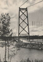
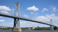
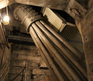
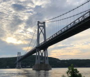
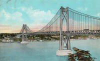
1930: Mid-Hudson
Poughkeepsie and Highland, New York, USA - Hudson River
| Bridgemeister ID: | 166 (added before 2003) |
| Year Completed: | 1930 |
| Name: | Mid-Hudson |
| Also Known As: | Franklin Delano Roosevelt Mid-Hudson |
| Location: | Poughkeepsie and Highland, New York, USA |
| Crossing: | Hudson River |
| Coordinates: | 41.702933 N 73.946683 W |
| Maps: | Acme, GeoHack, Google, OpenStreetMap |
| Principals: | Ralph Modjeski |
| References: | AAJ, BPL, PTS2, SJR, USS |
| Use: | Vehicular (two-lane, heavy vehicles), with walkway |
| Status: | In use (last checked: 2019) |
| Main Cables: | Wire (steel) |
| Suspended Spans: | 3 |
| Main Span: | 1 x 457.2 meters (1,500 feet) |
| Side Spans: | 2 x 228.6 meters (750 feet) |
| Deck width: | 39 feet |
Notes:
- Although the length of the main span of the bridge is officially 1,500 feet, the actual length is 1,495 feet. During construction one of the caissons slid and tilted from its intended location. While efforts were made to move the caisson back, it was ultimately fixed in a position that left the main span five feet short of 1,500. Not wanting to lose the claim of having a 1,500-foot bridge, the shortfall has been kept out of official records since.
External Links:
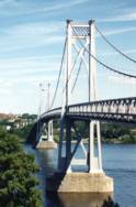
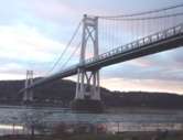
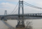
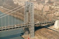
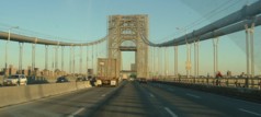
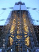
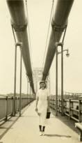
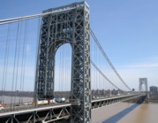
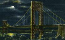
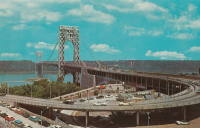
1931: George Washington
New York, New York and Fort Lee, New Jersey, USA - Hudson River
| Bridgemeister ID: | 169 (added before 2003) |
| Year Completed: | 1931 |
| Name: | George Washington |
| Also Known As: | GWB |
| Location: | New York, New York and Fort Lee, New Jersey, USA |
| Crossing: | Hudson River |
| Coordinates: | 40.85333 N 73.955 W |
| Maps: | Acme, GeoHack, Google, OpenStreetMap |
| Principals: | O.H. Ammann, Leon Moisseiff, Dana, Gilbert |
| References: | AAJ, AOB, ARF, BBR, BC3, BFL, BMA, BONJ, BOU, BPL, BRU, COB, CTW, ENR19270811a, ENR19270811b, ENR19290411c, GBD, LAB, LACE, PTS2, SIX, SJR |
| Use: | Vehicular (double-deck), with walkway |
| Status: | In use (last checked: 2022) |
| Main Cables: | Wire (steel) |
| Suspended Spans: | 3 |
| Main Span: | 1 x 1,066.8 meters (3,500 feet) |
| Side Spans: | 2 x 198.1 meters (650 feet) |
| Deck width: | 120 feet |
Notes:
- Became longest suspension bridge by eclipsing 1929 Ambassador - Detroit, Michigan, USA and Windsor, Ontario, Canada.
- Eclipsed by new longest suspension bridge 1937 Golden Gate - San Francisco and Marin County, California, USA.
External Links:
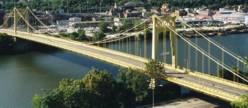
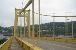
1931: South Tenth Street
Pittsburgh, Pennsylvania, USA - Monongahela River
| Bridgemeister ID: | 173 (added before 2003) |
| Year Completed: | 1931 |
| Name: | South Tenth Street |
| Also Known As: | South Side, Tenth Street, Philip Murray |
| Location: | Pittsburgh, Pennsylvania, USA |
| Crossing: | Monongahela River |
| Coordinates: | 40.43166 N 79.989 W |
| Maps: | Acme, GeoHack, Google, OpenStreetMap |
| Principals: | Sydney A. Shubin |
| References: | AAJ, BOP, BPL, PBR, SSS, USS |
| Use: | Vehicular (four-lane), with walkway |
| Status: | In use (last checked: 2019) |
| Main Cables: | Wire (steel) |
| Suspended Spans: | 3 |
| Main Span: | 1 x 228.6 meters (750 feet) |
| Side Spans: | 2 x 83.8 meters (275 feet) |
| Deck width: | 54 feet |
External Links:
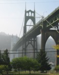
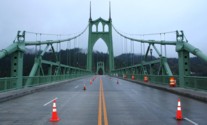
1931: St. Johns
Portland, Oregon, USA - Willamette River
| Bridgemeister ID: | 174 (added before 2003) |
| Year Completed: | 1931 |
| Name: | St. Johns |
| Location: | Portland, Oregon, USA |
| Crossing: | Willamette River |
| Coordinates: | 45.585 N 122.76333 W |
| Maps: | Acme, GeoHack, Google, OpenStreetMap |
| Principals: | Robinson and Steinman |
| References: | AAJ, ADDS, BC3, BCO, BFL, BPL, GBD, LAB, SJR |
| Use: | Vehicular (four-lane), with walkway |
| Status: | In use (last checked: 2022) |
| Main Cables: | Wire (steel) |
| Suspended Spans: | 3 |
| Main Span: | 1 x 367.9 meters (1,207 feet) |
| Side Spans: | 2 x 131.1 meters (430.25 feet) |
| Deck width: | 52 feet |
Notes:
- Substantially rehabilitated, 2003-2005.
External Links:
1932: Prairie du Chien
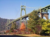
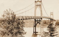
Praire du Chien, Wisconsin and Marquette, Iowa, USA - Mississippi River
| Bridgemeister ID: | 177 (added before 2003) |
| Year Completed: | 1932 |
| Name: | Prairie du Chien |
| Location: | Praire du Chien, Wisconsin and Marquette, Iowa, USA |
| Crossing: | Mississippi River |
| Coordinates: | 43.046 N 91.17 W |
| Maps: | Acme, GeoHack, Google, OpenStreetMap |
| Principals: | Austin Bridge Co. |
| References: | AAJ, AUB, BPL |
| Use: | Vehicular (two-lane) |
| Status: | Removed, 1974 |
| Main Cables: | Wire (steel) |
| Main Span: | 1 x 144.2 meters (473 feet) |
Notes:
- There were two back-to-back suspension bridges at this location.
- Connects to 1932 Prairie du Chien - Praire du Chien, Wisconsin and Marquette, Iowa, USA.
External Links:
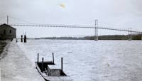
1932: Prairie du Chien
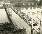
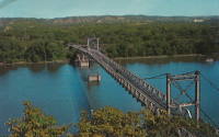
Praire du Chien, Wisconsin and Marquette, Iowa, USA - Mississippi River
| Bridgemeister ID: | 1256 (added before 2003) |
| Year Completed: | 1932 |
| Name: | Prairie du Chien |
| Location: | Praire du Chien, Wisconsin and Marquette, Iowa, USA |
| Crossing: | Mississippi River |
| Coordinates: | 43.05 N 91.162 W |
| Maps: | Acme, GeoHack, Google, OpenStreetMap |
| Principals: | Austin Bridge Co. |
| References: | AAJ, AUB, BPL |
| Use: | Vehicular (two-lane) |
| Status: | Removed, 1974 |
| Main Cables: | Wire (steel) |
| Main Span: | 1 x 144.2 meters (473 feet) |
Notes:
- There were two back-to-back suspension bridges at this location.
- Connects to 1932 Prairie du Chien - Praire du Chien, Wisconsin and Marquette, Iowa, USA.
External Links:


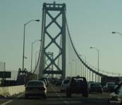
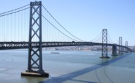
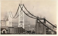
1936: San Francisco-Oakland Bay
Oakland and San Francisco, California, USA - San Francisco Bay
| Bridgemeister ID: | 184 (added before 2003) |
| Year Completed: | 1936 |
| Name: | San Francisco-Oakland Bay |
| Location: | Oakland and San Francisco, California, USA |
| Crossing: | San Francisco Bay |
| Coordinates: | 37.78667 N 122.39 W |
| Maps: | Acme, GeoHack, Google, OpenStreetMap |
| Principals: | C.H. Purcell, Glenn B. Woodruff |
| References: | AAJ, AZB, BAAW, BC3, BPL, GBD, LAB, OBB1, SFOM, USS |
| Use: | Vehicular (double-deck) |
| Status: | In use (last checked: 2022) |
| Main Cables: | Wire (steel) |
| Suspended Spans: | 6 |
| Main Spans: | 1 x 678 meters (2,224.4 feet), 1 x 673.6 meters (2,210 feet) |
| Side Spans: | 4 |
| Deck width: | 66 feet (58 feet roadway) |
Notes:
External Links:

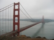
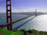
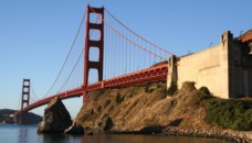
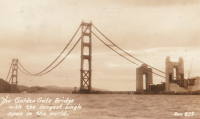
1937: Golden Gate
San Francisco and Marin County, California, USA - San Francisco Bay
| Bridgemeister ID: | 188 (added before 2003) |
| Year Completed: | 1937 |
| Name: | Golden Gate |
| Location: | San Francisco and Marin County, California, USA |
| Crossing: | San Francisco Bay |
| Coordinates: | 37.82 N 122.47667 W |
| Maps: | Acme, GeoHack, Google, OpenStreetMap |
| Principals: | Joseph B. Strauss, Leon Moisseiff, Charles A. Ellis, Irving F. Morrow |
| References: | AAJ, AZB, BAAW, BBR, BC3, BFL, BLD, BMA, BOU, BPL, BRU, COB, CTW, GAT, GBD, GGB, LAB, SPG |
| Use: | Vehicular (major highway), with walkway |
| Status: | In use (last checked: 2022) |
| Main Cables: | Wire (steel) |
| Suspended Spans: | 3 |
| Main Span: | 1 x 1,280.2 meters (4,200 feet) |
| Side Spans: | 2 x 343 meters (1,125.41 feet) |
| Deck width: | 80 feet |
Notes:
- Became longest suspension bridge by eclipsing 1931 George Washington (GWB) - New York, New York and Fort Lee, New Jersey, USA.
- Eclipsed by new longest suspension bridge 1964 Verrazzano Narrows (Verrazano Narrows) - Brooklyn and Staten Island, New York, USA.
External Links:

1939: Bronx-Whitestone
The Bronx and Queens, New York, USA - East River
| Bridgemeister ID: | 191 (added before 2003) |
| Year Completed: | 1939 |
| Name: | Bronx-Whitestone |
| Location: | The Bronx and Queens, New York, USA |
| Crossing: | East River |
| Coordinates: | 40.80167 N 73.83 W |
| Maps: | Acme, GeoHack, Google, OpenStreetMap |
| Principals: | O. H. Ammann, Allston Dana |
| References: | AAJ, ARF, BAAW, BBR, BFL, BPL, GBD, SIX |
| Use: | Vehicular (major highway) |
| Status: | In use (last checked: 2022) |
| Main Cables: | Wire (steel) |
| Suspended Spans: | 3 |
| Main Span: | 1 x 701 meters (2,300 feet) |
| Side Spans: | 2 x 224 meters (735 feet) |
Notes:
External Links:

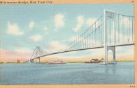
1939: Sullivan-Hutsonville
Hutsonville, Illinois and Sullivan, Indiana, USA - Wabash River
| Bridgemeister ID: | 196 (added before 2003) |
| Year Completed: | 1939 |
| Name: | Sullivan-Hutsonville |
| Location: | Hutsonville, Illinois and Sullivan, Indiana, USA |
| Crossing: | Wabash River |
| Coordinates: | 39.1101 N 87.6551 W |
| Maps: | Acme, GeoHack, Google, OpenStreetMap |
| Principals: | Steinman & Robinson, R.V. Milbank, Wisconsin Bridge & Iron Co., Charles J. Glasgow |
| References: | AAJ, BPL, IMB, SJR19880926 |
| Use: | Vehicular (two-lane), with walkway |
| Status: | Demolished, 1989 |
| Main Cables: | Wire (steel) |
| Suspended Spans: | 3 |
| Main Span: | 1 x 106.7 meters (350 feet) |
| Side Spans: | 2 x 45.7 meters (150 feet) |
| Deck width: | 20 feet |
| Characteristics: | Self-anchored |
Notes:
- Demolished 1989. This bridge was Steinman's attempt at a self-anchored suspension bridge and met a controversial demise in 1989. An article in the September 26, 1988 issue of the Springfield, IL "The State Journal-Register" describes the ongoing controversy. The company to which the $100,000 demolition contract was let offered to turn the money over to save the bridge. The locals agreed, but the company's Chief Engineer Stephen Schneider was quoted, "I think Indiana really wants to tear it down. They've been ... forced to send inspectors out every two weeks. I think they just want the headache gone." Gary Abell, spokesman for the Indiana Dept. Of Highways said its design is "not one of the best. It works in theory, but not in practice. This is like trying to save a mistake." After a lot of back-and-forth, the locals gave up, "We've had it with them. We don't want anything more to do with it. They can tear the damn thing down." Animosity toward this bridge continues 13 years after its demolition. In 2002, in an email to Wayne Grodkiewicz (who provided me with much information about this bridge), an INDOT representative said, "I am not sure why you are interested in that bridge, but from our stand point, it was a very poorly designed bridge that had many many problems from the day that it was completed, until it was brought down."
External Links:
1940: Orleans
Orleans, California, USA - Klamath River
| Bridgemeister ID: | 197 (added before 2003) |
| Year Completed: | 1940 |
| Name: | Orleans |
| Location: | Orleans, California, USA |
| Crossing: | Klamath River |
| Principals: | C.H. Purcell, Murphy Pacific Co. |
| References: | BPL, WOT |
| Status: | Destroyed, 1965 |
Notes:
- BPL: Washed away during 1965 floods. An article in the September 13, 1966 edition of the Humboldt Standard says it was destroyed by flood in 1964.
- Replaced 1912 Orleans - Orleans, California, USA.
- Replaced by 1967 Orleans - Orleans, California, USA.
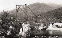
1940: Tacoma Narrows
Tacoma and Gig Harbor, Washington, USA - Puget Sound
| Bridgemeister ID: | 198 (added before 2003) |
| Year Completed: | 1940 |
| Name: | Tacoma Narrows |
| Also Known As: | Galloping Gertie |
| Location: | Tacoma and Gig Harbor, Washington, USA |
| Crossing: | Puget Sound |
| Coordinates: | 47.267015 N 122.548462 W |
| Maps: | Acme, GeoHack, Google, OpenStreetMap |
| Principals: | Leon Moisseiff |
| References: | AAJ, BAR, BBR, BFL, BMA, BPL, COB, CTT, GBD, IT1999F, SPW |
| Use: | Vehicular (two-lane, heavy vehicles), with walkway |
| Status: | Collapsed, 1940 |
| Main Cables: | Wire (steel) |
| Suspended Spans: | 3 |
| Main Span: | 1 x 853.4 meters (2,800 feet) |
| Side Spans: | 2 x 335.3 meters (1,100 feet) |
| Deck width: | 39 feet |
Notes:
- Famously destroyed by wind, November 7, 1940.
- Replaced by 1950 Tacoma Narrows (Sturdy Gertie, Second Tacoma Narrows) - Tacoma and Gig Harbor, Washington, USA.
- See 1944 Liard River - Liard River Hot Springs vicinity, British Columbia, Canada. According to CTT, "Two sections from the Tacoma bridge's east approach were [re]used in the Liard span."
External Links:


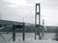

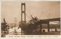
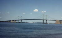
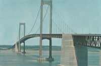
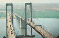
1951: Delaware Memorial I
New Castle, Delaware and Pennsville, New Jersey, USA - Delaware River
| Bridgemeister ID: | 207 (added before 2003) |
| Year Completed: | 1951 |
| Name: | Delaware Memorial I |
| Location: | New Castle, Delaware and Pennsville, New Jersey, USA |
| Crossing: | Delaware River |
| Coordinates: | 39.689227 N 75.520800 W |
| Maps: | Acme, GeoHack, Google, OpenStreetMap |
| Principals: | Homer R. Seely, Enoch R. Needles, Othmar Ammann, et. al. |
| References: | BONJ, BPL, CTD, GBD |
| Use: | Vehicular (major highway) |
| Status: | In use (last checked: 2022) |
| Main Cables: | Wire (steel) |
| Suspended Spans: | 3 |
| Main Span: | 1 x 655.3 meters (2,150 feet) |
| Side Spans: | 2 x 228.6 meters (750 feet) |
| Deck width: | 59.1 feet |
Notes:
External Links:
1967: Orleans
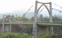
Orleans, California, USA - Klamath River
| Bridgemeister ID: | 223 (added before 2003) |
| Year Completed: | 1967 |
| Name: | Orleans |
| Location: | Orleans, California, USA |
| Crossing: | Klamath River |
| Coordinates: | 41.30167 N 123.53333 W |
| Maps: | Acme, GeoHack, Google, OpenStreetMap |
| Principals: | Ostap Bender, A.P. Bezzone, Jr. |
| References: | BCO, BPL, WOT |
| Use: | Vehicular (two-lane, heavy vehicles), with walkway |
| Status: | In use (last checked: 2021) |
| Main Cables: | Wire (steel) |
| Suspended Spans: | 3 |
| Main Span: | 1 x 131.1 meters (430 feet) |
| Side Spans: | 2 |
Notes:
- Replaced 1940 Orleans - Orleans, California, USA.
External Links:
1969: Claiborne Pell
Newport and Jamestown, Rhode Island, USA - Narragansett Bay
| Bridgemeister ID: | 226 (added before 2003) |
| Year Completed: | 1969 |
| Name: | Claiborne Pell |
| Also Known As: | Newport, Newport-Pell |
| Location: | Newport and Jamestown, Rhode Island, USA |
| Crossing: | Narragansett Bay |
| Coordinates: | 41.505 N 71.34166 W |
| Maps: | Acme, GeoHack, Google, OpenStreetMap |
| Principals: | Parsons, Brinkerhoff, Quade, Douglas |
| References: | BPL |
| Use: | Vehicular (four-lane) |
| Status: | In use (last checked: 2022) |
| Main Cables: | Wire (steel) |
| Suspended Spans: | 3 |
| Main Span: | 1 x 487.7 meters (1,600 feet) |
| Side Spans: | 2 x 209.4 meters (687 feet) |
Notes:
- 2022, November: USD$82.5M grant awarded to fund improvements to deck and suspension system intended to extend the life of the bridge by 50-75 years.
External Links:
