Inventory Search Results (301-387 of 387)
387 suspension bridges were found for search criteria: AAJ. Bridges 301 through 387 (of 387 total) appear below. Click the Bridgemeister ID number to isolate the bridge on its own page. If you don't see what you were looking for, try an image search with the same criteria: AAJ. This will find the bridge if it is pictured on the site, but is not a catenary suspension bridge.
Related:
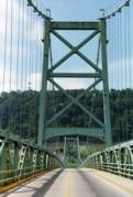
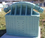
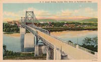
1927: General U.S. Grant
Portsmouth, Ohio and Fullerton, Kentucky, USA - Ohio River
| Bridgemeister ID: | 151 (added before 2003) |
| Year Completed: | 1927 |
| Name: | General U.S. Grant |
| Location: | Portsmouth, Ohio and Fullerton, Kentucky, USA |
| Crossing: | Ohio River |
| Coordinates: | 38.725 N 82.99833 W |
| Maps: | Acme, GeoHack, Google, OpenStreetMap |
| Principals: | Robinson and Steinman, J.E. Greiner, Dravo Co. |
| References: | AAJ, PTS2, SSS |
| Use: | Vehicular (two-lane, heavy vehicles) |
| Status: | Demolished, July 2001 |
| Main Cables: | Wire (steel) |
| Suspended Spans: | 3 |
| Main Span: | 1 x 213.4 meters (700 feet) |
| Side Spans: | 2 x 106.7 meters (350 feet) |
| Deck width: | 28.5 feet |
Notes:
- AAJ: "Recabled" in 1939.
External Links:
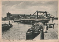
1927: Hugo Preuss
Berlin, Germany - Berlin-Spandau Ship Canal
| Bridgemeister ID: | 2090 (added 2006-07-02) |
| Year Completed: | 1927 |
| Name: | Hugo Preuss |
| Also Known As: | Hugo Preuß, Humboldthafen, Admiral Scheer |
| Location: | Berlin, Germany |
| Crossing: | Berlin-Spandau Ship Canal |
| Coordinates: | 52.523580 N 13.372238 E |
| Maps: | Acme, GeoHack, Google, OpenStreetMap |
| References: | AAJ, PTS2 |
| Use: | Vehicular |
| Status: | Destroyed, 1945 |
| Main Cables: | Eyebar |
| Suspended Spans: | 3 |
| Main Span: | 1 |
| Side Spans: | 2 |
| Characteristics: | Self-anchored |
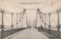
1927: Montjean-sur-Loire
Montjean-sur-Loire, Maine-et-Loire, France - Loire River
| Bridgemeister ID: | 1602 (added 2005-02-06) |
| Year Completed: | 1927 |
| Name: | Montjean-sur-Loire |
| Location: | Montjean-sur-Loire, Maine-et-Loire, France |
| Crossing: | Loire River |
| Coordinates: | 47.395958 N 0.858340 W |
| Maps: | Acme, GeoHack, Google, OpenStreetMap |
| References: | AAJ, PTS2 |
| Use: | Vehicular |
| Status: | Destroyed, 1936 |
| Main Cables: | Wire |
| Suspended Spans: | 6 |
| Main Spans: | 4 |
| Side Spans: | 2 |
Notes:
- 1935: One of the towers fails in a windstorm causing part of the bridge to collapse.
- 1936: The remainder of the derelict bridge is wrecked by a flood.
- Replaced 1840 Montjean-sur-Loire - Montjean-sur-Loire, Maine-et-Loire, France.
- Replaced by 1938 Montjean-sur-Loire - Montjean-sur-Loire, Maine-et-Loire, France.
External Links:
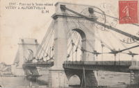
1927: Port à l'Anglais
Alfortville and Vitry-sur-Seine, Val-de-Marne, France - Seine River
| Bridgemeister ID: | 1114 (added 2004-01-05) |
| Year Completed: | 1927 |
| Name: | Port à l'Anglais |
| Location: | Alfortville and Vitry-sur-Seine, Val-de-Marne, France |
| Crossing: | Seine River |
| Coordinates: | 48.797333 N 2.41875 E |
| Maps: | Acme, GeoHack, Google, OpenStreetMap |
| References: | AAJ, BC3, BPF, PTS2 |
| Use: | Vehicular (three-lane), with walkway |
| Status: | In use (last checked: 2021) |
| Main Cables: | Wire |
| Suspended Spans: | 3 |
| Main Span: | 1 x 124 meters (406.8 feet) |
| Side Spans: | 1 x 54 meters (177.2 feet), 1 x 52 meters (170.6 feet) |
| Deck width: | 40 feet |
Notes:
- This bridge was originally built with the Gisclard suspension system. Such bridges are not included in the Bridgemeister suspension bridge inventory. However, at some point the suspension system was modified to be more similar to a standard suspension bridge. It isn't clear when this modification occurred.
- Near Créteil (Saint-Maur) - Créteil-sur-Marne and Saint-Maur-des-Fossés, Val-de-Marne, France.
External Links:
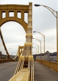
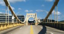
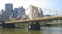
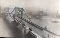
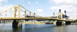
1927: Rachel Carson
Pittsburgh, Pennsylvania, USA - Allegheny River
| Bridgemeister ID: | 150 (added before 2003) |
| Year Completed: | 1927 |
| Name: | Rachel Carson |
| Also Known As: | Ninth Street |
| Location: | Pittsburgh, Pennsylvania, USA |
| Crossing: | Allegheny River |
| Coordinates: | 40.44669 N 79.99980 W |
| Maps: | Acme, GeoHack, Google, OpenStreetMap |
| Principals: | Vernon R. Covell, T.J. Wilkerson, A.D. Nutter, H.E. Dodge, Stanley L. Roush |
| References: | AAJ, BOP, BPL, PBR, PTS2, USS |
| Use: | Vehicular (four-lane), with walkway |
| Status: | In use (last checked: 2014) |
| Main Cables: | Eyebar (steel) |
| Suspended Spans: | 3 |
| Main Span: | 1 x 131.1 meters (430 feet) |
| Side Spans: | 2 x 65.5 meters (215 feet) |
| Characteristics: | Self-anchored |
Notes:
- Self-anchored.
- Next to 1926 Andy Warhol (Seventh Street) - Pittsburgh, Pennsylvania, USA.
- Next to 1928 Roberto Clemente (Sixth Street) - Pittsburgh, Pennsylvania, USA.
External Links:
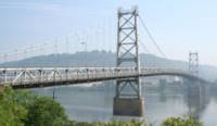
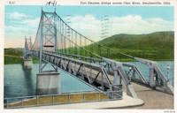
1928: Fort Steuben
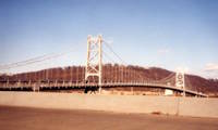
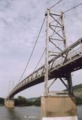
Steubenville, Ohio and Weirton, West Virginia, USA - Ohio River
| Bridgemeister ID: | 154 (added before 2003) |
| Year Completed: | 1928 |
| Name: | Fort Steuben |
| Location: | Steubenville, Ohio and Weirton, West Virginia, USA |
| Crossing: | Ohio River |
| Coordinates: | 40.37833 N 80.615 W |
| Maps: | Acme, GeoHack, Google, OpenStreetMap |
| Principals: | Dravo Co. |
| References: | AAJ, PTS2 |
| Use: | Vehicular (two-lane, heavy vehicles), with walkway |
| Status: | Demolished, February 2012 (last checked: 2012) |
| Main Cables: | Wire (steel) |
| Suspended Spans: | 3 |
| Main Span: | 1 x 209.9 meters (688.75 feet) |
| Side Spans: | 2 x 86.3 meters (283 feet) |
| Deck width: | 20.25 feet |
Notes:
- January 2009: Closed indefinitely following inspections revealing major deterioration. Demolished in 2012.
- Near 1905 Market Street - Steubenville, Ohio and East Steubenville, West Virginia, USA.
External Links:
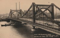
1928: Kiyosu
Chuo City, Tokyo, Japan - Sumida River
| Bridgemeister ID: | 440 (added before 2003) |
| Year Completed: | 1928 |
| Name: | Kiyosu |
| Also Known As: | 清洲橋 |
| Location: | Chuo City, Tokyo, Japan |
| Crossing: | Sumida River |
| Coordinates: | 35.682395 N 139.792022 E |
| Maps: | Acme, GeoHack, Google, OpenStreetMap |
| Principals: | Yutaka Tanaka |
| References: | AAJ, BAAW, PTS2, SSS |
| Use: | Vehicular (four-lane), with walkway |
| Status: | In use (last checked: 2022) |
| Main Cables: | Eyebar (steel) |
| Suspended Spans: | 3 |
| Main Span: | 1 x 91.4 meters (299.9 feet) |
| Side Spans: | 2 |
| Deck width: | 85 feet |
| Characteristics: | Self-anchored |
Notes:
- Self-anchored.
- 2019: Major rehabilitation in progress.
External Links:
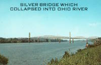
1928: Point Pleasant
Point Pleasant, West Virginia and Kanauga, Gallipolis vicinity, Ohio, USA - Ohio River
| Bridgemeister ID: | 156 (added before 2003) |
| Year Completed: | 1928 |
| Name: | Point Pleasant |
| Also Known As: | Silver |
| Location: | Point Pleasant, West Virginia and Kanauga, Gallipolis vicinity, Ohio, USA |
| Crossing: | Ohio River |
| Coordinates: | 38.845 N 82.141111 W |
| Maps: | Acme, GeoHack, Google, OpenStreetMap |
| Principals: | J.E. Greiner Co. |
| References: | AAJ, BDO, ENR19290620a, ENR19290620b, GBD, LAB, PTS2, SSS |
| Use: | Vehicular, with walkway |
| Status: | Collapsed, 1967 |
| Main Cables: | Eyebar (steel) |
| Suspended Spans: | 3 |
| Main Span: | 1 x 213.4 meters (700 feet) |
| Side Spans: | 2 x 115.8 meters (380 feet) |
| Deck width: | 27 feet |
Notes:
- Hybrid truss, suspension bridge. Collapsed December 15, 1967 while full with traffic. 46 people died.
- Companion to 1928 Saint Marys (Hi Carpenter, Short Route) - Saint Marys, West Virginia and Newport, Ohio, USA.
External Links:

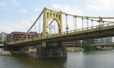
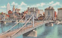
1928: Roberto Clemente
Pittsburgh, Pennsylvania, USA - Allegheny River
| Bridgemeister ID: | 158 (added before 2003) |
| Year Completed: | 1928 |
| Name: | Roberto Clemente |
| Also Known As: | Sixth Street |
| Location: | Pittsburgh, Pennsylvania, USA |
| Crossing: | Allegheny River |
| Coordinates: | 40.44558 N 80.00332 W |
| Maps: | Acme, GeoHack, Google, OpenStreetMap |
| Principals: | Vernon R. Covell, T.J. Wilkerson, A.D. Nutter, H.E. Dodge, Stanley L. Roush |
| References: | AAJ, BOP, BPL, PBR, PTS2, SSS, USS |
| Use: | Vehicular (four-lane), with walkway |
| Status: | In use (last checked: 2014) |
| Main Cables: | Eyebar (steel) |
| Suspended Spans: | 3 |
| Main Span: | 1 x 131.1 meters (430 feet) |
| Side Spans: | 2 x 65.5 meters (215 feet) |
| Characteristics: | Self-anchored |
Notes:
- Self-anchored.
- Next to 1926 Andy Warhol (Seventh Street) - Pittsburgh, Pennsylvania, USA.
- Next to 1927 Rachel Carson (Ninth Street) - Pittsburgh, Pennsylvania, USA.
External Links:

1929: Ambassador
Detroit, Michigan, USA and Windsor, Ontario, Canada - Detroit River
| Bridgemeister ID: | 160 (added before 2003) |
| Year Completed: | 1929 |
| Name: | Ambassador |
| Location: | Detroit, Michigan, USA and Windsor, Ontario, Canada |
| Crossing: | Detroit River |
| Coordinates: | 42.31210 N 83.07402 W |
| Maps: | Acme, GeoHack, Google, OpenStreetMap |
| Principals: | Jonathan Jones, McClintic-Marshall |
| References: | AAJ, AMB, GBD, PTS2 |
| Use: | Vehicular (major highway) |
| Status: | In use (last checked: 2022) |
| Main Cables: | Wire (steel) |
| Suspended Spans: | 1 |
| Main Span: | 1 x 563.9 meters (1,850 feet) |
| Deck width: | 55 feet |
Notes:
- Became longest suspension bridge by eclipsing 1926 Benjamin Franklin (Philadelphia-Camden) - Philadelphia, Pennsylvania and Camden, New Jersey, USA.
- Eclipsed by new longest suspension bridge 1931 George Washington (GWB) - New York, New York and Fort Lee, New Jersey, USA.
External Links:

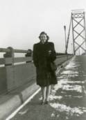
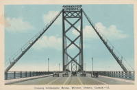
1929: Grand Mère
Grand-Mère, Quebec, Canada - St. Maurice River
| Bridgemeister ID: | 162 (added before 2003) |
| Year Completed: | 1929 |
| Name: | Grand Mère |
| Location: | Grand-Mère, Quebec, Canada |
| Crossing: | St. Maurice River |
| Coordinates: | 46.620117 N 72.6794 W |
| Maps: | Acme, GeoHack, Google, OpenStreetMap |
| Principals: | Robinson and Steinman |
| References: | AAJ, BC3, BPL, PTS2, SJR |
| Use: | Vehicular (two-lane, heavy vehicles), with walkway |
| Status: | In use (last checked: 2019) |
| Main Cables: | Wire (steel) |
| Suspended Spans: | 1 |
| Main Span: | 1 x 289.2 meters (948.8 feet) |
| Deck width: | 26 feet |
External Links:
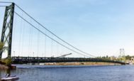
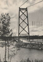
1929: Hipólito Yrigoyen
Necochea and Quequén, Argentina - Rio Quequén
| Bridgemeister ID: | 441 (added before 2003) |
| Year Completed: | 1929 |
| Name: | Hipólito Yrigoyen |
| Also Known As: | Rio Quequén |
| Location: | Necochea and Quequén, Argentina |
| Crossing: | Rio Quequén |
| Coordinates: | 38.552048 S 58.725680 W |
| Maps: | Acme, GeoHack, Google, OpenStreetMap |
| Principals: | P. Palazzo |
| References: | AAJ, SSS |
| Use: | Vehicular (two-lane), with walkway |
| Status: | In use (last checked: 2019) |
| Main Cables: | Wire (steel) |
| Suspended Spans: | 3 |
| Main Span: | 1 x 150 meters (492 feet) |
| Side Spans: | 2 x 59.7 meters (196 feet) |
External Links:
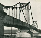
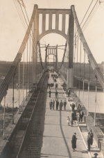
1929: Köln-Mülheim
Köln (Cologne) and Mülheim, North Rhine-Westphalia, Germany - Rhine River
| Bridgemeister ID: | 1426 (added 2004-07-18) |
| Year Completed: | 1929 |
| Name: | Köln-Mülheim |
| Location: | Köln (Cologne) and Mülheim, North Rhine-Westphalia, Germany |
| Crossing: | Rhine River |
| Coordinates: | 50.963968 N 6.996659 E |
| Maps: | Acme, GeoHack, Google, OpenStreetMap |
| Principals: | Adolf Abel |
| References: | AAJ |
| Use: | Vehicular, with walkway |
| Status: | Destroyed, 1944 |
| Main Cables: | Wire (steel) |
| Suspended Spans: | 3 |
| Main Span: | 1 x 317 meters (1,040 feet) |
| Side Spans: | 2 x 91.4 meters (300 feet) |
| Deck width: | 91.5 feet |
| Characteristics: | Self-anchored |
Notes:
External Links:
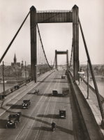
1929: McPhaul
Yuma, Arizona, USA - Gila River
| Bridgemeister ID: | 161 (added before 2003) |
| Year Completed: | 1929 |
| Name: | McPhaul |
| Also Known As: | Dome, Gila River |
| Location: | Yuma, Arizona, USA |
| Crossing: | Gila River |
| Coordinates: | 32.75969 N 114.42158 W |
| Maps: | Acme, GeoHack, Google, OpenStreetMap |
| Principals: | Levy Construction Company |
| References: | AAJ, SJR, YS20041217 |
| Use: | Vehicular (one-lane) |
| Status: | Closed (last checked: 2008) |
| Main Cables: | Wire (steel) |
| Suspended Spans: | 1 |
| Main Span: | 1 x 283.5 meters (930.1 feet) |
| Deck width: | 16 feet |
Notes:
- YS20041217: Renamed McPhaul Bridge in honor of Henry Harrison "Harry" McPhaul, "the only Yuma resident who ever became an Arizona Ranger." Bypassed, 1968. 150 feet of deck damaged by fire, 1990.
External Links:
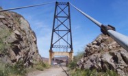
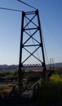
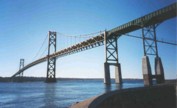
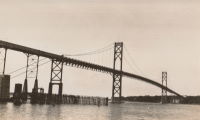
1929: Mount Hope
Bristol and Portsmouth, Rhode Island, USA - Mount Hope Bay
| Bridgemeister ID: | 163 (added before 2003) |
| Year Completed: | 1929 |
| Name: | Mount Hope |
| Location: | Bristol and Portsmouth, Rhode Island, USA |
| Crossing: | Mount Hope Bay |
| Coordinates: | 41.64 N 71.25833 W |
| Maps: | Acme, GeoHack, Google, OpenStreetMap |
| Principals: | Robinson and Steinman |
| References: | AAJ, ADDS, ENR19290411a, ENR19290411b, ENR19290411c, GBD, PTS2 |
| Use: | Vehicular (two-lane, heavy vehicles), with walkway |
| Status: | In use (last checked: 2022) |
| Main Cables: | Wire (steel) |
| Suspended Spans: | 3 |
| Main Span: | 1 x 365.8 meters (1,200 feet) |
| Side Spans: | 2 x 153.6 meters (504 feet) |
| Deck width: | 34 feet |
Annotated Citations:
- Flynn, Sean. "Mount Hope Bridge's support cables are corroding. It'll take $35 million to save them.." Newport Daily News, 13 Dec. 2021, www.newportri.com/story/news/local/2021/12/13/dehumidification-system-needed-save-mount-hope-bridge-ri-cables-corrosion/6456270001/
"'According to a 2016 inspection of the cables at the Mount Hope Bridge, there is significant breakage of the hundreds of wires that make up each of the cables,' RITBA Executive Director Lori Caron Silveira wrote to the Rhode Island House Finance Committee on Dec. 7"
- "Potential Exposure $1B — RI’s Mount Hope Bridge Is in Critical Need of Repair, Says Bridge Authority." GoLocalProv, 9 Dec. 2021, www.golocalprov.com/news/potential-exposure-1b-ris-mount-hope-bridge-is-in-critical-need-of-repair-s
"...Lori Caron Silveira, Executive Director of the [Rhode Island Turnpike and Bridge Authority] warns, 'The cables and anchorages of the 92-year-old Mount Hope Bridge urgently need dehumidification if the Mount Hope is to remain structurally safe and able to continue serving the East Bay and interstate commerce.'"
- Barrett, Scott. "'The bridge is safe': But time is of the essence for Mount Hope Bridge cable repair plan." Newport Daily News, 30 Mar. 2022, www.newportri.com/story/news/local/2022/03/30/mount-hope-bridge-cable-repair-plan-advances-payment-plan-unknown/7207276001/
"The process to preserve the deteriorating cables on the Mount Hope Bridge is underway, though how it will be paid for remains a question mark… the [Rhode Island Turnpike and Bridge Authority] has put out a request for proposals for a dehumidification system for the two large supporting cables on the 93-year-old suspension bridge."
External Links:

| Bridgemeister ID: | 1657 (added 2005-03-19) |
| Year Completed: | 1929 |
| Name: | Ogden Park |
| Location: | Chicago, Illinois, USA |
| At or Near Feature: | Ogden Park |
| Principals: | Linn White, C.R. Hoyt, George T. Donahue |
| References: | AAJ, ENR19290808 |
| Use: | Footbridge |
| Status: | Removed |
| Main Cables: | Wire |
| Suspended Spans: | 1 |
| Main Span: | 1 x 36 meters (118 feet) |
| Deck width: | 8.5 feet |
Notes:
- Looking at a picture of this bridge spanning about 150 feet of water, and looking at present-day maps and images of Ogden Park, it can be confusing trying to reconcile the location of this bridge as present-day Ogden Park has no waterways. The Chicago Park District web site explains, "Additionally, each [of several city parks] had a beautiful landscape with a meandering waterway near a meadow of ballfields. Ogden Park's waterway was drained and filled in 1940."
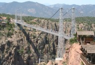
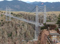
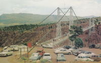
1929: Royal Gorge
Canon City, Colorado, USA - Arkansas River
| Bridgemeister ID: | 164 (added before 2003) |
| Year Completed: | 1929 |
| Name: | Royal Gorge |
| Location: | Canon City, Colorado, USA |
| Crossing: | Arkansas River |
| Coordinates: | 38.46129 N 105.32541 W |
| Maps: | Acme, GeoHack, Google, OpenStreetMap |
| Principals: | George F. Cole, O.K. Peck |
| References: | AAJ, BC3, BMA, GBD |
| Use: | Vehicular (two-lane) |
| Status: | In use (last checked: 2020) |
| Main Cables: | Wire (steel) |
| Suspended Spans: | 3 |
| Main Span: | 1 x 268.2 meters (880 feet) |
| Side Spans: | 2 |
| Deck width: | 18 feet |
Notes:
- This bridge was built solely as a tourist attraction.
External Links:
1929: Springbank
London, Ontario, Canada - River Thames
| Bridgemeister ID: | 290 (added before 2003) |
| Year Completed: | 1929 |
| Name: | Springbank |
| Location: | London, Ontario, Canada |
| Crossing: | River Thames |
| At or Near Feature: | Springbank Park |
| Principals: | J. R. Rostron |
| References: | AAJ |
| Use: | Footbridge |
| Status: | Replaced, 2002 |
| Main Cables: | Wire (steel) |
| Suspended Spans: | 1 |
| Main Span: | 1 x 71.6 meters (235 feet) |
| Deck width: | 5 feet |
Notes:
- Replaced by truss, 2002.
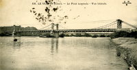
1930: Le Guétin
Le Guétin, Cuffy vicinity, Cher and Gimouille, Nièvre, France - Allier River
| Bridgemeister ID: | 2844 (added 2005-03-19) |
| Year Completed: | 1930 |
| Name: | Le Guétin |
| Location: | Le Guétin, Cuffy vicinity, Cher and Gimouille, Nièvre, France |
| Crossing: | Allier River |
| Coordinates: | 46.947881 N 3.073013 E |
| Maps: | Acme, GeoHack, Google, OpenStreetMap |
| References: | AAJ |
| Use: | Vehicular |
| Status: | Replaced |
| Main Cables: | Wire (steel) |
| Suspended Spans: | 5 |
| Main Spans: | 5 |
Notes:
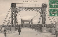
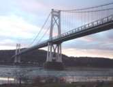
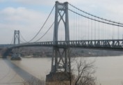
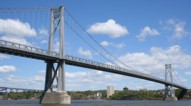
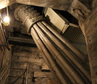
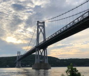
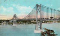
1930: Mid-Hudson
Poughkeepsie and Highland, New York, USA - Hudson River
| Bridgemeister ID: | 166 (added before 2003) |
| Year Completed: | 1930 |
| Name: | Mid-Hudson |
| Also Known As: | Franklin Delano Roosevelt Mid-Hudson |
| Location: | Poughkeepsie and Highland, New York, USA |
| Crossing: | Hudson River |
| Coordinates: | 41.702933 N 73.946683 W |
| Maps: | Acme, GeoHack, Google, OpenStreetMap |
| Principals: | Ralph Modjeski |
| References: | AAJ, BPL, PTS2, SJR, USS |
| Use: | Vehicular (two-lane, heavy vehicles), with walkway |
| Status: | In use (last checked: 2019) |
| Main Cables: | Wire (steel) |
| Suspended Spans: | 3 |
| Main Span: | 1 x 457.2 meters (1,500 feet) |
| Side Spans: | 2 x 228.6 meters (750 feet) |
| Deck width: | 39 feet |
Notes:
- Although the length of the main span of the bridge is officially 1,500 feet, the actual length is 1,495 feet. During construction one of the caissons slid and tilted from its intended location. While efforts were made to move the caisson back, it was ultimately fixed in a position that left the main span five feet short of 1,500. Not wanting to lose the claim of having a 1,500-foot bridge, the shortfall has been kept out of official records since.
External Links:
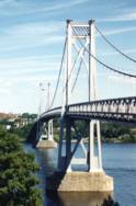
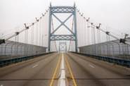
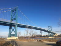
1931: Anthony Wayne
Toledo, Ohio, USA - Maumee River
| Bridgemeister ID: | 168 (added before 2003) |
| Year Completed: | 1931 |
| Name: | Anthony Wayne |
| Location: | Toledo, Ohio, USA |
| Crossing: | Maumee River |
| Coordinates: | 41.64086 N 83.53361 W |
| Maps: | Acme, GeoHack, Google, OpenStreetMap |
| Principals: | Waddell and Hardesty |
| References: | AAJ, SJR, SSS |
| Use: | Vehicular (major highway), with walkway |
| Status: | In use (last checked: 2021) |
| Main Cables: | Wire (steel) |
| Suspended Spans: | 3 |
| Main Span: | 1 x 239.3 meters (785 feet) |
| Side Spans: | 2 x 71.2 meters (233.5 feet) |
| Deck width: | 60 feet |
External Links:
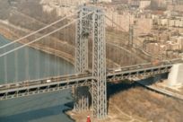
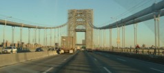
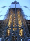
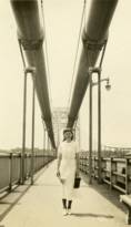
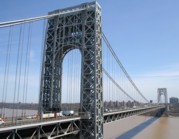
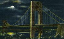
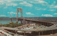
1931: George Washington
New York, New York and Fort Lee, New Jersey, USA - Hudson River
| Bridgemeister ID: | 169 (added before 2003) |
| Year Completed: | 1931 |
| Name: | George Washington |
| Also Known As: | GWB |
| Location: | New York, New York and Fort Lee, New Jersey, USA |
| Crossing: | Hudson River |
| Coordinates: | 40.85333 N 73.955 W |
| Maps: | Acme, GeoHack, Google, OpenStreetMap |
| Principals: | O.H. Ammann, Leon Moisseiff, Dana, Gilbert |
| References: | AAJ, AOB, ARF, BBR, BC3, BFL, BMA, BONJ, BOU, BPL, BRU, COB, CTW, ENR19270811a, ENR19270811b, ENR19290411c, GBD, LAB, LACE, PTS2, SIX, SJR |
| Use: | Vehicular (double-deck), with walkway |
| Status: | In use (last checked: 2022) |
| Main Cables: | Wire (steel) |
| Suspended Spans: | 3 |
| Main Span: | 1 x 1,066.8 meters (3,500 feet) |
| Side Spans: | 2 x 198.1 meters (650 feet) |
| Deck width: | 120 feet |
Notes:
- Became longest suspension bridge by eclipsing 1929 Ambassador - Detroit, Michigan, USA and Windsor, Ontario, Canada.
- Eclipsed by new longest suspension bridge 1937 Golden Gate - San Francisco and Marin County, California, USA.
External Links:
1931: Hagwilget
Hagwilget, British Columbia, Canada - Bulkley River
| Bridgemeister ID: | 170 (added before 2003) |
| Year Completed: | 1931 |
| Name: | Hagwilget |
| Also Known As: | Bulkley Canyon |
| Location: | Hagwilget, British Columbia, Canada |
| Crossing: | Bulkley River |
| At or Near Feature: | Hagwilget Canyon |
| Coordinates: | 55.25740 N 127.60380 W |
| Maps: | Acme, GeoHack, Google, OpenStreetMap |
| Principals: | BC Department of Public Works |
| References: | AAJ |
| Use: | Vehicular (one-lane) |
| Status: | In use (last checked: 2008) |
| Main Cables: | Wire (steel) |
| Suspended Spans: | 1 |
| Main Span: | 1 x 140.2 meters (460 feet) |
| Deck width: | 16 feet |
Notes:
External Links:
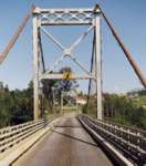
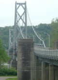
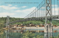
1931: Simon Kenton Memorial
Maysville, Kentucky and Aberdeen, Ohio, USA - Ohio River
| Bridgemeister ID: | 172 (added before 2003) |
| Year Completed: | 1931 |
| Name: | Simon Kenton Memorial |
| Also Known As: | Maysville |
| Location: | Maysville, Kentucky and Aberdeen, Ohio, USA |
| Crossing: | Ohio River |
| Coordinates: | 38.649890 N 83.759670 W |
| Maps: | Acme, GeoHack, Google, OpenStreetMap |
| Principals: | Modjeski, Masters & Chase |
| References: | AAJ, SJR, SSS |
| Use: | Vehicular (two-lane), with walkway |
| Status: | In use (last checked: 2022) |
| Main Cables: | Wire (steel) |
| Suspended Spans: | 3 |
| Main Span: | 1 x 323.1 meters (1,060 feet) |
| Side Spans: | 2 x 141.7 meters (464.9 feet) |
| Deck width: | 28 feet |
Notes:
- 2022, March: USD$23.4 million budgeted for rehabilitation project including suspender cable replacements, steel repairs, and painting.
- 2019: Closed late 2019 due to suspender cable corrosion. Short-term fixes applied to reduce the stress on the suspenders and to prevent rusting.
- 2020, June: Reopened with a 15-ton weight limit after installation of temporary support rods and brackets to reduce the stress on damaged cables.
External Links:
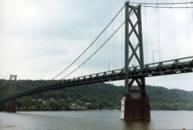
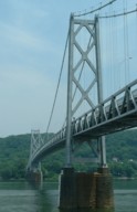
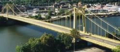
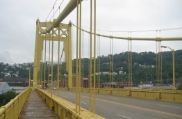
1931: South Tenth Street
Pittsburgh, Pennsylvania, USA - Monongahela River
| Bridgemeister ID: | 173 (added before 2003) |
| Year Completed: | 1931 |
| Name: | South Tenth Street |
| Also Known As: | South Side, Tenth Street, Philip Murray |
| Location: | Pittsburgh, Pennsylvania, USA |
| Crossing: | Monongahela River |
| Coordinates: | 40.43166 N 79.989 W |
| Maps: | Acme, GeoHack, Google, OpenStreetMap |
| Principals: | Sydney A. Shubin |
| References: | AAJ, BOP, BPL, PBR, SSS, USS |
| Use: | Vehicular (four-lane), with walkway |
| Status: | In use (last checked: 2019) |
| Main Cables: | Wire (steel) |
| Suspended Spans: | 3 |
| Main Span: | 1 x 228.6 meters (750 feet) |
| Side Spans: | 2 x 83.8 meters (275 feet) |
| Deck width: | 54 feet |
External Links:
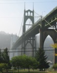
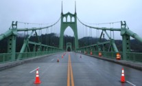
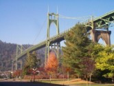
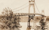
1931: St. Johns
Portland, Oregon, USA - Willamette River
| Bridgemeister ID: | 174 (added before 2003) |
| Year Completed: | 1931 |
| Name: | St. Johns |
| Location: | Portland, Oregon, USA |
| Crossing: | Willamette River |
| Coordinates: | 45.585 N 122.76333 W |
| Maps: | Acme, GeoHack, Google, OpenStreetMap |
| Principals: | Robinson and Steinman |
| References: | AAJ, ADDS, BC3, BCO, BFL, BPL, GBD, LAB, SJR |
| Use: | Vehicular (four-lane), with walkway |
| Status: | In use (last checked: 2022) |
| Main Cables: | Wire (steel) |
| Suspended Spans: | 3 |
| Main Span: | 1 x 367.9 meters (1,207 feet) |
| Side Spans: | 2 x 131.1 meters (430.25 feet) |
| Deck width: | 52 feet |
Notes:
- Substantially rehabilitated, 2003-2005.
External Links:
1931: Teil
Le Teil, Ardèche and Montélimar, Drôme, France - Rhône River
| Bridgemeister ID: | 1549 (added 2004-11-13) |
| Year Completed: | 1931 |
| Name: | Teil |
| Location: | Le Teil, Ardèche and Montélimar, Drôme, France |
| Crossing: | Rhône River |
| Coordinates: | 44.5519 N 4.692617 E |
| Maps: | Acme, GeoHack, Google, OpenStreetMap |
| References: | AAJ, BPF |
| Use: | Vehicular (two-lane, heavy vehicles), with walkway |
| Status: | In use (last checked: 2005) |
| Main Cables: | Wire (steel) |
| Suspended Spans: | 1 |
| Main Span: | 1 x 235 meters (771 feet) |
Notes:
- Destroyed, 1944. Rebuilt, 1950.
- Replaced 1839 Teil - Le Teil, Ardèche and Montélimar, Drôme, France.
External Links:
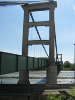
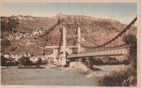
1931: Vicq-sur-Gartempe
Vicq-sur-Gartempe, Vienne, France - Gartempe River
| Bridgemeister ID: | 3997 (added 2020-03-27) |
| Year Completed: | 1931 |
| Name: | Vicq-sur-Gartempe |
| Location: | Vicq-sur-Gartempe, Vienne, France |
| Crossing: | Gartempe River |
| References: | AAJ |
| Use: | Vehicular |
| Status: | Replaced, 1989 |
| Main Cables: | Wire (steel) |
| Suspended Spans: | 1 |
Notes:
- 1989: Replaced and subsequently removed.
- Replaced 1881 Vicq-sur-Gartempe - Vicq-sur-Gartempe, Vienne, France.
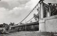
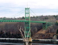
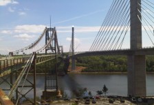
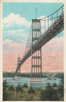
1931: Waldo-Hancock
Verona and Bucksport vicinity, Maine, USA - Penobscot River
| Bridgemeister ID: | 175 (added before 2003) |
| Year Completed: | 1931 |
| Name: | Waldo-Hancock |
| Location: | Verona and Bucksport vicinity, Maine, USA |
| Crossing: | Penobscot River |
| Coordinates: | 44.56 N 68.80333 W |
| Maps: | Acme, GeoHack, Google, OpenStreetMap |
| Principals: | Robinson and Steinman |
| References: | AAJ, ADDS, GBD, SSS, USS |
| Use: | Vehicular (two-lane, heavy vehicles), with walkway |
| Status: | Demolished, 2012 |
| Main Cables: | Wire (steel) |
| Suspended Spans: | 3 |
| Main Span: | 1 x 243.8 meters (800 feet) |
| Side Spans: | 2 x 106.7 meters (350 feet) |
| Deck width: | 27 feet |
Notes:
- Replacement cable-stayed bridge, (the Penobscot Narrows Bridge) completed, late 2006.
External Links:
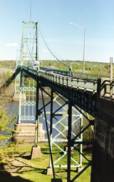
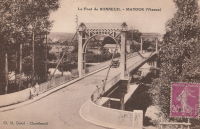
1932: Bonneuil-Matours
Bonneuil-Matours, Vienne, France - Vienne River
| Bridgemeister ID: | 2356 (added 2007-08-19) |
| Year Completed: | 1932 |
| Name: | Bonneuil-Matours |
| Location: | Bonneuil-Matours, Vienne, France |
| Crossing: | Vienne River |
| Coordinates: | 46.681758 N 0.575535 E |
| Maps: | Acme, GeoHack, Google, OpenStreetMap |
| References: | AAJ |
| Use: | Vehicular (two-lane) |
| Status: | Closed, January 4, 2021 (last checked: 2022) |
| Main Cables: | Wire (steel) |
| Suspended Spans: | 1 |
Notes:
- 2021, January: Closed for replacement of deck and suspension system.
- 2021: While undergoing reconstruction, one of the piers settles abnormally.
- 2022, September: Work expected to be completed in November 2023.
- At former location of Bonneuil-Matours - Bonneuil-Matours, Vienne, France. Unclear if the newer bridge was a direct replacement.
1932: Lewis River
Yale, Washington, USA - Lewis River
| Bridgemeister ID: | 176 (added before 2003) |
| Year Completed: | 1932 |
| Name: | Lewis River |
| Also Known As: | Yale |
| Location: | Yale, Washington, USA |
| Crossing: | Lewis River |
| Coordinates: | 45.96167 N 122.37167 W |
| Maps: | Acme, GeoHack, Google, OpenStreetMap |
| Principals: | Harold H. Gilbert, Gilpin Construction Co. |
| References: | AAJ, SPW, SSS |
| Use: | Vehicular (one-lane) |
| Status: | In use (last checked: 2005) |
| Main Cables: | Wire (steel) |
| Suspended Spans: | 1 |
| Main Span: | 1 x 91.4 meters (300 feet) |
| Deck width: | 17 feet |
Notes:
- Rebuilt 1957, 1958.
External Links:
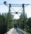
1932: Prairie du Chien
Praire du Chien, Wisconsin and Marquette, Iowa, USA - Mississippi River
| Bridgemeister ID: | 177 (added before 2003) |
| Year Completed: | 1932 |
| Name: | Prairie du Chien |
| Location: | Praire du Chien, Wisconsin and Marquette, Iowa, USA |
| Crossing: | Mississippi River |
| Coordinates: | 43.046 N 91.17 W |
| Maps: | Acme, GeoHack, Google, OpenStreetMap |
| Principals: | Austin Bridge Co. |
| References: | AAJ, AUB, BPL |
| Use: | Vehicular (two-lane) |
| Status: | Removed, 1974 |
| Main Cables: | Wire (steel) |
| Main Span: | 1 x 144.2 meters (473 feet) |
Notes:
- There were two back-to-back suspension bridges at this location.
- Connects to 1932 Prairie du Chien - Praire du Chien, Wisconsin and Marquette, Iowa, USA.
External Links:
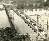
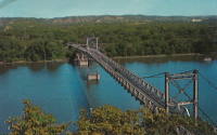
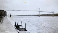
1932: Prairie du Chien
Praire du Chien, Wisconsin and Marquette, Iowa, USA - Mississippi River
| Bridgemeister ID: | 1256 (added before 2003) |
| Year Completed: | 1932 |
| Name: | Prairie du Chien |
| Location: | Praire du Chien, Wisconsin and Marquette, Iowa, USA |
| Crossing: | Mississippi River |
| Coordinates: | 43.05 N 91.162 W |
| Maps: | Acme, GeoHack, Google, OpenStreetMap |
| Principals: | Austin Bridge Co. |
| References: | AAJ, AUB, BPL |
| Use: | Vehicular (two-lane) |
| Status: | Removed, 1974 |
| Main Cables: | Wire (steel) |
| Main Span: | 1 x 144.2 meters (473 feet) |
Notes:
- There were two back-to-back suspension bridges at this location.
- Connects to 1932 Prairie du Chien - Praire du Chien, Wisconsin and Marquette, Iowa, USA.
External Links:


1933: (suspension bridge)
Happy Camp vicinity, California, USA - Klamath River
| Bridgemeister ID: | 1011 (added 2003-11-21) |
| Year Completed: | 1933 |
| Name: | (suspension bridge) |
| Location: | Happy Camp vicinity, California, USA |
| Crossing: | Klamath River |
| Principals: | WPA |
| References: | AAJ |
| Use: | Vehicular (one-lane) |
| Status: | Dismantled |
| Main Cables: | Wire (steel) |
| Suspended Spans: | 1 |
| Main Span: | 1 x 91.4 meters (300 feet) |
Notes:
- Moved to Cassidy - Sierra National Forest, California, USA. The bridge was disassembled, shortened, and relocated in the 1950's to the Ansel Adams Wilderness, Minarets Ranger District, Sierra National Forest, California as the "Cassidy" suspension bridge.
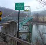
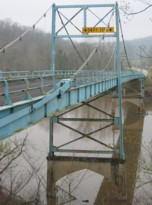
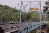
1933: Green's Mill
Camden County, Missouri, USA - Little Niangua River
| Bridgemeister ID: | 179 (added before 2003) |
| Year Completed: | 1933 |
| Name: | Green's Mill |
| Also Known As: | Little Niangua, J Road |
| Location: | Camden County, Missouri, USA |
| Crossing: | Little Niangua River |
| Coordinates: | 38.065326 N 92.909309 W |
| Maps: | Acme, GeoHack, Google, OpenStreetMap |
| Principals: | Howard Mullins, Scully Steel Co., American Steel & Wire Co., Clinton Bridge Works |
| References: | AAJ, SSS, USS |
| Use: | Vehicular (two-lane, heavy vehicles) |
| Status: | Bypassed, 2020 (last checked: 2023) |
| Main Cables: | Wire (steel) |
| Suspended Spans: | 3 |
| Main Span: | 1 x 68.6 meters (225 feet) |
| Side Spans: | 1 x 34.3 meters (112.5 feet), 1 x 34.3 meters (112.4 feet) |
| Deck width: | 20 feet |
| Characteristics: | Self-anchored |
Notes:
- Self-anchored.
- 2007, October: Closed for a few weeks for emergency repairs. According to an October 4, 2007 article in the Lake Sun Leader (Missouri): "a routine inspection revealed a problem in the substructure... too much movement was detected at a location underneath the north side of the bridge." Other sources mentioned a faulty "pin."
- 2018: Missouri Department of Transportation (MoDOT) plans to replace the bridge and is seeking groups to take ownership of the bridge and possibly relocate it.
- 2020: A new bridge is completed, bypassing the suspension bridge.
- 2023, March: Ownership transferred from Missouri Department of Transportation to Green's Mill Historic Bridge, Inc. to preserve the since bypassed bridge.
1933: San Rafael
Mao, Dominican Republic - Rio Yakue Del Norte
| Bridgemeister ID: | 447 (added before 2003) |
| Year Completed: | 1933 |
| Name: | San Rafael |
| Location: | Mao, Dominican Republic |
| Crossing: | Rio Yakue Del Norte |
| Principals: | John A. Roebling's Sons Co. |
| References: | AAJ, SJR, SSS |
| Use: | Vehicular (two-lane, heavy vehicles) |
| Main Cables: | Wire (steel) |
| Suspended Spans: | 1 |
| Main Span: | 1 x 137.6 meters (451.5 feet) |
| Deck width: | 18 feet |
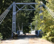
1933: Sims
Sims, California, USA - Sacramento River
| Bridgemeister ID: | 650 (added 2003-02-22) |
| Year Completed: | 1933 |
| Name: | Sims |
| Also Known As: | CCC |
| Location: | Sims, California, USA |
| Crossing: | Sacramento River |
| At or Near Feature: | Sims Camp |
| Coordinates: | 41.063433 N 122.360067 W |
| Maps: | Acme, GeoHack, Google, OpenStreetMap |
| Principals: | Raymond Huber, Civilian Conservation Corps |
| References: | AAJ |
| Use: | Vehicular (one-lane) |
| Status: | Restricted to foot traffic (last checked: 2021) |
| Main Cables: | Wire (steel) |
| Suspended Spans: | 1 |
| Main Span: | 1 x 48.8 meters (160 feet) |
Notes:
- CCC is "Civilian Conservation Corps".
1933: Veurey
Veurey-Voroize, Isère, France - Isère River
| Bridgemeister ID: | 4881 (added 2020-07-18) |
| Year Completed: | 1933 |
| Name: | Veurey |
| Location: | Veurey-Voroize, Isère, France |
| Crossing: | Isère River |
| References: | AAJ |
| Use: | Vehicular |
| Status: | Removed |
| Main Cables: | Wire (steel) |
Notes:
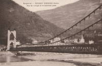
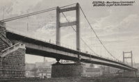
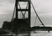
1934: King Alexander I
Belgrade, Serbia - Sava River
| Bridgemeister ID: | 957 (added 2003-11-01) |
| Year Completed: | 1934 |
| Name: | King Alexander I |
| Also Known As: | King Aleksandar |
| Location: | Belgrade, Serbia |
| Crossing: | Sava River |
| Coordinates: | 44.814946 N 20.448665 E |
| Maps: | Acme, GeoHack, Google, OpenStreetMap |
| Principals: | Société de Construction des Batignolles |
| References: | AAJ |
| Use: | Vehicular, with walkway |
| Status: | Destroyed, April 12, 1941 |
| Main Cables: | Wire (steel) |
| Suspended Spans: | 1 |
| Main Span: | 1 x 260.9 meters (856 feet) |
| Deck width: | 72 feet |
| Characteristics: | Rocker towers |
Notes:
- 1941, April 12: Partially demolished in an attempt to slow advancing German troops.
- 1944, April 16: Remainder of the bridge is demolished.
External Links:
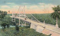
1934: Rio Higuamo
San Pedro de Macoris vicinity, Dominican Republic - Rio Higuamo
| Bridgemeister ID: | 448 (added before 2003) |
| Year Completed: | 1934 |
| Name: | Rio Higuamo |
| Also Known As: | Ramfis |
| Location: | San Pedro de Macoris vicinity, Dominican Republic |
| Crossing: | Rio Higuamo |
| Coordinates: | 18.503230 N 69.336561 W |
| Maps: | Acme, GeoHack, Google, OpenStreetMap |
| Principals: | John A. Roebling's Sons Co. |
| References: | AAJ, SSS |
| Use: | Vehicular |
| Status: | In use (last checked: 2023) |
| Main Cables: | Wire (steel) |
| Suspended Spans: | 3 |
| Main Span: | 1 x 168.9 meters (554 feet) |
| Side Spans: | 2 x 56.7 meters (186 feet) |
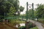
1934: Stewart Park I
Ithaca, New York, USA - Fall Creek arm
| Bridgemeister ID: | 839 (added 2003-06-28) |
| Year Completed: | 1934 |
| Name: | Stewart Park I |
| Location: | Ithaca, New York, USA |
| Crossing: | Fall Creek arm |
| At or Near Feature: | Stewart Park |
| Coordinates: | 42.458961 N 76.505590 W |
| Maps: | Acme, GeoHack, Google, OpenStreetMap |
| Principals: | Civil Works Administration |
| References: | AAJ |
| Use: | Footbridge |
| Status: | In use (last checked: 2014) |
| Main Cables: | Wire (steel) |
| Suspended Spans: | 1 |
| Main Span: | 1 x 25 meters (82 feet) estimated |
Notes:
- There are two suspension footbridges at this park. This one crosses a short run off of Fall Creek just before it enters Cayuga Lake. The other crosses Fall Creek.
- Near 1934 Stewart Park II - Ithaca, New York, USA.
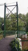
1934: Stewart Park II
Ithaca, New York, USA - Fall Creek
| Bridgemeister ID: | 840 (added 2003-06-28) |
| Year Completed: | 1934 |
| Name: | Stewart Park II |
| Location: | Ithaca, New York, USA |
| Crossing: | Fall Creek |
| At or Near Feature: | Stewart Park |
| Coordinates: | 42.458281 N 76.505359 W |
| Maps: | Acme, GeoHack, Google, OpenStreetMap |
| Principals: | Civil Works Administration |
| References: | AAJ |
| Use: | Footbridge |
| Status: | In use (last checked: 2014) |
| Main Cables: | Wire (steel) |
| Suspended Spans: | 1 |
| Main Span: | 1 x 33.8 meters (111 feet) estimated |
Notes:
- There are two suspension footbridges at this park.
- Near 1934 Stewart Park I - Ithaca, New York, USA.
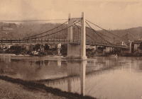
1935: Condrieu
Condrieu, Rhône and Les Roches-de-Condrieu, Isère, France - Rhône River
| Bridgemeister ID: | 1494 (added 2004-09-19) |
| Year Completed: | 1935 |
| Name: | Condrieu |
| Location: | Condrieu, Rhône and Les Roches-de-Condrieu, Isère, France |
| Crossing: | Rhône River |
| Coordinates: | 45.45655 N 4.768722 E |
| Maps: | Acme, GeoHack, Google, OpenStreetMap |
| References: | AAJ |
| Use: | Vehicular (two-lane), with walkway |
| Status: | Destroyed, June 1940 |
| Main Cables: | Wire (steel) |
| Suspended Spans: | 2 |
| Main Spans: | 2 |
Notes:
- Replaced 1831 Condrieu - Condrieu, Rhône and Les Roches-de-Condrieu, Isère, France.
- Replaced by Condrieu - Condrieu, Rhône and Les Roches-de-Condrieu, Isère, France.
External Links:
- Pont de Condrieu - Wikipedia
- Pont entre Condrieu et les Roches detruit le 20 juin 1940 - Wikimedia. Image of the destroyed bridge.
- Structurae - Structure ID 20013233
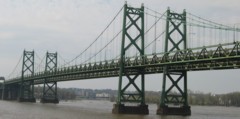
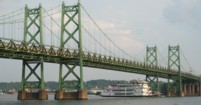
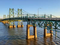
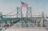
1935: Iowa-Illinois Memorial
Bettendorf, Iowa and Moline, Illinois, USA - Mississippi River
| Bridgemeister ID: | 180 (added before 2003) |
| Year Completed: | 1935 |
| Name: | Iowa-Illinois Memorial |
| Also Known As: | Interstate 74 Bridge, I-74 Bridge |
| Location: | Bettendorf, Iowa and Moline, Illinois, USA |
| Crossing: | Mississippi River |
| Coordinates: | 41.520264 N 90.513034 W |
| Maps: | Acme, GeoHack, Google, OpenStreetMap |
| Principals: | Modjeski, Masters, and Chase |
| References: | AAJ, CMR |
| Use: | Vehicular, with walkway |
| Status: | Bypassed, 2020 (last checked: 2022) |
| Main Cables: | Wire (steel) |
| Suspended Spans: | 3 |
| Main Span: | 1 x 225.6 meters (740 feet) |
| Side Spans: | 2 x 112.8 meters (370 feet) |
| Deck width: | 24.2 feet |
Notes:
- 2017, June 26: Groundbreaking ceremony for a replacement bridge for the twin Iowa-Illinois Memorial bridges. The new bridge is expected to be completed in 2020.
- 2020, November: Replacement span opens (for Iowa-bound traffic previously carried across the older of the two suspension bridges). Suspension bridge expected to be demolished in 2022.
- 2023: Demolition expected to be completed in 2024.
- Next to 1960 Iowa-Illinois Memorial (Interstate 74 Bridge, I-74 Bridge) - Bettendorf, Iowa and Moline, Illinois, USA.
External Links:
1935: l'Île d'Orléans
Quebec City, Quebec, Canada - St. Lawrence River
| Bridgemeister ID: | 183 (added before 2003) |
| Year Completed: | 1935 |
| Name: | l'Île d'Orléans |
| Also Known As: | Isle of Orleans, Orleans Island, Taschereau |
| Location: | Quebec City, Quebec, Canada |
| Crossing: | St. Lawrence River |
| Coordinates: | 46.880233 N 71.137883 W |
| Maps: | Acme, GeoHack, Google, OpenStreetMap |
| Principals: | Monsarrat and Pratley |
| References: | AAJ |
| Use: | Vehicular (two-lane, heavy vehicles), with walkway |
| Status: | In use (last checked: 2019) |
| Main Cables: | Wire (steel) |
| Suspended Spans: | 3 |
| Main Span: | 1 x 323 meters (1,059.7 feet) |
| Side Spans: | 2 x 127 meters (416.7 feet) |
| Deck width: | 30 feet |
Notes:
- Replacement proposed to start in 2024.
- Near Montmorency Falls - Quebec City vicinity, Quebec, Canada.
External Links:

1936: (suspension bridge)
Grave Creek, Oregon, USA - Rogue River
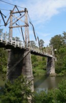
1936: Kindee
Kindee, Ellenborough vicinity, New South Wales, Australia - Hastings River
| Bridgemeister ID: | 1296 (added 2004-03-19) |
| Year Completed: | 1936 |
| Name: | Kindee |
| Location: | Kindee, Ellenborough vicinity, New South Wales, Australia |
| Crossing: | Hastings River |
| Coordinates: | 31.42233 S 152.47044 E |
| Maps: | Acme, GeoHack, Google, OpenStreetMap |
| References: | AAJ |
| Use: | Vehicular (one-lane) |
| Status: | In use (last checked: 2019) |
| Main Cables: | Wire (steel) |
| Suspended Spans: | 3 |
| Main Span: | 1 x 67.1 meters (220 feet) |
| Side Spans: | 2 x 26.8 meters (88 feet) |
| Characteristics: | Braced (trussed) chain/cable, Hinged cables |
Notes:
- Odd timber suspension bridge that has large diagonal stiffening members giving it the appearance of a "braced chain" bridge. AAJ describes it: "the construction in each span is of the three-hinged, trussed cable type or inverted three-hinged arch type. The form of the trussed cable is the Fidler truss."
- Brett Evill transcribed a plaque at the bridge: "This bridge with unusual trussed cables was designed by DMR engineers V Karmalsky and A T Britton. Steelwork was supplied by Morison and Bearby of Newcastle and timber by R McMillan of Long Flat. Sadly, the contractor R B Haydon was killed during construction and work was completed by the Department. Opened on 19 December 1936, the bridge and its approaches cost £5,000.
"Erected to commemorate Australia's bicentenary in 1988 by the Department of Main Roads and the National Roads and Motorists Association (NRMA)" - Similar to 1951 Marias River (Pugsley) - Chester vicinity, Montana, USA.
- Similar to (footbridge) - Sarov (Саров), Nizhny Novgorod Oblast, Russia.
- Similar to Allan - Segenhoe, Scone vicinity, New South Wales, Australia.
- Similar to Ininskiy (Ининский) - Inya (Иня), Altai Republic, Russia.
- Similar to Reku Vel' - Solginskiy (Солгинский), Arkhangelsk Oblast, Russia.
1936: Krefeld-Uerdinger
Uerdingen, Krefeld vicinity and Duisburg, Germany - Rhine River
| Bridgemeister ID: | 959 (added 2003-11-01) |
| Year Completed: | 1936 |
| Name: | Krefeld-Uerdinger |
| Location: | Uerdingen, Krefeld vicinity and Duisburg, Germany |
| Crossing: | Rhine River |
| Coordinates: | 51.349835 N 6.659175 E |
| Maps: | Acme, GeoHack, Google, OpenStreetMap |
| References: | AAJ |
| Use: | Vehicular (two-lane) |
| Status: | In use (last checked: 2020) |
| Main Cables: | Riveted plate |
| Suspended Spans: | 3 |
| Main Span: | 1 x 250 meters (820.25 feet) |
| Side Spans: | 2 |
| Deck width: | 64 feet |
Notes:
- Destroyed 1945, rebuilt 1950.
External Links:
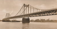
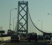
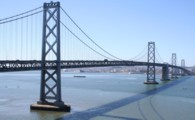
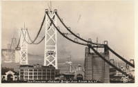
1936: San Francisco-Oakland Bay
Oakland and San Francisco, California, USA - San Francisco Bay
| Bridgemeister ID: | 184 (added before 2003) |
| Year Completed: | 1936 |
| Name: | San Francisco-Oakland Bay |
| Location: | Oakland and San Francisco, California, USA |
| Crossing: | San Francisco Bay |
| Coordinates: | 37.78667 N 122.39 W |
| Maps: | Acme, GeoHack, Google, OpenStreetMap |
| Principals: | C.H. Purcell, Glenn B. Woodruff |
| References: | AAJ, AZB, BAAW, BC3, BPL, GBD, LAB, OBB1, SFOM, USS |
| Use: | Vehicular (double-deck) |
| Status: | In use (last checked: 2022) |
| Main Cables: | Wire (steel) |
| Suspended Spans: | 6 |
| Main Spans: | 1 x 678 meters (2,224.4 feet), 1 x 673.6 meters (2,210 feet) |
| Side Spans: | 4 |
| Deck width: | 66 feet (58 feet roadway) |
Notes:
External Links:

1936: Triborough
New York and Queens, New York, USA - East River
| Bridgemeister ID: | 186 (added before 2003) |
| Year Completed: | 1936 |
| Name: | Triborough |
| Also Known As: | Robert F. Kennedy |
| Location: | New York and Queens, New York, USA |
| Crossing: | East River |
| At or Near Feature: | Randalls-Wards Island |
| Coordinates: | 40.781283 N 73.9273 W |
| Maps: | Acme, GeoHack, Google, OpenStreetMap |
| Principals: | O.H. Ammann, Allston Dana |
| References: | AAJ, GBD, SIX |
| Use: | Vehicular (major highway), with walkway |
| Status: | In use (last checked: 2022) |
| Main Cables: | Wire (steel) |
| Suspended Spans: | 3 |
| Main Span: | 1 x 420.6 meters (1,380 feet) |
| Side Spans: | 2 x 214.8 meters (704.75 feet) |
| Deck width: | 96 feet |
External Links:
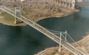
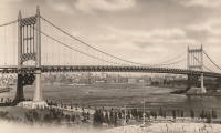
1936: Walter Taylor
Indooroopilly and Chelmer, Queensland, Australia - Brisbane River
| Bridgemeister ID: | 449 (added before 2003) |
| Year Completed: | 1936 |
| Name: | Walter Taylor |
| Location: | Indooroopilly and Chelmer, Queensland, Australia |
| Crossing: | Brisbane River |
| Coordinates: | 27.505467 S 152.9737 E |
| Maps: | Acme, GeoHack, Google, OpenStreetMap |
| References: | AAJ, STC |
| Use: | Vehicular |
| Status: | In use (last checked: 2015) |
| Main Cables: | Wire (steel) |
| Suspended Spans: | 1 |
| Main Span: | 1 x 182.9 meters (600.1 feet) |
Notes:
- Hybrid truss-suspension where truss rises up to meet main cables.
- Two-year refurbishment started, late 2007, to replace and strengthen joints along the cables and deck truss.
External Links:
1937: Aiguilly
Roanne vicinity and Vougy vicinity, Loire, France - Loire River
| Bridgemeister ID: | 1567 (added 2004-11-28) |
| Year Completed: | 1937 |
| Name: | Aiguilly |
| Location: | Roanne vicinity and Vougy vicinity, Loire, France |
| Crossing: | Loire River |
| References: | AAJ, BPF |
| Use: | Vehicular |
| Status: | Destroyed, 1940 |
| Main Cables: | Wire (steel) |
| Suspended Spans: | 1 |
| Main Span: | 1 x 135 meters (442.9 feet) |
Notes:
- Destroyed to slow advancing German troops, 1940.
- Replaced 1841 Aiguilly - Roanne vicinity and Vougy vicinity, Loire, France.
- Replaced by 1945 Aiguilly - Roanne vicinity and Vougy vicinity, Loire, France.
External Links:
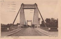
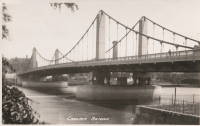
1937: Chelsea
London, England, United Kingdom - River Thames
| Bridgemeister ID: | 450 (added before 2003) |
| Year Completed: | 1937 |
| Name: | Chelsea |
| Location: | London, England, United Kingdom |
| Crossing: | River Thames |
| Coordinates: | 51.48438 N 0.14984 W |
| Maps: | Acme, GeoHack, Google, OpenStreetMap |
| Principals: | Sir Pierson Frank, Rendel, Tritton and Palmer |
| References: | AAJ, BTH |
| Use: | Vehicular (three or more lanes), with walkway |
| Status: | In use (last checked: 2019) |
| Main Cables: | Wire (steel) |
| Suspended Spans: | 3 |
| Main Span: | 1 x 107.3 meters (352 feet) |
| Side Spans: | 2 x 52.7 meters (173 feet) |
| Deck width: | 64 feet |
Notes:
External Links:
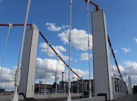
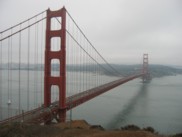
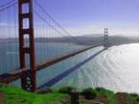
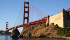
1937: Golden Gate
San Francisco and Marin County, California, USA - San Francisco Bay
| Bridgemeister ID: | 188 (added before 2003) |
| Year Completed: | 1937 |
| Name: | Golden Gate |
| Location: | San Francisco and Marin County, California, USA |
| Crossing: | San Francisco Bay |
| Coordinates: | 37.82 N 122.47667 W |
| Maps: | Acme, GeoHack, Google, OpenStreetMap |
| Principals: | Joseph B. Strauss, Leon Moisseiff, Charles A. Ellis, Irving F. Morrow |
| References: | AAJ, AZB, BAAW, BBR, BC3, BFL, BLD, BMA, BOU, BPL, BRU, COB, CTW, GAT, GBD, GGB, LAB, SPG |
| Use: | Vehicular (major highway), with walkway |
| Status: | In use (last checked: 2022) |
| Main Cables: | Wire (steel) |
| Suspended Spans: | 3 |
| Main Span: | 1 x 1,280.2 meters (4,200 feet) |
| Side Spans: | 2 x 343 meters (1,125.41 feet) |
| Deck width: | 80 feet |
Notes:
- Became longest suspension bridge by eclipsing 1931 George Washington (GWB) - New York, New York and Fort Lee, New Jersey, USA.
- Eclipsed by new longest suspension bridge 1964 Verrazzano Narrows (Verrazano Narrows) - Brooklyn and Staten Island, New York, USA.
External Links:

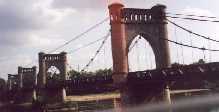
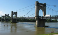
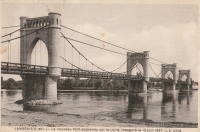
1937: Langeais
Langeais, Indre-et-Loire, France - Loire River
| Bridgemeister ID: | 1029 (added 2003-11-30) |
| Year Completed: | 1937 |
| Name: | Langeais |
| Location: | Langeais, Indre-et-Loire, France |
| Crossing: | Loire River |
| Coordinates: | 47.319667 N 0.404217 E |
| Maps: | Acme, GeoHack, Google, OpenStreetMap |
| References: | AAJ, BPF |
| Use: | Vehicular (two-lane), with walkway |
| Status: | In use (last checked: 2021) |
| Main Cables: | Wire (steel) |
| Suspended Spans: | 5 |
| Main Spans: | 3 x 90 meters (295.29 feet) |
| Side Spans: | 2 x 45 meters (147.64 feet) |
Notes:
- 1940: Deck collapsed.
- 1946: Repaired, but carrying just a footbridge.
- 1950: Rebuilt as a vehicular bridge.
- 1983: Reinforced to support heavier traffic.
- Replaced 1849 Langeais - Langeais, Indre-et-Loire, France.
External Links:
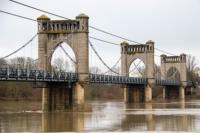
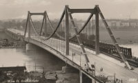
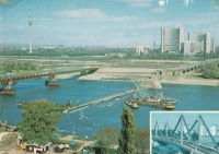
1937: Reichsbrücke
Vienna, Austria - Danube River
| Bridgemeister ID: | 4589 (added 2020-06-06) |
| Year Completed: | 1937 |
| Name: | Reichsbrücke |
| Location: | Vienna, Austria |
| Crossing: | Danube River |
| Coordinates: | 48.227267 N 16.407719 E |
| Maps: | Acme, GeoHack, Google, OpenStreetMap |
| References: | AAJ |
| Use: | Vehicular |
| Status: | Collapsed, August 1, 1976 |
| Main Cables: | Eyebar (steel) |
| Suspended Spans: | 1 |
| Main Span: | 1 x 241.2 meters (791.3 feet) |
Notes:
- Renovated 1948-1952.
External Links:
1937: Rio Chiriquí
David, Panama - Rio Chiriquí
| Bridgemeister ID: | 451 (added before 2003) |
| Year Completed: | 1937 |
| Name: | Rio Chiriquí |
| Location: | David, Panama |
| Crossing: | Rio Chiriquí |
| Principals: | Conde B. McCullough |
| References: | AAJ, CBM |
| Use: | Vehicular |
| Main Cables: | Wire (steel) |
| Suspended Spans: | 1 |
| Main Span: | 1 x 121.9 meters (400 feet) |
| Deck width: | 20 feet |
External Links:
1937: Rio Choluteca
Choluteca, Honduras - Rio Choluteca
| Bridgemeister ID: | 452 (added before 2003) |
| Year Completed: | 1937 |
| Name: | Rio Choluteca |
| Location: | Choluteca, Honduras |
| Crossing: | Rio Choluteca |
| Coordinates: | 13.312089 N 87.191631 W |
| Maps: | Acme, GeoHack, Google, OpenStreetMap |
| Principals: | Conde B. McCullough, R. Archibald |
| References: | AAJ, CBM, MSSB |
| Use: | Vehicular (two-lane), with walkway |
| Status: | In use (last checked: 2016) |
| Main Cables: | Wire (steel) |
| Suspended Spans: | 4 |
| Main Spans: | 2 x 100.6 meters (330 feet) |
| Side Spans: | 2 x 33.5 meters (110 feet) |
| Deck width: | 30 feet |
External Links:
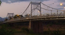
1937: Rio Tamasalupa
Asuncíon Mita, Guatemala - Rio Tamasalupa
| Bridgemeister ID: | 453 (added before 2003) |
| Year Completed: | 1937 |
| Name: | Rio Tamasalupa |
| Location: | Asuncíon Mita, Guatemala |
| Crossing: | Rio Tamasalupa |
| Coordinates: | 14.304190 N 89.717344 W |
| Maps: | Acme, GeoHack, Google, OpenStreetMap |
| Principals: | Conde B. McCullough, R. Archibald |
| References: | AAJ, CBM |
| Use: | Vehicular (two-lane) |
| Status: | In use (last checked: 2019) |
| Main Cables: | Eyebar (steel) |
| Suspended Spans: | 3 |
| Main Span: | 1 x 73.2 meters (240 feet) |
| Side Spans: | 2 x 30.5 meters (100 feet) |
| Deck width: | 20 feet |
External Links:
1938: Manning
Riggins Hot Springs vicinity, Idaho, USA - Salmon River
| Bridgemeister ID: | 1333 (added 2004-05-01) |
| Year Completed: | 1938 |
| Name: | Manning |
| Also Known As: | Crevasse |
| Location: | Riggins Hot Springs vicinity, Idaho, USA |
| Crossing: | Salmon River |
| At or Near Feature: | Manning Crevice |
| Coordinates: | 45.401517 N 116.11682 W |
| Maps: | Acme, GeoHack, Google, OpenStreetMap |
| Principals: | J. P. Martin, E. Myers |
| References: | AAJ |
| Use: | Vehicular (one-lane) |
| Status: | Replaced, 2018 |
| Main Cables: | Wire (steel) |
| Suspended Spans: | 1 |
| Main Span: | 1 x 73.2 meters (240 feet) |
Notes:
- 2018: Replaced by another suspension bridge, removed at some point 2018-2020.
- Replaced by 2018 Manning Crevice - Riggins Hot Springs vicinity, Idaho, USA.
External Links:

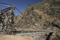
1938: Thousand Islands International I
Wellesley Island and Collins Landing, New York, USA - St. Lawrence River
| Bridgemeister ID: | 364 (added before 2003) |
| Year Completed: | 1938 |
| Name: | Thousand Islands International I |
| Location: | Wellesley Island and Collins Landing, New York, USA |
| Crossing: | St. Lawrence River |
| At or Near Feature: | American Channel |
| Coordinates: | 44.30333 N 75.98333 W |
| Maps: | Acme, GeoHack, Google, OpenStreetMap |
| Principals: | Robinson and Steinman |
| References: | AAJ, ADDS |
| Use: | Vehicular (two-lane, heavy vehicles), with walkway |
| Status: | In use (last checked: 2022) |
| Main Cables: | Wire (steel) |
| Suspended Spans: | 3 |
| Main Span: | 1 x 243.8 meters (800 feet) |
| Side Spans: | 2 x 106.7 meters (350 feet) |
Notes:
External Links:


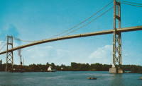
1938: Thousand Islands International II
Georgina Island and Selton, Ontario, Canada - St. Lawrence River
| Bridgemeister ID: | 365 (added before 2003) |
| Year Completed: | 1938 |
| Name: | Thousand Islands International II |
| Location: | Georgina Island and Selton, Ontario, Canada |
| Crossing: | St. Lawrence River |
| Coordinates: | 44.36323 N 75.98271 W |
| Maps: | Acme, GeoHack, Google, OpenStreetMap |
| Principals: | Robinson and Steinman |
| References: | AAJ, ADDS |
| Use: | Vehicular (two-lane, heavy vehicles), with walkway |
| Status: | In use (last checked: 2022) |
| Main Cables: | Wire (steel) |
| Suspended Spans: | 3 |
| Main Span: | 1 x 228.6 meters (750 feet) |
| Side Spans: | 2 x 91.4 meters (300 feet) |
Notes:
- Companion to 1938 Thousand Islands International I - Wellesley Island and Collins Landing, New York, USA.
External Links:
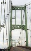
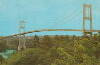
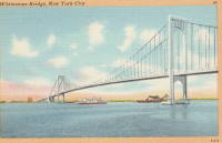
1939: Bronx-Whitestone
The Bronx and Queens, New York, USA - East River
| Bridgemeister ID: | 191 (added before 2003) |
| Year Completed: | 1939 |
| Name: | Bronx-Whitestone |
| Location: | The Bronx and Queens, New York, USA |
| Crossing: | East River |
| Coordinates: | 40.80167 N 73.83 W |
| Maps: | Acme, GeoHack, Google, OpenStreetMap |
| Principals: | O. H. Ammann, Allston Dana |
| References: | AAJ, ARF, BAAW, BBR, BFL, BPL, GBD, SIX |
| Use: | Vehicular (major highway) |
| Status: | In use (last checked: 2022) |
| Main Cables: | Wire (steel) |
| Suspended Spans: | 3 |
| Main Span: | 1 x 701 meters (2,300 feet) |
| Side Spans: | 2 x 224 meters (735 feet) |
Notes:
External Links:

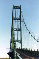
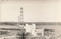
1939: Deer Isle
Sedgwick, Maine, USA - Eggemoggin Reach
| Bridgemeister ID: | 193 (added before 2003) |
| Year Completed: | 1939 |
| Name: | Deer Isle |
| Location: | Sedgwick, Maine, USA |
| Crossing: | Eggemoggin Reach |
| Coordinates: | 44.290167 N 68.691383 W |
| Maps: | Acme, GeoHack, Google, OpenStreetMap |
| Principals: | Robinson and Steinman |
| References: | AAJ, BBR, IT1999F |
| Use: | Vehicular (two-lane, heavy vehicles), with walkway |
| Status: | In use (last checked: 2022) |
| Main Cables: | Wire (steel) |
| Suspended Spans: | 3 |
| Main Span: | 1 x 329.2 meters (1,080 feet) |
| Side Spans: | 2 x 147.5 meters (484 feet) |
Notes:
- Gained much media attention in July 2018 when a bracket broke loose connecting the maintenance access cables to the main cables even though it had no impact on the structural integrity of the bridge.
External Links:

1939: Lions Gate
Vancouver, British Columbia, Canada - Vancouver Harbor
| Bridgemeister ID: | 194 (added before 2003) |
| Year Completed: | 1939 |
| Name: | Lions Gate |
| Also Known As: | First Narrows |
| Location: | Vancouver, British Columbia, Canada |
| Crossing: | Vancouver Harbor |
| At or Near Feature: | Burrard Inlet |
| Coordinates: | 49.31533 N 123.13846 W |
| Maps: | Acme, GeoHack, Google, OpenStreetMap |
| Principals: | Monsarrat and Pratley |
| References: | AAJ, BAR, BMA |
| Use: | Vehicular (major highway) |
| Status: | In use (last checked: 2019) |
| Main Cables: | Wire (steel) |
| Suspended Spans: | 3 |
| Main Span: | 1 x 472.4 meters (1,550 feet) |
| Side Spans: | 2 x 187.5 meters (615 feet) |
| Deck width: | 39 feet |
External Links:

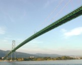
1939: Otto Beit
Makuti, Zimbabwe and Chirundu, Zambia - Zambezi River
| Bridgemeister ID: | 937 (added 2003-10-25) |
| Year Completed: | 1939 |
| Name: | Otto Beit |
| Also Known As: | Chirundu |
| Location: | Makuti, Zimbabwe and Chirundu, Zambia |
| Crossing: | Zambezi River |
| Coordinates: | 16.038006 S 28.852322 E |
| Maps: | Acme, GeoHack, Google, OpenStreetMap |
| Principals: | Ralph Freeman, Dorman Long & Co Ltd |
| References: | AAJ, WOT |
| Use: | Vehicular (two-lane, heavy vehicles) |
| Status: | In use (last checked: 2018) |
| Main Cables: | Wire (steel) |
| Main Span: | 1 x 320 meters (1,049.9 feet) |
External Links:
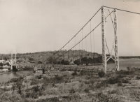
1939: Sullivan-Hutsonville
Hutsonville, Illinois and Sullivan, Indiana, USA - Wabash River
| Bridgemeister ID: | 196 (added before 2003) |
| Year Completed: | 1939 |
| Name: | Sullivan-Hutsonville |
| Location: | Hutsonville, Illinois and Sullivan, Indiana, USA |
| Crossing: | Wabash River |
| Coordinates: | 39.1101 N 87.6551 W |
| Maps: | Acme, GeoHack, Google, OpenStreetMap |
| Principals: | Steinman & Robinson, R.V. Milbank, Wisconsin Bridge & Iron Co., Charles J. Glasgow |
| References: | AAJ, BPL, IMB, SJR19880926 |
| Use: | Vehicular (two-lane), with walkway |
| Status: | Demolished, 1989 |
| Main Cables: | Wire (steel) |
| Suspended Spans: | 3 |
| Main Span: | 1 x 106.7 meters (350 feet) |
| Side Spans: | 2 x 45.7 meters (150 feet) |
| Deck width: | 20 feet |
| Characteristics: | Self-anchored |
Notes:
- Demolished 1989. This bridge was Steinman's attempt at a self-anchored suspension bridge and met a controversial demise in 1989. An article in the September 26, 1988 issue of the Springfield, IL "The State Journal-Register" describes the ongoing controversy. The company to which the $100,000 demolition contract was let offered to turn the money over to save the bridge. The locals agreed, but the company's Chief Engineer Stephen Schneider was quoted, "I think Indiana really wants to tear it down. They've been ... forced to send inspectors out every two weeks. I think they just want the headache gone." Gary Abell, spokesman for the Indiana Dept. Of Highways said its design is "not one of the best. It works in theory, but not in practice. This is like trying to save a mistake." After a lot of back-and-forth, the locals gave up, "We've had it with them. We don't want anything more to do with it. They can tear the damn thing down." Animosity toward this bridge continues 13 years after its demolition. In 2002, in an email to Wayne Grodkiewicz (who provided me with much information about this bridge), an INDOT representative said, "I am not sure why you are interested in that bridge, but from our stand point, it was a very poorly designed bridge that had many many problems from the day that it was completed, until it was brought down."
External Links:
1940: (pipeline bridge)
Sioux City, Iowa and Dakota City vicinity, Nebraska, USA - Missouri River
| Bridgemeister ID: | 2252 (added 2007-03-31) |
| Year Completed: | 1940 |
| Name: | (pipeline bridge) |
| Location: | Sioux City, Iowa and Dakota City vicinity, Nebraska, USA |
| Crossing: | Missouri River |
| Coordinates: | 42.43842 N 96.38387 W |
| Maps: | Acme, GeoHack, Google, OpenStreetMap |
| References: | AAJ |
| Use: | Pipeline |
| Status: | Removed, 2005 |
| Main Cables: | Wire (steel) |
| Main Span: | 1 x 404 meters (1,325.5 feet) estimated |
Notes:
- Large pipeline suspension bridge located near the Big Soo terminal.
External Links:
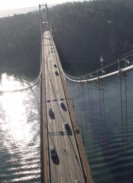
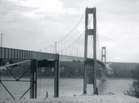
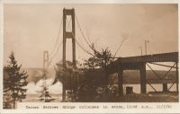
1940: Tacoma Narrows
Tacoma and Gig Harbor, Washington, USA - Puget Sound
| Bridgemeister ID: | 198 (added before 2003) |
| Year Completed: | 1940 |
| Name: | Tacoma Narrows |
| Also Known As: | Galloping Gertie |
| Location: | Tacoma and Gig Harbor, Washington, USA |
| Crossing: | Puget Sound |
| Coordinates: | 47.267015 N 122.548462 W |
| Maps: | Acme, GeoHack, Google, OpenStreetMap |
| Principals: | Leon Moisseiff |
| References: | AAJ, BAR, BBR, BFL, BMA, BPL, COB, CTT, GBD, IT1999F, SPW |
| Use: | Vehicular (two-lane, heavy vehicles), with walkway |
| Status: | Collapsed, 1940 |
| Main Cables: | Wire (steel) |
| Suspended Spans: | 3 |
| Main Span: | 1 x 853.4 meters (2,800 feet) |
| Side Spans: | 2 x 335.3 meters (1,100 feet) |
| Deck width: | 39 feet |
Notes:
- Famously destroyed by wind, November 7, 1940.
- Replaced by 1950 Tacoma Narrows (Sturdy Gertie, Second Tacoma Narrows) - Tacoma and Gig Harbor, Washington, USA.
- See 1944 Liard River - Liard River Hot Springs vicinity, British Columbia, Canada. According to CTT, "Two sections from the Tacoma bridge's east approach were [re]used in the Liard span."
External Links:



1941: Saint-Denis-de-Pile
Saint-Denis-de-Pile and Bonzac, Gironde, France - Isle River
| Bridgemeister ID: | 2962 (added 2019-10-06) |
| Year Completed: | 1941 |
| Name: | Saint-Denis-de-Pile |
| Location: | Saint-Denis-de-Pile and Bonzac, Gironde, France |
| Crossing: | Isle River |
| Coordinates: | 44.993221 N 0.207261 W |
| Maps: | Acme, GeoHack, Google, OpenStreetMap |
| References: | AAJ |
| Use: | Vehicular (two-lane) |
| Status: | In use (last checked: 2019) |
| Main Cables: | Wire (steel) |
| Suspended Spans: | 1 |
Notes:
- 1931, June 3, 1931: Deck and hangers fail during load testing when a truck hits a cable. Ten people die in the accident.
- 1935: Construction starts on a replacement bridge.
- Replaced Saint-Denis-de-Pile - Saint-Denis-de-Pile and Bonzac, Gironde, France.
External Links:
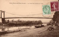
Bas-Monistrol
Bas-en-Basset and Monistrol-sur-Loire, Haute-Loire, France - Loire River
| Bridgemeister ID: | 3334 (added 2019-12-08) |
| Name: | Bas-Monistrol |
| Location: | Bas-en-Basset and Monistrol-sur-Loire, Haute-Loire, France |
| Crossing: | Loire River |
| Coordinates: | 45.294889 N 4.118132 E |
| Maps: | Acme, GeoHack, Google, OpenStreetMap |
| References: | AAJ |
| Use: | Vehicular |
| Status: | Only towers remain (last checked: 2018) |
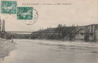
Beauchastel
Beauchastel, Ardèche, France - Eyrieux River
| Bridgemeister ID: | 4063 (added 2020-03-30) |
| Name: | Beauchastel |
| Location: | Beauchastel, Ardèche, France |
| Crossing: | Eyrieux River |
| References: | AAJ |
| Use: | Vehicular |
| Status: | Removed |
| Main Cables: | Wire (iron) |
Notes:
- AAJ supposes this bridge was completed in 1842 based on a contract let in 1840 proposing a two-year construction period, but other material suggest the bridge was built later.
External Links:
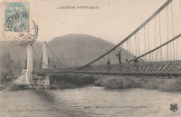
Cendrecourt
Cendrecourt, Haute-Saône, France - Saône River
| Bridgemeister ID: | 4720 (added 2020-06-26) |
| Name: | Cendrecourt |
| Location: | Cendrecourt, Haute-Saône, France |
| Crossing: | Saône River |
| Coordinates: | 47.840527 N 5.917462 E |
| Maps: | Acme, GeoHack, Google, OpenStreetMap |
| References: | AAJ |
| Use: | Vehicular |
| Status: | Destroyed, 1940 |
| Main Cables: | Wire |
| Suspended Spans: | 1 |
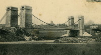
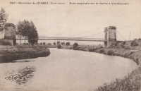
Cormery
Cormery and Truyes, Indre-et-Loire, France - Indre River
| Bridgemeister ID: | 1939 (added 2005-10-29) |
| Name: | Cormery |
| Location: | Cormery and Truyes, Indre-et-Loire, France |
| Crossing: | Indre River |
| Principals: | Joseph Chaley |
| References: | AAJ |
| Status: | Removed |
| Main Cables: | Wire (iron) |
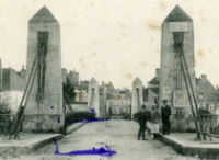
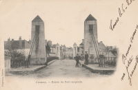
Frans
Villefranche-sur-Saône, Rhône and Jassans-Riottier, Ain, France - Saône River
| Bridgemeister ID: | 5657 (added 2021-01-01) |
| Name: | Frans |
| Location: | Villefranche-sur-Saône, Rhône and Jassans-Riottier, Ain, France |
| Crossing: | Saône River |
| Coordinates: | 45.984570 N 4.750048 E |
| Maps: | Acme, GeoHack, Google, OpenStreetMap |
| References: | AAJ |
| Use: | Vehicular |
| Status: | Removed, 1900 |
| Main Cables: | Wire (iron) |
| Suspended Spans: | 2 |
| Main Spans: | 2 |
External Links:
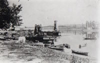
Gignac
Gignac and Lagamas, Hérault, France - Hérault River
| Bridgemeister ID: | 3188 (added 2019-11-10) |
| Name: | Gignac |
| Also Known As: | Lagamas |
| Location: | Gignac and Lagamas, Hérault, France |
| Crossing: | Hérault River |
| Coordinates: | 43.663873 N 3.537615 E |
| Maps: | Acme, GeoHack, Google, OpenStreetMap |
| References: | AAJ |
| Use: | Vehicular (one-lane) |
| Status: | In use (last checked: 2014) |
| Main Cables: | Wire |
| Suspended Spans: | 1 |
Notes:
- Likely completed in 1869 or early 1870s.
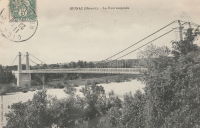
Gluges
Gluges, Lot, France - Dordogne River
| Bridgemeister ID: | 1584 (added 2005-01-22) |
| Name: | Gluges |
| Location: | Gluges, Lot, France |
| Crossing: | Dordogne River |
| Coordinates: | 44.907676 N 1.627499 E |
| Maps: | Acme, GeoHack, Google, OpenStreetMap |
| References: | AAJ |
| Use: | Vehicular (two-lane) |
| Status: | In use (last checked: 2022) |
| Main Cables: | Wire (steel) |
| Suspended Spans: | 1 |
Notes:
- This is the modern suspension bridge of 20th-century construction at Gluges. It is unclear if this bridge is at the same location as the older Gluges suspension bridge.
- See Gluges - Gluges, Lot, France.
External Links:
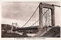
Groléjac
Groléjac, Dordogne, France - Dordogne River
| Bridgemeister ID: | 1930 (added 2005-10-27) |
| Name: | Groléjac |
| Location: | Groléjac, Dordogne, France |
| Crossing: | Dordogne River |
| References: | AAJ |
| Use: | Vehicular (one-lane) |
| Status: | Removed |
Notes:
- AAJ estimates completed in 1844 because of source indicating contract was let in 1841 with construction time set at three years.
- Currently, there is a bridge at Groléjac that has the shape of a suspension bridge, but appears to be a concrete cantilever. This newer bridge was completed in 1932.
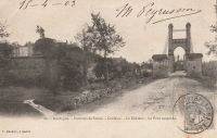
Mananjary
Mananjary vicinity, Madagascar - Mananjary River
| Bridgemeister ID: | 5654 (added 2020-12-31) |
| Name: | Mananjary |
| Location: | Mananjary vicinity, Madagascar |
| Crossing: | Mananjary River |
| Coordinates: | 21.218314 S 48.233091 E |
| Maps: | Acme, GeoHack, Google, OpenStreetMap |
| References: | AAJ |
| Use: | Vehicular (one-lane) |
| Status: | Extant (last checked: 2020) |
| Main Cables: | Wire (steel) |
| Main Span: | 1 x 159.4 meters (523 feet) |
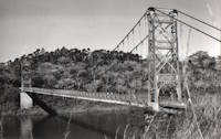
Montmorency Falls
Quebec City vicinity, Quebec, Canada - Montmorency Falls
| Bridgemeister ID: | 1526 (added 2004-10-24) |
| Name: | Montmorency Falls |
| Location: | Quebec City vicinity, Quebec, Canada |
| Crossing: | Montmorency Falls |
| Coordinates: | 46.890706 N 71.147952 W |
| Maps: | Acme, GeoHack, Google, OpenStreetMap |
| References: | AAJ, HBE |
| Use: | Vehicular |
| Status: | Failed, April 30, 1856 |
| Main Cables: | Wire (iron) |
| Suspended Spans: | 1 |
Notes:
- Towers from this bridge are still visible next to the towers of the current suspension footbridge. HBE, in 1911, notes that it "collapsed some years ago carrying a wagon and its driver into the cataract."
- Jakkula (AAJ) cites an article tracing back to the Quebec Gazette stating the bridge failed on April 30, 1856 resulting in the loss of "several" lives and recounting the troubled history of the bridge: "There had been statements made before to the effect that the bridge was not to be trusted. People crossed it with terror. On the northern bank, 5 of the 7 strands of one of the wire cables had previously given way, and the cable had been repaired."
- Later at same location Montmorency Falls - Quebec City vicinity, Quebec, Canada.
Peseux
Chaussin and Peseux, Jura, France - Doubs River
| Bridgemeister ID: | 1600 (added 2005-02-06) |
| Name: | Peseux |
| Location: | Chaussin and Peseux, Jura, France |
| Crossing: | Doubs River |
| References: | AAJ |
| Use: | Vehicular |
| Status: | Removed |
| Main Cables: | Wire |
| Suspended Spans: | 1 |
External Links:
- Art-et-Histoire - Pont de Peseux à Chaussin - 1846. Surmises bridge was completed in 1946.

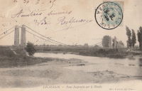
| Bridgemeister ID: | 2187 (added 2007-01-18) |
| Name: | Port D'Agrès |
| Location: | Port D'Agrès, Aveyron, France |
| Crossing: | Lot River |
| References: | AAJ |
| Use: | Vehicular (one-lane), with walkway |
| Status: | Replaced, 1924 |
| Suspended Spans: | 1 |
| Main Span: | 1 x 90 meters (295.29 feet) |
| Deck width: | 14.44 feet |
Notes:
- AAJ suggests bridge was completed in 1837 based on contract being let in 1835 anticipating two years of construction.
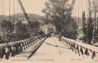
Pouilly-sous-Charlieu
Pouilly-sous-Charlieu and Briennon, Loire, France - Loire River
| Bridgemeister ID: | 2188 (added 2007-01-18) |
| Name: | Pouilly-sous-Charlieu |
| Location: | Pouilly-sous-Charlieu and Briennon, Loire, France |
| Crossing: | Loire River |
| References: | AAJ |
| Use: | Vehicular |
| Status: | Removed |
| Main Cables: | Wire (iron) |
Notes:
- AAJ suggests bridge was completed in 1836 based on contract for construction let in early 1835.
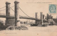
Retournac
Retournac, Haute-Loire, France - Loire River
| Bridgemeister ID: | 4065 (added 2020-03-31) |
| Name: | Retournac |
| Location: | Retournac, Haute-Loire, France |
| Crossing: | Loire River |
| References: | AAJ |
| Use: | Vehicular |
| Status: | Destroyed, 1846 |
Notes:
- AAJ supposes this bridge was completed in 1841 based a contract let in early 1839 for a two-year construction duration. Other sources suggest 1838 or 1839, but appear to be based on the contract date and not the completion of construction.
- Destroyed by flood, 1846.
- Replaced by 1850 Retournac - Retournac, Haute-Loire, France.
Saint-Ambroix
Saint-Ambroix, Gard, France - Cèze River
| Bridgemeister ID: | 4064 (added 2020-03-30) |
| Name: | Saint-Ambroix |
| Location: | Saint-Ambroix, Gard, France |
| Crossing: | Cèze River |
| References: | AAJ |
| Use: | Vehicular |
| Status: | Removed |
| Main Cables: | Wire (iron) |
| Suspended Spans: | 1 |
Notes:
- AAJ supposes this bridge was completed in 1841 based on a contract let in 1840 proposing an 18-month construction period.
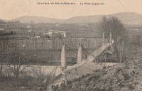
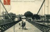
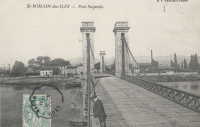
Saint-Romain-des-Iles
Saint-Romain-des-Iles, Saône-et-Loire and Ain, France - Saône River
| Bridgemeister ID: | 2130 (added 2006-10-22) |
| Name: | Saint-Romain-des-Iles |
| Location: | Saint-Romain-des-Iles, Saône-et-Loire and Ain, France |
| Crossing: | Saône River |
| References: | AAJ |
| Use: | Vehicular |
| Status: | Removed |
| Main Cables: | Wire |
Notes:
- Completed during or before 1840.
Sector
Sector, Romney, West Virginia, USA - South Branch Potomac River
| Bridgemeister ID: | 4922 (added 2020-07-26) |
| Name: | Sector |
| Location: | Sector, Romney, West Virginia, USA |
| Crossing: | South Branch Potomac River |
| Coordinates: | 39.227030 N 78.853329 W |
| Maps: | Acme, GeoHack, Google, OpenStreetMap |
| References: | AAJ |
| Use: | Vehicular |
| Status: | Removed |
| Main Cables: | Wire |
| Suspended Spans: | 2 |
| Main Spans: | 1 x 18.3 meters (60 feet), 1 x 27.4 meters (90 feet) |
Notes:
- Coordinates are approximate location of this bridge, believed to be where present day (2020) Fleming-Sector Road would have continued to intersect the river. Location was also known as Glebe Station.
External Links: