Inventory Search Results (301-400 of 700)
700 suspension bridges were found for search criteria: David completed between 1700 and 2010 including undated bridges. Bridges 301 through 400 (of 700 total) appear below. Click the Bridgemeister ID number to isolate the bridge on its own page. If you don't see what you were looking for, try an image search with the same criteria: David. This will find the bridge if it is pictured on the site, but is not a catenary suspension bridge.
Related:
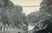
1913: (footbridge)
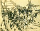
Ithaca, New York, USA - Fall Creek Gorge
| Bridgemeister ID: | 260 (added before 2003) |
| Year Completed: | 1913 |
| Name: | (footbridge) |
| Location: | Ithaca, New York, USA |
| Crossing: | Fall Creek Gorge |
| At or Near Feature: | Cornell University campus |
| Use: | Footbridge |
| Status: | Removed |
Notes:
- Closed August, 1960.
- Replaced by 1961 Triphammer (Fall Creek) - Ithaca, New York, USA.
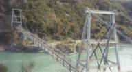
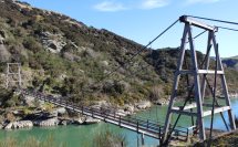
1913: Horseshoe Bend
Horseshoe Bend, Millers Flat vicinity, New Zealand - Clutha River
| Bridgemeister ID: | 695 (added 2003-03-08) |
| Year Completed: | 1913 |
| Name: | Horseshoe Bend |
| Location: | Horseshoe Bend, Millers Flat vicinity, New Zealand |
| Crossing: | Clutha River |
| Coordinates: | 45.722574 S 169.471335 E |
| Maps: | Acme, GeoHack, Google, OpenStreetMap |
| Principals: | John Edie, Jimmy Doake |
| References: | GAP |
| Use: | Footbridge |
| Status: | In use (last checked: 2017) |
| Main Cables: | Wire |
| Suspended Spans: | 1 |
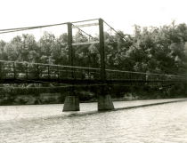
1913: Middle
Warsaw, Missouri, USA - Osage River
| Bridgemeister ID: | 149 (added before 2003) |
| Year Completed: | 1913 |
| Name: | Middle |
| Location: | Warsaw, Missouri, USA |
| Crossing: | Osage River |
| Principals: | J.S. Kidwell, C.F. Bibb |
| References: | BOTO |
| Use: | Vehicular (one-lane) |
| Status: | Demolished |
| Main Cables: | Wire |
| Suspended Spans: | 2 |
| Main Span: | 1 x 140.8 meters (462 feet) |
| Side Span: | 1 x 36.6 meters (120 feet) |
| Deck width: | 12 feet |
Notes:
- Repaired 1927, repaired 1936, damaged by flood 1943. Closed, 1975.
- Replaced 1895 Drake - Warsaw, Missouri, USA.
External Links:
- Historic Bridges of the United States - Warsaw Middle Bridge - Benton County, Missouri
- Structurae - Structure ID 20011002
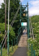
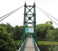
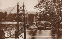
1913: Port-na-Craig
Pitlochry and Port-na Craig, Scotland, United Kingdom - River Tummel
| Bridgemeister ID: | 547 (added before 2003) |
| Year Completed: | 1913 |
| Name: | Port-na-Craig |
| Location: | Pitlochry and Port-na Craig, Scotland, United Kingdom |
| Crossing: | River Tummel |
| Coordinates: | 56.698167 N 3.733017 W |
| Maps: | Acme, GeoHack, Google, OpenStreetMap |
| Use: | Footbridge |
| Status: | In use (last checked: 2014) |
| Main Cables: | Wire (steel) |
| Suspended Spans: | 1 |
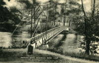
1913: Swing
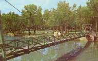
Sheboygan Falls, Wisconsin, USA - Sheboygan River
| Bridgemeister ID: | 314 (added before 2003) |
| Year Completed: | 1913 |
| Name: | Swing |
| Location: | Sheboygan Falls, Wisconsin, USA |
| Crossing: | Sheboygan River |
| At or Near Feature: | River Park |
| Use: | Footbridge |
| Status: | Replaced, 1987 |
| Main Cables: | Wire (steel) |
| Suspended Spans: | 1 |
| Main Span: | 1 x 45.7 meters (150 feet) estimated |
Notes:
- Jim Lucht writes that this bridge was "Damaged beyond repair when a vehicle struck the timber tower."
- Replaced by 1987 Swing - Sheboygan Falls, Wisconsin, USA.
1913: Swinging
Tishomingo, Oklahoma, USA - Pennington Creek
| Bridgemeister ID: | 129 (added before 2003) |
| Year Completed: | 1913 |
| Name: | Swinging |
| Location: | Tishomingo, Oklahoma, USA |
| Crossing: | Pennington Creek |
| Principals: | Western Bridge Company |
| Use: | Vehicular |
| Status: | Destroyed |
Notes:
- The description on the back of a postcard reads: "The only remaining swinging bridge in the state of Oklahoma crossable by automobile spans beautiful Pennington Creek in Tishomingo. The guaranteed strength of the bridge is 164 tons and is located 3 blocks south of the old Chickasaw Capitol on South Capitol Avenue. The bridge was built by Western Bridge Company of Sherman, Texas and was dedicated November 28, 1913."
- Destroyed by flood.
- An article in the April 7, 1964 issue of The Ada Evening News (Oklahoma) titled "Tishomingo Acts To Save Famed Bridge": "Tishomingo's Swinging Bridge, a landmark since Territorial days, may yet be saved from the junk man. Indeed, with a little luck, it may be put back into service to carry traffic across Pennington Creek as it did in its heyday. Some 25 persons attended a regular city council meeting Monday night to urge that the bridge be repaired; and the council appointed a committee to look into the cost of such a project. "It looks favorable," Mayor Lee butler said Tuesday. "It looks like we might get it repaired." The old suspension bridge has been closed to traffic for several years. Floor planks have rotted and fallen away, and the whole structure was condemned as unsafe. The problem of financing has held the city back from repairing the ancient structure. However, Butler said the county commissioners have offered to help, and quite a few individual citizens have promised donations to assist the project. When the committee reports back on the cost, Butler said, the council will be ready to take action."
- The bridge must have been repaired in the mid-1960's and reopened. An article in the July 9, 1978 issue of The Ada Evening News (Oklahoma) titled "Repair of Tishomingo's Suspension Bridge Slated": "Work is expected to begin in the near future on the renovation of the suspension bridge here which spans Pennington Creek. The landmark structure and last swinging bridge in the state open to vehicular traffic was closed last May when city officials deemed it was 'too dangerous' to keep open due to its deteriorated state. In an effort to reopen the bridge as soon as possible, the Tishomingo City Council acted last week to approve funding for materials necessary to repair the 65-year-old structure and has arranged for participants in the Young Adult Conservation Corps camp at Sulphur to provide the manpower needed for the work. Frank Glover, head of the Tishomingo street department, said the Johnston County commissioners have also promised to aid in the repair of the bridge. Glover said he hopes the renovation will be completed this summer. He estimated materials for the work will cost the city about $5,000- $6,000. The bridge will have to be renovated from the bottom up, including the replacement of the entire wooden floor, Glover said. He said city officials are still looking for someone knowledgeable about the construction of suspension bridges to aid in the repair of the structure."
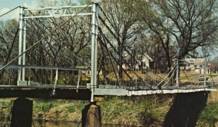
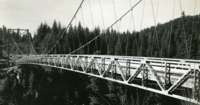
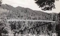
1913: Wind River
Carson, Washington, USA - Wind River
| Bridgemeister ID: | 1005 (added 2003-11-21) |
| Year Completed: | 1913 |
| Name: | Wind River |
| Location: | Carson, Washington, USA |
| Crossing: | Wind River |
| References: | SPW |
| Use: | Vehicular (one-lane) |
| Status: | Replaced |
| Main Cables: | Wire |
| Suspended Spans: | 1 |
Notes:
- The bridge appears identical in the two photos except for the tops of the towers. In one of the photos, it appears some protective housing has been added to cover the cable saddles and an extra brace has been added across the tower.
- Replaced by 1925 Wind River - Carson, Washington, USA.
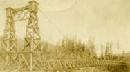
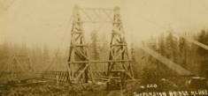
1914: (suspension bridge)
Mangaweka vicinity, New Zealand - Rangitikei River
| Bridgemeister ID: | 697 (added 2003-03-08) |
| Year Completed: | 1914 |
| Name: | (suspension bridge) |
| Location: | Mangaweka vicinity, New Zealand |
| Crossing: | Rangitikei River |
| At or Near Feature: | 'Meeting of the Waters' |
| Coordinates: | 39.754594 S 175.835543 E |
| Maps: | Acme, GeoHack, Google, OpenStreetMap |
| Principals: | S.A.R. Mair |
| References: | GAP |
| Use: | Vehicular (one-lane) |
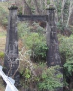
| Status: | Only towers remain, since 1961 (last checked: 2017) |
| Main Cables: | Wire |
| Suspended Spans: | 1 |
Notes:
- GAP: Located at junction of Rangitikei and Hautapu rivers. Replaced, 1961, but original towers remain at the site as of 2017.
1914: Dresden
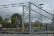
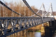
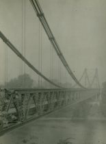
Dresden, Ohio, USA - Muskingum River
| Bridgemeister ID: | 132 (added before 2003) |
| Year Completed: | 1914 |
| Name: | Dresden |
| Location: | Dresden, Ohio, USA |
| Crossing: | Muskingum River |
| Coordinates: | 40.12079 N 82.00000 W |
| Maps: | Acme, GeoHack, Google, OpenStreetMap |
| Principals: | Bellefontaine Bridge and Steel Co. |
| References: | GBD, OCEN198202, PTS2 |
| Use: | Vehicular (one-lane) |
| Status: | Closed (last checked: 2022) |
| Main Cables: | Eyebar (steel) |
| Suspended Spans: | 2 |
| Main Span: | 1 x 135 meters (443 feet) |
| Side Span: | 1 |
Notes:
- 2022, January: Ohio Department of Transportation recommends removal of the bridge due to its deteriorating condition.
- Replaced 1853 Dresden - Dresden, Ohio, USA.
Annotated Citations:
- Hannahs, Nichole. "ODOT Recommends Removal of Suspension Bridge." WHIZ News, 25 Jan. 2022, whiznews.com/2022/01/25/odot-recommends-removal-of-suspension-bridge/
"…ODOT recommended the removal of the structure, which would cost between $1-$2 million, which would be funded by the state. Other more costly options include more than $6 million to make it structurally sound for pedestrians to walk on and over $3.5 million to rehab it and then it still couldn’t be used."
External Links:


1914: Pênsil
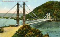
São Vicente, Brazil
| Bridgemeister ID: | 902 (added 2003-10-11) |
| Year Completed: | 1914 |
| Name: | Pênsil |
| Also Known As: | Pensil |
| Location: | São Vicente, Brazil |
| Coordinates: | 23.974960 S 46.388756 W |
| Maps: | Acme, GeoHack, Google, OpenStreetMap |
| Use: | Vehicular (one-lane) |
| Status: | In use (last checked: 2017) |
| Main Cables: | Wire (steel) |
| Suspended Spans: | 1 |
| Main Span: | 1 x 180 meters (590.6 feet) |
External Links:
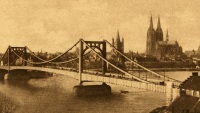
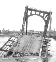
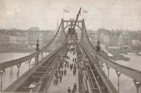
1915: Deutz
Köln (Cologne), Germany - Rhine River
| Bridgemeister ID: | 432 (added before 2003) |
| Year Completed: | 1915 |
| Name: | Deutz |
| Also Known As: | Deutzer, Hindenburg |
| Location: | Köln (Cologne), Germany |
| Crossing: | Rhine River |
| References: | AAJ, BRU |
| Use: | Vehicular |
| Status: | Collapsed, 1945 |
| Main Cables: | Chain (steel) |
| Suspended Spans: | 3 |
| Main Span: | 1 x 184.4 meters (605 feet) |
| Side Spans: | 2 x 92.2 meters (302.5 feet) |
| Deck width: | 59.6 feet |
| Characteristics: | Self-anchored |
Notes:
- First long-span self-anchored suspension bridge.
External Links:
1916: Swinging
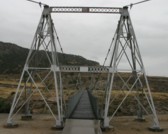
Thermopolis, Wyoming, USA - Big Horn River
| Bridgemeister ID: | 301 (added before 2003) |
| Year Completed: | 1916 |
| Name: | Swinging |
| Location: | Thermopolis, Wyoming, USA |
| Crossing: | Big Horn River |
| At or Near Feature: | Hot Springs State Park |
| Coordinates: | 43.654733 N 108.196167 W |
| Maps: | Acme, GeoHack, Google, OpenStreetMap |
| Use: | Footbridge |
| Status: | In use (last checked: 2006) |
| Main Cables: | Wire (steel) |
| Suspended Spans: | 2 |
| Main Span: | 1 x 58.8 meters (193 feet) estimated |
| Side Span: | 1 x 10.7 meters (35 feet) estimated |
Notes:
- According to sign at the bridge: condemned 1984, removed 1991, restored 1992.
External Links:

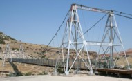
1918: Camp Sherman
Chillicothe, Ohio, USA - Scioto River
| Bridgemeister ID: | 4956 (added 2020-08-08) |
| Year Completed: | 1918 |
| Name: | Camp Sherman |
| Location: | Chillicothe, Ohio, USA |
| Crossing: | Scioto River |
| Principals: | U.S. Army |
| Status: | Removed |
| Main Cables: | Wire (steel) |
| Suspended Spans: | 1 |
| Main Span: | 1 |
Notes:
- Provided access to the Camp Sherman rifle range which sat across the Scioto River from the main part of the campl.
- From an article "Came the False Armistice but Weary Soldiers Unaware” in the September 7, 1968 edition of the Xenia Daily Gazette: "The firing range at old Camp Sherman during World War 1 was a long march from camp to the base of historic Mt. Logan. It was reached by way of a narrow suspension bridge which swayed sickeningly to the measured tempo of the marching soldiers and was an experience in itself."
External Links:
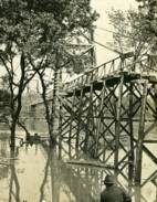
1919: Hansen
Twin Falls vicinity, Idaho, USA - Snake River
| Bridgemeister ID: | 334 (added before 2003) |
| Year Completed: | 1919 |
| Name: | Hansen |
| Location: | Twin Falls vicinity, Idaho, USA |
| Crossing: | Snake River |
| Principals: | Freygang and Trocon |
| References: | AAJ, PTS2 |
| Use: | Vehicular (two-lane) |
| Status: | Replaced, 1966 |
| Main Cables: | Wire (steel) |
| Suspended Spans: | 1 |
| Main Span: | 1 x 185.3 meters (608 feet) |
| Deck width: | 17 feet |
External Links:
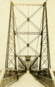
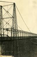
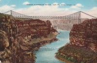
1920: Les Andelys
Les Andelys, Eure, France - Seine River
| Bridgemeister ID: | 1597 (added 2005-02-06) |
| Year Completed: | 1920 |
| Name: | Les Andelys |
| Location: | Les Andelys, Eure, France |
| Crossing: | Seine River |
| Coordinates: | 49.236737 N 1.399657 E |
| Maps: | Acme, GeoHack, Google, OpenStreetMap |
| Principals: | Ferdinand Arnodin |
| Use: | Vehicular |
| Status: | Demolished, June 9, 1940 |
| Main Cables: | Wire (steel) |
| Suspended Spans: | 1 |
Notes:
- Completed in 1914 but not opened until 1920.
- The present-day Les Andelys bridge appears to have been constructed on the same piers as this predecessor.
- Demolished in June 1940 by the French army to slow advancing German troops during WWII.
- At former location of 1838 Les Andelys - Les Andelys, Eure, France. The 1920 bridge was not an immediate replacement. A stone arch bridge replaced the 1838 suspension bridge destroyed in 1870. The arch bridge was replaced by this (1920) suspension bridge.
- Replaced by 1947 Les Andelys - Les Andelys, Eure, France.
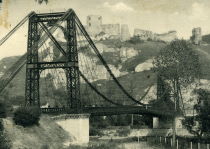
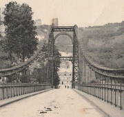
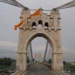
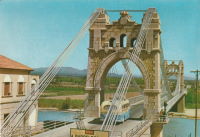
1921: Amposta
Amposta, Spain - Ebro River
| Bridgemeister ID: | 935 (added 2003-10-25) |
| Year Completed: | 1921 |
| Name: | Amposta |
| Also Known As: | Penjant |
| Location: | Amposta, Spain |
| Crossing: | Ebro River |
| Coordinates: | 40.714866 N 0.581695 E |
| Maps: | Acme, GeoHack, Google, OpenStreetMap |
| Principals: | José Eugenio Ribera |
| Use: | Vehicular (two-lane) |
| Status: | In use (last checked: 2019) |
| Main Cables: | Wire (steel) |
| Suspended Spans: | 1 |
Notes:
- Damaged during Spanish Civil War, restored 1941.
External Links:
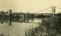
1921: Kingston-Port Ewen
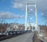
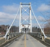
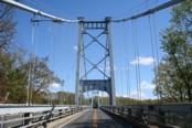
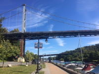
Kingston, New York, USA - Rondout Creek
| Bridgemeister ID: | 138 (added before 2003) |
| Year Completed: | 1921 |
| Name: | Kingston-Port Ewen |
| Also Known As: | Wurts Street, Rondout Creek |
| Location: | Kingston, New York, USA |
| Crossing: | Rondout Creek |
| Coordinates: | 41.916129 N 73.983999 W |
| Maps: | Acme, GeoHack, Google, OpenStreetMap |
| Principals: | Holton D. Robinson, Daniel E. Moran, William Yates |
| References: | AAJ, PTS, PTS2, SJR, SSS |
| Use: | Vehicular (two-lane, heavy vehicles), with walkway |
| Status: | In use, September 2020 (last checked: 2021) |
| Main Cables: | Wire (steel) |
| Suspended Spans: | 3 |
| Main Span: | 1 x 214.9 meters (705 feet) |
| Side Spans: | 2 x 53.7 meters (176.25 feet) |
| Deck width: | 37 feet |
Notes:
- 2008, March: Closed for ten weeks for cable inspection.
- 2018, December: Closed for maintenance. Expected to reopen February, 2019.
- 2019: Major rehabilitation continues to be delayed for several years.
- 2020, September: Closed temporarily. Major renovation project continues to be delayed.
- 2020, December: Closed indefinitely.
- 2021, May: Bids for renovation to be sought in June. Work expected to start in September.
- 2021, October: Groundbreaking ceremony for long-anticipated restoration project. Expected to be completed in 2023 at a cost of US$44.6M
Annotated Citations:
- Kirby, Paul. "Bids for Rondout Creek Bridge overhaul to be sought next month; work expected to start in September." Daily Freeman, 5 May 2021, www.dailyfreeman.com/news/local-news/bids-for-rondout-creek-bridge-overhaul-to-be-sought-next-month-work-expected-to-start/article_612258c4-adce-11eb-8dd6-9f0ac0c85540.html.
"Bids for the planned overhaul of the Rondout Creek Bridge will be sought in June, and the state Department of Transportation expects to award contracts for the work in August, the office of state Assemblyman Kevin Cahill said this week... The rehabilitation of the suspension bridge, which carries Wurts Street over the creek between Kingston and Port Ewen, could cost as much as $37 million, Cahill said previously. The state will pay for the project, which is expected to begin this fall."
External Links:
- Dave Longendyke's website. Several photos of the bridge's construction.
- Structurae - Structure ID 20007345
1921: St. Marien
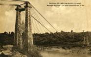
St. Marien, Budelière vicinity, Évaux-les-Bains and Budelière, Creuse, France - Tardes River
| Bridgemeister ID: | 1159 (added 2004-01-18) |
| Year Completed: | 1921 |
| Name: | St. Marien |
| Location: | St. Marien, Budelière vicinity, Évaux-les-Bains and Budelière, Creuse, France |
| Crossing: | Tardes River |
| Coordinates: | 46.233320 N 2.508124 E |
| Maps: | Acme, GeoHack, Google, OpenStreetMap |
| Use: | Vehicular (one-lane) |
| Status: | In use (last checked: 2017) |
| Suspended Spans: | 1 |
Notes:
- Located just before the Tardes flows into the Cher. Sometimes noted as near Evaux-les-Bains.
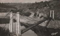
1922: Duck Run
Truebada, Glenville vicinity, West Virginia, USA - Little Kanawha River
| Bridgemeister ID: | 139 (added before 2003) |
| Year Completed: | 1922 |
| Name: | Duck Run |
| Also Known As: | Truebada Swinging |
| Location: | Truebada, Glenville vicinity, West Virginia, USA |
| Crossing: | Little Kanawha River |
| Coordinates: | 38.92830 N 80.78731 W |
| Maps: | Acme, GeoHack, Google, OpenStreetMap |
| Principals: | William M. Moss, Fred Lewis |
| Use: | Vehicular (one-lane) |
| Status: | Closed (last checked: 2007) |
| Main Cables: | Wire |
| Suspended Spans: | 3 |
| Main Span: | 1 x 62.5 meters (205 feet) estimated |
| Side Spans: | 1 x 20.1 meters (66 feet) estimated, 1 x 23.5 meters (77 feet) estimated |
Notes:
- Bypassed, 1991.
External Links:
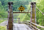
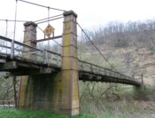
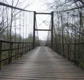
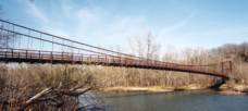
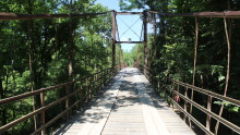
1922: Glaize
Brumley vicinity, Missouri, USA - Grand Glaize Creek
| Bridgemeister ID: | 332 (added before 2003) |
| Year Completed: | 1922 |
| Name: | Glaize |
| Also Known As: | Auglaize, Grand Glaize, Grand Auglaize |
| Location: | Brumley vicinity, Missouri, USA |
| Crossing: | Grand Glaize Creek |
| Coordinates: | 38.077098 N 92.526488 W |
| Maps: | Acme, GeoHack, Google, OpenStreetMap |
| Principals: | Joseph A. Dice |
| References: | BOTO |
| Use: | Vehicular (one-lane) |
| Status: | Closed, January 6, 2021 (last checked: 2021) |
| Main Cables: | Wire (steel) |
| Suspended Spans: | 2 |
| Main Span: | 1 x 126.2 meters (414 feet) estimated |
| Side Span: | 1 |
| Deck width: | 12 feet |
Notes:
- 2020, October 8: Added to National Register of Historic Places.
- 2021, January 6: Closed due to structural issues with the bridge's anchors.
- 2021, February 6: New inspection of the current issue ("loose cables"). Bridge is still closed.
- Near 1925 Mill Creek - Brumley vicinity, Missouri, USA.
External Links:
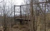
1922: Llanstephan
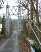
Llanstephan, Wales, United Kingdom - River Wye
| Bridgemeister ID: | 1964 (added 2005-11-12) |
| Year Completed: | 1922 |
| Name: | Llanstephan |
| Location: | Llanstephan, Wales, United Kingdom |
| Crossing: | River Wye |
| Coordinates: | 52.06604 N 3.29614 W |
| Maps: | Acme, GeoHack, Google, OpenStreetMap |
| Principals: | David Rowell & Co. |
| Use: | Vehicular (one-lane) |
| Status: | In use (last checked: 2021) |
| Main Cables: | Wire (steel) |
| Suspended Spans: | 1 |
External Links:
1922: Porthill
Shrewsbury, England, United Kingdom - River Severn
| Bridgemeister ID: | 434 (added before 2003) |
| Year Completed: | 1922 |
| Name: | Porthill |
| Location: | Shrewsbury, England, United Kingdom |
| Crossing: | River Severn |
| Coordinates: | 52.708233 N 2.763083 W |
| Maps: | Acme, GeoHack, Google, OpenStreetMap |
| Principals: | David Rowell & Co. |
| References: | NTB |
| Use: | Footbridge |
| Status: | In use (last checked: 2010) |
| Suspended Spans: | 1 |
External Links:
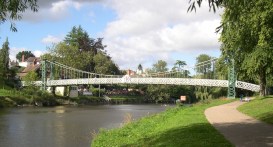
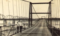
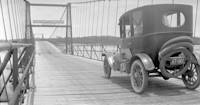
| Bridgemeister ID: | 5589 (added 2020-12-22) |
| Year Completed: | 1923 |
| Name: | 98th Meridian |
| Also Known As: | Byers |
| Location: | Byers vicinity, Texas and Temple, Oklahoma, USA |
| Crossing: | Red River |
| Coordinates: | 34.127249 N 98.214114 W |
| Maps: | Acme, GeoHack, Google, OpenStreetMap |
| Principals: | Austin Bridge Co. |
| References: | AUB |
| Use: | Vehicular |
| Status: | Destroyed, 1938 |
| Main Cables: | Wire (steel) |
Notes:
- AUB describes the Byers bridge: "This bridge, three spans of 567' each, one side span of 107', and a 16' roadway, had originally been built in 1914."
- 1935: Damaged by flood.
- 1938: Destroyed by flood.
- Replaced 1914 98th Meridian (Byers) - Byers, Texas and Temple, Oklahoma, USA.
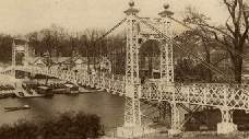
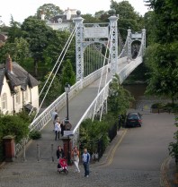
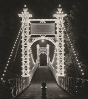
1923: Queens Park
Chester and Handbridge, England, United Kingdom - River Dee
| Bridgemeister ID: | 435 (added before 2003) |
| Year Completed: | 1923 |
| Name: | Queens Park |
| Location: | Chester and Handbridge, England, United Kingdom |
| Crossing: | River Dee |
| Coordinates: | 53.18796 N 2.88421 W |
| Maps: | Acme, GeoHack, Google, OpenStreetMap |
| Principals: | Charles Greenwood, David Rowell & Co., William E. Barker |
| References: | BRB, NTB |
| Use: | Footbridge |
| Status: | In use (last checked: 2019) |
| Main Cables: | Wire (steel) |
| Suspended Spans: | 1 |
| Main Span: | 1 x 83.8 meters (275 feet) |
Notes:
External Links:
- Chesterwiki - Suspension Bridge. Interesting details about the bridge.
1924: Agness
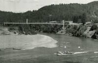
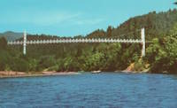
Agness, Oregon, USA - Rogue River
| Bridgemeister ID: | 273 (added before 2003) |
| Year Completed: | 1924 |
| Name: | Agness |
| Location: | Agness, Oregon, USA |
| Crossing: | Rogue River |
| Principals: | U.S. Forest Service |
| References: | AAJ |
| Status: | Destroyed, 1964 |
| Main Cables: | Wire |
| Main Span: | 1 x 92.7 meters (304 feet) |
| Side Span: | 1 |
Notes:
- A postcard reads, "This historic forestry suspension bridge over the Rogue River was... constructed of steel carried piece by piece up-river from Gold Beach by the mail boats. This bridge was swept away by flood waters 100 feet over flood stage during December 1964."
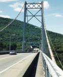
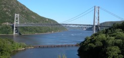
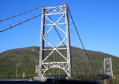
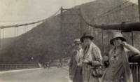
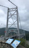
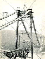
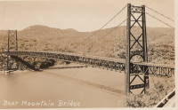
1924: Bear Mountain
Anthony's Nose and Bear Mountain, New York, USA - Hudson River
| Bridgemeister ID: | 141 (added before 2003) |
| Year Completed: | 1924 |
| Name: | Bear Mountain |
| Location: | Anthony's Nose and Bear Mountain, New York, USA |
| Crossing: | Hudson River |
| Coordinates: | 41.32 N 73.985 W |
| Maps: | Acme, GeoHack, Google, OpenStreetMap |
| Principals: | Howard C. Baird |
| References: | AAJ, BAAW, BBR, CPW, PTS2, SJR |
| Use: | Vehicular (two-lane, heavy vehicles), with walkway |
| Status: | In use (last checked: 2022) |
| Main Cables: | Wire (steel) |
| Suspended Spans: | 1 |
| Main Span: | 1 x 497.4 meters (1,632 feet) |
| Deck width: | 48 feet |
Notes:
- Became longest suspension bridge by eclipsing 1903 Williamsburg - New York and Brooklyn, New York, USA.
- Eclipsed by new longest suspension bridge 1926 Benjamin Franklin (Philadelphia-Camden) - Philadelphia, Pennsylvania and Camden, New Jersey, USA.
- Near 2002 Popolopen (William J. Moreau Popolopen) - Fort Montgomery, New York, USA.
External Links:
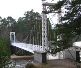
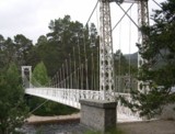
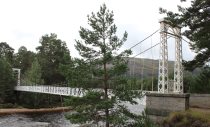
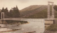
1924: Invercauld
Braemar vicinity, Scotland, United Kingdom - River Dee
| Bridgemeister ID: | 1906 (added 2005-10-08) |
| Year Completed: | 1924 |
| Name: | Invercauld |
| Also Known As: | Ballochbuie, Garbh Allt Shiel |
| Location: | Braemar vicinity, Scotland, United Kingdom |
| Crossing: | River Dee |
| Coordinates: | 57.001768 N 3.322743 W |
| Maps: | Acme, GeoHack, Google, OpenStreetMap |
| Principals: | James Abernethy & Co. |
| References: | HARPER, HBR |
| Use: | Footbridge |
| Status: | In use (last checked: 2014) |
| Main Cables: | Wire (steel) |
| Suspended Spans: | 1 |
External Links:
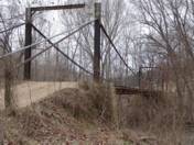
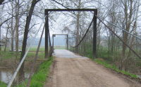
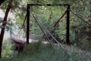
1924: Kemna
St. Elizabeth, Missouri, USA - Tavern Creek
| Bridgemeister ID: | 611 (added 2003-01-14) |
| Year Completed: | 1924 |
| Name: | Kemna |
| Location: | St. Elizabeth, Missouri, USA |
| Crossing: | Tavern Creek |
| Coordinates: | 38.247265 N 92.245431 W |
| Maps: | Acme, GeoHack, Google, OpenStreetMap |
| Principals: | Joseph A. Dice |
| References: | BOTO |
| Use: | Vehicular (one-lane) |
| Status: | In use (last checked: 2019) |
| Main Cables: | Wire (steel) |
| Suspended Spans: | 1 |
| Main Span: | 1 x 50.9 meters (167 feet) |
| Deck width: | 11.1 feet |
Notes:
- Original timber towers replaced, 1978.
- Similar to 1925 Mill Creek - Brumley vicinity, Missouri, USA.
- Near 1925 Kliethermes (Brumley) - St. Anthony vicinity, Missouri, USA.
External Links:
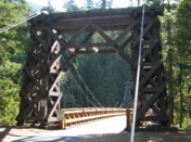
1924: Longmire
Packwood vicinity, Washington, USA - Nisqually River
| Bridgemeister ID: | 142 (added before 2003) |
| Year Completed: | 1924 |
| Name: | Longmire |
| Location: | Packwood vicinity, Washington, USA |
| Crossing: | Nisqually River |
| At or Near Feature: | Mt. Rainier National Park |
| Coordinates: | 46.74903 N 121.80777 W |
| Maps: | Acme, GeoHack, Google, OpenStreetMap |
| Principals: | James A. French |
| Use: | Vehicular (one-lane) and Pipeline |
| Status: | In use (last checked: 2006) |
| Main Cables: | Wire (steel) |
| Suspended Spans: | 1 |
| Main Span: | 1 x 55.8 meters (183 feet) estimated |
Notes:
- Reconstructed, 1950.
External Links:
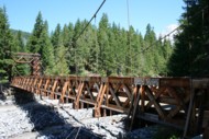
1924: Otowi
Otowi, New Mexico, USA - Rio Grande
| Bridgemeister ID: | 143 (added before 2003) |
| Year Completed: | 1924 |
| Name: | Otowi |
| Location: | Otowi, New Mexico, USA |
| Crossing: | Rio Grande |
| Coordinates: | 35.874725 N 106.141861 W |
| Maps: | Acme, GeoHack, Google, OpenStreetMap |
| Principals: | James A. French |
| References: | GBD |
| Use: | Vehicular |
| Status: | Extant (last checked: 2019) |
| Main Cables: | Wire (steel) |
| Suspended Spans: | 1 |
| Main Span: | 1 x 53 meters (174 feet) |
| Deck width: | 10 feet |
Notes:
- Bypassed, 1948.
External Links:

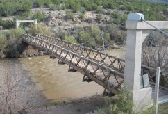
1924: Swinging
Thomson, Minnesota, USA - St. Louis River
| Bridgemeister ID: | 2103 (added 2006-08-19) |
| Year Completed: | 1924 |
| Name: | Swinging |
| Location: | Thomson, Minnesota, USA |
| Crossing: | St. Louis River |
| At or Near Feature: | Jay Cooke State Park |
| Coordinates: | 46.653649 N 92.370458 W |
| Maps: | Acme, GeoHack, Google, OpenStreetMap |
| Principals: | U.S. Forest Service |
| Use: | Footbridge |
| Status: | Replaced, 1935 |
| Main Cables: | Wire |
Notes:
- Replaced by 1935 Swinging - Thomson, Minnesota, USA.
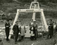
1925: A.A. Hadley
Honeydew vicinity, California, USA - Mattole River
| Bridgemeister ID: | 589 (added 2003-01-05) |
| Year Completed: | 1925 |
| Name: | A.A. Hadley |
| Also Known As: | Mattole River, Lindley |
| Location: | Honeydew vicinity, California, USA |
| Crossing: | Mattole River |
| Coordinates: | 40.25 N 124.165 W |
| Maps: | Acme, GeoHack, Google, OpenStreetMap |
| Use: | Vehicular (one-lane) |
| Status: | In use (last checked: 2004) |
| Main Cables: | Wire (steel) |
| Suspended Spans: | 1 |
External Links:
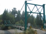
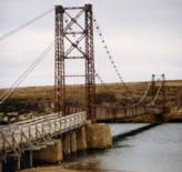
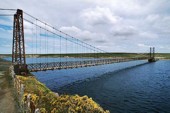
1925: Bodie Creek
Falkland Islands
| Bridgemeister ID: | 1922 (added 2005-10-09) |
| Year Completed: | 1925 |
| Name: | Bodie Creek |
| Location: | Falkland Islands |
| Coordinates: | 51.853916 S 59.016884 W |
| Maps: | Acme, GeoHack, Google, OpenStreetMap |
| Principals: | David Rowell & Co., Charles Peters |
| Use: | Vehicular (one-lane) and Stock |
| Status: | Closed, 1997 (last checked: 2018) |
| Main Cables: | Wire (steel) |
| Suspended Spans: | 1 |
External Links:
- The Bodie Creek Suspension Bridge. Detailed account of the bridge's history and construction.
- Structurae - Structure ID 20035736
1925: Buechter
St. Anthony vicinity, Missouri, USA - Tavern Creek
| Bridgemeister ID: | 610 (added 2003-01-14) |
| Year Completed: | 1925 |
| Name: | Buechter |
| Location: | St. Anthony vicinity, Missouri, USA |
| Crossing: | Tavern Creek |
| Coordinates: | 38.141573 N 92.297910 W |
| Maps: | Acme, GeoHack, Google, OpenStreetMap |
| Principals: | Joseph A. Dice |
| References: | BOTO |
| Use: | Vehicular (one-lane) |
| Status: | Demolished, 2011 |
| Main Cables: | Wire (steel) |
| Suspended Spans: | 1 |
| Main Span: | 1 x 42.7 meters (140 feet) |
| Deck width: | 12.1 feet |
Notes:
- Completed circa 1925.
- Sometimes spelled Buetcher. The road the bridge carried is named with the "Buechter" spelling.
- Renovated 1986.
- Similar to 1925 Kliethermes (Brumley) - St. Anthony vicinity, Missouri, USA.
External Links:
- Historic Bridges of the United States - Buechter Bridge - Miller County, Missouri
- Structurae - Structure ID 20014258
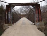
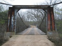
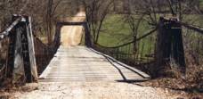
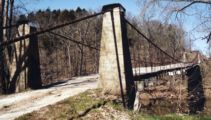
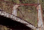
1925: Kliethermes
St. Anthony vicinity, Missouri, USA - Tavern Creek
| Bridgemeister ID: | 609 (added 2003-01-14) |
| Year Completed: | 1925 |
| Name: | Kliethermes |
| Also Known As: | Brumley |
| Location: | St. Anthony vicinity, Missouri, USA |
| Crossing: | Tavern Creek |
| Coordinates: | 38.178223 N 92.322981 W |
| Maps: | Acme, GeoHack, Google, OpenStreetMap |
| Principals: | Joseph A. Dice |
| References: | BOTO |
| Use: | Vehicular (one-lane) |
| Status: | Removed, March, 2008 |
| Main Cables: | Wire (steel) |
| Suspended Spans: | 1 |
| Main Span: | 1 x 65.8 meters (215.8 feet) |
| Deck width: | 10.8 feet |
Notes:
- Renovated, 1988. Closed, Spring 2006. Subsequently demolished in 2008.
- Completed circa 1925.
- Similar to 1925 Buechter - St. Anthony vicinity, Missouri, USA.
External Links:
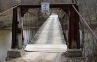
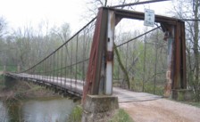
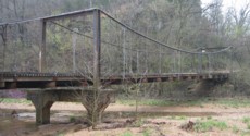
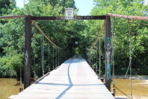
1925: Mill Creek
Brumley vicinity, Missouri, USA - Mill Creek
| Bridgemeister ID: | 342 (added before 2003) |
| Year Completed: | 1925 |
| Name: | Mill Creek |
| Location: | Brumley vicinity, Missouri, USA |
| Crossing: | Mill Creek |
| Coordinates: | 38.078408 N 92.524264 W |
| Maps: | Acme, GeoHack, Google, OpenStreetMap |
| Principals: | Joseph A. Dice |
| References: | BOTO |
| Use: | Vehicular (one-lane) |
| Status: | In use (last checked: 2020) |
| Main Cables: | Wire (steel) |
| Suspended Spans: | 2 |
| Main Span: | 1 x 29.3 meters (96 feet) estimated |
| Side Span: | 1 |
| Deck width: | 11.1 feet |
Notes:
- Original cables now assisted by additional steel cables.
- Similar to 1924 Kemna - St. Elizabeth, Missouri, USA.
- Near 1922 Glaize (Auglaize, Grand Glaize, Grand Auglaize) - Brumley vicinity, Missouri, USA. The bridges are less than half a mile apart.
External Links:

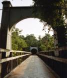
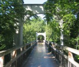
1925: Swinging
River Falls, Wisconsin, USA - Kinnickinnic River South Fork
| Bridgemeister ID: | 1193 (added 2004-01-25) |
| Year Completed: | 1925 |
| Name: | Swinging |
| Location: | River Falls, Wisconsin, USA |
| Crossing: | Kinnickinnic River South Fork |
| At or Near Feature: | Glen Park |
| Coordinates: | 44.853817 N 92.6333 W |
| Maps: | Acme, GeoHack, Google, OpenStreetMap |
| Use: | Footbridge |
| Status: | In use (last checked: 2006) |
| Main Cables: | Wire (steel) |
| Suspended Spans: | 3 |
| Main Span: | 1 x 39.6 meters (130 feet) |
| Side Spans: | 2 x 9.1 meters (30 feet) |
Notes:
- Rehabilitated, 1985.
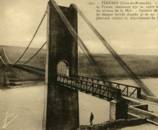
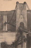
1925: Térénez
Landévennec vicinity and Rosnoen vicinity, Finistère, France - Aulne River
| Bridgemeister ID: | 1912 (added 2005-10-08) |
| Year Completed: | 1925 |
| Name: | Térénez |
| Location: | Landévennec vicinity and Rosnoen vicinity, Finistère, France |
| Crossing: | Aulne River |
| Coordinates: | 48.269120 N 4.262766 W |
| Maps: | Acme, GeoHack, Google, OpenStreetMap |
| Use: | Vehicular |
| Status: | Destroyed, 1944 |
| Main Cables: | Wire |
| Main Span: | 1 x 272 meters (892.4 feet) |
Notes:
- Coordinates are approximate, adjacent to the two subsequent replacement bridges.
- Replaced by 1952 Térénez - Landévennec vicinity and Rosnoen vicinity, Finistère, France.
External Links:
1925: Wind River
Carson, Washington, USA - Wind River
| Bridgemeister ID: | 1004 (added 2003-11-21) |
| Year Completed: | 1925 |
| Name: | Wind River |
| Location: | Carson, Washington, USA |
| Crossing: | Wind River |
| References: | SPW |
| Use: | Vehicular |
| Status: | Replaced, 1961 |
| Main Cables: | Wire (steel) |
| Suspended Spans: | 1 |
Notes:
- Circa 1930's steel vehicular suspension bridge. Bypassed, 1961 (by the Conrad Lundy Jr. bridge) and removed some time after.
- Replaced 1913 Wind River - Carson, Washington, USA.

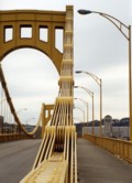
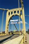
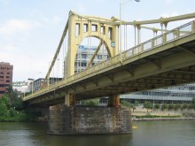
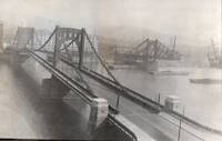
1926: Andy Warhol
Pittsburgh, Pennsylvania, USA - Allegheny River
| Bridgemeister ID: | 148 (added before 2003) |
| Year Completed: | 1926 |
| Name: | Andy Warhol |
| Also Known As: | Seventh Street |
| Location: | Pittsburgh, Pennsylvania, USA |
| Crossing: | Allegheny River |
| Coordinates: | 40.44626 N 80.00145 W |
| Maps: | Acme, GeoHack, Google, OpenStreetMap |
| Principals: | Vernon R. Covell, T.J. Wilkerson, A.D. Nutter, H.E. Dodge, Stanley L. Roush |
| References: | AAJ, BOP, BPL, PBR, PTS2, USS |
| Use: | Vehicular (four-lane), with walkway |
| Status: | In use (last checked: 2014) |
| Main Cables: | Eyebar (steel) |
| Suspended Spans: | 3 |
| Main Span: | 1 x 134.7 meters (442 feet) |
| Side Spans: | 2 x 67.4 meters (221 feet) |
| Deck width: | 62 feet |
| Characteristics: | Self-anchored |
Notes:
- Self-anchored.
- Replaced 1884 North Side (Seventh Street) - Pittsburgh, Pennsylvania, USA.
- Next to 1927 Rachel Carson (Ninth Street) - Pittsburgh, Pennsylvania, USA.
- Next to 1928 Roberto Clemente (Sixth Street) - Pittsburgh, Pennsylvania, USA.
External Links:
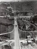
1926: Arapuni
Arapuni Power Station, New Zealand - Waikato River
| Bridgemeister ID: | 714 (added 2003-03-08) |
| Year Completed: | 1926 |
| Name: | Arapuni |
| Location: | Arapuni Power Station, New Zealand |
| Crossing: | Waikato River |
| Coordinates: | 38.070585 S 175.644480 E |
| Maps: | Acme, GeoHack, Google, OpenStreetMap |
| Principals: | David Rowell & Co., Armstrong Whitworth |
| References: | GAP |
| Use: | Footbridge |
| Status: | In use (last checked: 2019) |
| Main Cables: | Wire (steel) |
| Suspended Spans: | 1 |
External Links:
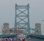
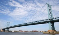
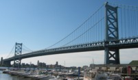
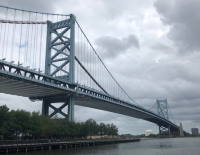
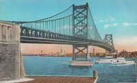
1926: Benjamin Franklin
Philadelphia, Pennsylvania and Camden, New Jersey, USA - Delaware River
| Bridgemeister ID: | 145 (added before 2003) |
| Year Completed: | 1926 |
| Name: | Benjamin Franklin |
| Also Known As: | Philadelphia-Camden |
| Location: | Philadelphia, Pennsylvania and Camden, New Jersey, USA |
| Crossing: | Delaware River |
| Coordinates: | 39.95333 N 75.135 W |
| Maps: | Acme, GeoHack, Google, OpenStreetMap |
| Principals: | Modjeski, Webster, Ball, Moiseff |
| References: | AAJ, BBR, BFL, BONJ, BPL, DRB, GBD, PTL, PTS2, USS |
| Use: | Vehicular (major highway) and Rail (subway), with walkway |
| Status: | In use (last checked: 2007) |
| Main Cables: | Wire (steel) |
| Suspended Spans: | 3 |
| Main Span: | 1 x 533.4 meters (1,750 feet) |
| Side Spans: | 2 x 219.3 meters (719.5 feet) |
| Deck width: | 125.5 feet |
Notes:
- Became longest suspension bridge by eclipsing 1924 Bear Mountain - Anthony's Nose and Bear Mountain, New York, USA.
- Eclipsed by new longest suspension bridge 1929 Ambassador - Detroit, Michigan, USA and Windsor, Ontario, Canada.
- Near 1957 Walt Whitman - Philadelphia, Pennsylvania and Camden, New Jersey, USA.
External Links:
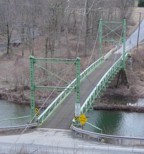
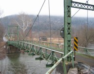
1926: Corbett
Corbett, New York, USA - East Branch Delaware River
| Bridgemeister ID: | 324 (added before 2003) |
| Year Completed: | 1926 |
| Name: | Corbett |
| Also Known As: | Corbett and Stuart |
| Location: | Corbett, New York, USA |
| Crossing: | East Branch Delaware River |
| Coordinates: | 42.04633 N 75.02768 W |
| Maps: | Acme, GeoHack, Google, OpenStreetMap |
| Principals: | John A. Roebling's Sons Co. |
| References: | SJR |
| Use: | Vehicular (one-lane) |
| Status: | In use (last checked: 2005) |
| Main Cables: | Wire (steel) |
| Suspended Spans: | 1 |
1926: Fron
Fron, Llandyssil, Wales, United Kingdom - River Severn
| Bridgemeister ID: | 4617 (added 2020-06-07) |
| Year Completed: | 1926 |
| Name: | Fron |
| Location: | Fron, Llandyssil, Wales, United Kingdom |
| Crossing: | River Severn |
| Coordinates: | 52.568132 N 3.207281 W |
| Maps: | Acme, GeoHack, Google, OpenStreetMap |
| Principals: | David Rowell & Co. |
| Use: | Footbridge |
| Status: | Extant (last checked: 2009) |
| Main Cables: | Wire (steel) |
External Links:
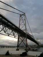
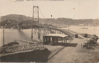
1926: Hercilio Luz
Florianopolis, Santa Catarina, Brazil
| Bridgemeister ID: | 437 (added before 2003) |
| Year Completed: | 1926 |
| Name: | Hercilio Luz |
| Also Known As: | Florianopolis |
| Location: | Florianopolis, Santa Catarina, Brazil |
| Coordinates: | 27.59393 S 48.56619 W |
| Maps: | Acme, GeoHack, Google, OpenStreetMap |
| Principals: | David B. Steinman, Holton D. Robinson |
| References: | AAJ, ADDS, BBR, PTS2, USS |
| Use: | Vehicular (two-lane, heavy vehicles), with walkway |
| Status: | In use (last checked: 2011) |
| Main Cables: | Eyebar (steel) |
| Suspended Spans: | 1 |
| Main Span: | 1 x 339.5 meters (1,113.75 feet) |
| Deck width: | 37 feet |
External Links:
1926: Lower Hurunui
North Canterbury, New Zealand - Hurunui River
| Bridgemeister ID: | 719 (added 2003-03-08) |
| Year Completed: | 1926 |
| Name: | Lower Hurunui |
| Location: | North Canterbury, New Zealand |
| Crossing: | Hurunui River |
| Coordinates: | 42.907226 S 173.273596 E |
| Maps: | Acme, GeoHack, Google, OpenStreetMap |
| Principals: | H.F. Toogood |
| References: | GAP |
| Use: | Vehicular (one-lane) |
| Status: | In use (last checked: 2017) |
| Main Cables: | Wire (steel) |
Notes:
- GAP: Refurbished, 1983.
- Not entirely clear the bridge described in GAP as the "Lower Hurunui" bridge near the mouth of the Hurunui is the same bridge as the present day bridge carrying Blythe Road. The detailed description of the 1926 bridge does not seem to match the current structure. However, Thornton also implied major changes to the bridge during the 1983 refurbishment.
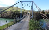
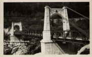
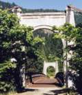
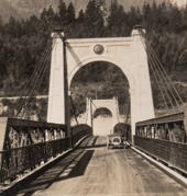
1926: Second Alexandra
Spuzzum, British Columbia, Canada - Fraser River
| Bridgemeister ID: | 147 (added before 2003) |
| Year Completed: | 1926 |
| Name: | Second Alexandra |
| Location: | Spuzzum, British Columbia, Canada |
| Crossing: | Fraser River |
| At or Near Feature: | Caribou Highway |
| Coordinates: | 49.70739 N 121.41669 W |
| Maps: | Acme, GeoHack, Google, OpenStreetMap |
| References: | BPL |
| Use: | Vehicular (one-lane) |
| Status: | Restricted to foot traffic (last checked: 2021) |
| Main Cables: | Wire (steel) |
| Suspended Spans: | 1 |
| Main Span: | 1 x 82.3 meters (270 feet) |
Notes:
1927: (suspension bridge)
Neals Landing, Donalsonville vicinity, Georgia and Jackson County, Florida, USA - Chattahoochee River
| Bridgemeister ID: | 2145 (added 2006-11-05) |
| Year Completed: | 1927 |
| Name: | (suspension bridge) |
| Location: | Neals Landing, Donalsonville vicinity, Georgia and Jackson County, Florida, USA |
| Crossing: | Chattahoochee River |
| Principals: | Austin Bridge Co. |
| References: | PTS2, RRC |
| Use: | Vehicular |
| Status: | Removed |
| Main Cables: | Wire |
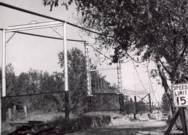
Notes:
- Condemned, 1953, due to sinking foundation.
- Follow the image for more information about this bridge and location.
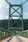
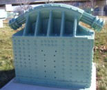
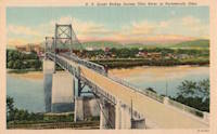
1927: General U.S. Grant
Portsmouth, Ohio and Fullerton, Kentucky, USA - Ohio River
| Bridgemeister ID: | 151 (added before 2003) |
| Year Completed: | 1927 |
| Name: | General U.S. Grant |
| Location: | Portsmouth, Ohio and Fullerton, Kentucky, USA |
| Crossing: | Ohio River |
| Coordinates: | 38.725 N 82.99833 W |
| Maps: | Acme, GeoHack, Google, OpenStreetMap |
| Principals: | Robinson and Steinman, J.E. Greiner, Dravo Co. |
| References: | AAJ, PTS2, SSS |
| Use: | Vehicular (two-lane, heavy vehicles) |
| Status: | Demolished, July 2001 |
| Main Cables: | Wire (steel) |
| Suspended Spans: | 3 |
| Main Span: | 1 x 213.4 meters (700 feet) |
| Side Spans: | 2 x 106.7 meters (350 feet) |
| Deck width: | 28.5 feet |
Notes:
- AAJ: "Recabled" in 1939.
External Links:
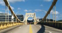
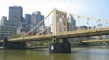
1927: Rachel Carson
Pittsburgh, Pennsylvania, USA - Allegheny River
| Bridgemeister ID: | 150 (added before 2003) |
| Year Completed: | 1927 |
| Name: | Rachel Carson |
| Also Known As: | Ninth Street |
| Location: | Pittsburgh, Pennsylvania, USA |
| Crossing: | Allegheny River |
| Coordinates: | 40.44669 N 79.99980 W |
| Maps: | Acme, GeoHack, Google, OpenStreetMap |
| Principals: | Vernon R. Covell, T.J. Wilkerson, A.D. Nutter, H.E. Dodge, Stanley L. Roush |
| References: | AAJ, BOP, BPL, PBR, PTS2, USS |
| Use: | Vehicular (four-lane), with walkway |
| Status: | In use (last checked: 2014) |
| Main Cables: | Eyebar (steel) |
| Suspended Spans: | 3 |
| Main Span: | 1 x 131.1 meters (430 feet) |
| Side Spans: | 2 x 65.5 meters (215 feet) |
| Characteristics: | Self-anchored |
Notes:
- Self-anchored.
- Next to 1926 Andy Warhol (Seventh Street) - Pittsburgh, Pennsylvania, USA.
- Next to 1928 Roberto Clemente (Sixth Street) - Pittsburgh, Pennsylvania, USA.
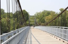
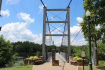
External Links:


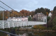
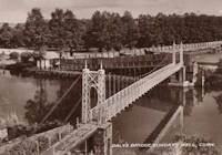
| Bridgemeister ID: | 553 (added before 2003) |
| Year Completed: | 1927 |
| Name: | Shaky |
| Also Known As: | Shakey, Daly's |
| Location: | Cork, Ireland |
| Crossing: | River Lee |
| At or Near Feature: | Sunday's Well, Fitzgerald's Park |
| Coordinates: | 51.896585 N 8.499218 W |
| Maps: | Acme, GeoHack, Google, OpenStreetMap |
| Principals: | David Rowell & Co. |
| Use: | Footbridge |
| Status: | In use (last checked: 2020) |
| Main Cables: | Wire (steel) |
| Suspended Spans: | 1 |
Notes:
- 2019, September: Dismantled for refurbishment, expected to be completed in early 2020.
- 2020, September: Refurbishment stalled during contract negotiations with contract. Bridge has been reassembled with new cables but work is not completed.
- 2020, October: Completion of refurbishment still on hold as two companies involved in the project go into examinership.
- 2020, December: Restored bridge reopens.
External Links:
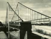
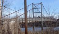
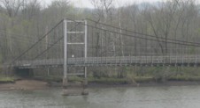
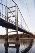
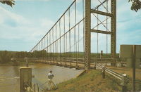
1927: Upper
Warsaw, Missouri, USA - Osage River
| Bridgemeister ID: | 1070 (added 2003-12-27) |
| Year Completed: | 1927 |
| Name: | Upper |
| Also Known As: | Swinging |
| Location: | Warsaw, Missouri, USA |
| Crossing: | Osage River |
| Coordinates: | 38.244110 N 93.388767 W |
| Maps: | Acme, GeoHack, Google, OpenStreetMap |
| Principals: | Joseph A. Dice |
| References: | BOTO |
| Use: | Vehicular (one-lane) |
| Status: | Restricted to foot traffic (last checked: 2020) |
| Main Cables: | Wire (steel) |
| Suspended Spans: | 2 |
| Main Span: | 1 x 152.4 meters (500 feet) estimated |
| Side Span: | 1 x 29 meters (95 feet) estimated |
Notes:
- Joseph Dice supervised the construction of this bridge to replace the 1904 structure destroyed in a tornado in 1924. A postcard of this bridge reads: "built in 1927 by the Benton County Court and by popular subscription of citizens to replace a similar bridge destroyed by a windstorm two years earlier. Structure swings on two wire cables imbedded and anchored in concrete and stone. The towers and floor beams are of steel while the floor is of wood. A state highway crosses this bridge."
- Reopened for pedestrians, 2007, after being closed for several years.
- Replaced 1904 Upper (Swinging) - Warsaw, Missouri, USA.
External Links:
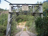
1928: Colfax-Iowa Hill
Colfax vicinity, California, USA - North Fork American River
| Bridgemeister ID: | 588 (added 2003-01-05) |
| Year Completed: | 1928 |
| Name: | Colfax-Iowa Hill |
| Location: | Colfax vicinity, California, USA |
| Crossing: | North Fork American River |
| Coordinates: | 39.09993 N 120.92480 W |
| Maps: | Acme, GeoHack, Google, OpenStreetMap |
| Use: | Vehicular (one-lane) |
| Status: | Restricted to foot traffic (last checked: 2021) |
| Main Cables: | Wire (steel) |
| Suspended Spans: | 1 |
Notes:
1928: Point Pleasant
Point Pleasant, West Virginia and Kanauga, Gallipolis vicinity, Ohio, USA - Ohio River
| Bridgemeister ID: | 156 (added before 2003) |
| Year Completed: | 1928 |
| Name: | Point Pleasant |
| Also Known As: | Silver |
| Location: | Point Pleasant, West Virginia and Kanauga, Gallipolis vicinity, Ohio, USA |
| Crossing: | Ohio River |
| Coordinates: | 38.845 N 82.141111 W |
| Maps: | Acme, GeoHack, Google, OpenStreetMap |
| Principals: | J.E. Greiner Co. |
| References: | AAJ, BDO, ENR19290620a, ENR19290620b, GBD, LAB, PTS2, SSS |
| Use: | Vehicular, with walkway |
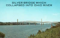
| Status: | Collapsed, 1967 |
| Main Cables: | Eyebar (steel) |
| Suspended Spans: | 3 |
| Main Span: | 1 x 213.4 meters (700 feet) |
| Side Spans: | 2 x 115.8 meters (380 feet) |
| Deck width: | 27 feet |
Notes:
- Hybrid truss, suspension bridge. Collapsed December 15, 1967 while full with traffic. 46 people died.
- Companion to 1928 Saint Marys (Hi Carpenter, Short Route) - Saint Marys, West Virginia and Newport, Ohio, USA.
External Links:

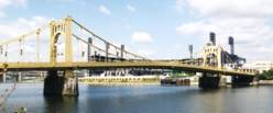
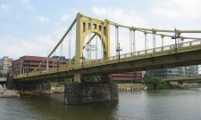
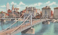
1928: Roberto Clemente
Pittsburgh, Pennsylvania, USA - Allegheny River
| Bridgemeister ID: | 158 (added before 2003) |
| Year Completed: | 1928 |
| Name: | Roberto Clemente |
| Also Known As: | Sixth Street |
| Location: | Pittsburgh, Pennsylvania, USA |
| Crossing: | Allegheny River |
| Coordinates: | 40.44558 N 80.00332 W |
| Maps: | Acme, GeoHack, Google, OpenStreetMap |
| Principals: | Vernon R. Covell, T.J. Wilkerson, A.D. Nutter, H.E. Dodge, Stanley L. Roush |
| References: | AAJ, BOP, BPL, PBR, PTS2, SSS, USS |
| Use: | Vehicular (four-lane), with walkway |
| Status: | In use (last checked: 2014) |
| Main Cables: | Eyebar (steel) |
| Suspended Spans: | 3 |
| Main Span: | 1 x 131.1 meters (430 feet) |
| Side Spans: | 2 x 65.5 meters (215 feet) |
| Characteristics: | Self-anchored |
Notes:
- Self-anchored.
- Next to 1926 Andy Warhol (Seventh Street) - Pittsburgh, Pennsylvania, USA.
- Next to 1927 Rachel Carson (Ninth Street) - Pittsburgh, Pennsylvania, USA.
External Links:

1928: Saint-Hubert
Port Saint-Hubert, Plouër-sur-Rance vicinity and La Ville-es-Nonais, Côtes-d'Armor, France - Rance River
| Bridgemeister ID: | 1492 (added 2004-09-19) |
| Year Completed: | 1928 |
| Name: | Saint-Hubert |
| Location: | Port Saint-Hubert, Plouër-sur-Rance vicinity and La Ville-es-Nonais, Côtes-d'Armor, France |
| Crossing: | Rance River |
| Use: | Vehicular |
| Status: | Destroyed, 1944 |
| Main Cables: | Wire |
| Suspended Spans: | 1 |
Notes:
- Replaced by 1959 Saint-Hubert - Port Saint-Hubert, Plouër-sur-Rance vicinity and La Ville-es-Nonais, Côtes-d'Armor, France.
External Links:
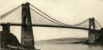
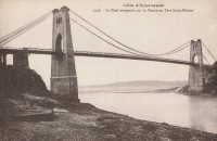
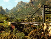
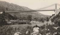
| Bridgemeister ID: | 1449 (added 2004-07-31) |
| Year Completed: | 1928 |
| Name: | Tarassac |
| Location: | St. Martin-de-l'Arcon vicinity, Hérault, France |
| Crossing: | Orb River |
| Coordinates: | 43.564766 N 2.974529 E |
| Maps: | Acme, GeoHack, Google, OpenStreetMap |
| References: | BC3 |
| Use: | Vehicular (one-lane) |
| Status: | In use (last checked: 2019) |
| Main Cables: | Wire (steel) |
| Suspended Spans: | 1 |
| Main Span: | 1 x 104.2 meters (342 feet) |
Notes:
External Links:
1929: Ambassador
Detroit, Michigan, USA and Windsor, Ontario, Canada - Detroit River
| Bridgemeister ID: | 160 (added before 2003) |
| Year Completed: | 1929 |
| Name: | Ambassador |
| Location: | Detroit, Michigan, USA and Windsor, Ontario, Canada |
| Crossing: | Detroit River |
| Coordinates: | 42.31210 N 83.07402 W |
| Maps: | Acme, GeoHack, Google, OpenStreetMap |
| Principals: | Jonathan Jones, McClintic-Marshall |
| References: | AAJ, AMB, GBD, PTS2 |
| Use: | Vehicular (major highway) |
| Status: | In use (last checked: 2022) |
| Main Cables: | Wire (steel) |
| Suspended Spans: | 1 |
| Main Span: | 1 x 563.9 meters (1,850 feet) |
| Deck width: | 55 feet |
Notes:
- Became longest suspension bridge by eclipsing 1926 Benjamin Franklin (Philadelphia-Camden) - Philadelphia, Pennsylvania and Camden, New Jersey, USA.
- Eclipsed by new longest suspension bridge 1931 George Washington (GWB) - New York, New York and Fort Lee, New Jersey, USA.
External Links:

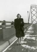
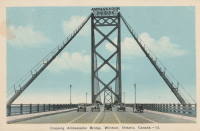
1929: Grand Mère
Grand-Mère, Quebec, Canada - St. Maurice River
| Bridgemeister ID: | 162 (added before 2003) |
| Year Completed: | 1929 |
| Name: | Grand Mère |
| Location: | Grand-Mère, Quebec, Canada |
| Crossing: | St. Maurice River |
| Coordinates: | 46.620117 N 72.6794 W |
| Maps: | Acme, GeoHack, Google, OpenStreetMap |
| Principals: | Robinson and Steinman |
| References: | AAJ, BC3, BPL, PTS2, SJR |
| Use: | Vehicular (two-lane, heavy vehicles), with walkway |
| Status: | In use (last checked: 2019) |
| Main Cables: | Wire (steel) |
| Suspended Spans: | 1 |
| Main Span: | 1 x 289.2 meters (948.8 feet) |
| Deck width: | 26 feet |
External Links:
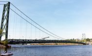
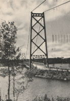
1929: Hipólito Yrigoyen
Necochea and Quequén, Argentina - Rio Quequén
| Bridgemeister ID: | 441 (added before 2003) |
| Year Completed: | 1929 |
| Name: | Hipólito Yrigoyen |
| Also Known As: | Rio Quequén |
| Location: | Necochea and Quequén, Argentina |
| Crossing: | Rio Quequén |
| Coordinates: | 38.552048 S 58.725680 W |
| Maps: | Acme, GeoHack, Google, OpenStreetMap |
| Principals: | P. Palazzo |
| References: | AAJ, SSS |
| Use: | Vehicular (two-lane), with walkway |
| Status: | In use (last checked: 2019) |
| Main Cables: | Wire (steel) |
| Suspended Spans: | 3 |
| Main Span: | 1 x 150 meters (492 feet) |
| Side Spans: | 2 x 59.7 meters (196 feet) |
External Links:
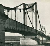
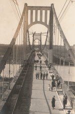
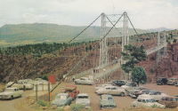
1929: Royal Gorge
Canon City, Colorado, USA - Arkansas River
| Bridgemeister ID: | 164 (added before 2003) |
| Year Completed: | 1929 |
| Name: | Royal Gorge |
| Location: | Canon City, Colorado, USA |
| Crossing: | Arkansas River |
| Coordinates: | 38.46129 N 105.32541 W |
| Maps: | Acme, GeoHack, Google, OpenStreetMap |
| Principals: | George F. Cole, O.K. Peck |
| References: | AAJ, BC3, BMA, GBD |
| Use: | Vehicular (two-lane) |
| Status: | In use (last checked: 2020) |
| Main Cables: | Wire (steel) |
| Suspended Spans: | 3 |
| Main Span: | 1 x 268.2 meters (880 feet) |
| Side Spans: | 2 |
| Deck width: | 18 feet |
Notes:
- This bridge was built solely as a tourist attraction.
External Links:
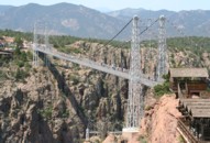
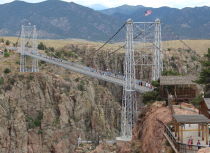
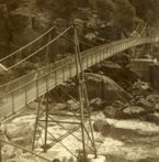
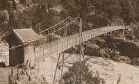
1930: Alexandra
Launceston, Tasmania, Australia - South Esk River
| Bridgemeister ID: | 444 (added before 2003) |
| Year Completed: | 1930 |
| Name: | Alexandra |
| Also Known As: | Basin |
| Location: | Launceston, Tasmania, Australia |
| Crossing: | South Esk River |
| At or Near Feature: | First Basin Water, Cataract Gorge Reserve |
| Coordinates: | 41.44681 S 147.11813 E |
| Maps: | Acme, GeoHack, Google, OpenStreetMap |
| References: | STC |
| Use: | Footbridge |
| Status: | In use (last checked: 2019) |
| Main Cables: | Wire (steel) |
| Suspended Spans: | 3 |
| Main Span: | 1 x 45.7 meters (149.9 feet) |
| Side Spans: | 1 x 16.8 meters (55.1 feet), 1 x 10.7 meters (35.1 feet) |
Notes:
- 2004: Refurbished, including replacement of cables which supposedly dated to the first Alexandra bridge.
- 2020, October: Maintenance project started focused on corrosion prevention including stripping paint and repainting.
- Replaced 1904 Alexandra (Basin) - Launceston, Tasmania, Australia.
- Near 1939 Duck Reach - Launceston, Tasmania, Australia.
- Near 1995 Duck Reach - Launceston, Tasmania, Australia.
External Links:
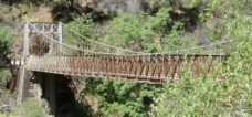
1930: Colfax-Foresthill
Yankee Jims, Colfax vicinity, California, USA - North Fork American River
| Bridgemeister ID: | 165 (added before 2003) |
| Year Completed: | 1930 |
| Name: | Colfax-Foresthill |
| Also Known As: | Yankee Jims |
| Location: | Yankee Jims, Colfax vicinity, California, USA |
| Crossing: | North Fork American River |
| Coordinates: | 39.040306 N 120.902667 W |
| Maps: | Acme, GeoHack, Google, OpenStreetMap |
| Use: | Vehicular (one-lane) |
| Status: | In use (last checked: 2023) |
| Main Cables: | Wire (steel) |
| Suspended Spans: | 1 |
| Main Span: | 1 x 53 meters (173.9 feet) estimated |
Notes:
- 2023: Replacement announced. The suspension bridge will be preserved and remain in place.
- Companion to 1928 Colfax-Iowa Hill - Colfax vicinity, California, USA.
External Links:
- Facebook - Placer County Government. Video discussing the history of the bridge and planned replacement project.
- Structurae - Structure ID 20011089
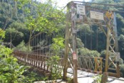
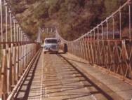
1930: Cranberry Lake
Cranberry Lake, Byram, New Jersey, USA - Cranberry Lake
| Bridgemeister ID: | 153 (added before 2003) |
| Year Completed: | 1930 |
| Name: | Cranberry Lake |
| Location: | Cranberry Lake, Byram, New Jersey, USA |
| Crossing: | Cranberry Lake |
| Coordinates: | 40.95401 N 74.73714 W |
| Maps: | Acme, GeoHack, Google, OpenStreetMap |
| References: | BONJ, PQU |
| Use: | Footbridge |
| Status: | Closed, 2019 (last checked: 2020) |
| Main Cables: | Wire (steel) |
| Suspended Spans: | 3 |
| Main Span: | 1 x 61.5 meters (201.7 feet) estimated |
| Side Spans: | 2 x 21.8 meters (71.5 feet) estimated |
Notes:
- 1928 and 1931 also sometimes cited as years of completion. Construction appears to have completed in December 1930, possibly opening in early 1931.
- 2019: Closed pending repairs and rehabilitation.
External Links:
- Save Our Bridge. "Dedicated to restoring and preserving the historic Cranberry Lake footbridge - one of the oldest pedestrian footbridges in the state of New Jersey."
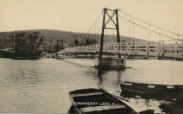
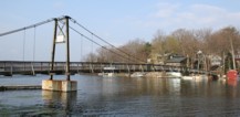
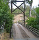
1930: Horse Creek
Horse Creek, California, USA - Klamath River
| Bridgemeister ID: | 586 (added 2003-01-05) |
| Year Completed: | 1930 |
| Name: | Horse Creek |
| Location: | Horse Creek, California, USA |
| Crossing: | Klamath River |
| Coordinates: | 41.824678 N 122.997667 W |
| Maps: | Acme, GeoHack, Google, OpenStreetMap |
| Use: | Vehicular (one-lane) |
| Status: | In use (last checked: 2012) |
| Main Cables: | Wire (steel) |
| Suspended Spans: | 1 |
Notes:
External Links:
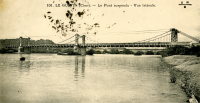
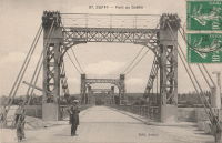
1930: Le Guétin
Le Guétin, Cuffy vicinity, Cher and Gimouille, Nièvre, France - Allier River
| Bridgemeister ID: | 2844 (added 2005-03-19) |
| Year Completed: | 1930 |
| Name: | Le Guétin |
| Location: | Le Guétin, Cuffy vicinity, Cher and Gimouille, Nièvre, France |
| Crossing: | Allier River |
| Coordinates: | 46.947881 N 3.073013 E |
| Maps: | Acme, GeoHack, Google, OpenStreetMap |
| References: | AAJ |
| Use: | Vehicular |
| Status: | Replaced |
| Main Cables: | Wire (steel) |
| Suspended Spans: | 5 |
| Main Spans: | 5 |
Notes:
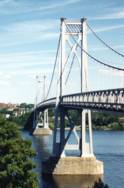
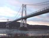
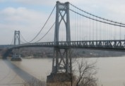
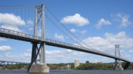
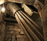
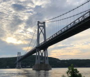
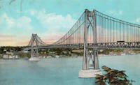
1930: Mid-Hudson
Poughkeepsie and Highland, New York, USA - Hudson River
| Bridgemeister ID: | 166 (added before 2003) |
| Year Completed: | 1930 |
| Name: | Mid-Hudson |
| Also Known As: | Franklin Delano Roosevelt Mid-Hudson |
| Location: | Poughkeepsie and Highland, New York, USA |
| Crossing: | Hudson River |
| Coordinates: | 41.702933 N 73.946683 W |
| Maps: | Acme, GeoHack, Google, OpenStreetMap |
| Principals: | Ralph Modjeski |
| References: | AAJ, BPL, PTS2, SJR, USS |
| Use: | Vehicular (two-lane, heavy vehicles), with walkway |
| Status: | In use (last checked: 2019) |
| Main Cables: | Wire (steel) |
| Suspended Spans: | 3 |
| Main Span: | 1 x 457.2 meters (1,500 feet) |
| Side Spans: | 2 x 228.6 meters (750 feet) |
| Deck width: | 39 feet |
Notes:
- Although the length of the main span of the bridge is officially 1,500 feet, the actual length is 1,495 feet. During construction one of the caissons slid and tilted from its intended location. While efforts were made to move the caisson back, it was ultimately fixed in a position that left the main span five feet short of 1,500. Not wanting to lose the claim of having a 1,500-foot bridge, the shortfall has been kept out of official records since.
External Links:
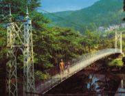
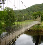
1930: Sappers'
Betws-y-Coed, Wales, United Kingdom - River Conwy
| Bridgemeister ID: | 445 (added before 2003) |
| Year Completed: | 1930 |
| Name: | Sappers' |
| Location: | Betws-y-Coed, Wales, United Kingdom |
| Crossing: | River Conwy |
| Coordinates: | 53.09221 N 3.79928 W |
| Maps: | Acme, GeoHack, Google, OpenStreetMap |
| Principals: | David Rowell & Co. |
| Use: | Footbridge |
| Status: | Closed, December 2021 (last checked: 2023) |
| Main Cables: | Wire (steel) |
| Suspended Spans: | 1 |
Notes:
- 2021, December: Closed due to deteriorating condition. Repairs expected to start in April 2022.
- 2023, February: Still closed. May be replaced.
Annotated Citations:
- Evans, Hari. "Near century old Snowdonia wobbly bridge that's rotting away and may soon be replaced." North Wales Live, 9 Feb. 2023, https://www.dailypost.co.uk/news/north-wales-news/near-century-old-snowdonia-wobbly-26198160.
"The suspension bridge used to be renowned for its wobbly midpoint and was a key shortcut across the River Conwy for locals and tourists. However, structural reviews conducted last year found that virtually the entire bridge would need to be refurbished, with the entire timber deck as well as other parts replaced completely."
External Links:
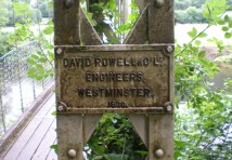
1931: Cavaillon
Cavaillon, Vaucluse and Bouches-du-Rhône, France - Durance River
| Bridgemeister ID: | 1013 (added 2003-11-22) |
| Year Completed: | 1931 |
| Name: | Cavaillon |
| Location: | Cavaillon, Vaucluse and Bouches-du-Rhône, France |
| Crossing: | Durance River |
| Use: | Vehicular |
| Status: | Destroyed, 1944 |
| Main Cables: | Wire |
| Suspended Spans: | 1 |
Notes:
- Destroyed August 24, 1944.
- Replaced 1837 Cavaillon - Cavaillon, Vaucluse and Bouches-du-Rhône, France.
External Links:
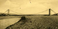
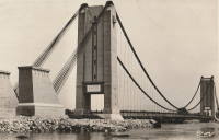
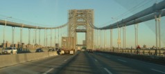
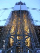
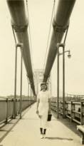
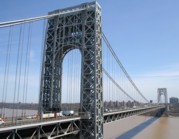
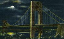
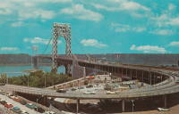
1931: George Washington
New York, New York and Fort Lee, New Jersey, USA - Hudson River
| Bridgemeister ID: | 169 (added before 2003) |
| Year Completed: | 1931 |
| Name: | George Washington |
| Also Known As: | GWB |
| Location: | New York, New York and Fort Lee, New Jersey, USA |
| Crossing: | Hudson River |
| Coordinates: | 40.85333 N 73.955 W |
| Maps: | Acme, GeoHack, Google, OpenStreetMap |
| Principals: | O.H. Ammann, Leon Moisseiff, Dana, Gilbert |
| References: | AAJ, AOB, ARF, BBR, BC3, BFL, BMA, BONJ, BOU, BPL, BRU, COB, CTW, ENR19270811a, ENR19270811b, ENR19290411c, GBD, LAB, LACE, PTS2, SIX, SJR |
| Use: | Vehicular (double-deck), with walkway |
| Status: | In use (last checked: 2022) |
| Main Cables: | Wire (steel) |
| Suspended Spans: | 3 |
| Main Span: | 1 x 1,066.8 meters (3,500 feet) |
| Side Spans: | 2 x 198.1 meters (650 feet) |
| Deck width: | 120 feet |
Notes:
- Became longest suspension bridge by eclipsing 1929 Ambassador - Detroit, Michigan, USA and Windsor, Ontario, Canada.
- Eclipsed by new longest suspension bridge 1937 Golden Gate - San Francisco and Marin County, California, USA.
External Links:
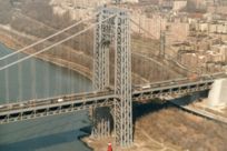
1931: Saint-Pierre
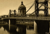
Toulouse, Haute-Garonne, France - Garonne River
| Bridgemeister ID: | 2049 (added 2006-05-21) |
| Year Completed: | 1931 |
| Name: | Saint-Pierre |
| Location: | Toulouse, Haute-Garonne, France |
| Crossing: | Garonne River |
| Coordinates: | 43.602833 N 1.435199 E |
| Maps: | Acme, GeoHack, Google, OpenStreetMap |
| Use: | Vehicular |
| Status: | Demolished, 1986 |
| Main Cables: | Wire |
Notes:
External Links:

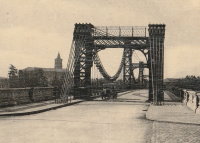
1931: Simon Kenton Memorial
Maysville, Kentucky and Aberdeen, Ohio, USA - Ohio River
| Bridgemeister ID: | 172 (added before 2003) |
| Year Completed: | 1931 |
| Name: | Simon Kenton Memorial |
| Also Known As: | Maysville |
| Location: | Maysville, Kentucky and Aberdeen, Ohio, USA |
| Crossing: | Ohio River |
| Coordinates: | 38.649890 N 83.759670 W |
| Maps: | Acme, GeoHack, Google, OpenStreetMap |
| Principals: | Modjeski, Masters & Chase |
| References: | AAJ, SJR, SSS |
| Use: | Vehicular (two-lane), with walkway |
| Status: | In use (last checked: 2022) |
| Main Cables: | Wire (steel) |
| Suspended Spans: | 3 |
| Main Span: | 1 x 323.1 meters (1,060 feet) |
| Side Spans: | 2 x 141.7 meters (464.9 feet) |
| Deck width: | 28 feet |
Notes:
- 2022, March: USD$23.4 million budgeted for rehabilitation project including suspender cable replacements, steel repairs, and painting.
- 2019: Closed late 2019 due to suspender cable corrosion. Short-term fixes applied to reduce the stress on the suspenders and to prevent rusting.
- 2020, June: Reopened with a 15-ton weight limit after installation of temporary support rods and brackets to reduce the stress on damaged cables.
External Links:
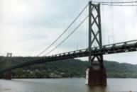
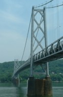
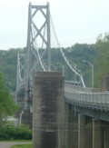
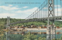
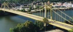
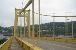
1931: South Tenth Street
Pittsburgh, Pennsylvania, USA - Monongahela River
| Bridgemeister ID: | 173 (added before 2003) |
| Year Completed: | 1931 |
| Name: | South Tenth Street |
| Also Known As: | South Side, Tenth Street, Philip Murray |
| Location: | Pittsburgh, Pennsylvania, USA |
| Crossing: | Monongahela River |
| Coordinates: | 40.43166 N 79.989 W |
| Maps: | Acme, GeoHack, Google, OpenStreetMap |
| Principals: | Sydney A. Shubin |
| References: | AAJ, BOP, BPL, PBR, SSS, USS |
| Use: | Vehicular (four-lane), with walkway |
| Status: | In use (last checked: 2019) |
| Main Cables: | Wire (steel) |
| Suspended Spans: | 3 |
| Main Span: | 1 x 228.6 meters (750 feet) |
| Side Spans: | 2 x 83.8 meters (275 feet) |
| Deck width: | 54 feet |
External Links:
1931: St. Johns
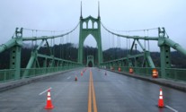
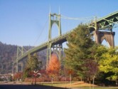
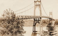
Portland, Oregon, USA - Willamette River
| Bridgemeister ID: | 174 (added before 2003) |
| Year Completed: | 1931 |
| Name: | St. Johns |
| Location: | Portland, Oregon, USA |
| Crossing: | Willamette River |
| Coordinates: | 45.585 N 122.76333 W |
| Maps: | Acme, GeoHack, Google, OpenStreetMap |
| Principals: | Robinson and Steinman |
| References: | AAJ, ADDS, BC3, BCO, BFL, BPL, GBD, LAB, SJR |
| Use: | Vehicular (four-lane), with walkway |
| Status: | In use (last checked: 2022) |
| Main Cables: | Wire (steel) |
| Suspended Spans: | 3 |
| Main Span: | 1 x 367.9 meters (1,207 feet) |
| Side Spans: | 2 x 131.1 meters (430.25 feet) |
| Deck width: | 52 feet |
Notes:
- Substantially rehabilitated, 2003-2005.
External Links:
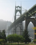
1931: Teil
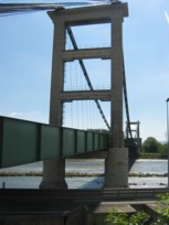
Le Teil, Ardèche and Montélimar, Drôme, France - Rhône River
| Bridgemeister ID: | 1549 (added 2004-11-13) |
| Year Completed: | 1931 |
| Name: | Teil |
| Location: | Le Teil, Ardèche and Montélimar, Drôme, France |
| Crossing: | Rhône River |
| Coordinates: | 44.5519 N 4.692617 E |
| Maps: | Acme, GeoHack, Google, OpenStreetMap |
| References: | AAJ, BPF |
| Use: | Vehicular (two-lane, heavy vehicles), with walkway |
| Status: | In use (last checked: 2005) |
| Main Cables: | Wire (steel) |
| Suspended Spans: | 1 |
| Main Span: | 1 x 235 meters (771 feet) |
Notes:
- Destroyed, 1944. Rebuilt, 1950.
- Replaced 1839 Teil - Le Teil, Ardèche and Montélimar, Drôme, France.
External Links:
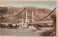
1931: Waldo-Hancock
Verona and Bucksport vicinity, Maine, USA - Penobscot River
| Bridgemeister ID: | 175 (added before 2003) |
| Year Completed: | 1931 |
| Name: | Waldo-Hancock |
| Location: | Verona and Bucksport vicinity, Maine, USA |
| Crossing: | Penobscot River |
| Coordinates: | 44.56 N 68.80333 W |
| Maps: | Acme, GeoHack, Google, OpenStreetMap |
| Principals: | Robinson and Steinman |
| References: | AAJ, ADDS, GBD, SSS, USS |
| Use: | Vehicular (two-lane, heavy vehicles), with walkway |
| Status: | Demolished, 2012 |
| Main Cables: | Wire (steel) |
| Suspended Spans: | 3 |
| Main Span: | 1 x 243.8 meters (800 feet) |
| Side Spans: | 2 x 106.7 meters (350 feet) |
| Deck width: | 27 feet |
Notes:
- Replacement cable-stayed bridge, (the Penobscot Narrows Bridge) completed, late 2006.
External Links:
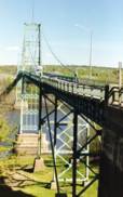
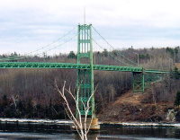
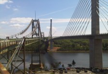
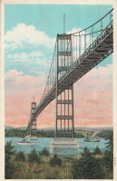
1932: Lewis River
Yale, Washington, USA - Lewis River
| Bridgemeister ID: | 176 (added before 2003) |
| Year Completed: | 1932 |
| Name: | Lewis River |
| Also Known As: | Yale |
| Location: | Yale, Washington, USA |
| Crossing: | Lewis River |
| Coordinates: | 45.96167 N 122.37167 W |
| Maps: | Acme, GeoHack, Google, OpenStreetMap |
| Principals: | Harold H. Gilbert, Gilpin Construction Co. |
| References: | AAJ, SPW, SSS |
| Use: | Vehicular (one-lane) |
| Status: | In use (last checked: 2005) |
| Main Cables: | Wire (steel) |
| Suspended Spans: | 1 |
| Main Span: | 1 x 91.4 meters (300 feet) |
| Deck width: | 17 feet |
Notes:
- Rebuilt 1957, 1958.
External Links:
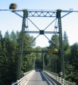
1932: Marmande
Marmande, Lot-et-Garonne, France - Garonne River
| Bridgemeister ID: | 1604 (added 2005-02-06) |
| Year Completed: | 1932 |
| Name: | Marmande |
| Also Known As: | Renaud Jean |
| Location: | Marmande, Lot-et-Garonne, France |
| Crossing: | Garonne River |
| Coordinates: | 44.498957 N 0.155951 E |
| Maps: | Acme, GeoHack, Google, OpenStreetMap |
| Use: | Vehicular (two-lane), with walkway |
| Status: | In use (last checked: 2020) |
| Main Cables: | Wire (steel) |
| Suspended Spans: | 1 |
Notes:
External Links:
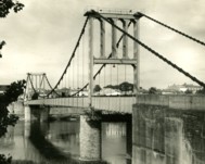
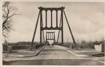
1932: Prairie du Chien
Praire du Chien, Wisconsin and Marquette, Iowa, USA - Mississippi River
| Bridgemeister ID: | 177 (added before 2003) |
| Year Completed: | 1932 |
| Name: | Prairie du Chien |
| Location: | Praire du Chien, Wisconsin and Marquette, Iowa, USA |
| Crossing: | Mississippi River |
| Coordinates: | 43.046 N 91.17 W |
| Maps: | Acme, GeoHack, Google, OpenStreetMap |
| Principals: | Austin Bridge Co. |
| References: | AAJ, AUB, BPL |
| Use: | Vehicular (two-lane) |
| Status: | Removed, 1974 |
| Main Cables: | Wire (steel) |
| Main Span: | 1 x 144.2 meters (473 feet) |
Notes:
- There were two back-to-back suspension bridges at this location.
- Connects to 1932 Prairie du Chien - Praire du Chien, Wisconsin and Marquette, Iowa, USA.
External Links:
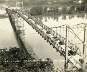
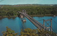
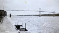
1932: Prairie du Chien
Praire du Chien, Wisconsin and Marquette, Iowa, USA - Mississippi River
| Bridgemeister ID: | 1256 (added before 2003) |
| Year Completed: | 1932 |
| Name: | Prairie du Chien |
| Location: | Praire du Chien, Wisconsin and Marquette, Iowa, USA |
| Crossing: | Mississippi River |
| Coordinates: | 43.05 N 91.162 W |
| Maps: | Acme, GeoHack, Google, OpenStreetMap |
| Principals: | Austin Bridge Co. |
| References: | AAJ, AUB, BPL |
| Use: | Vehicular (two-lane) |
| Status: | Removed, 1974 |
| Main Cables: | Wire (steel) |
| Main Span: | 1 x 144.2 meters (473 feet) |
Notes:
- There were two back-to-back suspension bridges at this location.
- Connects to 1932 Prairie du Chien - Praire du Chien, Wisconsin and Marquette, Iowa, USA.
External Links:


1932: Villemur-sur-Tarn
Villemur-sur-Tarn, Haute-Garonne, France - Tarn River
| Bridgemeister ID: | 1852 (added 2005-07-16) |
| Year Completed: | 1932 |
| Name: | Villemur-sur-Tarn |
| Location: | Villemur-sur-Tarn, Haute-Garonne, France |
| Crossing: | Tarn River |
| Coordinates: | 43.862459 N 1.505214 E |
| Maps: | Acme, GeoHack, Google, OpenStreetMap |
| Use: | Vehicular (two-lane), with walkway |
| Status: | In use (last checked: 2016) |
| Main Cables: | Wire (steel) |
| Suspended Spans: | 1 |
Notes:
External Links:
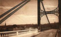
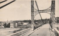
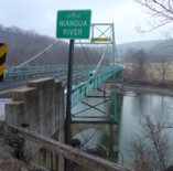
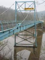
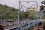
1933: Green's Mill
Camden County, Missouri, USA - Little Niangua River
| Bridgemeister ID: | 179 (added before 2003) |
| Year Completed: | 1933 |
| Name: | Green's Mill |
| Also Known As: | Little Niangua, J Road |
| Location: | Camden County, Missouri, USA |
| Crossing: | Little Niangua River |
| Coordinates: | 38.065326 N 92.909309 W |
| Maps: | Acme, GeoHack, Google, OpenStreetMap |
| Principals: | Howard Mullins, Scully Steel Co., American Steel & Wire Co., Clinton Bridge Works |
| References: | AAJ, SSS, USS |
| Use: | Vehicular (two-lane, heavy vehicles) |
| Status: | Bypassed, 2020 (last checked: 2023) |
| Main Cables: | Wire (steel) |
| Suspended Spans: | 3 |
| Main Span: | 1 x 68.6 meters (225 feet) |
| Side Spans: | 1 x 34.3 meters (112.5 feet), 1 x 34.3 meters (112.4 feet) |
| Deck width: | 20 feet |
| Characteristics: | Self-anchored |
Notes:
- Self-anchored.
- 2007, October: Closed for a few weeks for emergency repairs. According to an October 4, 2007 article in the Lake Sun Leader (Missouri): "a routine inspection revealed a problem in the substructure... too much movement was detected at a location underneath the north side of the bridge." Other sources mentioned a faulty "pin."
- 2018: Missouri Department of Transportation (MoDOT) plans to replace the bridge and is seeking groups to take ownership of the bridge and possibly relocate it.
- 2020: A new bridge is completed, bypassing the suspension bridge.
- 2023, March: Ownership transferred from Missouri Department of Transportation to Green's Mill Historic Bridge, Inc. to preserve the since bypassed bridge.
1933: Pertuiset
Pertuiset, Firminy vicinity, Loire, France - Loire River
| Bridgemeister ID: | 1166 (added 2004-01-19) |
| Year Completed: | 1933 |
| Name: | Pertuiset |
| Location: | Pertuiset, Firminy vicinity, Loire, France |
| Crossing: | Loire River |
| Coordinates: | 45.408785 N 4.248029 E |
| Maps: | Acme, GeoHack, Google, OpenStreetMap |
| Use: | Vehicular (one-lane) |
| Status: | Demolished, 1990 |
| Main Cables: | Wire (steel) |
| Suspended Spans: | 1 |
Notes:
- Bypassed by a cable-stayed bridge, 1989.
- Replaced 1842 Pertuiset - Pertuiset, Firminy vicinity, Loire, France.
External Links:
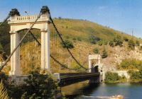
1934: (footbridge)
Ilkley, England, United Kingdom - River Wharfe
| Bridgemeister ID: | 1261 (added 2004-03-13) |
| Year Completed: | 1934 |
| Name: | (footbridge) |
| Location: | Ilkley, England, United Kingdom |
| Crossing: | River Wharfe |
| Coordinates: | 53.93241 N 1.81483 W |
| Maps: | Acme, GeoHack, Google, OpenStreetMap |
| Principals: | David Rowell & Co. |
| Use: | Footbridge |
| Status: | In use (last checked: 2022) |
| Main Cables: | Wire (steel) |
| Suspended Spans: | 1 |
Notes:
- Refurbished, 2001.
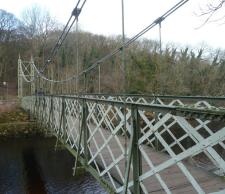
1934: King Alexander I
Belgrade, Serbia - Sava River
| Bridgemeister ID: | 957 (added 2003-11-01) |
| Year Completed: | 1934 |
| Name: | King Alexander I |
| Also Known As: | King Aleksandar |
| Location: | Belgrade, Serbia |
| Crossing: | Sava River |
| Coordinates: | 44.814946 N 20.448665 E |
| Maps: | Acme, GeoHack, Google, OpenStreetMap |
| Principals: | Société de Construction des Batignolles |
| References: | AAJ |
| Use: | Vehicular, with walkway |
| Status: | Destroyed, April 12, 1941 |
| Main Cables: | Wire (steel) |
| Suspended Spans: | 1 |
| Main Span: | 1 x 260.9 meters (856 feet) |
| Deck width: | 72 feet |
| Characteristics: | Rocker towers |
Notes:
- 1941, April 12: Partially demolished in an attempt to slow advancing German troops.
- 1944, April 16: Remainder of the bridge is demolished.
External Links:
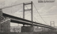
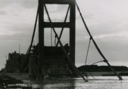
1934: Sifton Boulevard
Calgary, Alberta, Canada - Elbow River
| Bridgemeister ID: | 802 (added 2003-03-29) |
| Year Completed: | 1934 |
| Name: | Sifton Boulevard |
| Also Known As: | Riverdale Avenue, Sifton-Riverdale |
| Location: | Calgary, Alberta, Canada |
| Crossing: | Elbow River |
| Coordinates: | 51.019060 N 114.083178 W |
| Maps: | Acme, GeoHack, Google, OpenStreetMap |
| Use: | Footbridge |
| Status: | Wrecked, 2013 |
| Main Cables: | Wire |
| Suspended Spans: | 1 |
Notes:
- Footbridge with green steel towers. Distinct from the other Elbow River, Calgary footbridges in the inventory, but appeared very similar to the Sandy Beach bridge.
- Wrecked by flood, 2013.
- Similar to 1959 Sandy Beach (River Park, Riverpark) - Calgary, Alberta, Canada.
- Replaced by 2014 Riverdale Avenue - Calgary, Alberta, Canada.
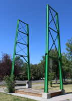
1935: Gaol Ferry
Bristol, England, United Kingdom - River Avon-New Cut
| Bridgemeister ID: | 1917 (added 2005-10-09) |
| Year Completed: | 1935 |
| Name: | Gaol Ferry |
| Also Known As: | Southville, St. Paul's, Coronation Road |
| Location: | Bristol, England, United Kingdom |
| Crossing: | River Avon-New Cut |
| Coordinates: | 51.445871 N 2.599464 W |
| Maps: | Acme, GeoHack, Google, OpenStreetMap |
| Principals: | David Rowell & Co. |
| Use: | Footbridge |
| Status: | Closed, August 2022 (last checked: August 2023) |
| Main Cables: | Wire (steel) |
| Suspended Spans: | 1 |
Notes:
- 2023, September: The bridge is scheduled to reopen following repairs.
Annotated Citations:
- Cork, Tristan. "Key footbridge connecting South Bristol to city centre to close for months." Bristol Post, 9 Dec. 2021, https://www.bristolpost.co.uk/news/bristol-news/key-footbridge-connecting-south-bristol-6326291.
Bridge is undergoing some repairs in late December 2021, but is still open. Expected to be closed January-March 2022 for more extensive repairs.
- Woolerton, Betty. "Gaol Ferry Bridge likely to be closed for another three months." Bristol 24/7, 24 Feb. 2023, https://www.bristol247.com/news-and-features/news/gaol-ferry-bridge-likely-to-be-closed-for-another-three-months/.
"A discovery of 'paper thin' steel work on Gaol Ferry Bridge has been cited as the reason for the extension of its closure by an unprecedented extra three months… Now, the council’s cabinet member for transport has apologised after contractors Griffiths have found 'the bridge is in a worse condition than we had thought.'"
External Links:
- Date for Gaol Ferry bridge closure in Bristol announced - BBC News. The bridge will be closed for 6-9 months from August 2022 for restoration.
- Structurae - Structure ID 20082369
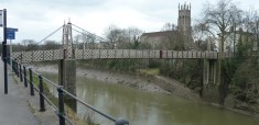
1935: Grand Coulee Dam
Grand Coulee, Washington, USA - Columbia River
| Bridgemeister ID: | 3157 (added 2019-11-03) |
| Year Completed: | 1935 |
| Name: | Grand Coulee Dam |
| Location: | Grand Coulee, Washington, USA |
| Crossing: | Columbia River |
| Use: | Conveyor |
| Status: | Removed |
| Main Cables: | Wire (steel) |
| Main Span: | 1 x 438 meters (1,437 feet) |
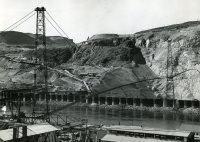
1935: Granite Falls
Granite Falls, Minnesota, USA - Minnesota River
| Bridgemeister ID: | 255 (added before 2003) |
| Year Completed: | 1935 |
| Name: | Granite Falls |
| Location: | Granite Falls, Minnesota, USA |
| Crossing: | Minnesota River |
| Coordinates: | 44.810108 N 95.537316 W |
| Maps: | Acme, GeoHack, Google, OpenStreetMap |
| Principals: | Minneapolis Bridge Company |
| References: | WCT20051125 |
| Use: | Footbridge |
| Status: | In use (last checked: 2019) |
| Main Cables: | Wire (steel) |
| Suspended Spans: | 3 |
| Main Span: | 1 |
| Side Spans: | 2 |
Notes:
- Damaged by floods, 1997 and 2001. Refurbished, 2014-2015.
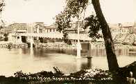
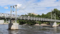
1935: Iowa-Illinois Memorial
Bettendorf, Iowa and Moline, Illinois, USA - Mississippi River
| Bridgemeister ID: | 180 (added before 2003) |
| Year Completed: | 1935 |
| Name: | Iowa-Illinois Memorial |
| Also Known As: | Interstate 74 Bridge, I-74 Bridge |
| Location: | Bettendorf, Iowa and Moline, Illinois, USA |
| Crossing: | Mississippi River |
| Coordinates: | 41.520264 N 90.513034 W |
| Maps: | Acme, GeoHack, Google, OpenStreetMap |
| Principals: | Modjeski, Masters, and Chase |
| References: | AAJ, CMR |
| Use: | Vehicular, with walkway |
| Status: | Bypassed, 2020 (last checked: 2022) |
| Main Cables: | Wire (steel) |
| Suspended Spans: | 3 |
| Main Span: | 1 x 225.6 meters (740 feet) |
| Side Spans: | 2 x 112.8 meters (370 feet) |
| Deck width: | 24.2 feet |
Notes:
- 2017, June 26: Groundbreaking ceremony for a replacement bridge for the twin Iowa-Illinois Memorial bridges. The new bridge is expected to be completed in 2020.
- 2020, November: Replacement span opens (for Iowa-bound traffic previously carried across the older of the two suspension bridges). Suspension bridge expected to be demolished in 2022.
- 2023: Demolition expected to be completed in 2024.
- Next to 1960 Iowa-Illinois Memorial (Interstate 74 Bridge, I-74 Bridge) - Bettendorf, Iowa and Moline, Illinois, USA.
External Links:
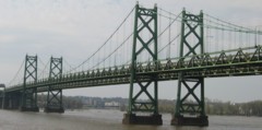
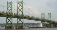
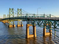
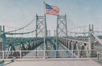
1935: l'Île d'Orléans
Quebec City, Quebec, Canada - St. Lawrence River
| Bridgemeister ID: | 183 (added before 2003) |
| Year Completed: | 1935 |
| Name: | l'Île d'Orléans |
| Also Known As: | Isle of Orleans, Orleans Island, Taschereau |
| Location: | Quebec City, Quebec, Canada |
| Crossing: | St. Lawrence River |
| Coordinates: | 46.880233 N 71.137883 W |
| Maps: | Acme, GeoHack, Google, OpenStreetMap |
| Principals: | Monsarrat and Pratley |
| References: | AAJ |
| Use: | Vehicular (two-lane, heavy vehicles), with walkway |
| Status: | In use (last checked: 2019) |
| Main Cables: | Wire (steel) |
| Suspended Spans: | 3 |
| Main Span: | 1 x 323 meters (1,059.7 feet) |
| Side Spans: | 2 x 127 meters (416.7 feet) |
| Deck width: | 30 feet |
Notes:
- Replacement proposed to start in 2024.
- Near Montmorency Falls - Quebec City vicinity, Quebec, Canada.
External Links:

1935: La Réole
La Réole, Gironde, France - Garonne River
| Bridgemeister ID: | 1769 (added 2005-04-22) |
| Year Completed: | 1935 |
| Name: | La Réole |
| Also Known As: | Rouergue |
| Location: | La Réole, Gironde, France |
| Crossing: | Garonne River |
| Coordinates: | 44.578853 N 0.034028 W |
| Maps: | Acme, GeoHack, Google, OpenStreetMap |
| Use: | Vehicular (two-lane), with walkway |
| Status: | In use (last checked: 2019) |
| Suspended Spans: | 1 |
Notes:
- See 1835 La Réole - La Réole, Gironde, France. Unsure if the newer bridge is at the same location.
External Links:
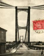
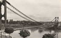
1935: Tréboul
Thérondels vicinity, Aveyron and Sainte-Marie, Cantal, France - Lac de Sarrans
| Bridgemeister ID: | 1989 (added 2005-12-02) |
| Year Completed: | 1935 |
| Name: | Tréboul |
| Location: | Thérondels vicinity, Aveyron and Sainte-Marie, Cantal, France |
| Crossing: | Lac de Sarrans |
| Coordinates: | 44.872780 N 2.867253 E |
| Maps: | Acme, GeoHack, Google, OpenStreetMap |
| Use: | Vehicular (one-lane) |
| Status: | In use (last checked: 2014) |
| Main Cables: | Wire (steel) |
| Suspended Spans: | 1 |
Notes:
External Links:

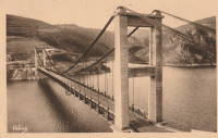
1936: (footbridge)
Hillsborough River State Park, Florida, USA - Hillsborough River
| Bridgemeister ID: | 285 (added before 2003) |
| Year Completed: | 1936 |
| Name: | (footbridge) |
| Location: | Hillsborough River State Park, Florida, USA |
| Crossing: | Hillsborough River |
| Coordinates: | 28.1499 N 82.23203 W |
| Maps: | Acme, GeoHack, Google, OpenStreetMap |
| Principals: | CCC |
| Use: | Footbridge |
| Status: | In use (last checked: 2004) |
| Main Cables: | Wire (steel) |
| Main Span: | 1 |
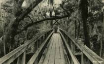
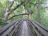
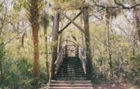
1936: Androscoggin Pedestrian
Topsham and Brunswick, Maine, USA - Androscoggin River
| Bridgemeister ID: | 182 (added before 2003) |
| Year Completed: | 1936 |
| Name: | Androscoggin Pedestrian |
| Also Known As: | Swinging |
| Location: | Topsham and Brunswick, Maine, USA |
| Crossing: | Androscoggin River |
| Coordinates: | 43.917500 N 69.972520 W |
| Maps: | Acme, GeoHack, Google, OpenStreetMap |
| Principals: | Works Progress Administration |
| References: | PPH19991019, PPH20050801 |
| Use: | Footbridge |
| Status: | In use (last checked: 2020) |
| Main Cables: | Wire (steel) |
| Suspended Spans: | 1 |
| Main Span: | 1 x 101.2 meters (332 feet) |
| Deck width: | 6 feet |
Notes:
- 2004, January: Added to National Register of Historic Places.
- 2006, December: Substantial rehabilitation completed.
- 2011, May: Dedicated as a Maine Historic Civil Engineering Landmark.
- Replaced 1892 Androscoggin Pedestrian (Swinging, Androscoggin Swinging) - Topsham and Brunswick, Maine, USA.
External Links:
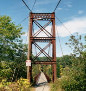
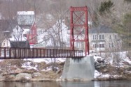
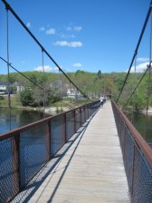
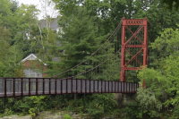
1936: Bitan
HsinTien, New Taipei City, Taiwan - Pitan "Green Lake"
| Bridgemeister ID: | 1680 (added 2005-03-25) |
| Year Completed: | 1936 |
| Name: | Bitan |
| Also Known As: | 碧潭吊橋, Green Lake, Pitan |
| Location: | HsinTien, New Taipei City, Taiwan |
| Crossing: | Pitan "Green Lake" |
| Coordinates: | 24.956483 N 121.53685 E |
| Maps: | Acme, GeoHack, Google, OpenStreetMap |
| Use: | Footbridge |
| Status: | In use (last checked: 2005) |
| Main Cables: | Wire (steel) |
Notes:
- Long, large footbridge. I've seen it spelled "Pitan" and "Bitan." Unclear which is correct.
External Links:
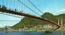
1936: Kellams
Kellams, New York and Stalker, Pennsylvania, USA - Delaware River
| Bridgemeister ID: | 97 (added before 2003) |
| Year Completed: | 1936 |
| Name: | Kellams |
| Also Known As: | Little Equinunk, Kellams-Stalker, Kellam |
| Location: | Kellams, New York and Stalker, Pennsylvania, USA |
| Crossing: | Delaware River |
| Coordinates: | 41.82333 N 75.11333 W |
| Maps: | Acme, GeoHack, Google, OpenStreetMap |
| References: | BDR, HHP, PTS2 |
| Use: | Vehicular (one-lane) |
| Status: | In use (last checked: 2019) |
| Main Cables: | Wire (steel) |
| Suspended Spans: | 1 |
| Main Span: | 1 x 117 meters (384 feet) |
Notes:
- Damaged by floodwaters June, 2006. Repaired October, 2006.
- Renovation completed, January, 2019.
- Replaced 1890 Kellams (Little Equinunk, Kellams-Stalker, Kellam) - Kellams, New York and Stalker, Pennsylvania, USA.
External Links:
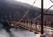
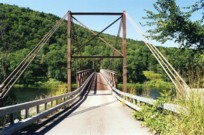
1936: San Francisco-Oakland Bay
Oakland and San Francisco, California, USA - San Francisco Bay
| Bridgemeister ID: | 184 (added before 2003) |
| Year Completed: | 1936 |
| Name: | San Francisco-Oakland Bay |
| Location: | Oakland and San Francisco, California, USA |
| Crossing: | San Francisco Bay |
| Coordinates: | 37.78667 N 122.39 W |
| Maps: | Acme, GeoHack, Google, OpenStreetMap |
| Principals: | C.H. Purcell, Glenn B. Woodruff |
| References: | AAJ, AZB, BAAW, BC3, BPL, GBD, LAB, OBB1, SFOM, USS |
| Use: | Vehicular (double-deck) |
| Status: | In use (last checked: 2022) |
| Main Cables: | Wire (steel) |
| Suspended Spans: | 6 |
| Main Spans: | 1 x 678 meters (2,224.4 feet), 1 x 673.6 meters (2,210 feet) |
| Side Spans: | 4 |
| Deck width: | 66 feet (58 feet roadway) |
Notes:
External Links:

1936: Swinging
Skowhegan, Maine, USA - Kennebec River
| Bridgemeister ID: | 363 (added before 2003) |
| Year Completed: | 1936 |
| Name: | Swinging |
| Location: | Skowhegan, Maine, USA |
| Crossing: | Kennebec River |
| Coordinates: | 44.76244 N 69.72064 W |
| Maps: | Acme, GeoHack, Google, OpenStreetMap |
| Principals: | Gerald Marble |
| References: | KJ20030410 |
| Use: | Footbridge |
| Status: | In use (last checked: 2006) |
| Main Cables: | Wire (steel) |
| Suspended Spans: | 1 |
| Main Span: | 1 x 67.1 meters (220 feet) |
Notes:
- Connects Skowhegan Island to Alder Street across the south channel of the Kennebec River.
- Repaired, 1995. Rehabilitation completed, 2006.
- Replaced 1902 Swinging - Skowhegan, Maine, USA.
