Suspension Bridges 1910-1931
This is a list of all 357 bridges in the suspension bridge inventory completed from 1910 through 1931, the year the George Washington Bridge was completed. Wherever you see a Bridgemeister ID number click it to isolate the bridge on its own page.
Related Lists:
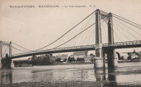
1910: Bouchemaine
Bouchemaine, Maine-et-Loire, France - Maine River
| Bridgemeister ID: | 1324 (added 2004-04-26) |
| Year Completed: | 1910 |
| Name: | Bouchemaine |
| Location: | Bouchemaine, Maine-et-Loire, France |
| Crossing: | Maine River |
| Coordinates: | 47.420130 N 0.608157 W |
| Maps: | Acme, GeoHack, Google, OpenStreetMap |
| Use: | Vehicular |
| Status: | Destroyed, 1944 |
| Main Cables: | Wire (iron) |
| Suspended Spans: | 3 |
| Main Span: | 1 |
| Side Spans: | 2 |
Notes:
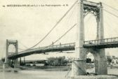
- Note the interesting stay and suspender arrangement in image. The side spans and much of the center span appear to be supported by stays. Only the center portion of the main span appears to be supported by verticle suspenders.
- Replaced by 1951 Bouchemaine - Bouchemaine, Maine-et-Loire, France.
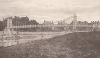
1910: Castle
Shrewsbury, England, United Kingdom
| Bridgemeister ID: | 1919 (added 2005-10-09) |
| Year Completed: | 1910 |
| Name: | Castle |
| Location: | Shrewsbury, England, United Kingdom |
| Principals: | David Rowell & Co. |
| Status: | Replaced, 1951 |
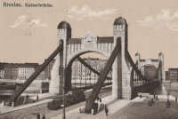
1910: Grunwaldzki
Wroclaw, Poland - Oder River
| Bridgemeister ID: | 431 (added before 2003) |
| Year Completed: | 1910 |
| Name: | Grunwaldzki |
| Also Known As: | Kaiser, Imperial, Kaiserbrücke |
| Location: | Wroclaw, Poland |
| Crossing: | Oder River |
| Coordinates: | 51.109503 N 17.052506 E |
| Maps: | Acme, GeoHack, Google, OpenStreetMap |
| Principals: | R. Weyerauch, M. Mayer |
| References: | AAJ |
| Use: | Vehicular (four-lane), with walkway |
| Status: | In use (last checked: 2019) |
| Main Cables: | Chain (steel) |
| Suspended Spans: | 1 |
| Main Span: | 1 x 126.5 meters (415 feet) |
External Links:
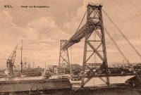
1910: Kiel Transporter
Kiel, Germany
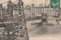
1910: La Feuillée
Lyon, Métropole de Lyon, France - Saône River
| Bridgemeister ID: | 6424 (added 2021-08-10) |
| Year Completed: | 1910 |
| Name: | La Feuillée |
| Location: | Lyon, Métropole de Lyon, France |
| Crossing: | Saône River |
| Coordinates: | 45.766389 N 4.829081 E |
| Maps: | Acme, GeoHack, Google, OpenStreetMap |
| References: | PQL |
| Use: | Footbridge |
| Status: | Destroyed, 1944 |
| Main Cables: | Wire (steel) |
| Suspended Spans: | 1 |
Notes:
1910: Linn Creek
Linn Creek, Missouri, USA - Osage River
| Bridgemeister ID: | 289 (added before 2003) |
| Year Completed: | 1910 |
| Name: | Linn Creek |
| Location: | Linn Creek, Missouri, USA |
| Crossing: | Osage River |
| Principals: | T.S. Hart |
| References: | AAJ, PTS2 |
| Use: | Vehicular |
| Status: | Removed, 1931 |
| Main Cables: | Wire |
| Suspended Spans: | 1 |
| Main Span: | 1 x 160 meters (525 feet) |
Notes:
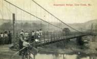
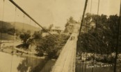
- Dismantled 1931 in preparation for inundation that created Lake Of The Ozarks.
External Links:
- www.LakeHistory.info. Michael Gillespie writes: "The supporting cables were cut and the tower was allowed to fall into the Osage River. The entire flood plain was being inundated by the waters of the newly created Lake of the Ozarks. During World War 2, the cables and tower were raised and sold for scrap. The shoreline of today's Lake of the Ozarks is just at the base of the bridge abutment. The toll house, seen in the photo just to the left of the bridge, is long gone, and everything below that has been underwater for 77 years. I have created a map of the road system at that location."
1910: Massena Center
Massena, New York, USA - Grasse River
| Bridgemeister ID: | 124 (added before 2003) |
| Year Completed: | 1910 |
| Name: | Massena Center |
| Location: | Massena, New York, USA |
| Crossing: | Grasse River |
| Coordinates: | 44.959213 N 74.830558 W |
| Maps: | Acme, GeoHack, Google, OpenStreetMap |
| Principals: | Holton D. Robinson |
| References: | AAJ, PTS2 |
| Use: | Vehicular (one-lane) |
| Status: | Closed, 1974 (last checked: 2020) |
| Main Cables: | Wire (steel) |
| Suspended Spans: | 3 |
| Main Span: | 1 x 121.9 meters (400 feet) |
| Side Spans: | 2 x 30.5 meters (100 feet) |
Notes:
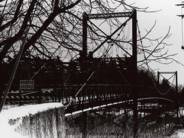
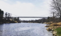
- Standing, but closed to all foot and vehicular traffic.
1910: Perttilä
Isokyrö, Finland - Kyrönjoki River
| Bridgemeister ID: | 2968 (added 2019-10-12) |
| Year Completed: | 1910 |
| Name: | Perttilä |
| Location: | Isokyrö, Finland |
| Crossing: | Kyrönjoki River |
| Coordinates: | 62.983733 N 22.355485 E |
| Maps: | Acme, GeoHack, Google, OpenStreetMap |
| Use: | Vehicular (one-lane) |
| Status: | Extant (last checked: 2019) |
| Main Cables: | Wire (steel) |
| Suspended Spans: | 1 |
1910: Skorpa
Kristiansund, Møre og Romsdal, Norway - Dunkersundet
| Bridgemeister ID: | 4461 (added 2020-04-25) |
| Year Completed: | 1910 |
| Name: | Skorpa |
| Location: | Kristiansund, Møre og Romsdal, Norway |
| Crossing: | Dunkersundet |
| Coordinates: | 63.123771 N 7.759424 E |
| Maps: | Acme, GeoHack, Google, kart.1881.no, OpenStreetMap |
| Use: | Footbridge |
| Status: | Removed |
| Main Cables: | Wire |
| Suspended Spans: | 2 |
| Main Span: | 1 x 40 meters (131.2 feet) estimated |
| Side Span: | 1 x 21 meters (68.9 feet) estimated |
Notes:
- Bypassed September 1, 1939. Removed at some point after. Tower piers still visible, 1970s. North tower pier removed by 2000s. South tower pier still remains, mid-2010s.
| Bridgemeister ID: | 4342 (added 2020-04-11) |
| Year Completed: | 1910 |
| Name: | Stoveland |
| Location: | Stoveland, Lindesnes, Agder, Norway |
| Crossing: | Marna |
| Coordinates: | 58.121219 N 7.529758 E |
| Maps: | Acme, GeoHack, Google, kart.1881.no, OpenStreetMap |
| Use: | Vehicular |
| Status: | Removed |
| Main Cables: | Wire (steel) |
| Main Span: | 1 x 46.3 meters (151.9 feet) estimated |
| Deck width: | 2.5 meters, expanded in 1948 to 3+ meters |
Notes:
- Removed at some point in 2009-2014 time frame.
1910: Swinging
Spelter, West Virginia, USA - West Fork River
| Bridgemeister ID: | 1983 (added 2005-12-02) |
| Year Completed: | 1910 |
| Name: | Swinging |
| Location: | Spelter, West Virginia, USA |
| Crossing: | West Fork River |
| Use: | Footbridge |
| Status: | Dismantled, 1951 |
| Main Cables: | Wire |
Notes:
- The book "Harrison County" in the "Images of America" series by Robert F. Stealey shows an image of this bridge stating it was "replaced by a new concrete span in the early 1960s".
External Links:
- Asturian-American Migration Forum :: Lleendu tema - History of Spelter, an American Asturian Community. Mentions: "The [Grasselli Company] built a swinging footbridge across the West Fork River in 1910 to connect the town of Spelter with the Fairmont-Clarksburg interurban trolley line. The trolley stop was called 'Ziesing'. Wagons forded the river to bring supplies not carried into the town by the B.&O. Railroad. A school house was built on the hill… DuPont sold the townsite in 1950, including the swinging bridge, to John J. Moschetta who immediately sold the houses to the employees occupying them at the time. Mr. Moschetta dismantled the swinging bridge in 1951… In 1962 a new cement bridge was constructed north of the old vehicular bridge."
1911: Affonso Penna
Itumbiara, Goiás and Araporã, Minas Gerais, Brazil - Paranaíba River
| Bridgemeister ID: | 7455 (added 2022-12-24) |
| Year Completed: | 1911 |
| Name: | Affonso Penna |
| Also Known As: | Afonso Pena |
| Location: | Itumbiara, Goiás and Araporã, Minas Gerais, Brazil |
| Crossing: | Paranaíba River |
| Coordinates: | 18.426530 S 49.206316 W |
| Maps: | Acme, GeoHack, Google, OpenStreetMap |
| Use: | Vehicular (one-lane) |
| Status: | In use (last checked: 2022) |
| Main Cables: | Wire (steel) |
| Suspended Spans: | 1 |
| Main Span: | 1 x 124 meters (406.8 feet) estimated |
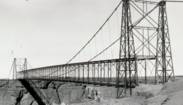
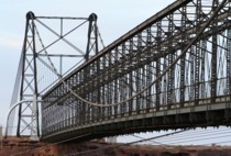
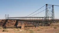
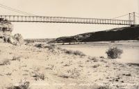
1911: Cameron
Cameron, Arizona, USA - Little Colorado River
| Bridgemeister ID: | 125 (added before 2003) |
| Year Completed: | 1911 |
| Name: | Cameron |
| Location: | Cameron, Arizona, USA |
| Crossing: | Little Colorado River |
| Coordinates: | 35.875733 N 111.412567 W |
| Maps: | Acme, GeoHack, Google, OpenStreetMap |
| Principals: | Midland Bridge Co., W.H. Code, John Charles |
| References: | GBD |
| Use: | Vehicular and Pipeline |
| Status: | Closed (last checked: 2012) |
| Main Cables: | Wire (steel) |
| Suspended Spans: | 1 |
| Main Span: | 1 x 201.2 meters (660 feet) |
Notes:
- The bridge currently carries a pipeline, but the road deck is closed to all traffic.
External Links:

1911: Coronation
Pitlochry, Scotland, United Kingdom - River Tummel
| Bridgemeister ID: | 2621 (added 2018-12-30) |
| Year Completed: | 1911 |
| Name: | Coronation |
| Location: | Pitlochry, Scotland, United Kingdom |
| Crossing: | River Tummel |
| At or Near Feature: | Linn of Tummel vicinity |
| Coordinates: | 56.720118 N 3.793993 W |
| Maps: | Acme, GeoHack, Google, OpenStreetMap |
| Use: | Footbridge |
| Status: | In use (last checked: 2022) |
| Main Cables: | Wire (steel) |
| Suspended Spans: | 1 |
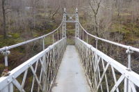
1911: Dryburgh Abbey
Dryburgh and St. Boswells, Scotland, United Kingdom - River Tweed
| Bridgemeister ID: | 6218 (added 2021-07-16) |
| Year Completed: | 1911 |
| Name: | Dryburgh Abbey |
| Location: | Dryburgh and St. Boswells, Scotland, United Kingdom |
| Crossing: | River Tweed |
| Coordinates: | 55.580452 N 2.654235 W |
| Maps: | Acme, GeoHack, Google, OpenStreetMap |
| Use: | Footbridge |
| Status: | In use (last checked: 2021) |
| Main Cables: | Wire (steel) |
| Suspended Spans: | 1 |
Notes:
- Although the current (as of 2021) Dryburgh Abbey bridge is often attributed to 1872, it more closely resembles bridges built starting in the 1890s.
- Replaced 1872 Dryburgh Abbey - Dryburgh and St. Boswells, Scotland, United Kingdom.
- Near Mertoun Estate - Mertoun, Scotland, United Kingdom.
External Links:
- The Happy Pontist: Scottish Bridges: 15. Dryburgh Abbey Footbridge
- Structurae - Structure ID 20016083
1911: Kaiwarra
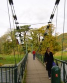
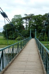
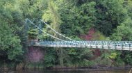
Ethelton vicinity, North Canterbury, New Zealand - Hurunui River
| Bridgemeister ID: | 691 (added 2003-03-08) |
| Year Completed: | 1911 |
| Name: | Kaiwarra |
| Location: | Ethelton vicinity, North Canterbury, New Zealand |
| Crossing: | Hurunui River |
| Principals: | Arthur Falkner, T. Ridley |
| References: | GAP |
| Use: | Vehicular (one-lane) |
| Main Cables: | Wire |
| Suspended Spans: | 1 |
| Main Span: | 1 x 46.8 meters (153.5 feet) |
External Links:
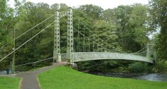
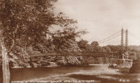
1911: King George V
Newton Stewart, Scotland, United Kingdom - River Cree
| Bridgemeister ID: | 2468 (added 2008-12-19) |
| Year Completed: | 1911 |
| Name: | King George V |
| Location: | Newton Stewart, Scotland, United Kingdom |
| Crossing: | River Cree |
| Coordinates: | 54.967048 N 4.485349 W |
| Maps: | Acme, GeoHack, Google, OpenStreetMap |
| Principals: | D. H. and F. Reid Engineers, Victoria Bridge Works |
| Use: | Footbridge |
| Status: | In use (last checked: 2019) |
| Main Cables: | Wire (steel) |
| Suspended Spans: | 1 |
Notes:
- Plaques posted at the bridge indicate major refurbishments in 1982 and 2001.
External Links:
1911: Massena
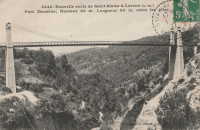
Saint-Blaise, Alpes-Maritimes, France
| Bridgemeister ID: | 7202 (added 2022-07-05) |
| Year Completed: | 1911 |
| Name: | Massena |
| Location: | Saint-Blaise, Alpes-Maritimes, France |
| Coordinates: | 43.822410 N 7.241796 E |
| Maps: | Acme, GeoHack, Google, OpenStreetMap |
| Use: | Vehicular |
| Status: | Destroyed, 1944 |
| Main Cables: | Wire (steel) |
| Main Span: | 1 |
1911: Pessac-sur-Dordogne
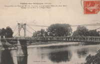
Pessac-sur-Dordogne, Gironde and Dordogne, France - Dordogne River
| Bridgemeister ID: | 2333 (added 2007-07-09) |
| Year Completed: | 1911 |
| Name: | Pessac-sur-Dordogne |
| Location: | Pessac-sur-Dordogne, Gironde and Dordogne, France |
| Crossing: | Dordogne River |
| Status: | Removed |
| Main Cables: | Wire |
Notes:
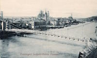
1911: Prinzregent-Luitpoldbrücke
Passau, Bavaria, Germany - Danube River
| Bridgemeister ID: | 2300 (added 2007-04-26) |
| Year Completed: | 1911 |
| Name: | Prinzregent-Luitpoldbrücke |
| Location: | Passau, Bavaria, Germany |
| Crossing: | Danube River |
| Use: | Vehicular |
| Status: | Destroyed, 1945 |
| Main Cables: | Wire (steel) |
| Suspended Spans: | 1 |
Notes:
- Near former location of 1869 Drahtsteg - Passau, Bavaria, Germany.
- Replaced by 1948 Luitpoldbrücke - Passau, Bavaria, Germany.
| Bridgemeister ID: | 4082 (added 2020-04-04) |
| Year Completed: | 1911 |
| Name: | Sponga |
| Location: | Setermoen, Bardu, Troms og Finnmark, Norway |
| Crossing: | Barduelva |
| Coordinates: | 68.872685 N 18.370350 E |
| Maps: | Acme, GeoHack, Google, kart.1881.no, OpenStreetMap |
| Use: | Vehicular (one-lane) |
| Status: | Removed |
| Main Cables: | Wire (steel) |
| Suspended Spans: | 1 |
| Main Span: | 1 x 50 meters (164 feet) |
| Deck width: | 2 meters |
External Links:
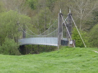
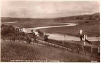
1911: Swing
Llandeilo, Wales, United Kingdom - Towy River
| Bridgemeister ID: | 1399 (added 2004-07-04) |
| Year Completed: | 1911 |
| Name: | Swing |
| Also Known As: | King's, Shaky |
| Location: | Llandeilo, Wales, United Kingdom |
| Crossing: | Towy River |
| Coordinates: | 51.884462 N 3.986061 W |
| Maps: | Acme, GeoHack, Google, OpenStreetMap |
| Use: | Footbridge |
| Status: | In use (last checked: 2018) |
| Main Cables: | Wire (steel) |
| Suspended Spans: | 1 |
External Links:
1911: Treyz
Cooks Falls, New York, USA - Beaver Kill
| Bridgemeister ID: | 6776 (added 2021-10-27) |
| Year Completed: | 1911 |
| Name: | Treyz |
| Also Known As: | George I. Treyz |
| Location: | Cooks Falls, New York, USA |
| Crossing: | Beaver Kill |
| Coordinates: | 41.956829 N 74.992559 W |
| Maps: | Acme, GeoHack, Google, OpenStreetMap |
| Principals: | John A. Roebling's Sons |
| Use: | Tramway |
| Status: | Only towers remain (last checked: 2016) |
| Main Cables: | Wire (steel) |
| Main Span: | 1 x 70 meters (229.7 feet) estimated |
| Side Spans: | 2 |
Notes:
- Facility served by the bridge closed in 1925 at which time the bridge was likely abandoned. Towers appear to still be standing (in late 2010s).
External Links:
- A Delaware County Primer complied by Sue Hudson. "West of Cooks Falls and east of Horton, on the O&W. Acid plant built here by Eugene King burned in June 1888, was rebuilt, and was later bought by local entrepreneur, George I. Treyz. Railroad suspension bridge constructed in 1911 by John A. Roebling's Sons Company of Trenton, NJ to connect Treyz's acid factory, saw mill, and planing mill on Russell Brook to the O&W, which ran on the other side of the Beaver Kill."
- Cooks Falls - Colchester Historical Society. "Arthur Leighton and George I. Treyz developed the acid factory industries in Cook's Falls... Treyz had a close relationship with the O&W Railroad, which helped both to prosper. Treyz installed a Roebling suspension bridge between his plant and the O&W Railroad. This siding was known as the Grove Switch. A narrow gauge railway was constructed and ran up Russell Brook to the Russell School. This line carried logs and sawed lumber down to the Treyz plant and the O&W Railroad."
1912: (flume bridge)
Rudsmoen, Kongsberg, Viken, Norway - Numedalslågen
| Bridgemeister ID: | 4097 (added 2020-04-05) |
| Year Completed: | 1912 |
| Name: | (flume bridge) |
| Location: | Rudsmoen, Kongsberg, Viken, Norway |
| Crossing: | Numedalslågen |
| At or Near Feature: | Gravenfoss |
| Coordinates: | 59.615535 N 9.677242 E |
| Maps: | Acme, GeoHack, Google, kart.1881.no, OpenStreetMap |
| Use: | Flume |
| Status: | Removed |
| Main Cables: | Wire (steel) |
| Suspended Spans: | 1 |
| Main Span: | 1 x 25 meters (82 feet) estimated |
Notes:
- Spans the head of a diversion channel of Numedalslågen at the crest of Gravenfoss.
- Based on historic aerial images, removed between 1979 and 2003.
- Connects to 1912 (flume bridge) - Sunnegrenda, Kongsberg, Viken, Norway.
- Connects to 1912 (flume bridge) - Sunnegrenda, Kongsberg, Viken, Norway.
1912: (flume bridge)
Sunnegrenda, Kongsberg, Viken, Norway - Numedalslågen
| Bridgemeister ID: | 4095 (added 2020-04-05) |
| Year Completed: | 1912 |
| Name: | (flume bridge) |
| Location: | Sunnegrenda, Kongsberg, Viken, Norway |
| Crossing: | Numedalslågen |
| At or Near Feature: | Labrofossen |
| Coordinates: | 59.617045 N 9.667134 E |
| Maps: | Acme, GeoHack, Google, kart.1881.no, OpenStreetMap |
| Use: | Flume |
| Status: | Extant (last checked: 2019) |
| Main Cables: | Wire (steel) |
| Suspended Spans: | 1 |
| Main Span: | 1 x 54 meters (177.2 feet) |
Notes:
1912: (flume bridge)
Sunnegrenda, Kongsberg, Viken, Norway
| Bridgemeister ID: | 4096 (added 2020-04-05) |
| Year Completed: | 1912 |
| Name: | (flume bridge) |
| Location: | Sunnegrenda, Kongsberg, Viken, Norway |
| Coordinates: | 59.620334 N 9.667028 E |
| Maps: | Acme, GeoHack, Google, kart.1881.no, OpenStreetMap |
| Use: | Flume |
| Status: | Extant (last checked: 2019) |
| Main Cables: | Wire (steel) |
| Suspended Spans: | 2 |
| Main Spans: | 2 x 20.75 meters (68.1 feet) estimated |
Notes:
- Crosses a pair of intake tubes just south of the diversion of Numedalslågen at Labrofossen.
- Connects to 1912 (flume bridge) - Rudsmoen, Kongsberg, Viken, Norway.
- Connects to 1912 (flume bridge) - Sunnegrenda, Kongsberg, Viken, Norway.
1912: Branstetter
Warsaw vicinity, Missouri, USA - Osage River
| Bridgemeister ID: | 2042 (added 2006-05-07) |
| Year Completed: | 1912 |
| Name: | Branstetter |
| Also Known As: | Peal Bend |
| Location: | Warsaw vicinity, Missouri, USA |
| Crossing: | Osage River |
| Principals: | Joseph A. Dice |
| References: | BOTO |
| Use: | Vehicular (one-lane) |
| Status: | Removed |
| Main Cables: | Wire (steel) |
| Main Span: | 1 x 182.9 meters (600 feet) |
Notes:
- Heavily damaged by wind, 1924. Rebuilt.
- Location inundated by the Harry S. Truman Reservoir.
External Links:
1912: County Line
Henry County and St. Clair County, Missouri, USA - Osage River
| Bridgemeister ID: | 3518 (added 2019-12-24) |
| Year Completed: | 1912 |
| Name: | County Line |
| Also Known As: | Gilbert-Harris |
| Location: | Henry County and St. Clair County, Missouri, USA |
| Crossing: | Osage River |
| Principals: | Joseph A. Dice |
| References: | BOTO |
| Use: | Vehicular (one-lane) |
| Status: | Removed |
| Main Cables: | Wire (steel) |
Notes:
- Location inundated by the Harry S. Truman Reservoir.
External Links:
- Bridgehunter - County Line Bridge. Robert Hayden (BOTO) describes the County Line bridge briefly as being the first steel-towered Joe Dice bridge but the image at shows large timber towers like other pre-steel towered Dice bridges.
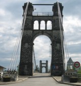
1912: Groslée
Groslée, Ain and Brangues, Isère, France - Rhône River
| Bridgemeister ID: | 1536 (added 2004-10-31) |
| Year Completed: | 1912 |
| Name: | Groslée |
| Location: | Groslée, Ain and Brangues, Isère, France |
| Crossing: | Rhône River |
| Coordinates: | 45.712333 N 5.548533 E |
| Maps: | Acme, GeoHack, Google, OpenStreetMap |
| Principals: | Ferdinand Arnodin |
| References: | BPF |
| Use: | Vehicular, with walkway |
| Status: | In use (last checked: 2019) |
| Main Cables: | Wire (steel) |
| Suspended Spans: | 1 |
| Main Span: | 1 x 177 meters (580.7 feet) estimated |
Notes:
External Links:
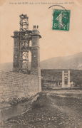
1912: Hagwilget
Hagwilget, British Columbia, Canada - Bulkley River
| Bridgemeister ID: | 1229 (added 2004-02-15) |
| Year Completed: | 1912 |
| Name: | Hagwilget |
| Also Known As: | Bulkley Canyon |
| Location: | Hagwilget, British Columbia, Canada |
| Crossing: | Bulkley River |
| At or Near Feature: | Hagwilget Canyon |
| Coordinates: | 55.257347 N 127.604616 W |
| Maps: | Acme, GeoHack, Google, OpenStreetMap |
| References: | AAJ |
| Use: | Vehicular (one-lane) |
| Status: | Replaced, 1931 |
| Main Cables: | Wire (steel) |
| Suspended Spans: | 1 |
| Main Span: | 1 x 137.5 meters (451 feet) |
| Deck width: | 9 feet |
Notes:
- AAJ: Restricted to foot traffic, 1929.
- Replaced by 1931 Hagwilget (Bulkley Canyon) - Hagwilget, British Columbia, Canada.
- See Walcott - Walcott, British Columbia, Canada. Part or all of the dismantled 1912 Hagwilget bridge may have been reused for this bridge at Walcott.

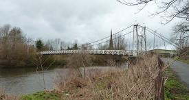
1912: Howley
Howley, Warrington, Cheshire and Latchford, England, United Kingdom - River Mersey
| Bridgemeister ID: | 1836 (added 2005-07-02) |
| Year Completed: | 1912 |
| Name: | Howley |
| Location: | Howley, Warrington, Cheshire and Latchford, England, United Kingdom |
| Crossing: | River Mersey |
| At or Near Feature: | Victoria Park |
| Coordinates: | 53.387333 N 2.57845 W |
| Maps: | Acme, GeoHack, Google, OpenStreetMap |
| Principals: | David Rowell & Co. |
| Use: | Footbridge |
| Status: | In use (last checked: 2012) |
| Main Cables: | Wire (steel) |
| Suspended Spans: | 1 |
1912: Ireland's Road
Ashley Clinton vicinity, New Zealand
| Bridgemeister ID: | 693 (added 2003-03-08) |
| Year Completed: | 1912 |
| Name: | Ireland's Road |
| Also Known As: | Wilson Cutting Road |
| Location: | Ashley Clinton vicinity, New Zealand |
| Principals: | Joseph Dawson |
| References: | GAP |
| Use: | Vehicular |
| Status: | Replaced, 1968 |
| Main Span: | 1 x 43.4 meters (142.4 feet) |
Notes:
- GAP: Completed c. 1912. Replaced by culvert, c.1968.
- See 1912 Mangatewai Road (Boyle Road) - Ashley Clinton vicinity, New Zealand.
| Bridgemeister ID: | 3131 (added 2019-11-02) |
| Year Completed: | 1912 |
| Name: | Kirkesnes |
| Location: | Rundhaug, Målselv, Troms og Finnmark, Norway |
| Crossing: | Målselv |
| Coordinates: | 69.019334 N 18.897597 E |
| Maps: | Acme, GeoHack, Google, kart.1881.no, OpenStreetMap |
| Use: | Vehicular (one-lane) |
| Status: | Removed |
| Main Cables: | Wire (steel) |
Notes:
- 2010: Abutments remain.
1912: Mangatewai Road
Ashley Clinton vicinity, New Zealand - Mangatewai River
| Bridgemeister ID: | 692 (added 2003-03-08) |
| Year Completed: | 1912 |
| Name: | Mangatewai Road |
| Also Known As: | Boyle Road |
| Location: | Ashley Clinton vicinity, New Zealand |
| Crossing: | Mangatewai River |
| Principals: | Joseph Dawson |
| References: | GAP |
| Use: | Vehicular |
| Status: | Demolished, 1970 |
| Main Span: | 1 x 53.1 meters (174.2 feet) |
Notes:
- GAP: Completed c.1912. Destroyed by earthquake, 1931.
- Hamish Kynoch writes: "This bridge over the Mangatewai River was located on Boyle Road. It was damaged in the large earthquake in 1931, but stood for many years, and was used occasionally for livestock, with wooden planking over the crack in the concrete deck. It was demolished about 1970 by dynamiting the anchor blocks at one end of the bridge. There was no replacement and the old road is now closed. Another bridge of the same design was located about three miles away on Wilson Cutting Road."
- See 1912 Ireland's Road (Wilson Cutting Road) - Ashley Clinton vicinity, New Zealand.
1912: Miller
Miller, Cleburne County, Arkansas, USA - Little Red River
| Bridgemeister ID: | 1073 (added 2003-12-27) |
| Year Completed: | 1912 |
| Name: | Miller |
| Location: | Miller, Cleburne County, Arkansas, USA |
| Crossing: | Little Red River |
| Principals: | Henry Churchill |
| Use: | Vehicular (one-lane) |
| Status: | Inundated |
| Main Cables: | Wire |
| Suspended Spans: | 1 |
| Main Span: | 1 x 114.3 meters (375 feet) estimated |
| Deck width: | ~10 feet |
Notes:
- Built as part of same contract as nearby 1912 Winkley bridge.
- Inundated by Greer's Ferry Lake upon completion of Greer's Ferry Dam, early 1960's.
- Companion to 1912 Tumbling Shoals - Tumbling Shoals, Arkansas, USA.
- Companion to 1912 Winkley (Swinging) - Heber Springs, Arkansas, USA.
External Links:
1912: Miret
Saint-Denis-lès-Martel, Lot, France - Dordogne River
| Bridgemeister ID: | 1986 (added 2005-12-02) |
| Year Completed: | 1912 |
| Name: | Miret |
| Also Known As: | Mezels |
| Location: | Saint-Denis-lès-Martel, Lot, France |
| Crossing: | Dordogne River |
| Coordinates: | 44.927380 N 1.670215 E |
| Maps: | Acme, GeoHack, Google, OpenStreetMap |
| Use: | Vehicular (one-lane) |
| Status: | In use (last checked: 2019) |
| Main Cables: | Wire |
| Suspended Spans: | 1 |
| Main Span: | 1 x 140 meters (459.3 feet) |
Notes:
- Possibly completed 1914, not 1912.
- In vicinity of Mezels and Floirac.
External Links:
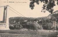
1912: Orleans
Orleans, California, USA - Klamath River
| Bridgemeister ID: | 126 (added before 2003) |
| Year Completed: | 1912 |
| Name: | Orleans |
| Location: | Orleans, California, USA |
| Crossing: | Klamath River |
| Use: | Vehicular (one-lane) |
| Status: | Destroyed, 1936? |
| Main Cables: | Wire |
Notes:
- Some accounts state this bridge was destroyed by fire in 1921. A brief mention in the July 18, 1926 edition of The Fresno Bee implies it was destroyed in June of 1926.
- Replaced by 1940 Orleans - Orleans, California, USA.
External Links:
- Catalog Number 1983/001/SBPM01034 - Sacramento Bee. This "Center for Sacramento History" catalog entry suggests the bridge survived until 1936. Given the bridge was ultimately replaced in 1940, this later date makes more sense than some of the earlier claims of it being destroyed in the 1920s unless there were some intermediate reconstructions.
- Klamath River at Orleans - California State Library. This image shows a bridge of similar construction but apparently shorter span than the other images linked here. However, matching buildings seen in the background of multiple images place it at the same location. Given the muddled suspension bridge chronology at this location and frequency of Klamath River floods, it seems likely there were multiple reconstructions of this bridge.
- Orleans Bridge 1910 - California State Library. Image purporting to be the Orleans bridge under construction in 1910, but it does not appear to be the same location.
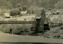
1912: Sauro
Vicenza, Veneto, Italy - Bacchiglione River
| Bridgemeister ID: | 3228 (added 2019-11-11) |
| Year Completed: | 1912 |
| Name: | Sauro |
| Location: | Vicenza, Veneto, Italy |
| Crossing: | Bacchiglione River |
| Coordinates: | 45.547632 N 11.550810 E |
| Maps: | Acme, GeoHack, Google, OpenStreetMap |
| Use: | Footbridge |
| Status: | In use (last checked: 2019) |
| Main Cables: | Wire (steel) |
| Suspended Spans: | 1 |
External Links:
1912: Sewell's Road
Scarborough, Ontario, Canada - Rouge River
| Bridgemeister ID: | 831 (added 2003-06-01) |
| Year Completed: | 1912 |
| Name: | Sewell's Road |
| Location: | Scarborough, Ontario, Canada |
| Crossing: | Rouge River |
| Coordinates: | 43.82754 N 79.19962 W |
| Maps: | Acme, GeoHack, Google, OpenStreetMap |
| Principals: | Frank Barber, Lewis Construction |
| Use: | Vehicular (one-lane) |
| Status: | In use (last checked: 2021) |
| Main Cables: | Wire (steel) |
| Suspended Spans: | 3 |
| Main Span: | 1 x 30.5 meters (100 feet) estimated |
| Side Spans: | 2 x 9.1 meters (30 feet) estimated |
Notes:
- Restoration completed April, 1981.
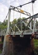
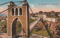
1912: Sidi M'Cid
Constantine, Algeria - Oued Rhumel
| Bridgemeister ID: | 1101 (added 2004-01-02) |
| Year Completed: | 1912 |
| Name: | Sidi M'Cid |
| Location: | Constantine, Algeria |
| Crossing: | Oued Rhumel |
| Coordinates: | 36.372592 N 6.614448 E |
| Maps: | Acme, GeoHack, Google, OpenStreetMap |
| Principals: | Ferdinand Arnodin |
| References: | AAJ |
| Use: | Vehicular (one-lane) |
| Status: | In use (last checked: 2019) |
| Main Cables: | Wire (steel) |
| Suspended Spans: | 1 |
| Main Span: | 1 x 164.6 meters (540 feet) |
| Deck width: | 19.5 feet |
External Links:

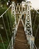
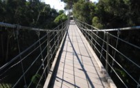
1912: Spruce Street
Hillcrest, San Diego, California, USA - Kate Sessions Canyon
| Bridgemeister ID: | 635 (added 2003-01-20) |
| Year Completed: | 1912 |
| Name: | Spruce Street |
| Location: | Hillcrest, San Diego, California, USA |
| Crossing: | Kate Sessions Canyon |
| At or Near Feature: | Bankers Hill Canyon |
| Coordinates: | 32.73878 N 117.16541 W |
| Maps: | Acme, GeoHack, Google, OpenStreetMap |
| Principals: | Edwin Capp |
| Use: | Footbridge |
| Status: | In use (last checked: 2021) |
| Main Cables: | Wire (steel) |
| Suspended Spans: | 2 |
| Main Span: | 1 x 91.4 meters (300 feet) |
| Side Span: | 1 |
1912: Tumbling Shoals
Tumbling Shoals, Arkansas, USA - Little Red River
| Bridgemeister ID: | 1072 (added 2003-12-27) |
| Year Completed: | 1912 |
| Name: | Tumbling Shoals |
| Location: | Tumbling Shoals, Arkansas, USA |
| Crossing: | Little Red River |
| Principals: | Henry Churchill |
| Use: | Vehicular |
| Status: | Removed |
| Main Cables: | Wire |
| Suspended Spans: | 1 |
| Main Span: | 1 x 134.1 meters (440 feet) estimated |
Notes:
- Built as part of same contract as nearby 1912 Winkley bridge.
- Inundated by Greer's Ferry Lake upon completion of Greer's Ferry Dam, early 1960's.
- Companion to 1912 Miller - Miller, Cleburne County, Arkansas, USA.
- Companion to 1912 Winkley (Swinging) - Heber Springs, Arkansas, USA.
External Links:
1912: Winkley
Heber Springs, Arkansas, USA - Little Red River
| Bridgemeister ID: | 127 (added before 2003) |
| Year Completed: | 1912 |
| Name: | Winkley |
| Also Known As: | Swinging |
| Location: | Heber Springs, Arkansas, USA |
| Crossing: | Little Red River |
| Coordinates: | 35.489833 N 91.973918 W |
| Maps: | Acme, GeoHack, Google, OpenStreetMap |
| Principals: | Henry Churchill |
| References: | GBD |
| Use: | Vehicular (one-lane) |
| Status: | Collapsed, 1989 |
| Main Cables: | Wire |
| Main Span: | 1 x 167.6 meters (550 feet) |
Notes:
- 1949: Wooden towers replaced by steel towers.
- 1972: Restricted to pedestrians.
- 1989, October 28: Collapsed killing 5 people and injuring 18 others.
- Location also known as "Winkley Ford" and "Turner's Ferry".
- Companion to 1912 Miller - Miller, Cleburne County, Arkansas, USA.
- Companion to 1912 Tumbling Shoals - Tumbling Shoals, Arkansas, USA.
External Links:
- Historic Bridges of the United States - Winkley Bridge - Cleburne County, Arkansas
- Structurae - Structure ID 20001341
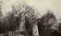
1913: (footbridge)
Ithaca, New York, USA - Fall Creek Gorge
| Bridgemeister ID: | 260 (added before 2003) |
| Year Completed: | 1913 |
| Name: | (footbridge) |
| Location: | Ithaca, New York, USA |
| Crossing: | Fall Creek Gorge |
| At or Near Feature: | Cornell University campus |
| Use: | Footbridge |
| Status: | Removed |
Notes:
- Closed August, 1960.
- Replaced by 1961 Triphammer (Fall Creek) - Ithaca, New York, USA.
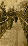
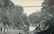
1913: Øvre Salangen
Prestbakklia, Salangen, Troms og Finnmark, Norway - Salangsdalselva
| Bridgemeister ID: | 4083 (added 2020-04-04) |
| Year Completed: | 1913 |
| Name: | Øvre Salangen |
| Location: | Prestbakklia, Salangen, Troms og Finnmark, Norway |
| Crossing: | Salangsdalselva |
| Coordinates: | 68.867263 N 18.014549 E |
| Maps: | Acme, GeoHack, Google, kart.1881.no, OpenStreetMap |
| Use: | Vehicular (one-lane) |
| Status: | Removed |
| Main Cables: | Wire (steel) |
| Suspended Spans: | 1 |
| Main Span: | 1 x 54 meters (177.2 feet) |
External Links:
| Bridgemeister ID: | 3920 (added 2020-03-20) |
| Year Completed: | 1913 |
| Name: | Bellingmo |
| Location: | Bellingmo, Alvdal, Innlandet, Norway |
| Crossing: | Glomma |
| Coordinates: | 62.02715 N 10.78453 E |
| Maps: | Acme, GeoHack, Google, kart.1881.no, OpenStreetMap |
| Use: | Vehicular (one-lane) |
| Status: | In use (last checked: 2019) |
| Main Cables: | Wire (steel) |
| Suspended Spans: | 1 |
| Main Span: | 1 x 80 meters (262.5 feet) estimated |
1913: Brilliant
Castlegar vicinity, British Columbia, Canada - Kootenay River
| Bridgemeister ID: | 128 (added before 2003) |
| Year Completed: | 1913 |
| Name: | Brilliant |
| Also Known As: | Doukhobor |
| Location: | Castlegar vicinity, British Columbia, Canada |
| Crossing: | Kootenay River |
| Coordinates: | 49.31793 N 117.63023 W |
| Maps: | Acme, GeoHack, Google, OpenStreetMap |
| Principals: | J. R. Grant |
| References: | AAJ, PTS2 |
| Use: | Vehicular (one-lane) |
| Status: | Restricted to foot traffic (last checked: 2010) |
| Main Cables: | Wire (steel) |
| Suspended Spans: | 1 |
| Main Span: | 1 x 100.9 meters (331 feet) |
| Deck width: | 16 feet |
Notes:
- 2010, May: Bridge is reopened for pedestrian traffic after a restoration project. Bridge had been closed and derelict prior.
- Near 1984 Zuckerberg Island Heritage Park - Castlegar, British Columbia, Canada.
External Links:
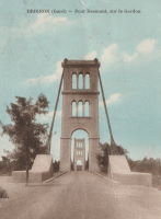
1913: Desmons
Brignon, Gard, France - Gardon River
| Bridgemeister ID: | 6983 (added 2022-04-03) |
| Year Completed: | 1913 |
| Name: | Desmons |
| Location: | Brignon, Gard, France |
| Crossing: | Gardon River |
| Use: | Vehicular |
| Status: | Demolished, March, 1989 |
| Main Cables: | Wire |
| Suspended Spans: | 1 |
| Main Span: | 1 |
Notes:
- Replaced 1904 Desmons - Brignon, Gard, France.
External Links:
1913: Flakkebrua
Flakk, Birkenes, Agder, Norway - Tovdalselva
| Bridgemeister ID: | 4316 (added 2020-04-10) |
| Year Completed: | 1913 |
| Name: | Flakkebrua |
| Location: | Flakk, Birkenes, Agder, Norway |
| Crossing: | Tovdalselva |
| Coordinates: | 58.338842 N 8.220412 E |
| Maps: | Acme, GeoHack, Google, kart.1881.no, OpenStreetMap |
| Use: | Vehicular (one-lane) |
| Status: | Replaced, 2001 |
| Main Cables: | Wire (steel) |
| Suspended Spans: | 1 |
| Main Span: | 1 x 59 meters (193.6 feet) estimated |
| Deck width: | ~2 meters |
Notes:
- Translated from Norwegian: "The bridge came in 1913. It soon became clear that the bridge was built of poor materials. It was too late, so the logs could tear it down in flood times. It was therefore reinforced with new cables... In 1935, a major improvement was made to the bridge. It got plank deck so it could be run by horse and carriage over it. At the same time, a new road was worked up through the Tollenesholta from Flakkebrua to Osen. The bridge was also used by smaller private cars until the 1960s. Then it was closed to all motorized traffic. It was still used as a walking and cycling route."
- Replaced by 2001 Flakkebrua - Flakk, Birkenes, Agder, Norway.
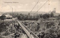
1913: Grängesberg
Grängesberg, Sweden - Skärningen Grängesberg
| Bridgemeister ID: | 8152 (added 2024-02-03) |
| Year Completed: | 1913 |
| Name: | Grängesberg |
| Location: | Grängesberg, Sweden |
| Crossing: | Skärningen Grängesberg |
| Coordinates: | 60.082389 N 14.998528 E |
| Maps: | Acme, GeoHack, Google, OpenStreetMap |
| Use: | Footbridge |
| Status: | Dismantled, 1925 |
| Main Cables: | Wire (steel) |
| Main Span: | 1 |
Notes:
- Coordinates indicate approximate location of the bridge over the large mine cut (Skärningen) at Grängesberg. The bridge was dismantled in 1925 so that the cut could be widened. It was reassembled at Vansbro.
- Moved to Vansbro (Saltviksbro) - Vansbro, Sweden.
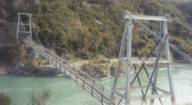
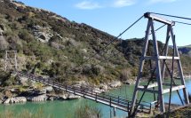
1913: Horseshoe Bend
Horseshoe Bend, Millers Flat vicinity, New Zealand - Clutha River
| Bridgemeister ID: | 695 (added 2003-03-08) |
| Year Completed: | 1913 |
| Name: | Horseshoe Bend |
| Location: | Horseshoe Bend, Millers Flat vicinity, New Zealand |
| Crossing: | Clutha River |
| Coordinates: | 45.722574 S 169.471335 E |
| Maps: | Acme, GeoHack, Google, OpenStreetMap |
| Principals: | John Edie, Jimmy Doake |
| References: | GAP |
| Use: | Footbridge |
| Status: | In use (last checked: 2017) |
| Main Cables: | Wire |
| Suspended Spans: | 1 |
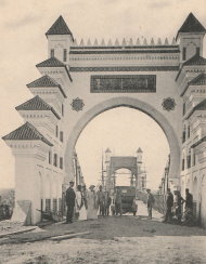
1913: Kerman
Ksar el-Kebir (Alcazarquivir), Morocco - Oued Loukos
| Bridgemeister ID: | 5847 (added 2021-05-13) |
| Year Completed: | 1913 |
| Name: | Kerman |
| Location: | Ksar el-Kebir (Alcazarquivir), Morocco |
| Crossing: | Oued Loukos |
| Use: | Vehicular |
| Status: | Removed |
1913: Makarovskiy
Kronstadt (Кронштадт), Kotlin Island, St. Petersburg, Russia - Петровского дока
| Bridgemeister ID: | 7121 (added 2022-06-13) |
| Year Completed: | 1913 |
| Name: | Makarovskiy |
| Also Known As: | Макаровский, Makarov |
| Location: | Kronstadt (Кронштадт), Kotlin Island, St. Petersburg, Russia |
| Crossing: | Петровского дока |
| At or Near Feature: | Ravine Park (Овражный парк) |
| Coordinates: | 59.990911 N 29.775796 E |
| Maps: | Acme, GeoHack, Google, OpenStreetMap |
| Use: | Footbridge |
| Status: | In use (last checked: 2022) |
| Main Cables: | Eyebar (steel) |
| Suspended Spans: | 1 |
| Characteristics: | Braced (trussed) chain/cable |
Notes:
- Braced chain suspension system.
External Links:
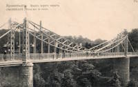
1913: Middle
Warsaw, Missouri, USA - Osage River
| Bridgemeister ID: | 149 (added before 2003) |
| Year Completed: | 1913 |
| Name: | Middle |
| Location: | Warsaw, Missouri, USA |
| Crossing: | Osage River |
| Principals: | J.S. Kidwell, C.F. Bibb |
| References: | BOTO |
| Use: | Vehicular (one-lane) |
| Status: | Demolished |
| Main Cables: | Wire |
| Suspended Spans: | 2 |
| Main Span: | 1 x 140.8 meters (462 feet) |
| Side Span: | 1 x 36.6 meters (120 feet) |
| Deck width: | 12 feet |
Notes:
- Repaired 1927, repaired 1936, damaged by flood 1943. Closed, 1975.
- Replaced 1895 Drake - Warsaw, Missouri, USA.
External Links:
- Historic Bridges of the United States - Warsaw Middle Bridge - Benton County, Missouri
- Structurae - Structure ID 20011002
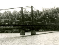
1913: Peninsula
Ngatimoti, New Zealand - Motueka River
| Bridgemeister ID: | 694 (added 2003-03-08) |
| Year Completed: | 1913 |
| Name: | Peninsula |
| Location: | Ngatimoti, New Zealand |
| Crossing: | Motueka River |
| Principals: | D.F. Whiteside |
| References: | GAP |
| Use: | Vehicular |
| Main Cables: | Wire (steel) |
| Suspended Spans: | 3 |
| Main Span: | 1 x 58.5 meters (191.9 feet) |
Notes:
- GAP: Reconstructed, 1938.
External Links:
1913: Port-na-Craig
Pitlochry and Port-na Craig, Scotland, United Kingdom - River Tummel
| Bridgemeister ID: | 547 (added before 2003) |
| Year Completed: | 1913 |
| Name: | Port-na-Craig |
| Location: | Pitlochry and Port-na Craig, Scotland, United Kingdom |
| Crossing: | River Tummel |
| Coordinates: | 56.698167 N 3.733017 W |
| Maps: | Acme, GeoHack, Google, OpenStreetMap |
| Use: | Footbridge |
| Status: | In use (last checked: 2014) |
| Main Cables: | Wire (steel) |
| Suspended Spans: | 1 |
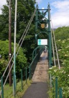
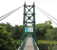
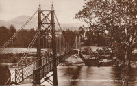
1913: South Fork Mule
Hyampom vicinity, California, USA - South Fork Trinity River
| Bridgemeister ID: | 1993 (added 2005-12-10) |
| Year Completed: | 1913 |
| Name: | South Fork Mule |
| Also Known As: | Limestairs |
| Location: | Hyampom vicinity, California, USA |
| Crossing: | South Fork Trinity River |
| At or Near Feature: | Six Rivers National Forest |
| Coordinates: | 40.719083 N 123.523217 W |
| Maps: | Acme, GeoHack, Google, OpenStreetMap |
| Use: | Footbridge |
| Status: | In use (last checked: 2013) |
| Main Cables: | Wire (steel) |
| Suspended Spans: | 1 |
Notes:
- 2006: The bridge is closed. Marilyn Renaker of the "Committee to Save the Mule Bridge" writes in late August, 2006: "Trinity County and the Forest Service would like to abandon the Mule Bridge. Hyampom had a town meeting about this and everyone was opposed to the removal of the bridge which has been a part of our community since 1913."
- 2010: Multi-year repair and reconstruction project started.
- 2013: Bridge is reopened.
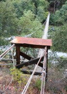
1913: Swing
Sheboygan Falls, Wisconsin, USA - Sheboygan River
| Bridgemeister ID: | 314 (added before 2003) |
| Year Completed: | 1913 |
| Name: | Swing |
| Location: | Sheboygan Falls, Wisconsin, USA |
| Crossing: | Sheboygan River |
| At or Near Feature: | River Park |
| Use: | Footbridge |
| Status: | Replaced, 1987 |
| Main Cables: | Wire (steel) |
| Suspended Spans: | 1 |
| Main Span: | 1 x 45.7 meters (150 feet) estimated |
Notes:
- Jim Lucht writes that this bridge was "Damaged beyond repair when a vehicle struck the timber tower."
- Replaced by 1987 Swing - Sheboygan Falls, Wisconsin, USA.
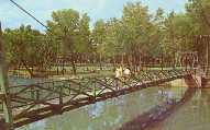
1913: Swinging
Tishomingo, Oklahoma, USA - Pennington Creek
| Bridgemeister ID: | 129 (added before 2003) |
| Year Completed: | 1913 |
| Name: | Swinging |
| Location: | Tishomingo, Oklahoma, USA |
| Crossing: | Pennington Creek |
| Principals: | Western Bridge Company |
| Use: | Vehicular |
| Status: | Destroyed |
Notes:
- The description on the back of a postcard reads: "The only remaining swinging bridge in the state of Oklahoma crossable by automobile spans beautiful Pennington Creek in Tishomingo. The guaranteed strength of the bridge is 164 tons and is located 3 blocks south of the old Chickasaw Capitol on South Capitol Avenue. The bridge was built by Western Bridge Company of Sherman, Texas and was dedicated November 28, 1913."
- Destroyed by flood.
- An article in the April 7, 1964 issue of The Ada Evening News (Oklahoma) titled "Tishomingo Acts To Save Famed Bridge": "Tishomingo's Swinging Bridge, a landmark since Territorial days, may yet be saved from the junk man. Indeed, with a little luck, it may be put back into service to carry traffic across Pennington Creek as it did in its heyday. Some 25 persons attended a regular city council meeting Monday night to urge that the bridge be repaired; and the council appointed a committee to look into the cost of such a project. "It looks favorable," Mayor Lee butler said Tuesday. "It looks like we might get it repaired." The old suspension bridge has been closed to traffic for several years. Floor planks have rotted and fallen away, and the whole structure was condemned as unsafe. The problem of financing has held the city back from repairing the ancient structure. However, Butler said the county commissioners have offered to help, and quite a few individual citizens have promised donations to assist the project. When the committee reports back on the cost, Butler said, the council will be ready to take action."
- The bridge must have been repaired in the mid-1960's and reopened. An article in the July 9, 1978 issue of The Ada Evening News (Oklahoma) titled "Repair of Tishomingo's Suspension Bridge Slated": "Work is expected to begin in the near future on the renovation of the suspension bridge here which spans Pennington Creek. The landmark structure and last swinging bridge in the state open to vehicular traffic was closed last May when city officials deemed it was 'too dangerous' to keep open due to its deteriorated state. In an effort to reopen the bridge as soon as possible, the Tishomingo City Council acted last week to approve funding for materials necessary to repair the 65-year-old structure and has arranged for participants in the Young Adult Conservation Corps camp at Sulphur to provide the manpower needed for the work. Frank Glover, head of the Tishomingo street department, said the Johnston County commissioners have also promised to aid in the repair of the bridge. Glover said he hopes the renovation will be completed this summer. He estimated materials for the work will cost the city about $5,000- $6,000. The bridge will have to be renovated from the bottom up, including the replacement of the entire wooden floor, Glover said. He said city officials are still looking for someone knowledgeable about the construction of suspension bridges to aid in the repair of the structure."
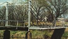
1913: Whitesville
Whitesville, West Virginia, USA - Coal River
| Bridgemeister ID: | 2142 (added 2006-11-04) |
| Year Completed: | 1913 |
| Name: | Whitesville |
| Location: | Whitesville, West Virginia, USA |
| Crossing: | Coal River |
| References: | AAJ |
| Use: | Footbridge |
| Status: | Collapsed, July 24, 1926 |
| Main Cables: | Wire |
| Main Span: | 1 x 65.2 meters (214 feet) |
| Deck width: | 5 feet |
Notes:
- Collapsed July 24, 1926 while overloaded with people watching a carnival performance. The July 25, 1926 edition of The Charleston Gazette reports the incident in an article with headline "Half Hundred Hurt When Crowded Bridge Collapses at Whitesville, Five Dead, Three More May Die" and sub-headline "Span Fall Under Weight of Hundreds Assembled to Watch Fire Fighting Event on River Bank in Connection with Carnival Celebration; Governor Gore Accompanies Physicians and Nurses on Special Relief Train from Here."
- AAJ cites an Engineering News-Record article from July 29, 1926: "Failure of the bridge was caused by the parting of the turnbuckle on the north end of the east cable. The bridge was built in 1913 and repaired in 1925."
1913: Wind River
Carson, Washington, USA - Wind River
| Bridgemeister ID: | 1005 (added 2003-11-21) |
| Year Completed: | 1913 |
| Name: | Wind River |
| Location: | Carson, Washington, USA |
| Crossing: | Wind River |
| References: | SPW |
| Use: | Vehicular (one-lane) |
| Status: | Replaced |
| Main Cables: | Wire |
| Suspended Spans: | 1 |
Notes:
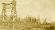
- The bridge appears identical in the two photos except for the tops of the towers. In one of the photos, it appears some protective housing has been added to cover the cable saddles and an extra brace has been added across the tower.
- Replaced by 1925 Wind River - Carson, Washington, USA.
1914: (suspension bridge)
Mangaweka vicinity, New Zealand - Rangitikei River
| Bridgemeister ID: | 697 (added 2003-03-08) |
| Year Completed: | 1914 |
| Name: | (suspension bridge) |
| Location: | Mangaweka vicinity, New Zealand |
| Crossing: | Rangitikei River |
| At or Near Feature: | 'Meeting of the Waters' |
| Coordinates: | 39.754594 S 175.835543 E |
| Maps: | Acme, GeoHack, Google, OpenStreetMap |
| Principals: | S.A.R. Mair |
| References: | GAP |
| Use: | Vehicular (one-lane) |
| Status: | Only towers remain, since 1961 (last checked: 2017) |
| Main Cables: | Wire |
| Suspended Spans: | 1 |
Notes:
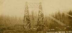
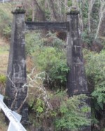
- GAP: Located at junction of Rangitikei and Hautapu rivers. Replaced, 1961, but original towers remain at the site as of 2017.
| Bridgemeister ID: | 600 (added 2003-01-11) |
| Year Completed: | 1914 |
| Name: | 98th Meridian |
| Also Known As: | Byers |
| Location: | Byers, Texas and Temple, Oklahoma, USA |
| Crossing: | Red River |
| Coordinates: | 34.124507 N 98.214251 W |
| Maps: | Acme, GeoHack, Google, OpenStreetMap |
| Principals: | Mitchell & Pigg |
| References: | AUB, HAERTX98, PTS2 |
| Use: | Vehicular |
| Status: | Destroyed, 1923 |
| Main Cables: | Wire (steel) |
| Suspended Spans: | 4 |
| Main Spans: | 3 x 172.8 meters (567 feet) |
| Side Span: | 1 x 32.6 meters (107 feet) |
Notes:
- Destroyed by tornado, 1923.
- Coordinates are the exact location of one of the remaining (as of 2020) piers of either this bridge or its replacement suspension bridge. Additional piers, south of that location, are also visible in satellite images.
- Replaced by 1923 98th Meridian (Byers) - Byers vicinity, Texas and Temple, Oklahoma, USA.
- See (suspension bridge) - Texas, USA. The 98th Meridian bridge may match this unknown "Red River" bridge photo. AUB describes the Byers bridge, "This bridge, three spans of 567' each, one side span of 107', and a 16' roadway, had originally been built in 1914."
1914: Bergheim
Bergheim, Bromma, Viken, Norway - Hallingdalselva
| Bridgemeister ID: | 4044 (added 2020-03-29) |
| Year Completed: | 1914 |
| Name: | Bergheim |
| Location: | Bergheim, Bromma, Viken, Norway |
| Crossing: | Hallingdalselva |
| Coordinates: | 60.47212 N 9.23048 E |
| Maps: | Acme, GeoHack, Google, kart.1881.no, OpenStreetMap |
| Use: | Vehicular (one-lane) |
| Status: | Replaced, 1975 |
| Main Cables: | Wire (steel) |
| Suspended Spans: | 1 |
| Main Span: | 1 x 62.5 meters (205.1 feet) estimated |
External Links:
1914: Churn Creek
Gang Ranch, British Columbia, Canada - Fraser River
| Bridgemeister ID: | 131 (added before 2003) |
| Year Completed: | 1914 |
| Name: | Churn Creek |
| Location: | Gang Ranch, British Columbia, Canada |
| Crossing: | Fraser River |
| Coordinates: | 51.527494 N 122.285082 W |
| Maps: | Acme, GeoHack, Google, OpenStreetMap |
| Principals: | Waddell & Harrington |
| References: | BPL |
| Use: | Vehicular (one-lane) |
| Status: | In use (last checked: 2018) |
| Main Cables: | Wire (steel) |
| Suspended Spans: | 1 |
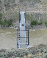
1914: Dresden
Dresden, Ohio, USA - Muskingum River
| Bridgemeister ID: | 132 (added before 2003) |
| Year Completed: | 1914 |
| Name: | Dresden |
| Location: | Dresden, Ohio, USA |
| Crossing: | Muskingum River |
| Coordinates: | 40.12079 N 82.00000 W |
| Maps: | Acme, GeoHack, Google, OpenStreetMap |
| Principals: | Bellefontaine Bridge and Steel Co. |
| References: | GBD, OCEN198202, PTS2 |
| Use: | Vehicular (one-lane) |
| Status: | Closed (last checked: 2022) |
| Main Cables: | Eyebar (steel) |
| Suspended Spans: | 2 |
| Main Span: | 1 x 135 meters (443 feet) |
| Side Span: | 1 |
Notes:
- 2022, January: Ohio Department of Transportation recommends removal of the bridge due to its deteriorating condition.
- Replaced 1853 Dresden - Dresden, Ohio, USA.
Annotated Citations:
- Hannahs, Nichole. "ODOT Recommends Removal of Suspension Bridge." WHIZ News, 25 Jan. 2022, whiznews.com/2022/01/25/odot-recommends-removal-of-suspension-bridge/
"…ODOT recommended the removal of the structure, which would cost between $1-$2 million, which would be funded by the state. Other more costly options include more than $6 million to make it structurally sound for pedestrians to walk on and over $3.5 million to rehab it and then it still couldn’t be used."
External Links:


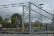
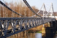
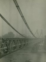
1914: Mokai
Taoroa Junction, New Zealand - Rangitikei River
| Bridgemeister ID: | 696 (added 2003-03-08) |
| Year Completed: | 1914 |
| Name: | Mokai |
| Location: | Taoroa Junction, New Zealand |
| Crossing: | Rangitikei River |
| Principals: | Joseph Dawson |
| References: | GAP |
| Use: | Vehicular (one-lane) |
| Status: | Replaced, 1963 |
| Main Cables: | Wire |
| Suspended Spans: | 1 |
| Main Span: | 1 x 77 meters (252.6 feet) |
Notes:
- GAP: Replaced, 1963, after overloaded sheep truck fell through deck.
External Links:
1914: Mountain Moon
Xiulin Township, Hualien County, Taiwan - Liwu River
| Bridgemeister ID: | 4931 (added 2020-07-31) |
| Year Completed: | 1914 |
| Name: | Mountain Moon |
| Also Known As: | 山月吊橋, Yamatsuki |
| Location: | Xiulin Township, Hualien County, Taiwan |
| Crossing: | Liwu River |
| At or Near Feature: | Taroko Gorge at Buluowan Terraces |
| Status: | Demolished, 1940-1941 |
Notes:
- Later at same location 2020 Mountain Moon (山月吊橋, Yamatsuki) - Xiulin Township, Hualien County, Taiwan.
1914: Old
Lillooet, British Columbia, Canada - Fraser River
| Bridgemeister ID: | 130 (added before 2003) |
| Year Completed: | 1914 |
| Name: | Old |
| Location: | Lillooet, British Columbia, Canada |
| Crossing: | Fraser River |
| Coordinates: | 50.711493 N 121.911333 W |
| Maps: | Acme, GeoHack, Google, OpenStreetMap |
| Principals: | Waddell & Harrington |
| References: | BPL |
| Use: | Vehicular (one-lane) |
| Status: | Restricted to foot traffic (last checked: 2015) |
| Main Cables: | Wire (steel) |
| Suspended Spans: | 1 |
| Main Span: | 1 x 121.9 meters (400 feet) estimated |
Notes:
- Known locally as "The Old Bridge."
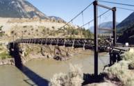
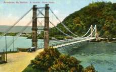
1914: Pênsil
São Vicente, Brazil
| Bridgemeister ID: | 902 (added 2003-10-11) |
| Year Completed: | 1914 |
| Name: | Pênsil |
| Also Known As: | Pensil |
| Location: | São Vicente, Brazil |
| Coordinates: | 23.974960 S 46.388756 W |
| Maps: | Acme, GeoHack, Google, OpenStreetMap |
| Use: | Vehicular (one-lane) |
| Status: | In use (last checked: 2017) |
| Main Cables: | Wire (steel) |
| Suspended Spans: | 1 |
| Main Span: | 1 x 180 meters (590.6 feet) |
External Links:
1914: Scotia-Rio Dell
Scotia and Rio Dell, California, USA - Eel River
| Bridgemeister ID: | 1150 (added 2004-01-18) |
| Year Completed: | 1914 |
| Name: | Scotia-Rio Dell |
| Location: | Scotia and Rio Dell, California, USA |
| Crossing: | Eel River |
| Use: | Vehicular (one-lane) |
| Status: | Destroyed, 1915 |
| Main Cables: | Wire |
| Suspended Spans: | 1 |
| Main Span: | 1 |
Notes:
- 1915: Destroyed by flood.
1914: Swing
Oudtshoorn, South Africa - Grobbelaarsriver
| Bridgemeister ID: | 4715 (added 2020-06-26) |
| Year Completed: | 1914 |
| Name: | Swing |
| Location: | Oudtshoorn, South Africa |
| Crossing: | Grobbelaarsriver |
| Coordinates: | 33.588007 S 22.200611 E |
| Maps: | Acme, GeoHack, Google, OpenStreetMap |
| Use: | Footbridge |
| Status: | In use (last checked: 2020) |
| Main Cables: | Wire (steel) |
| Suspended Spans: | 1 |
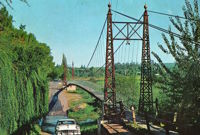
1914: Swinging
Allison, Arkansas, USA - South Sylamore Creek
| Bridgemeister ID: | 5856 (added 2021-05-15) |
| Year Completed: | 1914 |
| Name: | Swinging |
| Location: | Allison, Arkansas, USA |
| Crossing: | South Sylamore Creek |
| Coordinates: | 35.935672 N 92.121123 W |
| Maps: | Acme, GeoHack, Google, OpenStreetMap |
| Use: | Vehicular |
| Status: | Replaced, 1943 |
| Main Cables: | Wire (steel) |
| Suspended Spans: | 1 |
Notes:
- The bridge was heavily "reworked" in 1943 retaining the original main cables.
- Replaced by 1943 Swinging - Allison, Arkansas, USA.
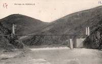
1914: Verdalle
Verdalle, Ayssenes vicinity, Aveyron, France - Tarn River
| Bridgemeister ID: | 3164 (added 2019-11-03) |
| Year Completed: | 1914 |
| Name: | Verdalle |
| Location: | Verdalle, Ayssenes vicinity, Aveyron, France |
| Crossing: | Tarn River |
| Coordinates: | 44.058557 N 2.788122 E |
| Maps: | Acme, GeoHack, Google, OpenStreetMap |
| Use: | Vehicular (one-lane) |
| Status: | In use (last checked: 2023) |
| Main Cables: | Wire |
| Suspended Spans: | 1 |
| Main Span: | 1 x 101 meters (331.4 feet) estimated |
External Links:
1915: (footbridge)
Chiwaukum vicinity, Washington, USA - Wenatchee River
| Bridgemeister ID: | 1424 (added 2004-07-18) |
| Year Completed: | 1915 |
| Name: | (footbridge) |
| Location: | Chiwaukum vicinity, Washington, USA |
| Crossing: | Wenatchee River |
| Principals: | National Forest Service |
| References: | AAJ, PTS2 |
| Use: | Footbridge |
| Main Cables: | Wire (steel) |
| Suspended Spans: | 1 |
| Main Span: | 1 x 57.9 meters (190 feet) |
1915: (suspension bridge)
Esbly and Isles-lès-Villenoy, Seine-et-Marne, France - Marne River
| Bridgemeister ID: | 8086 (added 2023-12-25) |
| Year Completed: | 1915 |
| Name: | (suspension bridge) |
| Location: | Esbly and Isles-lès-Villenoy, Seine-et-Marne, France |
| Crossing: | Marne River |
| Coordinates: | 48.911917 N 2.815222 E |
| Maps: | Acme, GeoHack, Google, OpenStreetMap |
| Status: | Removed |
| Main Cables: | Wire |
| Suspended Spans: | 1 |
Notes:
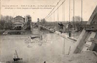
- Temporary footbridge or pipeline bridge (or both) built after the destruction of the vehicular bridge at this location during WWI in 1914. Likely in service until a replacement bridge was completed in 1922.
1915: (suspension bridge)
Landquart vicinity, Switzerland
| Bridgemeister ID: | 5675 (added 2021-02-27) |
| Year Completed: | 1915 |
| Name: | (suspension bridge) |
| Location: | Landquart vicinity, Switzerland |
| Main Cables: | Wire |
| Suspended Spans: | 1 |
External Links:
1915: Alexandrino de Alencar
Rio de Janeiro, Brazil
1915: Brown's Ford
Brown's Ford and Lowry City vicinity, Missouri, USA - Osage River
| Bridgemeister ID: | 2325 (added 2007-05-06) |
| Year Completed: | 1915 |
| Name: | Brown's Ford |
| Location: | Brown's Ford and Lowry City vicinity, Missouri, USA |
| Crossing: | Osage River |
| References: | AAJ |
| Status: | Removed |
| Main Cables: | Wire |
Notes:
- The June 22, 1940 edition of The Chillicothe Constitution-Tribune (Chillicothe, Missouri) has an article titled "Three Killed in Bridge Collapse, Workmen were repairing the structure near Lowry City, Mo." describing a fatal collapse of the bridge: "Three men were killed, three injured critically and an 8-year old boy believed drowned when cribbing on a wooden suspension bridge across the Osage River six miles east of Lowry City collapsed about 4 o'clock yesterday afternoon. The bridge, on a farm-to-market road in St. Clair County, was being remodeled. Of the ten men working and bystanders on and near the structure when it fell, only one escaped without injury. All those killed or injured lived in St. Clair County. On the west side of the bridge a framework of heavy timbers had been inserted between one of the suspension cables and an old wooden pier, which originally had supported the cable. The workmen were attempting to slide a steel pier under the cable, to replace the wooden pier. The cribbing suddenly gave way, and the pressure from the cable hurled the wood supports in all directions. The bridge floor dropped into the river, except for a small section near the east end."
1915: Deutz
Köln (Cologne), Germany - Rhine River
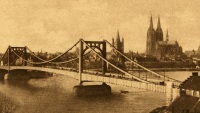
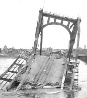
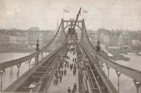
| Bridgemeister ID: | 432 (added before 2003) |
| Year Completed: | 1915 |
| Name: | Deutz |
| Also Known As: | Deutzer, Hindenburg |
| Location: | Köln (Cologne), Germany |
| Crossing: | Rhine River |
| References: | AAJ, BRU |
| Use: | Vehicular |
| Status: | Collapsed, 1945 |
| Main Cables: | Chain (steel) |
| Suspended Spans: | 3 |
| Main Span: | 1 x 184.4 meters (605 feet) |
| Side Spans: | 2 x 92.2 meters (302.5 feet) |
| Deck width: | 59.6 feet |
| Characteristics: | Self-anchored |
Notes:
- First long-span self-anchored suspension bridge.
External Links:
| Bridgemeister ID: | 4111 (added 2020-04-06) |
| Year Completed: | 1916 |
| Name: | (suspension bridge) |
| Location: | Tørdal, Drangedal, Vestfold Og Telemark, Norway |
| Crossing: | Loneelva |
| Coordinates: | 59.188715 N 8.802022 E |
| Maps: | Acme, GeoHack, Google, kart.1881.no, OpenStreetMap |
| Use: | Vehicular |
| Status: | Replaced, 1965 |
| Main Cables: | Wire |
| Suspended Spans: | 1 |
1916: Belpre-Parkersburg
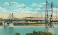
Parkersburg, West Virginia and Belpre, Ohio, USA - Ohio River
| Bridgemeister ID: | 134 (added before 2003) |
| Year Completed: | 1916 |
| Name: | Belpre-Parkersburg |
| Location: | Parkersburg, West Virginia and Belpre, Ohio, USA |
| Crossing: | Ohio River |
| Principals: | Hermann Laub |
| References: | AAJ, BPL, PTS2, SJR |
| Use: | Vehicular, with walkway |
| Status: | Demolished, March 16, 1980 |
| Main Cables: | Wire (steel) |
| Suspended Spans: | 3 |
| Main Span: | 1 x 236.2 meters (775 feet) |
| Side Spans: | 1 x 114.3 meters (375 feet), 1 x 83.8 meters (275 feet) |
| Deck width: | 22 feet |
External Links:
1916: Dewey
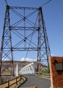
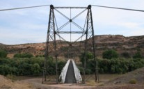
Moab vicinity, Utah, USA - Colorado River
| Bridgemeister ID: | 135 (added before 2003) |
| Year Completed: | 1916 |
| Name: | Dewey |
| Location: | Moab vicinity, Utah, USA |
| Crossing: | Colorado River |
| Coordinates: | 38.81187 N 109.30333 W |
| Maps: | Acme, GeoHack, Google, OpenStreetMap |
| Use: | Vehicular (one-lane) |
| Status: | Derelict, since April, 2008 (last checked: 2008) |
| Main Cables: | Wire (steel) |
| Suspended Spans: | 1 |
| Main Span: | 1 x 151.2 meters (496 feet) estimated |
Notes:
- Restored as footbridge, 2000.
- Deck destroyed by fire April 6, 2008. News reports stated a nearby brush fire (started by a young boy playing with matches) ignited the bridge.
External Links:
| Bridgemeister ID: | 4575 (added 2020-06-03) |
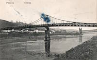
| Year Completed: | 1916 |
| Name: | Innsteg |
| Also Known As: | Hindenburg, Fünferlsteg |
| Location: | Passau, Germany |
| Crossing: | Inn River |
| Coordinates: | 48.569943 N 13.459694 E |
| Maps: | Acme, GeoHack, Google, OpenStreetMap |
| Use: | Footbridge |
| Status: | In use (last checked: 2019) |
| Main Cables: | Riveted plate |
| Suspended Spans: | 3 |
| Main Span: | 1 x 75.25 meters (246.9 feet) estimated |
| Side Spans: | 2 |
External Links:
1916: Katsuyama
Japan
1916: Mino
Mino, Gifu, Japan - Nagara River
| Bridgemeister ID: | 7908 (added 2023-10-21) |
| Year Completed: | 1916 |
| Name: | Mino |
| Also Known As: | 美濃橋 |
| Location: | Mino, Gifu, Japan |
| Crossing: | Nagara River |
| Coordinates: | 35.552417 N 136.910267 E |
| Maps: | Acme, GeoHack, Google, OpenStreetMap |
| Use: | Vehicular (one-lane) |
| Status: | Restricted to foot traffic, since c. 1960s (last checked: 2023) |
| Main Cables: | Wire (steel) |
| Suspended Spans: | 1 |
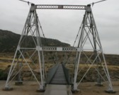
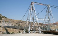
1916: Swinging
Thermopolis, Wyoming, USA - Big Horn River
| Bridgemeister ID: | 301 (added before 2003) |
| Year Completed: | 1916 |
| Name: | Swinging |
| Location: | Thermopolis, Wyoming, USA |
| Crossing: | Big Horn River |
| At or Near Feature: | Hot Springs State Park |
| Coordinates: | 43.654733 N 108.196167 W |
| Maps: | Acme, GeoHack, Google, OpenStreetMap |
| Use: | Footbridge |
| Status: | In use (last checked: 2006) |
| Main Cables: | Wire (steel) |
| Suspended Spans: | 2 |
| Main Span: | 1 x 58.8 meters (193 feet) estimated |
| Side Span: | 1 x 10.7 meters (35 feet) estimated |
Notes:
- According to sign at the bridge: condemned 1984, removed 1991, restored 1992.
External Links:

1916: Te Koura
Okahukura vicinity, New Zealand - Ongarue River
| Bridgemeister ID: | 718 (added 2003-03-08) |
| Year Completed: | 1916 |
| Name: | Te Koura |
| Location: | Okahukura vicinity, New Zealand |
| Crossing: | Ongarue River |
| References: | GAP |
| Use: | Footbridge |
| Status: | Derelict |
| Main Cables: | Wire |
| Suspended Spans: | 1 |
External Links:
1917: (suspension bridge)
Skhirat, Rabat vicinity, Morocco - Oued Cherrat
| Bridgemeister ID: | 529 (added before 2003) |
| Year Completed: | 1917 |
| Name: | (suspension bridge) |
| Location: | Skhirat, Rabat vicinity, Morocco |
| Crossing: | Oued Cherrat |
| Coordinates: | 33.814930 N 7.110061 W |
| Maps: | Acme, GeoHack, Google, OpenStreetMap |
| References: | BC3 |
| Use: | Vehicular |
| Status: | In use (last checked: 2019) |
| Main Cables: | Wire |
| Suspended Spans: | 1 |
| Main Span: | 1 x 102.4 meters (336 feet) |
External Links:
1917: Alderpoint
Alderpoint, California, USA - North Fork Eel River
| Bridgemeister ID: | 2232 (added 2007-03-19) |
| Year Completed: | 1917 |
| Name: | Alderpoint |
| Location: | Alderpoint, California, USA |
| Crossing: | North Fork Eel River |
| Coordinates: | 40.173364 N 123.603832 W |
| Maps: | Acme, GeoHack, Google, OpenStreetMap |
| Use: | Vehicular (one-lane) |
| Status: | Demolished, November, 1972 |
| Main Cables: | Wire (steel) |
| Suspended Spans: | 1 |
Notes:
- The Sunday November 5, 1972 edition of The Times Standard (Eureka, California) has three photos of the bridge collapsing. The caption is "Old Alderpoint Bridge Crashes into River." It continues: "Cables, securing the old Alderpoint Bridge across the North Fork of the Eel River, were cut Friday to send the structure splashing to the feet of the new concrete span that is replacing it. The $1-million new bridge was dedicated Saturday. The old suspension bridge was constructed in 1917."
- Coordinates are for the present-day (2021) bridge at this location. The suspension bridge was immediately adjacent.
1917: Bolombolo
Bolombolo, Colombia - Cauca River
| Bridgemeister ID: | 433 (added before 2003) |
| Year Completed: | 1917 |
| Name: | Bolombolo |
| Location: | Bolombolo, Colombia |
| Crossing: | Cauca River |
| Coordinates: | 5.967033 N 75.843217 W |
| Maps: | Acme, GeoHack, Google, OpenStreetMap |
| References: | USS |
| Use: | Vehicular (two-lane) |
| Status: | In use (last checked: 2015) |
| Main Cables: | Wire (steel) |
| Suspended Spans: | 1 |
| Main Span: | 1 x 118.9 meters (390 feet) |
| Deck width: | 10 feet |
External Links:
1917: Maoribank
Maoribank, Upper Hutt, New Zealand - Te Awa Kairangi / Hutt River
| Bridgemeister ID: | 699 (added 2003-03-08) |
| Year Completed: | 1917 |
| Name: | Maoribank |
| Also Known As: | Whiteman's |
| Location: | Maoribank, Upper Hutt, New Zealand |
| Crossing: | Te Awa Kairangi / Hutt River |
| Principals: | Joseph Dawson |
| References: | GAP |
| Use: | Vehicular (one-lane) |
| Status: | Collapsed, September 14, 1988 |
| Main Cables: | Wire (steel) |
| Suspended Spans: | 1 |
Notes:
- 1988, September 14: Collapsed due to flood.
External Links:
1917: Morrison
Morrison vicinity, Oklahoma, USA - Black Bear Creek
| Bridgemeister ID: | 2238 (added 2007-03-24) |
| Year Completed: | 1917 |
| Name: | Morrison |
| Location: | Morrison vicinity, Oklahoma, USA |
| Crossing: | Black Bear Creek |
| Coordinates: | 36.30811 N 96.95164 W |
| Maps: | Acme, GeoHack, Google, OpenStreetMap |
| Principals: | N.H. Sturgis |
| Use: | Vehicular (one-lane) |
| Status: | Removed |
| Main Cables: | Wire |
1917: Rio Chiriquí
Panama - Rio Chiriquí
| Bridgemeister ID: | 1425 (added 2004-07-18) |
| Year Completed: | 1917 |
| Name: | Rio Chiriquí |
| Location: | Panama |
| Crossing: | Rio Chiriquí |
| Principals: | A. S. Zinn |
| References: | AAJ, PTS2 |
| Use: | Vehicular |
| Main Cables: | Wire (steel) |
| Suspended Spans: | 1 |
| Main Span: | 1 x 125 meters (410 feet) |
| Deck width: | 7.7 feet |
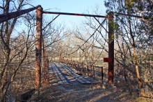
1917: Rock Church
Tolar vicinity, Hood County, Texas, USA - Paluxy River
| Bridgemeister ID: | 136 (added before 2003) |
| Year Completed: | 1917 |
| Name: | Rock Church |
| Location: | Tolar vicinity, Hood County, Texas, USA |
| Crossing: | Paluxy River |
| Coordinates: | 32.301402 N 97.957657 W |
| Maps: | Acme, GeoHack, Google, OpenStreetMap |
| References: | HAERTX98 |
| Use: | Vehicular (one-lane) |
| Status: | Extant (last checked: 2018) |
| Main Cables: | Wire |
| Suspended Spans: | 1 |
External Links:
1917: Schulweg
Hamm, North Rhine-Westphalia, Germany - Datteln-Hamm Canal
| Bridgemeister ID: | 1948 (added 2005-11-04) |
| Year Completed: | 1917 |
| Name: | Schulweg |
| Location: | Hamm, North Rhine-Westphalia, Germany |
| Crossing: | Datteln-Hamm Canal |
| Coordinates: | 51.694985 N 7.870143 E |
| Maps: | Acme, GeoHack, Google, OpenStreetMap |
| Use: | Footbridge |
| Status: | In use (last checked: 2018) |
| Main Cables: | Wire |
| Suspended Spans: | 3 |
| Main Span: | 1 |
| Side Spans: | 2 |
External Links:
| Bridgemeister ID: | 595 (added 2003-01-11) |
| Year Completed: | 1917 |
| Name: | Terral-Ringgold |
| Location: | Ringgold, Texas and Terral, Oklahoma, USA |
| Crossing: | Red River |
| Coordinates: | 33.878143 N 97.934776 W |
| Maps: | Acme, GeoHack, Google, OpenStreetMap |
| References: | AUB, PTS2 |
| Use: | Vehicular |
| Status: | Removed |
| Main Cables: | Wire |
| Suspended Spans: | 5 |
| Main Spans: | 3 x 137.2 meters (450 feet) |
| Side Spans: | 2 |
Notes:
- 1931: Replacement opened.
1917: Thusis
Thusis, Switzerland - Hinterrhein River
| Bridgemeister ID: | 3634 (added 2020-01-01) |
| Year Completed: | 1917 |
| Name: | Thusis |
| Location: | Thusis, Switzerland |
| Crossing: | Hinterrhein River |
| Coordinates: | 46.701886 N 9.446884 E |
| Maps: | Acme, GeoHack, Google, OpenStreetMap |
| Use: | Footbridge |
| Status: | In use (last checked: 2022) |
| Main Cables: | Wire |
| Suspended Spans: | 1 |
| Main Span: | 1 |
External Links:
1918: (footbridge)
Wakefield vicinity, New Zealand - Dove River
| Bridgemeister ID: | 700 (added 2003-03-08) |
| Year Completed: | 1918 |
| Name: | (footbridge) |
| Location: | Wakefield vicinity, New Zealand |
| Crossing: | Dove River |
| References: | GAP |
| Use: | Footbridge |
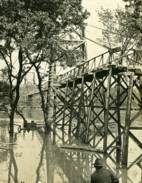
1918: Camp Sherman
Chillicothe, Ohio, USA - Scioto River
| Bridgemeister ID: | 4956 (added 2020-08-08) |
| Year Completed: | 1918 |
| Name: | Camp Sherman |
| Location: | Chillicothe, Ohio, USA |
| Crossing: | Scioto River |
| Principals: | U.S. Army |
| Status: | Removed |
| Main Cables: | Wire (steel) |
| Suspended Spans: | 1 |
| Main Span: | 1 |
Notes:
- Provided access to the Camp Sherman rifle range which sat across the Scioto River from the main part of the campl.
- From an article "Came the False Armistice but Weary Soldiers Unaware” in the September 7, 1968 edition of the Xenia Daily Gazette: "The firing range at old Camp Sherman during World War 1 was a long march from camp to the base of historic Mt. Logan. It was reached by way of a narrow suspension bridge which swayed sickeningly to the measured tempo of the marching soldiers and was an experience in itself."
External Links:
1918: Ookui
Yamaura, Komoro City, Nagano, Japan - Chikuma River
| Bridgemeister ID: | 6958 (added 2022-02-19) |
| Year Completed: | 1918 |
| Name: | Ookui |
| Also Known As: | Ookui-bashi, 大杭橋 |
| Location: | Yamaura, Komoro City, Nagano, Japan |
| Crossing: | Chikuma River |
| Coordinates: | 36.302159 N 138.422041 E |
| Maps: | Acme, GeoHack, Google, OpenStreetMap |
| Use: | Vehicular |
| Status: | Derelict (last checked: 2022) |
| Main Cables: | Wire (steel) |
| Suspended Spans: | 1 |
| Main Span: | 1 x 50 meters (164 feet) estimated |
Notes:
- 2019: Heavily damaged by typhoon. Appears to have already been closed to all traffic prior.
1918: Opiki Toll
Rangitane, New Zealand - Manawatu River
| Bridgemeister ID: | 698 (added 2003-03-08) |
| Year Completed: | 1918 |
| Name: | Opiki Toll |
| Also Known As: | Akers Toll |
| Location: | Rangitane, New Zealand |
| Crossing: | Manawatu River |
| Coordinates: | 40.431841 S 175.468575 E |
| Maps: | Acme, GeoHack, Google, OpenStreetMap |
| Principals: | Joseph Dawson |
| References: | AAJ, GAP, PTS2 |
| Use: | Vehicular |
| Status: | Derelict (last checked: 2024) |
| Main Cables: | Wire (steel) |
| Main Span: | 1 |
Notes:
- 1969: Bypassed.
- 2023, September: After many years of the main cables and suspenders hanging with no deck, one of the main cables collapsed.
- 2024, March: The collapsed main cable is raised back into position. The bridge, however, is still a just derelict monument with no deck.
External Links:
- ‘Iconic’ Ōpiki Bridge partly collapses in Manawatū River - nzherald.co.nz. Article regarding the September 2023 main cable collapse.
| Bridgemeister ID: | 4084 (added 2020-04-04) |
| Year Completed: | 1918 |
| Name: | Rånåsfoss |
| Location: | Rånåsfoss, Viken, Norway |
| Crossing: | Glomma |
| Coordinates: | 60.030429 N 11.329303 E |
| Maps: | Acme, GeoHack, Google, kart.1881.no, OpenStreetMap |
| Use: | Vehicular (one-lane) |
| Status: | Replaced |
| Main Cables: | Wire (steel) |
| Main Span: | 1 x 184 meters (603.7 feet) estimated |
Notes:
- Patrick S. O'Donnell notes: "This bridge was built in 1918 as a provisional suspension bridge to facilitate the construction of the dam a little less than a half kilometer downstream. Then it was built over and transformed into the 1927 Rånåsfoss bridge. It appears everything of the original bridge was replaced or new, except the lattice towers which in effect became rebar and are now encased in concrete. New anchorage pits were dug and new anchor eyebars placed within to accept the new main cables."
- Replaced by 1927 Rånåsfoss - Rånåsfoss, Viken, Norway.
External Links:
1918: Swinging
Old Hickory, Nashville and Goodlettsville, Nashville, Tennessee, USA - Cumberland River
| Bridgemeister ID: | 587 (added 2003-01-05) |
| Year Completed: | 1918 |
| Name: | Swinging |
| Location: | Old Hickory, Nashville and Goodlettsville, Nashville, Tennessee, USA |
| Crossing: | Cumberland River |
| At or Near Feature: | Hadley Bend |
| Coordinates: | 36.289002 N 86.685355 W |
| Maps: | Acme, GeoHack, Google, OpenStreetMap |
| Principals: | William G. Grove, American Bridge Co. |
| References: | AAJ, PTS2 |
| Use: | Vehicular (one-lane) |
| Status: | Removed |
| Main Cables: | Wire (steel) |
| Suspended Spans: | 1 |
| Main Span: | 1 x 164.6 meters (540 feet) |
| Deck width: | 8 feet |
Notes:
- Coordinates provided are approximate based on current-day (2021) location of Swinging Bridge Road.
External Links:
- Bridgehunter.com | Old Hickory Suspension Bridge
- DuPont High School Alumni Association - The Swinging Bridge. According to the description in this article provided by Old Hickory Branch Library this large bridge had a 540-foot main span and was used for vehicular traffic. "The suspension bridge... Was diverted from its original destination in South America because of the urgency of the war effort. It was built for pedestrian traffic and used only for that purpose at first... Upon determination that the bridge was capable of handling light traffic, a flagman was stationed at each end of the bridge on a 24-hour-a-day basis and cars began using the one-lane span." Kris Brummett adds: "The 540 foot span had no supports to prevent sideways movement and literally swayed back and forth. The bridge was used until 1929."
1918: Turkey Run State Park
Parke County, Indiana, USA - Sugar Creek
| Bridgemeister ID: | 269 (added before 2003) |
| Year Completed: | 1918 |
| Name: | Turkey Run State Park |
| Location: | Parke County, Indiana, USA |
| Crossing: | Sugar Creek |
| At or Near Feature: | Turkey Run State Park |
| Coordinates: | 39.88926 N 87.19948 W |
| Maps: | Acme, GeoHack, Google, OpenStreetMap |
| References: | IMB |
| Use: | Footbridge |
| Status: | In use (last checked: 2021) |
| Main Cables: | Wire (steel) |
| Suspended Spans: | 1 |
| Main Span: | 1 x 58.5 meters (192 feet) estimated |
Notes:
- IMB states, "The original bridge collapsed into Sugar Creek in 1917... the state's Department of Natural Resources promptly replaced the old with current structure."
- James Rader writes in 2008: "Three years ago flooding came up high enough to allow a couple of uprooted Sycamore trees to hit the bridge ripping out a large section of the wood railing and flooring from the middle of the bridge. Bridge was immediately closed. Structural analysis was completed and repairs were made including all new floor planks. Bridge is in great condition and should serve for many many more years to come."
External Links:
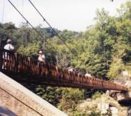
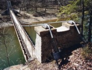
1919: Beebe
Beebe and Chelan, Washington, USA - Columbia River
| Bridgemeister ID: | 1188 (added 2004-01-24) |
| Year Completed: | 1919 |
| Name: | Beebe |
| Location: | Beebe and Chelan, Washington, USA |
| Crossing: | Columbia River |
| Coordinates: | 47.81308 N 119.97245 W |
| Maps: | Acme, GeoHack, Google, OpenStreetMap |
| Principals: | A. Munster, Wenatchee-Beebe Orchard Co. |
| References: | AAJ, PTS2, SPW |
| Use: | Pipeline and Vehicular |
| Status: | Only towers remain, since 1963 (last checked: 2022) |
| Main Cables: | Wire (steel) |
| Suspended Spans: | 1 |
| Main Span: | 1 x 192.6 meters (632 feet) |
| Deck width: | 12 feet |
Notes:
- The towers are still standing next to the current US97 crossing at Beebe.
- AAJ: Private bridge, built primarily to carry water to the owner's orchard, but also carried a roadway.
External Links:
- The Beebe Bridge | Empire Press | wenatcheeworld.com. Article about the history of the bridge.
- Structurae - Structure ID 20052092
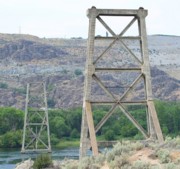
1919: Boyacá
Irra, Colombia - Cauca River
| Bridgemeister ID: | 2019 (added 2006-01-14) |
| Year Completed: | 1919 |
| Name: | Boyacá |
| Also Known As: | Irra |
| Location: | Irra, Colombia |
| Crossing: | Cauca River |
| Status: | Removed |
| Suspended Spans: | 1 |
| Main Span: | 1 x 120 meters (393.7 feet) |
1919: Coon Box Fork
Lorman, Fayette vicinity, Mississippi, USA - Shankstown Creek
| Bridgemeister ID: | 6426 (added 2021-08-10) |
| Year Completed: | 1919 |
| Name: | Coon Box Fork |
| Location: | Lorman, Fayette vicinity, Mississippi, USA |
| Crossing: | Shankstown Creek |
| Coordinates: | 31.789613 N 91.068857 W |
| Maps: | Acme, GeoHack, Google, OpenStreetMap |
| Principals: | Schuster and Jacob, Robert Taylor |
| Use: | Vehicular (one-lane) |
| Status: | Destroyed, 1990 |
| Main Cables: | Wire (steel) |
| Suspended Spans: | 3 |
| Main Span: | 1 |
| Side Spans: | 2 |
Notes:
- Some sources suggest the bridge survived until 2010, but this appears to be unlikely. Coordinates provided are for the current Shankstown Creek crossing of Coon Box Road. The suspension bridge may have been on a slightly different alignment.
- 1927: Repaired by W.H. Groome and Son incorporating an improved anchoring system.
External Links:
- MDAH Historic Resources Inventory Fact Sheet - Coon Box Fork Suspension Bridge. Photographs available here suggest remnants of the bridge are visible in the creek.
- NPGallery Asset Detail - Coon Box Fork Bridge. National Register of Historic Places site survey. Presents a brief history of the bridge, but perhaps confuses the matter of its location. States: "Swinging suspension bridge and county road right-of-way along Coon Box Road where the said bridge crosses North Fork Coles Creek." Current-day (2021) Coon Box Road crosses Shankstown Creek near North Fork Coles Creek, but never crosses North Fork Coles Creek. Historic maps of the area place the mid-1900s Shankstown Creek crossing of Coon Box Fork at roughly the same location as the current crossing (the coordinates provided in this record). Looking at historic satellite images of the location, the suspension bridge was probably on an alignment no more than 100 feet north of the current Coon Box Road Shankstown Creek bridge.
1919: Gordon
Gordon, New South Wales, Australia - Stony Creek
| Bridgemeister ID: | 8163 (added 2024-02-03) |
| Year Completed: | 1919 |
| Name: | Gordon |
| Location: | Gordon, New South Wales, Australia |
| Crossing: | Stony Creek |
| Coordinates: | 33.750472 S 151.156917 E |
| Maps: | Acme, GeoHack, Google, OpenStreetMap |
| Use: | Footbridge |
| Status: | Removed |
| Main Cables: | Wire |
| Main Span: | 1 x 67.1 meters (220 feet) |
External Links:
- 23 Jun 1919 - GORDON SUSPENSION BRIDGE. - Trove. Article from The Sydney Morning Herald dated Monday June 23 1919 titled "Gordon Suspension Bridge" regarding the grand opening of the bridge. The article indicates the bridge was on the alignment of Rosedale Road over Stony Creek.
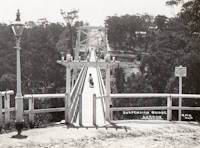
1919: Hansen
Twin Falls vicinity, Idaho, USA - Snake River
| Bridgemeister ID: | 334 (added before 2003) |
| Year Completed: | 1919 |
| Name: | Hansen |
| Location: | Twin Falls vicinity, Idaho, USA |
| Crossing: | Snake River |
| Principals: | Freygang and Trocon |
| References: | AAJ, PTS2 |
| Use: | Vehicular (two-lane) |
| Status: | Replaced, 1966 |
| Main Cables: | Wire (steel) |
| Suspended Spans: | 1 |
| Main Span: | 1 x 185.3 meters (608 feet) |
| Deck width: | 17 feet |
External Links:
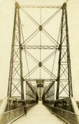
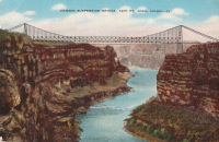
1919: Morgan's
Parinui, Manawatu-Wanganui, New Zealand - Mangapurua Stream
| Bridgemeister ID: | 7655 (added 2023-06-10) |
| Year Completed: | 1919 |
| Name: | Morgan's |
| Location: | Parinui, Manawatu-Wanganui, New Zealand |
| Crossing: | Mangapurua Stream |
| At or Near Feature: | Bridge to Nowhere Walk |
| Coordinates: | 39.270940 S 174.972349 E |
| Maps: | Acme, GeoHack, Google, OpenStreetMap |
| Status: | Derelict, since c. 1930s |
| Main Cables: | Wire |
| Main Span: | 1 |
Notes:
- 2022: Remnants are still visible adjacent to its replacement concrete deck arch bridge (1936) known as the "Bridge to Nowhere".
External Links:
1919: Parys
Parys, South Africa - Vaal River
| Bridgemeister ID: | 2900 (added 2019-09-13) |
| Year Completed: | 1919 |
| Name: | Parys |
| Location: | Parys, South Africa |
| Crossing: | Vaal River |
| Coordinates: | 26.894181 S 27.457217 E |
| Maps: | Acme, GeoHack, Google, OpenStreetMap |
| Use: | Footbridge |
| Status: | In use (last checked: 2019) |
| Main Cables: | Wire (steel) |
| Suspended Spans: | 3 |
| Main Span: | 1 |
| Side Spans: | 2 |
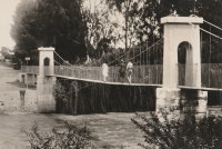
1920: (footbridge)
Follebu, Innlandet, Norway
| Bridgemeister ID: | 1564 (added 2004-11-27) |
| Year Completed: | 1920 |
| Name: | (footbridge) |
| Location: | Follebu, Innlandet, Norway |
| Coordinates: | 61.2153 N 10.269267 E |
| Maps: | Acme, GeoHack, Google, kart.1881.no, OpenStreetMap |
| Use: | Footbridge |
| Status: | In use (last checked: 2004) |
| Main Cables: | Wire |
Notes:
- Restored, 1977 and 1995.
1920: (suspension bridge)
Petrolia vicinity, California, USA - Mattole River
| Bridgemeister ID: | 4932 (added 2020-08-01) |
| Year Completed: | 1920 |
| Name: | (suspension bridge) |
| Location: | Petrolia vicinity, California, USA |
| Crossing: | Mattole River |
| Coordinates: | 40.276827 N 124.242913 W |
| Maps: | Acme, GeoHack, Google, OpenStreetMap |
| Use: | Vehicular |
| Status: | Replaced, 1974 |
| Main Cables: | Wire (steel) |
Notes:
- The June 29, 1974 edition of The Times-Standard of Eureka, California ran an article "Petrolia plans dedication" describing a new bridge dedicated to Elwyn "Ole" Lindley located 4.6 miles east of Petrolia: "the new re-enforced concrete girder with four bays replaced an old cable suspension bridge built in 1920." There is no other mention of the suspension bridge in the article. The location indicated by the coordinates given here is the location of the present day (2020) Lindley bridge crossing the Mattole River. It is unclear if this was the same Petrolia-area suspension bridge dismantled in 1962.
- See (suspension bridge) - Petrolia, California, USA. This entry may represent the same bridge.
1920: Alves Lima
Irapé, Chavantes, São Paulo and Ribeirão Claro, Paraná, Brazil - Paranapanema River
| Bridgemeister ID: | 3887 (added 2020-03-13) |
| Year Completed: | 1920 |
| Name: | Alves Lima |
| Also Known As: | Pênsil |
| Location: | Irapé, Chavantes, São Paulo and Ribeirão Claro, Paraná, Brazil |
| Crossing: | Paranapanema River |
| Coordinates: | 23.098928 S 49.742944 W |
| Maps: | Acme, GeoHack, Google, OpenStreetMap |
| Status: | Closed, c. November 2020 (last checked: 2021) |
| Main Cables: | Wire (steel) |
| Suspended Spans: | 1 |
Notes:
- 2020, November: Heavily damaged by fire. Closed indefinitely.
1920: Colgante
Rio Grande, Tierra del Fuego, Argentina - Rio Grande
| Bridgemeister ID: | 3366 (added 2019-12-21) |
| Year Completed: | 1920 |
| Name: | Colgante |
| Location: | Rio Grande, Tierra del Fuego, Argentina |
| Crossing: | Rio Grande |
| Coordinates: | 53.835799 S 67.792507 W |
| Maps: | Acme, GeoHack, Google, OpenStreetMap |
| Use: | Vehicular (one-lane) |
| Status: | Derelict, since December 13, 2010 (last checked: 2014) |
| Main Cables: | Wire (steel) |
| Suspended Spans: | 1 |
Notes:
- 2010, December 13: Wrecked by wind.
External Links:
- Hoy se cumplen 11 años de la caída del histórico puente colgante - Río Grande | Minuto Fueguino - Noticias de Tierra del Fuego AIAS. Detailed history of the bridge with many photos.
1920: Double
Forks of Coal, Alum Creek vicinity, West Virginia, USA - Little Coal River
| Bridgemeister ID: | 2121 (added 2006-09-17) |
| Year Completed: | 1920 |
| Name: | Double |
| Location: | Forks of Coal, Alum Creek vicinity, West Virginia, USA |
| Crossing: | Little Coal River |
| Coordinates: | 38.27243 N 81.80020 W |
| Maps: | Acme, GeoHack, Google, OpenStreetMap |
| Principals: | Oregonia Bridge Co. |
| Use: | Footbridge |
| Status: | Closed (last checked: February 2011) |
| Main Cables: | Wire (steel) |
| Main Span: | 1 x 45.7 meters (150 feet) estimated |
| Side Spans: | 1 x 15.5 meters (51 feet) estimated, 1 x 17.7 meters (58 feet) estimated |
Notes:
- The two Double Forks of Coal bridges were found to be barricaded in February 2011.
- Connects to 1920 Double - Forks of Coal, Alum Creek vicinity, West Virginia, USA. There are two bridges at this location, known collectively as "Double Bridges," spanning each fork of the Coal River at Forks of Coal.
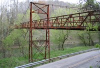
1920: Double
Forks of Coal, Alum Creek vicinity, West Virginia, USA - Big Coal River
| Bridgemeister ID: | 2122 (added 2006-09-17) |
| Year Completed: | 1920 |
| Name: | Double |
| Location: | Forks of Coal, Alum Creek vicinity, West Virginia, USA |
| Crossing: | Big Coal River |
| Coordinates: | 38.27248 N 81.79935 W |
| Maps: | Acme, GeoHack, Google, OpenStreetMap |
| Principals: | Oregonia Bridge Co. |
| Use: | Footbridge |
| Status: | Closed (last checked: February 2011) |
| Main Cables: | Wire (steel) |
| Suspended Spans: | 3 |
| Main Span: | 1 x 61 meters (200 feet) estimated |
| Side Spans: | 1 x 27.7 meters (91 feet), 1 x 21.3 meters (70 feet) |
Notes:
- The two Double Forks of Coal bridges were found to be barricaded in February 2011.
- Connects to 1920 Double - Forks of Coal, Alum Creek vicinity, West Virginia, USA. There are two bridges at this location, known collectively as "Double Bridges," spanning each fork of the Coal River at Forks of Coal.
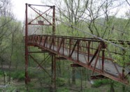
1920: Fort Seward
Fort Seward, California, USA - Eel River
| Bridgemeister ID: | 5671 (added 2021-01-30) |
| Year Completed: | 1920 |
| Name: | Fort Seward |
| Location: | Fort Seward, California, USA |
| Crossing: | Eel River |
| Coordinates: | 40.227599 N 123.646996 W |
| Maps: | Acme, GeoHack, Google, OpenStreetMap |
| Use: | Vehicular (one-lane) |
| Status: | Removed |
| Main Cables: | Wire (steel) |
External Links:
1920: Hyde Park Walking
Hyde Park and Leechburg, Pennsylvania, USA - Kiskiminetas River
| Bridgemeister ID: | 5842 (added 2021-05-13) |
| Year Completed: | 1920 |
| Name: | Hyde Park Walking |
| Location: | Hyde Park and Leechburg, Pennsylvania, USA |
| Crossing: | Kiskiminetas River |
| Coordinates: | 40.627771 N 79.597369 W |
| Maps: | Acme, GeoHack, Google, OpenStreetMap |
| Principals: | John A. Roebling's Sons |
| Use: | Footbridge |
| Status: | Destroyed, March 17, 1936 |
| Main Cables: | Wire (steel) |
| Suspended Spans: | 3 |
| Main Spans: | 3 |
Notes:
- Destroyed by flood, March 17, 1936.
- Replaced by 1937 Hyde Park Walking - Hyde Park and Leechburg, Pennsylvania, USA. The replacement was constructed based on the John A. Roebling's Sons plans from the first bridge.
1920: Jøssundbrua
Jøssund, Ørland, Trøndelag, Norway - Jøssundstraumen
| Bridgemeister ID: | 4466 (added 2020-04-26) |
| Year Completed: | 1920 |
| Name: | Jøssundbrua |
| Location: | Jøssund, Ørland, Trøndelag, Norway |
| Crossing: | Jøssundstraumen |
| Coordinates: | 63.842912 N 9.811104 E |
| Maps: | Acme, GeoHack, Google, kart.1881.no, OpenStreetMap |
| Use: | Vehicular (one-lane) |
| Status: | Removed |
| Main Cables: | Wire |
| Suspended Spans: | 1 |
| Main Span: | 1 x 44 meters (144.4 feet) estimated |
External Links:
1920: Kaibab Trail
Grand Canyon National Park, Arizona, USA - Colorado River
| Bridgemeister ID: | 2186 (added 2007-01-15) |
| Year Completed: | 1920 |
| Name: | Kaibab Trail |
| Location: | Grand Canyon National Park, Arizona, USA |
| Crossing: | Colorado River |
| Principals: | George C. Goodwin |
| References: | AAJ |
| Use: | Footbridge |
| Status: | Replaced, 1928 |
| Main Cables: | Wire |
| Suspended Spans: | 1 |
Notes:
- Replaced by 1928 Kaibab Trail (Black, South Kaibab) - Bright Angel Campground vicinity, Arizona, USA.
External Links:
1920: Lacy's
New Zealand - Retaruke River
| Bridgemeister ID: | 701 (added 2003-03-08) |
| Year Completed: | 1920 |
| Name: | Lacy's |
| Location: | New Zealand |
| Crossing: | Retaruke River |
| References: | GAP |
| Use: | Footbridge |
| Status: | Replaced |
Notes:
- GAP: Possibly completed 1915-1916.
- Replaced by 1932 Lacy's - Retaruke, New Zealand.
1920: Les Andelys
Les Andelys, Eure, France - Seine River
| Bridgemeister ID: | 1597 (added 2005-02-06) |
| Year Completed: | 1920 |
| Name: | Les Andelys |
| Location: | Les Andelys, Eure, France |
| Crossing: | Seine River |
| Coordinates: | 49.236737 N 1.399657 E |
| Maps: | Acme, GeoHack, Google, OpenStreetMap |
| Principals: | Ferdinand Arnodin |
| Use: | Vehicular |
| Status: | Demolished, June 9, 1940 |
| Main Cables: | Wire (steel) |
| Suspended Spans: | 1 |
Notes:
- Completed in 1914 but not opened until 1920.
- The present-day Les Andelys bridge appears to have been constructed on the same piers as this predecessor.
- Demolished in June 1940 by the French army to slow advancing German troops during WWII.
- At former location of 1838 Les Andelys - Les Andelys, Eure, France. The 1920 bridge was not an immediate replacement. A stone arch bridge replaced the 1838 suspension bridge destroyed in 1870. The arch bridge was replaced by this (1920) suspension bridge.
- Replaced by 1947 Les Andelys - Les Andelys, Eure, France.
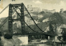
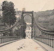
1920: Old Hill Place
Fayette vicinity, Mississippi, USA - Coles Creek South Fork
| Bridgemeister ID: | 137 (added before 2003) |
| Year Completed: | 1920 |
| Name: | Old Hill Place |
| Location: | Fayette vicinity, Mississippi, USA |
| Crossing: | Coles Creek South Fork |
| Coordinates: | 31.669433 N 91.180917 W |
| Maps: | Acme, GeoHack, Google, OpenStreetMap |
| References: | GBD |
| Use: | Vehicular (one-lane) |
| Status: | Derelict (last checked: 2005) |
| Main Cables: | Wire (steel) |
External Links:
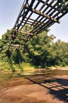
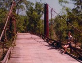
1920: Reeth Swing
Reeth vicinity, Swaledale, England, United Kingdom - River Swale
| Bridgemeister ID: | 807 (added 2003-03-30) |
| Year Completed: | 1920 |
| Name: | Reeth Swing |
| Location: | Reeth vicinity, Swaledale, England, United Kingdom |
| Crossing: | River Swale |
| Coordinates: | 54.385673 N 1.952474 W |
| Maps: | Acme, GeoHack, Google, OpenStreetMap |
| Principals: | J. Hird |
| Use: | Footbridge |
| Status: | In use (last checked: 2014) |
| Main Cables: | Wire |
| Suspended Spans: | 1 |
Notes:
- Destroyed by flood, rebuilt in 2002.
External Links:
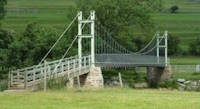
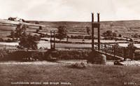
1920: Swinging
Millersburg, Pennsylvania, USA - Wiconisco Creek
| Bridgemeister ID: | 1924 (added 2005-10-23) |
| Year Completed: | 1920 |
| Name: | Swinging |
| Location: | Millersburg, Pennsylvania, USA |
| Crossing: | Wiconisco Creek |
| Use: | Footbridge |
| Status: | Destroyed, 1972 |
Notes:
- Destroyed by Hurricane Agnes, June 22, 1972.
- Replaced by 1996 Swinging - Millersburg, Pennsylvania, USA.
1921: (footbridge)
Oregon City and West Linn, Oregon, USA - Willamette River
| Bridgemeister ID: | 4954 (added 2020-08-08) |
| Year Completed: | 1921 |
| Name: | (footbridge) |
| Location: | Oregon City and West Linn, Oregon, USA |
| Crossing: | Willamette River |
| Use: | Footbridge |
| Status: | Removed, 1922 |
| Main Cables: | Wire (steel) |
Notes:
- See 1888 Oregon City - Oregon City and West Linn, Oregon, USA. The 1921 structure appears to have been a temporary, but large, footbridge constructed during the construction of the replacement of the older Oregon City suspension bridge.
External Links:
1921: Amposta
Amposta, Spain - Ebro River
| Bridgemeister ID: | 935 (added 2003-10-25) |
| Year Completed: | 1921 |
| Name: | Amposta |
| Also Known As: | Penjant |
| Location: | Amposta, Spain |
| Crossing: | Ebro River |
| Coordinates: | 40.714866 N 0.581695 E |
| Maps: | Acme, GeoHack, Google, OpenStreetMap |
| Principals: | José Eugenio Ribera |
| Use: | Vehicular (two-lane) |
| Status: | In use (last checked: 2019) |
| Main Cables: | Wire (steel) |
| Suspended Spans: | 1 |
Notes:
- Damaged during Spanish Civil War, restored 1941.
External Links:
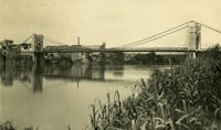
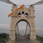
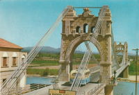
1921: Bagni di Lucca
Bagni di Lucca, Italy - Torrente Luna
| Bridgemeister ID: | 1473 (added 2004-09-02) |
| Year Completed: | 1921 |
| Name: | Bagni di Lucca |
| Location: | Bagni di Lucca, Italy |
| Crossing: | Torrente Luna |
| Coordinates: | 44.0092 N 10.5908 E |
| Maps: | Acme, GeoHack, Google, OpenStreetMap |
| Use: | Footbridge |
| Status: | In use (last checked: 2023) |
| Main Cables: | Wire (steel) |
| Suspended Spans: | 1 |
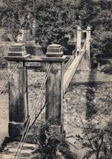
1921: Bridgeport
Bridgeport and Geary, Oklahoma, USA - South Canadian River
| Bridgemeister ID: | 1660 (added 2005-03-19) |
| Year Completed: | 1921 |
| Name: | Bridgeport |
| Also Known As: | Key, Postal |
| Location: | Bridgeport and Geary, Oklahoma, USA |
| Crossing: | South Canadian River |
| Coordinates: | 35.567306 N 98.374731 W |
| Maps: | Acme, GeoHack, Google, OpenStreetMap |
| References: | PTS2 |
| Use: | Vehicular |
| Status: | Removed |
| Main Cables: | Wire (steel) |
Notes:
- Remnants of at least one pier still standing, 2019.
| Bridgemeister ID: | 3908 (added 2020-03-15) |
| Year Completed: | 1921 |
| Name: | Høistad |
| Location: | Høistad, Norway |
| Crossing: | Glomma |
| Coordinates: | 62.50644 N 11.26111 E |
| Maps: | Acme, GeoHack, Google, kart.1881.no, OpenStreetMap |
| Use: | Vehicular (one-lane) |
| Status: | Removed |
| Main Cables: | Wire |
| Main Span: | 1 x 36 meters (118.1 feet) estimated |
Notes:
- Based on historic aerial images, removed 1953-1963.
External Links:
- DigitaltMuseum - Den gamle Høistad bru, med Røstfossen kraftverk i bakgrunnen. The 1818 - 1921 bridge that existed prior with the Røstefossen Kraftverk (Dam) just beyond.
- DigitaltMuseum - Kabelbru. Showing the northwest tower of the suspension bridge being constructed (~1920) on the far side of the river alongside of the 1818 bridge. One of the struts (topped with snow) extending out from the nearside tower is visible half way up the left edge.
1921: Kingston-Port Ewen
Kingston, New York, USA - Rondout Creek
| Bridgemeister ID: | 138 (added before 2003) |
| Year Completed: | 1921 |
| Name: | Kingston-Port Ewen |
| Also Known As: | Wurts Street, Rondout Creek |
| Location: | Kingston, New York, USA |
| Crossing: | Rondout Creek |
| Coordinates: | 41.916129 N 73.983999 W |
| Maps: | Acme, GeoHack, Google, OpenStreetMap |
| Principals: | Holton D. Robinson, Daniel E. Moran, William Yates |
| References: | AAJ, PTS, PTS2, SJR, SSS |
| Use: | Vehicular (two-lane, heavy vehicles), with walkway |
| Status: | In use, September 2020 (last checked: 2021) |
| Main Cables: | Wire (steel) |
| Suspended Spans: | 3 |
| Main Span: | 1 x 214.9 meters (705 feet) |
| Side Spans: | 2 x 53.7 meters (176.25 feet) |
| Deck width: | 37 feet |
Notes:
- 2008, March: Closed for ten weeks for cable inspection.
- 2018, December: Closed for maintenance. Expected to reopen February, 2019.
- 2019: Major rehabilitation continues to be delayed for several years.
- 2020, September: Closed temporarily. Major renovation project continues to be delayed.
- 2020, December: Closed indefinitely.
- 2021, May: Bids for renovation to be sought in June. Work expected to start in September.
- 2021, October: Groundbreaking ceremony for long-anticipated restoration project. Expected to be completed in 2023 at a cost of US$44.6M
Annotated Citations:
- Kirby, Paul. "Bids for Rondout Creek Bridge overhaul to be sought next month; work expected to start in September." Daily Freeman, 5 May 2021, www.dailyfreeman.com/news/local-news/bids-for-rondout-creek-bridge-overhaul-to-be-sought-next-month-work-expected-to-start/article_612258c4-adce-11eb-8dd6-9f0ac0c85540.html.
"Bids for the planned overhaul of the Rondout Creek Bridge will be sought in June, and the state Department of Transportation expects to award contracts for the work in August, the office of state Assemblyman Kevin Cahill said this week... The rehabilitation of the suspension bridge, which carries Wurts Street over the creek between Kingston and Port Ewen, could cost as much as $37 million, Cahill said previously. The state will pay for the project, which is expected to begin this fall."
External Links:
- Dave Longendyke's website. Several photos of the bridge's construction.
- Structurae - Structure ID 20007345
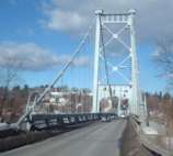
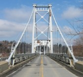
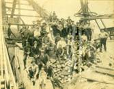
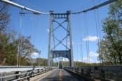
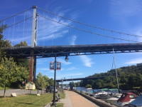
1921: Monowai
Monowai, New Zealand - Waiau River
| Bridgemeister ID: | 7593 (added 2023-05-07) |
| Year Completed: | 1921 |
| Name: | Monowai |
| Location: | Monowai, New Zealand |
| Crossing: | Waiau River |
| Use: | Vehicular |
| Status: | Destroyed, 1959 |
| Main Cables: | Wire (steel) |
| Main Span: | 1 |
Notes:
- 1959: Destroyed by nearby scrub fire.
- Near Lake Monowai Road - Monowai and Blackmount, New Zealand.
External Links:
1921: Niyodo
Japan
1921: St. Marien
St. Marien, Budelière vicinity, Évaux-les-Bains and Budelière, Creuse, France - Tardes River
| Bridgemeister ID: | 1159 (added 2004-01-18) |
| Year Completed: | 1921 |
| Name: | St. Marien |
| Location: | St. Marien, Budelière vicinity, Évaux-les-Bains and Budelière, Creuse, France |
| Crossing: | Tardes River |
| Coordinates: | 46.233320 N 2.508124 E |
| Maps: | Acme, GeoHack, Google, OpenStreetMap |
| Use: | Vehicular (one-lane) |
| Status: | In use (last checked: 2017) |
| Suspended Spans: | 1 |
Notes:
- Located just before the Tardes flows into the Cher. Sometimes noted as near Evaux-les-Bains.
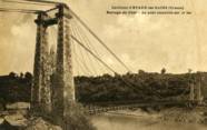
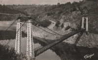
1922: (footbridge)
Bexley, Ohio, USA - Alum Creek
| Bridgemeister ID: | 819 (added 2003-05-31) |
| Year Completed: | 1922 |
| Name: | (footbridge) |
| Location: | Bexley, Ohio, USA |
| Crossing: | Alum Creek |
| At or Near Feature: | Wolfe Park |
| Coordinates: | 39.963831 N 82.947491 W |
| Maps: | Acme, GeoHack, Google, OpenStreetMap |
| References: | AAJ, PTS2 |
| Use: | Footbridge |
| Status: | In use (last checked: 2016) |
| Main Cables: | Wire (steel) |
| Suspended Spans: | 1 |
| Deck width: | 6.25 feet |
Notes:
- Closed 2013 for major refurbishment including a new deck. Reopened March. 2014.
- April 2015: Two main cables snap, causing a partial collapse of the bridge deck. Repaired and reopened August 5, 2016. Failure speculated to have been caused by the weight of the new deck installed 2013-2014.
1922: Arauca
Arauca, Colombia - Cauca River
| Bridgemeister ID: | 2017 (added 2006-01-14) |
| Year Completed: | 1922 |
| Name: | Arauca |
| Location: | Arauca, Colombia |
| Crossing: | Cauca River |
| Use: | Vehicular |
| Status: | Replaced, 1957 |
| Main Cables: | Wire (steel) |
| Suspended Spans: | 1 |
| Main Span: | 1 x 10² meters (334.6 feet) |
Notes:
1922: Carlos Holguín
Juanchito, Cali vicinity and Candelaria vicinity, Colombia - Cauca River
| Bridgemeister ID: | 2007 (added 2006-01-04) |
| Year Completed: | 1922 |
| Name: | Carlos Holguín |
| Location: | Juanchito, Cali vicinity and Candelaria vicinity, Colombia |
| Crossing: | Cauca River |
| Use: | Vehicular |
| Status: | Dismantled, 1956 |
| Main Cables: | Wire (steel) |
| Suspended Spans: | 1 |
| Main Span: | 1 x 120 meters (393.7 feet) |
Notes:
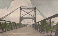
1922: Cortazar
Cortazar, Guanajuato, Mexico - Laja River
| Bridgemeister ID: | 6930 (added 2022-01-22) |
| Year Completed: | 1922 |
| Name: | Cortazar |
| Also Known As: | Arquitecto Ernesto Brunel |
| Location: | Cortazar, Guanajuato, Mexico |
| Crossing: | Laja River |
| Coordinates: | 20.491846 N 100.962915 W |
| Maps: | Acme, GeoHack, Google, OpenStreetMap |
| Use: | Vehicular (one-lane) |
| Status: | Restricted to foot traffic (last checked: 2021) |
| Main Cables: | Wire (steel) |
| Suspended Spans: | 1 |
Notes:
- 1922: During inauguration event, one end of the bridge dipped 1-2 feet, possibly due to the weight of the crowd. The bridge was repaired and entered into service.
- 2020-2021: Disassembled, rehabilitated, reassembled and reopened
1922: Dodge
Sweetwater County, Wyoming, USA - Green River
| Bridgemeister ID: | 5557 (added 2020-12-18) |
| Year Completed: | 1922 |
| Name: | Dodge |
| Location: | Sweetwater County, Wyoming, USA |
| Crossing: | Green River |
| Principals: | Harold H. Dodge |
| Use: | Stock |
| Status: | Removed |
| Main Cables: | Wire (steel) |
| Main Span: | 1 |
Notes:
- This bridge was located northwest of the present-day Seedskadee National Wildlife Refuge before Fontenelle. Appears to have been primarily a "sheep" bridge.
1922: Duck Run
Truebada, Glenville vicinity, West Virginia, USA - Little Kanawha River
| Bridgemeister ID: | 139 (added before 2003) |
| Year Completed: | 1922 |
| Name: | Duck Run |
| Also Known As: | Truebada Swinging |
| Location: | Truebada, Glenville vicinity, West Virginia, USA |
| Crossing: | Little Kanawha River |
| Coordinates: | 38.92830 N 80.78731 W |
| Maps: | Acme, GeoHack, Google, OpenStreetMap |
| Principals: | William M. Moss, Fred Lewis |
| Use: | Vehicular (one-lane) |
| Status: | Closed (last checked: 2007) |
| Main Cables: | Wire |
| Suspended Spans: | 3 |
| Main Span: | 1 x 62.5 meters (205 feet) estimated |
| Side Spans: | 1 x 20.1 meters (66 feet) estimated, 1 x 23.5 meters (77 feet) estimated |
Notes:
- Bypassed, 1991.
External Links:
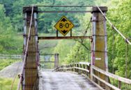
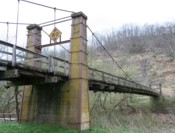
1922: Glaize
Brumley vicinity, Missouri, USA - Grand Glaize Creek
| Bridgemeister ID: | 332 (added before 2003) |
| Year Completed: | 1922 |
| Name: | Glaize |
| Also Known As: | Auglaize, Grand Glaize, Grand Auglaize |
| Location: | Brumley vicinity, Missouri, USA |
| Crossing: | Grand Glaize Creek |
| Coordinates: | 38.077098 N 92.526488 W |
| Maps: | Acme, GeoHack, Google, OpenStreetMap |
| Principals: | Joseph A. Dice |
| References: | BOTO |
| Use: | Vehicular (one-lane) |
| Status: | Closed, January 6, 2021 (last checked: 2021) |
| Main Cables: | Wire (steel) |
| Suspended Spans: | 2 |
| Main Span: | 1 x 126.2 meters (414 feet) estimated |
| Side Span: | 1 |
| Deck width: | 12 feet |
Notes:
- 2020, October 8: Added to National Register of Historic Places.
- 2021, January 6: Closed due to structural issues with the bridge's anchors.
- 2021, February 6: New inspection of the current issue ("loose cables"). Bridge is still closed.
- Near 1925 Mill Creek - Brumley vicinity, Missouri, USA.
External Links:
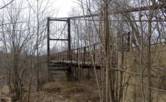
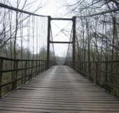
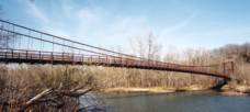
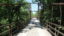
1922: Kawamoto
Japan
1922: Kyrkälv
Dala-Floda, Gagnef, Dalarna, Sweden - Västerdalälven
| Bridgemeister ID: | 8294 (added 2024-02-08) |
| Year Completed: | 1922 |
| Name: | Kyrkälv |
| Also Known As: | Kyrkälvbro, Kyrkbron |
| Location: | Dala-Floda, Gagnef, Dalarna, Sweden |
| Crossing: | Västerdalälven |
| Coordinates: | 60.507000 N 14.800972 E |
| Maps: | Acme, GeoHack, Google, OpenStreetMap |
| Use: | Vehicular (one-lane) |
| Status: | In use (last checked: 2023) |
| Main Cables: | Wire (steel) |
| Suspended Spans: | 1 |
| Main Span: | 1 x 122 meters (400.3 feet) |
Notes:
- 1980: Heavily damaged by fire. Rebuilt and reopened in 1983.
- Near Swing - Dala-Floda, Gagnef, Dalarna, Sweden.
External Links:
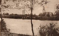
1922: Llanstephan
Llanstephan, Wales, United Kingdom - River Wye
| Bridgemeister ID: | 1964 (added 2005-11-12) |
| Year Completed: | 1922 |
| Name: | Llanstephan |
| Location: | Llanstephan, Wales, United Kingdom |
| Crossing: | River Wye |
| Coordinates: | 52.06604 N 3.29614 W |
| Maps: | Acme, GeoHack, Google, OpenStreetMap |
| Principals: | David Rowell & Co. |
| Use: | Vehicular (one-lane) |
| Status: | In use (last checked: 2021) |
| Main Cables: | Wire (steel) |
| Suspended Spans: | 1 |
External Links:
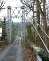
1922: Momosuke
Nagiso-cho, Kiso-gun, Nagano, Japan - Kiso River
| Bridgemeister ID: | 1051 (added 2003-12-07) |
| Year Completed: | 1922 |
| Name: | Momosuke |
| Also Known As: | 桃介橋 |
| Location: | Nagiso-cho, Kiso-gun, Nagano, Japan |
| Crossing: | Kiso River |
| Coordinates: | 35.600776 N 137.606515 E |
| Maps: | Acme, GeoHack, Google, OpenStreetMap |
| Use: | Footbridge |
| Status: | In use (last checked: 2019) |
| Main Cables: | Wire (steel) |
| Suspended Spans: | 4 |
| Main Spans: | 2 x 104.5 meters (342.8 feet) |
| Side Spans: | 2 x 23.9 meters (78.4 feet) |
Notes:
- Rebuilt 1993.
External Links:
1922: Porthill
Shrewsbury, England, United Kingdom - River Severn
| Bridgemeister ID: | 434 (added before 2003) |
| Year Completed: | 1922 |
| Name: | Porthill |
| Location: | Shrewsbury, England, United Kingdom |
| Crossing: | River Severn |
| Coordinates: | 52.708233 N 2.763083 W |
| Maps: | Acme, GeoHack, Google, OpenStreetMap |
| Principals: | David Rowell & Co. |
| References: | NTB |
| Use: | Footbridge |
| Status: | In use (last checked: 2010) |
| Suspended Spans: | 1 |
External Links:
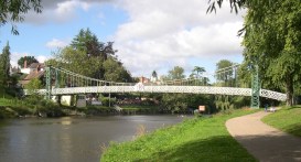
1922: Robert Lowe
Whitehorse vicinity, Yukon, Canada - Miles Canyon
| Bridgemeister ID: | 1054 (added 2003-12-13) |
| Year Completed: | 1922 |
| Name: | Robert Lowe |
| Also Known As: | Miles Canyon |
| Location: | Whitehorse vicinity, Yukon, Canada |
| Crossing: | Miles Canyon |
| Coordinates: | 60.66223 N 135.02921 W |
| Maps: | Acme, GeoHack, Google, OpenStreetMap |
| Use: | Footbridge |
| Status: | In use (last checked: 2020) |
| Main Cables: | Wire (steel) |
| Suspended Spans: | 1 |
| Main Span: | 1 x 39.6 meters (130 feet) estimated |
External Links:
| Bridgemeister ID: | 4499 (added 2020-05-02) |
| Year Completed: | 1922 |
| Name: | Strandvoldbrua |
| Location: | Trysil, Innlandet, Norway |
| Crossing: | Klarälven |
| Coordinates: | 61.343151 N 12.230457 E |
| Maps: | Acme, GeoHack, Google, kart.1881.no, OpenStreetMap |
| Use: | Vehicular (one-lane) |
| Status: | Replaced |
| Main Cables: | Wire (steel) |
| Suspended Spans: | 1 |
| Main Span: | 1 x 90 meters (295.3 feet) estimated |
Notes:
- Closed December 7, 1993 after a cable snapped.
- Replaced by 2018 Strandvoldbrua - Trysil, Innlandet, Norway.
| Bridgemeister ID: | 3884 (added 2020-03-08) |
| Year Completed: | 1922 |
| Name: | Teigen |
| Also Known As: | Vikvar |
| Location: | Mebonden, Selbu, Trøndelag, Norway |
| Crossing: | Nea |
| Coordinates: | 63.222013 N 11.013363 E |
| Maps: | Acme, GeoHack, Google, kart.1881.no, OpenStreetMap |
| Use: | Vehicular (one-lane) |
| Status: | Removed |
| Main Cables: | Wire |
| Suspended Spans: | 1 |
| Main Span: | 1 x 60 meters (196.9 feet) estimated |
Notes:
- Based on historical aerial images, removed at some point 1962-1975.
- Replaced 1903 Teigen (Vikvar) - Mebonden, Selbu, Trøndelag, Norway.
1923: (footbridge)
Kirschbaumwasen, Germany - Murg River
| Bridgemeister ID: | 1882 (added 2005-09-24) |
| Year Completed: | 1923 |
| Name: | (footbridge) |
| Location: | Kirschbaumwasen, Germany |
| Crossing: | Murg River |
| Coordinates: | 48.6233 N 8.354967 E |
| Maps: | Acme, GeoHack, Google, OpenStreetMap |
| Use: | Footbridge |
| Status: | In use (last checked: 2005) |
| Suspended Spans: | 1 |
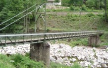
1923: (suspension bridge)
Karaka, New Zealand - Marokopa River
| Bridgemeister ID: | 703 (added 2003-03-08) |
| Year Completed: | 1923 |
| Name: | (suspension bridge) |
| Location: | Karaka, New Zealand |
| Crossing: | Marokopa River |
| References: | GAP |
1923: (suspension bridge)
Murchison vicinity, New Zealand - Buller River
| Bridgemeister ID: | 702 (added 2003-03-08) |
| Year Completed: | 1923 |
| Name: | (suspension bridge) |
| Location: | Murchison vicinity, New Zealand |
| Crossing: | Buller River |
| References: | GAP |
| Bridgemeister ID: | 5589 (added 2020-12-22) |
| Year Completed: | 1923 |
| Name: | 98th Meridian |
| Also Known As: | Byers |
| Location: | Byers vicinity, Texas and Temple, Oklahoma, USA |
| Crossing: | Red River |
| Coordinates: | 34.127249 N 98.214114 W |
| Maps: | Acme, GeoHack, Google, OpenStreetMap |
| Principals: | Austin Bridge Co. |
| References: | AUB |
| Use: | Vehicular |
| Status: | Destroyed, 1938 |
| Main Cables: | Wire (steel) |
Notes:
- AUB describes the Byers bridge: "This bridge, three spans of 567' each, one side span of 107', and a 16' roadway, had originally been built in 1914."
- 1935: Damaged by flood.
- 1938: Destroyed by flood.
- Replaced 1914 98th Meridian (Byers) - Byers, Texas and Temple, Oklahoma, USA.
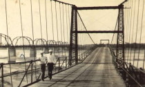
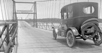
| Bridgemeister ID: | 3921 (added 2020-03-20) |
| Year Completed: | 1923 |
| Name: | Atna |
| Location: | Atna, Stor-Elvdal, Innlandet, Norway |
| Crossing: | Glomma |
| Coordinates: | 61.72890 N 10.82639 E |
| Maps: | Acme, GeoHack, Google, kart.1881.no, OpenStreetMap |
| Use: | Vehicular (one-lane) |
| Status: | In use (last checked: 2019) |
| Main Cables: | Wire (steel) |
| Suspended Spans: | 1 |
| Main Span: | 1 x 150 meters (492.1 feet) estimated |
Notes:
- Rehabilitated, 1989.
1923: Blagnac
Blagnac, Haute-Garonne, France - Garonne River
| Bridgemeister ID: | 2959 (added 2019-10-06) |
| Year Completed: | 1923 |
| Name: | Blagnac |
| Location: | Blagnac, Haute-Garonne, France |
| Crossing: | Garonne River |
| Coordinates: | 43.624930 N 1.401531 E |
| Maps: | Acme, GeoHack, Google, OpenStreetMap |
| Use: | Vehicular |
| Status: | Replaced, 1983 |
| Main Cables: | Wire (steel) |
| Suspended Spans: | 3 |
| Main Spans: | 3 |
Notes:
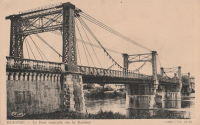
1923: Kaneyama
Japan
1923: McKeown
Tyrola, Ada vicinity and Konawa, Oklahoma, USA - Canadian River
| Bridgemeister ID: | 2146 (added 2006-11-11) |
| Year Completed: | 1923 |
| Name: | McKeown |
| Also Known As: | Ada-Konawa |
| Location: | Tyrola, Ada vicinity and Konawa, Oklahoma, USA |
| Crossing: | Canadian River |
| References: | PTS2 |
| Use: | Vehicular |
| Status: | Removed, 1936 |
| Main Cables: | Wire |
Notes:
- J.W. Pigg (of Mitchell & Pigg, prominent Texas suspension bridge builders of the early 20th century) was reportedly involved in the construction of the bridge. Steinman gives a date of 1922, but newspaper articles from mid-1923 describe the plans as still under consideration. The bridge was likely completed in 1923 or 1924.
- A photograph of the bridge appears in the December 16, 1934 issue of The Daily Oklahoman (Oklahoma City) with caption: "This Old Bridge Is Doomed," sub-caption "Suspension Bridge on Highway 48 North of Ada," and a blurb: "This old bridge, known as the McKeown bridge, across the Canadian River between Ada and Konawa, is being condemned and will be rebuilt. It is a suspension bridge, one of the few in the state, but when the bridge is rebuilt it will be minus its 'suspenders.'"
- The November 12, 1936 edition of The Ada Evening News reports: "The old suspension, bridge across the river north ot Ada is being torn down, but no one knew just where it will be located when and if it is rebuilt. Konawa wants to build it west of the city of Konawa. Mr. Clark [division engineer for the state highway department] did not know if any provisions have yet been made for its erection."
1923: Memorial Swinging
Winamac, Indiana, USA - Tippecanoe River
| Bridgemeister ID: | 849 (added 2003-07-27) |
| Year Completed: | 1923 |
| Name: | Memorial Swinging |
| Also Known As: | Soldiers and Sailors Memorial |
| Location: | Winamac, Indiana, USA |
| Crossing: | Tippecanoe River |
| At or Near Feature: | City Park |
| Coordinates: | 41.05245 N 86.59936 W |
| Maps: | Acme, GeoHack, Google, OpenStreetMap |
| Use: | Footbridge |
| Status: | In use (last checked: 2021) |
| Main Cables: | Wire (steel) |
| Suspended Spans: | 1 |
External Links:
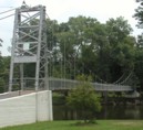
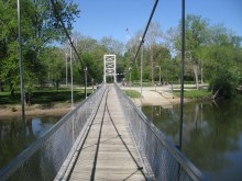
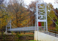
1923: Oued Yquem
Skhirat and Temara, Morocco - Oued Yquem
| Bridgemeister ID: | 4610 (added 2020-06-07) |
| Year Completed: | 1923 |
| Name: | Oued Yquem |
| Location: | Skhirat and Temara, Morocco |
| Crossing: | Oued Yquem |
| Coordinates: | 33.873400 N 6.995066 W |
| Maps: | Acme, GeoHack, Google, OpenStreetMap |
| Use: | Vehicular |
| Status: | Extant (last checked: 2019) |
| Main Cables: | Wire |
| Suspended Spans: | 1 |
External Links:
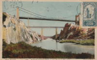
1923: Queens Park
Chester and Handbridge, England, United Kingdom - River Dee
| Bridgemeister ID: | 435 (added before 2003) |
| Year Completed: | 1923 |
| Name: | Queens Park |
| Location: | Chester and Handbridge, England, United Kingdom |
| Crossing: | River Dee |
| Coordinates: | 53.18796 N 2.88421 W |
| Maps: | Acme, GeoHack, Google, OpenStreetMap |
| Principals: | Charles Greenwood, David Rowell & Co., William E. Barker |
| References: | BRB, NTB |
| Use: | Footbridge |
| Status: | In use (last checked: 2019) |
| Main Cables: | Wire (steel) |
| Suspended Spans: | 1 |
| Main Span: | 1 x 83.8 meters (275 feet) |
Notes:
External Links:
- Chesterwiki - Suspension Bridge. Interesting details about the bridge.
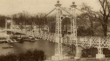
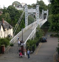
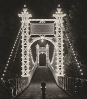
| Bridgemeister ID: | 3956 (added 2020-03-22) |
| Year Completed: | 1923 |
| Name: | Svanfoss |
| Location: | Brårud, Nes, Viken, Norway |
| Crossing: | Vorma |
| Coordinates: | 60.21450 N 11.35531 E |
| Maps: | Acme, GeoHack, Google, kart.1881.no, OpenStreetMap |
| Use: | Vehicular (one-lane) |
| Status: | Removed |
| Main Cables: | Wire (steel) |
| Suspended Spans: | 1 |
| Main Span: | 1 x 49 meters (160.8 feet) estimated |
Notes:
- Originally constructed as a stayed bridge in 1905, rebuilt as a suspension bridge in 1923.
- Based on historic aerial images, removed between 1972 and 2005.
External Links:
1923: Twin
Mangaweka vicinity, New Zealand - Kaiwhatau River
| Bridgemeister ID: | 704 (added 2003-03-08) |
| Year Completed: | 1923 |
| Name: | Twin |
| Location: | Mangaweka vicinity, New Zealand |
| Crossing: | Kaiwhatau River |
| References: | GAP |
1924: (footbridge)
Oklahoma, USA - Baron Fork Creek
| Bridgemeister ID: | 1804 (added 2005-05-18) |
| Year Completed: | 1924 |
| Name: | (footbridge) |
| Location: | Oklahoma, USA |
| Crossing: | Baron Fork Creek |
| Use: | Footbridge |
| Main Cables: | Wire (steel) |
| Main Span: | 1 x 48.8 meters (160 feet) |
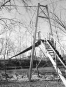
1924: (suspension bridge)
Cattle Flat, West Wanaka, Wanaka vicinity, New Zealand - Matukituki River
| Bridgemeister ID: | 715 (added 2003-03-08) |
| Year Completed: | 1924 |
| Name: | (suspension bridge) |
| Location: | Cattle Flat, West Wanaka, Wanaka vicinity, New Zealand |
| Crossing: | Matukituki River |
| Coordinates: | 44.636005 S 168.992132 E |
| Maps: | Acme, GeoHack, Google, OpenStreetMap |
| References: | GAP |
| Use: | Vehicular |
| Status: | Destroyed, September 10, 1970 |
| Main Cables: | Wire (steel) |
| Suspended Spans: | 1 |
Notes:
- GAP: Built circa 1924. Destroyed by flood c.1971.
- Later at same location Matukituki River - Cattle Flat, West Wanaka, Wanaka vicinity, Otago, New Zealand.
External Links:
- Papers Past | Newspapers | Press | 12 September 1970 | BRIDGE DOWN. Article dated September 11, 1970: "The single-span suspension bridge across the West Matukituki River, 13 miles from Wanaka, was blown away by gale-force winds yesterday afternoon, cutting the only road access to West Wanaka station, where 10 persons are now isolated."
1924: (suspension bridge)
Moorefield, West Virginia, USA - South Fork South Branch Potomac River
| Bridgemeister ID: | 5584 (added 2020-12-21) |
| Year Completed: | 1924 |
| Name: | (suspension bridge) |
| Location: | Moorefield, West Virginia, USA |
| Crossing: | South Fork South Branch Potomac River |
| Coordinates: | 39.027926 N 78.947506 W |
| Maps: | Acme, GeoHack, Google, OpenStreetMap |
| Use: | Vehicular (one-lane) |
| Status: | Destroyed, After 1974 |
| Main Cables: | Wire (steel) |
| Main Span: | 1 |
Notes:
- Coordinates indicate likely location of this bridge, destroyed by flood debris at some point after 1974.
External Links:
1924: (suspension bridge)
Tolaga Bay vicinity, New Zealand - Mangaheia River
| Bridgemeister ID: | 712 (added 2003-03-08) |
| Year Completed: | 1924 |
| Name: | (suspension bridge) |
| Location: | Tolaga Bay vicinity, New Zealand |
| Crossing: | Mangaheia River |
| Principals: | Tom Ryan |
| References: | GAP |
Notes:
- GAP: completed circa 1924, in addition to "The Five Bridges" also spanning the Mangaheia
1924: Agness
Agness, Oregon, USA - Rogue River
| Bridgemeister ID: | 273 (added before 2003) |
| Year Completed: | 1924 |
| Name: | Agness |
| Location: | Agness, Oregon, USA |
| Crossing: | Rogue River |
| Principals: | U.S. Forest Service |
| References: | AAJ |
| Status: | Destroyed, 1964 |
| Main Cables: | Wire |
| Main Span: | 1 x 92.7 meters (304 feet) |
| Side Span: | 1 |
Notes:
- A postcard reads, "This historic forestry suspension bridge over the Rogue River was... constructed of steel carried piece by piece up-river from Gold Beach by the mail boats. This bridge was swept away by flood waters 100 feet over flood stage during December 1964."
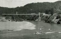
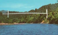
1924: Bear Mountain
Anthony's Nose and Bear Mountain, New York, USA - Hudson River
| Bridgemeister ID: | 141 (added before 2003) |
| Year Completed: | 1924 |
| Name: | Bear Mountain |
| Location: | Anthony's Nose and Bear Mountain, New York, USA |
| Crossing: | Hudson River |
| Coordinates: | 41.32 N 73.985 W |
| Maps: | Acme, GeoHack, Google, OpenStreetMap |
| Principals: | Howard C. Baird |
| References: | AAJ, BAAW, BBR, CPW, PTS2, SJR |
| Use: | Vehicular (two-lane, heavy vehicles), with walkway |
| Status: | In use (last checked: 2022) |
| Main Cables: | Wire (steel) |
| Suspended Spans: | 1 |
| Main Span: | 1 x 497.4 meters (1,632 feet) |
| Deck width: | 48 feet |
Notes:
- Became longest suspension bridge by eclipsing 1903 Williamsburg - New York and Brooklyn, New York, USA.
- Eclipsed by new longest suspension bridge 1926 Benjamin Franklin (Philadelphia-Camden) - Philadelphia, Pennsylvania and Camden, New Jersey, USA.
- Near 2002 Popolopen (William J. Moreau Popolopen) - Fort Montgomery, New York, USA.
External Links:
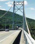
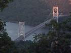
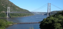
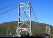
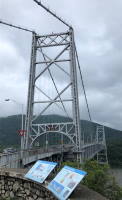
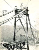
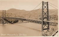
1924: Burrator Reservoir
Sheepstor, England, United Kingdom - Burrator Reservoir
| Bridgemeister ID: | 2314 (added 2007-05-05) |
| Year Completed: | 1924 |
| Name: | Burrator Reservoir |
| Location: | Sheepstor, England, United Kingdom |
| Crossing: | Burrator Reservoir |
| Use: | Vehicular |
| Status: | Removed |
| Main Cables: | Wire (steel) |
Notes:
- Large temporary bridge built to carry traffic across the reservoir while work was underway to raise Burrator Dam. Possibly completed 1925.
1924: Curry
Curry, Alaska, USA - Susitna River
| Bridgemeister ID: | 1189 (added 2004-01-24) |
| Year Completed: | 1924 |
| Name: | Curry |
| Location: | Curry, Alaska, USA |
| Crossing: | Susitna River |
| Use: | Footbridge |
| Status: | Removed |
| Main Cables: | Wire |
| Suspended Spans: | 1 |
Notes:
- Long narrow footbridge with timber towers. Deck replaced, 1926.
1924: Eikernsund
Darbu, Eikeren, Viken, Norway - Strait separating Eikeren and Fiskumvannet
| Bridgemeister ID: | 4085 (added 2020-04-04) |
| Year Completed: | 1924 |
| Name: | Eikernsund |
| Also Known As: | Eikernsundet, Eikern Strait |
| Location: | Darbu, Eikeren, Viken, Norway |
| Crossing: | Strait separating Eikeren and Fiskumvannet |
| Coordinates: | 59.699851 N 9.844541 E |
| Maps: | Acme, GeoHack, Google, kart.1881.no, OpenStreetMap |
| Use: | Vehicular (one-lane) |
| Status: | Removed |
| Main Cables: | Wire (steel) |
| Suspended Spans: | 1 |
| Main Span: | 1 x 90 meters (295.3 feet) estimated |
| Deck width: | ~3 meters |
Notes:
- Out of service, circa 1980. Subsequently removed.
External Links:
1924: Invercauld
Braemar vicinity, Scotland, United Kingdom - River Dee
| Bridgemeister ID: | 1906 (added 2005-10-08) |
| Year Completed: | 1924 |
| Name: | Invercauld |
| Also Known As: | Ballochbuie, Garbh Allt Shiel |
| Location: | Braemar vicinity, Scotland, United Kingdom |
| Crossing: | River Dee |
| Coordinates: | 57.001768 N 3.322743 W |
| Maps: | Acme, GeoHack, Google, OpenStreetMap |
| Principals: | James Abernethy & Co. |
| References: | HARPER, HBR |
| Use: | Footbridge |
| Status: | In use (last checked: 2014) |
| Main Cables: | Wire (steel) |
| Suspended Spans: | 1 |
External Links:
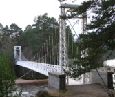
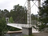
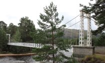
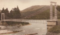
1924: Kemna
St. Elizabeth, Missouri, USA - Tavern Creek
| Bridgemeister ID: | 611 (added 2003-01-14) |
| Year Completed: | 1924 |
| Name: | Kemna |
| Location: | St. Elizabeth, Missouri, USA |
| Crossing: | Tavern Creek |
| Coordinates: | 38.247265 N 92.245431 W |
| Maps: | Acme, GeoHack, Google, OpenStreetMap |
| Principals: | Joseph A. Dice |
| References: | BOTO |
| Use: | Vehicular (one-lane) |
| Status: | In use (last checked: 2019) |
| Main Cables: | Wire (steel) |
| Suspended Spans: | 1 |
| Main Span: | 1 x 50.9 meters (167 feet) |
| Deck width: | 11.1 feet |
Notes:
- Original timber towers replaced, 1978.
- Similar to 1925 Mill Creek - Brumley vicinity, Missouri, USA.
- Near 1925 Kliethermes (Brumley) - St. Anthony vicinity, Missouri, USA.
External Links:
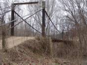
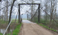
1924: Komnes
Komnes, Viken, Norway - Numedalslågen
| Bridgemeister ID: | 4094 (added 2020-04-05) |
| Year Completed: | 1924 |
| Name: | Komnes |
| Location: | Komnes, Viken, Norway |
| Crossing: | Numedalslågen |
| Coordinates: | 59.506986 N 9.890720 E |
| Maps: | Acme, GeoHack, Google, kart.1881.no, OpenStreetMap |
| Use: | Vehicular (one-lane) |
| Status: | In use (last checked: 2018) |
| Main Cables: | Wire (steel) |
| Suspended Spans: | 1 |
| Main Span: | 1 x 100 meters (328.1 feet) estimated |
External Links:
1924: Larry's River
Larry's River, Nova Scotia, Canada - Larry's River Estuary
| Bridgemeister ID: | 7594 (added 2023-05-07) |
| Year Completed: | 1924 |
| Name: | Larry's River |
| Location: | Larry's River, Nova Scotia, Canada |
| Crossing: | Larry's River Estuary |
| Use: | Footbridge |
| Status: | Dismantled, 1944 |
| Main Cables: | Wire (steel) |
| Suspended Spans: | 3 |
| Main Span: | 1 |
| Side Spans: | 2 |
External Links:
- Early Planning and Construction: 1922-1945 - Larry's River Footbridge Preservation Society. Blog post with several images of the site and bridge.
- Nova Scotia Archives - Clara Dennis Nova Scotia Archives 1981-541 no. 655. Image of Larry's River suspension bridge.
- Nova Scotia Archives - Clara Dennis Nova Scotia Archives 1981-541 no. 656. Image of Larry's River suspension bridge.
- Nova Scotia Archives - Clara Dennis Nova Scotia Archives 1981-541 no. 657. Image of Larry's River suspension bridge.
1924: Longmire
Packwood vicinity, Washington, USA - Nisqually River
| Bridgemeister ID: | 142 (added before 2003) |
| Year Completed: | 1924 |
| Name: | Longmire |
| Location: | Packwood vicinity, Washington, USA |
| Crossing: | Nisqually River |
| At or Near Feature: | Mt. Rainier National Park |
| Coordinates: | 46.74903 N 121.80777 W |
| Maps: | Acme, GeoHack, Google, OpenStreetMap |
| Principals: | James A. French |
| Use: | Vehicular (one-lane) and Pipeline |
| Status: | In use (last checked: 2006) |
| Main Cables: | Wire (steel) |
| Suspended Spans: | 1 |
| Main Span: | 1 x 55.8 meters (183 feet) estimated |
Notes:
- Reconstructed, 1950.
External Links:
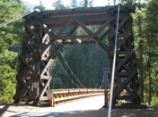
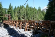
1924: Mangaheia I
Tauwhareparae Road, Tolaga Bay vicinity, New Zealand - Mangaheia River
| Bridgemeister ID: | 707 (added 2003-03-08) |
| Year Completed: | 1924 |
| Name: | Mangaheia I |
| Location: | Tauwhareparae Road, Tolaga Bay vicinity, New Zealand |
| Crossing: | Mangaheia River |
| Principals: | Tom Ryan |
| References: | GAP |
| Use: | Vehicular (one-lane) |
| Status: | Replaced |
| Main Cables: | Wire (steel) |
| Suspended Spans: | 1 |
| Main Span: | 1 x 41 meters (134.5 feet) |
Notes:
- GAP: completed circa 1924. One of "The Five Bridges" that spanned the Mangaheia on the Tauwhareparae Road.
1924: Mangaheia II
Tauwhareparae Road, Tolaga Bay vicinity, New Zealand - Mangaheia River
| Bridgemeister ID: | 708 (added 2003-03-08) |
| Year Completed: | 1924 |
| Name: | Mangaheia II |
| Location: | Tauwhareparae Road, Tolaga Bay vicinity, New Zealand |
| Crossing: | Mangaheia River |
| Principals: | Tom Ryan |
| References: | GAP |
| Use: | Vehicular (one-lane) |
| Status: | Replaced |
| Main Cables: | Wire (steel) |
Notes:
- GAP: completed circa 1924. One of "The Five Bridges" that spanned the Mangaheia on the Tauwhareparae Road.
1924: Mangaheia III
Tauwhareparae Road, Tolaga Bay vicinity, New Zealand - Mangaheia River
| Bridgemeister ID: | 709 (added 2003-03-08) |
| Year Completed: | 1924 |
| Name: | Mangaheia III |
| Location: | Tauwhareparae Road, Tolaga Bay vicinity, New Zealand |
| Crossing: | Mangaheia River |
| Principals: | Tom Ryan |
| References: | GAP |
| Use: | Vehicular (one-lane) |
| Status: | Replaced |
| Main Cables: | Wire (steel) |
Notes:
- GAP: completed circa 1924. One of "The Five Bridges" that spanned the Mangaheia on the Tauwhareparae Road.
1924: Mangaheia IV
Tauwhareparae Road, Tolaga Bay vicinity, New Zealand - Mangaheia River
| Bridgemeister ID: | 710 (added 2003-03-08) |
| Year Completed: | 1924 |
| Name: | Mangaheia IV |
| Location: | Tauwhareparae Road, Tolaga Bay vicinity, New Zealand |
| Crossing: | Mangaheia River |
| Principals: | Tom Ryan |
| References: | GAP |
| Use: | Vehicular (one-lane) |
| Status: | Replaced |
| Main Cables: | Wire (steel) |
Notes:
- GAP: completed circa 1924. One of "The Five Bridges" that spanned the Mangaheia on the Tauwhareparae Road.
1924: Mangaheia V
Tauwhareparae Road, Tolaga Bay vicinity, New Zealand - Mangaheia River
| Bridgemeister ID: | 711 (added 2003-03-08) |
| Year Completed: | 1924 |
| Name: | Mangaheia V |
| Location: | Tauwhareparae Road, Tolaga Bay vicinity, New Zealand |
| Crossing: | Mangaheia River |
| Principals: | Tom Ryan |
| References: | GAP |
| Use: | Vehicular (one-lane) |
| Status: | Replaced |
| Main Cables: | Wire (steel) |
Notes:
- GAP: completed circa 1924. One of "The Five Bridges" that spanned the Mangaheia on the Tauwhareparae Road.
| Bridgemeister ID: | 140 (added before 2003) |
| Year Completed: | 1924 |
| Name: | Nocona |
| Also Known As: | Bluff, Ketchum Bluff, Ketchum's Bluff |
| Location: | Nocona vicinity, Texas and Jefferson County, Oklahoma, USA |
| Crossing: | Red River |
| At or Near Feature: | Ketchum Bluff |
| Coordinates: | 33.93579 N 97.75869 W |
| Maps: | Acme, GeoHack, Google, OpenStreetMap |
| Principals: | Austin Bridge Co. |
| References: | AUB, HAERTX98, PTS2 |
| Use: | Vehicular |
| Status: | Only towers remain (last checked: 2007) |
| Main Cables: | Wire (steel) |
| Main Span: | 1 x 213.4 meters (700 feet) |
Notes:
- Legend has it the bridge was burned during a dispute. This likely occurred before 1955. Some sources suggest it occurred before or during 1950. The road that leads to the Texas side of the former crossing is "Burned Out Bridge Road." Follow the image of the derelict tower to see the remains of the bridge.
- AUB mentions: "In January 1924, a contract was entered into with Nocona Bridge Company for a bridge across Red River, nine miles north of Nocona, connecting Texas and Oklahoma. The plans called for a 700' span, 16' roadway, and the main cables to contain 1,000 No. 9 galvanized wires each. The building of this, [the Austin Bridge Company's] first complete cable bridge, and the experience gained therefrom helped to launch Austin Bridge Company into an interesting and profitable line of work."
External Links:
- Nocona Suspension Bridge at Ketchum Bluff, Texas. University of Texas Arlington Libraries Digital Gallery
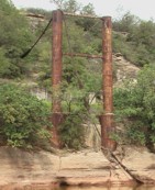
1924: Otowi
Otowi, New Mexico, USA - Rio Grande
| Bridgemeister ID: | 143 (added before 2003) |
| Year Completed: | 1924 |
| Name: | Otowi |
| Location: | Otowi, New Mexico, USA |
| Crossing: | Rio Grande |
| Coordinates: | 35.874725 N 106.141861 W |
| Maps: | Acme, GeoHack, Google, OpenStreetMap |
| Principals: | James A. French |
| References: | GBD |
| Use: | Vehicular |
| Status: | Extant (last checked: 2019) |
| Main Cables: | Wire (steel) |
| Suspended Spans: | 1 |
| Main Span: | 1 x 53 meters (174 feet) |
| Deck width: | 10 feet |
Notes:
- Bypassed, 1948.
External Links:

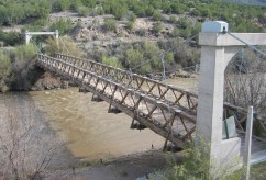
1924: Saint-Leu
Saint-Leu-d'Esserent, Oise, France - Oise River
| Bridgemeister ID: | 1947 (added 2005-11-04) |
| Year Completed: | 1924 |
| Name: | Saint-Leu |
| Location: | Saint-Leu-d'Esserent, Oise, France |
| Crossing: | Oise River |
| Coordinates: | 49.213680 N 2.422861 E |
| Maps: | Acme, GeoHack, Google, OpenStreetMap |
| References: | AAJ |
| Use: | Vehicular (two-lane) |
| Status: | In use (last checked: 2022) |
| Main Cables: | Wire (steel) |
| Suspended Spans: | 1 |
External Links:
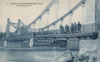
1924: Shoki
Japan
| Bridgemeister ID: | 3355 (added 2019-12-15) |
| Year Completed: | 1924 |
| Name: | Skutskär |
| Location: | Skutskär, Sweden |
| Crossing: | Dalälven |
| Coordinates: | 60.611988 N 17.442079 E |
| Maps: | Acme, GeoHack, Google, OpenStreetMap |
| Use: | Vehicular (one-lane) |
| Status: | In use (last checked: 2019) |
| Main Cables: | Wire (steel) |
| Suspended Spans: | 1 |
| Main Span: | 1 x 10⁷ meters (351 feet) estimated |
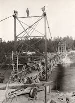
1924: Swinging
Thomson, Minnesota, USA - St. Louis River
| Bridgemeister ID: | 2103 (added 2006-08-19) |
| Year Completed: | 1924 |
| Name: | Swinging |
| Location: | Thomson, Minnesota, USA |
| Crossing: | St. Louis River |
| At or Near Feature: | Jay Cooke State Park |
| Coordinates: | 46.653649 N 92.370458 W |
| Maps: | Acme, GeoHack, Google, OpenStreetMap |
| Principals: | U.S. Forest Service |
| Use: | Footbridge |
| Status: | Replaced, 1935 |
| Main Cables: | Wire |
Notes:
- Replaced by 1935 Swinging - Thomson, Minnesota, USA.
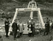
1924: Villemur-sur-Tarn
Villemur-sur-Tarn, Haute-Garonne, France - Tarn River
| Bridgemeister ID: | 1851 (added 2005-07-16) |
| Year Completed: | 1924 |
| Name: | Villemur-sur-Tarn |
| Location: | Villemur-sur-Tarn, Haute-Garonne, France |
| Crossing: | Tarn River |
| Use: | Vehicular |
| Status: | Destroyed, 1930 |
| Main Cables: | Wire (steel) |
Notes:
- 1930: Destroyed by flood.
- Replaced 1845 Villemur-sur-Tarn - Villemur-sur-Tarn, Haute-Garonne, France.
- Replaced by 1932 Villemur-sur-Tarn - Villemur-sur-Tarn, Haute-Garonne, France.
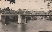
1925: (suspension bridge)
Hakis, Gilgit-Baltistan, Pakistan - Gilgit River
| Bridgemeister ID: | 6716 (added 2021-10-09) |
| Year Completed: | 1925 |
| Name: | (suspension bridge) |
| Location: | Hakis, Gilgit-Baltistan, Pakistan |
| Crossing: | Gilgit River |
| Coordinates: | 36.218917 N 73.510083 E |
| Maps: | Acme, GeoHack, Google, OpenStreetMap |
| Use: | Vehicular (one-lane) |
| Status: | In use (last checked: 2021) |
| Main Cables: | Wire |
| Suspended Spans: | 1 |
| Main Span: | 1 x 60.4 meters (198 feet) estimated |
External Links:
- X (Twitter). Post with several images of the bridge. September 12, 2021.
1925: A.A. Hadley
Honeydew vicinity, California, USA - Mattole River
| Bridgemeister ID: | 589 (added 2003-01-05) |
| Year Completed: | 1925 |
| Name: | A.A. Hadley |
| Also Known As: | Mattole River, Lindley |
| Location: | Honeydew vicinity, California, USA |
| Crossing: | Mattole River |
| Coordinates: | 40.25 N 124.165 W |
| Maps: | Acme, GeoHack, Google, OpenStreetMap |
| Use: | Vehicular (one-lane) |
| Status: | In use (last checked: 2004) |
| Main Cables: | Wire (steel) |
| Suspended Spans: | 1 |
External Links:
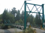
1925: Blair Grove
Miranda vicinity, California, USA - South Fok Eel River
| Bridgemeister ID: | 5667 (added 2021-01-30) |
| Year Completed: | 1925 |
| Name: | Blair Grove |
| Location: | Miranda vicinity, California, USA |
| Crossing: | South Fok Eel River |
| Coordinates: | 40.258954 N 123.841625 W |
| Maps: | Acme, GeoHack, Google, OpenStreetMap |
| Use: | Vehicular (one-lane) |
| Status: | Removed |
| Main Cables: | Wire (steel) |
| Main Span: | 1 |
Notes:
- May have been completed 1923-1924. Coordinates represent the suspected former location of this bridge.
- See 1925 A.A. Hadley (Mattole River, Lindley) - Honeydew vicinity, California, USA. The towers of the Blair Grove and Hadley bridges appear identical.
External Links:
1925: Bodie Creek
Falkland Islands
| Bridgemeister ID: | 1922 (added 2005-10-09) |
| Year Completed: | 1925 |
| Name: | Bodie Creek |
| Location: | Falkland Islands |
| Coordinates: | 51.853916 S 59.016884 W |
| Maps: | Acme, GeoHack, Google, OpenStreetMap |
| Principals: | David Rowell & Co., Charles Peters |
| Use: | Vehicular (one-lane) and Stock |
| Status: | Closed, 1997 (last checked: 2018) |
| Main Cables: | Wire (steel) |
| Suspended Spans: | 1 |
External Links:
- The Bodie Creek Suspension Bridge. Detailed account of the bridge's history and construction.
- Structurae - Structure ID 20035736
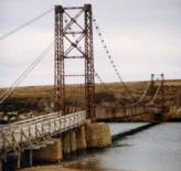
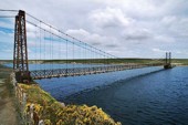
1925: Buechter
St. Anthony vicinity, Missouri, USA - Tavern Creek
| Bridgemeister ID: | 610 (added 2003-01-14) |
| Year Completed: | 1925 |
| Name: | Buechter |
| Location: | St. Anthony vicinity, Missouri, USA |
| Crossing: | Tavern Creek |
| Coordinates: | 38.141573 N 92.297910 W |
| Maps: | Acme, GeoHack, Google, OpenStreetMap |
| Principals: | Joseph A. Dice |
| References: | BOTO |
| Use: | Vehicular (one-lane) |
| Status: | Demolished, 2011 |
| Main Cables: | Wire (steel) |
| Suspended Spans: | 1 |
| Main Span: | 1 x 42.7 meters (140 feet) |
| Deck width: | 12.1 feet |
Notes:
- Completed circa 1925.
- Sometimes spelled Buetcher. The road the bridge carried is named with the "Buechter" spelling.
- Renovated 1986.
- Similar to 1925 Kliethermes (Brumley) - St. Anthony vicinity, Missouri, USA.
External Links:
- Historic Bridges of the United States - Buechter Bridge - Miller County, Missouri
- Structurae - Structure ID 20014258
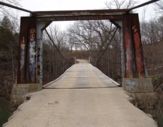
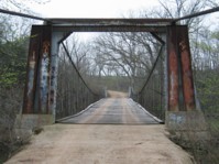
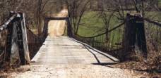
1925: Elvenes
Elvenes, Kirkenes, Sør-Varanger, Troms og Finnmark, Norway - Pasvikelva
| Bridgemeister ID: | 3765 (added 2020-02-29) |
| Year Completed: | 1925 |
| Name: | Elvenes |
| Location: | Elvenes, Kirkenes, Sør-Varanger, Troms og Finnmark, Norway |
| Crossing: | Pasvikelva |
| Coordinates: | 69.679423 N 30.113124 E |
| Maps: | Acme, GeoHack, Google, kart.1881.no, OpenStreetMap |
| Use: | Vehicular (one-lane) |
| Status: | Destroyed, 1944 |
| Main Cables: | Wire (steel) |
| Suspended Spans: | 1 |
| Main Span: | 1 x 10⁷ meters (351 feet) |
| Deck width: | 2.6 meters |
Notes:
- Later at same location 1950 Elvenes - Elvenes, Kirkenes, Sør-Varanger, Troms og Finnmark, Norway.
External Links:
1925: Grimma
Grimma, Saxony, Germany - Mulde River
| Bridgemeister ID: | 1504 (added 2004-10-08) |
| Year Completed: | 1925 |
| Name: | Grimma |
| Location: | Grimma, Saxony, Germany |
| Crossing: | Mulde River |
| Coordinates: | 51.22805 N 12.72555 E |
| Maps: | Acme, GeoHack, Google, OpenStreetMap |
| Use: | Footbridge |
| Status: | In use (last checked: 2022) |
| Main Cables: | Wire (steel) |
| Suspended Spans: | 1 |
| Main Span: | 1 x 80 meters (262.5 feet) |
| Deck width: | 1.8 meters between side rails |
Notes:
- Rebuilt, 1949. Reconstruction, 1989, 1998, and in 2003 after 2002 flood damage.
External Links:
1925: Kliethermes
St. Anthony vicinity, Missouri, USA - Tavern Creek
| Bridgemeister ID: | 609 (added 2003-01-14) |
| Year Completed: | 1925 |
| Name: | Kliethermes |
| Also Known As: | Brumley |
| Location: | St. Anthony vicinity, Missouri, USA |
| Crossing: | Tavern Creek |
| Coordinates: | 38.178223 N 92.322981 W |
| Maps: | Acme, GeoHack, Google, OpenStreetMap |
| Principals: | Joseph A. Dice |
| References: | BOTO |
| Use: | Vehicular (one-lane) |
| Status: | Removed, March, 2008 |
| Main Cables: | Wire (steel) |
| Suspended Spans: | 1 |
| Main Span: | 1 x 65.8 meters (215.8 feet) |
| Deck width: | 10.8 feet |
Notes:
- Renovated, 1988. Closed, Spring 2006. Subsequently demolished in 2008.
- Completed circa 1925.
- Similar to 1925 Buechter - St. Anthony vicinity, Missouri, USA.
External Links:
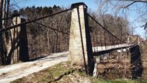
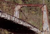
1925: Luzancy
Luzancy, Seine-et-Marne, France - Marne River
| Bridgemeister ID: | 4920 (added 2020-07-26) |
| Year Completed: | 1925 |
| Name: | Luzancy |
| Location: | Luzancy, Seine-et-Marne, France |
| Crossing: | Marne River |
| References: | AAJ, PTS2 |
| Use: | Vehicular |
| Status: | Destroyed |
| Main Cables: | Reinforced Concrete |
| Suspended Spans: | 1 |
Notes:
- Described as a "rigid suspension bridge of reinforced concrete."
- Replaced 1831 Luzancy - Luzancy, Seine-et-Marne, France.
- Similar to 1926 Laon - Laon, Aisne, France.
- Similar to Pommiers - Pommiers, Aisne, France.
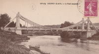
1925: Mellah Slimane
Constantine, Algeria - Oued Rhumel
| Bridgemeister ID: | 1117 (added 2004-01-05) |
| Year Completed: | 1925 |
| Name: | Mellah Slimane |
| Also Known As: | Perrégaux |
| Location: | Constantine, Algeria |
| Crossing: | Oued Rhumel |
| Coordinates: | 36.366261 N 6.615007 E |
| Maps: | Acme, GeoHack, Google, OpenStreetMap |
| Principals: | Ferdinand Arnodin |
| Use: | Footbridge |
| Status: | In use (last checked: 2019) |
| Main Cables: | Wire (steel) |
| Suspended Spans: | 1 |
| Main Span: | 1 x 125 meters (410.1 feet) |
| Deck width: | 2.4 meters |
External Links:
- Mellah Slimane Bridge - Wikipedia
- Perregaux Footbridge - HighestBridges.com
- Structurae - Structure ID 20009826
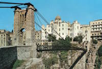
1925: Mill Creek
Brumley vicinity, Missouri, USA - Mill Creek
| Bridgemeister ID: | 342 (added before 2003) |
| Year Completed: | 1925 |
| Name: | Mill Creek |
| Location: | Brumley vicinity, Missouri, USA |
| Crossing: | Mill Creek |
| Coordinates: | 38.078408 N 92.524264 W |
| Maps: | Acme, GeoHack, Google, OpenStreetMap |
| Principals: | Joseph A. Dice |
| References: | BOTO |
| Use: | Vehicular (one-lane) |
| Status: | In use (last checked: 2020) |
| Main Cables: | Wire (steel) |
| Suspended Spans: | 2 |
| Main Span: | 1 x 29.3 meters (96 feet) estimated |
| Side Span: | 1 |
| Deck width: | 11.1 feet |
Notes:
- Original cables now assisted by additional steel cables.
- Similar to 1924 Kemna - St. Elizabeth, Missouri, USA.
- Near 1922 Glaize (Auglaize, Grand Glaize, Grand Auglaize) - Brumley vicinity, Missouri, USA. The bridges are less than half a mile apart.
External Links:

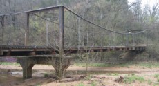
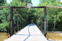
1925: Pandora
Pandora, Limón, Costa Rica - Estrella River
| Bridgemeister ID: | 436 (added before 2003) |
| Year Completed: | 1925 |
| Name: | Pandora |
| Also Known As: | Southeast Passage |
| Location: | Pandora, Limón, Costa Rica |
| Crossing: | Estrella River |
| Coordinates: | 9.736861 N 82.962167 W |
| Maps: | Acme, GeoHack, Google, OpenStreetMap |
| References: | PTS2, USS |
| Use: | Vehicular (one-lane) |
| Status: | Extant (last checked: 2022) |
| Main Cables: | Wire (steel) |
| Suspended Spans: | 1 |
| Main Span: | 1 x 73.2 meters (240 feet) |
Notes:
- Originally built with a set of tram tracks designed for cars hauling bananas.
- Next to (footbridge) - Pandora, Limón, Costa Rica.
1925: Powhatan
Powhatan, Arkansas, USA - Black River
1925: Springvale
Taihape vicinity, New Zealand - Rangitikei River
| Bridgemeister ID: | 713 (added 2003-03-08) |
| Year Completed: | 1925 |
| Name: | Springvale |
| Location: | Taihape vicinity, New Zealand |
| Crossing: | Rangitikei River |
| Coordinates: | 39.488097 S 176.033601 E |
| Maps: | Acme, GeoHack, Google, OpenStreetMap |
| References: | GAP |
| Use: | Vehicular (one-lane) |
| Status: | Restricted to foot traffic (last checked: 2015) |
| Main Cables: | Wire (steel) |
| Suspended Spans: | 1 |
External Links:
1925: Swinging
River Falls, Wisconsin, USA - Kinnickinnic River South Fork
| Bridgemeister ID: | 1193 (added 2004-01-25) |
| Year Completed: | 1925 |
| Name: | Swinging |
| Location: | River Falls, Wisconsin, USA |
| Crossing: | Kinnickinnic River South Fork |
| At or Near Feature: | Glen Park |
| Coordinates: | 44.853817 N 92.6333 W |
| Maps: | Acme, GeoHack, Google, OpenStreetMap |
| Use: | Footbridge |
| Status: | In use (last checked: 2006) |
| Main Cables: | Wire (steel) |
| Suspended Spans: | 3 |
| Main Span: | 1 x 39.6 meters (130 feet) |
| Side Spans: | 2 x 9.1 meters (30 feet) |
Notes:
- Rehabilitated, 1985.
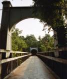
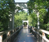
1925: Térénez
Landévennec vicinity and Rosnoen vicinity, Finistère, France - Aulne River
| Bridgemeister ID: | 1912 (added 2005-10-08) |
| Year Completed: | 1925 |
| Name: | Térénez |
| Location: | Landévennec vicinity and Rosnoen vicinity, Finistère, France |
| Crossing: | Aulne River |
| Coordinates: | 48.269120 N 4.262766 W |
| Maps: | Acme, GeoHack, Google, OpenStreetMap |
| Use: | Vehicular |
| Status: | Destroyed, 1944 |
| Main Cables: | Wire |
| Main Span: | 1 x 272 meters (892.4 feet) |
Notes:
- Coordinates are approximate, adjacent to the two subsequent replacement bridges.
- Replaced by 1952 Térénez - Landévennec vicinity and Rosnoen vicinity, Finistère, France.
External Links:
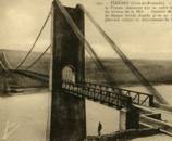
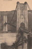
1925: Wind River
Carson, Washington, USA - Wind River
| Bridgemeister ID: | 1004 (added 2003-11-21) |
| Year Completed: | 1925 |
| Name: | Wind River |
| Location: | Carson, Washington, USA |
| Crossing: | Wind River |
| References: | SPW |
| Use: | Vehicular |
| Status: | Replaced, 1961 |
| Main Cables: | Wire (steel) |
| Suspended Spans: | 1 |
Notes:
- Circa 1930's steel vehicular suspension bridge. Bypassed, 1961 (by the Conrad Lundy Jr. bridge) and removed some time after.
- Replaced 1913 Wind River - Carson, Washington, USA.
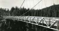

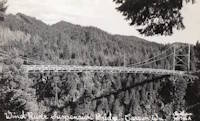
1926: (suspension bridge)
Arero, Tolaga Bay vicinity, New Zealand
| Bridgemeister ID: | 720 (added 2003-03-08) |
| Year Completed: | 1926 |
| Name: | (suspension bridge) |
| Location: | Arero, Tolaga Bay vicinity, New Zealand |
| References: | GAP |
1926: (suspension bridge)
Fort Collins, Colorado, USA - Cache La Poudre River
| Bridgemeister ID: | 2327 (added 2007-06-11) |
| Year Completed: | 1926 |
| Name: | (suspension bridge) |
| Location: | Fort Collins, Colorado, USA |
| Crossing: | Cache La Poudre River |
| Coordinates: | 40.578366 N 105.045251 W |
| Maps: | Acme, GeoHack, Google, OpenStreetMap |
| Status: | Extant (last checked: 2019) |
| Main Cables: | Wire |
Notes:
- Suspended flume, carried waste material away from the Great Western Sugar Co. factory. Has not been used since 1950s.
1926: Andy Warhol
Pittsburgh, Pennsylvania, USA - Allegheny River
| Bridgemeister ID: | 148 (added before 2003) |
| Year Completed: | 1926 |
| Name: | Andy Warhol |
| Also Known As: | Seventh Street |
| Location: | Pittsburgh, Pennsylvania, USA |
| Crossing: | Allegheny River |
| Coordinates: | 40.44626 N 80.00145 W |
| Maps: | Acme, GeoHack, Google, OpenStreetMap |
| Principals: | Vernon R. Covell, T.J. Wilkerson, A.D. Nutter, H.E. Dodge, Stanley L. Roush |
| References: | AAJ, BOP, BPL, PBR, PTS2, USS |
| Use: | Vehicular (four-lane), with walkway |
| Status: | In use (last checked: 2014) |
| Main Cables: | Eyebar (steel) |
| Suspended Spans: | 3 |
| Main Span: | 1 x 134.7 meters (442 feet) |
| Side Spans: | 2 x 67.4 meters (221 feet) |
| Deck width: | 62 feet |
| Characteristics: | Self-anchored |
Notes:
- Self-anchored.
- Replaced 1884 North Side (Seventh Street) - Pittsburgh, Pennsylvania, USA.
- Next to 1927 Rachel Carson (Ninth Street) - Pittsburgh, Pennsylvania, USA.
- Next to 1928 Roberto Clemente (Sixth Street) - Pittsburgh, Pennsylvania, USA.
External Links:
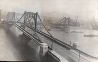
1926: Arapuni
Arapuni Power Station, New Zealand - Waikato River
| Bridgemeister ID: | 714 (added 2003-03-08) |
| Year Completed: | 1926 |
| Name: | Arapuni |
| Location: | Arapuni Power Station, New Zealand |
| Crossing: | Waikato River |
| Coordinates: | 38.070585 S 175.644480 E |
| Maps: | Acme, GeoHack, Google, OpenStreetMap |
| Principals: | David Rowell & Co., Armstrong Whitworth |
| References: | GAP |
| Use: | Footbridge |
| Status: | In use (last checked: 2019) |
| Main Cables: | Wire (steel) |
| Suspended Spans: | 1 |
External Links:
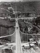
1926: Benjamin Franklin
Philadelphia, Pennsylvania and Camden, New Jersey, USA - Delaware River
| Bridgemeister ID: | 145 (added before 2003) |
| Year Completed: | 1926 |
| Name: | Benjamin Franklin |
| Also Known As: | Philadelphia-Camden |
| Location: | Philadelphia, Pennsylvania and Camden, New Jersey, USA |
| Crossing: | Delaware River |
| Coordinates: | 39.95333 N 75.135 W |
| Maps: | Acme, GeoHack, Google, OpenStreetMap |
| Principals: | Modjeski, Webster, Ball, Moiseff |
| References: | AAJ, BBR, BFL, BONJ, BPL, DRB, GBD, PTL, PTS2, USS |
| Use: | Vehicular (major highway) and Rail (subway), with walkway |
| Status: | In use (last checked: 2007) |
| Main Cables: | Wire (steel) |
| Suspended Spans: | 3 |
| Main Span: | 1 x 533.4 meters (1,750 feet) |
| Side Spans: | 2 x 219.3 meters (719.5 feet) |
| Deck width: | 125.5 feet |
Notes:
- Became longest suspension bridge by eclipsing 1924 Bear Mountain - Anthony's Nose and Bear Mountain, New York, USA.
- Eclipsed by new longest suspension bridge 1929 Ambassador - Detroit, Michigan, USA and Windsor, Ontario, Canada.
- Near 1957 Walt Whitman - Philadelphia, Pennsylvania and Camden, New Jersey, USA.
External Links:
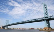
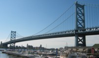
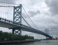
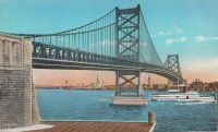
1926: Bertrand Road
Huirangi, New Zealand - Waitara River
| Bridgemeister ID: | 716 (added 2003-03-08) |
| Year Completed: | 1926 |
| Name: | Bertrand Road |
| Location: | Huirangi, New Zealand |
| Crossing: | Waitara River |
| Coordinates: | 39.047336 S 174.254549 E |
| Maps: | Acme, GeoHack, Google, OpenStreetMap |
| Principals: | N.C. Fookes |
| References: | GAP |
| Use: | Vehicular (one-lane) |
| Status: | In use, 2006 (last checked: 2017) |
| Main Cables: | Wire (steel) |
| Suspended Spans: | 1 |
| Main Span: | 1 x 61 meters (200.1 feet) |
Notes:
- Closed to vehicular traffic, 1985. Closed to all traffic, 2004. Refurbished and subsequently reopened 2006.
- Damaged by over-sized truck May 20, 2017 and closed. Reopened July 2017.
- Replaced 1897 Bertrand Road (Tikorangi) - Huirangi, New Zealand.
External Links:
1926: Boeckman
St. Elizabeth, Missouri, USA - Big Tavern Creek
| Bridgemeister ID: | 608 (added 2003-01-14) |
| Year Completed: | 1926 |
| Name: | Boeckman |
| Location: | St. Elizabeth, Missouri, USA |
| Crossing: | Big Tavern Creek |
| Coordinates: | 38.22667 N 92.24 W |
| Maps: | Acme, GeoHack, Google, OpenStreetMap |
| Principals: | Joseph A. Dice |
| References: | BOTO |
| Use: | Vehicular |
| Status: | Replaced, 2003 |
| Main Cables: | Wire (steel) |
| Suspended Spans: | 1 |
| Main Span: | 1 x 48.8 meters (160 feet) |
| Deck width: | 12.4 feet |
Notes:
- Federal Highway Administration year 2000 data listed 1910 as the year of completion.
- Original timber towers replaced with steel towers, 1988.
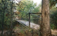
1926: Corbett
Corbett, New York, USA - East Branch Delaware River
| Bridgemeister ID: | 324 (added before 2003) |
| Year Completed: | 1926 |
| Name: | Corbett |
| Also Known As: | Corbett and Stuart |
| Location: | Corbett, New York, USA |
| Crossing: | East Branch Delaware River |
| Coordinates: | 42.04633 N 75.02768 W |
| Maps: | Acme, GeoHack, Google, OpenStreetMap |
| Principals: | John A. Roebling's Sons Co. |
| References: | SJR |
| Use: | Vehicular (one-lane) |
| Status: | In use (last checked: 2005) |
| Main Cables: | Wire (steel) |
| Suspended Spans: | 1 |
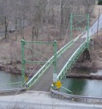
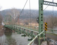
1926: Dhakuria
Rabindra Sarovar, Kolkata, West Bengal, India - Rabindra Sarovar Lake
| Bridgemeister ID: | 2847 (added 2019-07-07) |
| Year Completed: | 1926 |
| Name: | Dhakuria |
| Location: | Rabindra Sarovar, Kolkata, West Bengal, India |
| Crossing: | Rabindra Sarovar Lake |
| Coordinates: | 22.511127 N 88.355322 E |
| Maps: | Acme, GeoHack, Google, OpenStreetMap |
| Use: | Footbridge |
| Status: | In use (last checked: 2019) |
| Main Cables: | Wire (steel) |
| Suspended Spans: | 1 |
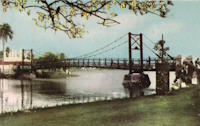
1926: Eustaquio Palacios
Roldanillo vicinity and Zarzal vicinity, Colombia - Cauca River
| Bridgemeister ID: | 2012 (added 2006-01-04) |
| Year Completed: | 1926 |
| Name: | Eustaquio Palacios |
| Location: | Roldanillo vicinity and Zarzal vicinity, Colombia |
| Crossing: | Cauca River |
| Coordinates: | 4.405070 N 76.101374 W |
| Maps: | Acme, GeoHack, Google, OpenStreetMap |
| Use: | Vehicular (one-lane) |
| Status: | Derelict (last checked: 2007) |
| Main Cables: | Wire (steel) |
| Suspended Spans: | 1 |
Notes:
- Bypassed, 1978. Still standing, but partially dismantled.
- Next to (pipeline bridge) - Roldanillo vicinity and Zarzal vicinity, Colombia.
1926: Fron
Fron, Llandyssil, Wales, United Kingdom - River Severn
| Bridgemeister ID: | 4617 (added 2020-06-07) |
| Year Completed: | 1926 |
| Name: | Fron |
| Location: | Fron, Llandyssil, Wales, United Kingdom |
| Crossing: | River Severn |
| Coordinates: | 52.568132 N 3.207281 W |
| Maps: | Acme, GeoHack, Google, OpenStreetMap |
| Principals: | David Rowell & Co. |
| Use: | Footbridge |
| Status: | Extant (last checked: 2009) |
| Main Cables: | Wire (steel) |
External Links:
| Bridgemeister ID: | 3880 (added 2020-03-08) |
| Year Completed: | 1926 |
| Name: | Henmo |
| Location: | Østeraunet, Aunet, Tydal and Henmo, Aunet, Tydal, Trøndelag, Norway |
| Crossing: | Nea |
| Coordinates: | 63.04982 N 11.58648 E |
| Maps: | Acme, GeoHack, Google, kart.1881.no, OpenStreetMap |
| Use: | Vehicular (one-lane) |
| Status: | Replaced, 1975 |
| Main Cables: | Wire (steel) |
| Main Span: | 1 x 60 meters (196.9 feet) estimated |
Notes:
1926: Hercilio Luz
Florianopolis, Santa Catarina, Brazil
| Bridgemeister ID: | 437 (added before 2003) |
| Year Completed: | 1926 |
| Name: | Hercilio Luz |
| Also Known As: | Florianopolis |
| Location: | Florianopolis, Santa Catarina, Brazil |
| Coordinates: | 27.59393 S 48.56619 W |
| Maps: | Acme, GeoHack, Google, OpenStreetMap |
| Principals: | David B. Steinman, Holton D. Robinson |
| References: | AAJ, ADDS, BBR, PTS2, USS |
| Use: | Vehicular (two-lane, heavy vehicles), with walkway |
| Status: | In use (last checked: 2011) |
| Main Cables: | Eyebar (steel) |
| Suspended Spans: | 1 |
| Main Span: | 1 x 339.5 meters (1,113.75 feet) |
| Deck width: | 37 feet |
External Links:
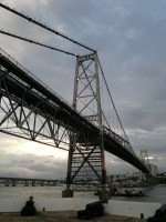
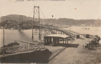
1926: Hidalgo-Reynosa International
Hidalgo, Texas, USA and Reynosa, Tamaulipas, Mexico - Rio Grande
| Bridgemeister ID: | 146 (added before 2003) |
| Year Completed: | 1926 |
| Name: | Hidalgo-Reynosa International |
| Location: | Hidalgo, Texas, USA and Reynosa, Tamaulipas, Mexico |
| Crossing: | Rio Grande |
| Principals: | Austin Bridge Co. |
| References: | AAJ, AUB, HAERTX98, PTS2 |
| Use: | Vehicular |
| Status: | Demolished, 1960's |
| Main Cables: | Wire (steel) |
| Suspended Spans: | 1 |
| Main Span: | 1 x 137.2 meters (450 feet) |
Notes:
- Damaged by flood, 1933. Rebuilt, 1934. Cables failed, 1939. Rebuilt.
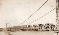
1926: La Guasca
El Peñol and Policarpa, Narino, Colombia - Patia River
| Bridgemeister ID: | 7648 (added 2023-06-03) |
| Year Completed: | 1926 |
| Name: | La Guasca |
| Also Known As: | Puerto Rico |
| Location: | El Peñol and Policarpa, Narino, Colombia |
| Crossing: | Patia River |
| Coordinates: | 1.594139 N 77.429486 W |
| Maps: | Acme, GeoHack, Google, OpenStreetMap |
| Principals: | Julio Souza Alves |
| Use: | Vehicular (one-lane) |
| Status: | Demolished, 2003 and 2020-2021 |
| Main Cables: | Wire (steel) |
Notes:
- 2003: Much of the bridge is dynamited. Stone towers remain.
- 2020 (or early 2021): The stone towers are demolished to make way for a replacement bridge.
External Links:
- Alcalde de Policarpa, en Nariño, dinamitó una joya de la ingeniería portuguesa de 100 años de antigüedad. Article about the history of the bridge and its destruction.
- Facebook. Several images of Claudia Cabrera, former mayor of Policarpa, escorted across a pulley system installed between the bridge towers.
- Facebook. Older image of the bridge with deck intact.
- Facebook. Work progressing on the replacement bridge. November 1, 2022.
- Google Maps - Puente De La Guaca. Image with the remaining towers visible, September 2018.
- Google Maps - Puente De La Guaca. Image taken in front of one of the towers, September 2018.
- Google Maps - Puente De La Guaca. Image of remaining tower , September 2018.
| Bridgemeister ID: | 8219 (added 2024-02-06) |
| Year Completed: | 1926 |
| Name: | Laon |
| Location: | Laon, Aisne, France |
| Coordinates: | 49.571000 N 3.635639 E |
| Maps: | Acme, GeoHack, Google, OpenStreetMap |
| References: | PTS2 |
| Use: | Vehicular |
| Status: | In use (last checked: 2023) |
| Main Cables: | Reinforced Concrete |
| Suspended Spans: | 2 |
| Side Spans: | 2 |
Notes:
- Rigid reinforced concrete suspension bridge.
- Similar to 1925 Luzancy - Luzancy, Seine-et-Marne, France.
- Similar to Pommiers - Pommiers, Aisne, France.
External Links:
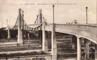
1926: Lower Hurunui
North Canterbury, New Zealand - Hurunui River
| Bridgemeister ID: | 719 (added 2003-03-08) |
| Year Completed: | 1926 |
| Name: | Lower Hurunui |
| Location: | North Canterbury, New Zealand |
| Crossing: | Hurunui River |
| Coordinates: | 42.907226 S 173.273596 E |
| Maps: | Acme, GeoHack, Google, OpenStreetMap |
| Principals: | H.F. Toogood |
| References: | GAP |
| Use: | Vehicular (one-lane) |
| Status: | In use (last checked: 2017) |
| Main Cables: | Wire (steel) |
Notes:
- GAP: Refurbished, 1983.
- Not entirely clear the bridge described in GAP as the "Lower Hurunui" bridge near the mouth of the Hurunui is the same bridge as the present day bridge carrying Blythe Road. The detailed description of the 1926 bridge does not seem to match the current structure. However, Thornton also implied major changes to the bridge during the 1983 refurbishment.
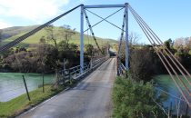
1926: Nassau
Nassau, Rheinland-Pfalz, Germany - Lahn River
| Bridgemeister ID: | 1133 (added 2004-01-16) |
| Year Completed: | 1926 |
| Name: | Nassau |
| Location: | Nassau, Rheinland-Pfalz, Germany |
| Crossing: | Lahn River |
| Coordinates: | 50.311299 N 7.795710 E |
| Maps: | Acme, GeoHack, Google, OpenStreetMap |
| References: | AAJ |
| Use: | Vehicular (two-lane) |
| Status: | Removed (last checked: 2004) |
| Main Cables: | Riveted plate |
| Main Span: | 1 x 74.9 meters (245.75 feet) |
Notes:
- The "cables" of this bridge appear to have been steel plates riveted together. The deck is plate girder. Not surprisingly, recent photos of the bridge show it resting on two intermediate piers. AAJ describes the cables: "'laminated chains' made of flat iron plates, there being two such chains to a side, each of five plates riveted together."
- Replaced 1830 (suspension bridge) - Nassau, Germany.
- Replaced by 2005 Nassau - Nassau, Rheinland-Pfalz, Germany.
External Links:
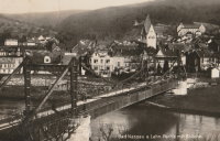
| Bridgemeister ID: | 7273 (added 2022-07-22) |
| Year Completed: | 1926 |
| Name: | Oiselay |
| Location: | Sorgues, Vaucluse, France |
| Coordinates: | 44.023850 N 4.843694 E |
| Maps: | Acme, GeoHack, Google, OpenStreetMap |
| Use: | Vehicular (one-lane) |
| Status: | Closed (last checked: 2021) |
| Main Cables: | Wire (steel) |
| Suspended Spans: | 1 |
| Main Span: | 1 x 151 meters (495.4 feet) estimated |
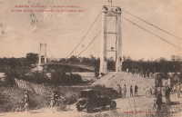
1926: Oriente
Oriente, Jiménez, Cartago, Costa Rica - Pejibaye River
| Bridgemeister ID: | 438 (added before 2003) |
| Year Completed: | 1926 |
| Name: | Oriente |
| Location: | Oriente, Jiménez, Cartago, Costa Rica |
| Crossing: | Pejibaye River |
| Coordinates: | 9.834250 N 83.681556 W |
| Maps: | Acme, GeoHack, Google, OpenStreetMap |
| References: | PTS2, USS |
| Use: | Vehicular |
| Status: | Removed, c. 2002-2015 |
| Main Cables: | Wire (steel) |
| Suspended Spans: | 1 |
| Main Span: | 1 x 45.7 meters (150 feet) |
Notes:
- Built with a set of tram tracks designed for cars hauling fruit.
- Older sources refer to the "Pejivalle" river.
- Removed at some point in the 2002-2015 time frame.
1926: Satok
Kuching, Sarawak, Malaysia - Sarawak River
| Bridgemeister ID: | 1574 (added 2004-12-12) |
| Year Completed: | 1926 |
| Name: | Satok |
| Also Known As: | Yellow |
| Location: | Kuching, Sarawak, Malaysia |
| Crossing: | Sarawak River |
| Coordinates: | 1.554709 N 110.324370 E |
| Maps: | Acme, GeoHack, Google, OpenStreetMap |
| Use: | Footbridge and Pipeline |
| Status: | Collapsed, 2004 |
| Main Cables: | Wire (steel) |
| Suspended Spans: | 1 |
| Main Span: | 1 x 130 meters (426.5 feet) |
Notes:
- 1992: Closed to pedestrian traffic.
- 2004, October 7: Collapsed. Was still closed to pedestrian traffic at the time of the collapse, but was still carrying the local water supply.
- Later at same location 2021 Satok - Kuching, Sarawak, Malaysia.
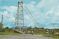
1926: Second Alexandra
Spuzzum, British Columbia, Canada - Fraser River
| Bridgemeister ID: | 147 (added before 2003) |
| Year Completed: | 1926 |
| Name: | Second Alexandra |
| Location: | Spuzzum, British Columbia, Canada |
| Crossing: | Fraser River |
| At or Near Feature: | Caribou Highway |
| Coordinates: | 49.70739 N 121.41669 W |
| Maps: | Acme, GeoHack, Google, OpenStreetMap |
| References: | BPL |
| Use: | Vehicular (one-lane) |
| Status: | Restricted to foot traffic (last checked: 2021) |
| Main Cables: | Wire (steel) |
| Suspended Spans: | 1 |
| Main Span: | 1 x 82.3 meters (270 feet) |
Notes:
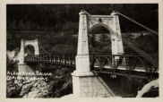
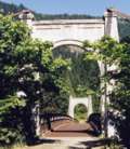
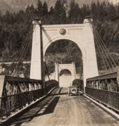
1926: Shirakawa
Shirakawa, Gifu, Japan - Hida River
| Bridgemeister ID: | 3206 (added 2019-11-10) |
| Year Completed: | 1926 |
| Name: | Shirakawa |
| Also Known As: | 白川橋 |
| Location: | Shirakawa, Gifu, Japan |
| Crossing: | Hida River |
| Coordinates: | 35.579518 N 137.186653 E |
| Maps: | Acme, GeoHack, Google, OpenStreetMap |
| Use: | Vehicular (one-lane) |
| Status: | Restricted to foot traffic (last checked: 2014) |
| Main Cables: | Wire (steel) |
| Suspended Spans: | 3 |
| Main Span: | 1 x 74.6 meters (244.8 feet) |
| Side Spans: | 2 x 20 meters (65.6 feet) |
External Links:
1926: Swinging
Pawhuska, Oklahoma, USA - Bird Creek
| Bridgemeister ID: | 3061 (added 2019-10-26) |
| Year Completed: | 1926 |
| Name: | Swinging |
| Location: | Pawhuska, Oklahoma, USA |
| Crossing: | Bird Creek |
| Coordinates: | 36.659110 N 96.341366 W |
| Maps: | Acme, GeoHack, Google, OpenStreetMap |
| Principals: | J.M. Buckley |
| Use: | Footbridge |
| Status: | In use (last checked: 2019) |
| Main Cables: | Wire (steel) |
1926: Yunguita
Colombia - Suaza River
| Bridgemeister ID: | 439 (added before 2003) |
| Year Completed: | 1926 |
| Name: | Yunguita |
| Location: | Colombia |
| Crossing: | Suaza River |
| References: | USS |
| Use: | Vehicular |
| Main Cables: | Wire (steel) |
| Suspended Spans: | 1 |
| Main Span: | 1 x 103.3 meters (339 feet) |
| Deck width: | 10 feet |
External Links:
1927: (footbridge)
Forst, Germany - Lusatian Neisse River
| Bridgemeister ID: | 5562 (added 2020-12-19) |
| Year Completed: | 1927 |
| Name: | (footbridge) |
| Location: | Forst, Germany |
| Crossing: | Lusatian Neisse River |
| Coordinates: | 51.748356 N 14.659815 E |
| Maps: | Acme, GeoHack, Google, OpenStreetMap |
| References: | AAJ |
| Use: | Footbridge |
| Status: | Removed |
| Main Cables: | Eyebar (steel) |
| Suspended Spans: | 3 |
| Main Span: | 1 x 39.6 meters (129.89 feet) |
| Side Spans: | 2 x 19.8 meters (64.94 feet) |
Notes:
- Coordinates are for likely alignment of this former bridge, with at least one pier remaining (as of 2020).
1927: (footbridge)
Töpeln and Wöllsdorf, Saxony, Germany - Zschopau River
| Bridgemeister ID: | 2301 (added 2007-04-26) |
| Year Completed: | 1927 |
| Name: | (footbridge) |
| Location: | Töpeln and Wöllsdorf, Saxony, Germany |
| Crossing: | Zschopau River |
| Use: | Footbridge |
| Status: | Destroyed, 2002, by flood |
| Main Cables: | Wire (steel) |
| Suspended Spans: | 1 |
Notes:
- Replaced by a cable-stayed bridge April, 2004.
1927: (suspension bridge)
Neals Landing, Donalsonville vicinity, Georgia and Jackson County, Florida, USA - Chattahoochee River
| Bridgemeister ID: | 2145 (added 2006-11-05) |
| Year Completed: | 1927 |
| Name: | (suspension bridge) |
| Location: | Neals Landing, Donalsonville vicinity, Georgia and Jackson County, Florida, USA |
| Crossing: | Chattahoochee River |
| Principals: | Austin Bridge Co. |
| References: | PTS2, RRC |
| Use: | Vehicular |
| Status: | Removed |
| Main Cables: | Wire |
Notes:
- Condemned, 1953, due to sinking foundation.
- Follow the image for more information about this bridge and location.
| Bridgemeister ID: | 3931 (added 2020-03-20) |
| Year Completed: | 1927 |
| Name: | Bingsfoss |
| Location: | Sørumsand, Lillestrøm, Viken, Norway |
| Crossing: | Glomma |
| Coordinates: | 59.98854 N 11.26129 E |
| Maps: | Acme, GeoHack, Google, kart.1881.no, OpenStreetMap |
| Use: | Vehicular |
| Status: | Removed, 1978 |
| Main Cables: | Wire (steel) |
| Suspended Spans: | 1 |
| Main Span: | 1 x 132 meters (433.1 feet) estimated |
External Links:
1927: Briollay
Briollay, Maine-et-Loire, France - Sarthe River
| Bridgemeister ID: | 6700 (added 2021-10-03) |
| Year Completed: | 1927 |
| Name: | Briollay |
| Location: | Briollay, Maine-et-Loire, France |
| Crossing: | Sarthe River |
| Use: | Vehicular |
| Status: | Removed |
| Main Cables: | Wire |
Notes:
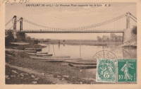
1927: Bryan-Fannin
Telephone, Bonham vicinity, Fannin County, Texas and Bryan County, Oklahoma, USA - Red River
| Bridgemeister ID: | 602 (added 2003-01-11) |
| Year Completed: | 1927 |
| Name: | Bryan-Fannin |
| Also Known As: | Telephone, Snow's Ferry, Bryant-Fannin |
| Location: | Telephone, Bonham vicinity, Fannin County, Texas and Bryan County, Oklahoma, USA |
| Crossing: | Red River |
| Coordinates: | 33.844484 N 96.011125 W |
| Maps: | Acme, GeoHack, Google, OpenStreetMap |
| Principals: | Austin Bridge Co. |
| References: | AUB, PTS2 |
| Use: | Vehicular |
| Status: | Collapsed, December, 1940 |
| Main Cables: | Wire (steel) |
| Suspended Spans: | 3 |
| Main Span: | 1 |
| Side Spans: | 2 |
Notes:
- Sometimes referenced as "Bryant-Fannin". The bridge unquestionably connected Fannin County to Bryan County, Oklahoma, but according to a www.rootsweb.com article (Fannin County TXGenWeb - Ferry's in Fannin County, from Pat Pryor, by Kathy J. Ellis) it was erected at a site known as "Bryant's Crossing" named for a local, Dave Bryant. The Steinman inventory lists it as "Bryan-Fannin". AUB mentions it as "Bryant-Fannin". The Rootsweb article also mentions it collapsed in 1940 under weight of a truck.
- An article in the December 6, 1940 issue of The Port Arthur News (Texas) titled: "Suspension Bridge Plunges Into Red River" describes the collapse: "Owners of a $75,000 tollbridge which plunged into the Red River Wednesday when a suspension cable anchor pulled loose were undecided today whether it would be rebuilt. The bridge, owned by the Austin Bridge company of Dallas, was near Telephone, Tex., 12 miles north of here, and was several miles from a principal highway. Most of the traffic from the Bonham area toward Oklahoma is across a structure built recently to replace a toll bridge at nearby Sowell's bluff that collapsed in 1930. Mrs. Jim Freeman, toll keeper, said she heard a 'rumble' and looked up to see the 'deadman anchor' pull loose, throwing the entire weight of the 1,300 foot span on the other cable. It snapped, and the flooring and steel framework of the bridge sagged into the water. No one was on the structure when it fell."
- Remains of three piers are still visible, 2019.
1927: Chartrouse
Arles, Bouches-du-Rhône, France - Rhône River
| Bridgemeister ID: | 4846 (added 2020-07-11) |
| Year Completed: | 1927 |
| Name: | Chartrouse |
| Location: | Arles, Bouches-du-Rhône, France |
| Crossing: | Rhône River |
| At or Near Feature: | Lône des Pilotes |
| Coordinates: | 43.463752 N 4.743590 E |
| Maps: | Acme, GeoHack, Google, OpenStreetMap |
| Use: | Vehicular (one-lane) |
| Status: | In use (last checked: 2019) |
| Main Cables: | Wire (steel) |
| Suspended Spans: | 1 |
External Links:
1927: Durant-Bonham
Bonham vicinity, Fannin County, Texas and Yuba/Durant vicinity, Oklahoma, USA - Red River
| Bridgemeister ID: | 603 (added 2003-01-11) |
| Year Completed: | 1927 |
| Name: | Durant-Bonham |
| Also Known As: | Sowell's Bluff |
| Location: | Bonham vicinity, Fannin County, Texas and Yuba/Durant vicinity, Oklahoma, USA |
| Crossing: | Red River |
| Principals: | Austin Bridge Co. |
| References: | AUB, PTS2 |
| Use: | Vehicular |
| Status: | Collapsed, 1934 |
| Main Cables: | Wire (steel) |
Notes:
- According to a rootsweb article (Fannin County TXGenWeb - Ferry's in Fannin County, from Pat Pryor, by Kathy J. Ellis), "when in 1932 this bridge fell, many people said that acid had been put on the cables to break them so that people from Oklahoma could not cross to Bonham." However, the true date of collapse may have been in 1934. The February 2, 1934 issue of The Daily Oklahoman has a front-page article with a photo of the bridge with collapsed deck. The photo is captioned: "The Red River Bridge on Highway 22 Near Durant After the Midnight Crash," and the article reads: "Here Is the debris of a $60,000 investment made by the states of Oklahoma and Texas eight months ago when they purchased the Bonham-Durant bridge across the Red river on highway 22. Three of the five spans of the 1,500-foot suspension bridge turned upside down and dropped into the river bed when a four-Inch wire cable rusted and broke in two about 15 feet from the ground on the Texas side. A lull in the usual heavy traffic across the bridge prevented accidents. The crash came at midnight, and one motorist had barely reached the Texas side when the cable gave away. Other motorists stopped their cars just in time to witness the spans of the bridge crash 40 feet into the stream. The bridge was built in 1926 and was operated as a toll bridge until 1933 when the two states bought it and made it a free crossing."
- In the October 1989 edition of the Oklahoma Water News an article (excerpted from an article in The Chronicles of Oklahoma by Dr. Bernice N. Crockett) states: "On January 15, 1934, a norther of terrific force came up which cause the Sowell's Bluff Bridge to fall. At 1 a.m. the wire cables on the Fannin side of the river became twisted, then snapped, broken in half, and the entire massive structure fell into the river below -- a complete wreck."
1927: General U.S. Grant
Portsmouth, Ohio and Fullerton, Kentucky, USA - Ohio River
| Bridgemeister ID: | 151 (added before 2003) |
| Year Completed: | 1927 |
| Name: | General U.S. Grant |
| Location: | Portsmouth, Ohio and Fullerton, Kentucky, USA |
| Crossing: | Ohio River |
| Coordinates: | 38.725 N 82.99833 W |
| Maps: | Acme, GeoHack, Google, OpenStreetMap |
| Principals: | Robinson and Steinman, J.E. Greiner, Dravo Co. |
| References: | AAJ, PTS2, SSS |
| Use: | Vehicular (two-lane, heavy vehicles) |
| Status: | Demolished, July 2001 |
| Main Cables: | Wire (steel) |
| Suspended Spans: | 3 |
| Main Span: | 1 x 213.4 meters (700 feet) |
| Side Spans: | 2 x 106.7 meters (350 feet) |
| Deck width: | 28.5 feet |
Notes:
- AAJ: "Recabled" in 1939.
External Links:
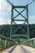
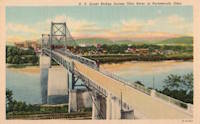
1927: Hellestraumen
Helle, Vaksdal, Vestland, Norway - Hellestraumen
| Bridgemeister ID: | 4412 (added 2020-04-19) |
| Year Completed: | 1927 |
| Name: | Hellestraumen |
| Location: | Helle, Vaksdal, Vestland, Norway |
| Crossing: | Hellestraumen |
| Coordinates: | 60.564000 N 5.753306 E |
| Maps: | Acme, GeoHack, Google, kart.1881.no, OpenStreetMap |
| Use: | Vehicular (one-lane) |
| Status: | In use (last checked: 2019) |
| Main Cables: | Wire (steel) |
| Suspended Spans: | 1 |
| Main Span: | 1 x 53 meters (173.9 feet) estimated |
1927: Hugo Preuss
Berlin, Germany - Berlin-Spandau Ship Canal
| Bridgemeister ID: | 2090 (added 2006-07-02) |
| Year Completed: | 1927 |
| Name: | Hugo Preuss |
| Also Known As: | Hugo Preuß, Humboldthafen, Admiral Scheer |
| Location: | Berlin, Germany |
| Crossing: | Berlin-Spandau Ship Canal |
| Coordinates: | 52.523580 N 13.372238 E |
| Maps: | Acme, GeoHack, Google, OpenStreetMap |
| References: | AAJ, PTS2 |
| Use: | Vehicular |
| Status: | Destroyed, 1945 |
| Main Cables: | Eyebar |
| Suspended Spans: | 3 |
| Main Span: | 1 |
| Side Spans: | 2 |
| Characteristics: | Self-anchored |
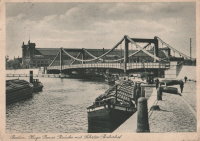
1927: Jargeau
Jargeau and Saint-Denis-de-l'Hôtel, Loiret, France - Loire River
| Bridgemeister ID: | 6805 (added 2021-11-21) |
| Year Completed: | 1927 |
| Name: | Jargeau |
| Also Known As: | Saint-Denis-de-l'Hôtel |
| Location: | Jargeau and Saint-Denis-de-l'Hôtel, Loiret, France |
| Crossing: | Loire River |
| Coordinates: | 47.868650 N 2.124035 E |
| Maps: | Acme, GeoHack, Google, OpenStreetMap |
| Use: | Vehicular |
| Status: | Replaced, 1965 |
| Main Cables: | Wire (steel) |
Notes:
- 1937: Strengthened.
- 1940: Partially destroyed to slow advancing German troops.
- 1943: Repairs completed and bridge reopened.
- 1944: Partially destroyed.
- 1944-1945: Repaired and reopened.
- 1965: Closed and replaced due to concerns about deteriorating main cable strength.
- Replaced 1834 Jargeau (Saint-Denis-de-l'Hôtel) - Jargeau and Saint-Denis-de-l'Hôtel, Loiret, France.
External Links:
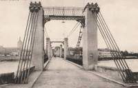
1927: Limestone Ford
Awatere Valley, Marlborough, New Zealand
| Bridgemeister ID: | 722 (added 2003-03-08) |
| Year Completed: | 1927 |
| Name: | Limestone Ford |
| Location: | Awatere Valley, Marlborough, New Zealand |
| References: | GAP |
| Status: | Replaced |
Notes:
- GAP: Replaced, early 1970's.
1927: Mediacanoa
Buga, Colombia - Cauca River
| Bridgemeister ID: | 2010 (added 2006-01-04) |
| Year Completed: | 1927 |
| Name: | Mediacanoa |
| Location: | Buga, Colombia |
| Crossing: | Cauca River |
| References: | PTS2 |
| Use: | Vehicular |
| Status: | Replaced |
| Main Cables: | Wire (steel) |
| Suspended Spans: | 1 |
| Main Span: | 1 x 110 meters (360.9 feet) |
1927: Miyoshi
Tokushima, Tokushima, Japan - Yoshino River
| Bridgemeister ID: | 1145 (added 2004-01-17) |
| Year Completed: | 1927 |
| Name: | Miyoshi |
| Location: | Tokushima, Tokushima, Japan |
| Crossing: | Yoshino River |
| References: | BAAW |
| Status: | Removed |
| Main Cables: | Wire |
| Main Span: | 1 x 139.9 meters (459 feet) |
Notes:
- BAAW: suspension cables removed, 1989, replaced by arches. However, the modified structure (pictured in BAAW) appears to be more of a continuous truss than an arch-based structure. The bridge appears to have been subsequently removed entirely as there are no current (as of 2020) Yoshino River bridges near Myoshi resembling the bridge.
1927: Montjean-sur-Loire
Montjean-sur-Loire, Maine-et-Loire, France - Loire River
| Bridgemeister ID: | 1602 (added 2005-02-06) |
| Year Completed: | 1927 |
| Name: | Montjean-sur-Loire |
| Location: | Montjean-sur-Loire, Maine-et-Loire, France |
| Crossing: | Loire River |
| Coordinates: | 47.395958 N 0.858340 W |
| Maps: | Acme, GeoHack, Google, OpenStreetMap |
| References: | AAJ, PTS2 |
| Use: | Vehicular |
| Status: | Destroyed, 1936 |
| Main Cables: | Wire |
| Suspended Spans: | 6 |
| Main Spans: | 4 |
| Side Spans: | 2 |
Notes:
- 1935: One of the towers fails in a windstorm causing part of the bridge to collapse.
- 1936: The remainder of the derelict bridge is wrecked by a flood.
- Replaced 1840 Montjean-sur-Loire - Montjean-sur-Loire, Maine-et-Loire, France.
- Replaced by 1938 Montjean-sur-Loire - Montjean-sur-Loire, Maine-et-Loire, France.
External Links:
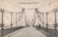
1927: Orellana
El Rancho, El Progresso, Guatemala - Rio Motagua
| Bridgemeister ID: | 1481 (added 2004-09-04) |
| Year Completed: | 1927 |
| Name: | Orellana |
| Location: | El Rancho, El Progresso, Guatemala |
| Crossing: | Rio Motagua |
| Use: | Vehicular |
| Main Cables: | Wire |
External Links:
1927: Port à l'Anglais
Alfortville and Vitry-sur-Seine, Val-de-Marne, France - Seine River
| Bridgemeister ID: | 1114 (added 2004-01-05) |
| Year Completed: | 1927 |
| Name: | Port à l'Anglais |
| Location: | Alfortville and Vitry-sur-Seine, Val-de-Marne, France |
| Crossing: | Seine River |
| Coordinates: | 48.797333 N 2.41875 E |
| Maps: | Acme, GeoHack, Google, OpenStreetMap |
| References: | AAJ, BC3, BPF, PTS2 |
| Use: | Vehicular (three-lane), with walkway |
| Status: | In use (last checked: 2021) |
| Main Cables: | Wire |
| Suspended Spans: | 3 |
| Main Span: | 1 x 124 meters (406.8 feet) |
| Side Spans: | 1 x 54 meters (177.2 feet), 1 x 52 meters (170.6 feet) |
| Deck width: | 40 feet |
Notes:
- This bridge was originally built with the Gisclard suspension system. Such bridges are not included in the Bridgemeister suspension bridge inventory. However, at some point the suspension system was modified to be more similar to a standard suspension bridge. It isn't clear when this modification occurred.
- Near Créteil (Saint-Maur) - Créteil-sur-Marne and Saint-Maur-des-Fossés, Val-de-Marne, France.
External Links:
1927: Rachel Carson
Pittsburgh, Pennsylvania, USA - Allegheny River
| Bridgemeister ID: | 150 (added before 2003) |
| Year Completed: | 1927 |
| Name: | Rachel Carson |
| Also Known As: | Ninth Street |
| Location: | Pittsburgh, Pennsylvania, USA |
| Crossing: | Allegheny River |
| Coordinates: | 40.44669 N 79.99980 W |
| Maps: | Acme, GeoHack, Google, OpenStreetMap |
| Principals: | Vernon R. Covell, T.J. Wilkerson, A.D. Nutter, H.E. Dodge, Stanley L. Roush |
| References: | AAJ, BOP, BPL, PBR, PTS2, USS |
| Use: | Vehicular (four-lane), with walkway |
| Status: | In use (last checked: 2014) |
| Main Cables: | Eyebar (steel) |
| Suspended Spans: | 3 |
| Main Span: | 1 x 131.1 meters (430 feet) |
| Side Spans: | 2 x 65.5 meters (215 feet) |
| Characteristics: | Self-anchored |
Notes:
- Self-anchored.
- Next to 1926 Andy Warhol (Seventh Street) - Pittsburgh, Pennsylvania, USA.
- Next to 1928 Roberto Clemente (Sixth Street) - Pittsburgh, Pennsylvania, USA.
External Links:

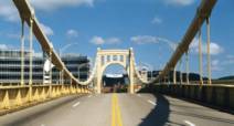
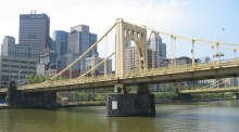

1927: Ravine
Douglass College Campus, New Brunswick, New Jersey, USA
| Bridgemeister ID: | 877 (added 2003-08-31) |
| Year Completed: | 1927 |
| Name: | Ravine |
| Also Known As: | Old Bouncer, Kissing |
| Location: | Douglass College Campus, New Brunswick, New Jersey, USA |
| Coordinates: | 40.485867 N 74.43495 W |
| Maps: | Acme, GeoHack, Google, OpenStreetMap |
| References: | BONJ |
| Use: | Footbridge |
| Status: | In use (last checked: 2020) |
| Main Cables: | Wire (steel) |
| Suspended Spans: | 1 |
| Main Span: | 1 x 30.8 meters (101 feet) estimated |
External Links:
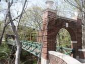
| Bridgemeister ID: | 3930 (added 2020-03-20) |
| Year Completed: | 1927 |
| Name: | Rånåsfoss |
| Location: | Rånåsfoss, Viken, Norway |
| Crossing: | Glomma |
| Coordinates: | 60.031390 N 11.327592 E |
| Maps: | Acme, GeoHack, Google, kart.1881.no, OpenStreetMap |
| Use: | Vehicular (one-lane) |
| Status: | In use (last checked: 2019) |
| Main Cables: | Wire (steel) |
| Suspended Spans: | 1 |
| Main Span: | 1 x 184 meters (603.7 feet) estimated |
Notes:
- Rehabilitation completed, 2016.
- Replaced 1918 Rånåsfoss - Rånåsfoss, Viken, Norway.
External Links:
1927: Saint Jo
Illinois Bend, Saint Jo vicinity, Texas and Wilson vicinity, Oklahoma, USA - Red River
| Bridgemeister ID: | 601 (added 2003-01-11) |
| Year Completed: | 1927 |
| Name: | Saint Jo |
| Also Known As: | Airline, Air-Line |
| Location: | Illinois Bend, Saint Jo vicinity, Texas and Wilson vicinity, Oklahoma, USA |
| Crossing: | Red River |
| Coordinates: | 33.917051 N 97.486010 W |
| Maps: | Acme, GeoHack, Google, OpenStreetMap |
| Principals: | Austin Bridge Co. |
| References: | AUB, PTS2 |
| Use: | Vehicular (one-lane) |
| Status: | Removed |
| Main Cables: | Wire (steel) |
| Suspended Spans: | 1 |
| Main Span: | 1 x 213.4 meters (700 feet) |
External Links:
- St Jo "Airline" Suspension Bridge over the Red River Texas - Facebook. Coordinates provided here are based on the research presented in this Bridgehunting Texas Facebook group post.
1927: San Pablo
Soná, Veraguas, Panama - Rio San Pablo
| Bridgemeister ID: | 7981 (added 2023-12-02) |
| Year Completed: | 1927 |
| Name: | San Pablo |
| Location: | Soná, Veraguas, Panama |
| Crossing: | Rio San Pablo |
| Coordinates: | 8.000111 N 81.296694 W |
| Maps: | Acme, GeoHack, Google, OpenStreetMap |
| Use: | Vehicular (one-lane) |
| Status: | Dismantled |
| Main Cables: | Wire (steel) |
| Suspended Spans: | 1 |
Notes:
- Dismantled and relocated to a crossing north of Soná where it survived until some point in the 2008-2013 time frame.
- Moved to Rio Cobre - Los Bajos del Cobre, Soná District, Veraguas, Panama.
External Links:
- Facebook. History of the bridge.
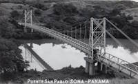
| Bridgemeister ID: | 553 (added before 2003) |
| Year Completed: | 1927 |
| Name: | Shaky |
| Also Known As: | Shakey, Daly's |
| Location: | Cork, Ireland |
| Crossing: | River Lee |
| At or Near Feature: | Sunday's Well, Fitzgerald's Park |
| Coordinates: | 51.896585 N 8.499218 W |
| Maps: | Acme, GeoHack, Google, OpenStreetMap |
| Principals: | David Rowell & Co. |
| Use: | Footbridge |
| Status: | In use (last checked: 2020) |
| Main Cables: | Wire (steel) |
| Suspended Spans: | 1 |
Notes:
- 2019, September: Dismantled for refurbishment, expected to be completed in early 2020.
- 2020, September: Refurbishment stalled during contract negotiations with contract. Bridge has been reassembled with new cables but work is not completed.
- 2020, October: Completion of refurbishment still on hold as two companies involved in the project go into examinership.
- 2020, December: Restored bridge reopens.
External Links:
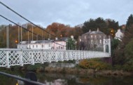
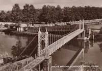
1927: Upper
Warsaw, Missouri, USA - Osage River
| Bridgemeister ID: | 1070 (added 2003-12-27) |
| Year Completed: | 1927 |
| Name: | Upper |
| Also Known As: | Swinging |
| Location: | Warsaw, Missouri, USA |
| Crossing: | Osage River |
| Coordinates: | 38.244110 N 93.388767 W |
| Maps: | Acme, GeoHack, Google, OpenStreetMap |
| Principals: | Joseph A. Dice |
| References: | BOTO |
| Use: | Vehicular (one-lane) |
| Status: | Restricted to foot traffic (last checked: 2020) |
| Main Cables: | Wire (steel) |
| Suspended Spans: | 2 |
| Main Span: | 1 x 152.4 meters (500 feet) estimated |
| Side Span: | 1 x 29 meters (95 feet) estimated |
Notes:
- Joseph Dice supervised the construction of this bridge to replace the 1904 structure destroyed in a tornado in 1924. A postcard of this bridge reads: "built in 1927 by the Benton County Court and by popular subscription of citizens to replace a similar bridge destroyed by a windstorm two years earlier. Structure swings on two wire cables imbedded and anchored in concrete and stone. The towers and floor beams are of steel while the floor is of wood. A state highway crosses this bridge."
- Reopened for pedestrians, 2007, after being closed for several years.
- Replaced 1904 Upper (Swinging) - Warsaw, Missouri, USA.
External Links:
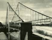
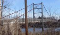
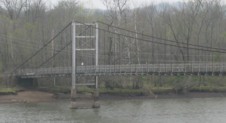
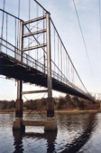
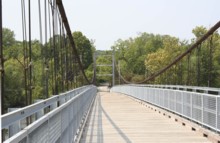
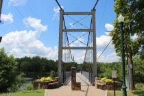
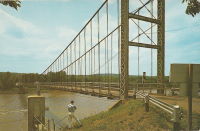
1927: Waiho Gorge
Franz Josef Glacier vicinity, New Zealand - Waiho River
| Bridgemeister ID: | 721 (added 2003-03-08) |
| Year Completed: | 1927 |
| Name: | Waiho Gorge |
| Location: | Franz Josef Glacier vicinity, New Zealand |
| Crossing: | Waiho River |
| Coordinates: | 43.393202 S 170.180682 E |
| Maps: | Acme, GeoHack, Google, OpenStreetMap |
| References: | GAP |
| Use: | Vehicular |
| Status: | Removed, c. 1990 |
| Main Cables: | Wire (steel) |
| Suspended Spans: | 1 |
| Main Span: | 1 x 91.4 meters (300 feet) |
External Links:
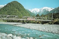
1927: White Star
Dayhoit, Kentucky, USA - Cumberland River
| Bridgemeister ID: | 2556 (added 2012-01-01) |
| Year Completed: | 1927 |
| Name: | White Star |
| Location: | Dayhoit, Kentucky, USA |
| Crossing: | Cumberland River |
| Use: | Vehicular (one-lane) |
| Status: | Removed |
| Main Cables: | Wire |
Notes:
- The town of Dayhoit has also been known as Day, White Star, and Wilhoit.
External Links:
1928: (suspension bridge)
Galesburg, Illinois, USA - Lake Bracken
| Bridgemeister ID: | 280 (added before 2003) |
| Year Completed: | 1928 |
| Name: | (suspension bridge) |
| Location: | Galesburg, Illinois, USA |
| Crossing: | Lake Bracken |
| At or Near Feature: | Lake Bracken Country Club Boat Harbor |
| Coordinates: | 40.861999 N 90.350571 W |
| Maps: | Acme, GeoHack, Google, OpenStreetMap |
| Use: | Footbridge |
| Status: | In use (last checked: 2021) |
| Main Cables: | Wire |
| Suspended Spans: | 1 |
1928: (suspension bridge)
Rio Rico, Mexico and Mercedes, Texas, USA - Rio Grande
| Bridgemeister ID: | 3914 (added 2020-03-20) |
| Year Completed: | 1928 |
| Name: | Åbrua |
| Also Known As: | Aaen |
| Location: | Tynset, Innlandet, Norway |
| Crossing: | Glomma |
| Coordinates: | 62.288617 N 10.823438 E |
| Maps: | Acme, GeoHack, Google, kart.1881.no, OpenStreetMap |
| Use: | Vehicular (one-lane) |
| Status: | Replaced, 1980 |
| Main Cables: | Wire (steel) |
| Suspended Spans: | 1 |
| Main Span: | 1 x 10⁹ meters (357.6 feet) estimated |
Notes:
- Heavily damaged by flood, likely prior to 1969. Appears to have been repaired before being replaced with another suspension bridge in 1980.
- Replaced by 1980 Åbrua (Aaen) - Tynset, Innlandet, Norway.
External Links:
1928: Bernardo Arango
La Virginia vicinity and Cerritos vicinity, Colombia - Cauca River
| Bridgemeister ID: | 2016 (added 2006-01-14) |
| Year Completed: | 1928 |
| Name: | Bernardo Arango |
| Location: | La Virginia vicinity and Cerritos vicinity, Colombia |
| Crossing: | Cauca River |
| Coordinates: | 4.891980 N 75.882927 W |
| Maps: | Acme, GeoHack, Google, OpenStreetMap |
| Use: | Vehicular (one-lane) |
| Status: | In use (last checked: 2019) |
| Main Cables: | Wire (steel) |
| Suspended Spans: | 1 |
| Main Span: | 1 x 190 meters (623.4 feet) |
1928: Colfax-Iowa Hill
Colfax vicinity, California, USA - North Fork American River
| Bridgemeister ID: | 588 (added 2003-01-05) |
| Year Completed: | 1928 |
| Name: | Colfax-Iowa Hill |
| Location: | Colfax vicinity, California, USA |
| Crossing: | North Fork American River |
| Coordinates: | 39.09993 N 120.92480 W |
| Maps: | Acme, GeoHack, Google, OpenStreetMap |
| Use: | Vehicular (one-lane) |
| Status: | Restricted to foot traffic (last checked: 2021) |
| Main Cables: | Wire (steel) |
| Suspended Spans: | 1 |
Notes:
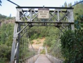
1928: Des Arc
Des Arc, Arkansas, USA - White River
| Bridgemeister ID: | 152 (added before 2003) |
| Year Completed: | 1928 |
| Name: | Des Arc |
| Also Known As: | Swinging |
| Location: | Des Arc, Arkansas, USA |
| Crossing: | White River |
| Coordinates: | 34.974811 N 91.487684 W |
| Maps: | Acme, GeoHack, Google, OpenStreetMap |
| Principals: | Austin Bridge Co |
| References: | AUB, PTS2 |
| Use: | Vehicular |
| Status: | Demolished, August 1970 |
| Main Cables: | Wire (steel) |
| Suspended Spans: | 3 |
| Main Span: | 1 x 198.1 meters (650 feet) |
| Side Spans: | 2 x 97.5 meters (320 feet) |
Notes:
- The coordinates provided here indicate the approximate alignment of the bridge, about 0.5 miles southeast of the current (2020s) Des Arc White River crossing. The bridge delivered traffic near the east end of East Chester Street in Des Arc.
External Links:
1928: Fort Steuben
Steubenville, Ohio and Weirton, West Virginia, USA - Ohio River
| Bridgemeister ID: | 154 (added before 2003) |
| Year Completed: | 1928 |
| Name: | Fort Steuben |
| Location: | Steubenville, Ohio and Weirton, West Virginia, USA |
| Crossing: | Ohio River |
| Coordinates: | 40.37833 N 80.615 W |
| Maps: | Acme, GeoHack, Google, OpenStreetMap |
| Principals: | Dravo Co. |
| References: | AAJ, PTS2 |
| Use: | Vehicular (two-lane, heavy vehicles), with walkway |
| Status: | Demolished, February 2012 (last checked: 2012) |
| Main Cables: | Wire (steel) |
| Suspended Spans: | 3 |
| Main Span: | 1 x 209.9 meters (688.75 feet) |
| Side Spans: | 2 x 86.3 meters (283 feet) |
| Deck width: | 20.25 feet |
Notes:
- January 2009: Closed indefinitely following inspections revealing major deterioration. Demolished in 2012.
- Near 1905 Market Street - Steubenville, Ohio and East Steubenville, West Virginia, USA.
External Links:
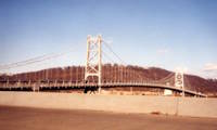
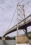
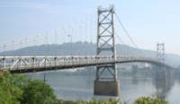
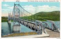
1928: Kaibab Trail
Bright Angel Campground vicinity, Arizona, USA - Colorado River
| Bridgemeister ID: | 155 (added before 2003) |
| Year Completed: | 1928 |
| Name: | Kaibab Trail |
| Also Known As: | Black, South Kaibab |
| Location: | Bright Angel Campground vicinity, Arizona, USA |
| Crossing: | Colorado River |
| At or Near Feature: | Grand Canyon National Park |
| Coordinates: | 36.10076 N 112.08918 W |
| Maps: | Acme, GeoHack, Google, OpenStreetMap |
| Principals: | Ward P. Webber, John H. Lawrence |
| Use: | Footbridge |
| Status: | In use (last checked: 2007) |
| Main Cables: | Wire (steel) |
| Suspended Spans: | 1 |
| Main Span: | 1 x 126.8 meters (416 feet) estimated |
| Deck width: | 5 feet |
Notes:
- Replaced 1920 Kaibab Trail - Grand Canyon National Park, Arizona, USA.
- Near Silver - Bright Angel Campground vicinity, Arizona, USA.
External Links:
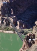
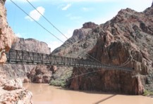
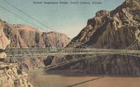
1928: Kiyosu
Chuo City, Tokyo, Japan - Sumida River
| Bridgemeister ID: | 440 (added before 2003) |
| Year Completed: | 1928 |
| Name: | Kiyosu |
| Also Known As: | 清洲橋 |
| Location: | Chuo City, Tokyo, Japan |
| Crossing: | Sumida River |
| Coordinates: | 35.682395 N 139.792022 E |
| Maps: | Acme, GeoHack, Google, OpenStreetMap |
| Principals: | Yutaka Tanaka |
| References: | AAJ, BAAW, PTS2, SSS |
| Use: | Vehicular (four-lane), with walkway |
| Status: | In use (last checked: 2022) |
| Main Cables: | Eyebar (steel) |
| Suspended Spans: | 3 |
| Main Span: | 1 x 91.4 meters (299.9 feet) |
| Side Spans: | 2 |
| Deck width: | 85 feet |
| Characteristics: | Self-anchored |
Notes:
- Self-anchored.
- 2019: Major rehabilitation in progress.
External Links:
1928: Morca
Morca and Balangera, Italy - Sesia River
| Bridgemeister ID: | 2677 (added 2019-03-30) |
| Year Completed: | 1928 |
| Name: | Morca |
| Location: | Morca and Balangera, Italy |
| Crossing: | Sesia River |
| Coordinates: | 45.821768 N 8.214935 E |
| Maps: | Acme, GeoHack, Google, OpenStreetMap |
| Principals: | Giuseppe Magistrini |
| Use: | Vehicular (one-lane) |
| Status: | In use (last checked: 2022) |
| Main Cables: | Wire (steel) |
| Suspended Spans: | 1 |
| Main Span: | 1 x 93 meters (305.1 feet) estimated |
External Links:
1928: Point Pleasant
Point Pleasant, West Virginia and Kanauga, Gallipolis vicinity, Ohio, USA - Ohio River
| Bridgemeister ID: | 156 (added before 2003) |
| Year Completed: | 1928 |
| Name: | Point Pleasant |
| Also Known As: | Silver |
| Location: | Point Pleasant, West Virginia and Kanauga, Gallipolis vicinity, Ohio, USA |
| Crossing: | Ohio River |
| Coordinates: | 38.845 N 82.141111 W |
| Maps: | Acme, GeoHack, Google, OpenStreetMap |
| Principals: | J.E. Greiner Co. |
| References: | AAJ, BDO, ENR19290620a, ENR19290620b, GBD, LAB, PTS2, SSS |
| Use: | Vehicular, with walkway |
| Status: | Collapsed, 1967 |
| Main Cables: | Eyebar (steel) |
| Suspended Spans: | 3 |
| Main Span: | 1 x 213.4 meters (700 feet) |
| Side Spans: | 2 x 115.8 meters (380 feet) |
| Deck width: | 27 feet |
Notes:
- Hybrid truss, suspension bridge. Collapsed December 15, 1967 while full with traffic. 46 people died.
- Companion to 1928 Saint Marys (Hi Carpenter, Short Route) - Saint Marys, West Virginia and Newport, Ohio, USA.
External Links:

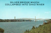
1928: Roberto Clemente
Pittsburgh, Pennsylvania, USA - Allegheny River
| Bridgemeister ID: | 158 (added before 2003) |
| Year Completed: | 1928 |
| Name: | Roberto Clemente |
| Also Known As: | Sixth Street |
| Location: | Pittsburgh, Pennsylvania, USA |
| Crossing: | Allegheny River |
| Coordinates: | 40.44558 N 80.00332 W |
| Maps: | Acme, GeoHack, Google, OpenStreetMap |
| Principals: | Vernon R. Covell, T.J. Wilkerson, A.D. Nutter, H.E. Dodge, Stanley L. Roush |
| References: | AAJ, BOP, BPL, PBR, PTS2, SSS, USS |
| Use: | Vehicular (four-lane), with walkway |
| Status: | In use (last checked: 2014) |
| Main Cables: | Eyebar (steel) |
| Suspended Spans: | 3 |
| Main Span: | 1 x 131.1 meters (430 feet) |
| Side Spans: | 2 x 65.5 meters (215 feet) |
| Characteristics: | Self-anchored |
Notes:
- Self-anchored.
- Next to 1926 Andy Warhol (Seventh Street) - Pittsburgh, Pennsylvania, USA.
- Next to 1927 Rachel Carson (Ninth Street) - Pittsburgh, Pennsylvania, USA.
External Links:

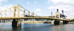
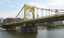
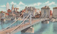
1928: Roma-Miguel Alemán International
Roma, Texas, USA and Ciudad Miguel Alemán, Mexico - Rio Grande
| Bridgemeister ID: | 157 (added before 2003) |
| Year Completed: | 1928 |
| Name: | Roma-Miguel Alemán International |
| Also Known As: | Roma-San Pedro International |
| Location: | Roma, Texas, USA and Ciudad Miguel Alemán, Mexico |
| Crossing: | Rio Grande |
| Coordinates: | 26.403821 N 99.018856 W |
| Maps: | Acme, GeoHack, Google, OpenStreetMap |
| Principals: | George Cole, Starr County Bridge Co., Compañía del Puente de San Pedro de Roma |
| References: | HAERTX98, PTS2 |
| Use: | Vehicular |
| Status: | Closed, 1979 (last checked: 2023) |
| Main Cables: | Wire (steel) |
| Suspended Spans: | 1 |
| Main Span: | 1 x 192 meters (629.9 feet) |
| Deck width: | 6.9 meters |
Notes:
- Closed. Scheduled to be restored as pedestrian crossing.
External Links:
1928: Saint Marys
Saint Marys, West Virginia and Newport, Ohio, USA - Ohio River
| Bridgemeister ID: | 159 (added before 2003) |
| Year Completed: | 1928 |
| Name: | Saint Marys |
| Also Known As: | Hi Carpenter, Short Route |
| Location: | Saint Marys, West Virginia and Newport, Ohio, USA |
| Crossing: | Ohio River |
| Principals: | J.E. Greiner Co. |
| References: | BPL, GBD, PTS2 |
| Use: | Vehicular |
| Status: | Demolished, 1971 |
| Main Cables: | Eyebar (steel) |
| Suspended Spans: | 3 |
| Main Span: | 1 x 213.4 meters (700 feet) |
| Side Spans: | 2 |
Notes:
- Same design as the Silver Bridge that famously collapsed in 1967. Demolished 1971 as a precautionary measure because the engineers decided they could not tell if it suffered from the same flaw as the Silver Bridge without dismantling the eyebars.
- Companion to 1928 Point Pleasant (Silver) - Point Pleasant, West Virginia and Kanauga, Gallipolis vicinity, Ohio, USA.
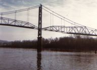
1928: Saint-Hubert
Port Saint-Hubert, Plouër-sur-Rance vicinity and La Ville-es-Nonais, Côtes-d'Armor, France - Rance River
| Bridgemeister ID: | 1492 (added 2004-09-19) |
| Year Completed: | 1928 |
| Name: | Saint-Hubert |
| Location: | Port Saint-Hubert, Plouër-sur-Rance vicinity and La Ville-es-Nonais, Côtes-d'Armor, France |
| Crossing: | Rance River |
| Use: | Vehicular |
| Status: | Destroyed, 1944 |
| Main Cables: | Wire |
| Suspended Spans: | 1 |
Notes:
- Replaced by 1959 Saint-Hubert - Port Saint-Hubert, Plouër-sur-Rance vicinity and La Ville-es-Nonais, Côtes-d'Armor, France.
External Links:
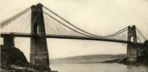
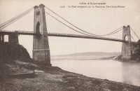
1928: Senumstad
Væting, Birkenes, Agder, Norway - Tovdalselva
| Bridgemeister ID: | 4320 (added 2020-04-10) |
| Year Completed: | 1928 |
| Name: | Senumstad |
| Location: | Væting, Birkenes, Agder, Norway |
| Crossing: | Tovdalselva |
| Coordinates: | 58.417324 N 8.291204 E |
| Maps: | Acme, GeoHack, Google, kart.1881.no, OpenStreetMap |
| Use: | Footbridge |
| Status: | Replaced, 1957 |
Notes:
- Replaced by 1957 Senumstad - Væting, Birkenes, Agder, Norway.
1928: Tamate
Kashiwara, Osaka, Japan - Ishi River
| Bridgemeister ID: | 4651 (added 2020-06-17) |
| Year Completed: | 1928 |
| Name: | Tamate |
| Also Known As: | 玉手橋 |
| Location: | Kashiwara, Osaka, Japan |
| Crossing: | Ishi River |
| Coordinates: | 34.566634 N 135.621691 E |
| Maps: | Acme, GeoHack, Google, OpenStreetMap |
| Status: | Restricted to foot traffic (last checked: 2019) |
| Main Cables: | Wire (steel) |
| Suspended Spans: | 5 |
| Main Spans: | 3 |
| Side Spans: | 2 |
External Links:
| Bridgemeister ID: | 1449 (added 2004-07-31) |
| Year Completed: | 1928 |
| Name: | Tarassac |
| Location: | St. Martin-de-l'Arcon vicinity, Hérault, France |
| Crossing: | Orb River |
| Coordinates: | 43.564766 N 2.974529 E |
| Maps: | Acme, GeoHack, Google, OpenStreetMap |
| References: | BC3 |
| Use: | Vehicular (one-lane) |
| Status: | In use (last checked: 2019) |
| Main Cables: | Wire (steel) |
| Suspended Spans: | 1 |
| Main Span: | 1 x 104.2 meters (342 feet) |
Notes:
External Links:
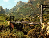
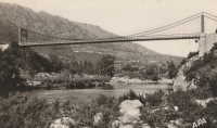
| Bridgemeister ID: | 2731 (added 2019-06-22) |
| Year Completed: | 1928 |
| Name: | Ulvøya |
| Also Known As: | Ulvøybrua |
| Location: | Oslo, Norway |
| Crossing: | Ulvøysund |
| Coordinates: | 59.872686 N 10.777882 E |
| Maps: | Acme, GeoHack, Google, kart.1881.no, OpenStreetMap |
| Use: | Vehicular (one-lane) |
| Status: | In use (last checked: 2019) |
| Main Cables: | Wire (steel) |
| Suspended Spans: | 1 |
| Main Span: | 1 x 143 meters (469.2 feet) |
External Links:
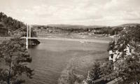
1928: Volonne
Volonne, Alpes-de-Haute-Provence, France - Durance River
| Bridgemeister ID: | 2004 (added 2005-12-26) |
| Year Completed: | 1928 |
| Name: | Volonne |
| Location: | Volonne, Alpes-de-Haute-Provence, France |
| Crossing: | Durance River |
| Use: | Vehicular |
| Status: | Destroyed, 1944 |
Notes:
- Replaced 1845 Volonne - Volonne, Alpes-de-Haute-Provence, France.
- Replaced by 1949 Volonne - Volonne, Alpes-de-Haute-Provence, France.
External Links:
1928: Zapata
Zapata, Texas, USA and Ciudad Guerrero, Mexico - Rio Grande
| Bridgemeister ID: | 1445 (added 2004-07-31) |
| Year Completed: | 1928 |
| Name: | Zapata |
| Location: | Zapata, Texas, USA and Ciudad Guerrero, Mexico |
| Crossing: | Rio Grande |
| References: | HAERTX98, PTS2 |
| Use: | Vehicular |
| Status: | Inundated, 1953 |
| Main Cables: | Wire (steel) |
| Suspended Spans: | 3 |
| Main Span: | 1 x 165 meters (541.3 feet) |
| Side Spans: | 2 |
Notes:
- Inundated during creation of Falcon Reservoir.
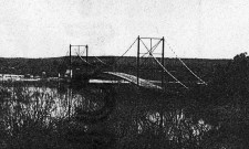
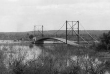
| Bridgemeister ID: | 4463 (added 2020-04-26) |
| Year Completed: | 1929 |
| Name: | (suspension bridge) |
| Location: | Gol, Viken, Norway |
| Crossing: | Vesleåne |
| Coordinates: | 60.698535 N 8.951871 E |
| Maps: | Acme, GeoHack, Google, kart.1881.no, OpenStreetMap |
| Status: | Removed |
| Main Cables: | Wire |
| Suspended Spans: | 1 |
| Main Span: | 1 x 26 meters (85.3 feet) estimated |
Notes:
- Removed at some point between 1972 and 2006.
External Links:
1929: (suspension bridge)
Ngapakira, New Zealand - Ruakituri River
| Bridgemeister ID: | 725 (added 2003-03-08) |
| Year Completed: | 1929 |
| Name: | (suspension bridge) |
| Location: | Ngapakira, New Zealand |
| Crossing: | Ruakituri River |
1929: (suspension bridge)
Waimata Valley, Gisborne vicinity, New Zealand - Waimata River
| Bridgemeister ID: | 728 (added 2003-03-08) |
| Year Completed: | 1929 |
| Name: | (suspension bridge) |
| Location: | Waimata Valley, Gisborne vicinity, New Zealand |
| Crossing: | Waimata River |
| References: | GAP |
1929: Ambassador
Detroit, Michigan, USA and Windsor, Ontario, Canada - Detroit River
| Bridgemeister ID: | 160 (added before 2003) |
| Year Completed: | 1929 |
| Name: | Ambassador |
| Location: | Detroit, Michigan, USA and Windsor, Ontario, Canada |
| Crossing: | Detroit River |
| Coordinates: | 42.31210 N 83.07402 W |
| Maps: | Acme, GeoHack, Google, OpenStreetMap |
| Principals: | Jonathan Jones, McClintic-Marshall |
| References: | AAJ, AMB, GBD, PTS2 |
| Use: | Vehicular (major highway) |
| Status: | In use (last checked: 2022) |
| Main Cables: | Wire (steel) |
| Suspended Spans: | 1 |
| Main Span: | 1 x 563.9 meters (1,850 feet) |
| Deck width: | 55 feet |
Notes:
- Became longest suspension bridge by eclipsing 1926 Benjamin Franklin (Philadelphia-Camden) - Philadelphia, Pennsylvania and Camden, New Jersey, USA.
- Eclipsed by new longest suspension bridge 1931 George Washington (GWB) - New York, New York and Fort Lee, New Jersey, USA.
External Links:


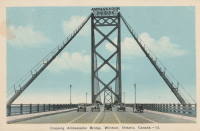
1929: Auburn-Coloma
Auburn and Coloma, California, USA - North Fork American River
| Bridgemeister ID: | 1624 (added 2005-02-27) |
| Year Completed: | 1929 |
| Name: | Auburn-Coloma |
| Location: | Auburn and Coloma, California, USA |
| Crossing: | North Fork American River |
| Principals: | Smith Brothers |
| Use: | Vehicular (one-lane) |
| Status: | Replaced, 1948 |
| Main Cables: | Wire |
| Suspended Spans: | 1 |
Notes:

| Bridgemeister ID: | 4017 (added 2020-03-28) |
| Year Completed: | 1929 |
| Name: | Borglund |
| Location: | Borglund, Veme, Ringerike, Viken, Norway |
| Crossing: | Sogna |
| Coordinates: | 60.20807 N 10.05918 E |
| Maps: | Acme, GeoHack, Google, kart.1881.no, OpenStreetMap |
| Use: | Footbridge |
| Status: | In use (last checked: 2020) |
| Main Cables: | Wire (steel) |
| Suspended Spans: | 1 |
| Main Span: | 1 x 65.5 meters (214.9 feet) estimated |
| Deck width: | ~2 meters |
Notes:
- Major rehabilitation completed, 2017, including complete replacement of towers.
1929: Chainbridge
Berwyn, Llangollen, Wales, United Kingdom - River Dee
| Bridgemeister ID: | 1303 (added 2004-04-09) |
| Year Completed: | 1929 |
| Name: | Chainbridge |
| Also Known As: | Chain |
| Location: | Berwyn, Llangollen, Wales, United Kingdom |
| Crossing: | River Dee |
| Coordinates: | 52.98025 N 3.1946 W |
| Maps: | Acme, GeoHack, Google, OpenStreetMap |
| Principals: | Sir Henry Robertson |
| Use: | Footbridge |
| Status: | In use (last checked: 2019) |
| Main Cables: | Chain |
| Suspended Spans: | 1 |
| Main Span: | 1 |
Notes:
- Crosses both River Dee and Llangollen Canal
- A thorough report on these bridges was published in 2010 by the Royal Commission on the Ancient and Historical Monuments of Wales (RCAHMW), Chain Bridge, Llantysilio, Denbighshire. The Pickering bridge (built 1817, according to the report) was contructed with the deck laid on the chains. This bridge was removed in 1870 but appears not to have been replaced until at least 1876. The new bridge, not simply refurbished, was constructed with the deck supported by the chains underneath, but in an "underspanned" fashion with small pillars resting on the chains, supporting a level deck. This bridge was destroyed by flood on Feb. 16, 1928. The report also investigates whether the chains of the current (1929) bridge are the original chains from the 1817 Pickering bridge and concludes there is evidence "supporting the hypothesis that the chains we see on the bridge today are same as those put on the bridge in 1817" and adds "If the present chains are the originals, there is little reason to doubt that they are the oldest suspension bridge chains in the western world."
- 2015: Underwent major restoration and reopened.
External Links:
- Chainbridge Hotel. The bridge is situated next to the hotel. Their web site notes the original "chain bridge" at this location was built in 1814 by Exuperious Pickering and was refurbished in 1870 and rebuilt in 1929.
- Structurae - Structure ID 20074318
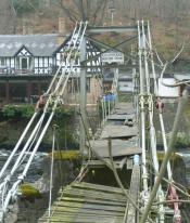
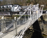
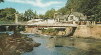
1929: Creighton's
Inangahua County, New Zealand - Maruia River
| Bridgemeister ID: | 724 (added 2003-03-08) |
| Year Completed: | 1929 |
| Name: | Creighton's |
| Location: | Inangahua County, New Zealand |
| Crossing: | Maruia River |
| References: | GAP |
1929: Fox River
Fox Glacier, New Zealand - Fox River
| Bridgemeister ID: | 729 (added 2003-03-08) |
| Year Completed: | 1929 |
| Name: | Fox River |
| Location: | Fox Glacier, New Zealand |
| Crossing: | Fox River |
| Coordinates: | 43.487188 S 170.029302 E |
| Maps: | Acme, GeoHack, Google, OpenStreetMap |
| References: | GAP |
| Use: | Footbridge |
| Status: | In use (last checked: 2014) |
| Main Cables: | Wire (steel) |
| Suspended Spans: | 1 |
| Main Span: | 1 x 70 meters (229.7 feet) |
External Links:
1929: Grand Mère
Grand-Mère, Quebec, Canada - St. Maurice River
| Bridgemeister ID: | 162 (added before 2003) |
| Year Completed: | 1929 |
| Name: | Grand Mère |
| Location: | Grand-Mère, Quebec, Canada |
| Crossing: | St. Maurice River |
| Coordinates: | 46.620117 N 72.6794 W |
| Maps: | Acme, GeoHack, Google, OpenStreetMap |
| Principals: | Robinson and Steinman |
| References: | AAJ, BC3, BPL, PTS2, SJR |
| Use: | Vehicular (two-lane, heavy vehicles), with walkway |
| Status: | In use (last checked: 2019) |
| Main Cables: | Wire (steel) |
| Suspended Spans: | 1 |
| Main Span: | 1 x 289.2 meters (948.8 feet) |
| Deck width: | 26 feet |
External Links:
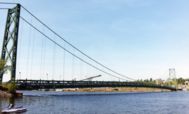
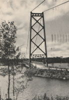
1929: Hinckesman's Access Road
Frasertown vicinity, Hawke's Bay, New Zealand - Mangapoike River
| Bridgemeister ID: | 726 (added 2003-03-08) |
| Year Completed: | 1929 |
| Name: | Hinckesman's Access Road |
| Location: | Frasertown vicinity, Hawke's Bay, New Zealand |
| Crossing: | Mangapoike River |
| Principals: | T. Delaney |
| References: | GAP |
| Use: | Vehicular |
| Status: | Destroyed, 1935 |
Notes:
- GAP: Destroyed by flood, 1935.
- Replaced by 1936 Hinckesman's Access Road - Frasertown vicinity, Hawke's Bay, New Zealand.
1929: Hipólito Yrigoyen
Necochea and Quequén, Argentina - Rio Quequén
| Bridgemeister ID: | 441 (added before 2003) |
| Year Completed: | 1929 |
| Name: | Hipólito Yrigoyen |
| Also Known As: | Rio Quequén |
| Location: | Necochea and Quequén, Argentina |
| Crossing: | Rio Quequén |
| Coordinates: | 38.552048 S 58.725680 W |
| Maps: | Acme, GeoHack, Google, OpenStreetMap |
| Principals: | P. Palazzo |
| References: | AAJ, SSS |
| Use: | Vehicular (two-lane), with walkway |
| Status: | In use (last checked: 2019) |
| Main Cables: | Wire (steel) |
| Suspended Spans: | 3 |
| Main Span: | 1 x 150 meters (492 feet) |
| Side Spans: | 2 x 59.7 meters (196 feet) |
External Links:
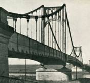
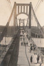
| Bridgemeister ID: | 2378 (added 2007-10-21) |
| Year Completed: | 1929 |
| Name: | Idabel-Clarksville |
| Location: | Idabel vicinity, Oklahoma and Clarksville vicinity, Texas, USA |
| Crossing: | Red River |
| Principals: | Austin Bridge Co. |
| References: | AUB |
| Use: | Vehicular |
| Status: | Destroyed, 1933 |
| Main Cables: | Wire (steel) |
| Suspended Spans: | 3 |
| Main Span: | 1 x 213.4 meters (700 feet) |
| Side Spans: | 2 x 76.2 meters (250 feet) |
| Deck width: | 16 feet |
Notes:
- The November 1933 issue of The Wisconsin Engineer (a publication of the University of Wisconsin) has an article by C.W.P. Walter about research that was being performed by the University of Wisconsin's Engineering Department: "The particular hardware laden contrivance [in the Engineering Building] is a half-model of the Red River Bridge which carried light highway traffic between Clarksville, Texas, and Idabel, Oklahoma. In the early part of this year movement of the Red River as a result of flood waters washed away one of the intermediate piers supporting the end spans, and cause the cable to drop and be subjected to impact loading. It was contended by the company owning the bridge that the cable was overstressed and injured to such an extent that it would be necessary for the insurance company to replace the cable as well as the pier. A committee... was appointed to investigate the questions involved. While the investigation proceeded the Red River continued to scour away the foundation of the existing piers, ultimately causing the bridge to collapse completely."
- AUB mentions this bridge very briefly: "In 1928, [Jim Diamond] was employed by Austin Bridge Company as a consultant on the super-structure and cable work for the White River bridge at Des Arc. Later in the same year, he represented the owners as job engineer on the bridge built by the Company across Red River above Clarksville, Texas."
- Apparently this bridge was damaged by flood the same week it was supposed to open. In the October 1989 edition of the Oklahoma Water News an article (excerpted from an article in The Chronicles of Oklahoma by Dr. Bernice N. Crockett) writes: "The Austin Bridge Company completed the bridge May 19, 1929, but on May 23, when more than 400 people went to see the new bridge opened, an estimated 40 feet of the Red River bank had caved in near the bridge. Heavy rains continued to hinder road construction. A resident near the bridge recalled the night of May 19, 1929, as the night the river changed its course, and by morning had moved the entire structure into Oklahoma." The bridge eventually opened on June 20.
- The Friday December 30, 1932 edition of The Port Arthur News ran an article "Red River Bridge Damaged By Water". Texarkana, Dec. 30 (1932).: "High stages in Red River, that earlier this week demolished the Texas side approach to the privately owned suspension bridge [?] miles north of Clarksville on highway 37 to Idabel have been in recession since Wednesday but indicated continued heavy rains such as last night are expected to bring additional high water with probably further damage to the bridge. More than 50 feet of the approach is gone and the ground piers have crumpled, leaving the anchor cables alone holding the bridge in place."
- It appears the final end to this short-lived bridge didn't come until late May, 1933 when it was completely destroyed by flood.
External Links:
- Historic Suspension Bridges: Advent of the State Highway Department. This Texas Department of Transportation page mentions: "Five of the eleven suspension bridges built by [Austin Bridge Company] were toll bridges over the Red River. The Red River is notorious for its volatile, melting, red clay banks. The bridge between Clarksville, Texas, and Idabel, Oklahoma, was built by ABC in 1928, and washed out during flooding in 1932."
1929: Kane's
Melbourne, Victoria, Australia - Yarra River
| Bridgemeister ID: | 443 (added before 2003) |
| Year Completed: | 1929 |
| Name: | Kane's |
| Location: | Melbourne, Victoria, Australia |
| Crossing: | Yarra River |
| At or Near Feature: | Yarra Bend Park, Studley Park |
| Coordinates: | 37.80006 S 145.00966 E |
| Maps: | Acme, GeoHack, Google, OpenStreetMap |
| Use: | Footbridge |
| Status: | In use (last checked: 2022) |
| Main Cables: | Wire (steel) |
| Suspended Spans: | 1 |
| Main Span: | 1 x 64 meters (210 feet) estimated |
Notes:
- Rebuilt 1935.
1929: Köln-Mülheim
Köln (Cologne) and Mülheim, North Rhine-Westphalia, Germany - Rhine River
| Bridgemeister ID: | 1426 (added 2004-07-18) |
| Year Completed: | 1929 |
| Name: | Köln-Mülheim |
| Location: | Köln (Cologne) and Mülheim, North Rhine-Westphalia, Germany |
| Crossing: | Rhine River |
| Coordinates: | 50.963968 N 6.996659 E |
| Maps: | Acme, GeoHack, Google, OpenStreetMap |
| Principals: | Adolf Abel |
| References: | AAJ |
| Use: | Vehicular, with walkway |
| Status: | Destroyed, 1944 |
| Main Cables: | Wire (steel) |
| Suspended Spans: | 3 |
| Main Span: | 1 x 317 meters (1,040 feet) |
| Side Spans: | 2 x 91.4 meters (300 feet) |
| Deck width: | 91.5 feet |
| Characteristics: | Self-anchored |
Notes:
External Links:
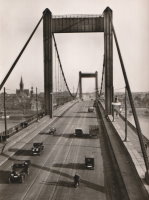
1929: Lakshman Jhula
Rishikesh, Uttarakhand, India - Ganges River
| Bridgemeister ID: | 442 (added before 2003) |
| Year Completed: | 1929 |
| Name: | Lakshman Jhula |
| Location: | Rishikesh, Uttarakhand, India |
| Crossing: | Ganges River |
| Coordinates: | 30.126454 N 78.329753 E |
| Maps: | Acme, GeoHack, Google, OpenStreetMap |
| Principals: | P.H. Tillard |
| Use: | Footbridge |
| Status: | In use (last checked: 2019) |
| Main Cables: | Wire (steel) |
| Suspended Spans: | 1 |
External Links:
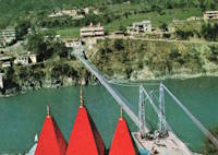
1929: McPhaul
Yuma, Arizona, USA - Gila River
| Bridgemeister ID: | 161 (added before 2003) |
| Year Completed: | 1929 |
| Name: | McPhaul |
| Also Known As: | Dome, Gila River |
| Location: | Yuma, Arizona, USA |
| Crossing: | Gila River |
| Coordinates: | 32.75969 N 114.42158 W |
| Maps: | Acme, GeoHack, Google, OpenStreetMap |
| Principals: | Levy Construction Company |
| References: | AAJ, SJR, YS20041217 |
| Use: | Vehicular (one-lane) |
| Status: | Closed (last checked: 2008) |
| Main Cables: | Wire (steel) |
| Suspended Spans: | 1 |
| Main Span: | 1 x 283.5 meters (930.1 feet) |
| Deck width: | 16 feet |
Notes:
- YS20041217: Renamed McPhaul Bridge in honor of Henry Harrison "Harry" McPhaul, "the only Yuma resident who ever became an Arizona Ranger." Bypassed, 1968. 150 feet of deck damaged by fire, 1990.
External Links:
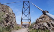
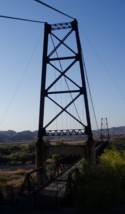
1929: Mount Hope
Bristol and Portsmouth, Rhode Island, USA - Mount Hope Bay
| Bridgemeister ID: | 163 (added before 2003) |
| Year Completed: | 1929 |
| Name: | Mount Hope |
| Location: | Bristol and Portsmouth, Rhode Island, USA |
| Crossing: | Mount Hope Bay |
| Coordinates: | 41.64 N 71.25833 W |
| Maps: | Acme, GeoHack, Google, OpenStreetMap |
| Principals: | Robinson and Steinman |
| References: | AAJ, ADDS, ENR19290411a, ENR19290411b, ENR19290411c, GBD, PTS2 |
| Use: | Vehicular (two-lane, heavy vehicles), with walkway |
| Status: | In use (last checked: 2022) |
| Main Cables: | Wire (steel) |
| Suspended Spans: | 3 |
| Main Span: | 1 x 365.8 meters (1,200 feet) |
| Side Spans: | 2 x 153.6 meters (504 feet) |
| Deck width: | 34 feet |
Annotated Citations:
- Flynn, Sean. "Mount Hope Bridge's support cables are corroding. It'll take $35 million to save them.." Newport Daily News, 13 Dec. 2021, www.newportri.com/story/news/local/2021/12/13/dehumidification-system-needed-save-mount-hope-bridge-ri-cables-corrosion/6456270001/
"'According to a 2016 inspection of the cables at the Mount Hope Bridge, there is significant breakage of the hundreds of wires that make up each of the cables,' RITBA Executive Director Lori Caron Silveira wrote to the Rhode Island House Finance Committee on Dec. 7"
- "Potential Exposure $1B — RI’s Mount Hope Bridge Is in Critical Need of Repair, Says Bridge Authority." GoLocalProv, 9 Dec. 2021, www.golocalprov.com/news/potential-exposure-1b-ris-mount-hope-bridge-is-in-critical-need-of-repair-s
"...Lori Caron Silveira, Executive Director of the [Rhode Island Turnpike and Bridge Authority] warns, 'The cables and anchorages of the 92-year-old Mount Hope Bridge urgently need dehumidification if the Mount Hope is to remain structurally safe and able to continue serving the East Bay and interstate commerce.'"
- Barrett, Scott. "'The bridge is safe': But time is of the essence for Mount Hope Bridge cable repair plan." Newport Daily News, 30 Mar. 2022, www.newportri.com/story/news/local/2022/03/30/mount-hope-bridge-cable-repair-plan-advances-payment-plan-unknown/7207276001/
"The process to preserve the deteriorating cables on the Mount Hope Bridge is underway, though how it will be paid for remains a question mark… the [Rhode Island Turnpike and Bridge Authority] has put out a request for proposals for a dehumidification system for the two large supporting cables on the 93-year-old suspension bridge."
External Links:
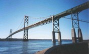

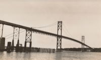
| Bridgemeister ID: | 1657 (added 2005-03-19) |
| Year Completed: | 1929 |
| Name: | Ogden Park |
| Location: | Chicago, Illinois, USA |
| At or Near Feature: | Ogden Park |
| Principals: | Linn White, C.R. Hoyt, George T. Donahue |
| References: | AAJ, ENR19290808 |
| Use: | Footbridge |
| Status: | Removed |
| Main Cables: | Wire |
| Suspended Spans: | 1 |
| Main Span: | 1 x 36 meters (118 feet) |
| Deck width: | 8.5 feet |
Notes:
- Looking at a picture of this bridge spanning about 150 feet of water, and looking at present-day maps and images of Ogden Park, it can be confusing trying to reconcile the location of this bridge as present-day Ogden Park has no waterways. The Chicago Park District web site explains, "Additionally, each [of several city parks] had a beautiful landscape with a meandering waterway near a meadow of ballfields. Ogden Park's waterway was drained and filled in 1940."
1929: Roberto Delgado
Anacaro, Ansermanuevo vicinity and Cartago vicinity, Colombia - Cauca River
| Bridgemeister ID: | 2015 (added 2006-01-14) |
| Year Completed: | 1929 |
| Name: | Roberto Delgado |
| Also Known As: | Anacaro |
| Location: | Anacaro, Ansermanuevo vicinity and Cartago vicinity, Colombia |
| Crossing: | Cauca River |
| Coordinates: | 4.784574 N 75.968443 W |
| Maps: | Acme, GeoHack, Google, OpenStreetMap |
| Use: | Vehicular |
| Status: | Derelict (last checked: 2015) |
| Main Cables: | Wire (steel) |
| Suspended Spans: | 1 |
| Main Span: | 1 x 120 meters (393.7 feet) |
1929: Royal Gorge
Canon City, Colorado, USA - Arkansas River
| Bridgemeister ID: | 164 (added before 2003) |
| Year Completed: | 1929 |
| Name: | Royal Gorge |
| Location: | Canon City, Colorado, USA |
| Crossing: | Arkansas River |
| Coordinates: | 38.46129 N 105.32541 W |
| Maps: | Acme, GeoHack, Google, OpenStreetMap |
| Principals: | George F. Cole, O.K. Peck |
| References: | AAJ, BC3, BMA, GBD |
| Use: | Vehicular (two-lane) |
| Status: | In use (last checked: 2020) |
| Main Cables: | Wire (steel) |
| Suspended Spans: | 3 |
| Main Span: | 1 x 268.2 meters (880 feet) |
| Side Spans: | 2 |
| Deck width: | 18 feet |
Notes:
- This bridge was built solely as a tourist attraction.
External Links:
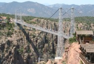
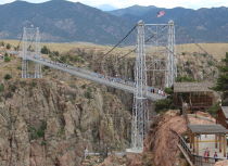
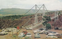
1929: Springbank
London, Ontario, Canada - River Thames
| Bridgemeister ID: | 290 (added before 2003) |
| Year Completed: | 1929 |
| Name: | Springbank |
| Location: | London, Ontario, Canada |
| Crossing: | River Thames |
| At or Near Feature: | Springbank Park |
| Principals: | J. R. Rostron |
| References: | AAJ |
| Use: | Footbridge |
| Status: | Replaced, 2002 |
| Main Cables: | Wire (steel) |
| Suspended Spans: | 1 |
| Main Span: | 1 x 71.6 meters (235 feet) |
| Deck width: | 5 feet |
Notes:
- Replaced by truss, 2002.
1930: (footbridge)
Grey Valley, Slaty Creek vicinity, New Zealand - Big River
| Bridgemeister ID: | 734 (added 2003-03-08) |
| Year Completed: | 1930 |
| Name: | (footbridge) |
| Location: | Grey Valley, Slaty Creek vicinity, New Zealand |
| Crossing: | Big River |
| References: | GAP |
| Use: | Footbridge |
1930: (footbridge)
Hartola, Finland - Tainionvirta
| Bridgemeister ID: | 5544 (added 2020-12-13) |
| Year Completed: | 1930 |
| Name: | (footbridge) |
| Location: | Hartola, Finland |
| Crossing: | Tainionvirta |
| Coordinates: | 61.568078 N 26.019536 E |
| Maps: | Acme, GeoHack, Google, OpenStreetMap |
| Use: | Footbridge |
| Status: | In use (last checked: 2020) |
| Main Cables: | Wire (steel) |
| Suspended Spans: | 1 |
1930: (pipeline bridge)
Hollenberg, Kansas, USA - Little Blue River
| Bridgemeister ID: | 167 (added before 2003) |
| Year Completed: | 1930 |
| Name: | (pipeline bridge) |
| Location: | Hollenberg, Kansas, USA |
| Crossing: | Little Blue River |
| Principals: | Matthews & Kenan |
| References: | USS |
| Use: | Pipeline |
| Main Cables: | Wire (steel) |
| Suspended Spans: | 3 |
| Main Span: | 1 x 152.4 meters (500 feet) |
| Side Spans: | 2 x 70.1 meters (230 feet) |
1930: (suspension bridge)
Anderson's farm, New Zealand - Tangarakau River
| Bridgemeister ID: | 733 (added 2003-03-08) |
| Year Completed: | 1930 |
| Name: | (suspension bridge) |
| Location: | Anderson's farm, New Zealand |
| Crossing: | Tangarakau River |
| References: | GAP |
1930: (suspension bridge)
Te Araroa vicinity, New Zealand - Kopuapounamu River
| Bridgemeister ID: | 730 (added 2003-03-08) |
| Year Completed: | 1930 |
| Name: | (suspension bridge) |
| Location: | Te Araroa vicinity, New Zealand |
| Crossing: | Kopuapounamu River |
| References: | GAP |
1930: (suspension bridge)
Whangaehu Valley, Kakatahi, New Zealand - Whangaehu River
| Bridgemeister ID: | 731 (added 2003-03-08) |
| Year Completed: | 1930 |
| Name: | (suspension bridge) |
| Location: | Whangaehu Valley, Kakatahi, New Zealand |
| Crossing: | Whangaehu River |
| At or Near Feature: | Field's Track |
| Coordinates: | 39.621392 S 175.422532 E |
| Maps: | Acme, GeoHack, Google, OpenStreetMap |
| References: | GAP |
| Status: | Removed |
| Main Span: | 1 x 53.5 meters (175.5 feet) |
Notes:
- GAP: "On Field's Track, which links the Parapara (Wanganui-Raethi) Road at Kakatahi with the Whangaehu Valley."
- Coordinates are for the current (2020) Field's Track crossing of the Whangaehu River.
1930: Alexandra
Launceston, Tasmania, Australia - South Esk River
| Bridgemeister ID: | 444 (added before 2003) |
| Year Completed: | 1930 |
| Name: | Alexandra |
| Also Known As: | Basin |
| Location: | Launceston, Tasmania, Australia |
| Crossing: | South Esk River |
| At or Near Feature: | First Basin Water, Cataract Gorge Reserve |
| Coordinates: | 41.44681 S 147.11813 E |
| Maps: | Acme, GeoHack, Google, OpenStreetMap |
| References: | STC |
| Use: | Footbridge |
| Status: | In use (last checked: 2019) |
| Main Cables: | Wire (steel) |
| Suspended Spans: | 3 |
| Main Span: | 1 x 45.7 meters (149.9 feet) |
| Side Spans: | 1 x 16.8 meters (55.1 feet), 1 x 10.7 meters (35.1 feet) |
Notes:
- 2004: Refurbished, including replacement of cables which supposedly dated to the first Alexandra bridge.
- 2020, October: Maintenance project started focused on corrosion prevention including stripping paint and repainting.
- Replaced 1904 Alexandra (Basin) - Launceston, Tasmania, Australia.
- Near 1939 Duck Reach - Launceston, Tasmania, Australia.
- Near 1995 Duck Reach - Launceston, Tasmania, Australia.
External Links:
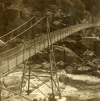
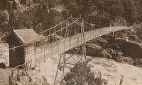
1930: Bolko
Opole, Poland - Oder River
| Bridgemeister ID: | 7903 (added 2023-10-15) |
| Year Completed: | 1930 |
| Name: | Bolko |
| Also Known As: | Bolkobrücke |
| Location: | Opole, Poland |
| Crossing: | Oder River |
| Coordinates: | 50.658406 N 17.921887 E |
| Maps: | Acme, GeoHack, Google, OpenStreetMap |
| Status: | Destroyed, 1945 |
| Suspended Spans: | 2 |
| Characteristics: | Self-anchored |
External Links:
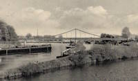
1930: Capens
Capens, Haute-Garonne, France - Garonne River
| Bridgemeister ID: | 6742 (added 2021-10-23) |
| Year Completed: | 1930 |
| Name: | Capens |
| Location: | Capens, Haute-Garonne, France |
| Crossing: | Garonne River |
| Use: | Vehicular |
| Status: | Removed |
| Main Cables: | Wire (steel) |
| Main Span: | 1 |
Notes:
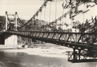
1930: Colfax-Foresthill
Yankee Jims, Colfax vicinity, California, USA - North Fork American River
| Bridgemeister ID: | 165 (added before 2003) |
| Year Completed: | 1930 |
| Name: | Colfax-Foresthill |
| Also Known As: | Yankee Jims |
| Location: | Yankee Jims, Colfax vicinity, California, USA |
| Crossing: | North Fork American River |
| Coordinates: | 39.040306 N 120.902667 W |
| Maps: | Acme, GeoHack, Google, OpenStreetMap |
| Use: | Vehicular (one-lane) |
| Status: | In use (last checked: 2023) |
| Main Cables: | Wire (steel) |
| Suspended Spans: | 1 |
| Main Span: | 1 x 53 meters (173.9 feet) estimated |
Notes:
- 2023: Replacement announced. The suspension bridge will be preserved and remain in place.
- Companion to 1928 Colfax-Iowa Hill - Colfax vicinity, California, USA.
External Links:
- Facebook - Placer County Government. Video discussing the history of the bridge and planned replacement project.
- Structurae - Structure ID 20011089
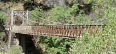
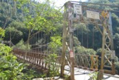
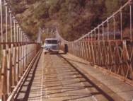
1930: Cranberry Lake
Cranberry Lake, Byram, New Jersey, USA - Cranberry Lake
| Bridgemeister ID: | 153 (added before 2003) |
| Year Completed: | 1930 |
| Name: | Cranberry Lake |
| Location: | Cranberry Lake, Byram, New Jersey, USA |
| Crossing: | Cranberry Lake |
| Coordinates: | 40.95401 N 74.73714 W |
| Maps: | Acme, GeoHack, Google, OpenStreetMap |
| References: | BONJ, PQU |
| Use: | Footbridge |
| Status: | Closed, 2019 (last checked: 2020) |
| Main Cables: | Wire (steel) |
| Suspended Spans: | 3 |
| Main Span: | 1 x 61.5 meters (201.7 feet) estimated |
| Side Spans: | 2 x 21.8 meters (71.5 feet) estimated |
Notes:
- 1928 and 1931 also sometimes cited as years of completion. Construction appears to have completed in December 1930, possibly opening in early 1931.
- 2019: Closed pending repairs and rehabilitation.
External Links:
- Save Our Bridge. "Dedicated to restoring and preserving the historic Cranberry Lake footbridge - one of the oldest pedestrian footbridges in the state of New Jersey."
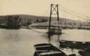
1930: Diffloo Hanging
Panbari N.C., Assam, India - Diffloo River
| Bridgemeister ID: | 7422 (added 2022-12-09) |
| Year Completed: | 1930 |
| Name: | Diffloo Hanging |
| Also Known As: | ডিফলু হ্যাংগিং ব্রিজ |
| Location: | Panbari N.C., Assam, India |
| Crossing: | Diffloo River |
| Coordinates: | 26.605922 N 93.581004 E |
| Maps: | Acme, GeoHack, Google, OpenStreetMap |
| Status: | In use (last checked: 2022) |
| Main Cables: | Wire (steel) |
| Suspended Spans: | 1 |
1930: General Juan Vicente Gómez
El Dorado, Bolívar, Venezuela - Rio Cuyuní
| Bridgemeister ID: | 4772 (added 2020-07-03) |
| Year Completed: | 1930 |
| Name: | General Juan Vicente Gómez |
| Location: | El Dorado, Bolívar, Venezuela |
| Crossing: | Rio Cuyuní |
| Coordinates: | 6.715560 N 61.610438 W |
| Maps: | Acme, GeoHack, Google, OpenStreetMap |
| Use: | Vehicular (one-lane) |
| Status: | Restricted to foot traffic (last checked: 2018) |
| Main Cables: | Wire (steel) |
| Suspended Spans: | 1 |
External Links:
1930: Horse Creek
Horse Creek, California, USA - Klamath River
| Bridgemeister ID: | 586 (added 2003-01-05) |
| Year Completed: | 1930 |
| Name: | Horse Creek |
| Location: | Horse Creek, California, USA |
| Crossing: | Klamath River |
| Coordinates: | 41.824678 N 122.997667 W |
| Maps: | Acme, GeoHack, Google, OpenStreetMap |
| Use: | Vehicular (one-lane) |
| Status: | In use (last checked: 2012) |
| Main Cables: | Wire (steel) |
| Suspended Spans: | 1 |
Notes:
External Links:
1930: Kamoro
Antanambazaha, Madagascar - Mahajamba River
| Bridgemeister ID: | 4750 (added 2020-06-27) |
| Year Completed: | 1930 |
| Name: | Kamoro |
| Location: | Antanambazaha, Madagascar |
| Crossing: | Mahajamba River |
| Coordinates: | 16.460751 S 47.168838 E |
| Maps: | Acme, GeoHack, Google, OpenStreetMap |
| Principals: | Gaston Leinekugel Le Cocq |
| References: | KSBM |
| Use: | Vehicular (one-lane) |
| Status: | Restricted to foot traffic (last checked: 2017) |
| Main Cables: | Wire (steel) |
| Suspended Spans: | 2 |
| Main Span: | 1 x 206.5 meters (677.5 feet) |
| Side Span: | 1 x 54 meters (177.2 feet) |
| Deck width: | 4 meters |
Notes:
External Links:
1930: Klenklen
Pilot Grove vicinity, Missouri, USA - Lamine River
| Bridgemeister ID: | 1570 (added 2004-12-05) |
| Year Completed: | 1930 |
| Name: | Klenklen |
| Location: | Pilot Grove vicinity, Missouri, USA |
| Crossing: | Lamine River |
| Coordinates: | 38.828284 N 93.034299 W |
| Maps: | Acme, GeoHack, Google, OpenStreetMap |
| Principals: | Joseph A. Dice |
| References: | HAERMO91 |
| Use: | Vehicular (one-lane) |
| Status: | Removed, c. 1996 |
| Main Cables: | Wire (steel) |
| Suspended Spans: | 2 |
| Main Span: | 1 x 61 meters (200 feet) |
| Side Span: | 1 x 9.1 meters (30 feet) |
Notes:
- Partially collapsed. Closed and replaced 1994, demolished c. 1996.
- Coordinates are approximate, showing location of replacement.
- Sometimes spelled as "Klenken."
- Sometimes cited as having been completed in 1929, HAER MO-91 (reference HAERMO91) states construction began September 1929 and completed in April 1930.
1930: Layrac-sur-Tarn
Layrac-sur-Tarn, Haute-Garonne, France - Tarn River
| Bridgemeister ID: | 7184 (added 2022-07-02) |
| Year Completed: | 1930 |
| Name: | Layrac-sur-Tarn |
| Location: | Layrac-sur-Tarn, Haute-Garonne, France |
| Crossing: | Tarn River |
| Use: | Vehicular |
| Status: | Removed |
| Main Cables: | Wire (steel) |
| Suspended Spans: | 1 |
| Main Span: | 1 |
Notes:
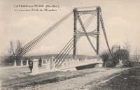
1930: Le Guétin
Le Guétin, Cuffy vicinity, Cher and Gimouille, Nièvre, France - Allier River
| Bridgemeister ID: | 2844 (added 2005-03-19) |
| Year Completed: | 1930 |
| Name: | Le Guétin |
| Location: | Le Guétin, Cuffy vicinity, Cher and Gimouille, Nièvre, France |
| Crossing: | Allier River |
| Coordinates: | 46.947881 N 3.073013 E |
| Maps: | Acme, GeoHack, Google, OpenStreetMap |
| References: | AAJ |
| Use: | Vehicular |
| Status: | Replaced |
| Main Cables: | Wire (steel) |
| Suspended Spans: | 5 |
| Main Spans: | 5 |
Notes:
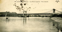
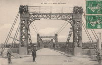
1930: Libertador
San Cristobal and Táriba, Táchira, Venezuela - Rio Torbes
| Bridgemeister ID: | 4580 (added 2020-06-05) |
| Year Completed: | 1930 |
| Name: | Libertador |
| Location: | San Cristobal and Táriba, Táchira, Venezuela |
| Crossing: | Rio Torbes |
| Coordinates: | 7.810055 N 72.232265 W |
| Maps: | Acme, GeoHack, Google, OpenStreetMap |
| Use: | Vehicular |
| Status: | In use (last checked: 2019) |
| Main Cables: | Wire (steel) |
| Suspended Spans: | 3 |
| Main Span: | 1 |
| Side Spans: | 2 |
External Links:
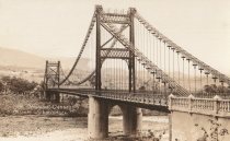
1930: Mid-Hudson
Poughkeepsie and Highland, New York, USA - Hudson River
| Bridgemeister ID: | 166 (added before 2003) |
| Year Completed: | 1930 |
| Name: | Mid-Hudson |
| Also Known As: | Franklin Delano Roosevelt Mid-Hudson |
| Location: | Poughkeepsie and Highland, New York, USA |
| Crossing: | Hudson River |
| Coordinates: | 41.702933 N 73.946683 W |
| Maps: | Acme, GeoHack, Google, OpenStreetMap |
| Principals: | Ralph Modjeski |
| References: | AAJ, BPL, PTS2, SJR, USS |
| Use: | Vehicular (two-lane, heavy vehicles), with walkway |
| Status: | In use (last checked: 2019) |
| Main Cables: | Wire (steel) |
| Suspended Spans: | 3 |
| Main Span: | 1 x 457.2 meters (1,500 feet) |
| Side Spans: | 2 x 228.6 meters (750 feet) |
| Deck width: | 39 feet |
Notes:
- Although the length of the main span of the bridge is officially 1,500 feet, the actual length is 1,495 feet. During construction one of the caissons slid and tilted from its intended location. While efforts were made to move the caisson back, it was ultimately fixed in a position that left the main span five feet short of 1,500. Not wanting to lose the claim of having a 1,500-foot bridge, the shortfall has been kept out of official records since.
External Links:
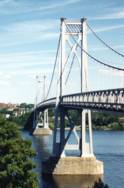
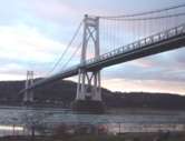
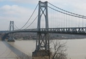
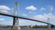
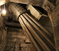
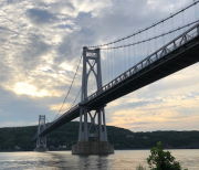
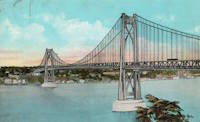
1930: Riscle
Riscle, Gers, France - Adour River
| Bridgemeister ID: | 7316 (added 2022-08-28) |
| Year Completed: | 1930 |
| Name: | Riscle |
| Location: | Riscle, Gers, France |
| Crossing: | Adour River |
| Coordinates: | 43.663878 N 0.081895 W |
| Maps: | Acme, GeoHack, Google, OpenStreetMap |
| Use: | Vehicular |
| Status: | Destroyed, 1944 |
| Main Cables: | Wire (steel) |
| Main Span: | 1 |
Notes:
- Replaced by 1955 Riscle - Riscle, Gers, France.
External Links:
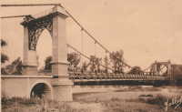
1930: Sappers'
Betws-y-Coed, Wales, United Kingdom - River Conwy
| Bridgemeister ID: | 445 (added before 2003) |
| Year Completed: | 1930 |
| Name: | Sappers' |
| Location: | Betws-y-Coed, Wales, United Kingdom |
| Crossing: | River Conwy |
| Coordinates: | 53.09221 N 3.79928 W |
| Maps: | Acme, GeoHack, Google, OpenStreetMap |
| Principals: | David Rowell & Co. |
| Use: | Footbridge |
| Status: | Closed, December 2021 (last checked: 2023) |
| Main Cables: | Wire (steel) |
| Suspended Spans: | 1 |
Notes:
- 2021, December: Closed due to deteriorating condition. Repairs expected to start in April 2022.
- 2023, February: Still closed. May be replaced.
Annotated Citations:
- Evans, Hari. "Near century old Snowdonia wobbly bridge that's rotting away and may soon be replaced." North Wales Live, 9 Feb. 2023, https://www.dailypost.co.uk/news/north-wales-news/near-century-old-snowdonia-wobbly-26198160.
"The suspension bridge used to be renowned for its wobbly midpoint and was a key shortcut across the River Conwy for locals and tourists. However, structural reviews conducted last year found that virtually the entire bridge would need to be refurbished, with the entire timber deck as well as other parts replaced completely."
External Links:
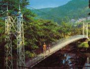
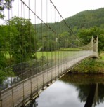
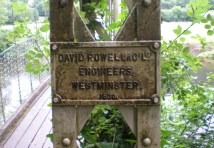
1930: Slade's
Rockville vicinity, Rhode Island, USA - Yawgoog Pond
| Bridgemeister ID: | 1642 (added 2005-03-14) |
| Year Completed: | 1930 |
| Name: | Slade's |
| Location: | Rockville vicinity, Rhode Island, USA |
| Crossing: | Yawgoog Pond |
| Principals: | Paul W. Slade |
| Use: | Footbridge |
| Status: | Removed, 1948 |
| Main Cables: | Wire |
| Suspended Spans: | 1 |
| Main Span: | 1 x 59.4 meters (195 feet) |
1930: Tsoelike
Lesotho - Orange River
| Bridgemeister ID: | 1994 (added 2005-12-10) |
| Year Completed: | 1930 |
| Name: | Tsoelike |
| Location: | Lesotho |
| Crossing: | Orange River |
| Coordinates: | 30.002343 S 28.662395 E |
| Maps: | Acme, GeoHack, Google, OpenStreetMap |
| Use: | Vehicular (one-lane) |
| Status: | Extant (last checked: 2019) |
| Main Cables: | Wire (steel) |
| Suspended Spans: | 1 |
External Links:
1931: (suspension bridge)
Murchison District, New Zealand - Matiri River
| Bridgemeister ID: | 737 (added 2003-03-08) |
| Year Completed: | 1931 |
| Name: | (suspension bridge) |
| Location: | Murchison District, New Zealand |
| Crossing: | Matiri River |
| References: | GAP |
| Status: | Removed |
Notes:
- GAP: Maybe completed early 1932, no longer in existence.
1931: (suspension bridge)
Wakarara, Tikokino vicinity, New Zealand - Waipawa River
| Bridgemeister ID: | 736 (added 2003-03-08) |
| Year Completed: | 1931 |
| Name: | (suspension bridge) |
| Location: | Wakarara, Tikokino vicinity, New Zealand |
| Crossing: | Waipawa River |
| Principals: | S.T. Silver |
| References: | GAP |
1931: Anthony Wayne
Toledo, Ohio, USA - Maumee River
| Bridgemeister ID: | 168 (added before 2003) |
| Year Completed: | 1931 |
| Name: | Anthony Wayne |
| Location: | Toledo, Ohio, USA |
| Crossing: | Maumee River |
| Coordinates: | 41.64086 N 83.53361 W |
| Maps: | Acme, GeoHack, Google, OpenStreetMap |
| Principals: | Waddell and Hardesty |
| References: | AAJ, SJR, SSS |
| Use: | Vehicular (major highway), with walkway |
| Status: | In use (last checked: 2021) |
| Main Cables: | Wire (steel) |
| Suspended Spans: | 3 |
| Main Span: | 1 x 239.3 meters (785 feet) |
| Side Spans: | 2 x 71.2 meters (233.5 feet) |
| Deck width: | 60 feet |
External Links:
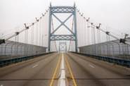
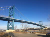
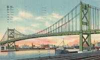
1931: Bemis
Notchland, Hart's Location vicinity, New Hampshire, USA - Saco River
| Bridgemeister ID: | 316 (added before 2003) |
| Year Completed: | 1931 |
| Name: | Bemis |
| Location: | Notchland, Hart's Location vicinity, New Hampshire, USA |
| Crossing: | Saco River |
| At or Near Feature: | Davis Path trail, White Mountain National Park |
| Coordinates: | 44.12047 N 71.35367 W |
| Maps: | Acme, GeoHack, Google, OpenStreetMap |
| References: | PQU |
| Use: | Footbridge |
| Status: | Replaced, c. 2001 |
| Suspended Spans: | 2 |
| Main Span: | 1 x 32.9 meters (108 feet) |
| Side Span: | 1 x 15.2 meters (50 feet) |
Notes:
- Replaced by a small single-towered cable-stayed bridge, circa 2001.
External Links:
1931: Buchanan Dam
Buchanan Dam, Texas, USA - Colorado River
| Bridgemeister ID: | 2514 (added 2009-12-30) |
| Year Completed: | 1931 |
| Name: | Buchanan Dam |
| Location: | Buchanan Dam, Texas, USA |
| Crossing: | Colorado River |
| Use: | Vehicular (one-lane) |
| Status: | Removed |
| Main Cables: | Wire (steel) |
| Suspended Spans: | 1 |
Notes:
- Large one-lane suspension bridge built during the construction of Buchanan Dam.
1931: Cavaillon
Cavaillon, Vaucluse and Bouches-du-Rhône, France - Durance River
| Bridgemeister ID: | 1013 (added 2003-11-22) |
| Year Completed: | 1931 |
| Name: | Cavaillon |
| Location: | Cavaillon, Vaucluse and Bouches-du-Rhône, France |
| Crossing: | Durance River |
| Use: | Vehicular |
| Status: | Destroyed, 1944 |
| Main Cables: | Wire |
| Suspended Spans: | 1 |
Notes:
- Destroyed August 24, 1944.
- Replaced 1837 Cavaillon - Cavaillon, Vaucluse and Bouches-du-Rhône, France.
External Links:
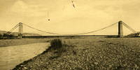
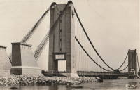
1931: Châtillon-sur-Loire
Châtillon-sur-Loire, Loiret, France - Loire River
| Bridgemeister ID: | 1018 (added 2003-11-22) |
| Year Completed: | 1931 |
| Name: | Châtillon-sur-Loire |
| Location: | Châtillon-sur-Loire, Loiret, France |
| Crossing: | Loire River |
| Coordinates: | 47.598786 N 2.761769 E |
| Maps: | Acme, GeoHack, Google, OpenStreetMap |
| Use: | Vehicular |
| Status: | Destroyed, June, 1940 |
| Main Cables: | Wire (steel) |
| Suspended Spans: | 4 |
| Main Spans: | 4 |
Notes:
- Replaced 1841 Châtillon-sur-Loire - Châtillon-sur-Loire, Loiret, France.
- Replaced by 1951 Châtillon-sur-Loire - Châtillon-sur-Loire, Loiret, France.
External Links:
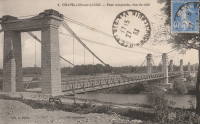
1931: Feneyrols
Feneyrols, Tarn-et-Garonne, France - Aveyron River
| Bridgemeister ID: | 1551 (added 2004-11-13) |
| Year Completed: | 1931 |
| Name: | Feneyrols |
| Location: | Feneyrols, Tarn-et-Garonne, France |
| Crossing: | Aveyron River |
| Coordinates: | 44.129389 N 1.819662 E |
| Maps: | Acme, GeoHack, Google, OpenStreetMap |
| Use: | Vehicular (two-lane) |
| Status: | In use (last checked: 2022) |
| Main Cables: | Wire (steel) |
| Suspended Spans: | 1 |
| Main Span: | 1 x 86 meters (282.2 feet) estimated |
External Links:
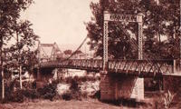
1931: Gamlebrua
Kongsberg, Viken, Norway - Numedalslågen
| Bridgemeister ID: | 536 (added before 2003) |
| Year Completed: | 1931 |
| Name: | Gamlebrua |
| Location: | Kongsberg, Viken, Norway |
| Crossing: | Numedalslågen |
| Coordinates: | 59.662620 N 9.652555 E |
| Maps: | Acme, GeoHack, Google, kart.1881.no, OpenStreetMap |
| Use: | Vehicular (one-lane), with walkway |
| Status: | In use (last checked: 2019) |
| Main Cables: | Wire (steel) |
| Suspended Spans: | 1 |
| Main Span: | 1 x 110 meters (360.9 feet) estimated |
External Links:
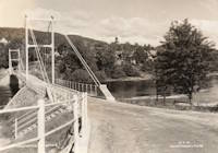
1931: George Washington
New York, New York and Fort Lee, New Jersey, USA - Hudson River
| Bridgemeister ID: | 169 (added before 2003) |
| Year Completed: | 1931 |
| Name: | George Washington |
| Also Known As: | GWB |
| Location: | New York, New York and Fort Lee, New Jersey, USA |
| Crossing: | Hudson River |
| Coordinates: | 40.85333 N 73.955 W |
| Maps: | Acme, GeoHack, Google, OpenStreetMap |
| Principals: | O.H. Ammann, Leon Moisseiff, Dana, Gilbert |
| References: | AAJ, AOB, ARF, BBR, BC3, BFL, BMA, BONJ, BOU, BPL, BRU, COB, CTW, ENR19270811a, ENR19270811b, ENR19290411c, GBD, LAB, LACE, PTS2, SIX, SJR |
| Use: | Vehicular (double-deck), with walkway |
| Status: | In use (last checked: 2022) |
| Main Cables: | Wire (steel) |
| Suspended Spans: | 3 |
| Main Span: | 1 x 1,066.8 meters (3,500 feet) |
| Side Spans: | 2 x 198.1 meters (650 feet) |
| Deck width: | 120 feet |
Notes:
- Became longest suspension bridge by eclipsing 1929 Ambassador - Detroit, Michigan, USA and Windsor, Ontario, Canada.
- Eclipsed by new longest suspension bridge 1937 Golden Gate - San Francisco and Marin County, California, USA.
External Links:
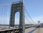
1931: Hagwilget
Hagwilget, British Columbia, Canada - Bulkley River
| Bridgemeister ID: | 170 (added before 2003) |
| Year Completed: | 1931 |
| Name: | Hagwilget |
| Also Known As: | Bulkley Canyon |
| Location: | Hagwilget, British Columbia, Canada |
| Crossing: | Bulkley River |
| At or Near Feature: | Hagwilget Canyon |
| Coordinates: | 55.25740 N 127.60380 W |
| Maps: | Acme, GeoHack, Google, OpenStreetMap |
| Principals: | BC Department of Public Works |
| References: | AAJ |
| Use: | Vehicular (one-lane) |
| Status: | In use (last checked: 2008) |
| Main Cables: | Wire (steel) |
| Suspended Spans: | 1 |
| Main Span: | 1 x 140.2 meters (460 feet) |
| Deck width: | 16 feet |
Notes:
External Links:
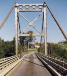
1931: Long Shoal
Warsaw vicinity, Missouri, USA - Osage River
| Bridgemeister ID: | 3517 (added 2019-12-24) |
| Year Completed: | 1931 |
| Name: | Long Shoal |
| Location: | Warsaw vicinity, Missouri, USA |
| Crossing: | Osage River |
| Principals: | Joseph A. Dice |
| References: | BOTO |
| Use: | Vehicular |
| Status: | Collapsed, September 21, 1965 |
| Main Cables: | Wire (steel) |
Notes:
- Collapsed, killing three people, September 1965.
1931: Mata River
Makarika, Ruatoria vicinity, New Zealand - Mata River
| Bridgemeister ID: | 735 (added 2003-03-08) |
| Year Completed: | 1931 |
| Name: | Mata River |
| Location: | Makarika, Ruatoria vicinity, New Zealand |
| Crossing: | Mata River |
| References: | GAP |
| Use: | Vehicular (one-lane) |
| Status: | Replaced |
| Main Cables: | Wire (steel) |
| Suspended Spans: | 1 |
| Main Span: | 1 x 151 meters (495.4 feet) |
External Links:
| Bridgemeister ID: | 1560 (added 2004-11-26) |
| Year Completed: | 1931 |
| Name: | Ponkila |
| Location: | Muhos, Finland |
| Crossing: | Muhosjoki |
| Coordinates: | 64.808996 N 26.005233 E |
| Maps: | Acme, GeoHack, Google, OpenStreetMap |
| Principals: | L. Iloniemi |
| Use: | Vehicular (one-lane) |
| Status: | Restricted to foot traffic (last checked: 2004) |
| Main Cables: | Wire (steel) |
1931: Raensbrua
Kråkebumoen vicinity, Kristiansand, Agder, Norway - Tovdalselva
| Bridgemeister ID: | 4314 (added 2020-04-10) |
| Year Completed: | 1931 |
| Name: | Raensbrua |
| Location: | Kråkebumoen vicinity, Kristiansand, Agder, Norway |
| Crossing: | Tovdalselva |
| Coordinates: | 58.277040 N 8.176805 E |
| Maps: | Acme, GeoHack, Google, kart.1881.no, OpenStreetMap |
| Use: | Footbridge |
| Status: | Only towers remain (last checked: 2019) |
| Main Cables: | Wire (steel) |
| Suspended Spans: | 1 |
| Main Span: | 1 x 75 meters (246.1 feet) estimated |
Notes:
- In a derelict state by late 2000s. Only the towers remain by late 2010s.
1931: Rubens
Los Angeles vicinity, Natales, Chile - Rio Rubens
| Bridgemeister ID: | 6917 (added 2022-01-21) |
| Year Completed: | 1931 |
| Name: | Rubens |
| Location: | Los Angeles vicinity, Natales, Chile |
| Crossing: | Rio Rubens |
| Coordinates: | 52.036240 S 71.947632 W |
| Maps: | Acme, GeoHack, Google, OpenStreetMap |
| Use: | Vehicular |
| Status: | Derelict (last checked: 2021) |
| Main Cables: | Wire (steel) |
| Main Span: | 1 x 42 meters (137.8 feet) estimated |
External Links:
- Licitan estudio de ingeniería para la reposición del puente Rubens | La Prensa Austral. "Tender for engineering study for the replacement of the Rubens bridge." Article (2018) discusses replacement of the adjacent highway bridge, but also mentions plans to restore the suspension bridge as tourist attraction.
1931: Saint-Pierre
Toulouse, Haute-Garonne, France - Garonne River
| Bridgemeister ID: | 2049 (added 2006-05-21) |
| Year Completed: | 1931 |
| Name: | Saint-Pierre |
| Location: | Toulouse, Haute-Garonne, France |
| Crossing: | Garonne River |
| Coordinates: | 43.602833 N 1.435199 E |
| Maps: | Acme, GeoHack, Google, OpenStreetMap |
| Use: | Vehicular |
| Status: | Demolished, 1986 |
| Main Cables: | Wire |
Notes:
External Links:

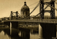
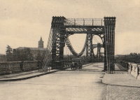
1931: Saint-Sulpice
Saint-Sulpice-la-Pointe, Tarn, France - Agout River
| Bridgemeister ID: | 7489 (added 2022-12-30) |
| Year Completed: | 1931 |
| Name: | Saint-Sulpice |
| Location: | Saint-Sulpice-la-Pointe, Tarn, France |
| Crossing: | Agout River |
| Coordinates: | 43.777048 N 1.686685 E |
| Maps: | Acme, GeoHack, Google, OpenStreetMap |
| Use: | Vehicular, with walkway |
| Status: | In use (last checked: 2022) |
| Main Cables: | Wire (steel) |
| Suspended Spans: | 1 |
Notes:
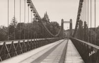
1931: Sidaway
Cleveland, Ohio, USA - Kingsbury Run
| Bridgemeister ID: | 171 (added before 2003) |
| Year Completed: | 1931 |
| Name: | Sidaway |
| Location: | Cleveland, Ohio, USA |
| Crossing: | Kingsbury Run |
| Coordinates: | 41.477805 N 81.642944 W |
| Maps: | Acme, GeoHack, Google, OpenStreetMap |
| Principals: | Wilbur Watson, Fred Plummer. New York, Chicago, and St. Louis Railroad Co. |
| References: | BMC |
| Use: | Footbridge |
| Status: | Derelict, since 1966 (last checked: 2023) |
| Main Cables: | Wire (steel) |
| Suspended Spans: | 3 |
| Main Span: | 1 x 121.9 meters (400 feet) |
| Side Spans: | 2 x 42.7 meters (140 feet) |
| Deck width: | 6 feet |
Notes:
- 2023, February: Given landmark status by the Cleveland City Council so that it is eligible to receive grants for preservation.
- BMC describes a feud between the neighborhoods on either side of the bridge that led to events in July 1966: "someone set fire to the wooden deck and ripped out fifteen feet of the southern portion. The bridge now is considered a nuisance."
- 2022, October: Added to National Register of Historic Places.
External Links:
- Sidaway Bridge once connected Black and white neighborhoods. Now it connects us to the past.. July 22, 2020 news article by News 5 (ABC) Cleveland.
- Structurae - Structure ID 20015438
1931: Simon Kenton Memorial
Maysville, Kentucky and Aberdeen, Ohio, USA - Ohio River
| Bridgemeister ID: | 172 (added before 2003) |
| Year Completed: | 1931 |
| Name: | Simon Kenton Memorial |
| Also Known As: | Maysville |
| Location: | Maysville, Kentucky and Aberdeen, Ohio, USA |
| Crossing: | Ohio River |
| Coordinates: | 38.649890 N 83.759670 W |
| Maps: | Acme, GeoHack, Google, OpenStreetMap |
| Principals: | Modjeski, Masters & Chase |
| References: | AAJ, SJR, SSS |
| Use: | Vehicular (two-lane), with walkway |
| Status: | In use (last checked: 2022) |
| Main Cables: | Wire (steel) |
| Suspended Spans: | 3 |
| Main Span: | 1 x 323.1 meters (1,060 feet) |
| Side Spans: | 2 x 141.7 meters (464.9 feet) |
| Deck width: | 28 feet |
Notes:
- 2022, March: USD$23.4 million budgeted for rehabilitation project including suspender cable replacements, steel repairs, and painting.
- 2019: Closed late 2019 due to suspender cable corrosion. Short-term fixes applied to reduce the stress on the suspenders and to prevent rusting.
- 2020, June: Reopened with a 15-ton weight limit after installation of temporary support rods and brackets to reduce the stress on damaged cables.
External Links:
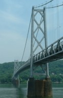
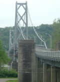
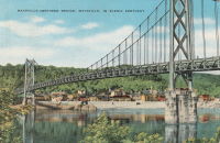
1931: South Tenth Street
Pittsburgh, Pennsylvania, USA - Monongahela River
| Bridgemeister ID: | 173 (added before 2003) |
| Year Completed: | 1931 |
| Name: | South Tenth Street |
| Also Known As: | South Side, Tenth Street, Philip Murray |
| Location: | Pittsburgh, Pennsylvania, USA |
| Crossing: | Monongahela River |
| Coordinates: | 40.43166 N 79.989 W |
| Maps: | Acme, GeoHack, Google, OpenStreetMap |
| Principals: | Sydney A. Shubin |
| References: | AAJ, BOP, BPL, PBR, SSS, USS |
| Use: | Vehicular (four-lane), with walkway |
| Status: | In use (last checked: 2019) |
| Main Cables: | Wire (steel) |
| Suspended Spans: | 3 |
| Main Span: | 1 x 228.6 meters (750 feet) |
| Side Spans: | 2 x 83.8 meters (275 feet) |
| Deck width: | 54 feet |
External Links:
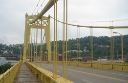
1931: St. Johns
Portland, Oregon, USA - Willamette River
| Bridgemeister ID: | 174 (added before 2003) |
| Year Completed: | 1931 |
| Name: | St. Johns |
| Location: | Portland, Oregon, USA |
| Crossing: | Willamette River |
| Coordinates: | 45.585 N 122.76333 W |
| Maps: | Acme, GeoHack, Google, OpenStreetMap |
| Principals: | Robinson and Steinman |
| References: | AAJ, ADDS, BC3, BCO, BFL, BPL, GBD, LAB, SJR |
| Use: | Vehicular (four-lane), with walkway |
| Status: | In use (last checked: 2022) |
| Main Cables: | Wire (steel) |
| Suspended Spans: | 3 |
| Main Span: | 1 x 367.9 meters (1,207 feet) |
| Side Spans: | 2 x 131.1 meters (430.25 feet) |
| Deck width: | 52 feet |
Notes:
- Substantially rehabilitated, 2003-2005.
External Links:
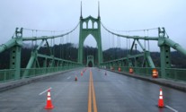
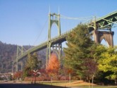
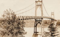
1931: Star Mine
Rosedale, Drumheller vicinity, Alberta, Canada - Red Deer River
| Bridgemeister ID: | 350 (added before 2003) |
| Year Completed: | 1931 |
| Name: | Star Mine |
| Also Known As: | Rosedale Swinging |
| Location: | Rosedale, Drumheller vicinity, Alberta, Canada |
| Crossing: | Red Deer River |
| Coordinates: | 51.420021 N 112.614473 W |
| Maps: | Acme, GeoHack, Google, OpenStreetMap |
| Principals: | George Lester MacKenzie |
| Use: | Footbridge |
| Status: | Closed, May 2020 (last checked: 2023) |
| Main Cables: | Wire (steel) |
| Suspended Spans: | 1 |
| Main Span: | 1 x 117 meters (383.9 feet) |
Notes:
- 1958: Rebuilt.
- 2020, May: Closed indefinitely due to safety concerns. During an inspection of the bridge "it was determined the northeast timber bridge support was in extremely poor condition."
- 2023, October: Contract to repair bridge awarded. Expected to reopen in April 2024.
Annotated Citations:
- Nairn, Lacie. "Town waiting on province for Rosedale suspension bridge repairs." The Drumheller Mail, 13 Apr. 2022, www.thestar.com/news/canada/2022/04/13/town-waiting-on-province-for-rosedale-suspension-bridge-repairs.html
The bridge is still closed. "The town initially hoped to complete repairs over the winter of 2021. However, as the land on the northern shore of the bridge was privately owned, land transfer negotiations were conducted between the Town, Alberta Transportation, and the landowner."
External Links:

1931: Teil
Le Teil, Ardèche and Montélimar, Drôme, France - Rhône River
| Bridgemeister ID: | 1549 (added 2004-11-13) |
| Year Completed: | 1931 |
| Name: | Teil |
| Location: | Le Teil, Ardèche and Montélimar, Drôme, France |
| Crossing: | Rhône River |
| Coordinates: | 44.5519 N 4.692617 E |
| Maps: | Acme, GeoHack, Google, OpenStreetMap |
| References: | AAJ, BPF |
| Use: | Vehicular (two-lane, heavy vehicles), with walkway |
| Status: | In use (last checked: 2005) |
| Main Cables: | Wire (steel) |
| Suspended Spans: | 1 |
| Main Span: | 1 x 235 meters (771 feet) |
Notes:
- Destroyed, 1944. Rebuilt, 1950.
- Replaced 1839 Teil - Le Teil, Ardèche and Montélimar, Drôme, France.
External Links:
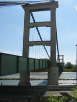
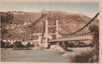
1931: Verdun-sur-Garonne
Verdun-sur-Garonne, Tarn-et-Garonne, France - Garonne River
| Bridgemeister ID: | 2347 (added 2007-08-18) |
| Year Completed: | 1931 |
| Name: | Verdun-sur-Garonne |
| Location: | Verdun-sur-Garonne, Tarn-et-Garonne, France |
| Crossing: | Garonne River |
| Coordinates: | 43.854713 N 1.242315 E |
| Maps: | Acme, GeoHack, Google, OpenStreetMap |
| Use: | Vehicular |
| Status: | Replaced, 2010 |
| Main Cables: | Wire (steel) |
| Suspended Spans: | 1 |
Notes:
- Coordinates are for the 2010 replacement suspension bridge, but construction photos of the newer bridge show the 1931 bridge was extremely close to the 2010 bridge.
- Replaced by 2010 Verdun-sur-Garonne - Verdun-sur-Garonne, Tarn-et-Garonne, France.
- See 1841 Verdun-sur-Garonne - Verdun-sur-Garonne, Tarn-et-Garonne, France. The relationship between the older and current bridges is unclear.
External Links:
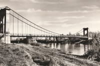
1931: Vicq-sur-Gartempe
Vicq-sur-Gartempe, Vienne, France - Gartempe River
| Bridgemeister ID: | 3997 (added 2020-03-27) |
| Year Completed: | 1931 |
| Name: | Vicq-sur-Gartempe |
| Location: | Vicq-sur-Gartempe, Vienne, France |
| Crossing: | Gartempe River |
| References: | AAJ |
| Use: | Vehicular |
| Status: | Replaced, 1989 |
| Main Cables: | Wire (steel) |
| Suspended Spans: | 1 |
Notes:
- 1989: Replaced and subsequently removed.
- Replaced 1881 Vicq-sur-Gartempe - Vicq-sur-Gartempe, Vienne, France.
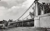
1931: Waldo-Hancock
Verona and Bucksport vicinity, Maine, USA - Penobscot River
| Bridgemeister ID: | 175 (added before 2003) |
| Year Completed: | 1931 |
| Name: | Waldo-Hancock |
| Location: | Verona and Bucksport vicinity, Maine, USA |
| Crossing: | Penobscot River |
| Coordinates: | 44.56 N 68.80333 W |
| Maps: | Acme, GeoHack, Google, OpenStreetMap |
| Principals: | Robinson and Steinman |
| References: | AAJ, ADDS, GBD, SSS, USS |
| Use: | Vehicular (two-lane, heavy vehicles), with walkway |
| Status: | Demolished, 2012 |
| Main Cables: | Wire (steel) |
| Suspended Spans: | 3 |
| Main Span: | 1 x 243.8 meters (800 feet) |
| Side Spans: | 2 x 106.7 meters (350 feet) |
| Deck width: | 27 feet |
Notes:
- Replacement cable-stayed bridge, (the Penobscot Narrows Bridge) completed, late 2006.
External Links:
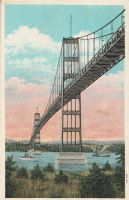
| Bridgemeister ID: | 446 (added before 2003) |
| Year Completed: | 1931 |
| Name: | Yagi-yama |
| Location: | Sendai, Miyagi, Japan |
| Coordinates: | 38.250273 N 140.852256 E |
| Maps: | Acme, GeoHack, Google, OpenStreetMap |
| Principals: | Yagi Kyubei |
| Use: | Vehicular |
| Status: | Replaced, 1965 |
| Main Cables: | Wire |
| Main Span: | 1 x 106.7 meters (350.1 feet) |
| Deck width: | 3.7 meters |
Do you have any information or photos for these bridges that you would like to share? Please email david.denenberg@bridgemeister.com.
